Embed Size (px)
Citation preview
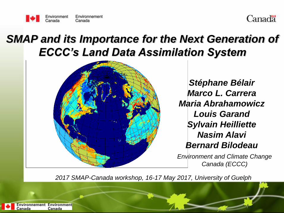
SMAP and its Importance for the Next Generation of
ECCC’s Land Data Assimilation System
2017 SMAP-Canada workshop, 16-17 May 2017, University of Guelph
Stéphane Bélair
Marco L. Carrera
Maria Abrahamowicz
Louis Garand
Sylvain Heilliette
Nasim Alavi
Bernard Bilodeau
Environment and Climate Change
Canada (ECCC)
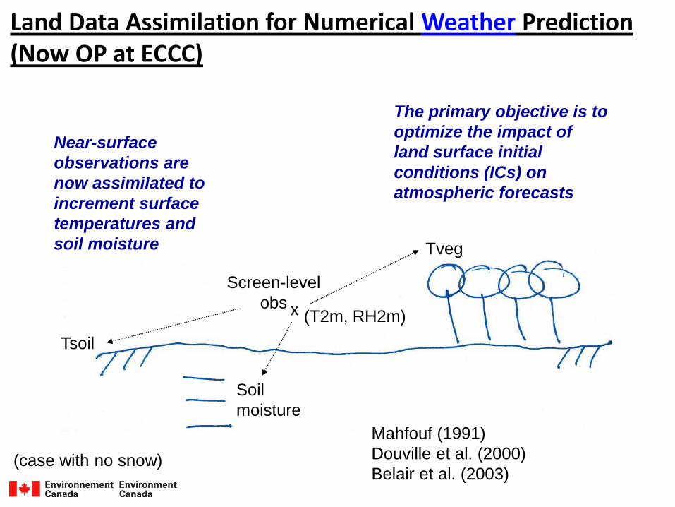
Land Data Assimilation for Numerical Weather Prediction (Now OP at ECCC)
Tsoil
Tveg
x
Screen-level
obs
Soil
moisture
(case with no snow)
(T2m, RH2m)
Near-surface
observations are
now assimilated to
increment surface
temperatures and
soil moisture
The primary objective is to
optimize the impact of
land surface initial
conditions (ICs) on
atmospheric forecasts
Mahfouf (1991)
Douville et al. (2000)
Belair et al. (2003)
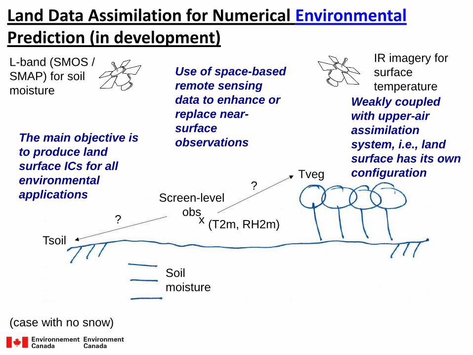
Land Data Assimilation for Numerical EnvironmentalPrediction (in development)
Screen-level
obs
Tsoil
Tveg
Soil
moisture
?
?
L-band (SMOS /
SMAP) for soil
moisture
IR imagery for
surface
temperature
(case with no snow)
The main objective is
to produce land
surface ICs for all
environmental
applications
Use of space-based
remote sensing
data to enhance or
replace near-
surface
observations
x (T2m, RH2m)
Weakly coupled
with upper-air
assimilation
system, i.e., land
surface has its own
configuration
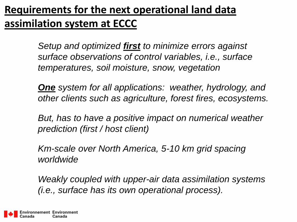
Requirements for the next operational land data assimilation system at ECCC
Setup and optimized first to minimize errors against
surface observations of control variables, i.e., surface
temperatures, soil moisture, snow, vegetation
One system for all applications: weather, hydrology, and
other clients such as agriculture, forest fires, ecosystems.
But, has to have a positive impact on numerical weather
prediction (first / host client)
Km-scale over North America, 5-10 km grid spacing
worldwide
Weakly coupled with upper-air data assimilation systems
(i.e., surface has its own operational process).
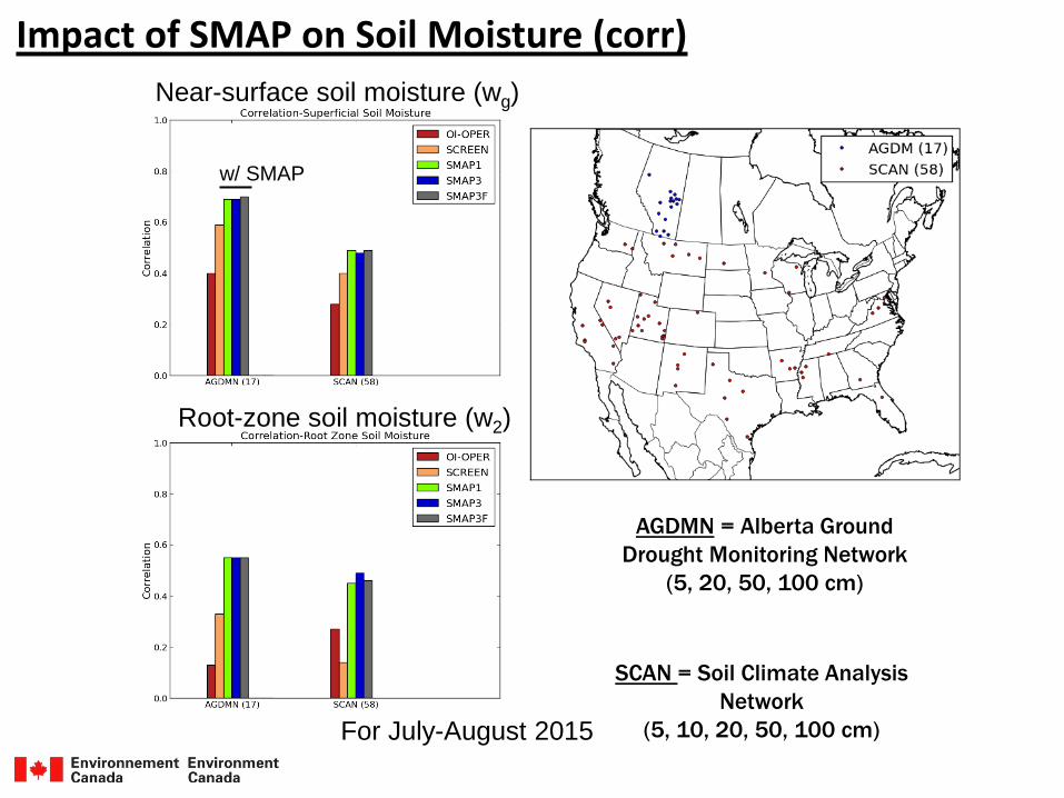
Impact of SMAP on Soil Moisture (corr)
Near-surface soil moisture (wg)
Root-zone soil moisture (w2)
AGDMN = Alberta Ground
Drought Monitoring Network
(5, 20, 50, 100 cm)
SCAN = Soil Climate Analysis
Network
(5, 10, 20, 50, 100 cm)For July-August 2015
w/ SMAP
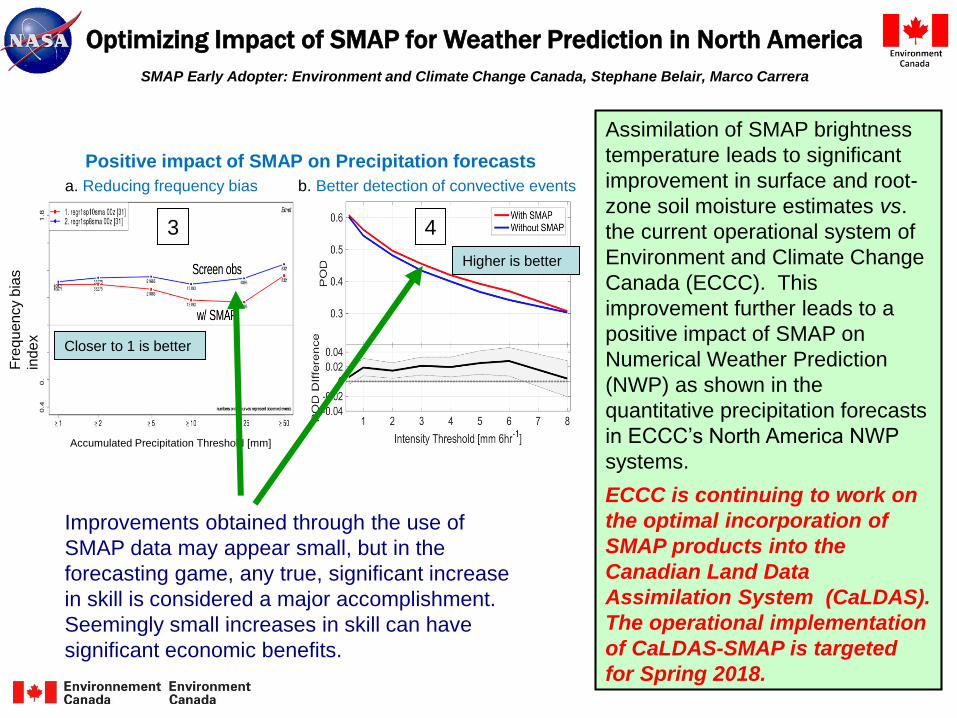
Optimizing Impact of SMAP for Weather Prediction in North America
SMAP Early Adopter: Environment and Climate Change Canada, Stephane Belair, Marco Carrera
Assimilation of SMAP brightness
temperature leads to significant
improvement in surface and root-
zone soil moisture estimates vs.
the current operational system of
Environment and Climate Change
Canada (ECCC). This
improvement further leads to a
positive impact of SMAP on
Numerical Weather Prediction
(NWP) as shown in the
quantitative precipitation forecasts
in ECCC’s North America NWP
systems.
ECCC is continuing to work on
the optimal incorporation of
SMAP products into the
Canadian Land Data
Assimilation System (CaLDAS).
The operational implementation
of CaLDAS-SMAP is targeted
for Spring 2018.
Positive impact of SMAP on Precipitation forecasts
a. Reducing frequency bias b. Better detection of convective events
Closer to 1 is better
Fre
qu
en
cy b
ias
inde
x
3
Accumulated Precipitation Threshold [mm]
4
Higher is better
Improvements obtained through the use of
SMAP data may appear small, but in the
forecasting game, any true, significant increase
in skill is considered a major accomplishment.
Seemingly small increases in skill can have
significant economic benefits.
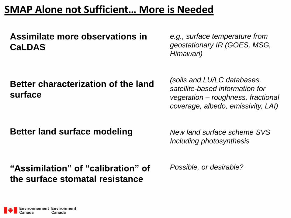
SMAP Alone not Sufficient… More is Needed
Assimilate more observations in
CaLDAS
Better characterization of the land
surface
Better land surface modeling
“Assimilation” of “calibration” of
the surface stomatal resistance
e.g., surface temperature from
geostationary IR (GOES, MSG,
Himawari)
(soils and LU/LC databases,
satellite-based information for
vegetation – roughness, fractional
coverage, albedo, emissivity, LAI)
New land surface scheme SVS
Including photosynthesis
Possible, or desirable?
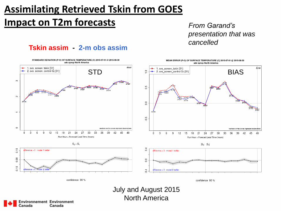
Assimilating Retrieved Tskin from GOESImpact on T2m forecasts
Tskin assim - 2-m obs assim
STD BIAS
July and August 2015
North America
From Garand’s
presentation that was
cancelled
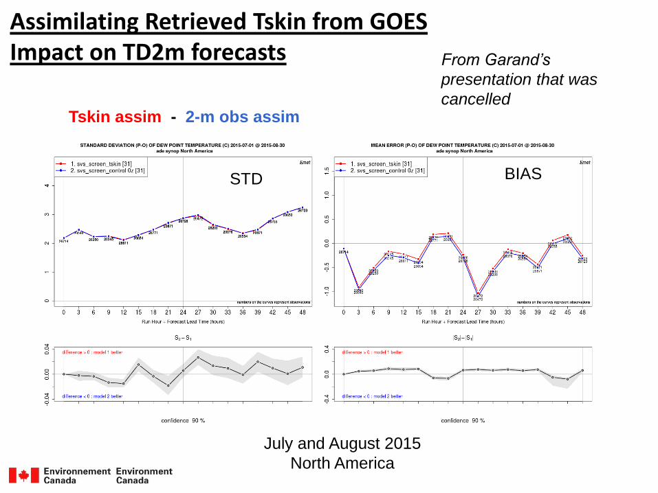
Assimilating Retrieved Tskin from GOESImpact on TD2m forecasts
Tskin assim - 2-m obs assim
STD BIAS
July and August 2015
North America
From Garand’s
presentation that was
cancelled
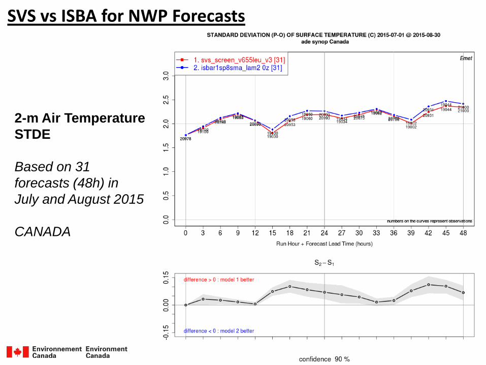
SVS vs ISBA for NWP Forecasts
2-m Air Temperature
STDE
Based on 31
forecasts (48h) in
July and August 2015
CANADA
SVS vs ISBA for NWP Forecasts
2-m Air Temperature
STDE
Based on 31
forecasts (48h) in
July and August 2015
USA
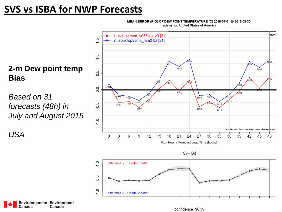
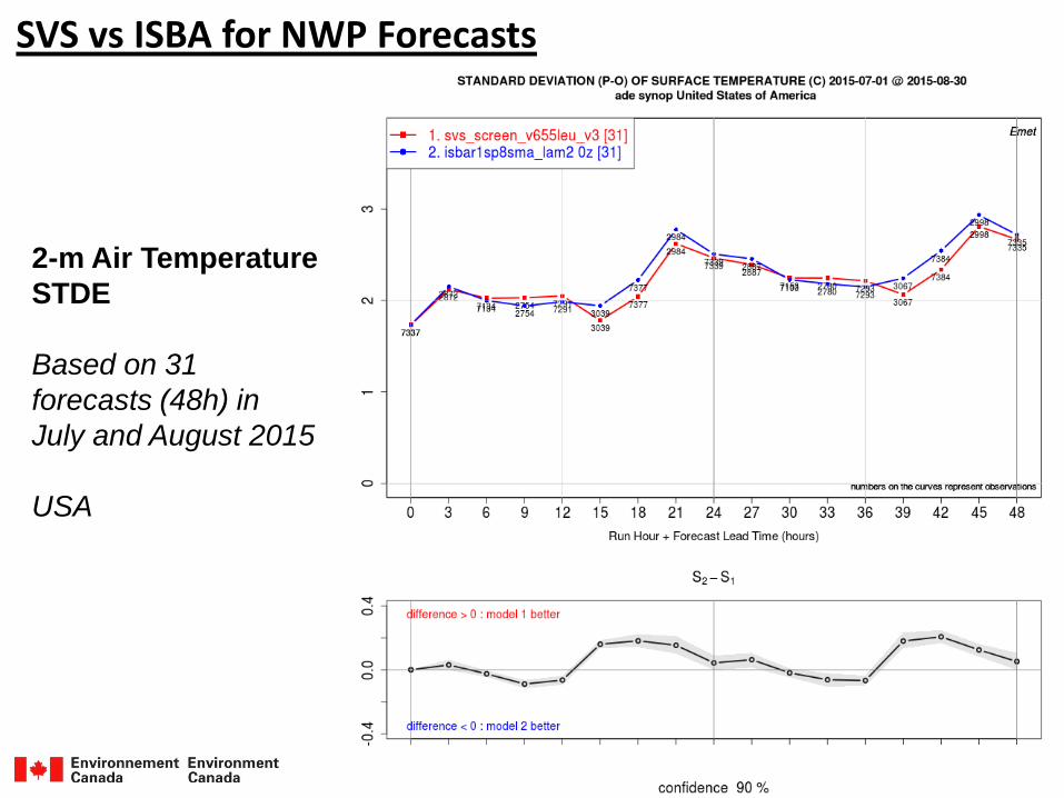
SVS vs ISBA for NWP Forecasts
2-m Dew point temp
Bias
Based on 31
forecasts (48h) in
July and August 2015
USA
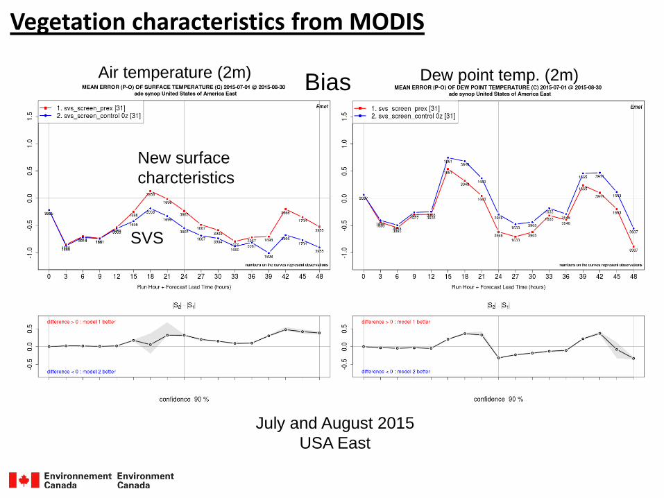
Vegetation characteristics from MODIS
New surface
charcteristics
SVS
BiasAir temperature (2m) Dew point temp. (2m)
July and August 2015
USA East
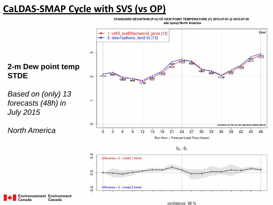
CaLDAS-SMAP Cycle with SVS (vs OP)
2-m Dew point temp
STDE
Based on (only) 13
forecasts (48h) in
July 2015
North America
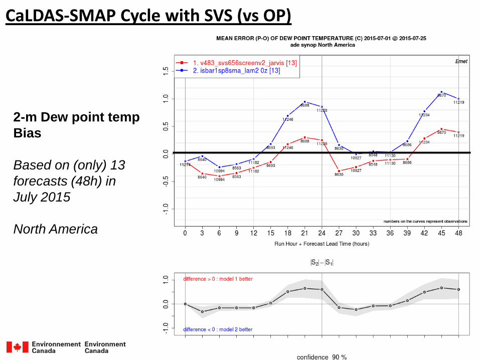
CaLDAS-SMAP Cycle with SVS (vs OP)
2-m Dew point temp
Bias
Based on (only) 13
forecasts (48h) in
July 2015
North America
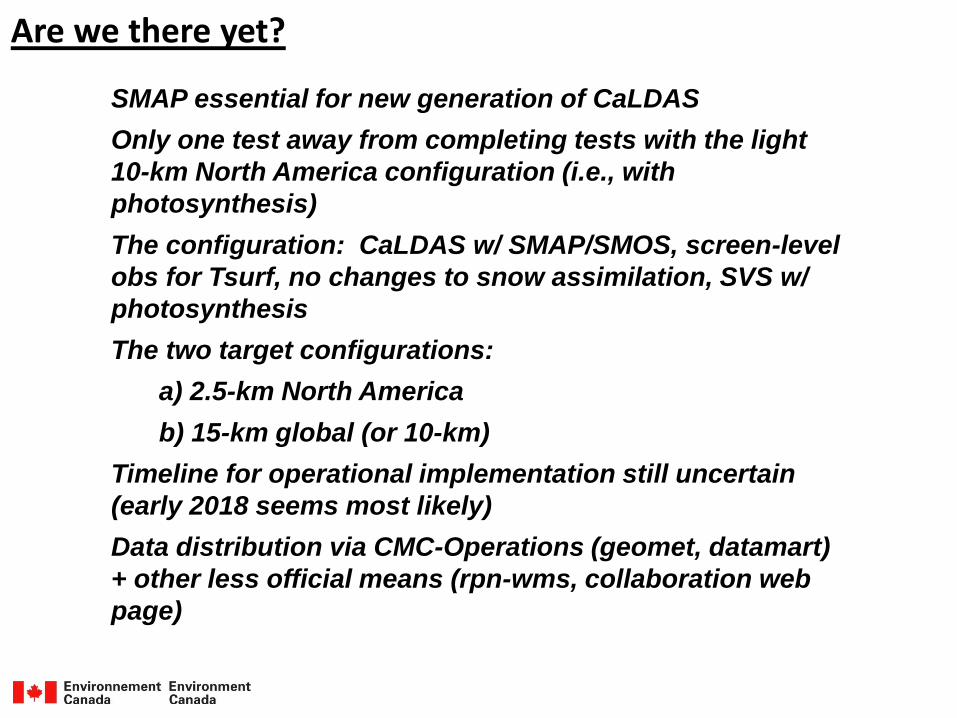
Are we there yet?
SMAP essential for new generation of CaLDAS
Only one test away from completing tests with the light
10-km North America configuration (i.e., with
photosynthesis)
The configuration: CaLDAS w/ SMAP/SMOS, screen-level
obs for Tsurf, no changes to snow assimilation, SVS w/
photosynthesis
The two target configurations:
a) 2.5-km North America
b) 15-km global (or 10-km)
Timeline for operational implementation still uncertain
(early 2018 seems most likely)
Data distribution via CMC-Operations (geomet, datamart)
+ other less official means (rpn-wms, collaboration web
page)

Backup Slides
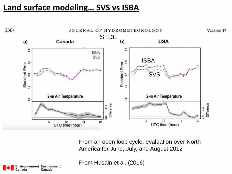
Land surface modeling… SVS vs ISBA
From an open loop cycle, evaluation over North
America for June, July, and August 2012
From Husain et al. (2016)
SVS
ISBA
STDE
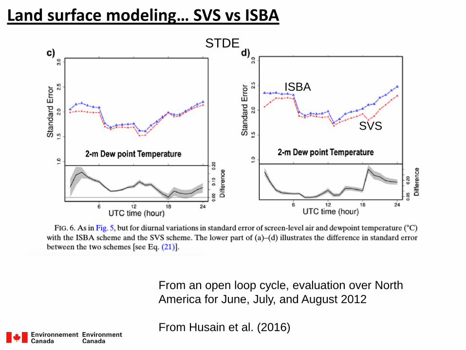
Land surface modeling… SVS vs ISBA
From an open loop cycle, evaluation over North
America for June, July, and August 2012
From Husain et al. (2016)
SVS
ISBA
STDE