Embed Size (px)
Citation preview
SMAP Applications Plan
Molly BrownSMAP Applications Coordinator
Susan MoranChair, SMAP Applications Working Group
Vanessa EscobarSMAP Support Scientist
“This plan provides an implementation strategy for promoting applications research and engaging a broad community of users in SMAP applications.”
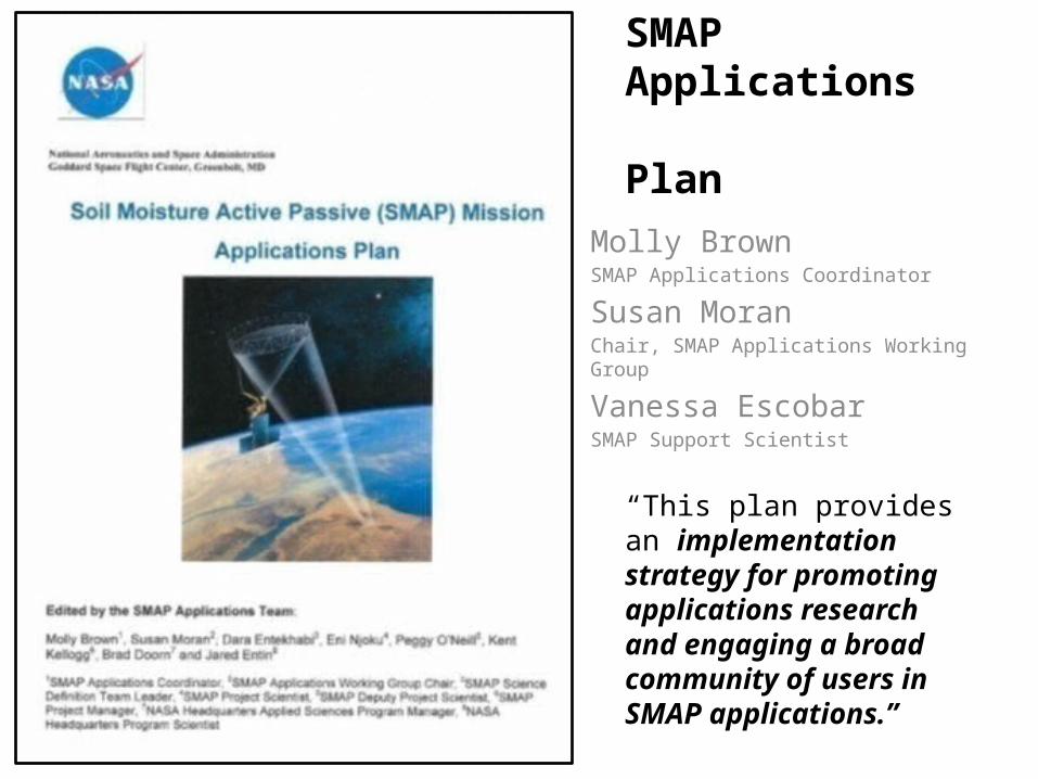
The SMAP Approach to Engagement
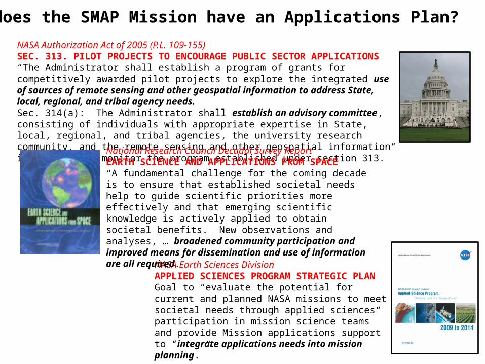
NASA Earth Sciences DivisionAPPLIED SCIENCES PROGRAM STRATEGIC PLANGoal to “evaluate the potential for current and planned NASA missions to meet societal needs through applied sciences participation in mission science teams” and provide Mission applications support to “integrate applications needs into mission planning.”
NASA Authorization Act of 2005 (P.L. 109-155) SEC. 313. PILOT PROJECTS TO ENCOURAGE PUBLIC SECTOR APPLICATIONS“The Administrator shall establish a program of grants for competitively awarded pilot projects to explore the integrated use of sources of remote sensing and other geospatial information to address State, local, regional, and tribal agency needs.Sec. 314(a): The Administrator shall establish an advisory committee, consisting of individuals with appropriate expertise in State, local, regional, and tribal agencies, the university research community, and the remote sensing and other geospatial information industries, to monitor the program established under section 313.”
National Research Council Decadal Survey ReportEARTH SCIENCE AND APPLICATIONS FROM SPACE“A fundamental challenge for the coming decade is to ensure that established societal needs help to guide scientific priorities more effectively and that emerging scientific knowledge is actively applied to obtain societal benefits. New observations and analyses, … broadened community participation and improved means for dissemination and use of information are all required.”
Why does the SMAP Mission have an Applications Plan?
What is a SMAP Application?
Applications are defined as innovative uses of SMAP data products in decision-making activities for societal benefit.
Applications research will provide fundamental knowledge of how SMAP data products can be scaled and integrated into users’ policy, business and management activities to improve decision-making efforts.
Users include individuals or groups in the public or private sectors with national or international applications at local to global scales.
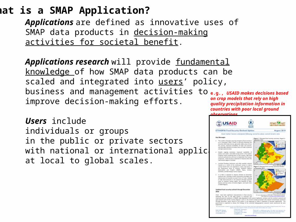
e.g., USAID makes decisions based on crop models that rely on high quality precipitation information in countries with poor local ground observations.
Examples of SMAP Applications Research
(K)
Precipitation bias (24-48h)
Control
EXAMPLE: NUMERICAL WEATHER PREDICTION
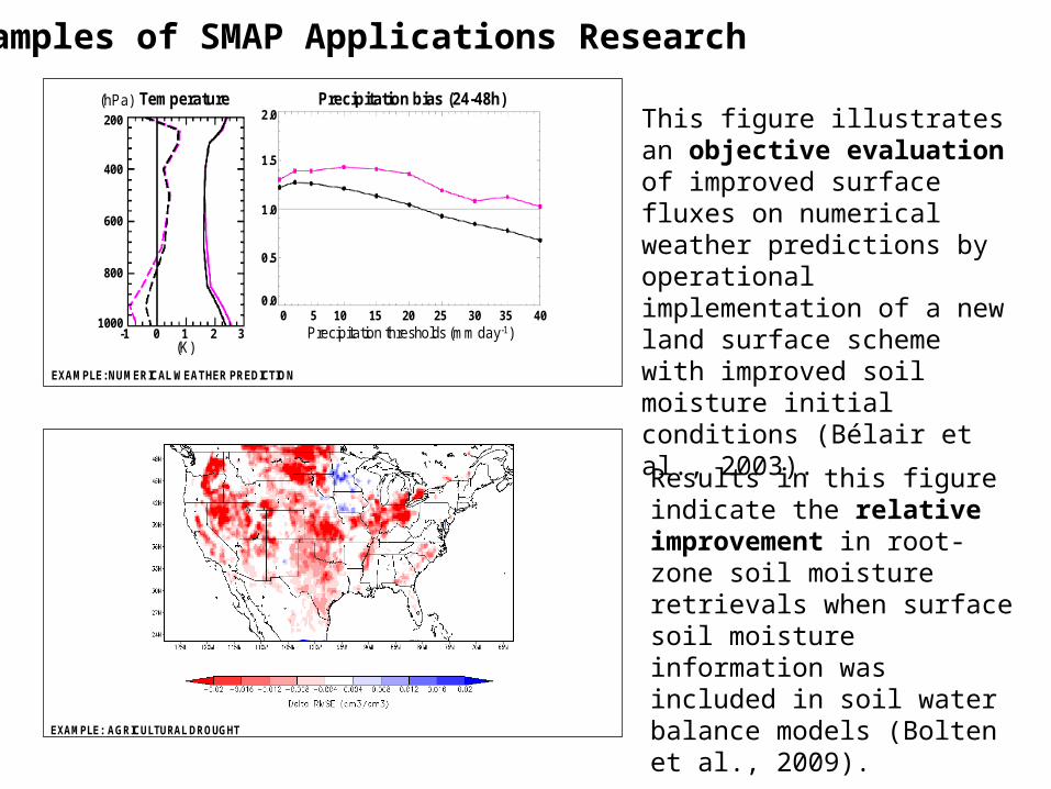
Soil moisture is a very important variable in numerical weather prediction systems. Because of its influence on evaporation and on the partition of available energy at the surface, soil moisture is one of the factors controlling the evolution of thedaytime atmospheric boundary layer. For drier soils, cooling caused by evaporation is generally limited, leading to increased warming and mixing in the atmospheric boundary layer (and vice-versa for humid soils). This directly affects near-surface air characteristics (i.e., air temperature and humidity) as well as pollutants concentration near the surface. Through this impact on the boundary layer, soil moisture plays a major role in the production of clouds and precipitation.
This figure illustrates an objective evaluation of the impact of improved surface fluxes on numerical weather predictions, obtained in the context of a 2001 operational implementation of a new land surface scheme with improved soil moisture initial conditions in the Canadian Meteorological Centre short-range regional forecasting system (Bélair et al. 2003). Root-mean-square errors (solid) and biases (dash) for 48-h predictions of air temperature are shown in the left panel. Biases for 24-48h precipitation accumulations are shown in the right panel. The control (magenta lines) and the new system with improved land surface scheme and soil moisture initial conditions (black lines) are compared against radiosondes (for air temperature) and surface observations (for precipitation), for a series of 48 cases.
200
400
600
800
10001 2
Temperature(hPa)
-1 0 3
0.0
0.5
1.0
1.5
2.0
0 5 1510 20 25 30 35 40Precipitation thresholds (mm day-1)
This figure illustrates an objective evaluation of improved surface fluxes on numerical weather predictions by operational implementation of a new land surface scheme with improved soil moisture initial conditions (Bélair et al., 2003).
EXAMPLE: AGRICULTURAL DROUGHTAgricultural drought represents a major source of inter-annual variability in regional agricultural productivity. Currently, drought
impacts on productivity trends are captured via soil water balance models forced with available global precipitation data products. Unfortunately, such products are prone to errors with frequently degrade the quality of modeled soil moisture products. Using a data denial framework, Bolten et al. [2009] examined the potential of currently available remotely-sensed soil moisture data products to enhance root-zone (top 1 meter) soil moisture products obtained by forcing a water balance model with real-time satellite-based precipitation information. Their evaluation strategy was based on three separate model runs for the contiguous United States: a “truth” simulation forced with a high-quality respective precipitation data set obtained from a raingauge analysis, an “open loop” run obtained using a real-time satellite-based precipitation product, and a “data assimilation” run in which surface soil moisture retrievals are assimilated into the open loop run. Results in the figure indicate the relative improvement (measured via the root-mean-square-error fit to the truth simulation) in root-zone soil moisture retrievals between the “open loop” and “data assimilation” runs. As seen in the figure, the inclusion of soil moisture information has a consistently positive impact on the characterization of root-zone soil moisture variations. Given the substantial improvement in both resolution and accuracy expected, relative to the currently available products used here, even larger amounts of added value areexpected to accompany the assimilation of SMAP data products.
Results in this figure indicate the relative improvement in root-zone soil moisture retrievals when surface soil moisture information was included in soil water balance models (Bolten et al., 2009).
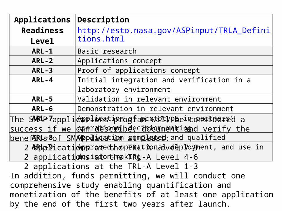
Applications Readiness Level
Description http://esto.nasa.gov/ASPinput/TRLA_Definitions.html
ARL-1 Basic researchARL-2 Applications conceptARL-3 Proof of applications conceptARL-4 Initial integration and verification in a laboratory environmentARL-5 Validation in relevant environmentARL-6 Demonstration in relevant environmentARL-7 Application of prototype in partners’ operational decision making ARL-8 Application completed and qualifiedARL-9 Approved, operational deployment, and use in decision-making
The SMAP applications program will be considered a success if we can describe, document and verify the benefits of SMAP data in at least:
2 applications at the TRL-A Level 7-9 2 applications at the TRL-A Level 4-62 applications at the TRL-A Level 1-3
In addition, funds permitting, we will conduct one comprehensive study enabling quantification and monetization of the benefits of at least one application by the end of the first two years after launch.
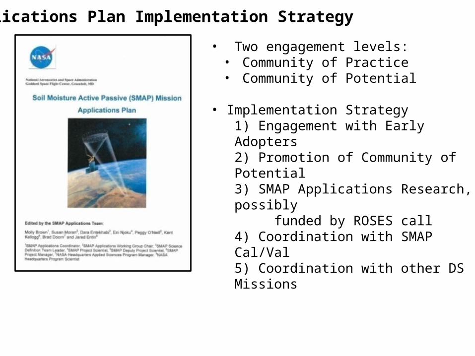
Applications Plan Implementation Strategy
• Two engagement levels:• Community of Practice• Community of Potential
• Implementation Strategy1) Engagement with Early Adopters2) Promotion of Community of Potential3) SMAP Applications Research, possibly funded by ROSES call4) Coordination with SMAP Cal/Val5) Coordination with other DS Missions
1) Engagement with Early Adopters
What is an Early Adopter?
Early Adopters are defined as those groups or individuals who have a clearly defined need for SMAP-like soil moisture or freeze/thaw data and who have sufficient interest and personnel to demonstrate the utility of SMAP data for their particular application.
Recall that applications are defined as innovative uses of SMAP data products in decision-making activities for societal benefit.
Why are we engaging Early Adopters?
To conduct pre-launch applications research to accelerate the use of SMAP products after the launch of SMAP
How are we engaging Early Adopters?
•MOA (unfunded, immediate)•ROSES RFP (funded in late 2012)
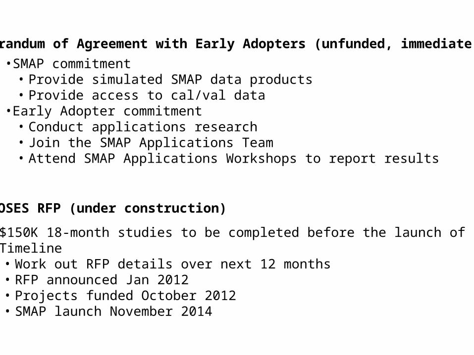
Memorandum of Agreement with Early Adopters (unfunded, immediate)
ROSES RFP (under construction)
•SMAP commitment• Provide simulated SMAP data products• Provide access to cal/val data
•Early Adopter commitment• Conduct applications research • Join the SMAP Applications Team• Attend SMAP Applications Workshops to report results
•$150K 18-month studies to be completed before the launch of SMAP•Timeline
• Work out RFP details over next 12 months• RFP announced Jan 2012• Projects funded October 2012• SMAP launch November 2014
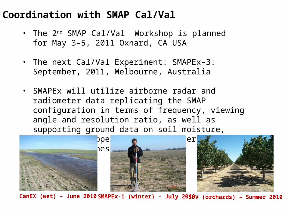
4) Coordination with SMAP Cal/Val
• The 2nd SMAP Cal/Val Workshop is planned for May 3-5, 2011 Oxnard, CA USA
• The next Cal/Val Experiment: SMAPEx-3: September, 2011, Melbourne, Australia
• SMAPEx will utilize airborne radar and radiometer data replicating the SMAP configuration in terms of frequency, viewing angle and resolution ratio, as well as supporting ground data on soil moisture, vegetation properties, soil temperature and surface roughness.
CanEX (wet) – June 2010 SMAPEx-1 (winter) – July 2010 SJV (orchards) – Summer 2010
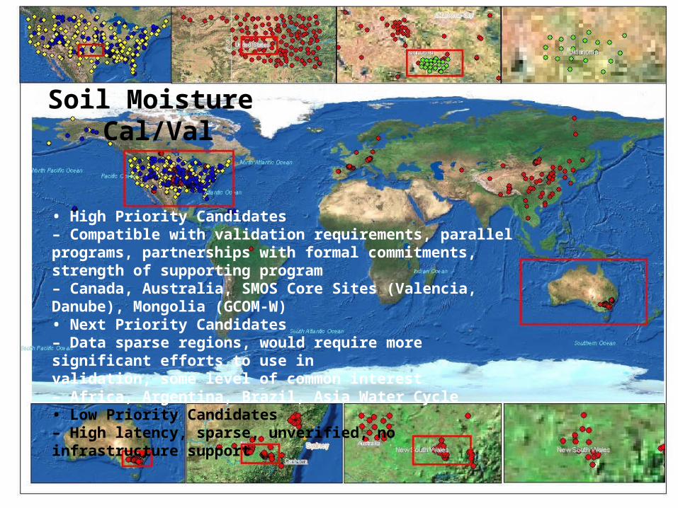
• High Priority Candidates– Compatible with validation requirements, parallel programs, partnerships with formal commitments, strength of supporting program– Canada, Australia, SMOS Core Sites (Valencia, Danube), Mongolia (GCOM-W)• Next Priority Candidates– Data sparse regions, would require more significant efforts to use invalidation, some level of common interest– Africa, Argentina, Brazil, Asia Water Cycle• Low Priority Candidates– High latency, sparse, unverified, no infrastructure support
Soil Moisture Cal/Val
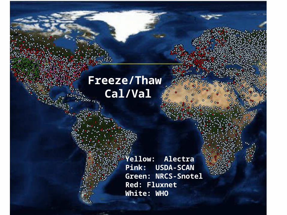
Yellow: AlectraPink: USDA-SCANGreen: NRCS-SnotelRed: FluxnetWhite: WHO
Freeze/Thaw Cal/Val

1st SMAP Applications Workshop, NOAA, September 9-11 20092nd Annual SMAP Applications Workshop, USDA, October 12-14 2011
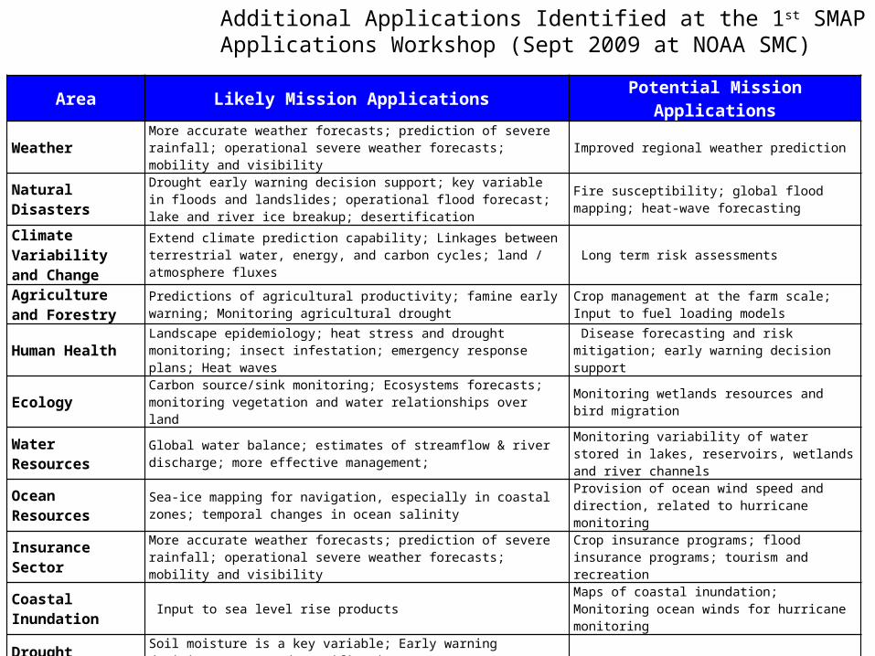
Area Likely Mission Applications Potential Mission Applications
Weather More accurate weather forecasts; prediction of severe rainfall; operational severe weather forecasts; mobility and visibility Improved regional weather prediction
Natural DisastersDrought early warning decision support; key variable in floods and landslides; operational flood forecast; lake and river ice breakup; desertification
Fire susceptibility; global flood mapping; heat-wave forecasting
Climate Variability and Change
Extend climate prediction capability; Linkages between terrestrial water, energy, and carbon cycles; land / atmosphere fluxes Long term risk assessments
Agriculture and Forestry
Predictions of agricultural productivity; famine early warning; Monitoring agricultural drought
Crop management at the farm scale; Input to fuel loading models
Human Health Landscape epidemiology; heat stress and drought monitoring; insect infestation; emergency response plans; Heat waves
Disease forecasting and risk mitigation; early warning decision support
Ecology Carbon source/sink monitoring; Ecosystems forecasts; monitoring vegetation and water relationships over land Monitoring wetlands resources and bird migration
Water Resources Global water balance; estimates of streamflow & river discharge; more effective management;
Monitoring variability of water stored in lakes, reservoirs, wetlands and river channels
Ocean Resources Sea-ice mapping for navigation, especially in coastal zones; temporal changes in ocean salinity
Provision of ocean wind speed and direction, related to hurricane monitoring
Insurance Sector More accurate weather forecasts; prediction of severe rainfall; operational severe weather forecasts; mobility and visibility
Crop insurance programs; flood insurance programs; tourism and recreation
Coastal Inundation
Input to sea level rise products Maps of coastal inundation; Monitoring ocean winds for hurricane monitoring
Drought Soil moisture is a key variable; Early warning decision support; desertification
Flood Improved forecasts; flood mapping; protect downstream resources; soil infiltration conditions; predict ice breakup;
Human Health Soil moisture is a key variable in monitoring vector population dynamics; decision support for malaria and other waterborne diseases
Ecosystem Health Monitoring of vegetation health & change; ecosystem dynamics Monitoring wetlands and bird migration
Landslides / Debris Flow
Soil moisture is a key variable; better prediction through consistent observations in mountainous regions
Wildfires Improved fuel loading models, especially for non-heavily forested areas
Additional Applications Identified at the 1st SMAP Applications Workshop (Sept 2009 at NOAA SMC)
1) Report progress from 1st Applications Workshop
2) Engage AppWG members in SMAP Cal/Val plans
3) Connect with the Community of Potential
4) Encourage more international participation in AppWG
5) Share lessons learned from applications research by SMAP Early Adopters• Thus, encourage more Early Adopters
6) Facilitate feedback from AppWG to SMAP Mission
Upcoming Workshop Goals
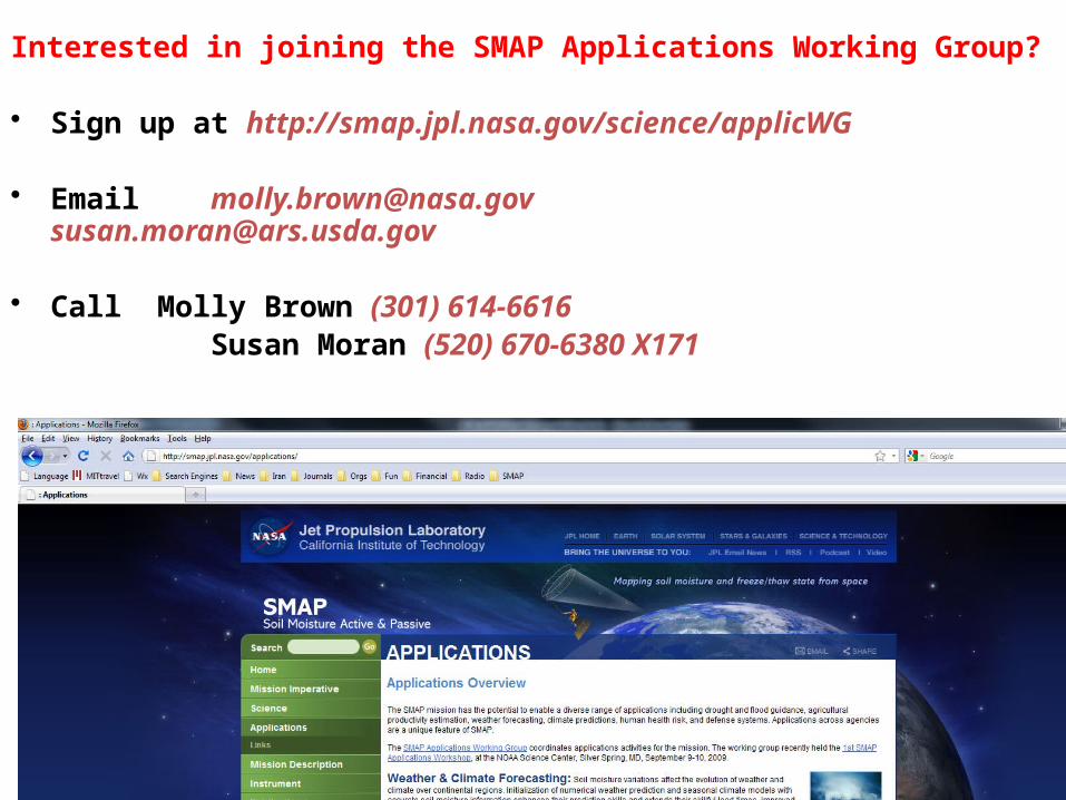
Interested in joining the SMAP Applications Working Group?
• Sign up at http://smap.jpl.nasa.gov/science/applicWG
• Email [email protected] [email protected]
• Call Molly Brown (301) 614-6616 Susan Moran (520) 670-6380 X171