Embed Size (px)
Citation preview
President: Bill Carroll, 5 Hutchinson Lane, Lenox, MA 01240, email: [email protected]
Vice President & Communications Committee: Joe Nelson, PO Box 267, Jericho, VT 05465, [email protected]
Secretary: Irene Barna, 7 Forbes Circle, Middlebury, VT 05753-1128, email: [email protected]
Membership: Dan Monger, email: [email protected]
THE BRIDGERThe Vermont Covered Bridge Society Newsletter – Issue #73
Events Vermont Covered Bridge Society
Fall Meeting September 29, 2018, 10:00 a.m.
Middlebury Congregational Church Addition 30 North Pleasant Street
Middlebury, Vermont
Meeting Agenda 9:00 a.m.
• Set-up time 10:00 a.m.
• Business meeting called to order • Reading of the minutes of the last meeting • Treasurer’s Report • Committee Reports
o Membership o Events o Communications o Bridge Watch o Historical o Publicity
11:00 a.m. • Vermont Architectural Historian Devin Coleman
will speak about his research on covered bridge builder Nichols Powers
12:00 p.m. • Break – dining arrangements and bridge tours
will be discussed The meeting is open to all comers. There are no fees.
• Snacks will be provided during the meeting. • Lunch on your own at restaurants nearby. • After adjournment, attendees are free to visit
the three local covered bridges. • Call Middlebury Chamber of Commerce at 802-
388-7951 for overnight accommodations.
Fall Meeting Directions: The meeting will be held in the meeting room adjacent to the Middlebury Congregational Church on 30 North Pleasant Street (Route 7), Middlebury. The church itself stands on the corner of Route 7 and Main Street. NOTE: We will not be meeting in the church; our meeting will be held in the contemporary addition, which faces North Pleasant Street (Route 7).
Library Update The Vermont Covered Bridge Society has recently welcomed several new members. Whether you are one of those new members, a long-time member, or a member somewhere in between, you share with us all a fondness for the historic covered bridges of Vermont and a concern for their preservation. One way to keep yourself informed is to read about the history and architecture of these beautiful structures. An easy and inexpensive way to do that is to avail yourself of the Society’s lending library. Details of the material available and the simple process for borrowing can be found on page 8 of this newsletter.
Summer Membership Update First, we all owe fellow member Philip R. Jordan a letter of gratitude. Phil, as editor and publisher of Vermont Magazine, placed an advertisement for the VCBS in the May-June 2018 issue of his magazine at no cost to us. In the ad, Phil mentioned our Web site and Facebook account. From the ad we gained three new members and two inquiries. Phil said he had responded to Joe Nelson’s “Needed – A New Life” article in the Spring 2018 issue of The Bridger. We all sincerely thank you, Phil.
THE BRIDGER SUMMER 2018
2
Phil must be doing something right in the management of his magazine. Sadly, in the May 10 issue of Vermont Digger, Governor Phil Scott announced that, after 72 years, he would no longer be publishing the state-run Vermont Life.
Secondly, there is a new policy which we must enforce. The VCBS presently has a total of 145 members. Sixty of those are life members, and 80 are annual members. The bad news is that 40 of our annual members are behind in their dues. Fourteen of them are in arrears of more than one year. We wish to inform the VCBS membership that if your copy of The Bridger arrives with a mailing label marked in red, it will be a subtle reminder that you are behind in your membership dues. Membership needs to be renewed each January 1st. Annual members who are more than one year behind in
dues need only pay for the current year to be considered in good standing. Members who don’t respond will be purged from the membership list. Finally, I wish to make a correction to my article, “Wood Preservation of Vermont Covered Bridges,” from the last issue of The Bridger. I misled our readers into possibly believing that copper naphthenate is found in our bodies. This is incorrect; ionic copper is found in our bodies, not naphthenate. In the previous two issues of The Bridger, I was remiss in my duties as Membership Chair in not listing members’ birthdays and anniversaries. Please bear with me. To be fair and get caught up, I am listing all birthdays and anniversaries from the winter, spring, and summer quarters. If I omitted anyone, please email me at [email protected].
Heartfelt Birthday and Anniversary Wishes to:
December
01 Terry and Jane Shaw 06 Priscilla O’Reilly 20 Ben and June Evans 20 Lyn Whiston 22 Richard Davis 23 Ed Barna 24 Dave and Marikka Guay 25 Ann Ovitt 26 Virginia Brackett 27 Steve and Susan Miyamoto 27 Dan Brock 28 Anthony and Pat Daniels 30 Gloria Davis 31 Jan Bramhall
January 04 Marclay and Thomas Davis 05 Aida Cyphers (1952) 12 Ray Hitchcock 12 Jim Patch 15 Dan Castellini 23 Ray and Adriene Hitchcock 29 Bill Jeffrey
February 02 Bill Caswell 07 Richard (Rick) Cyphers (1950)
12 Joe and Ruth Nelson 12 Robert Cassidy 14 Richard Howrigan 24 John Weaver 26 David Guay
March 02 John Billie 02 Gordon O’Reilly 04 Sarah Ann Gallagher 08 Neil Daniels 08 Merrilyn Towne 12 Priscilla Farmham 16 Bruce Laumeister 16 Bob Orr (1941) 21 Thomas and Lisette Keating 23 Steve Miyamoto 23 Greg Komeshok 24 Adrienne Hitchcock
April 02 Nancy Hoch 13 Gary Krick 22 Anthony Daniels 22 Dell and Nancy Hoch
May 03 William Carroll
03 Thomas Keating 04 Sarah Ann Gallagher 06 Debbie Whiston 09 Erwin Eckson 10 Charles Lovastik 12 James Crouse 15 Andy Behrens 17 Ron Bechard 20 Rick and Aida Cyphers 22 Irene Barna 22 Lisette Keating 27 June Gendron 28 Bill (Liam) McKone (1937)
June 04 Charlie Elflein 07 Carolyn Clapper 09 Bob and Joyce Orr (1962) 10 Ron and Marie Bechard 14 Dick and June Roy 20 Joanne Billie 20 Mark and Jan Bramhall 27 Glen Hall 27 Terry Shaw 28 Bob Kane 30 Lionel and Debra Whiston
THE BRIDGER SUMMER 2018
3
July 02 Dick and Kathleen Howrigan 04 Neil and Suzanne Daniels 05 Bill and Ada Jeffrey 11 Charles and Evelyn Lovastik 11 Marie Bechard 16 Melanie Schropp 20 Bob and Trish Kane 28 Ray Gendron 28 Dick Roy
28 Jan Lewandoski 28 Sandra Weaver
August 01 Irene Mele (1951) 08 Evelyn Lovastik 08 Virginia Eckson 10 Thomas Carpenter 13 N. David Charles 17 Euclid and Priscilla Farnham
18 Ed and Irene Barna 25 Jim and Linda Crouse 28 Mark Bramhall 29 Ray and Dolores Gendron 30 Ada Jeffrey 30 Robert McPherson
A Covered Bridge Tour – Pittsford to Clarendon
Pittsford The town of Pittsford was granted to Ephraim Doolittle and 63 others in 1761. A branch of the old Crown Point military road crossed Otter Creek there, the best fording place in the neighborhood. It was named Pitt’s Ford in honor of William Pitt, then Prime Minister of England. In the town of Pittsford alone, five covered bridges and bridge sites still stand, all within a two-mile stretch, as the crow flies. Hammond and Depot Bridges are near Florence. Heading south, the abutments of Mead Bridge, Cooley and Gorham Bridges can be viewed. Of the four bridges surviving in the town, three are in use – the Hammond span is retired.
The Pittsford bridges have a common appearance, with long gable overhang at the portals. The feature is designed to keep moisture away from the bridge’s main stringers, where they are bedded on the masonry of the abutment. Gorham, Hammond, Depot, and Cooley Bridges all feature an exaggerated portal overhang, and they all use the plank-lattice truss.
No one builder seems to have created the consistent appearance of the bridges. Abraham Owen used it when he built Depot Bridge in 1840, and again in 1841, when he and Nichols Powers built Gorham Bridge. Asa Nourse used it when he built Hammond Bridge in 1842. Powers employed it in Cooley Bridge in 1849. Powers later became a leading covered bridge builder. He went on to build Rutland’s Twin Bridges in 1850 and 1851, and Shrewsbury’s Brown Bridge in 1880, and none of these got the portal overhang treatment found in Pittsford.
Richard Sanders Allen in his Covered Bridges of the Northeast relates the following anecdote about the
Pittsford Bridges. “It was Avery Billings of nearby Rutland who went on record with the classic answer to a petition for one more bridge in his town, ‘Mr. Moderator,’ he bellowed in March meeting, ‘In as much as we have already built bridges over Otter Creek at Goodkins Falls, Ripley’s, Dorr’s, and Billings’s, four bridges in two-and-a-half miles, Mr. Moderator, I move we bridge the whole [dang] creek, lengthwise!’”
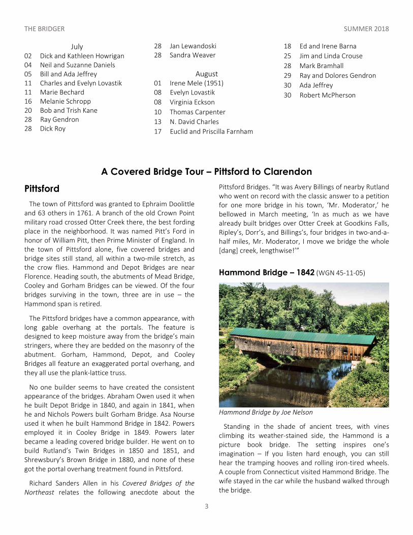
Hammond Bridge – 1842 (WGN 45-11-05)
Hammond Bridge by Joe Nelson
Standing in the shade of ancient trees, with vines climbing its weather-stained side, the Hammond is a picture book bridge. The setting inspires one’s imagination – If you listen hard enough, you can still hear the tramping hooves and rolling iron-tired wheels. A couple from Connecticut visited Hammond Bridge. The wife stayed in the car while the husband walked through the bridge.
THE BRIDGER SUMMER 2018
4
Suddenly, the car door locks clicked shut, then open, then shut and open again. Her first thought was that the husband was pressing the keyless remote, but the keys and remote were hanging from the ignition switch. Just then, the husband returned to the car. “I heard such strange noises on that bridge, like people talking and working, but I walked all the way to the end of the bridge, and no one was there.” (As reported by Country Magazine: October/November 2008)
The 139-foot Hammond Bridge spans the Otter Creek. It was lifted off its abutments by the 1927 flood and left stranded in a field more than a mile downstream. The town dragged the bridge back to its proper place the following winter, when the ground was firm and the ice on the creek would support the work.
Hammond Bridge is out of service now, and the road rerouted to bypass it. An historic site sign stands near the bridge portal. To find the bridge, leave Route 7 west on Kendall Hill Road, 6.7 miles south of Brandon, or 2 miles north of the junction of Route 7 and Route 3. Drive .6 mile. In the summer of 2003, the bridge, overdue for repairs, was deemed too dangerous even for pedestrian traffic. Part of a state-owned site along Kendall Hill Road, the bridge had been closed to vehicular traffic for more than a decade.
According to Jan Lewandoski in Restoration and Traditional Building, Inc., “A wooden bridge’s own dead load is the heaviest weight it has to carry, and is always its biggest problem. Through the years, Hammond Bridge has been subject to what engineers call ‘creep,’ a gradual increase in its downward deflection. Well-maintained covered bridges compensate with a slight upward bend known as camber, but this bridge has lost its camber entirely and is visibly sagging.”
The Hammond site is attractive to tourists because it’s adjacent to an historic trail on the other side of Otter Creek. The trail accesses the site of Fort Mott of Revolutionary War times and Pitt’s Ford, where troops could cross before there were any bridges.
To see Depot Bridge, pass the Hammond, crossing the railroad tracks. Drive up the hill to Florence-Proctor Road. Turn left and continue to a fork in the road. Take the left fork, drive through the narrow old railroad overpass, and continue on Florence-Proctor Road for about .9 mile. Turn left on Depot Street to approach the bridge.
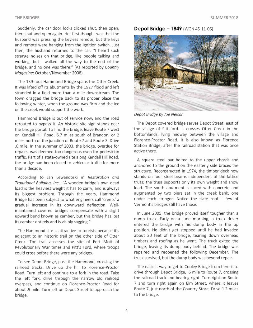
Depot Bridge – 1849 (WGN 45-11-06)
Depot Bridge by Joe Nelson
The Depot covered bridge serves Depot Street, east of the village of Pittsford. It crosses Otter Creek in the bottomlands, lying midway between the village and Florence-Proctor Road. It is also known as Florence Station Bridge, after the railroad station that was once active there.
A square steel bar bolted to the upper chords and anchored to the ground on the easterly side braces the structure. Reconstructed in 1974, the timber deck now stands on four steel beams independent of the lattice truss; the truss supports only its own weight and snow load. The south abutment is faced with concrete and augmented by two piers set in the creek bank, one under each stringer. Notice the slate roof – few of Vermont’s bridges still have those.
In June 2005, the bridge proved itself tougher than a dump truck. Early on a June morning, a truck driver entered the bridge with his dump body in the up position. He didn’t get stopped until he had invaded about 20 feet of the bridge, tearing down overhead timbers and roofing as he went. The truck exited the bridge, leaving its dump body behind. The bridge was repaired and reopened the following December. The truck survived, but the dump body was beyond repair.
The easiest way to get to Cooley Bridge from here is to drive through Depot Bridge, .6 mile to Route 7, crossing the railroad track and bearing right. Turn right on Route 7 and turn right again on Elm Street, where it leaves Route 7, just north of the Country Store. Drive 1.2 miles to the bridge.
THE BRIDGER SUMMER 2018
5
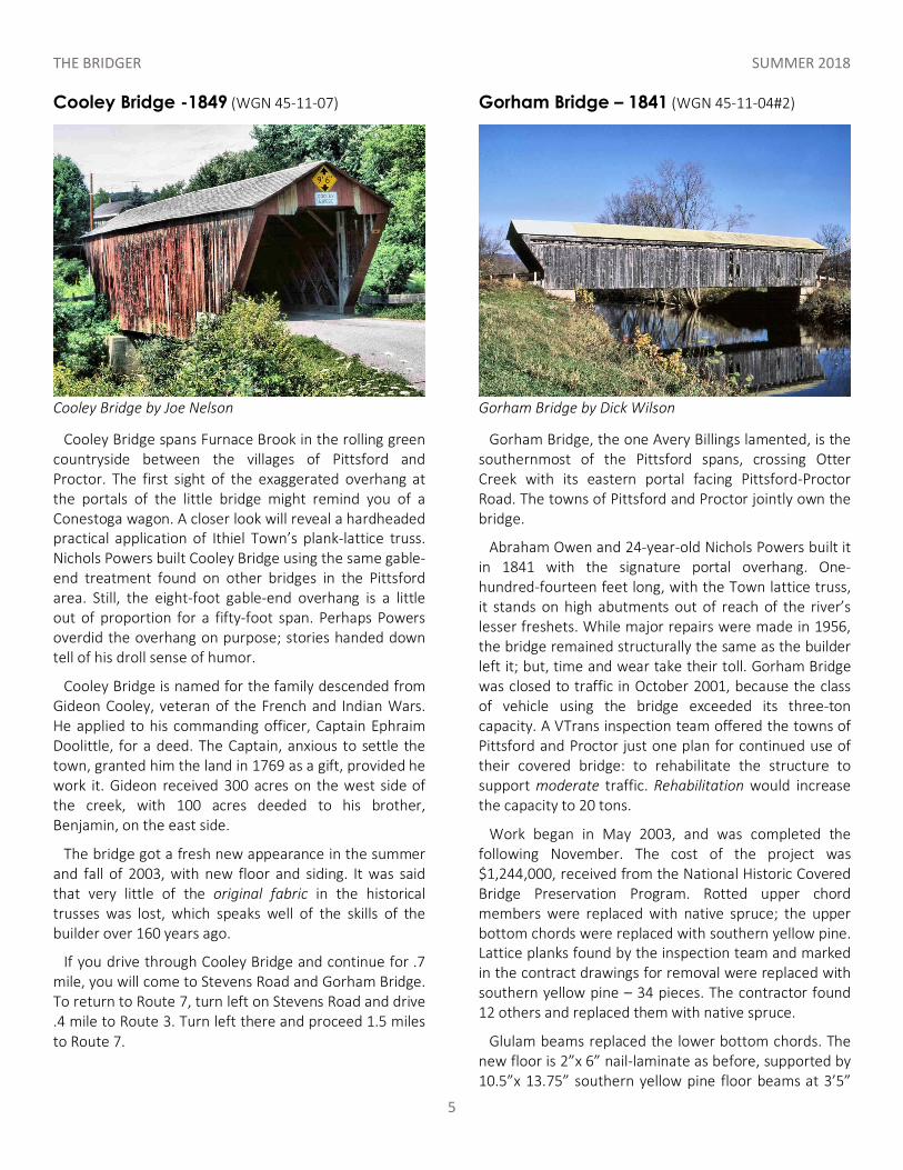
Cooley Bridge -1849 (WGN 45-11-07)
Cooley Bridge by Joe Nelson
Cooley Bridge spans Furnace Brook in the rolling green countryside between the villages of Pittsford and Proctor. The first sight of the exaggerated overhang at the portals of the little bridge might remind you of a Conestoga wagon. A closer look will reveal a hardheaded practical application of Ithiel Town’s plank-lattice truss. Nichols Powers built Cooley Bridge using the same gable-end treatment found on other bridges in the Pittsford area. Still, the eight-foot gable-end overhang is a little out of proportion for a fifty-foot span. Perhaps Powers overdid the overhang on purpose; stories handed down tell of his droll sense of humor.
Cooley Bridge is named for the family descended from Gideon Cooley, veteran of the French and Indian Wars. He applied to his commanding officer, Captain Ephraim Doolittle, for a deed. The Captain, anxious to settle the town, granted him the land in 1769 as a gift, provided he work it. Gideon received 300 acres on the west side of the creek, with 100 acres deeded to his brother, Benjamin, on the east side.
The bridge got a fresh new appearance in the summer and fall of 2003, with new floor and siding. It was said that very little of the original fabric in the historical trusses was lost, which speaks well of the skills of the builder over 160 years ago.
If you drive through Cooley Bridge and continue for .7 mile, you will come to Stevens Road and Gorham Bridge. To return to Route 7, turn left on Stevens Road and drive .4 mile to Route 3. Turn left there and proceed 1.5 miles to Route 7.
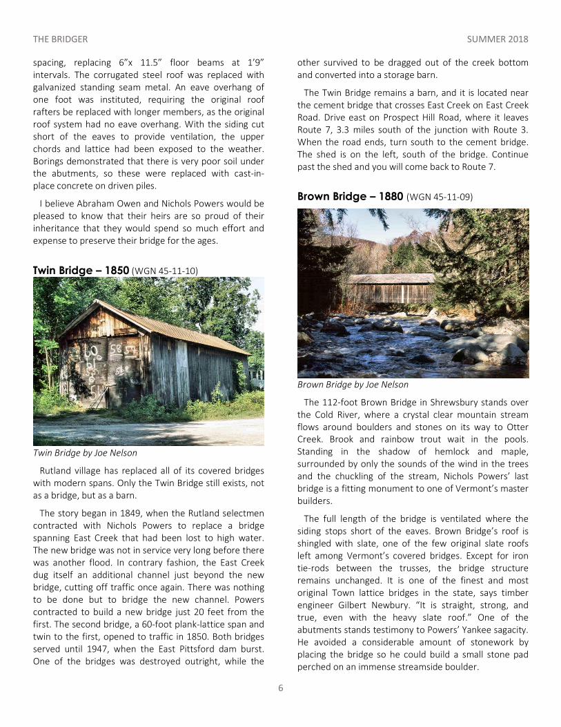
Gorham Bridge – 1841 (WGN 45-11-04#2)
Gorham Bridge by Dick Wilson
Gorham Bridge, the one Avery Billings lamented, is the southernmost of the Pittsford spans, crossing Otter Creek with its eastern portal facing Pittsford-Proctor Road. The towns of Pittsford and Proctor jointly own the bridge.
Abraham Owen and 24-year-old Nichols Powers built it in 1841 with the signature portal overhang. One-hundred-fourteen feet long, with the Town lattice truss, it stands on high abutments out of reach of the river’s lesser freshets. While major repairs were made in 1956, the bridge remained structurally the same as the builder left it; but, time and wear take their toll. Gorham Bridge was closed to traffic in October 2001, because the class of vehicle using the bridge exceeded its three-ton capacity. A VTrans inspection team offered the towns of Pittsford and Proctor just one plan for continued use of their covered bridge: to rehabilitate the structure to support moderate traffic. Rehabilitation would increase the capacity to 20 tons.
Work began in May 2003, and was completed the following November. The cost of the project was $1,244,000, received from the National Historic Covered Bridge Preservation Program. Rotted upper chord members were replaced with native spruce; the upper bottom chords were replaced with southern yellow pine. Lattice planks found by the inspection team and marked in the contract drawings for removal were replaced with southern yellow pine – 34 pieces. The contractor found 12 others and replaced them with native spruce.
Glulam beams replaced the lower bottom chords. The new floor is 2”x 6” nail-laminate as before, supported by 10.5”x 13.75” southern yellow pine floor beams at 3’5”
THE BRIDGER SUMMER 2018
6
spacing, replacing 6”x 11.5” floor beams at 1’9” intervals. The corrugated steel roof was replaced with galvanized standing seam metal. An eave overhang of one foot was instituted, requiring the original roof rafters be replaced with longer members, as the original roof system had no eave overhang. With the siding cut short of the eaves to provide ventilation, the upper chords and lattice had been exposed to the weather. Borings demonstrated that there is very poor soil under the abutments, so these were replaced with cast-in-place concrete on driven piles.
I believe Abraham Owen and Nichols Powers would be pleased to know that their heirs are so proud of their inheritance that they would spend so much effort and expense to preserve their bridge for the ages.
Twin Bridge – 1850 (WGN 45-11-10)
Twin Bridge by Joe Nelson
Rutland village has replaced all of its covered bridges with modern spans. Only the Twin Bridge still exists, not as a bridge, but as a barn.
The story began in 1849, when the Rutland selectmen contracted with Nichols Powers to replace a bridge spanning East Creek that had been lost to high water. The new bridge was not in service very long before there was another flood. In contrary fashion, the East Creek dug itself an additional channel just beyond the new bridge, cutting off traffic once again. There was nothing to be done but to bridge the new channel. Powers contracted to build a new bridge just 20 feet from the first. The second bridge, a 60-foot plank-lattice span and twin to the first, opened to traffic in 1850. Both bridges served until 1947, when the East Pittsford dam burst. One of the bridges was destroyed outright, while the
other survived to be dragged out of the creek bottom and converted into a storage barn.
The Twin Bridge remains a barn, and it is located near the cement bridge that crosses East Creek on East Creek Road. Drive east on Prospect Hill Road, where it leaves Route 7, 3.3 miles south of the junction with Route 3. When the road ends, turn south to the cement bridge. The shed is on the left, south of the bridge. Continue past the shed and you will come back to Route 7.
Brown Bridge – 1880 (WGN 45-11-09)
Brown Bridge by Joe Nelson
The 112-foot Brown Bridge in Shrewsbury stands over the Cold River, where a crystal clear mountain stream flows around boulders and stones on its way to Otter Creek. Brook and rainbow trout wait in the pools. Standing in the shadow of hemlock and maple, surrounded by only the sounds of the wind in the trees and the chuckling of the stream, Nichols Powers’ last bridge is a fitting monument to one of Vermont’s master builders.
The full length of the bridge is ventilated where the siding stops short of the eaves. Brown Bridge’s roof is shingled with slate, one of the few original slate roofs left among Vermont’s covered bridges. Except for iron tie-rods between the trusses, the bridge structure remains unchanged. It is one of the finest and most original Town lattice bridges in the state, says timber engineer Gilbert Newbury. “It is straight, strong, and true, even with the heavy slate roof.” One of the abutments stands testimony to Powers’ Yankee sagacity. He avoided a considerable amount of stonework by placing the bridge so he could build a small stone pad perched on an immense streamside boulder.
THE BRIDGER SUMMER 2018
7
Some decay and structural problems were found in a 2008 VTrans inspection of Brown Bridge. In 2011, Tropical Storm Irene took out the Upper Cold River Road leading down to the bridge, but did minimal damage to the bridge itself. The bridge’s recent VTrans rehabilitation included repairs to the truss lattices and abutments, replacement of the siding and some roof slates, and a few other repairs. The cost of repairs to the bridge was a modest $414,887.
In September 2014, the U.S. Secretary of the Interior and National Park Service announced the designation of nine new national historic landmarks, among them, Brown Bridge. A dedication ceremony took place at the bridge in July 2016, celebrating the bridge and the opening of the adjacent Jim Jeffords State Forest.
Brown Bridge crosses the Cold River on Upper Cold River Road, just below the bend in the road to Shrewsbury. Cold River Road can be reached by turning east off Route 7 under the traffic light at North Clarendon, 1.1 miles south of the junction with U.S. Route 4.
Clarendon The region that later became known as the town of Clarendon was settled by families from lower New England as early as 1762. It was then part of Albany County, claimed by New York, then split off as Charlotte County, New York, until Vermont declared itself a republic in 1788.
Clarendon, claimed under three different titles, became a flashpoint for the conflict between the Green Mountain Boys and New York officials. Governor Shirley of Massachusetts granted the first title as Durham Township in 1744 to Colonel John Henry Lydius of Albany, New York. New Hampshire Governor Benning Wentworth granted the area as Clarendon in 1761. New York Governor Dunmore issued the Socialborough grant in 1771. When the various settlers came together, the fur flew.
In 1773, after New York officers arrived to support the New York titles, Ethan Allen and 100 Green Mountain Boys marched in to support the New Hampshire grants. Ultimately, through the persuasion of kangaroo courts backed by rifles and cutlasses, most of the inhabitants agreed to purchase New Hampshire titles. In
consequence of their actions, a New York law was passed, adjudging the Green Mountain Boys to be guilty of felony and requiring them to suffer death, without trial or benefit of clergy, if they didn’t give themselves up. Allen dared them to come for him. The onset of the Revolution resolved the standoff.
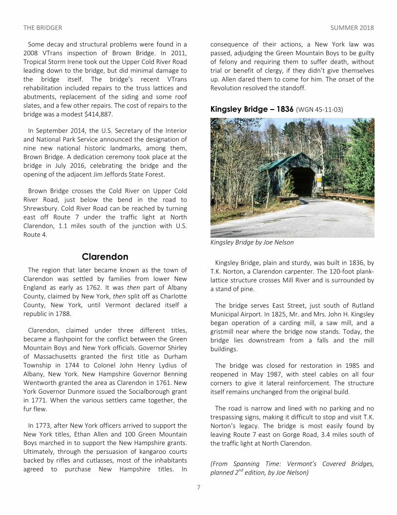
Kingsley Bridge – 1836 (WGN 45-11-03)
Kingsley Bridge by Joe Nelson
Kingsley Bridge, plain and sturdy, was built in 1836, by T.K. Norton, a Clarendon carpenter. The 120-foot plank-lattice structure crosses Mill River and is surrounded by a stand of pine.
The bridge serves East Street, just south of Rutland Municipal Airport. In 1825, Mr. and Mrs. John H. Kingsley began operation of a carding mill, a saw mill, and a gristmill near where the bridge now stands. Today, the bridge lies downstream from a falls and the mill buildings.
The bridge was closed for restoration in 1985 and reopened in May 1987, with steel cables on all four corners to give it lateral reinforcement. The structure itself remains unchanged from the original build.
The road is narrow and lined with no parking and no trespassing signs, making it difficult to stop and visit T.K. Norton’s legacy. The bridge is most easily found by leaving Route 7 east on Gorge Road, 3.4 miles south of the traffic light at North Clarendon.
(From Spanning Time: Vermont’s Covered Bridges, planned 2nd edition, by Joe Nelson)
THE BRIDGER SUMMER 2018
8
VCBS Lending Library: A Learning/Pleasure Reading/
Research Source The Vermont Covered Bridge Society has assembled a lending library available through media mail to all society members in good standing.
Librarian Warren Tripp has created a detailed book list complete with a description and critique of each book. Copies of the index are available by mail, or you may contact Joe Nelson for an electronic copy at [email protected], or go to http://www.vermontbridges.com/whatis.vcbs.htm#item7. A borrower can contact Warren Tripp, who will send the book by Postal Service Media Mail. Books are returned the same way.
Send Warren the complete title of the book(s) you wish to borrow. He will respond with the mailing cost and mail the order when the fee is received. The borrower is then responsible to return the item(s) in a reasonable time, preferably no longer than two months. Contact Warren Tripp, P.O. Box 185, South Barre, VT 05670, [email protected], phone 802-584-3545.
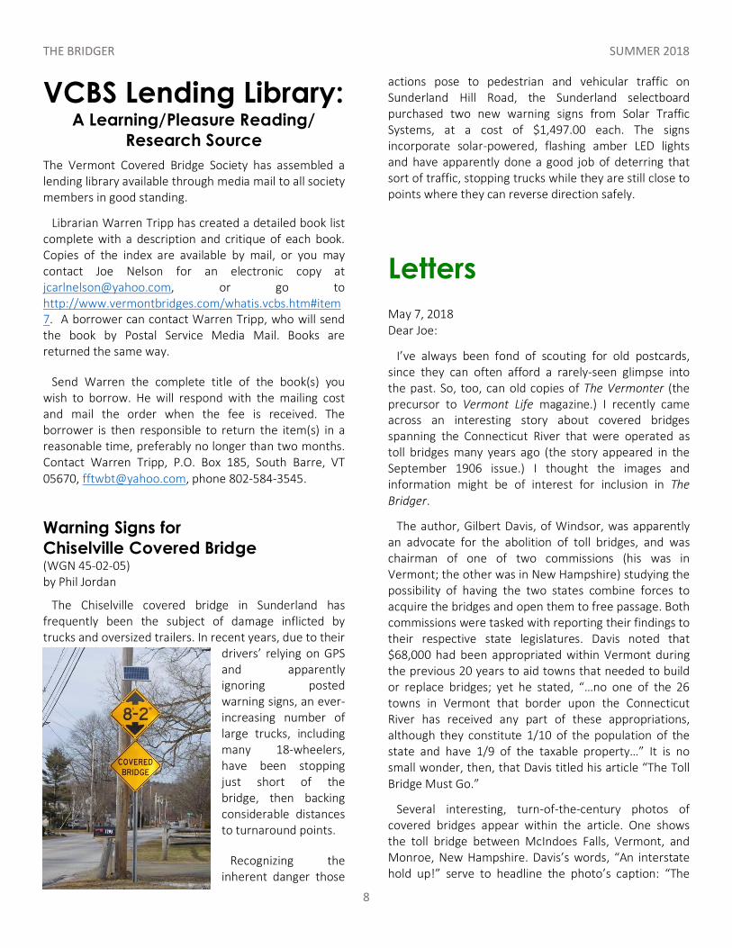
Warning Signs for Chiselville Covered Bridge (WGN 45-02-05) by Phil Jordan
The Chiselville covered bridge in Sunderland has frequently been the subject of damage inflicted by trucks and oversized trailers. In recent years, due to their
drivers’ relying on GPS and apparently ignoring posted warning signs, an ever-increasing number of large trucks, including many 18-wheelers, have been stopping just short of the bridge, then backing considerable distances to turnaround points.
Recognizing the inherent danger those
actions pose to pedestrian and vehicular traffic on Sunderland Hill Road, the Sunderland selectboard purchased two new warning signs from Solar Traffic Systems, at a cost of $1,497.00 each. The signs incorporate solar-powered, flashing amber LED lights and have apparently done a good job of deterring that sort of traffic, stopping trucks while they are still close to points where they can reverse direction safely.
Letters May 7, 2018 Dear Joe:
I’ve always been fond of scouting for old postcards, since they can often afford a rarely-seen glimpse into the past. So, too, can old copies of The Vermonter (the precursor to Vermont Life magazine.) I recently came across an interesting story about covered bridges spanning the Connecticut River that were operated as toll bridges many years ago (the story appeared in the September 1906 issue.) I thought the images and information might be of interest for inclusion in The Bridger.
The author, Gilbert Davis, of Windsor, was apparently an advocate for the abolition of toll bridges, and was chairman of one of two commissions (his was in Vermont; the other was in New Hampshire) studying the possibility of having the two states combine forces to acquire the bridges and open them to free passage. Both commissions were tasked with reporting their findings to their respective state legislatures. Davis noted that $68,000 had been appropriated within Vermont during the previous 20 years to aid towns that needed to build or replace bridges; yet he stated, “…no one of the 26 towns in Vermont that border upon the Connecticut River has received any part of these appropriations, although they constitute 1/10 of the population of the state and have 1/9 of the taxable property…” It is no small wonder, then, that Davis titled his article “The Toll Bridge Must Go.”
Several interesting, turn-of-the-century photos of covered bridges appear within the article. One shows the toll bridge between McIndoes Falls, Vermont, and Monroe, New Hampshire. Davis’s words, “An interstate hold up!” serve to headline the photo’s caption: “The
THE BRIDGER SUMMER 2018
9
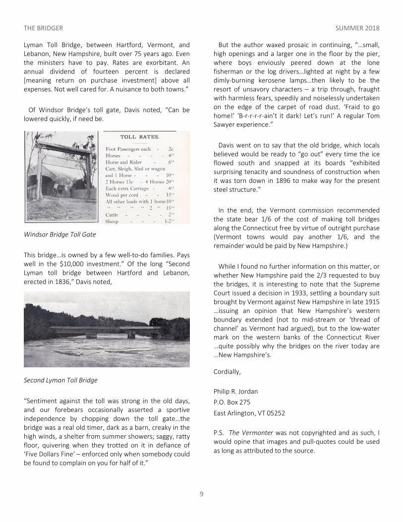
Lyman Toll Bridge, between Hartford, Vermont, and Lebanon, New Hampshire, built over 75 years ago. Even the ministers have to pay. Rates are exorbitant. An annual dividend of fourteen percent is declared [meaning return on purchase investment] above all expenses. Not well cared for. A nuisance to both towns.”
Of Windsor Bridge’s toll gate, Davis noted, “Can be lowered quickly, if need be.
Windsor Bridge Toll Gate
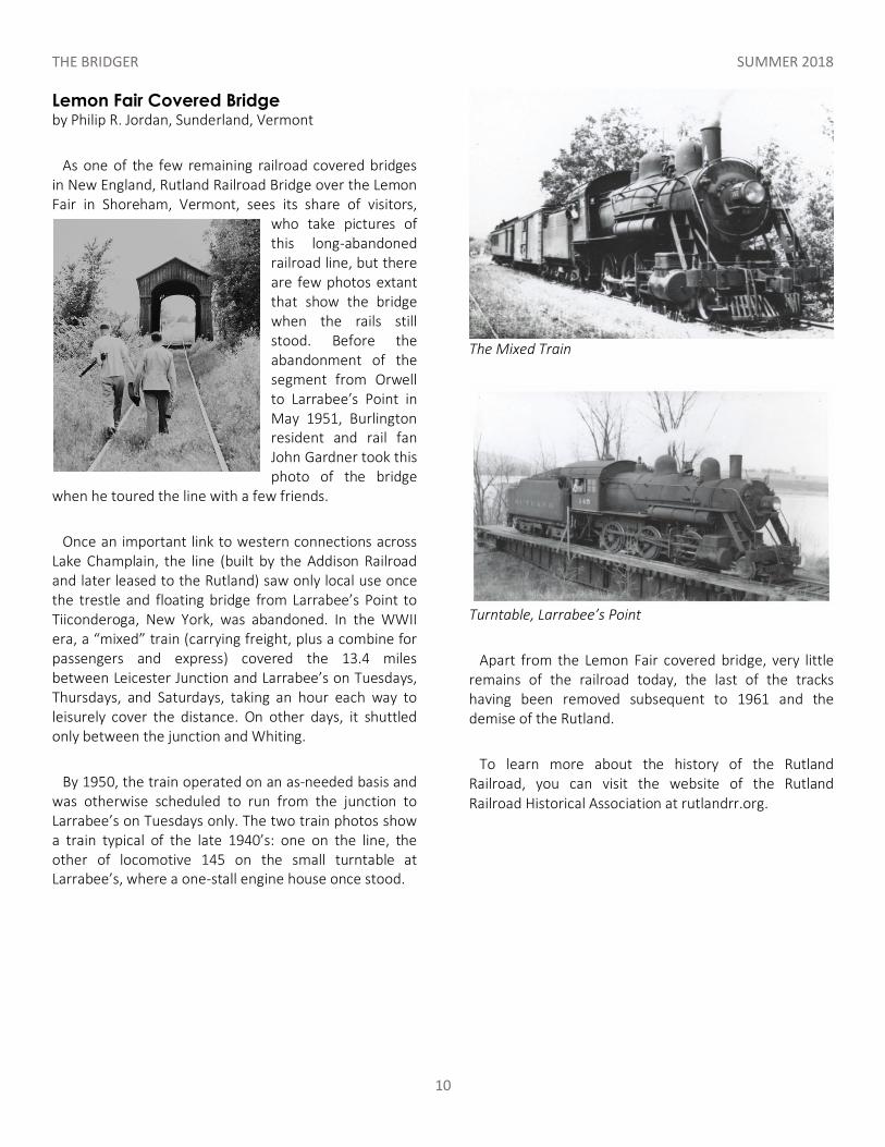
This bridge…is owned by a few well-to-do families. Pays well in the $10,000 investment.” Of the long “Second Lyman toll bridge between Hartford and Lebanon, erected in 1836,” Davis noted,
Second Lyman Toll Bridge
“Sentiment against the toll was strong in the old days, and our forebears occasionally asserted a sportive independence by chopping down the toll gate…the bridge was a real old timer, dark as a barn, creaky in the high winds, a shelter from summer showers; saggy, ratty floor, quivering when they trotted on it in defiance of ‘Five Dollars Fine’ – enforced only when somebody could be found to complain on you for half of it.”
But the author waxed prosaic in continuing, “…small, high openings and a larger one in the floor by the pier, where boys enviously peered down at the lone fisherman or the log drivers…lighted at night by a few dimly-burning kerosene lamps…then likely to be the resort of unsavory characters – a trip through, fraught with harmless fears, speedily and noiselessly undertaken on the edge of the carpet of road dust. ‘Fraid to go home!’ ‘B-r-r-r-r-ain’t it dark! Let’s run!’ A regular Tom Sawyer experience.”
Davis went on to say that the old bridge, which locals believed would be ready to “go out” every time the ice flowed south and snapped at its boards “exhibited surprising tenacity and soundness of construction when it was torn down in 1896 to make way for the present steel structure.”
In the end, the Vermont commission recommended the state bear 1/6 of the cost of making toll bridges along the Connecticut free by virtue of outright purchase (Vermont towns would pay another 1/6, and the remainder would be paid by New Hampshire.)
While I found no further information on this matter, or whether New Hampshire paid the 2/3 requested to buy the bridges, it is interesting to note that the Supreme Court issued a decision in 1933, settling a boundary suit brought by Vermont against New Hampshire in late 1915 …issuing an opinion that New Hampshire’s western boundary extended (not to mid-stream or ‘thread of channel’ as Vermont had argued), but to the low-water mark on the western banks of the Connecticut River …quite possibly why the bridges on the river today are …New Hampshire’s.
Cordially, Philip R. Jordan P.O. Box 275 East Arlington, VT 05252 P.S. The Vermonter was not copyrighted and as such, I would opine that images and pull-quotes could be used as long as attributed to the source.
THE BRIDGER SUMMER 2018
10
Lemon Fair Covered Bridge by Philip R. Jordan, Sunderland, Vermont
As one of the few remaining railroad covered bridges in New England, Rutland Railroad Bridge over the Lemon Fair in Shoreham, Vermont, sees its share of visitors,
who take pictures of this long-abandoned railroad line, but there are few photos extant that show the bridge when the rails still stood. Before the abandonment of the segment from Orwell to Larrabee’s Point in May 1951, Burlington resident and rail fan John Gardner took this photo of the bridge
when he toured the line with a few friends.
Once an important link to western connections across Lake Champlain, the line (built by the Addison Railroad and later leased to the Rutland) saw only local use once the trestle and floating bridge from Larrabee’s Point to Tiiconderoga, New York, was abandoned. In the WWII era, a “mixed” train (carrying freight, plus a combine for passengers and express) covered the 13.4 miles between Leicester Junction and Larrabee’s on Tuesdays, Thursdays, and Saturdays, taking an hour each way to leisurely cover the distance. On other days, it shuttled only between the junction and Whiting.
By 1950, the train operated on an as-needed basis and was otherwise scheduled to run from the junction to Larrabee’s on Tuesdays only. The two train photos show a train typical of the late 1940’s: one on the line, the other of locomotive 145 on the small turntable at Larrabee’s, where a one-stall engine house once stood.
The Mixed Train
Turntable, Larrabee’s Point
Apart from the Lemon Fair covered bridge, very little remains of the railroad today, the last of the tracks having been removed subsequent to 1961 and the demise of the Rutland.
To learn more about the history of the Rutland Railroad, you can visit the website of the Rutland Railroad Historical Association at rutlandrr.org.
THE BRIDGER SUMMER 2018
11
Spanning Time: Vermont's Covered Bridges by Joseph C. Nelson features 102 color photographs of Vermont's covered bridges in fifteen chapters, each a guided tour. The tours are complete with maps, commentary on the uniqueness of each bridge, and historic highlights about the towns and villages in which the bridges stand. An appendix provides: A Summary of Vermont's Covered Bridges; A Covered Bridge Glossary; A Bridge Truss section, explaining how trusses work; Thumbnail biographies of people who designed and built the bridges; A Covered Bridge Reading List, for bridge and history buffs; A detailed Index. Spanning Time: Vermont's Covered Bridges: 7" x 10", 288 pages. Published by New England Press at P.O. Box 575, Shelburne, VT 05482. Spanning Time is available directly from the author for $39.00, free shipping. Go to: www.vermontbridges.com/special% 20070514.htm. Also see: www.vermontbridges.com/bookreviews.htm.
New York State’s Covered Bridges - When one typically thinks of covered bridges, New York is not the first state to come to mind, but New York once had over 300 covered bridges. Floods, fires and progress have claimed all but 32. Readers will enjoy seeing NY’s current bridges, including the oldest existing covered bridge in the U.S., the Hyde Hall Covered Bridge, located in Glimmerglass State Park, and the world’s longest
single-span covered bridge in the world, the Blenheim Covered Bridge, washed away by Tropical Storm Irene in 2011. This book also highlights the Theodore Burr Covered Bridge Resource Center in Oxford, NY, the first ever center of its kind specifically designed for covered bridge researchers.
Visions of Vermont art gallery, Jeffersonville, Vermont at: https://www.visionsofvermont.com/ 802.644.8183 A special sale for the benefit of the Vermont Covered Bridge Society featuring the works of Eric Tobin. All proceeds of the unframed prints go to the VCBS. Sale of the framed prints will be shared 50/50. They are all Giclée on acid free paper. The glass is non-glare artist’s glass. 10x12 $125 unframed 16x20 $175 unframed 16x20 $550 Matted and framed 20x24 $850 Matted and framed
Connecticut and Rhode Island Covered Bridges – Price reduced! During their heyday in the mid- to late 1800s, more than 150 covered bridges dotted the landscape of Connecticut and Rhode Island. Since that time, floods, fires, and progress have claimed all but two of the historic structures. With over 200 images, this book provides insight into the covered bridge history of an area that has not been well documented in the past. To order your signed copy, send $20.00 to Bill Caswell, 535 Second NH Turnpike, Hillsboro, NH 03244.
Covered Bridges of New England —DVD Produced by Ocean State Video of Rhode Island for Public Television. On Sale: $20.00. Profits go to the Vermont Covered Bridge Society's Save-A-Bridge Program. For your copy send $20.00 plus $2.50 shipping to Joe Nelson, P.O. Box 267, Jericho, VT 05465-0267.
THE BRIDGER SUMMER 2018
12
Membership Application
(Business or Society please provide name of contact person)
____ New Member ____ Renewing Member
Name ___________________________________
Street ___________________________________
City _____________________________________
State ____________________ Zip ____________
Telephone________________________________
email____________________________________
Check type of membership ___ Individual - $10 ___ Family - $15 ___ Student - $8
___ Life single - $150 ___ Life couple - $200
___ Business/Organization/Municipality - $15
___ Sign me up for PDF version of newsletter
Check type of donation; We are a 501c3 Non-profit org. (Federal tax deductible.) ___Palladio - $2 ___Palmer - $5 ___Hale - $10
___Powers - $50 ___Town - $75 ___Tasker - $100
___Paddleford - $200 ___ Whipple - $250
(Memberships valid to the end of the current calendar year,
Dues and Donations will be used to promote preservation of Covered bridges.)
Please make all checks for dues and donations payable to: The Vermont Covered Bridge Society.
Mail to: V.C.B.S., Inc. P.O. Box 267 Jericho, VT 05465-0267