Embed Size (px)
Citation preview
Central Valley Regional Water Board Meeting of 21 September 2006, Item #7 Page 1
History, Lithology and Groundwater Conditions in the Tulare Lake Basin Information Item
Slide 1
History, Lithology, and Groundwater Conditions in
the Tulare Lake Basin
David A. SholesSenior Engineering Geologist
Item #7 21 September 2006
Good morning Mr. Chairman and members of the board. I am David Sholes, a Senior Engineering Geologist in the Agriculture and Planning Unit at the Fresno Office.
In recent board meetings, issues regarding Groundwater quality in the Tulare Lake Basin have been brought forward. Today I am providing an overview of groundwater quality in the Tulare Lake Basin. Groundwater quality is largely determined by natural conditions, and modified human influences.
This is an informational item only, and no action on your part is required.
Central Valley Regional Water Board Meeting of 21 September 2006, Item #7 Page 2
History, Lithology and Groundwater Conditions in the Tulare Lake Basin Information Item
Slide 2
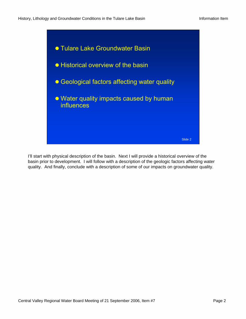
Tulare Lake Groundwater Basin
Historical overview of the basin
Geological factors affecting water quality
Water quality impacts caused by human influences
I’ll start with physical description of the basin. Next I will provide a historical overview of the basin prior to development. I will follow with a description of the geologic factors affecting water quality. And finally, conclude with a description of some of our impacts on groundwater quality.
Central Valley Regional Water Board Meeting of 21 September 2006, Item #7 Page 3
History, Lithology and Groundwater Conditions in the Tulare Lake Basin Information Item
Slide 3
i
Co
a
st
Ranges
C
o
a
R
a
n
g
e
s
C
a
s
c
a
d
e
R
a
n
g
e
Williamson, A.K., Prudic, D.E., and Swain, L.A., 1989, Ground-water flow in the Central
Valley, California: U.S. Geological Survey Professional Paper 1401-D, 127 p.
Tulare Basin
Central Valley drainage basinboundary
Tulare LakeGroundwater Basin
Fresno
Bakersfield
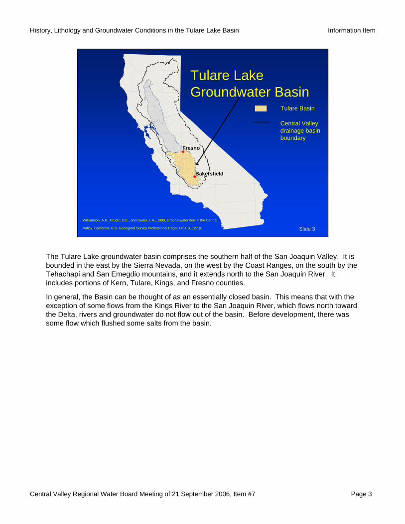
The Tulare Lake groundwater basin comprises the southern half of the San Joaquin Valley. It is bounded in the east by the Sierra Nevada, on the west by the Coast Ranges, on the south by the Tehachapi and San Emegdio mountains, and it extends north to the San Joaquin River. It includes portions of Kern, Tulare, Kings, and Fresno counties.
In general, the Basin can be thought of as an essentially closed basin. This means that with the exception of some flows from the Kings River to the San Joaquin River, which flows north toward the Delta, rivers and groundwater do not flow out of the basin. Before development, there was some flow which flushed some salts from the basin.
Central Valley Regional Water Board Meeting of 21 September 2006, Item #7 Page 4
History, Lithology and Groundwater Conditions in the Tulare Lake Basin Information Item
Slide 4
Tulare Lake - 1850
Fresno
Alpaugh
Hanford
Bakersfield
Visalia
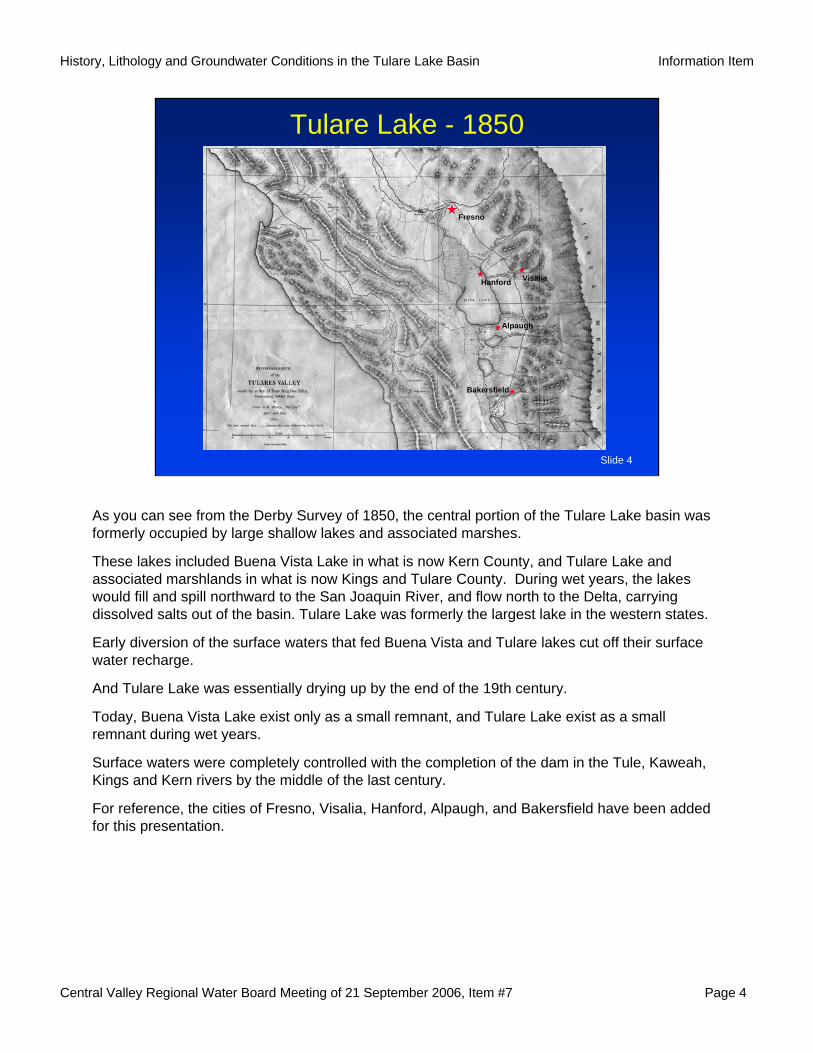
As you can see from the Derby Survey of 1850, the central portion of the Tulare Lake basin was formerly occupied by large shallow lakes and associated marshes.
These lakes included Buena Vista Lake in what is now Kern County, and Tulare Lake and associated marshlands in what is now Kings and Tulare County. During wet years, the lakes would fill and spill northward to the San Joaquin River, and flow north to the Delta, carrying dissolved salts out of the basin. Tulare Lake was formerly the largest lake in the western states.
Early diversion of the surface waters that fed Buena Vista and Tulare lakes cut off their surface water recharge.
And Tulare Lake was essentially drying up by the end of the 19th century.
Today, Buena Vista Lake exist only as a small remnant, and Tulare Lake exist as a small remnant during wet years.
Surface waters were completely controlled with the completion of the dam in the Tule, Kaweah, Kings and Kern rivers by the middle of the last century.
For reference, the cities of Fresno, Visalia, Hanford, Alpaugh, and Bakersfield have been added for this presentation.
Central Valley Regional Water Board Meeting of 21 September 2006, Item #7 Page 5
History, Lithology and Groundwater Conditions in the Tulare Lake Basin Information Item
Slide 5
Four FactorsAffecting Water Quality
1. The lithology (rocks) of the source area.2. Reducing conditions in the basin
sediments (lakes and marshes).3. Interactions between minerals in aquifer
sediments and the groundwater.4. Human influences.
Natural water quality can be affected by:
•The lithology (rocks) of the source area.
•Reducing conditions in the basin sediments (lakes and marshes).
•Interactions between minerals in aquifer sediments and the groundwater.
Combinations of the first three factors can largely explain the natural water quality observed in the Tulare Lake basin, and I will next show you where these factors affect water quality.
Human influences also affect water quality, and I will briefly describe some of these affects later in this presentation.
Central Valley Regional Water Board Meeting of 21 September 2006, Item #7 Page 6
History, Lithology and Groundwater Conditions in the Tulare Lake Basin Information Item
Slide 6
Fresno
Bakersfield
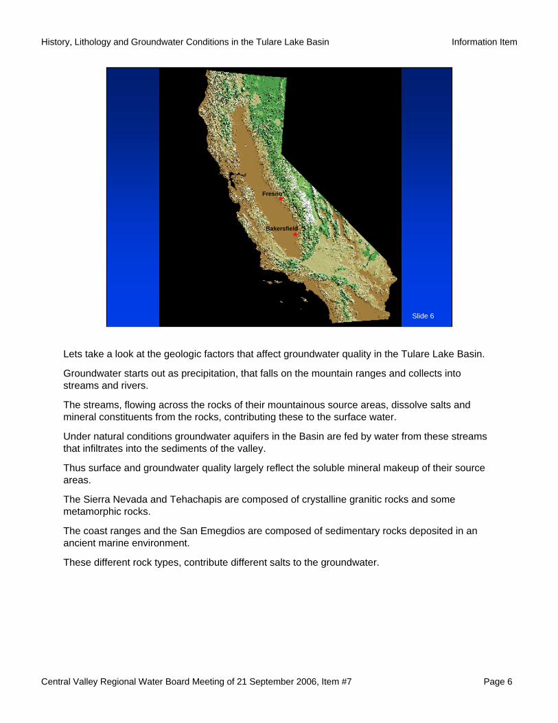
Lets take a look at the geologic factors that affect groundwater quality in the Tulare Lake Basin.
Groundwater starts out as precipitation, that falls on the mountain ranges and collects into streams and rivers.
The streams, flowing across the rocks of their mountainous source areas, dissolve salts and mineral constituents from the rocks, contributing these to the surface water.
Under natural conditions groundwater aquifers in the Basin are fed by water from these streams that infiltrates into the sediments of the valley.
Thus surface and groundwater quality largely reflect the soluble mineral makeup of their source areas.
The Sierra Nevada and Tehachapis are composed of crystalline granitic rocks and some metamorphic rocks.
The coast ranges and the San Emegdios are composed of sedimentary rocks deposited in an ancient marine environment.
These different rock types, contribute different salts to the groundwater.
Central Valley Regional Water Board Meeting of 21 September 2006, Item #7 Page 7
History, Lithology and Groundwater Conditions in the Tulare Lake Basin Information Item
Slide 7
Cross Section of the Central Valley
Modified from Page, 1986
Continental deposits
Marine sediments
Crystalline rock
Page, R.W., 1986, Geology of the fresh ground-water basin of the Central Valley, California, with texture maps and sections:U.S. Geological Survey Professional Paper 1401-C, 54 p.
River
NOT TO SCALE
Sierra Nevada
Coast Ranges
Pacific Ocean
Kern
SanJoaquin
River
KingsRiver
Tulare Lake Bed
Buena VistaLake Bed
Flood overflow
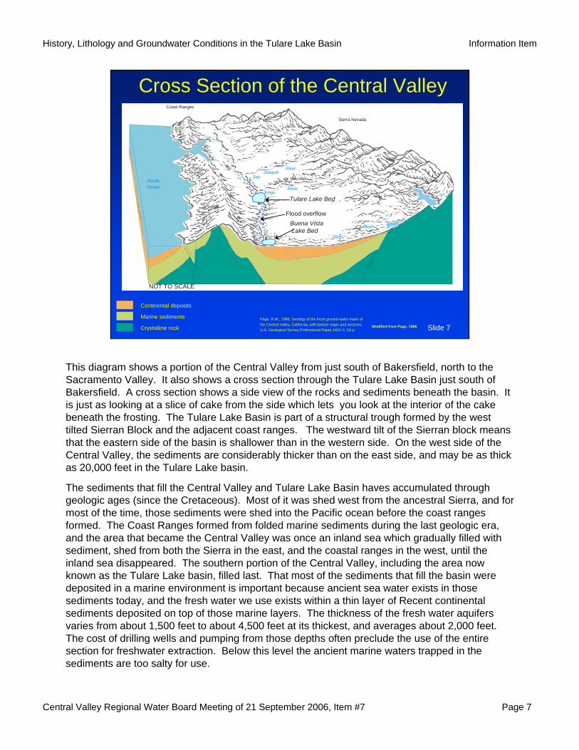
This diagram shows a portion of the Central Valley from just south of Bakersfield, north to the Sacramento Valley. It also shows a cross section through the Tulare Lake Basin just south of Bakersfield. A cross section shows a side view of the rocks and sediments beneath the basin. It is just as looking at a slice of cake from the side which lets you look at the interior of the cake beneath the frosting. The Tulare Lake Basin is part of a structural trough formed by the west tilted Sierran Block and the adjacent coast ranges. The westward tilt of the Sierran block means that the eastern side of the basin is shallower than in the western side. On the west side of the Central Valley, the sediments are considerably thicker than on the east side, and may be as thick as 20,000 feet in the Tulare Lake basin.
The sediments that fill the Central Valley and Tulare Lake Basin haves accumulated through geologic ages (since the Cretaceous). Most of it was shed west from the ancestral Sierra, and for most of the time, those sediments were shed into the Pacific ocean before the coast ranges formed. The Coast Ranges formed from folded marine sediments during the last geologic era, and the area that became the Central Valley was once an inland sea which gradually filled with sediment, shed from both the Sierra in the east, and the coastal ranges in the west, until the inland sea disappeared. The southern portion of the Central Valley, including the area now known as the Tulare Lake basin, filled last. That most of the sediments that fill the basin were deposited in a marine environment is important because ancient sea water exists in those sediments today, and the fresh water we use exists within a thin layer of Recent continental sediments deposited on top of those marine layers. The thickness of the fresh water aquifers varies from about 1,500 feet to about 4,500 feet at its thickest, and averages about 2,000 feet. The cost of drilling wells and pumping from those depths often preclude the use of the entire section for freshwater extraction. Below this level the ancient marine waters trapped in the sediments are too salty for use.
Central Valley Regional Water Board Meeting of 21 September 2006, Item #7 Page 8
History, Lithology and Groundwater Conditions in the Tulare Lake Basin Information Item
Slide 8
Cross Section of SJV“E” clay & Base of Fresh Water
Modified from Page, 1986
Coast Ranges Sierra
"E” clay
Continental Deposits Marine Rocks Marine Rocks and Continental Deposits Granitic and Metamorphic Rocks
Page, R.W., 1986, Geology of the fresh ground-water basin of
the Central Valley, California, with texture maps and sections:
U.S. Geological Survey Professional Paper 1401-C, 54 p.
? ?
?
?
Base of Fresh Water
MSL
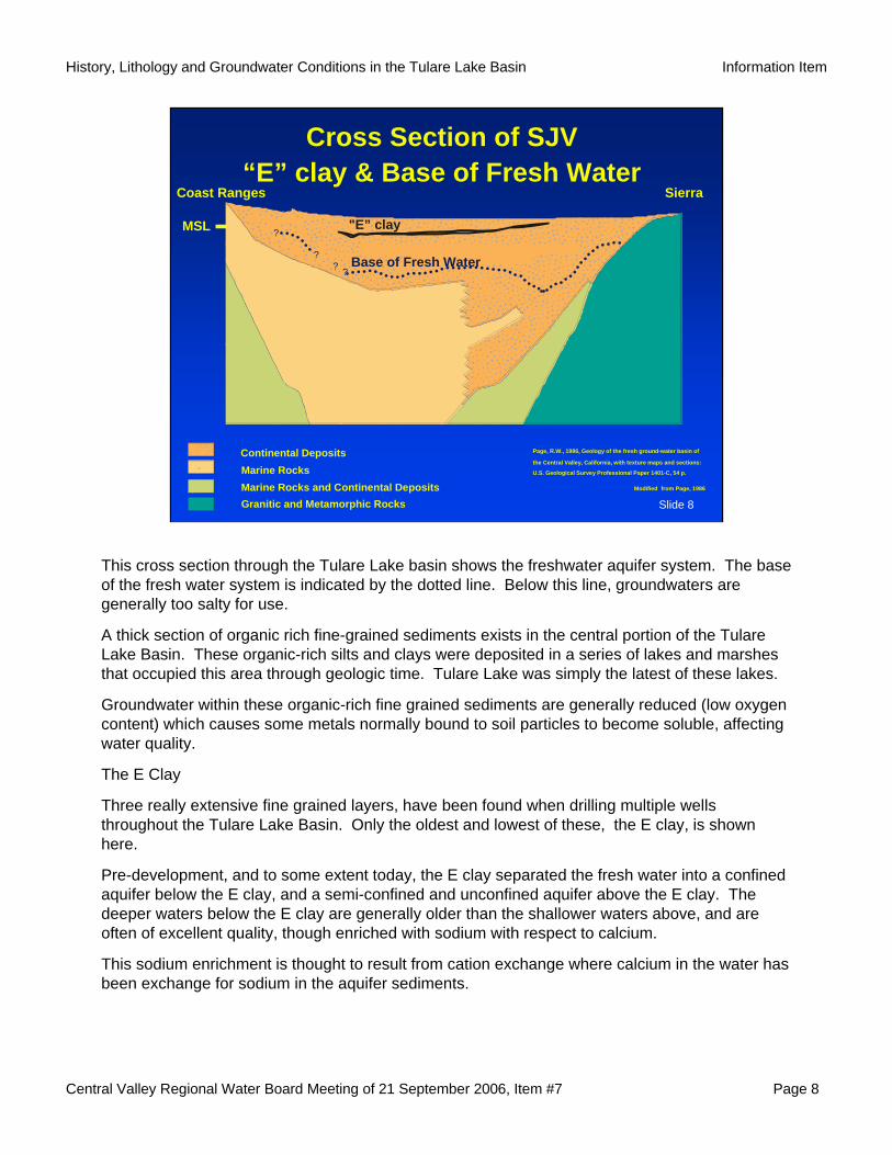
This cross section through the Tulare Lake basin shows the freshwater aquifer system. The base of the fresh water system is indicated by the dotted line. Below this line, groundwaters are generally too salty for use.
A thick section of organic rich fine-grained sediments exists in the central portion of the Tulare Lake Basin. These organic-rich silts and clays were deposited in a series of lakes and marshes that occupied this area through geologic time. Tulare Lake was simply the latest of these lakes.
Groundwater within these organic-rich fine grained sediments are generally reduced (low oxygen content) which causes some metals normally bound to soil particles to become soluble, affecting water quality.
The E Clay
Three really extensive fine grained layers, have been found when drilling multiple wells throughout the Tulare Lake Basin. Only the oldest and lowest of these, the E clay, is shown here.
Pre-development, and to some extent today, the E clay separated the fresh water into a confined aquifer below the E clay, and a semi-confined and unconfined aquifer above the E clay. The deeper waters below the E clay are generally older than the shallower waters above, and are often of excellent quality, though enriched with sodium with respect to calcium.
This sodium enrichment is thought to result from cation exchange where calcium in the water has been exchange for sodium in the aquifer sediments.
Central Valley Regional Water Board Meeting of 21 September 2006, Item #7 Page 9
History, Lithology and Groundwater Conditions in the Tulare Lake Basin Information Item
Slide 9
Westside
Basin
Eastside
Source Area
Base modified from USGS digital dataModified from Williamson and others,1989
Fresno
Bakersfield
HanfordVisalia
Alpaugh
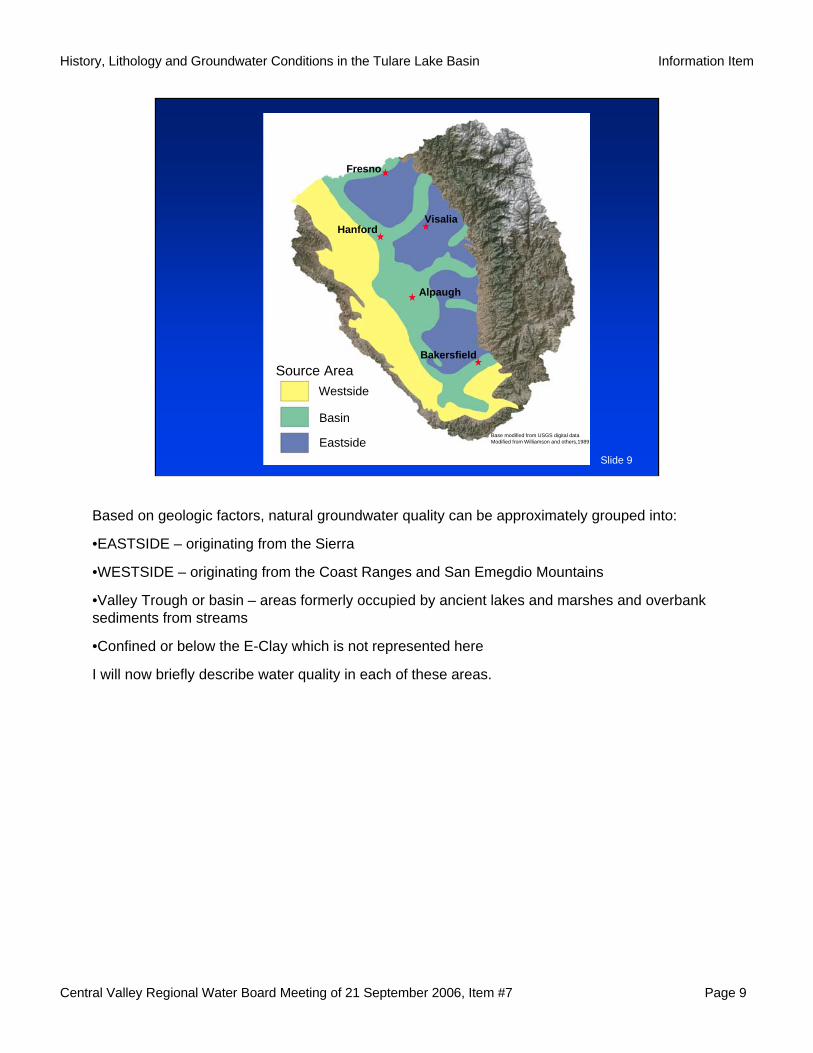
Based on geologic factors, natural groundwater quality can be approximately grouped into:
•EASTSIDE – originating from the Sierra
•WESTSIDE – originating from the Coast Ranges and San Emegdio Mountains
•Valley Trough or basin – areas formerly occupied by ancient lakes and marshes and overbank sediments from streams
•Confined or below the E-Clay which is not represented here
I will now briefly describe water quality in each of these areas.
Central Valley Regional Water Board Meeting of 21 September 2006, Item #7 Page 10
History, Lithology and Groundwater Conditions in the Tulare Lake Basin Information Item
Slide 10
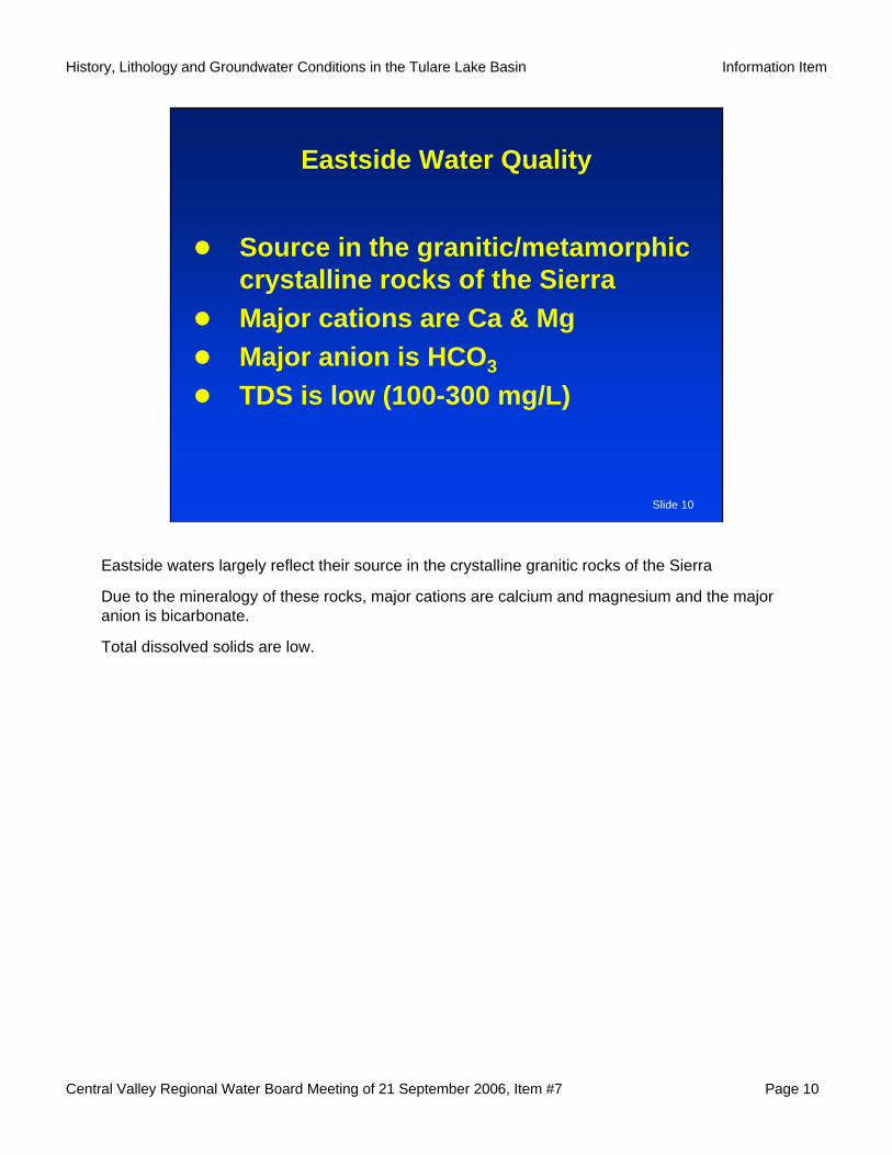
Eastside Water Quality
Source in the granitic/metamorphic crystalline rocks of the SierraMajor cations are Ca & MgMajor anion is HCO3
TDS is low (100-300 mg/L)
Eastside waters largely reflect their source in the crystalline granitic rocks of the Sierra
Due to the mineralogy of these rocks, major cations are calcium and magnesium and the major anion is bicarbonate.
Total dissolved solids are low.
Central Valley Regional Water Board Meeting of 21 September 2006, Item #7 Page 11
History, Lithology and Groundwater Conditions in the Tulare Lake Basin Information Item
Slide 11
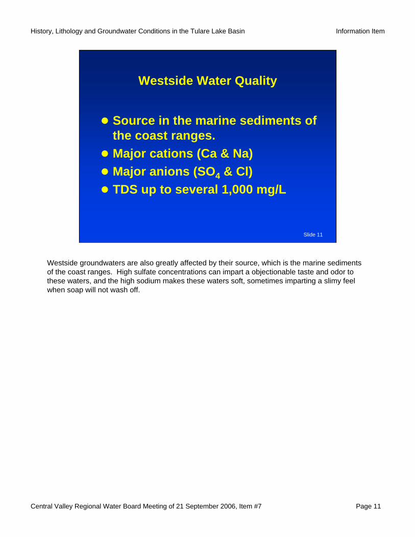
Westside Water Quality
Source in the marine sediments of the coast ranges. Major cations (Ca & Na)Major anions (SO4 & Cl)TDS up to several 1,000 mg/L
Westside groundwaters are also greatly affected by their source, which is the marine sediments of the coast ranges. High sulfate concentrations can impart a objectionable taste and odor to these waters, and the high sodium makes these waters soft, sometimes imparting a slimy feel when soap will not wash off.
Central Valley Regional Water Board Meeting of 21 September 2006, Item #7 Page 12
History, Lithology and Groundwater Conditions in the Tulare Lake Basin Information Item
Slide 12
200500
1,500
Dissolved-solids Concentration (mg/L)
Modified from Bertoldiand others, 1991
Fresno
Bakersfield
HanfordVisalia
Alpaugh
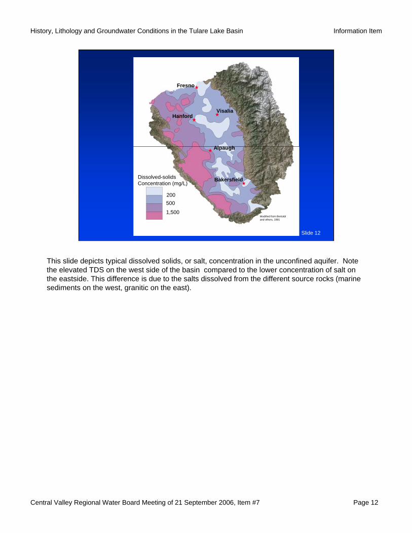
This slide depicts typical dissolved solids, or salt, concentration in the unconfined aquifer. Note the elevated TDS on the west side of the basin compared to the lower concentration of salt on the eastside. This difference is due to the salts dissolved from the different source rocks (marine sediments on the west, granitic on the east).
Central Valley Regional Water Board Meeting of 21 September 2006, Item #7 Page 13
History, Lithology and Groundwater Conditions in the Tulare Lake Basin Information Item
Slide 13
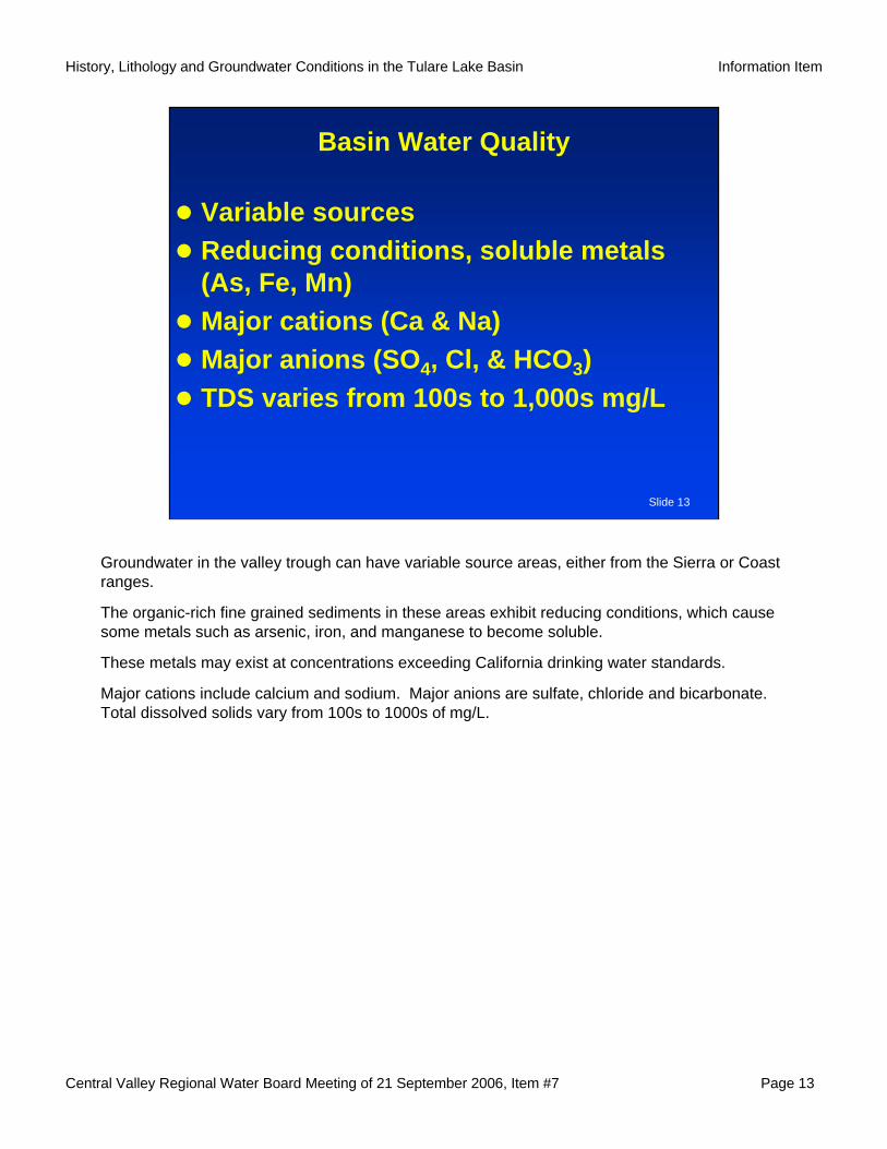
Basin Water Quality
Variable sourcesReducing conditions, soluble metals (As, Fe, Mn)Major cations (Ca & Na)Major anions (SO4, Cl, & HCO3)TDS varies from 100s to 1,000s mg/L
Groundwater in the valley trough can have variable source areas, either from the Sierra or Coast ranges.
The organic-rich fine grained sediments in these areas exhibit reducing conditions, which cause some metals such as arsenic, iron, and manganese to become soluble.
These metals may exist at concentrations exceeding California drinking water standards.
Major cations include calcium and sodium. Major anions are sulfate, chloride and bicarbonate. Total dissolved solids vary from 100s to 1000s of mg/L.
Central Valley Regional Water Board Meeting of 21 September 2006, Item #7 Page 14
History, Lithology and Groundwater Conditions in the Tulare Lake Basin Information Item
Slide 14
20
10
-102 4 6 8 10 12
0 H3AsO30
HAsO42-
H2AsO4--
H2AsO3--
H2
H2O
H2O
O2
As 5+
As 3+
OXIDIZING
REDUCING
pE
pH
Stability Diagram for Arsenic
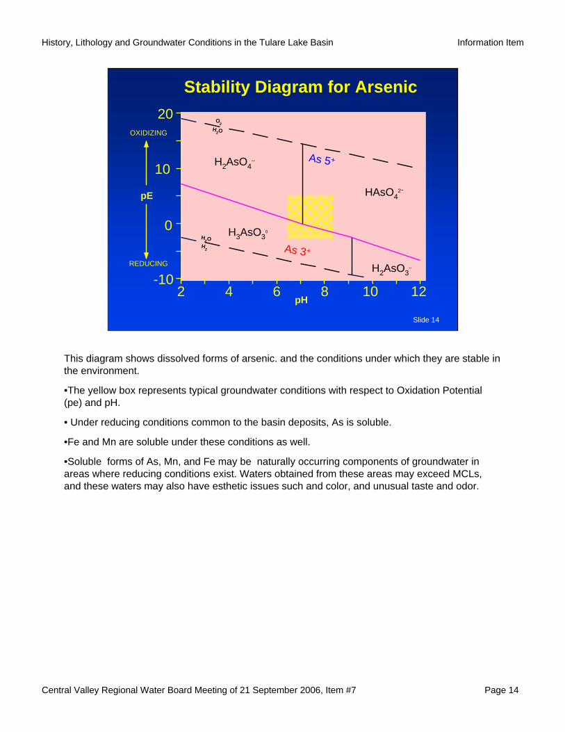
This diagram shows dissolved forms of arsenic. and the conditions under which they are stable in the environment.
•The yellow box represents typical groundwater conditions with respect to Oxidation Potential (pe) and pH.
• Under reducing conditions common to the basin deposits, As is soluble.
•Fe and Mn are soluble under these conditions as well.
•Soluble forms of As, Mn, and Fe may be naturally occurring components of groundwater in areas where reducing conditions exist. Waters obtained from these areas may exceed MCLs, and these waters may also have esthetic issues such and color, and unusual taste and odor.
Central Valley Regional Water Board Meeting of 21 September 2006, Item #7 Page 15
History, Lithology and Groundwater Conditions in the Tulare Lake Basin Information Item
Slide 15
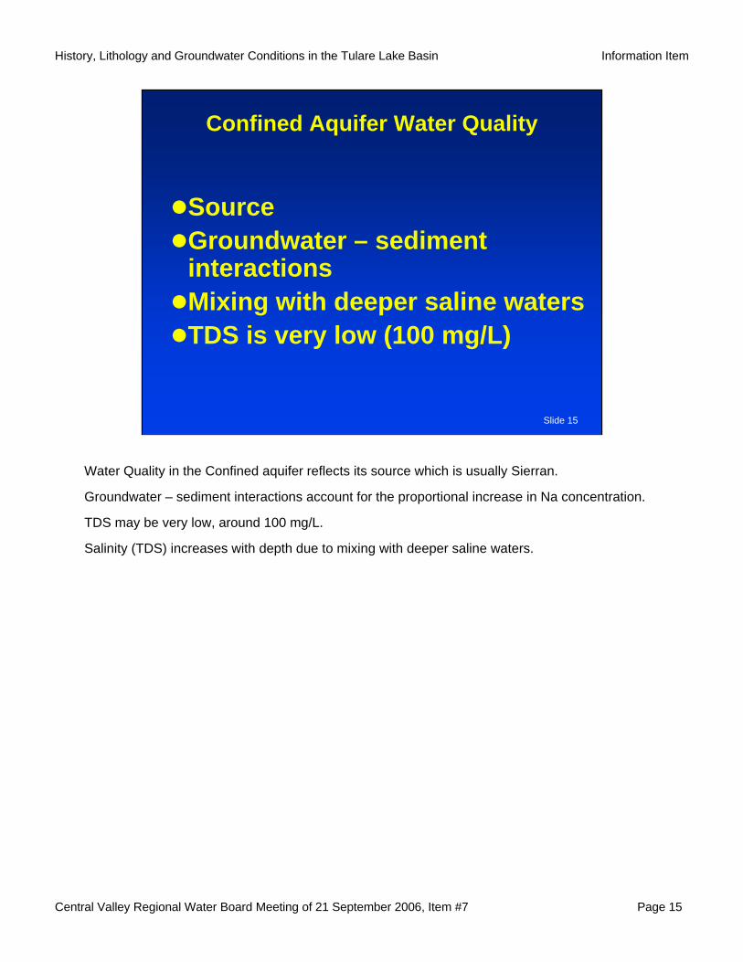
Confined Aquifer Water Quality
Source Groundwater – sediment interactionsMixing with deeper saline watersTDS is very low (100 mg/L)
Water Quality in the Confined aquifer reflects its source which is usually Sierran.
Groundwater – sediment interactions account for the proportional increase in Na concentration.
TDS may be very low, around 100 mg/L.
Salinity (TDS) increases with depth due to mixing with deeper saline waters.
Central Valley Regional Water Board Meeting of 21 September 2006, Item #7 Page 16
History, Lithology and Groundwater Conditions in the Tulare Lake Basin Information Item
Slide 16
Examples of Tulare Lake Basin Water Quality
C A T I O N S A N I O N S%meq/lNa+K HCO +CO3 3 Cl
Mg SO4
CaCalcium (Ca) Chloride (Cl)
Sulfa
te (S
O4)
+ C
hlor
ide
(Cl)
Calcium (Ca) + M
agnesium (M
g)
Carb
onat
e (C
O3)
+ B
icarb
onat
e (H
CO3)
Sodium (Na) + Potassium
(K)
Sulfate (SO4)M
agne
sium
(Mg)
80 60 40 20 20 40 60 80
80
60
40
20
20
40
60
80
20
40
60
80
80
60
40
20
2040
60
8020
40
60
80
80
60
40
20
80
60
4020
Total Dissolved Solids(Parts Per Million)
0 600
1,20
0
1,80
0
2,40
0
3,00
0
EastsideWestsideBasinConfined
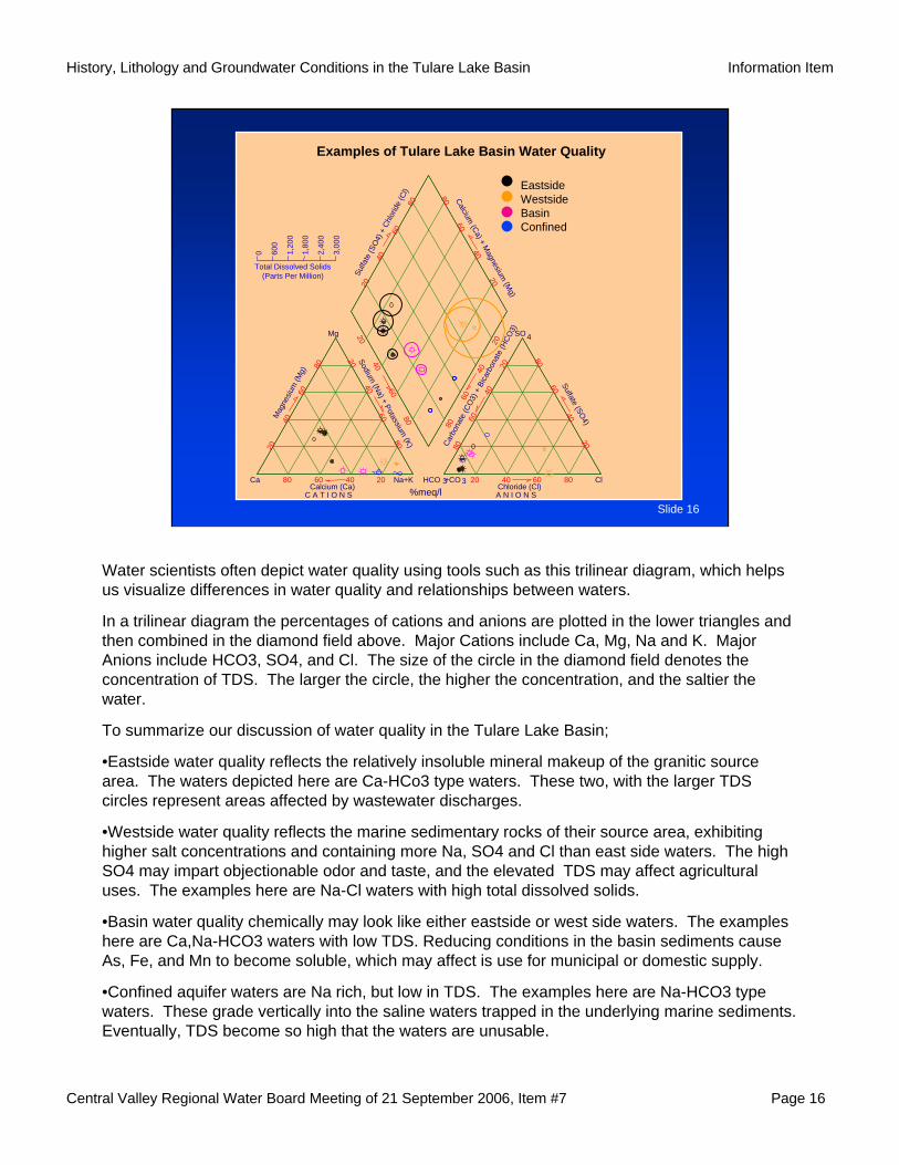
Water scientists often depict water quality using tools such as this trilinear diagram, which helps us visualize differences in water quality and relationships between waters.
In a trilinear diagram the percentages of cations and anions are plotted in the lower triangles and then combined in the diamond field above. Major Cations include Ca, Mg, Na and K. Major Anions include HCO3, SO4, and Cl. The size of the circle in the diamond field denotes the concentration of TDS. The larger the circle, the higher the concentration, and the saltier the water.
To summarize our discussion of water quality in the Tulare Lake Basin;
•Eastside water quality reflects the relatively insoluble mineral makeup of the granitic source area. The waters depicted here are Ca-HCo3 type waters. These two, with the larger TDS circles represent areas affected by wastewater discharges.
•Westside water quality reflects the marine sedimentary rocks of their source area, exhibiting higher salt concentrations and containing more Na, SO4 and Cl than east side waters. The high SO4 may impart objectionable odor and taste, and the elevated TDS may affect agricultural uses. The examples here are Na-Cl waters with high total dissolved solids.
•Basin water quality chemically may look like either eastside or west side waters. The examples here are Ca,Na-HCO3 waters with low TDS. Reducing conditions in the basin sediments cause As, Fe, and Mn to become soluble, which may affect is use for municipal or domestic supply.
•Confined aquifer waters are Na rich, but low in TDS. The examples here are Na-HCO3 type waters. These grade vertically into the saline waters trapped in the underlying marine sediments. Eventually, TDS become so high that the waters are unusable.
Central Valley Regional Water Board Meeting of 21 September 2006, Item #7 Page 17
History, Lithology and Groundwater Conditions in the Tulare Lake Basin Information Item
Slide 17
Human Influences
Surface water diversions & importsGroundwater extractionFertilizer & chemical useIncreased populationWastewater disposal
That completes my review of natural geologic processes that affect water quality,…
I would now like to turn to water quality issues within the Basin related to human influences.
Our use of surface and groundwater resources in the Tulare Lake Basin has profoundly changed the basin in many ways.
Human influences include:
•diversion of the basin’s surface waters and importation of surface water,
•increased extraction of groundwater,
•increased use of fertilizers and chemicals, and
•increased population and its use, reuse, and disposal of wastewater
And, certainly, there are many other issues that this board deals with continually.
This morning though, I am going to focus on two aspects that affect groundwater quality in the Basin. They are:
1. Changes in surface and groundwater flow patterns, and
2. The importation of water and salt from outside the basin
Central Valley Regional Water Board Meeting of 21 September 2006, Item #7 Page 18
History, Lithology and Groundwater Conditions in the Tulare Lake Basin Information Item
Slide 18
Slough
San Joaquin
River
Fresno
Slough
San Joaquin
River
NOT TO SCALEBertoldi, G.L., Johnston, R.H., and Evenson, K.D., 1991, Ground water in the Central Valley, California summary report: U.S. Geological Survey Professional Paper 1401-A, 44 p.
Fresno
Southwest Northeast
Unconfined
Confined“E” Clay
FresnoSlough
San Joaquin River
Pumping Center
Unconfined
Confined
Central Valley aquifer system
Saltwater Direction of ground-watermovement
“E” Clay
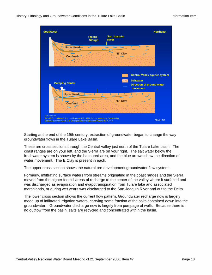
Starting at the end of the 19th century, extraction of groundwater began to change the way groundwater flows in the Tulare Lake Basin.
These are cross sections through the Central valley just north of the Tulare Lake basin. The coast ranges are on your left, and the Sierra are on your right. The salt water below the freshwater system is shown by the hachured area, and the blue arrows show the direction of water movement. The E Clay is present in each.
The upper cross section shows the natural pre-development groundwater flow system.
Formerly, infiltrating surface waters from streams originating in the coast ranges and the Sierra moved from the higher foothill areas of recharge to the center of the valley where it surfaced and was discharged as evaporation and evapotranspiration from Tulare lake and associated marshlands, or during wet years was discharged to the San Joaquin River and out to the Delta.
The lower cross section shows the current flow pattern. Groundwater recharge now is largely made up of infiltrated irrigation waters, carrying some fraction of the salts contained down into the groundwater. Groundwater discharge now is largely from pumpage of wells. Because there is no outflow from the basin, salts are recycled and concentrated within the basin.
Central Valley Regional Water Board Meeting of 21 September 2006, Item #7 Page 19
History, Lithology and Groundwater Conditions in the Tulare Lake Basin Information Item
Slide 19
Subsidence
Subsidence (ft)
4 12 20
Line of equal subsidence 12
Ireland, R.L., 1986, Land subsidence in the San Joaquin Valley, California, as of 1983:
U.S. Geological Survey Water-Resources Investigations Report 85-4196, 50 p.
Bakersfield
Maricopa
Fresno
Tulare
Wasco
Arvin
Kettleman City
Mendota
Los Banos
COAST
RANGES
S I E
R R A
T eh achap
i
Mountai n
s
35
36
37
121
120
119
118
MARIPOSA
MERCED
MADERA
FRESNOSANBENITO
MONTEREYKINGS
TULARE
SAN LUISOBISPO KERN
1
2016 12
82024
16
4San
Joaquin
River
CA Aqueduct
4
N E V A D A
4
48
12 8
1
1
4
8
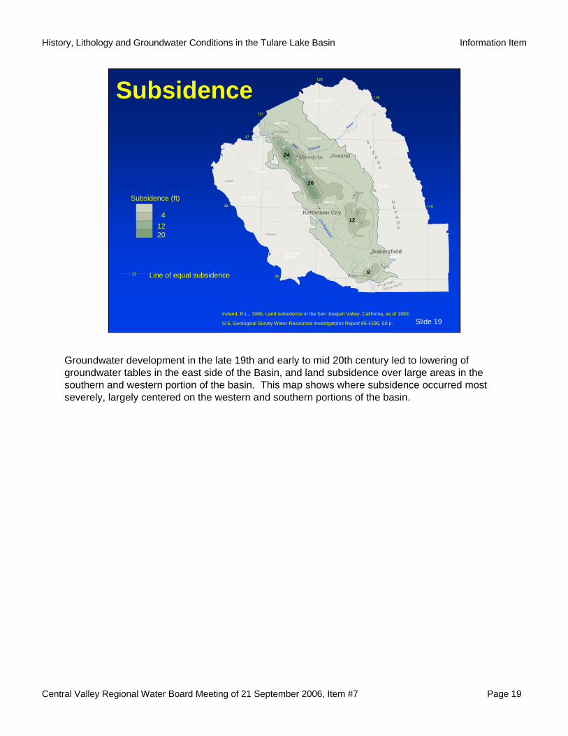
Groundwater development in the late 19th and early to mid 20th century led to lowering of groundwater tables in the east side of the Basin, and land subsidence over large areas in the southern and western portion of the basin. This map shows where subsidence occurred most severely, largely centered on the western and southern portions of the basin.
Central Valley Regional Water Board Meeting of 21 September 2006, Item #7 Page 20
History, Lithology and Groundwater Conditions in the Tulare Lake Basin Information Item
Slide 20
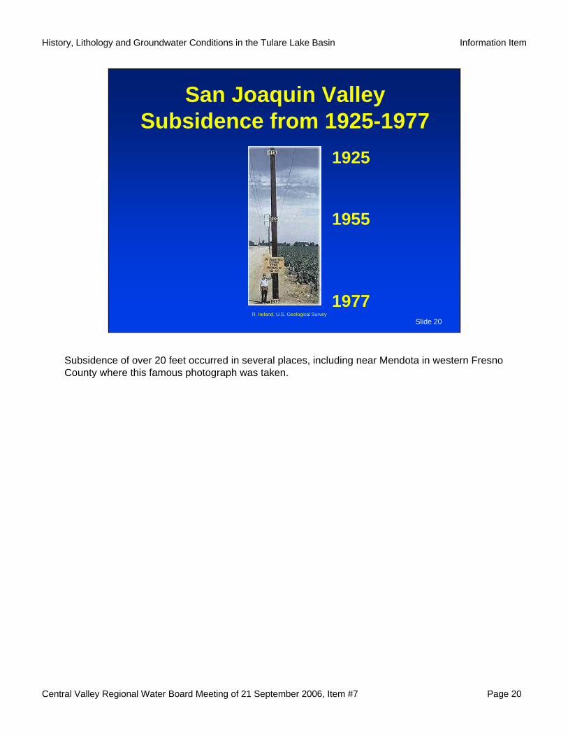
San Joaquin ValleySubsidence from 1925-1977
1925
1955
1977R. Ireland, U.S. Geological Survey
Subsidence of over 20 feet occurred in several places, including near Mendota in western Fresno County where this famous photograph was taken.
Central Valley Regional Water Board Meeting of 21 September 2006, Item #7 Page 21
History, Lithology and Groundwater Conditions in the Tulare Lake Basin Information Item
Slide 21
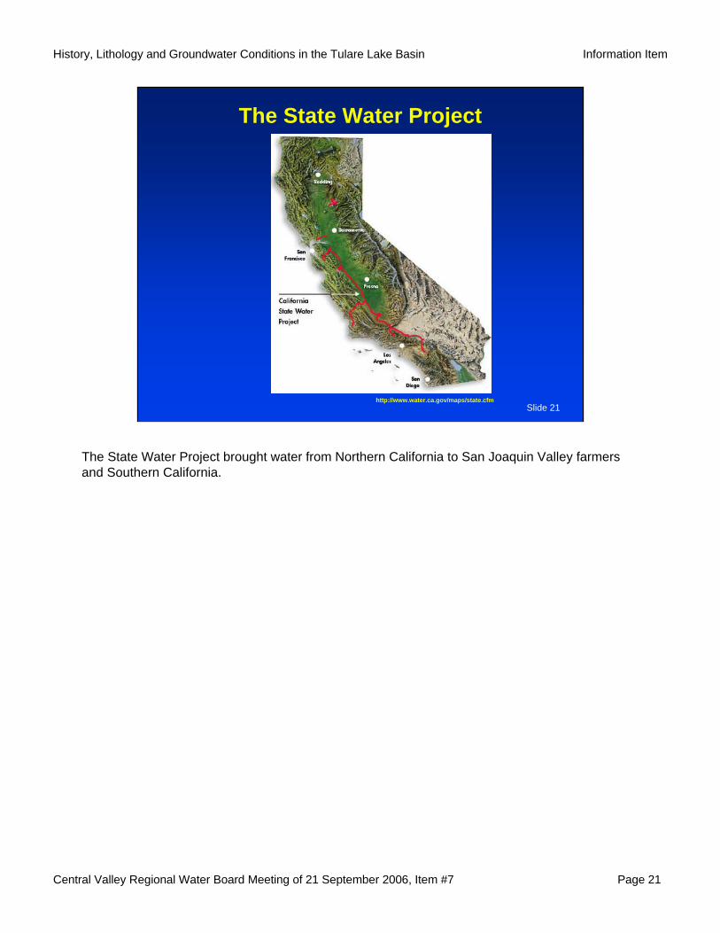
The State Water Project
http://www.water.ca.gov/maps/state.cfm
The State Water Project brought water from Northern California to San Joaquin Valley farmers and Southern California.
Central Valley Regional Water Board Meeting of 21 September 2006, Item #7 Page 22
History, Lithology and Groundwater Conditions in the Tulare Lake Basin Information Item
Slide 22
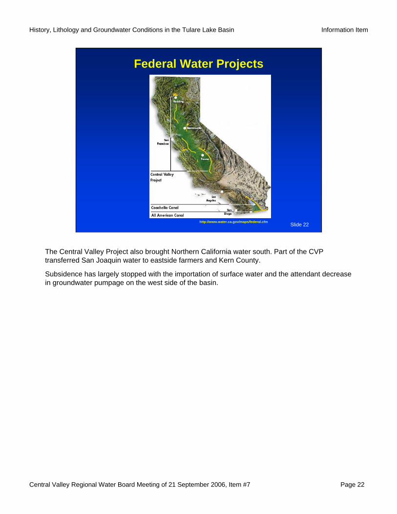
Federal Water Projects
http://www.water.ca.gov/maps/federal.cfm
The Central Valley Project also brought Northern California water south. Part of the CVP transferred San Joaquin water to eastside farmers and Kern County.
Subsidence has largely stopped with the importation of surface water and the attendant decrease in groundwater pumpage on the west side of the basin.
Central Valley Regional Water Board Meeting of 21 September 2006, Item #7 Page 23
History, Lithology and Groundwater Conditions in the Tulare Lake Basin Information Item
Slide 23
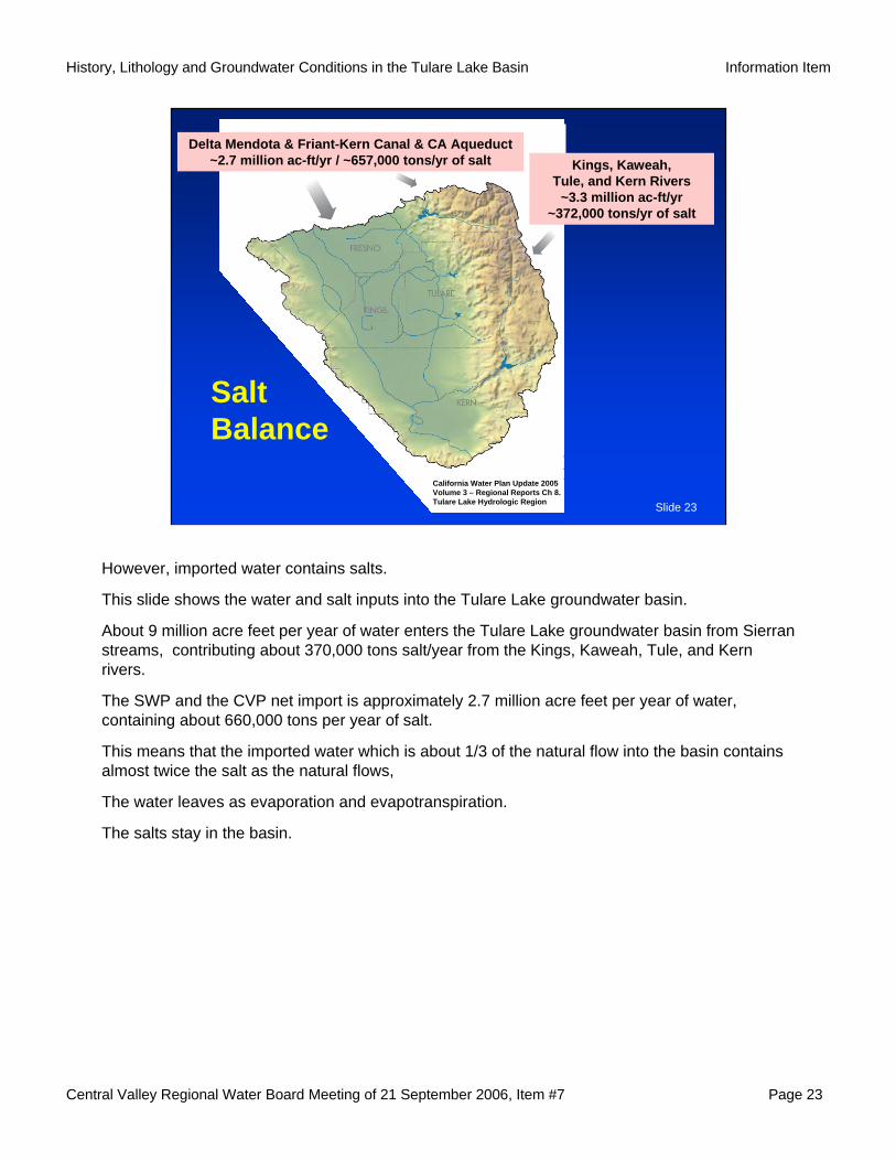
Delta Mendota & Friant-Kern Canal & CA Aqueduct ~2.7 million ac-ft/yr / ~657,000 tons/yr of salt Kings, Kaweah,
Tule, and Kern Rivers ~3.3 million ac-ft/yr
~372,000 tons/yr of salt
Salt Balance
California Water Plan Update 2005Volume 3 – Regional Reports Ch 8. Tulare Lake Hydrologic Region
However, imported water contains salts.
This slide shows the water and salt inputs into the Tulare Lake groundwater basin.
About 9 million acre feet per year of water enters the Tulare Lake groundwater basin from Sierran streams, contributing about 370,000 tons salt/year from the Kings, Kaweah, Tule, and Kern rivers.
The SWP and the CVP net import is approximately 2.7 million acre feet per year of water, containing about 660,000 tons per year of salt.
This means that the imported water which is about 1/3 of the natural flow into the basin contains almost twice the salt as the natural flows,
The water leaves as evaporation and evapotranspiration.
The salts stay in the basin.
Central Valley Regional Water Board Meeting of 21 September 2006, Item #7 Page 24
History, Lithology and Groundwater Conditions in the Tulare Lake Basin Information Item
Slide 24
Evaporation Basins
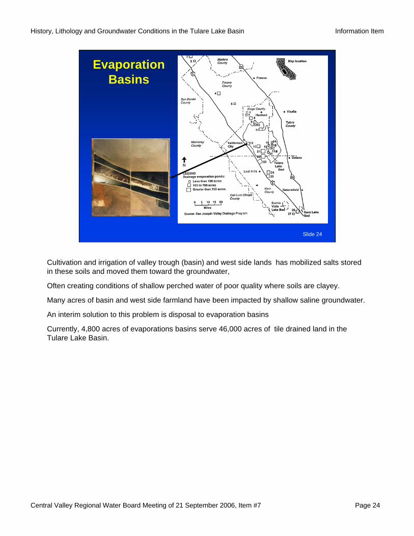
Cultivation and irrigation of valley trough (basin) and west side lands has mobilized salts stored in these soils and moved them toward the groundwater,
Often creating conditions of shallow perched water of poor quality where soils are clayey.
Many acres of basin and west side farmland have been impacted by shallow saline groundwater.
An interim solution to this problem is disposal to evaporation basins
Currently, 4,800 acres of evaporations basins serve 46,000 acres of tile drained land in the Tulare Lake Basin.
Central Valley Regional Water Board Meeting of 21 September 2006, Item #7 Page 25
History, Lithology and Groundwater Conditions in the Tulare Lake Basin Information Item
Slide 25
Evaporation Basin - Salt
A.Toto, RWQCB-5F
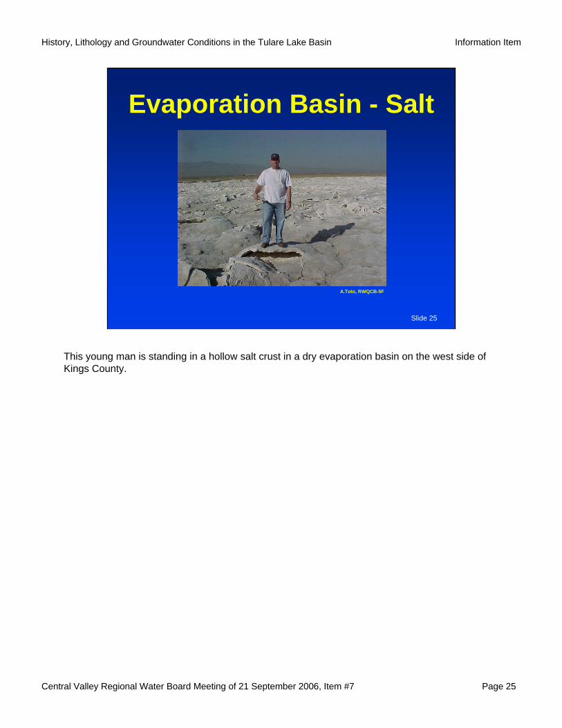
This young man is standing in a hollow salt crust in a dry evaporation basin on the west side of Kings County.

Central Valley Regional Water Board Meeting of 21 September 2006, Item #7 Page 26
History, Lithology and Groundwater Conditions in the Tulare Lake Basin Information Item
Slide 26Tulare Lake Basin
In summary with respect to Human Influences…
Central Valley Regional Water Board Meeting of 21 September 2006, Item #7 Page 27
History, Lithology and Groundwater Conditions in the Tulare Lake Basin Information Item
Slide 27
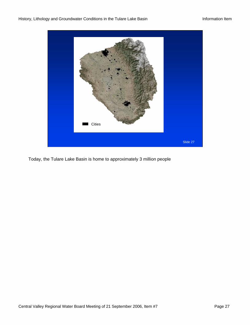
Cities
Today, the Tulare Lake Basin is home to approximately 3 million people

Central Valley Regional Water Board Meeting of 21 September 2006, Item #7 Page 28
History, Lithology and Groundwater Conditions in the Tulare Lake Basin Information Item
Slide 28
CitiesAg
Approximately 3 million acres of land are under cultivation. Much of it irrigated with imported water.

Central Valley Regional Water Board Meeting of 21 September 2006, Item #7 Page 29
History, Lithology and Groundwater Conditions in the Tulare Lake Basin Information Item
Slide 29
DairiesCitiesAg
There are 671 dairies, housing over 1,000,000 milk cows in the Tulare Lake Basin,

Central Valley Regional Water Board Meeting of 21 September 2006, Item #7 Page 30
History, Lithology and Groundwater Conditions in the Tulare Lake Basin Information Item
Slide 30
IndustrialDairiesCitiesAg
And approximately 100 facilities process the bounty grown or produced in the Tulare Lake Basin.
All of these are sources of salt and other materials that accumulate in the Tulare Lake Basin, affecting or having the potential to affect, groundwater quality.
Central Valley Regional Water Board Meeting of 21 September 2006, Item #7 Page 31
History, Lithology and Groundwater Conditions in the Tulare Lake Basin Information Item
Slide 31
SummaryNatural groundwater quality varies throughout the Tulare Lake Basin. Since the late 19th century, conditions in the Tulare Lake Basin have changed significantly.Our use of water has affected both groundwater flow and quality.Salt remains the most significant water quality issue in the Tulare Lake Basin.
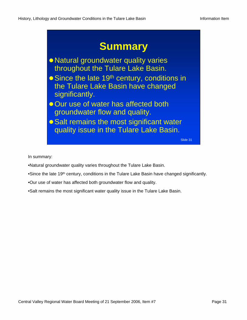
In summary:
•Natural groundwater quality varies throughout the Tulare Lake Basin.
•Since the late 19th century, conditions in the Tulare Lake Basin have changed significantly.
•Our use of water has affected both groundwater flow and quality.
•Salt remains the most significant water quality issue in the Tulare Lake Basin.
Central Valley Regional Water Board Meeting of 21 September 2006, Item #7 Page 32
History, Lithology and Groundwater Conditions in the Tulare Lake Basin Information Item
Slide 32
Questions?
That concludes my presentation.
I would be happy to answer any questions as time permits.