Embed Size (px)
Citation preview

DEFENCE AND SPACE DEFENCE AND SPACE
VISIT US: www.intelligence-airbusds.com
FOLLOW US: #AirbusSpace
Geospatial World Forum 2018
Streaming Analytics and
Using Data to
Accelerate Smarter
Cities and Mobility
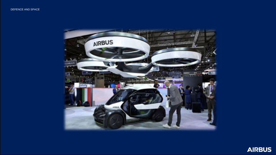
DEFENCE AND SPACE
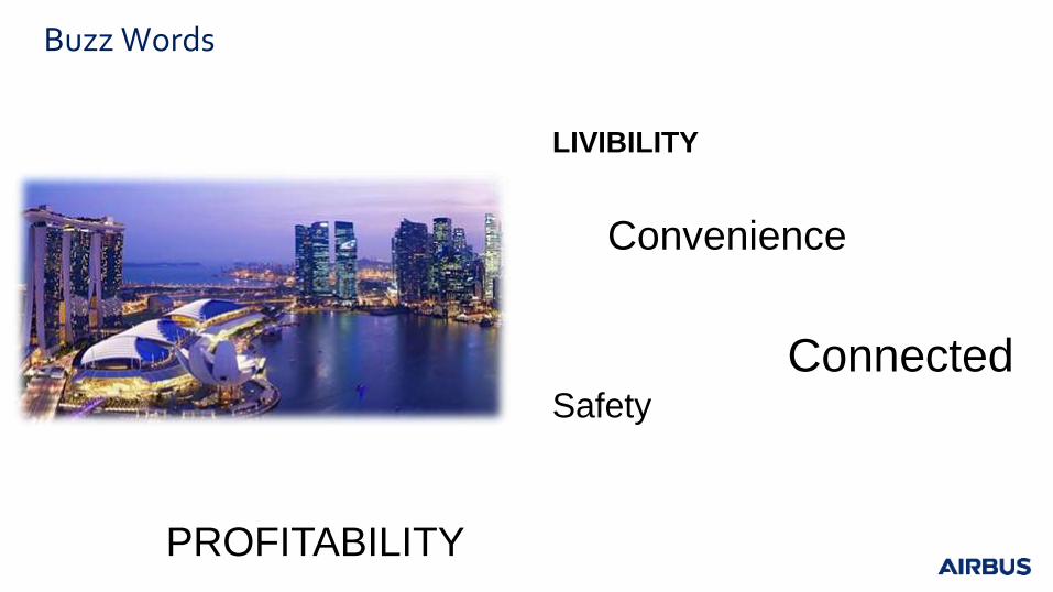
Buzz Words
LIVIBILITY
Convenience
Connected Safety
PROFITABILITY
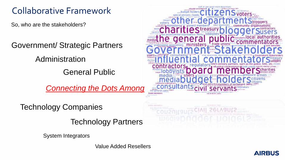
Collaborative Framework
So, who are the stakeholders?
Government/ Strategic Partners
General Public
Administration
Technology Companies
Technology Partners
System Integrators
Value Added Resellers
Connecting the Dots Among
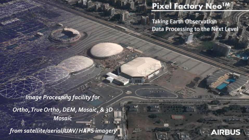
Pixel Facotry
Image Processing facility for
Ortho, True Ortho, DEM, Mosaic, & 3D
Mosaic
from satellite/aerial/UAV/ HAPS imagery
Pixel Facotry
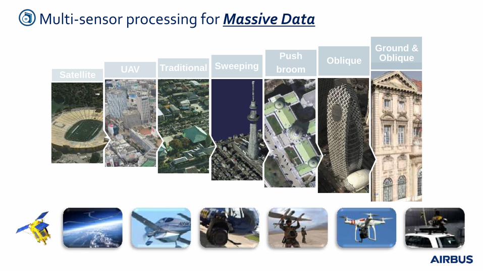
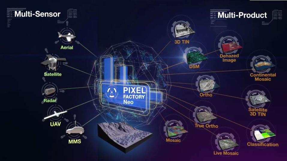
Multi-sensor processing for Massive Data
Ground & Oblique Oblique
Push
broom Sweeping Traditional UAV Satellite
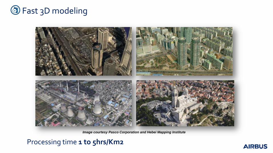
Image courtesy Pasco Corporation and Hebei Mapping Institute
Fast 3D modeling
Processing time 1 to 5hrs/Km2

High accuracy 3D Textured models from satellite imagery
Processing time 1 to 5h/Km2
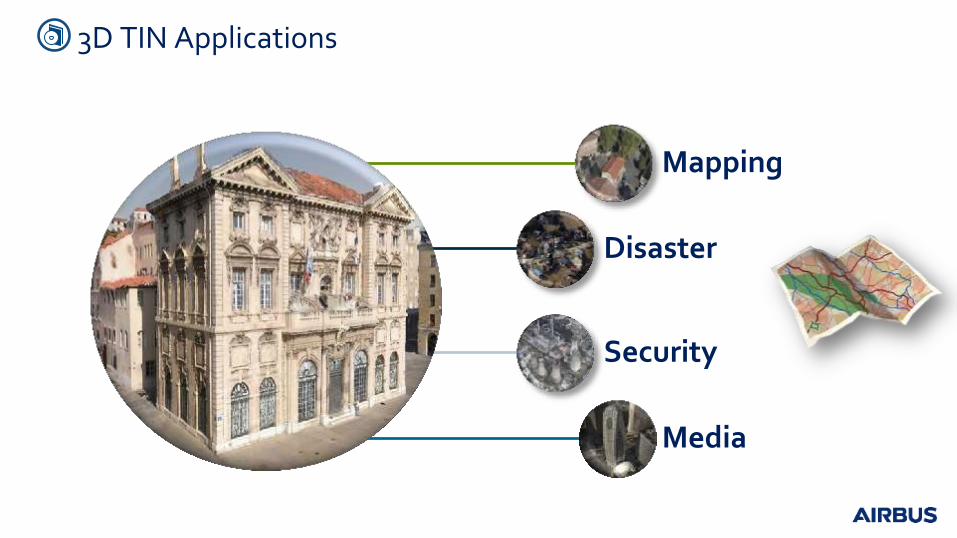
Mapping
Disaster
Security
Media
3D TIN Applications
11
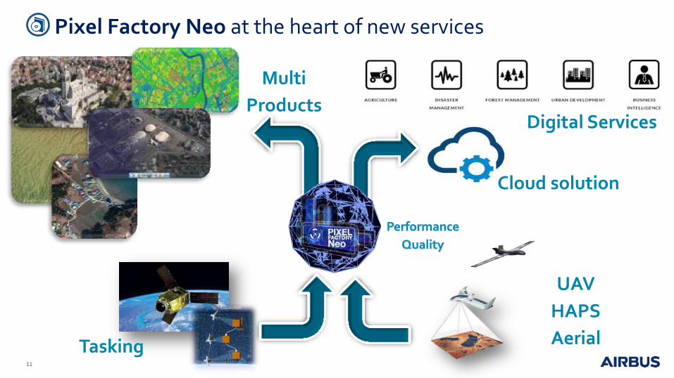
UAV
HAPS
Aerial Tasking
Multi
Products
Cloud solution
Digital Services
Pixel Factory Neo at the heart of new services
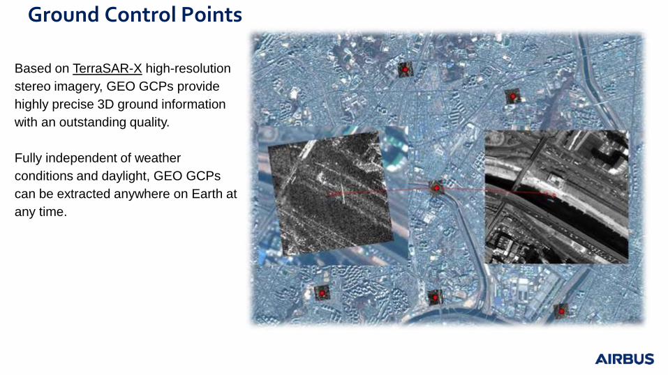
Ground Control Points
Based on TerraSAR-X high-resolution
stereo imagery, GEO GCPs provide
highly precise 3D ground information
with an outstanding quality.
Fully independent of weather
conditions and daylight, GEO GCPs
can be extracted anywhere on Earth at
any time.
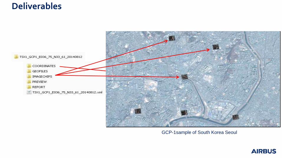
GCP-1sample of South Korea Seoul
Deliverables

DEFENCE AND SPACE
Shaping
the Future
through
Digital
Services
One Atlas
Starling Conflict Atlas Pixel Factory Neo
Intelligence Digital
Platform Data as a Service
Analytics & Prediction Massive Intelligence

Thank you
Copyright mention