Embed Size (px)
Citation preview

Federal Aviation Administration
Michael T. McNerney, Ph.D., P.E. Office of Airports Airport Safety and Standards Airport Engineering Division [email protected] (202) 267-8770 TRB ADC040 Transportation-Related Noise and Vibration Santa Fe, NM July 30, 2013
FAA Airports GIS Program Environmental Feature Classes for Airport Noise
Federal Aviation Administration
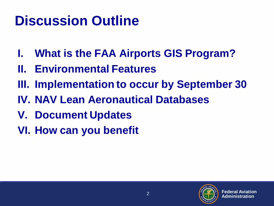
I. What is the FAA Airports GIS Program? II. Environmental Features III. Implementation to occur by September 30 IV. NAV Lean Aeronautical Databases V. Document Updates VI. How can you benefit
Discussion Outline
2
Federal Aviation Administration
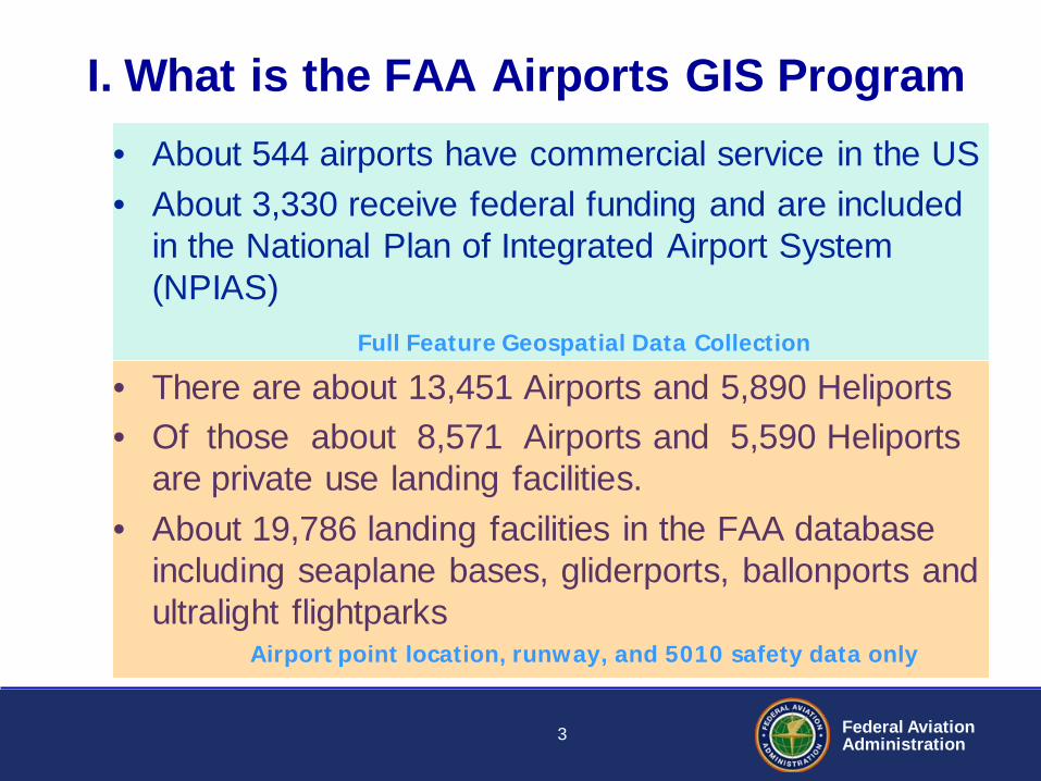
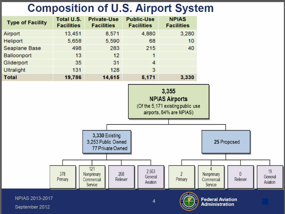
I. What is the FAA Airports GIS Program • About 544 airports have commercial service in the US • About 3,330 receive federal funding and are included
in the National Plan of Integrated Airport System (NPIAS)
• There are about 13,451 Airports and 5,890 Heliports • Of those about 8,571 Airports and 5,590 Heliports
are private use landing facilities. • About 19,786 landing facilities in the FAA database
including seaplane bases, gliderports, ballonports and ultralight flightparks
Full Feature Geospatial Data Collection
Airport point location, runway, and 5010 safety data only
3
Federal Aviation Administration
4
Federal Aviation Administration
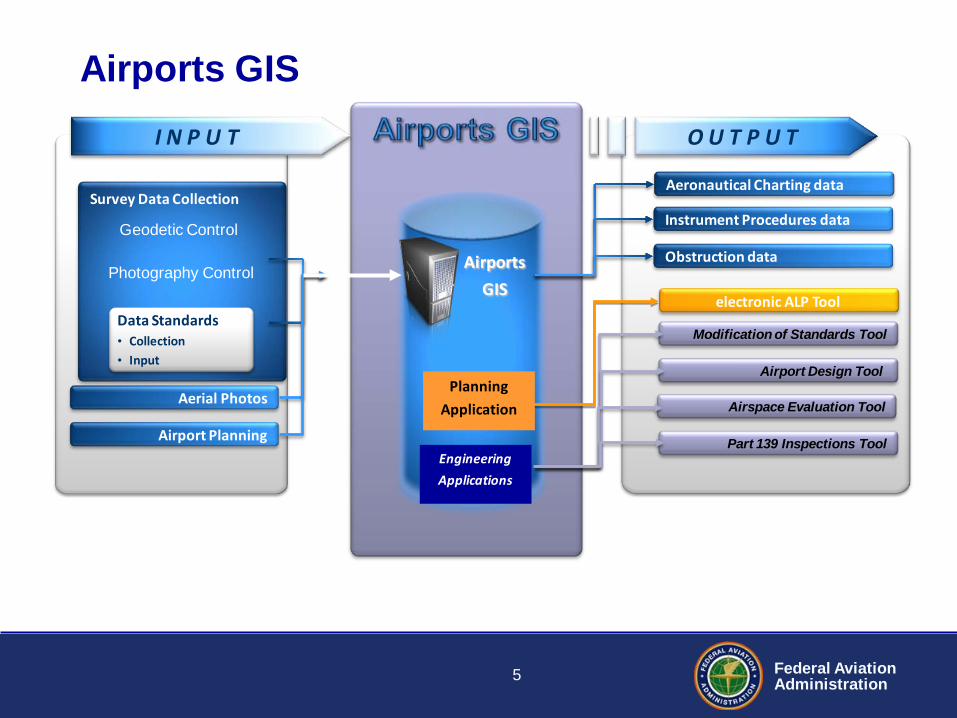
Survey Data Collection
Airports
GIS
O U T P U T
Airports GIS
Aeronautical Charting data
Instrument Procedures data
Obstruction data
Aerial Photos
Airport Planning
I N P U T
Data Standards • Collection • Input
Geodetic Control
Photography Control
Engineering
Applications
Modification of Standards Tool
Airport Design Tool
Airspace Evaluation Tool
Part 139 Inspections Tool
electronic ALP Tool
Planning
Application
5
Federal Aviation Administration
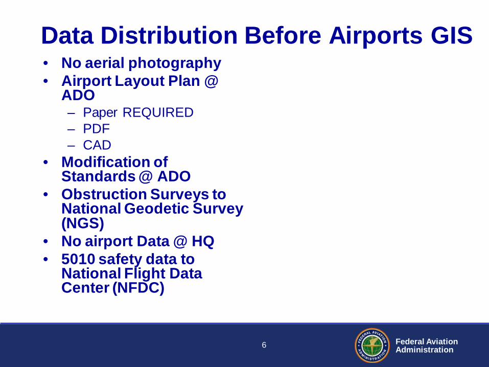
Data Distribution Before Airports GIS • No aerial photography • Airport Layout Plan @
ADO – Paper REQUIRED – PDF – CAD
• Modification of Standards @ ADO
• Obstruction Surveys to National Geodetic Survey (NGS)
• No airport Data @ HQ • 5010 safety data to
National Flight Data Center (NFDC)
6
Federal Aviation Administration
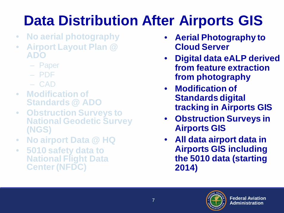
Data Distribution After Airports GIS • No aerial photography • Airport Layout Plan @
ADO – Paper – PDF – CAD
• Modification of Standards @ ADO
• Obstruction Surveys to National Geodetic Survey (NGS)
• No airport Data @ HQ • 5010 safety data to
National Flight Data Center (NFDC)
• Aerial Photography to Cloud Server
• Digital data eALP derived from feature extraction from photography
• Modification of Standards digital tracking in Airports GIS
• Obstruction Surveys in Airports GIS
• All data airport data in Airports GIS including the 5010 data (starting 2014)
7
Federal Aviation Administration
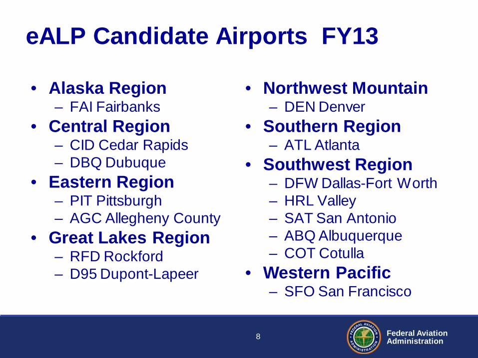
eALP Candidate Airports FY13
• Alaska Region – FAI Fairbanks
• Central Region – CID Cedar Rapids – DBQ Dubuque
• Eastern Region – PIT Pittsburgh – AGC Allegheny County
• Great Lakes Region – RFD Rockford – D95 Dupont-Lapeer
• Northwest Mountain – DEN Denver
• Southern Region – ATL Atlanta
• Southwest Region – DFW Dallas-Fort Worth – HRL Valley – SAT San Antonio – ABQ Albuquerque – COT Cotulla
• Western Pacific – SFO San Francisco
8
Federal Aviation Administration
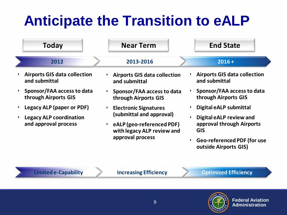
Anticipate the Transition to eALP
2016 +
Optimized Efficiency
2013-2016
Increasing Efficiency
2012
‣ Airports GIS data collection and submittal
‣ Sponsor/FAA access to data through Airports GIS
‣ Legacy ALP (paper or PDF)
‣ Legacy ALP coordination and approval process
‣ Airports GIS data collection and submittal
‣ Sponsor/FAA access to data through Airports GIS
‣ Electronic Signatures (submittal and approval)
‣ eALP (geo-referenced PDF) with legacy ALP review and approval process
‣ Airports GIS data collection and submittal
‣ Sponsor/FAA access to data through Airports GIS
‣ Digital eALP submittal
‣ Digital eALP review and approval through Airports GIS
‣ Geo-referenced PDF (for use outside Airports GIS)
Today End State Near Term
Limited e-Capability
9
Federal Aviation Administration
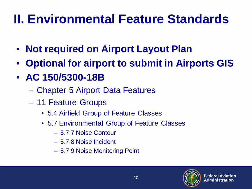
II. Environmental Feature Standards
• Not required on Airport Layout Plan • Optional for airport to submit in Airports GIS • AC 150/5300-18B
– Chapter 5 Airport Data Features – 11 Feature Groups
• 5.4 Airfield Group of Feature Classes • 5.7 Environmental Group of Feature Classes
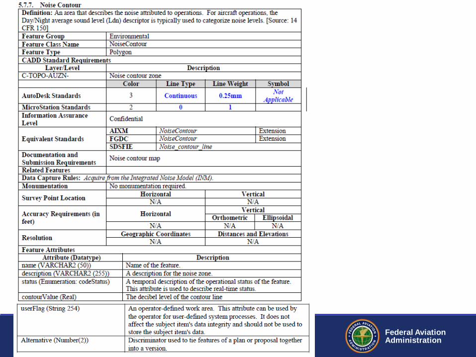
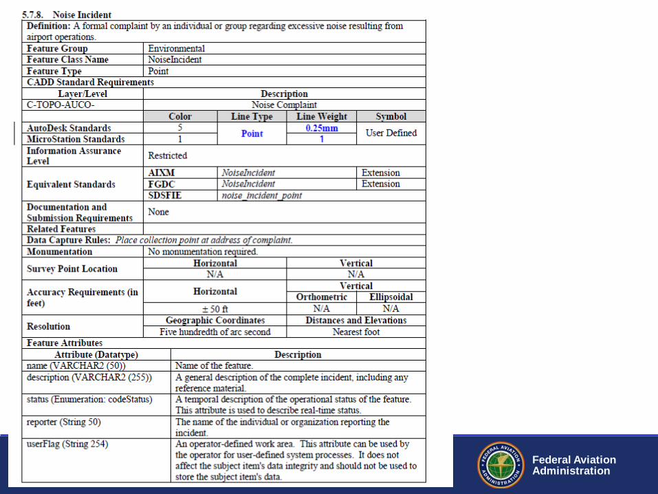
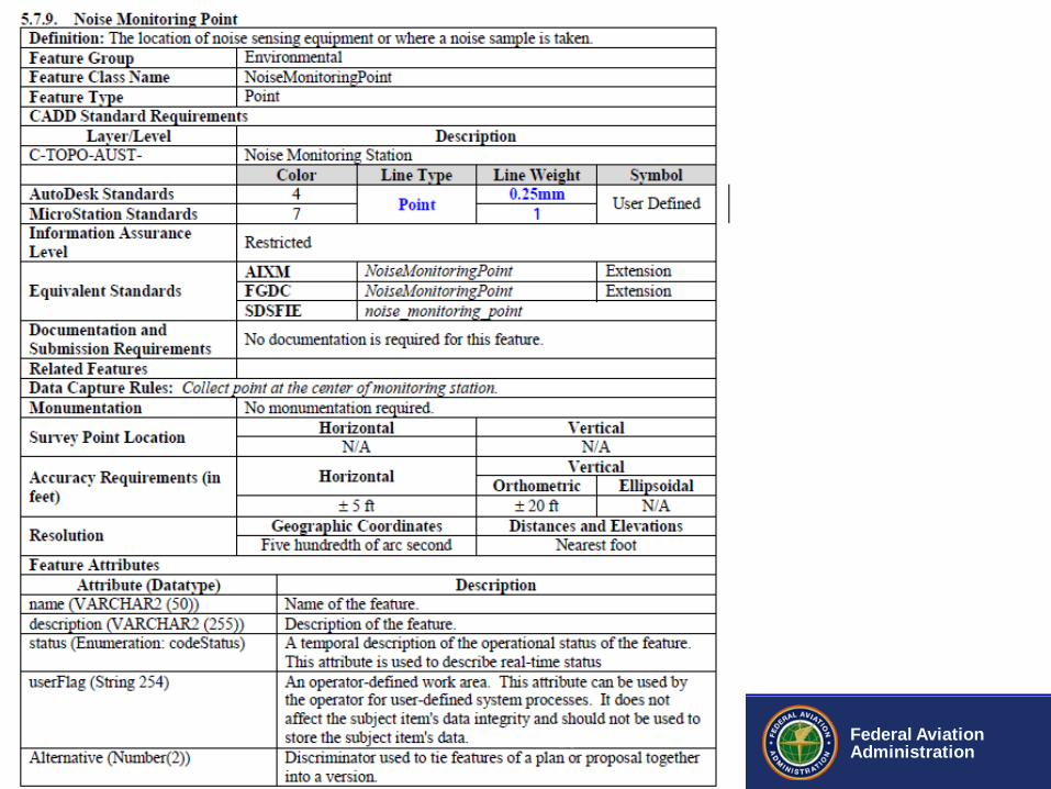
– 5.7.7 Noise Contour – 5.7.8 Noise Incident – 5.7.9 Noise Monitoring Point
10
Federal Aviation Administration
Slide # of #
Federal Aviation Administration
Federal Aviation Administration
13
Federal Aviation Administration
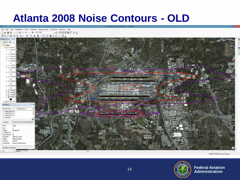
Atlanta 2008 Noise Contours - OLD
14

Federal Aviation Administration
ATL Airports GIS Data – 2008 Contours
15
Federal Aviation Administration
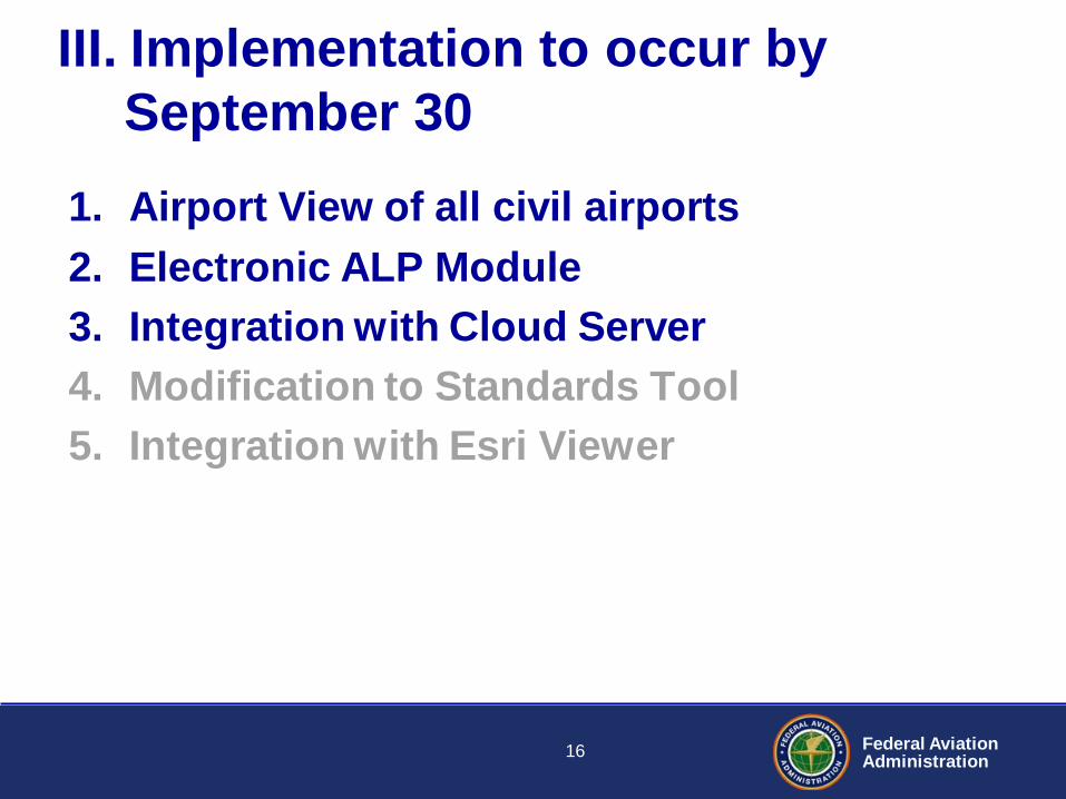
III. Implementation to occur by September 30
1. Airport View of all civil airports 2. Electronic ALP Module 3. Integration with Cloud Server 4. Modification to Standards Tool 5. Integration with Esri Viewer
16
Federal Aviation Administration
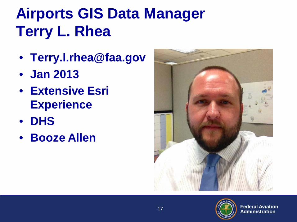
Airports GIS Data Manager Terry L. Rhea • [email protected] • Jan 2013 • Extensive Esri
Experience • DHS • Booze Allen
17
Federal Aviation Administration
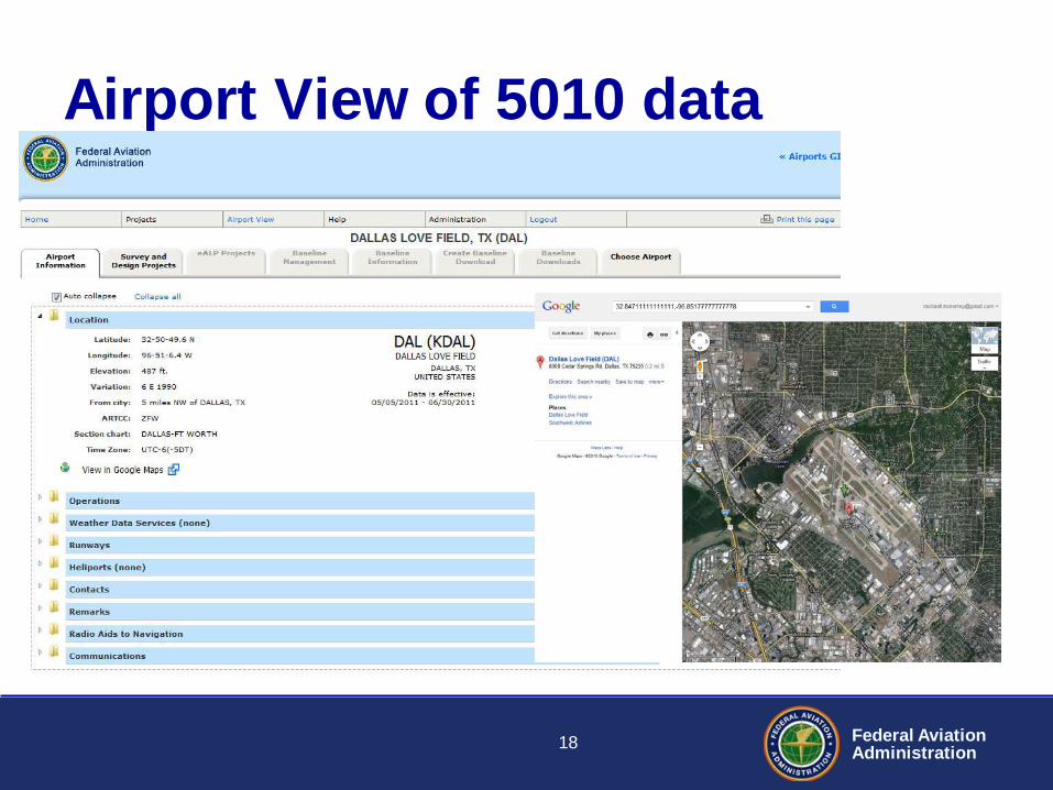
Airport View of 5010 data
18
Federal Aviation Administration
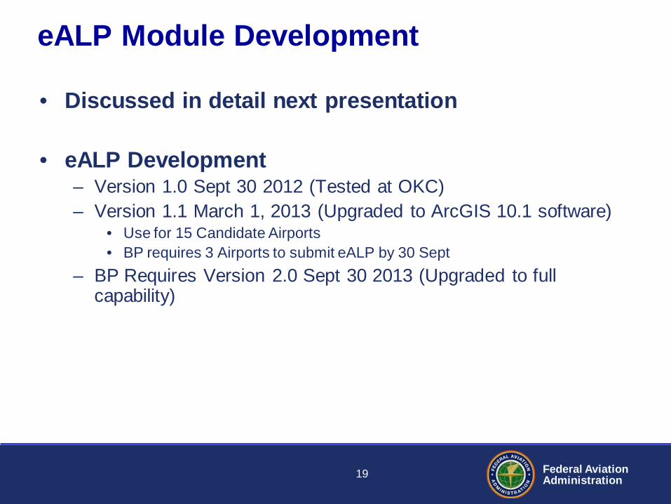
eALP Module Development
• Discussed in detail next presentation
• eALP Development – Version 1.0 Sept 30 2012 (Tested at OKC) – Version 1.1 March 1, 2013 (Upgraded to ArcGIS 10.1 software)
• Use for 15 Candidate Airports • BP requires 3 Airports to submit eALP by 30 Sept
– BP Requires Version 2.0 Sept 30 2013 (Upgraded to full capability)
19
Federal Aviation Administration
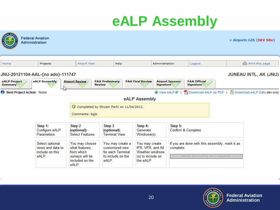
eALP Assembly
20
Federal Aviation Administration
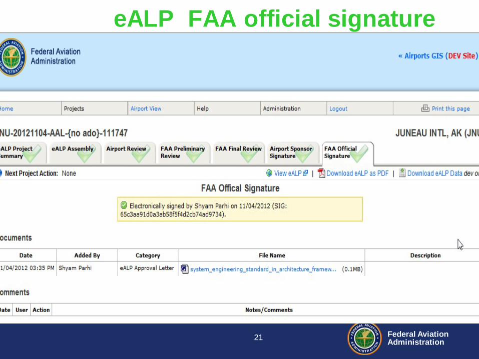
eALP FAA official signature
21
Federal Aviation Administration
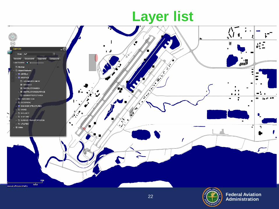
Layer list
22
Federal Aviation Administration
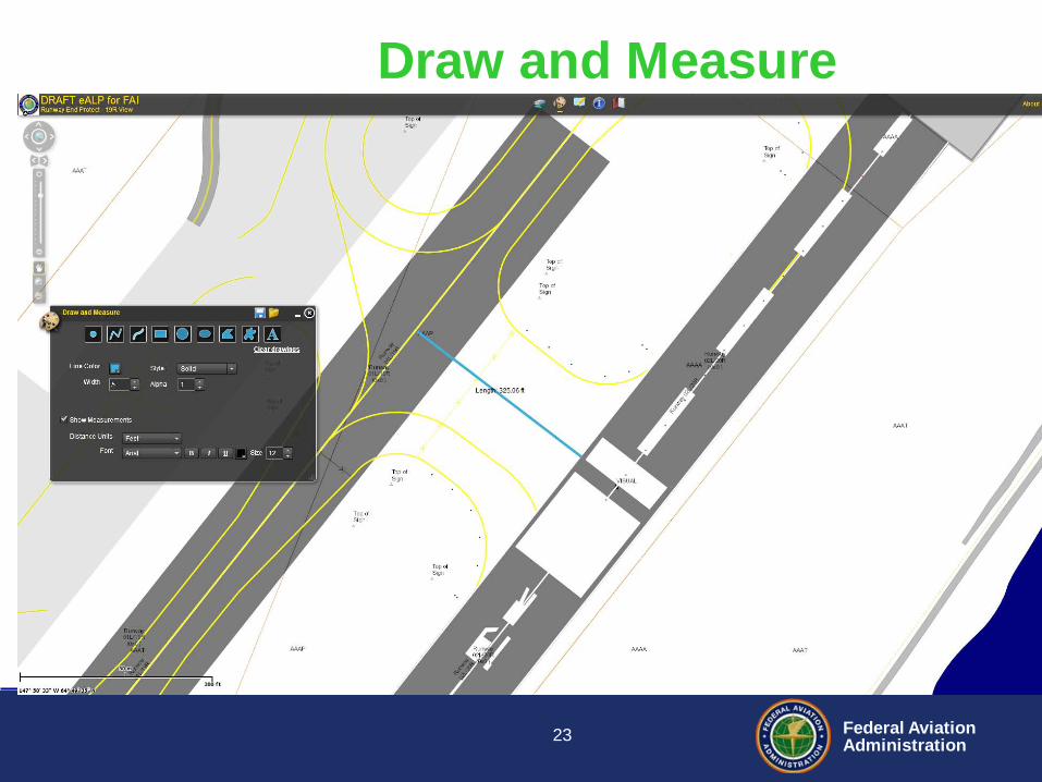
Draw and Measure
23
Federal Aviation Administration
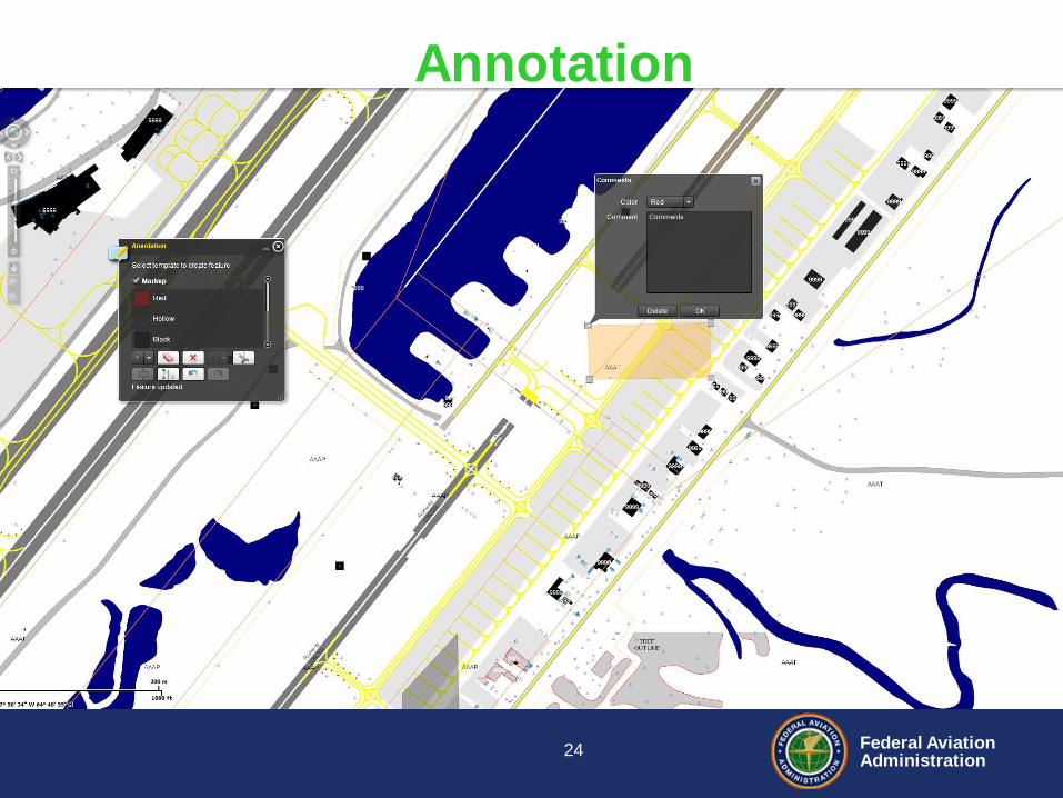
Annotation
24
Federal Aviation Administration
Cloud Server Implementation
• Cloud Server Data by Airport – All Collected High Resolution Aerial
Photography • Currently 450 airports
– Legacy ALPs in PDF Format – Airport Signage and Marking Plans – Runway Safety Area Determinations – Other optional PDF and Shapefiles
• SHP and KML files overlaid on aerial photography
25
Federal Aviation Administration
• Aeronautical Data Management (ADM) – NAV Lean initiative under ATO – Purpose was to streamline data for instrument procedures – 1.5 years of weekly meeting and executive buy in – Scheduled from March 2013 to September 2015
• Includes changing 5010 data to Airports GIS Web Interface
• AIM Agreement to Cooperate with ARP – Airports GIS is Authoritative Source – All Surveys enter into Airports GIS – AIM will use Airports GIS for
• Airport Diagrams, Digital NOTAMs, LVO/SMGCS Charting
IV. NAV Lean Implementation
26
Federal Aviation Administration
V. Document Update • Airports GIS Implementation Plan
– April 15, 2013 • Update to AC 5300-18B Change 1
– Clarifications only Draft July 2013 – New AC 5300-18C with schema change 2014/2015
27
Federal Aviation Administration
VI. How can you benefit • Airport can assign access to consultants • High resolution aerial photography
– Horizontal Accuracy Verified • Airport Layout geospatial data • Current and future runway locations • Upload .shp and PDF files for viewing
28

Federal Aviation Administration
Questions?
29