Embed Size (px)
Citation preview
1
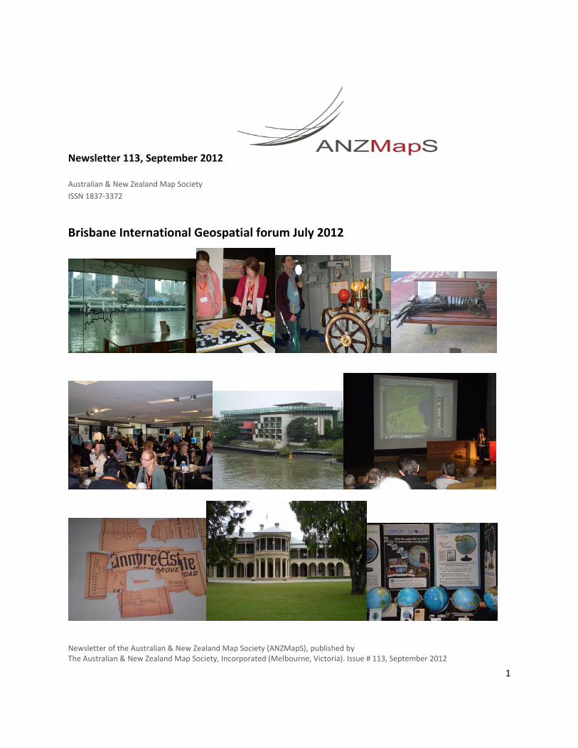
Newsletter 113, September 2012
Australian & New Zealand Map Society
ISSN 1837-3372
Brisbane International Geospatial forum July 2012
Newsletter of the Australian & New Zealand Map Society (ANZMapS), published by The Australian & New Zealand Map Society, Incorporated (Melbourne, Victoria). Issue # 113, September 2012
2
In this issue:
Brisbane 2012 Conference and AGM/News from the National Library of Australia/The Patricia Alonzo Memorial Prize/Welcome to new members/ News from the National Library of New Zealand/News from the State Library of New South Wales/Coming events, recent publications and other items of interest/ How to subscribe to the member e-mail list.
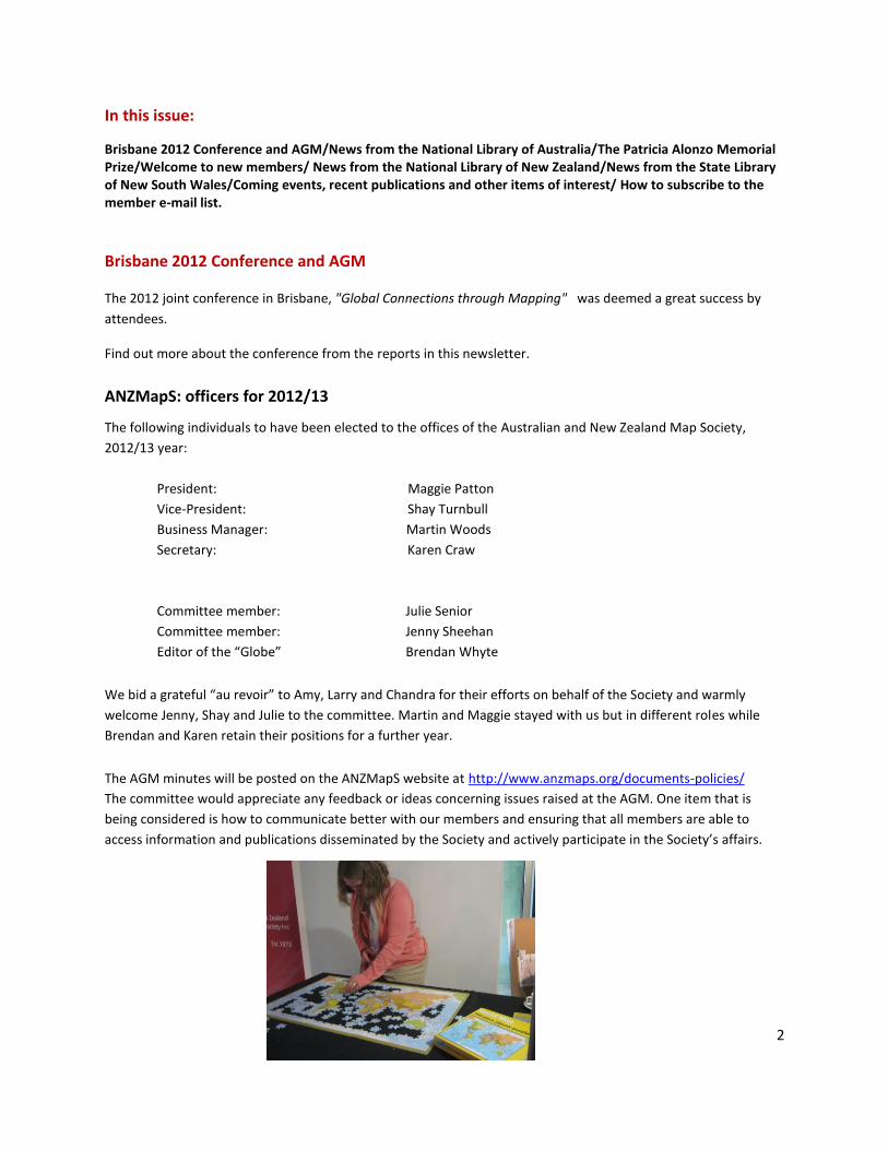
Brisbane 2012 Conference and AGM
The 2012 joint conference in Brisbane, "Global Connections through Mapping" was deemed a great success by
attendees.
Find out more about the conference from the reports in this newsletter.
ANZMapS: officers for 2012/13
The following individuals to have been elected to the offices of the Australian and New Zealand Map Society,
2012/13 year:
President: Maggie Patton
Vice-President: Shay Turnbull
Business Manager: Martin Woods
Secretary: Karen Craw
Committee member: Julie Senior
Committee member: Jenny Sheehan
Editor of the “Globe” Brendan Whyte
We bid a grateful “au revoir” to Amy, Larry and Chandra for their efforts on behalf of the Society and warmly
welcome Jenny, Shay and Julie to the committee. Martin and Maggie stayed with us but in different roles while
Brendan and Karen retain their positions for a further year.
The AGM minutes will be posted on the ANZMapS website at http://www.anzmaps.org/documents-policies/
The committee would appreciate any feedback or ideas concerning issues raised at the AGM. One item that is
being considered is how to communicate better with our members and ensuring that all members are able to
access information and publications disseminated by the Society and actively participate in the Society’s affairs.
3
The Dorothy Prescott Prize Each year, the Society awards The Dorothy Prescott Prize to the presenter of the best paper given at the Society’s
annual conference. The prize consists of $500 and a certificate, which the presenter receives upon publication of his winning paper in
“The Globe”.
This year’s winner, of the 3rd
annual Dorothy Prescott prize, is Rupert Gerritsen for his paper "Getting the strait
facts straight" about Flinders' search for a strait in the Australian coast likely to lead to an inland sea.
Congratulations to Rupert!
We look forward to publishing Rupert's paper in "The Globe" in due course.
Brendan Whyte
Globe editor, and member of the prize committee.
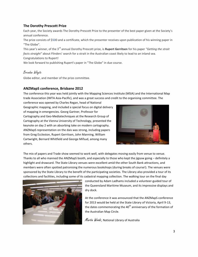
ANZMapS conference, Brisbane 2012 The conference this year was held jointly with the Mapping Sciences Institute (MSIA) and the International Map
trade Association (IMTA Asia-Pacific), and was a great success and credit to the organising committee. The
conference was opened by Charles Regan, head of National
Geographic mapping, and included a special focus on digital delivery
of mapping in emergencies. Georg Gartner, Professor for
Cartography and Geo-Mediatechniques at the Research Group of
Cartography at the Vienna University of Technology, presented the
keynote on day 2 with an absorbing take on modern cartography.
ANZMapS representation on the dais was strong, including papers
from Greg Eccleston, Rupert Gerritsen, John Manning, William
Cartwright, Bernard Whitfield and George Mifsud, among many
others.
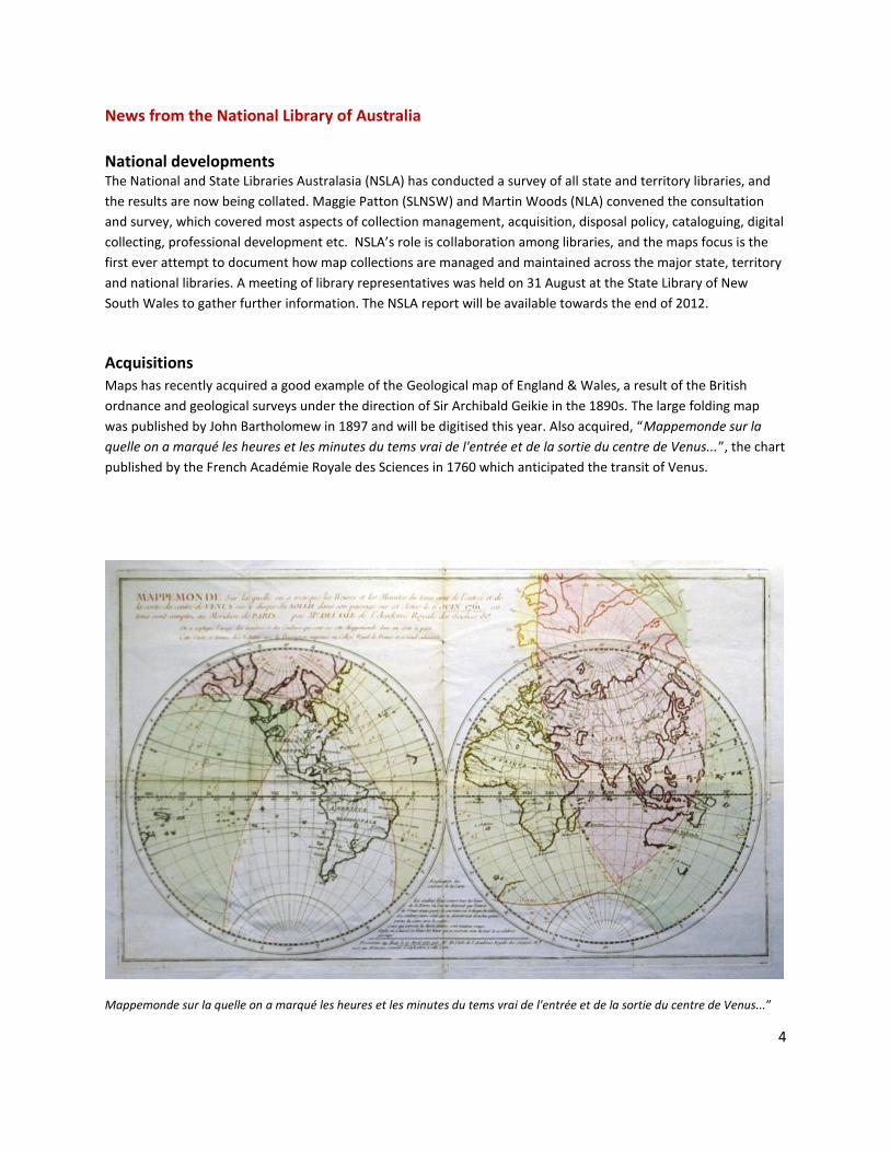
The mix of papers and Trade show seemed to work well, with delegates moving easily from venue to venue.
Thanks to all who manned the ANZMapS booth, and especially to those who kept the jigsaw going – definitely a
highlight and drawcard. The State Library venues were excellent amid the other South Bank attractions, and
members were often spotted patronising the numerous bookshops (during breaks of course!). The venues were
sponsored by the State Library to the benefit of the participating societies. The Library also provided a tour of its
collections and facilities, including some of its cadastral mapping collection. The walking tour on the final day
conducted by Adam Ladhams included a volunteer-guided tour of
the Queensland Maritime Museum, and its impressive displays and
dry dock.
At the conference it was announced that the ANZMapS conference
for 2013 would be held at the State Library of Victoria, April 9-13,
the dates commemorating the 40th
anniversary of the formation of
the Australian Map Circle.
Martin Woods, National Library of Australia
4
News from the National Library of Australia
National developments
The National and State Libraries Australasia (NSLA) has conducted a survey of all state and territory libraries, and
the results are now being collated. Maggie Patton (SLNSW) and Martin Woods (NLA) convened the consultation
and survey, which covered most aspects of collection management, acquisition, disposal policy, cataloguing, digital
collecting, professional development etc. NSLA’s role is collaboration among libraries, and the maps focus is the
first ever attempt to document how map collections are managed and maintained across the major state, territory
and national libraries. A meeting of library representatives was held on 31 August at the State Library of New
South Wales to gather further information. The NSLA report will be available towards the end of 2012.
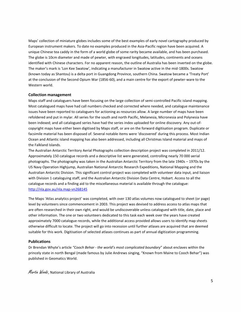
Acquisitions Maps has recently acquired a good example of the Geological map of England & Wales, a result of the British
ordnance and geological surveys under the direction of Sir Archibald Geikie in the 1890s. The large folding map
was published by John Bartholomew in 1897 and will be digitised this year. Also acquired, “Mappemonde sur la
qu ”, the chart
published by the rench Acad mie oyale des Sciences in 17 which anticipated the transit of enus.
Mappemonde sur la quelle on ”
5
Maps’ collection of miniature globes includes some of the best examples of early novel cartography produced by
European instrument makers. To date no examples produced in the Asia-Pacific region have been acquired. A
unique Chinese tea caddy in the form of a world globe of some rarity became available, and has been purchased.
The globe is 10cm diameter and made of pewter, with engraved longitudes, latitudes, continents and oceans
identified with Chinese characters. For no apparent reason, the outline of Australia has been inverted on the globe.
The maker’s mark is ‘Lon Kee Swatow’, indicating a manufacturer in Swatow active in the mid-1800s. Swatow
(known today as Shantou) is a delta port in Guangdong Province, southern China. Swatow became a ‘Treaty Port’
at the conclusion of the Second Opium War (1856-60), and a main centre for the export of pewter-ware to the
Western world.
Collection management
Maps staff and cataloguers have been focusing on the large collection of semi-controlled Pacific island mapping.
Most catalogued maps have had call numbers checked and corrected where needed, and catalogue maintenance
issues have been reported to cataloguers for actioning as resources allow. A large number of maps have been
refoldered and put in mylar. All series for the south and north Pacific, Melanesia, Micronesia and Polynesia have
been indexed; and all catalogued series have had the series index uploaded for online discovery. Any out-of-
copyright maps have either been digitised by Maps staff, or are on the forward digitisation program. Duplicate or
facsimile material has been disposed of. Several notable items were ‘discovered’ during this process. Most Indian
Ocean and Atlantic island mapping has also been addressed, including all Christmas Island material and maps of
the Falkland Islands.
The Australian Antarctic Territory Aerial Photographs collection description project was completed in 2011/12.
Approximately 150 catalogue records and a descriptive list were generated, controlling nearly 70 000 aerial
photographs. The photography was taken in the Australian Antarctic Territory from the late 1940s – 1970s by the
US Navy Operation Highjump, Australian National Antarctic Research Expeditions, National Mapping and the
Australian Antarctic Division. This significant control project was completed with volunteer data input, and liaison
with Division 1 cataloguing staff, and the Australian Antarctic Division Data Centre, Hobart. Access to all the
catalogue records and a finding aid to the miscellaneous material is available through the catalogue:
http://nla.gov.au/nla.map-vn268145
The Maps ‘Atlas analytics project’ was completed, with over 130 atlas volumes now catalogued to sheet (or page)
level by volunteers since commencement in 2003. This project was devised to address access to atlas maps that
are often researched in their own right, and would be undiscoverable unless catalogued with title, date, place and
other information. The one or two volunteers dedicated to this task each week over the years have created
approximately 7000 catalogue records, while the additional access provided allows users to identify map sheets
otherwise difficult to locate. The project will go into recession until further atlases are acquired that are deemed
suitable for this work. Digitisation of selected atlases continues as part of annual digitization programming.
Publications
Dr Brendan Whyte’s article “C B - w ’ p b y” about enclaves within the
princely state in north Bengal (made famous by Julie Andrews singing, “Known from Maine to Cooch Behar”) was
published in Geomatics World.
Martin Woods, National Library of Australia
6
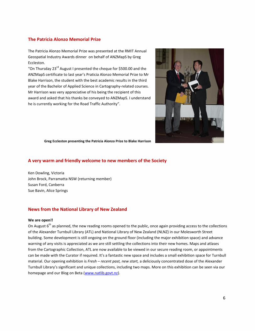
The Patricia Alonzo Memorial Prize The Patricia Alonzo Memorial Prize was presented at the RMIT Annual
Geospatial Industry Awards dinner on behalf of ANZMapS by Greg
Eccleston.
“On Thursday 23rd
August I presented the cheque for $500.00 and the
ANZMapS certificate to last year’s Praticia Alonzo Memorial Prize to Mr
Blake Harrison, the student with the best academic results in the third
year of the Bachelor of Applied Science in Cartography-related courses.
Mr Harrison was very appreciative of his being the recipient of this
award and asked that his thanks be conveyed to ANZMapS. I understand
he is currently working for the oad Traffic Authority”.
Greg Eccleston presenting the Patricia Alonzo Prize to Blake Harrison
A very warm and friendly welcome to new members of the Society
Ken Dowling, Victoria
John Brock, Parramatta NSW (returning member)
Susan Ford, Canberra
Sue Bavin, Alice Springs
News from the National Library of New Zealand We are open!!
On August 6th
as planned, the new reading rooms opened to the public, once again providing access to the collections
of the Alexander Turnbull Library (ATL) and National Library of New Zealand (NLNZ) in our Molesworth Street
building. Some development is still ongoing on the ground floor (including the major exhibition space) and advance
warning of any visits is appreciated as we are still settling the collections into their new homes. Maps and atlases
from the Cartographic Collection, ATL are now available to be viewed in our secure reading room, or appointments
can be made with the Curator if required. It’s a fantastic new space and includes a small exhibition space for Turnbull
material. Our opening exhibition is Fresh – recent past, new start, a deliciously concentrated dose of the Alexander
Turnbull Library’s significant and unique collections, including two maps. More on this exhibition can be seen via our
homepage and our Blog on Beta (www.natlib.govt.nz).
7
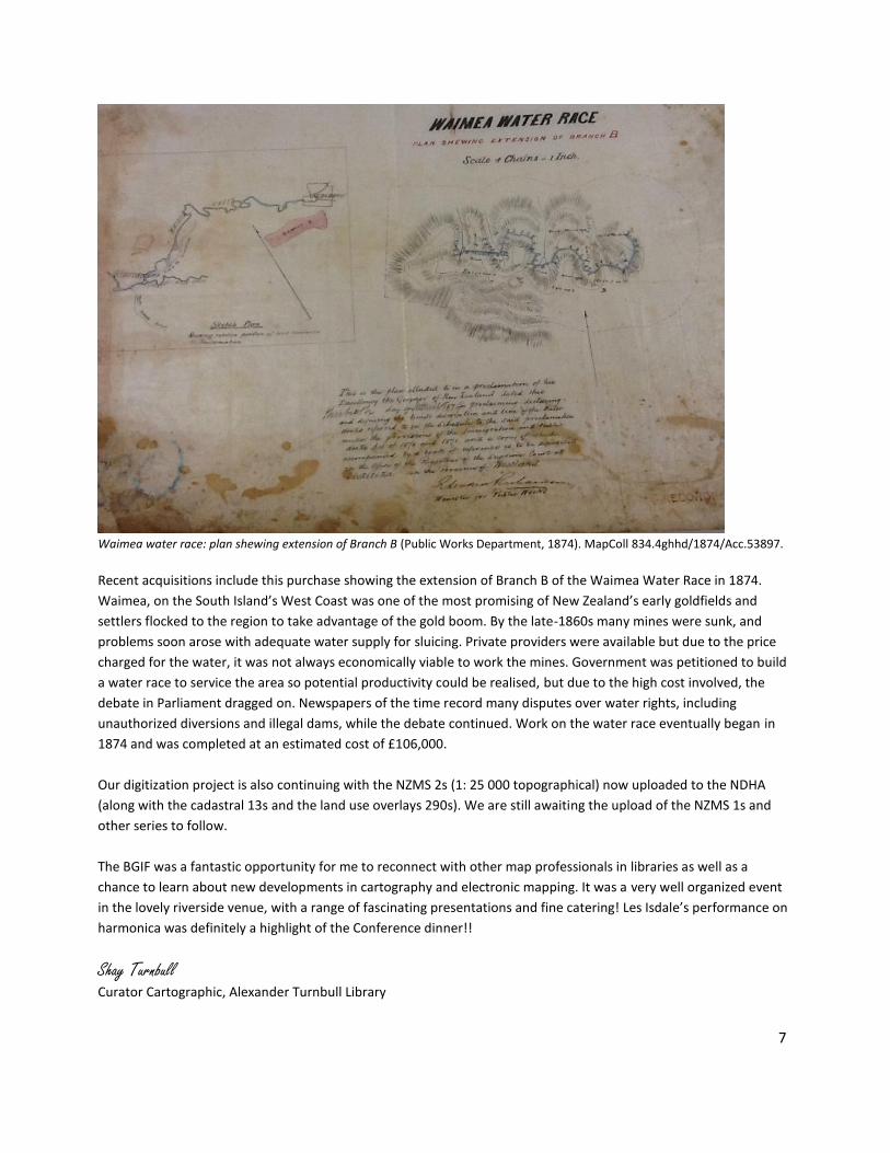
Waimea water race: plan shewing extension of Branch B (Public Works Department, 1874). MapColl 834.4ghhd/1874/Acc.53897. Recent acquisitions include this purchase showing the extension of Branch B of the Waimea Water Race in 1874.
Waimea, on the South Island’s West Coast was one of the most promising of New Zealand’s early goldfields and
settlers flocked to the region to take advantage of the gold boom. By the late-1860s many mines were sunk, and
problems soon arose with adequate water supply for sluicing. Private providers were available but due to the price
charged for the water, it was not always economically viable to work the mines. Government was petitioned to build
a water race to service the area so potential productivity could be realised, but due to the high cost involved, the
debate in Parliament dragged on. Newspapers of the time record many disputes over water rights, including
unauthorized diversions and illegal dams, while the debate continued. Work on the water race eventually began in
1874 and was completed at an estimated cost of £106,000.
Our digitization project is also continuing with the NZMS 2s (1: 25 000 topographical) now uploaded to the NDHA
(along with the cadastral 13s and the land use overlays 290s). We are still awaiting the upload of the NZMS 1s and
other series to follow.
The BGIF was a fantastic opportunity for me to reconnect with other map professionals in libraries as well as a
chance to learn about new developments in cartography and electronic mapping. It was a very well organized event
in the lovely riverside venue, with a range of fascinating presentations and fine catering! Les Isdale’s performance on
harmonica was definitely a highlight of the Conference dinner!!
Shay Turnbull Curator Cartographic, Alexander Turnbull Library
8
News from the State Library of New South Wales
Sarah Tyacke talk, 30 August 2012
On 30 August, the State Library of New South Wales hosted a talk by Sarah Tyacke. Formerly the director of special
collections at the British Library, Sarah is presently president of IMCoS and secretary of the International Society
for the History of the Map. She spoke with passion and with great authority on the life and works of Sir Robert
Dudley, and in particular Dudley’s charts in the first sea atlas published in English, Arcano del Mare (1 48). Sarah’s
talk attracted an audience of over 80 people, most of whom stayed on to admire the two Dudley charts in the
State Library’s collection.
eRecords update
The eRecords Project (http://www.sl.nsw.gov.au/about/projects/erecords/index.html) continues to create online
catalogue records for the many State Library of New South Wales collections that do not already have online
records. Since the project began in 2008, the eRecords team has created almost 35,000 maps records, all available
through the State Library catalogue and Trove. Attention was recently turned to our collection of maps in series.
Prior to the eRecords Project, most series were listed only in the Maps Card Catalogue. Only significant series or
those created since 1990 had eRecords. All series maps will receive eRecords, with additional attention being paid
to series relating specifically to New South Wales.
Recent acquisitions
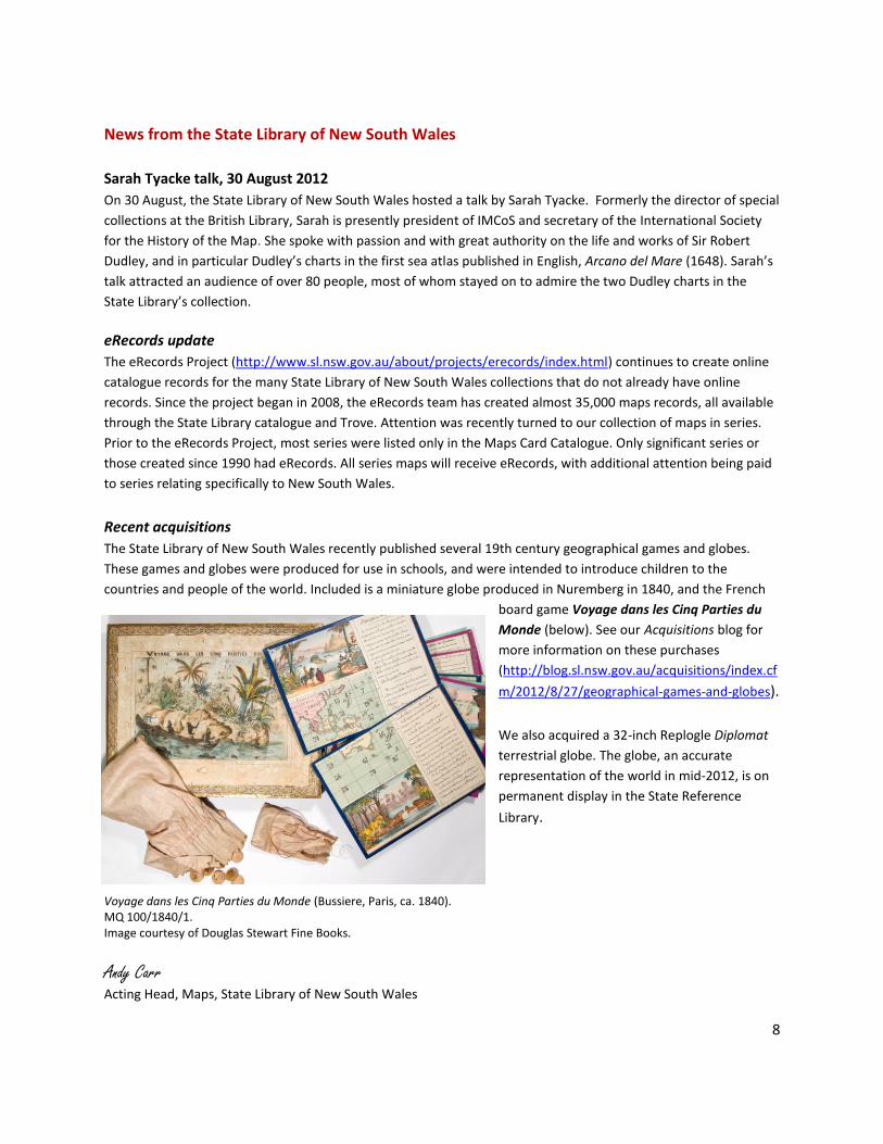
The State Library of New South Wales recently published several 19th century geographical games and globes.
These games and globes were produced for use in schools, and were intended to introduce children to the
countries and people of the world. Included is a miniature globe produced in Nuremberg in 1840, and the French
board game Voyage dans les Cinq Parties du
Monde (below). See our Acquisitions blog for
more information on these purchases
(http://blog.sl.nsw.gov.au/acquisitions/index.cf
m/2012/8/27/geographical-games-and-globes).
We also acquired a 32-inch Replogle Diplomat
terrestrial globe. The globe, an accurate
representation of the world in mid-2012, is on
permanent display in the State Reference
Library.
Voyage dans les Cinq Parties du Monde (Bussiere, Paris, ca. 1840). MQ 100/1840/1. Image courtesy of Douglas Stewart Fine Books.
Andy Carr Acting Head, Maps, State Library of New South Wales
9
Coming events, recent publications and other items of interest…
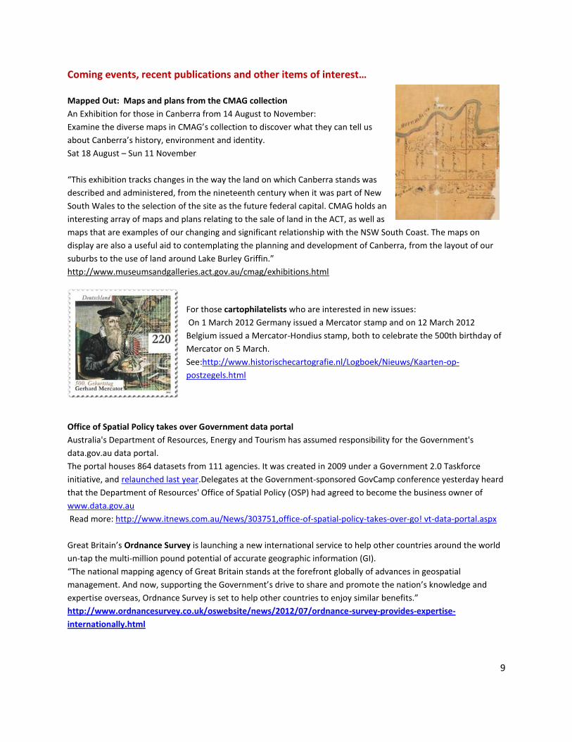
Mapped Out: Maps and plans from the CMAG collection
An Exhibition for those in Canberra from 14 August to November:
Examine the diverse maps in CMAG’s collection to discover what they can tell us
about Canberra’s history, environment and identity.
Sat 18 August – Sun 11 November
“This exhibition tracks changes in the way the land on which Canberra stands was
described and administered, from the nineteenth century when it was part of New
South Wales to the selection of the site as the future federal capital. CMAG holds an
interesting array of maps and plans relating to the sale of land in the ACT, as well as
maps that are examples of our changing and significant relationship with the NSW South Coast. The maps on
display are also a useful aid to contemplating the planning and development of Canberra, from the layout of our
suburbs to the use of land around Lake Burley Griffin.”
http://www.museumsandgalleries.act.gov.au/cmag/exhibitions.html
For those cartophilatelists who are interested in new issues:
On 1 March 2012 Germany issued a Mercator stamp and on 12 March 2012
Belgium issued a Mercator-Hondius stamp, both to celebrate the 500th birthday of
Mercator on 5 March.
See:http://www.historischecartografie.nl/Logboek/Nieuws/Kaarten-op-
postzegels.html
Office of Spatial Policy takes over Government data portal
Australia's Department of Resources, Energy and Tourism has assumed responsibility for the Government's
data.gov.au data portal.
The portal houses 864 datasets from 111 agencies. It was created in 2009 under a Government 2.0 Taskforce
initiative, and relaunched last year.Delegates at the Government-sponsored GovCamp conference yesterday heard
that the Department of Resources' Office of Spatial Policy (OSP) had agreed to become the business owner of
www.data.gov.au
Read more: http://www.itnews.com.au/News/303751,office-of-spatial-policy-takes-over-go! vt-data-portal.aspx
Great Britain’s Ordnance Survey is launching a new international service to help other countries around the world
un-tap the multi-million pound potential of accurate geographic information (GI).
“The national mapping agency of Great Britain stands at the forefront globally of advances in geospatial
management. And now, supporting the Government’s drive to share and promote the nation’s knowledge and
expertise overseas, Ordnance Survey is set to help other countries to enjoy similar benefits.”
http://www.ordnancesurvey.co.uk/oswebsite/news/2012/07/ordnance-survey-provides-expertise-
internationally.html
10
Surveyors fly high in new satellite deal (17/07/2012)
Geoscience Australia has signed a Memorandum of Understanding with the United States Geological Survey to
become a partner in the operation of the new US satellite, Landsat 8.
Minister for Resources and Energy, Martin Ferguson welcomed the news saying Landsat 8 was the latest in the
series of Landsat satellites and was expected to launch in January 2013.
Mr Ferguson said it would continue almost 40 years of operation of the Landsat series of land observing satellites
(part of the Landsat Data Continuity Mission) which was the longest continuous record of the Earth’s surface as
seen from space.
Websites of interest
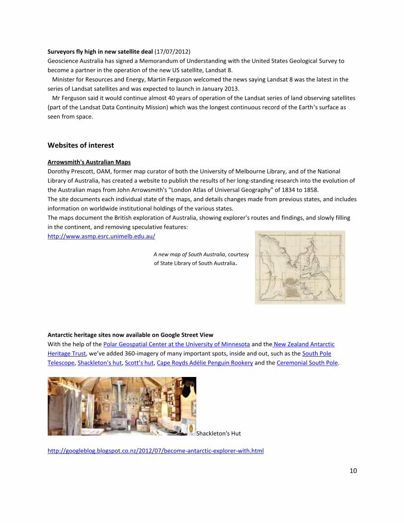
Arrowsmith's Australian Maps
Dorothy Prescott, OAM, former map curator of both the University of Melbourne Library, and of the National
Library of Australia, has created a website to publish the results of her long-standing research into the evolution of
the Australian maps from John Arrowsmith's "London Atlas of Universal Geography" of 1834 to 1858.
The site documents each individual state of the maps, and details changes made from previous states, and includes
information on worldwide institutional holdings of the various states.
The maps document the British exploration of Australia, showing explorer's routes and findings, and slowly filling
in the continent, and removing speculative features:
http://www.asmp.esrc.unimelb.edu.au/
A new map of South Australia, courtesy
of State Library of South Australia.
Antarctic heritage sites now available on Google Street View
With the help of the Polar Geospatial Center at the University of Minnesota and the New Zealand Antarctic
Heritage Trust, we’ve added 360-imagery of many important spots, inside and out, such as the South Pole
Telescope, Shackleton's hut, Scott’s hut, Cape Royds Adélie Penguin Rookery and the Ceremonial South Pole.
Shackleton's Hut
http://googleblog.blogspot.co.nz/2012/07/become-antarctic-explorer-with.html
11
For your entertainment. A Vintage Look at 'Modern Map Making' in the 1940s produced by Chevrolet. N.B. Over 8 minutes long (but you can bail out at any time).
Caught Mapping (1940) http://www.theatlantic.com/video/index/258710/Caught
Mapping, produced by Chevrolet in 1940, explores how roadmaps are
made. http://www.theatlantic.com/video/index/258710/
Directions Magazine has released GeoWebMap, a free, cloud based mapping service that enables you to easily
create custom maps from your own Excel, dBase, and CSV files. No login or registration required. Works with US,
Canadian, UK and Australian data.
http://www.directionsmag.com/geowebmaps/
2012 Digital Atlas of the Earth
DeLorme, the innovation leader in personal satellite messaging, tracking and navigation technology, today
announced the introduction of the 2012 Digital Atlas of the Earth (DAE 2012), the first-ever 1:125,000 scale
seamless topographic map with consistent coverage of the world.
Read more: http://www.sensysmag.com/news/top-stories/corporate-news/27767-delorme-unveils-new-version-
of-digital-atlas-of-the-earth.html
Google has released Google Map Maker for Australia. A crowdsourcing tool that allows users to edit and add to
Google Map. Roads, rivers, cycling paths, hiking trail, places, etc.
More info on the blog: http://google-au.blogspot.com.au/2012/08/calling-all-aussie-mappers-google-map.html
And more googly stuff…
How Google Builds Its Maps
“An exclusive look inside Ground Truth, the secretive program to build the world's best accurate maps.
Behind every Google Map, there is a much more complex map that's the key to your queries but hidden from your
view. The deep map contains the logic of places: their no-left-turns and freeway on-ramps, speed limits and traffic
conditions. This is the data that you're drawing from when you ask Google to navigate you from point A to point B -
- and last week, Google showed me the internal map and demonstrated how it was built. It's the first time the
company has let anyone watch how the project it calls GT, or "Ground Truth," actually works.”
Read more: http://www.theatlantic.com/technology/archive/12/09/how-google-builds-its-maps-and-what-it-
means-for-the-future-of-well-everything/261913/
12
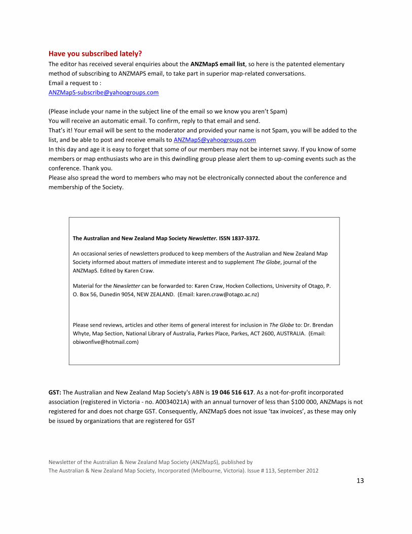
Map producers of interest A recommendation from Judith Scurfield at SLV
“I thought a contact and website of interest is Westprint, who are a company of map producers operating from
Nhill, in western Victoria. It is a real family concern, and the two younger members of the family who run the
business, Jo and her husband Graeme, were at the Brisbane conference. Jo's parents, John and Bev Deckert
started it in 1986 , producing maps of more remote parts of western Victoria, and later extending to the outback
areas of South and Central Australia. They still travel to these areas, researching such things as 4-wheel drive tracks,
National Parks, and use of GPS in outback areas. They produce a weekly email newsletter called "Friday Five",
which often lists second-hand travel books for sale, and has some entertaining jokes at the end. The web address is
www.westprint.com.au
And one from New Zealand just too even things up…
Geographx is a privately-owned mapping and cartographic design company based in Wellington, New Zealand.
Geographx designs and draws maps to order…
large format print maps for visitor centres and public galleries
maps for interpretative or directional signboards
sheetmaps for the wall or use in the field
maps for atlases, books, reports and other print publications
webmaps, maps for datashow presentations and mobile devices
interactive maps, dynamic maps and virtual flight video
…and they do have some very nice map posters for sale through their website.
Their map poster of Tongariro won an IMTA award at the Brisbane joint conference. Information about their company and services as well as sales of map posters is available from their website
http://geographx.co.nz/
Winner of the IMTA Gold award for a map sheet at the 2012 Conference and the
Graham Stanton Award for best mapping product overall.
13
Have you subscribed lately? The editor has received several enquiries about the ANZMapS email list, so here is the patented elementary
method of subscribing to ANZMAPS email, to take part in superior map-related conversations.
Email a request to :
(Please include your name in the subject line of the email so we know you aren’t Spam)
You will receive an automatic email. To confirm, reply to that email and send.
That’s it! Your email will be sent to the moderator and provided your name is not Spam, you will be added to the
list, and be able to post and receive emails to [email protected]
In this day and age it is easy to forget that some of our members may not be internet savvy. If you know of some
members or map enthusiasts who are in this dwindling group please alert them to up-coming events such as the
conference. Thank you.
Please also spread the word to members who may not be electronically connected about the conference and
membership of the Society.
The Australian and New Zealand Map Society Newsletter. ISSN 1837-3372.
An occasional series of newsletters produced to keep members of the Australian and New Zealand Map
Society informed about matters of immediate interest and to supplement The Globe, journal of the
ANZMapS. Edited by Karen Craw.
Material for the Newsletter can be forwarded to: Karen Craw, Hocken Collections, University of Otago, P.
O. Box 56, Dunedin 9054, NEW ZEALAND. (Email: [email protected])
Please send reviews, articles and other items of general interest for inclusion in The Globe to: Dr. Brendan
Whyte, Map Section, National Library of Australia, Parkes Place, Parkes, ACT 2600, AUSTRALIA. (Email:
GST: The Australian and New Zealand Map Society's ABN is 19 046 516 617. As a not-for-profit incorporated
association (registered in Victoria - no. A0034021A) with an annual turnover of less than $100 000, ANZMaps is not
registered for and does not charge GST. Consequently, ANZMapS does not issue ‘tax invoices’, as these may only
be issued by organizations that are registered for GST
Newsletter of the Australian & New Zealand Map Society (ANZMapS), published by
The Australian & New Zealand Map Society, Incorporated (Melbourne, Victoria). Issue # 113, September 2012

14