Embed Size (px)
Citation preview

geology: 3D space meets time
Michiel van der Meulen, Erik Simmelink, Jan Stafleu, Ronald Vernes, Jan
Gunnink, Geomodelling Teams
Geological Survey of the Netherlands

what is a geological survey?
10 januari 2011
M Bouman
TNO Nieuwe huisstijl
1
keywords
public organisation
systematic investigation of a country’s subsurface
identification of geo-resources and geo-hazards
repository of subsurface data and information

why subsurface data and information?
we live on top of the subsurface
relying on its resources
depending on its properties
coping with its processes
changing it in several ways
often unconscious of these facts
2
10 januari 2011
M Bouman
TNO Nieuwe huisstijl

3D, 4D, 5D?
architecture and properties = 3D C
+ processes = 4D F
5D? I
3
10 januari 2011
M Bouman
TNO Nieuwe huisstijl


presentation contents
(geology of) the Netherlands: quick facts
3D geomodelling: where do we stand?
energy, water, built environment
dissemination
collaboration
trends, enabling factors, perspective
5
10 januari 2011
M Bouman
TNO Nieuwe huisstijl

(geology of) the Netherlands
small European country
high population density
high land use intensity
high degree of urbanisation
60% coastal and fluvial lowlands
earth resources
energy
groundwater
construction materials
salt, silica sand
6
10 januari 2011
M Bouman
TNO Nieuwe huisstijl

A
B
(geology of) the Netherlands
small European country
high population density
high land use intensity
high degree of urbanisation
60% coastal and fluvial lowlands
challenges
water
lowlands, subsidence
ground conditions
7
10 januari 2011
M Bouman
TNO Nieuwe huisstijl

10 januari 2011
M Bouman
TNO Nieuwe huisstijl
8
lowlands ‘up’lands

Geological Survey of the Netherlands
geoscientific data, information and knowledge for
management of earth resources
safe living on subsiding lowlands
reduction of risks and costs associated with ground conditions
9
10 januari 2011
M Bouman
TNO Nieuwe huisstijl

Geological Survey of the Netherlands
core asset: DINO (national repository)
borehole data
geophysical and geochemical data
models (interpretations predictions)
national coverage, high data density
own and third-party data
standardized
freely accessible
10
10 januari 2011
M Bouman
TNO Nieuwe huisstijl

Base Zechstein Group (Upper Permian, 270 Ma bp)
10 januari 2011
M Bouman
TNO Nieuwe huisstijl
11

Base Triassic (250 Ma)
10 januari 2011
M Bouman
TNO Nieuwe huisstijl
12

Base Jurassic (200 Ma)
10 januari 2011
M Bouman
TNO Nieuwe huisstijl
13

Base Cretaceous (146 Ma)
10 januari 2011
M Bouman
TNO Nieuwe huisstijl
14

Base Tertiary (65 Ma)
10 januari 2011
M Bouman
TNO Nieuwe huisstijl
15

Base Neogene (23 Ma)
10 januari 2011
M Bouman
TNO Nieuwe huisstijl
16


layer models
limits to representation possibilities
especially for the Holocene
(complexity, data density)
voxel models

Utrecht
Amsterdam
Rotterdam

the delta unveiled

Dutch mountains? (geology)
Utrecht

Dutch mountains? (properties)
Utrecht

geomodelling in the Netherlands
layer and voxel models
predictions of the architecture and properties of the subsurface
application-oriented
systematic production, national coverage
2D maps (arbitrary) derived products
drivers / applications
traditionally: hydrocarbon and groundwater resources
new: built environment, sustainable geo-energy, underground storage
delivering a 1990s roadmap (‘towards property predictions in 3D’)
state of the art, however …

10 januari 2011
M Bouman
TNO Nieuwe huisstijl
24


1945
10 januari 2011 M Bouman
TNO Nieuwe huisstijl
26

Geological Survey
of the Netherlands
2010
10 januari 2011 M Bouman
TNO Nieuwe huisstijl
27

geomodelling in the built environment?
geotechnical applications
environmental issues
resolution high enough?
enough predictive value?
not, e.g., for
made ground
scale of individual buildings
and not including
underground constructions
cables, wires, pipelines

North Sea
Rotterdam
The Hague
Amsterdam
Utrecht
Rotterdam
The Hague
Amsterdam
Utrecht
29
10 januari 2011
M Bouman
TNO Nieuwe huisstijl


RandstadRail (lithology) N Z

RandstadRail (lithology) N Z
clay and loam
peat
fine sand
medium sand
coarse sand
anthropogenic & undifferentiated

High resolution pilot study using more data
GeoTOP (100 x 100 x 0,5 m): anytime, anyplace
enhanced resolution (20 x 20 x 0.5 m): custom made

34
10 januari 2011
M Bouman
TNO Nieuwe huisstijl

above-ground information
the urban environment is a detailed one!
step change
CityGML (3D info)
towards 3D urban planning
surface + subsurface
how to combine these evolving domains?
object-oriented vs. voxelised
buildings sitting on placemats

subsurface + surface information
technical issues will be resolved
thinking needs to be aligned system approach
when more detail is requested
not a matter of more computer power
but of more data! (including other data)
new development: key register for the subsurface

key-register for the subsurface (BRO)
Survey database to become part of the Dutch e-Government
by law, government bodies will have to feed and consult our database
“single acquisition and storage, multiple use”
data and models
operational in 2014/2015
more use by more users
higher expectations
accountability, reproducibility
detail, resolution
reliability, credibility
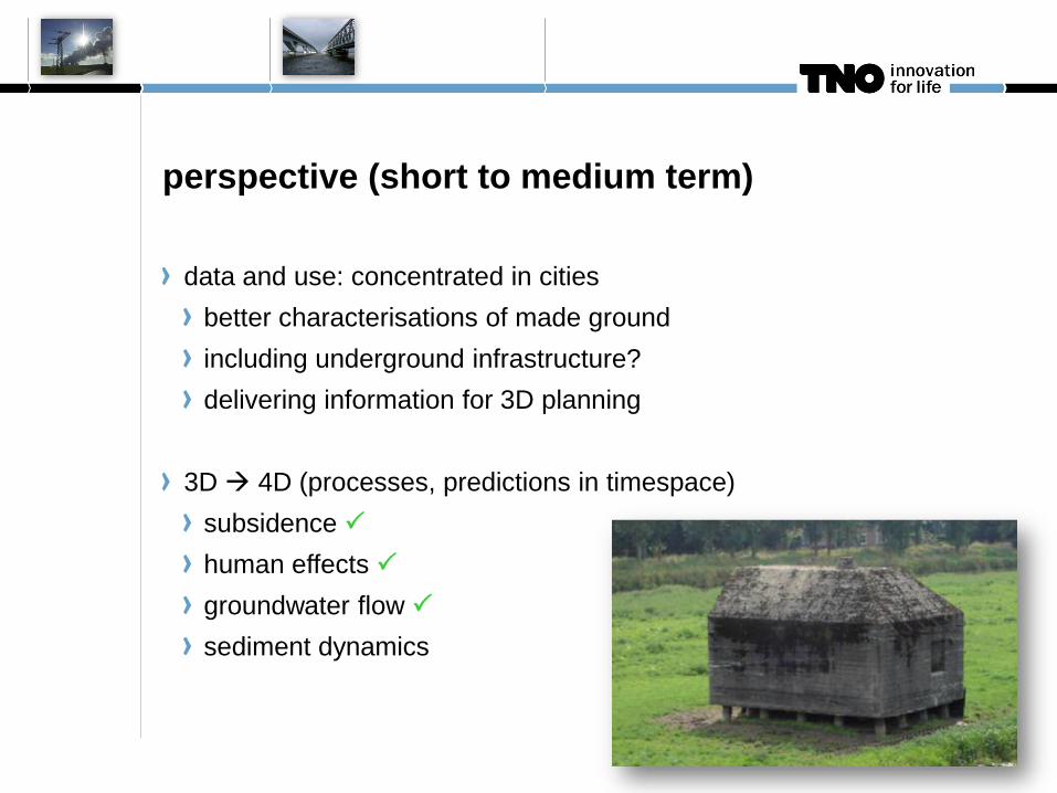
perspective (short to medium term)
data and use: concentrated in cities
better characterisations of made ground
including underground infrastructure?
delivering information for 3D planning
3D 4D (processes, predictions in timespace)
subsidence P
human effects P
groundwater flow P
sediment dynamics

conclusions
systematic geoscience modelling in the Netherlands:
over 2 decades of direct investment / experience
in providing 3D info
highly automated, but more than pushing buttons
late 1990s roadmap almost delivered
a new one features, amongst others:
the built environment
4D (systematically)
how to implement 5D? (PS scale is an issue!)