Embed Size (px)
Citation preview
The Global Administrative Unit Layers (GAUL)
BASIC CONCEPTS
Fabio Grita
System support officer, FAO
Objectives
To facilitate mapping and geospatial analysis of data across countries by harmonizing boundaries and names of the administrative units at global level
To provide the international community with the most
reliable and up-to-date data on international boundaries and administrative units for all countries in the world
To create an easily maintainable standard for
administrative units in order to geo-reference statistical, forecast and real-time datasets
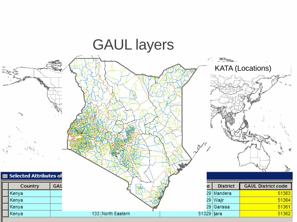
GAUL layers
WILAYA (Districts) KATA NDOGO TAARAFA (Divisions) KATA (Locations)
GAUL helps to geographically represent statistical information (e.g. crop production, nutrition, population, etc.) at national and sub-national levels
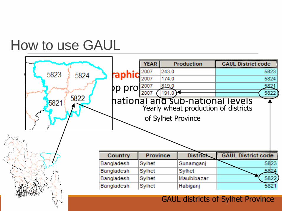
Yearly wheat production of districts
of Sylhet Province
How to use GAUL
GAUL districts of Sylhet Province
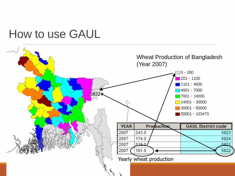
Wheat Production of Bangladesh
(Year 2007)
5822
Yearly wheat production
How to use GAUL
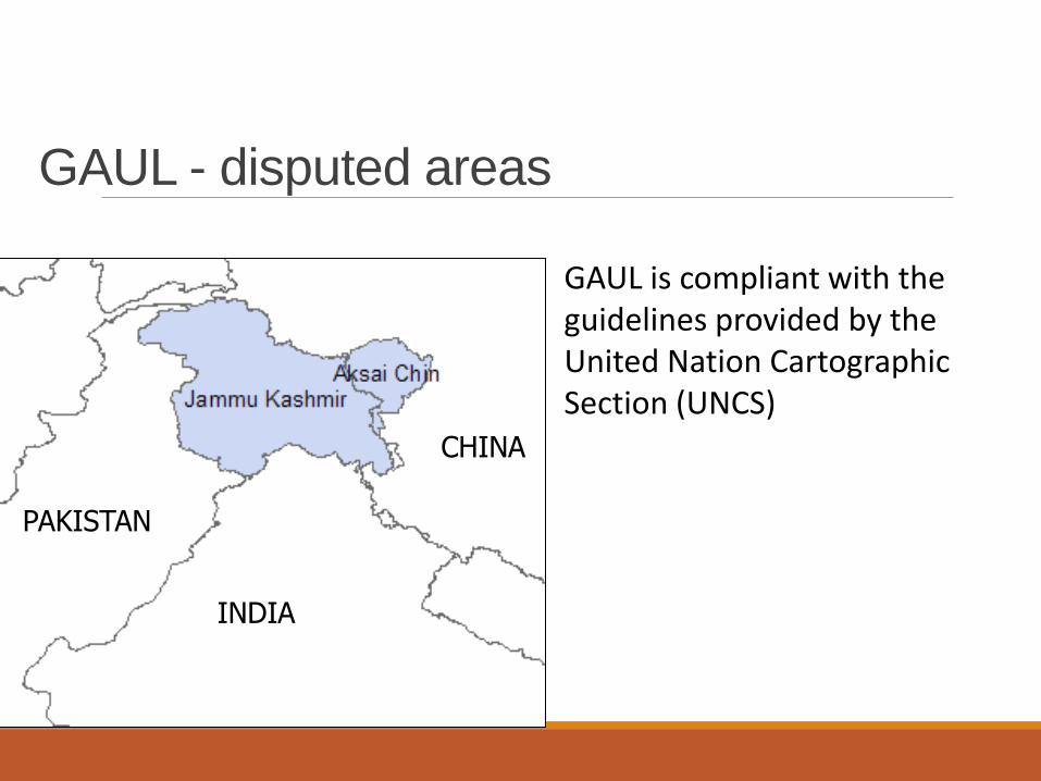
GAUL - disputed areas
GAUL is compliant with the guidelines provided by the United Nation Cartographic Section (UNCS)
INDIA
PAKISTAN
CHINA
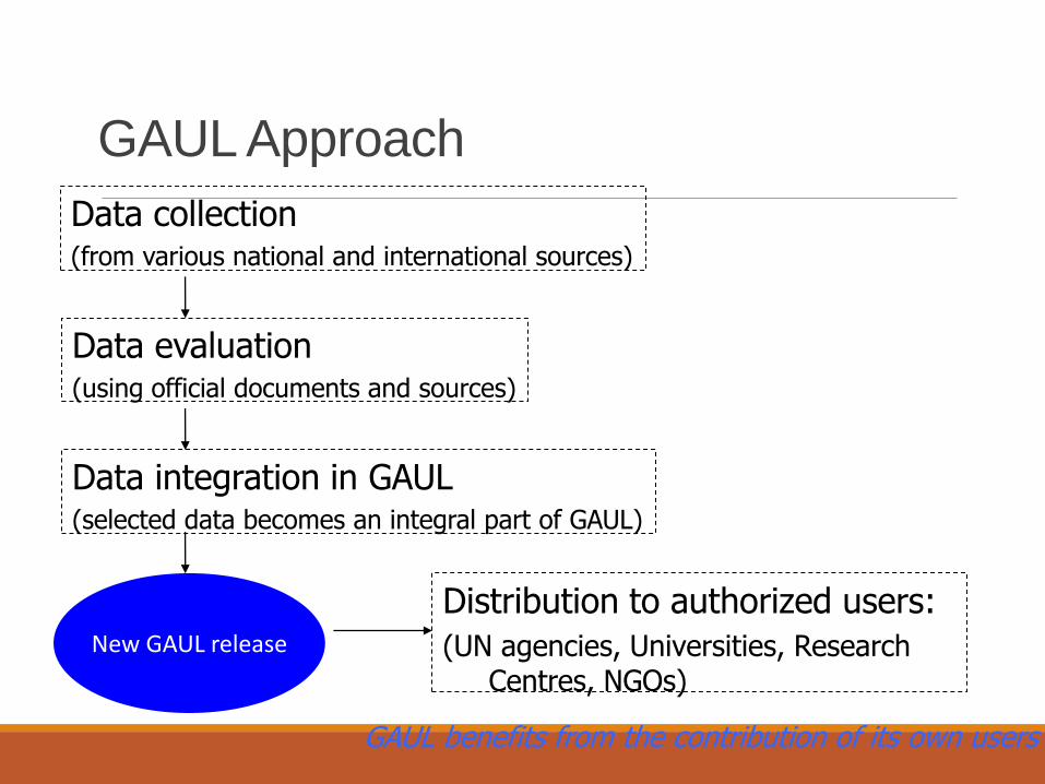
GAUL Approach
Data collection (from various national and international sources)
Data evaluation (using official documents and sources)
Data integration in GAUL (selected data becomes an integral part of GAUL)
New GAUL release
Distribution to authorized users:
(UN agencies, Universities, Research Centres, NGOs)
GAUL benefits from the contribution of its own users
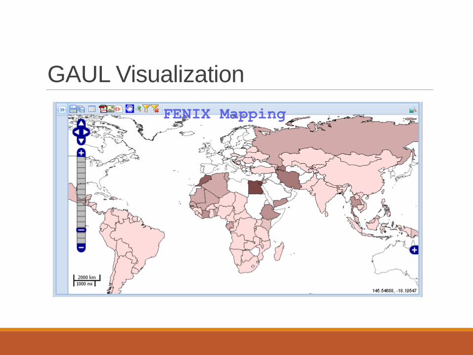
GAUL Visualization
FENIX Mapping

GAUL Users
Food and Agriculture Organization (FAO) Global Information and Early Warning System (EST)
◦ Rainfall Tool
Natural Resources Service (NRC) ◦ the South-East Asia poverty mapping project
Land and Water development division (NRL) ◦ AgroMaps: A global spatial database of agricultural land-use statistics aggregated by sub-national
administrative districts
◦ Aquastat: FAO's Information System on Water and Agriculture
Fishery Marine Resources Service (FIR) ◦ FIGIS: Fisheries Global Information System
Statistics Division (ESS) ◦ CountryStat
Information Technology Department (CIO)
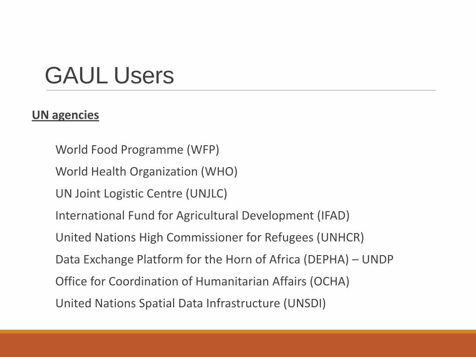
GAUL Users
UN agencies
World Food Programme (WFP)
World Health Organization (WHO)
UN Joint Logistic Centre (UNJLC)
International Fund for Agricultural Development (IFAD)
United Nations High Commissioner for Refugees (UNHCR)
Data Exchange Platform for the Horn of Africa (DEPHA) – UNDP
Office for Coordination of Humanitarian Affairs (OCHA)
United Nations Spatial Data Infrastructure (UNSDI)
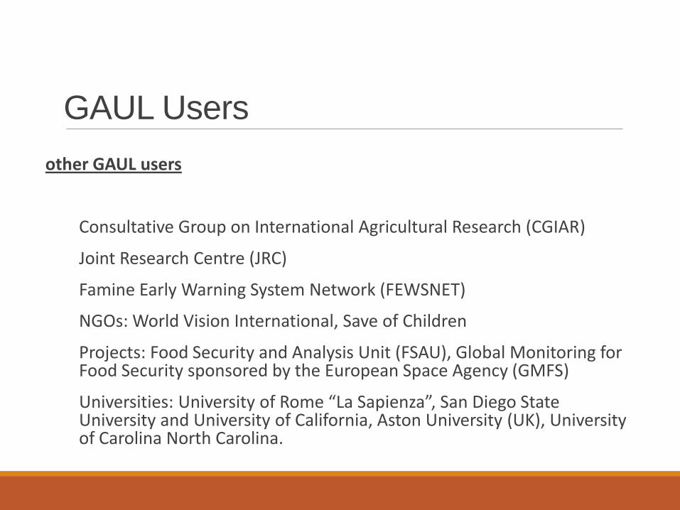
GAUL Users
other GAUL users
Consultative Group on International Agricultural Research (CGIAR)
Joint Research Centre (JRC)
Famine Early Warning System Network (FEWSNET)
NGOs: World Vision International, Save of Children
Projects: Food Security and Analysis Unit (FSAU), Global Monitoring for Food Security sponsored by the European Space Agency (GMFS)
Universities: University of Rome “La Sapienza”, San Diego State University and University of California, Aston University (UK), University of Carolina North Carolina.

Why users are interested in GAUL?
To have an authoritative source for boundaries and names
To display reliable boundaries/names in their applications
To rely on a solid geo-coding system for spatially represent their data (e.g. productions, population, etc.)
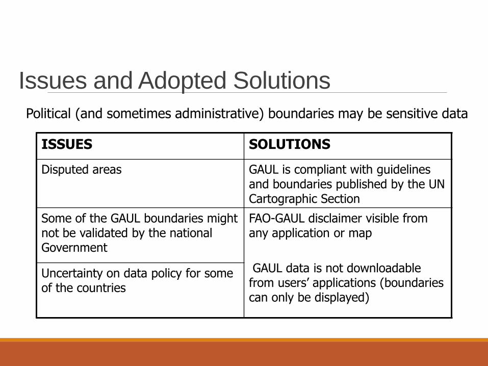
Issues and Adopted Solutions
ISSUES SOLUTIONS
Disputed areas GAUL is compliant with guidelines and boundaries published by the UN Cartographic Section
Some of the GAUL boundaries might not be validated by the national Government
FAO-GAUL disclaimer visible from any application or map
GAUL data is not downloadable from users’ applications (boundaries can only be displayed)
Uncertainty on data policy for some of the countries
Political (and sometimes administrative) boundaries may be sensitive data
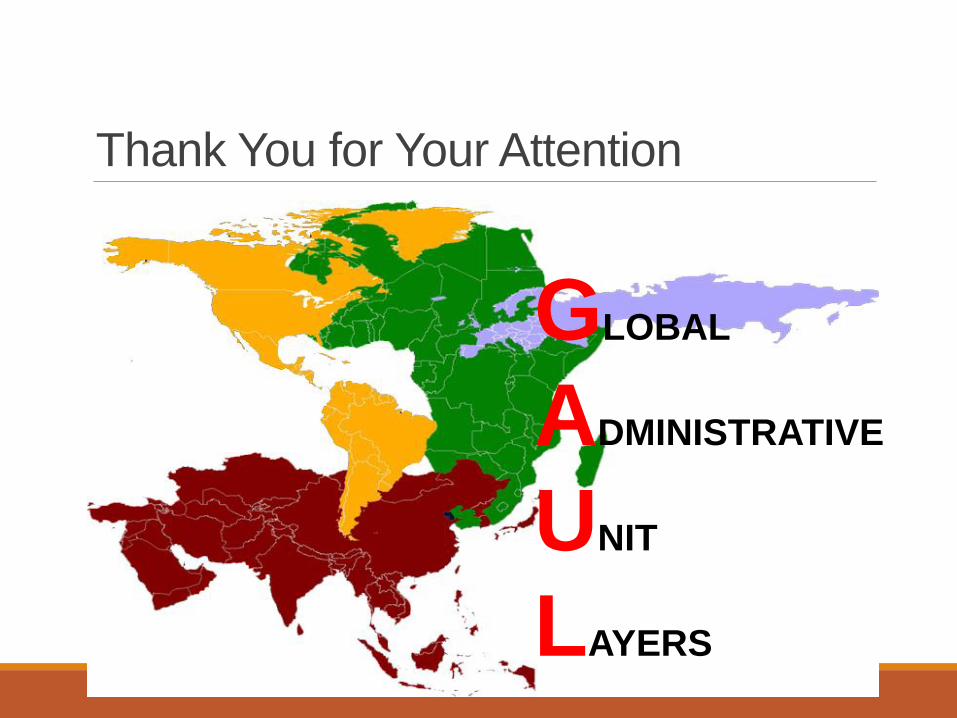
Thank You for Your Attention
GLOBAL
ADMINISTRATIVE
UNIT
LAYERS


![01 asterix the gaul [1959]](https://img.pdfslide.us/doc/110x75/55643b47d8b42ad3308b50c7/01-asterix-the-gaul-1959.jpg)