Embed Size (px)
Citation preview
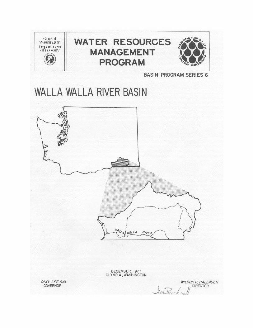
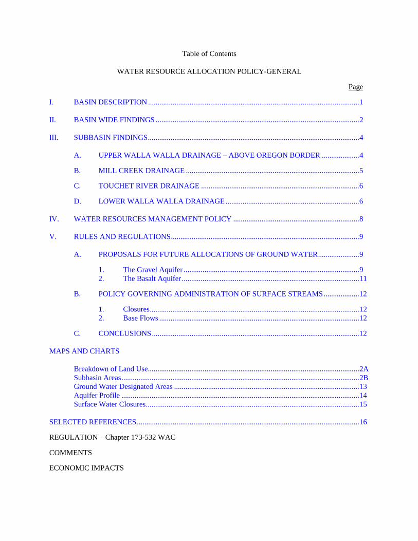
Table of Contents
WATER RESOURCE ALLOCATION POLICY-GENERAL
Page
I. BASIN DESCRIPTION ................................................................................................................1
II. BASIN WIDE FINDINGS ............................................................................................................2
III. SUBBASIN FINDINGS................................................................................................................4
A. UPPER WALLA WALLA DRAINAGE – ABOVE OREGON BORDER ....................4
B. MILL CREEK DRAINAGE ............................................................................................5
C. TOUCHET RIVER DRAINAGE ....................................................................................6
D. LOWER WALLA WALLA DRAINAGE .......................................................................6
IV. WATER RESOURCES MANAGEMENT POLICY ...................................................................8
V. RULES AND REGULATIONS....................................................................................................9
A. PROPOSALS FOR FUTURE ALLOCATIONS OF GROUND WATER......................9
1. The Gravel Aquifer .............................................................................................92. The Basalt Aquifer..............................................................................................11
B. POLICY GOVERNING ADMINISTRATION OF SURFACE STREAMS...................12
1. Closures...............................................................................................................122. Base Flows ..........................................................................................................12
C. CONCLUSIONS..............................................................................................................12
MAPS AND CHARTS
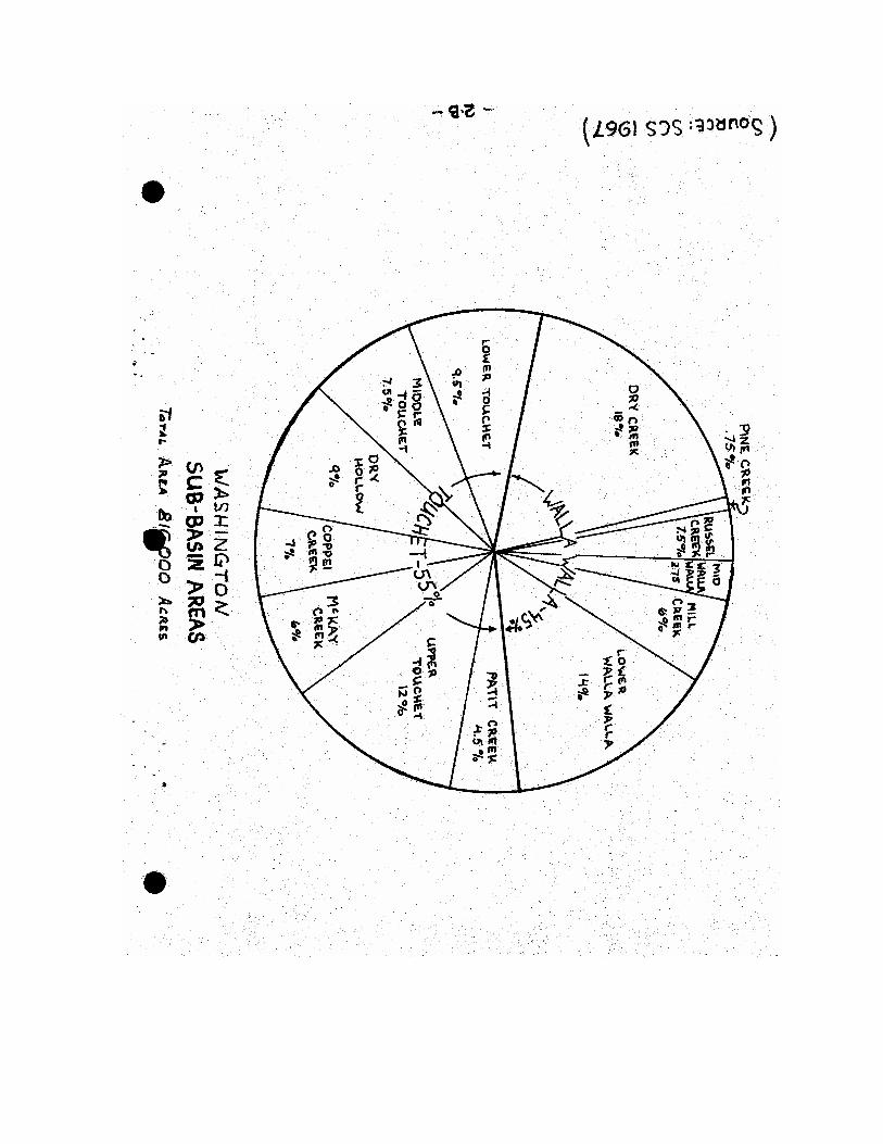
Breakdown of Land Use................................................................................................................2ASubbasin Areas..............................................................................................................................2BGround Water Designated Areas ..................................................................................................13Aquifer Profile ..............................................................................................................................14Surface Water Closures.................................................................................................................15
SELECTED REFERENCES......................................................................................................................16
REGULATION – Chapter 173-532 WAC
COMMENTS
ECONOMIC IMPACTS
BASIN PROGRAM SERIES NO. 6
WATER RESOURCES MANAGEMENT PROGRAM
WALLA WALLA RIVER BASIN
(WATER RESOURCES INVENTORY AREA NO. 32)
ByAlfred L. Hanson
Steve Mitchell
STATE OF WASHINGTON, DEPARTMENT OF ECOLOGYPOLICY DEVELOPMENT SECTION
WATER RESOURCES MANAGEMENT DIVISION
DECEMBER 1977
Department of EcologySt. Martins College
Olympia, Washington 98504
-1-
WALL WALLA BASIN - WRIA 32
WATER RESOURCE ALLOCATION POLICY - GENERAL
I. BASIN DESCRIPTION
The Walla Walla River Basin lies between the Snake River Basin on the North, the BlueMountains to the East and South, and the Umatilla River Basin on the South and West.The basin includes parts of Walla Walla and Columbia counties in Washington and partof Umatilla County in Oregon. The Washington portion has been designated WaterResource Inventory Area (WRIA) 32.
The Walla Walla Basin is divided into two physiographic areas: (a) The Walla Wallasection, and (b) the Blue Mountain section.
The Walla Walla section is situated on the upper eastern edge of the central ColumbiaBasin. It consists of rolling, treeless upland, deeply mantled by fine, windborne depositsof silt which overlie the previously eroded and incised Columbia River basalt. Thick lakeand stream terraced deposits occur in the valley.
The Blue Mountain section consists of the extremely northern extension of the BlueMountains of Oregon and the long, tilted plateau that extends northward into ColumbiaCounty. This is a tilted, folded, and faulted uplift of the Columbia River basalt. Thistopography is largely the result of erosion and stream cutting in the basalt. Flot-toppedridges, steep-walled canyons, and mountain slopes characterize this area of the basin.
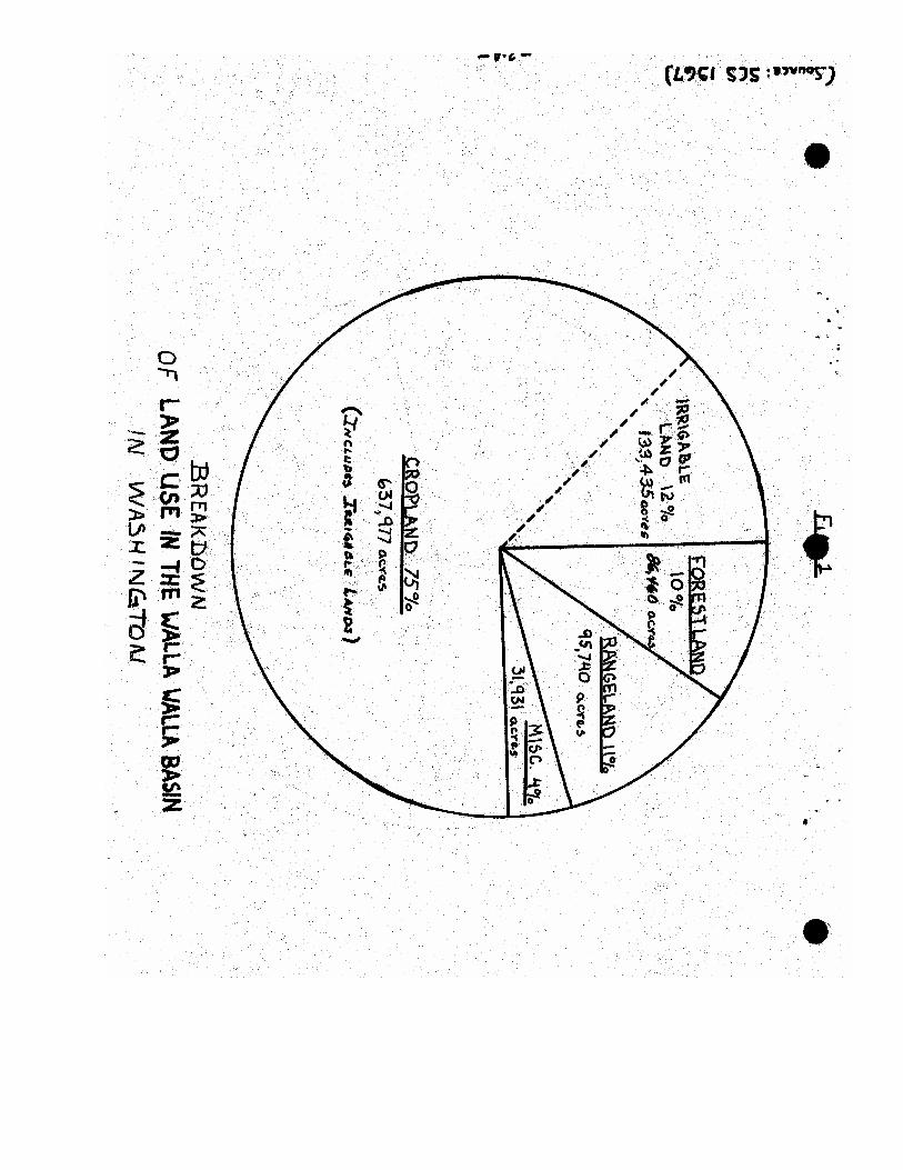
Total drainage area of the basin is 1,758 square miles of which 1,275 square miles or 73percent lies in Washington. Of the total basin area, 273 square miles or 15 percent isforest land. Approximately 952,217 acres (1,488 square miles) or 82 percent of the basinarea is in agriculture.
Figure 1 shows a breakdown of land uses in the Walla Walla Basin.
Municipal water systems are supplied from both surface and ground water sources. WallaWalla, the largest city in the basin, obtains approximately 85 percent of its water supplyfrom Mill Creek.
There are 31 community water systems in WRIA 32: Principal users are Walla Walla,College Place, Waitsburg, Dayton, Prescott, Dixie, Burbank, and five irrigation districtsnear College Place which primarily service residential customers. There are also 35 otherwater systems in WRIA 32 which are either noncommunity systems or communitysystems with less than 10 services.
-2-
The following findings have resulted from an investigation of all the availableinformation, and from an assessment of the land capability and river flow characteristicswithin the basin.
II. BASIN-WIDE FINDINGS
A. The primary source of runoff in the Walla Walla Basin is rainfall and snowmeltfrom the Blue Mountains. Precipitation in the basin ranges from about 7 inchesnear the western edge at Wallula to over 40 inches in the Blue Mountains.Maximum flows occur in the spring when snowmelt combines with the springrainy season. Minimum flows and dry stream beds occur in late summer due tolow precipitation and high irrigation demands.
B. There is sufficient water supply on an annual basis to satisfy most existing andfuture needs, provided seasonal distribution problems are resolved, and providedthat conjunctive use patterns for surface and ground water sources are instituted.
C. Total water use from all sources in the Washington portion of the Walla WallaBasin was approximately 400,000 acre-feet in 1974; of this total approximately228,000 acre-feet was actually depleted from the basin's supply. About 69 percentof this use was by irrigation, 22 percent by municipal, and 9 percent by industry.
D. Agriculture in the Walla Walla Basin covers 82 percent of the land area.Approximately 638,000 acres in Washington are drylands, and 37,700 acres areirrigated. Approximately 95,800 acres have irrigation potential and some of theseare receiving a partial irrigation supply. Primary use of dryland acreage is forsmall grains, while vegetables and alfalfa crops are of most importance onirrigated acreage.
E. Heavy competition exists between agriculture, municipal, and industrial demandsfor ground water, which is the only existing source of supply with a promise forfuture development.
F. Current records indicate that approximately 50,000 acres of the potentiallyirrigable lands could receive a full irrigation supply, provided existing surface andground water supplies are conjunctively managed to optimize their use. 43,000potentially irrigable acres lie in the area of the basin known as "Eureka Flats" andwould probably be irrigated out of the Snake River Drainage.
G. Present studies by computer models of the two aquifer systems in the basin,indicate that a substantial development potential does exist. Proper managementof further aquifer development can substantially increase public benefits from thatresource.
-3-
H. The gravel aquifer, which underlies approximately 120,000 acres in the WallaWalla-Milton-Freewater area, is recharged from surface streams, precipitation andthe basalt aquifer. Annual recharge amounts to 177,000 acre-feet; of this total,10,000 acre-feet is lost through direct evapotranspiration, 113,000 acre-feetreturns to streams, and 25,000 acre-feet was pumped to the land surface in 1975.
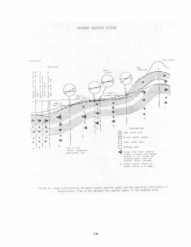
I. The primary basalt aquifer, which underlies the entire basin, is rechargedprimarily from the Blue Mountains. Annual recharge of this aquifer amounts to132,000 acre-feet; of this total 97,500 acre-feet discharges laterally to theColumbia and Snake rivers, 12,000 acre-feet to the gravel aquifer, and 22,500acre-feet was pumped to the land surface in 1975.
It would appear that this source has a potential for substantially greaterdevelopment; however, water levels have shown alarming declines in some areas,especially in the Walla Walla urbanized area.
Total storage capacity of the two ground-water aquifers is estimated at nearly7 million acre-feet with 3 million of that total being in the gravel aquifer.Approximately 2.6 million acre-feet in the basalt and 1 million acre-feet in thegravel aquifer have a potential for active use.
J. Principal industrial use of water in the basin is for the processing and canning ofvegetables. Food processors use approximately 20,000 acre-feet annually. WallaWalla's Water System supplies water for a portion of this industrial use. The City'ssource of supply comes from both ground water and surface water via Mill Creek.Some industrial users also have their own water rights in the ground-wateraquifers.
K. The existing anadromous fisheries of the basin is of little significance. Steelheadspawning runs still exist during periods of high stream flow; however, coho andchinook salmon runs are almost nonexistent due to extreme low flows and poorwater quality during their spawning season.
Most sport fisheries result from rainbow trout plants in the upper reaches of basinstreams and from resident Dolly Vardon, bass, and catfish.
Establishment of adequate perennial stream flows is essential to reestablish thefisheries resource.
L. All streams in the basin are administratively closed to further appropriation duringthe irrigation season. Existing rights are adjudicated for even the "wet year" highflows.
-4-
M. Oregon law, substantiated by Federal Court decision, stipulates that all water in astream in Oregon is reserved exclusively for use in Oregon by Oregon residents.The Walla Walla River is totally appropriated in Oregon during the dry season,and the river is dry at the State border. During these low flow periods, watersoccurring in the river in Washington are due to irrigation runoff, springs, anddirect discharges from the gravel aquifer.
N. The gravel aquifer straddles the border between Washington and Oregon andextends from north of Walla Walla to south of Milton-Freewater. Existingevidence indicates that the gravel aquifer will withstand substantially greaterpumpages. Overflow from each years' recharge provides streamflow in the lowerreaches of the Walla Walla River and its tributaries.
O. One multipurpose storage project has been authorized for construction by theUSBR on the Touchet River. This project would provide flood protection for thecities of Dayton and Waitsburg, and will furnish irrigation waters for an additional5,220 acres along the river. Other benefits include the enhancement of the sportfisheries, and recreational benefits.
Four other storage sites have been identified. These are the Joe West site inOregon on the North Fork of the Walla Walla, the Blue Creek site at theconfluence of Blue Creek and Mill Creek, the Mill Creek project located on theWashington-Oregon border, and the Hudson Bay watershed project on Pine andDry Creeks in Oregon.
III. SUBBASIN FINDINGS
A. UPPER WALLA WALLA DRAINAGE - ABOVE OREGON BORDER
1. The Walla Walla River originates in the Northeast corner of UmatillaCounty in Oregon. It dips south from there and then flows north throughMilton-Freewater, crossing the Oregon-Washington border 6 miles northof that city. The upper Walla Walla drains about 160 square miles with anaverage annual discharge of approximately 102 cfs not includingdiversions.
2. During the summer irrigation season, diversions from the river completelydeplete the flow. Further, the Oregon State Water Resources Board hasresolved that any unappropriated seasonal flows in the Walla Walla Riverbe reserved for future irrigation, domestic, municipal, industrial, andlivestock uses within Oregon.
3. Two storage projects are under consideration in the subbasin. The JoeWest project on the North Fork of the Walla Walla River, which is under
-5-
study by the United States Bureau of Reclamation. And, the Hudson Bayproject on Pine and Dry Creeks, which was studied by the SoilConservation Services under Public Law 90-566.
4. Milton-Freewater is the largest community in the subbasin with apopulation of about 4,500. Studies show that municipal water use is quitehigh, with per capita consumption in the neighborhood of 400 gallons perday.
5. Present irrigation in the subbasin amounts to approximately 26,000 acres,with 12,000 supplied from surface water sources and 14,000 from groundwater. There are potentially an additional 42,700 acres which could beirrigated if water is made available.
B. MILL CREEK DRAINAGE
1. Mill Creek originates in the Blue Mountains in Washington's ColumbiaCounty. It dips south into Oregon and then flows northwest through thecity of Walla Walla, and enters the Walla Walla River just west of the city.Mill Creek and its tributary Blue Creek drain an area of approximately 100square miles, with an average annual flow of 91 cfs.
2. A small dam off Mill Creek is used to divert flood flows. Water is alsodiverted from Mill Creek to provide a municipal and industrial supply forthe city of Walla Walla. This source represents approximately 85 percentof the city's water supply.
3. Two storage sites have been studied. One site on Blue Creek above itsconfluence with Mill Creek, the other site is located on Mill Creek nearthe Washington-Oregon border. The Blue Creek Dam under study by theCorps of Engineers has been deauthorized by that agency due to a lack ofeconomic feasibility.
4. Walla Walla with a population of approximately 28,000 is the largest cityin the basin. The city depends for its water supply on two sources, (1) ithas an adjudicated water right for 22 cfs on Mill Creek, and (2) rights towithdraw 19,600 acre-feet from the primary basalt aquifer. The city alsohas a water right in Oregon for 28 cfs from Mill Creek. The priority datefor this right is December 20, 1920.
5. Declining water levels in city wells tapping the basalt aquifer in the WallaWalla urbanized area, has caused the city to look elsewhere for their futurewater needs. To solve this problem, the city has proposed a dam and
-6-
reservoir on Mill Creek which would store 6,000 acre-feet betweenNovember 1 and June 1. For this purpose, the city has a water right permiton Mill Creek for 20 cfs in addition to their existing rights.
6. Irrigation in the Mill Creek subbasin totals approximately 4,000 acres,with 3,000 acres being irrigated from surface waters and the remainderfrom ground water sources. The potential for additional irrigation in thisarea appears slight, with only 300 acres being identified as having anirrigation potential at this time.
C. TOUCHET RIVER DRAINAGE
1. The Touchet River originates in the Blue Mountains in the southwestcorner of Columbia County and flows west through the cities of Daytonand Waitsburg, emptying into the Walla Walla River near Touchet. TheTouchet River drains an area of approximately 736 square miles, with anaverage annual discharge of 220 cfs not including diversions.
2. The USBR has authorization to build a dam on the Touchet River aboveDayton. This is a multipurpose project with irrigation, fisheriesenhancement, and flood control as its primary purpose. Total irrigationfrom the project would cover approximately 13,000 acres, with 5,220 acresgetting a full supply and 7,780 acres a supplemental supply. Total irrigableacreage in the subbasin amounts to approximately 61,600 acres.
3. Dayton with a population of 2,625 is the largest city in the subbasin. Thecity has a surface water right on the Touchet for 1000 acre-feet per year.
4. Although it appears that an adequate ground-water supply does exist in thesubbasin, little of present irrigation uses this source due to the pumpinglifts involved. Also, existing agriculture practices and economies wouldnot benefit substantially from well irrigation.
D. LOWER WALLA WALLA DRAINAGE
1. The lower Walla Walla River from the Oregon border to its confluencewith the Columbia River near Wallula drains an area of approximately 771square miles. Major tributary drainages of this subbasin, excluding theTouchet River and Mill Creek, are Pine Creek, Dry Creek, YellowhawkCreek, and Cottonwood Creek. Average annual discharge near the mouthis 573 cfs.
2. This part of the basin encompasses the low lying areas of the valley floor.Approximately 62,000 acres are presently irrigated; however, of this total
-7-
only about 24,000 acres enjoy a firm supply of water. The remainderreceive as little as ten percent of the required supply.
The river is completely appropriated during the irrigation season, and theresulting stream flows are very low during periods of low precipitation andrunoff. This also results in very low water quality and a subsequent loss ofsport fisheries. Irrigation from surface waters totals 19,250 acres, with anadditional 4,800 acres from ground waters.
The Water Resources Act of 1971 specifies that base flows be establishedfor all perennial streams. These are flow levels necessary to provide forpreservation of wildlife, fish, scenic, aesthetic, and other environmentalvalues. However, these flow levels will not be imposed unless onstreamstorage is provided to augment present flow levels. In the event of storage,all future water right allocations would be subject to the base flows.
Where there are surface waters available in excess of the base flows andexisting water rights, priorities among different uses will be established,and subsequently the amounts of water for future appropriation for thebeneficial uses will be specified. This management policy verifies theclosure from future surface water diversion, except domestic and livestockuses, on certain streams where and when there is not sufficient wateravailable.
All future appropriation of ground waters will be issued subject toprovisions of this Walla Walla River Basin Water Resources ManagementProgram or future revisions thereof. Existing valid water rights will not beaffected by these management policies.
3. The largest portion of the gravel aquifer lies in this subbasin. Yields fromthis source have historically ranged up to 300 gpm; however, the potentialexists for greater yields with improved well location and drillingtechniques. To date, approximately 25,000 acre-feet per year is withdrawnfrom this source. This represents 13 percent of the average annual rechargeto the aquifer. Annual recharge of this aquifer from all sources averages177,000 acre-feet.
Local interference problems occur in some areas where seasonalfluctuations of the water table affect water levels in shallow domesticwells. At other locations, the aquifer is hydraulically connected to surfacestreams and substantial drawdown from pumping wells occasionally affectavailable water in adjacent streams.
-8-
IV. WATER RESOURCES MANAGEMENT POLICY
The primary goal of the Walla Walla River Basin Water Resources Management Policy isto protect and fully utilize the basin surface and ground-water resources for the greatestbenefit to the people of the State of Washington. Efficient management and enforcementof water-use policies are essential for accomplishment of this primary goal in harmonywith the preservation of the natural aesthetic assets of the basin.
Ground water Withdrawals - Gravel Aquifer
This policy recognizes the interstate complexity of the gravel aquifer system. Thus, thefollowing procedure is recommended with some assurance that it is adoptable by bothWashington and Oregon.
Primary factors weighed in adopting these procedures are;
A. Projected development of new irrigation water use would appear to be small overthe near term, five to ten year period.
B. Unlimited use of the waters of the gravel aquifer may have an adverse effect onsome surface and ground water diversions.
C. Sufficient water is available in the gravel aquifer to supply anticipated demands inthe next five to ten years.
D. Under existing administrative procedures, the proliferation of shallow individualdomestic wells (existing and proposed) are a very real and significant deterrent tofull utilization of the available water resources in the aquifer.
E. The relative availability of ground water as compared to surface water isconsidered herein. Every effort will be made to encourage use of the water foundin the gravel aquifer, particularly where it is hydraulically connected to a surfacechannel of the streams of the basin.
F. Water rights, by virtue of previous or existing laws will be protected.
G. The existing use of ground water, either independently or in conjunction withsurface rights, will be encouraged to the fullest extent possible, subject to thepreservation of other existing rights.
H. The use of ground water may be considered as an alternate or partial source ofsupply for surface water rights previously issued, taking into consideration bothprevious usage and the necessity to protect the prior rights of others.
-9-
V. RULES AND REGULATIONS
A. Proposals for Future Allocations of Ground Water
1. The Gravel Aquifer
The gravel aquifer limitations have been determined. Best informationavailable indicates that there is sufficient water in the aquifer to adequatelysupply existing water rights and anticipated future demands. It is alsoknown that any large new withdrawals, along with some existingwithdrawals, may adversely affect senior surface and ground water rights.
It is the policy of the state to encourage full use of surface and groundwater where possible. To do this in the Walla Walla Basin will require thefollowing actions regarding maximum resource development consistentwith protecting the rights of existing appropriators:
a. Prior to granting a permit, each new ground water application willbe carefully evaluated to minimize interference between the newwell and existing wells and adjacent surface streams. The potentialeffect of the new well on water users with existing rights will beanalyzed using USGS model data and accepted engineeringformula.
b. Under actual pumping conditions, interference is considered toexist and the department will regulate ground water withdrawals ina given area when the pumping water levels in the wells, affectedby junior appropriators drops below the upper two-thirds thicknessof the aquifer. It is assumed that the wells are pumping from thebottom one-third of the aquifer and no effort will be made toprotect a senior appropriators bowl setting alone.
c. The department recognizes that some surface water appropriatorshave been adversely affected by new ground water withdrawalsadjacent to surface water streams. In order to minimize the effectof pumping wells on surface stream flow, new appropriations forground water will be required to locate wells outside of the zone ofdirect hydraulic continuity between the surface water stream andthe ground water aquifer. Generally, the zone reflecting directhydraulic continuity between the surface stream and pumping wellsis a narrow-corridor no more than 300 feet on each side of thestream channel. The actual limits of the corridor at any givenlocation will be determined by the department when individualground water applications are received.
-10-
In order to enhance the opportunity for full utilization of thesurface and ground waters of the Walla Walla River Basin, thoseappropriators holding valid surface water rights may file for achange in point of withdrawal, with this withdrawal point to belocated within the zone of direct hydraulic continuity on either sideof, or underlying, the stream channel. This change in point ofdiversion may be used as an alternate source of water when thesurface water source is inadequate to satisfy historic use conditionsunder an existing water right.
d. The department recognizes that the increase in new, shallow,individual domestic wells has resulted in many interferenceproblems. Therefore, it is the policy of the department to protectthese wells from junior rights only as described in (b) above.
The department further supports and encourages efforts by localgovernment to regionalize domestic water supplies. Regionaldomestic water supplies will alleviate many of the interferenceproblems presently experienced by shallow individual wells.
e. The stream depletion caused by a well will be calculated by themethod shown in the "The pumped Well" by Rover E. Glvoer,Technical Bulletin 100, Colorado State University, or by otheraccepted engineering formulae appropriately modified to reflect thepertinent physical conditions. See Appendix 2.
Transmissivity values will be obtained from the U.S. GeologicalSurvey's Water Supply Bulletin 45, Digital Model of the GravelAquifer, Walla Walla River Basin, Washington and Oregon, 1976,or from calculations using accepted engineering methods.
The specific yield or effective voids ratio generally descriptive ofthe material in the aquifer will be assumed to range between 10 and25 percent as indicated in the U.S.G.S. Water Supply Bulletin 45,Digital Model of the Gravel Aquifer, Walla Walla River Basin,Washington and Oregon, for the different areas of the aquifer, or adifferent value may be used when it can be substantiated generally,or as to any particular situation.
The consumptive use for irrigation purposes will be assumed to be65 percent of the total quantity pumped for irrigation uses, subjectto modification upon proof that a different consumptive usesituation exists with respect to a particular withdrawal. For usesother than irrigation, the amount will be determined from actualconditions.
-11-
2. The Basalt Aquifer
The basalt aquifer underlying the cities of Milton-Freewater, Walla Wallaand College has experienced a substantial decline in static water level.This decline cannot be discounted, as the primary basalt aquifer is thechief source of ground water for supplementing existing municipal surfacewater supplies and to provide additional water supply for future growth.
Best information available indicates that there appears to be sufficientwater in the basalt aquifer system to satisfy all existing and foreseeablefuture water use needs. However, some localized areas of the basin areexperiencing declines in water levels at a rate which has limited furtherdevelopment.
Notwithstanding the importance of irrigated agriculture in the basin, thecontinued availability of adequate water supplies for existing and futuremunicipal use is of paramount importance. Therefore, the Departmentadopts the following policy with regard to the future allocation of waterfrom the basalt aquifer system:
a. The Basalt aquifer's limitations have been determined and thedepartment's policy is to encourage full use of the resource. Safeyield of the aquifer has been determined to be 132,000 acre-feet onan annual average. In this regard, the aquifer will be closed tofurther appropriation when total annual withdrawal from theaquifer approaches 125,000 acre-feet which is approximately 95percent of the total annual recharge.
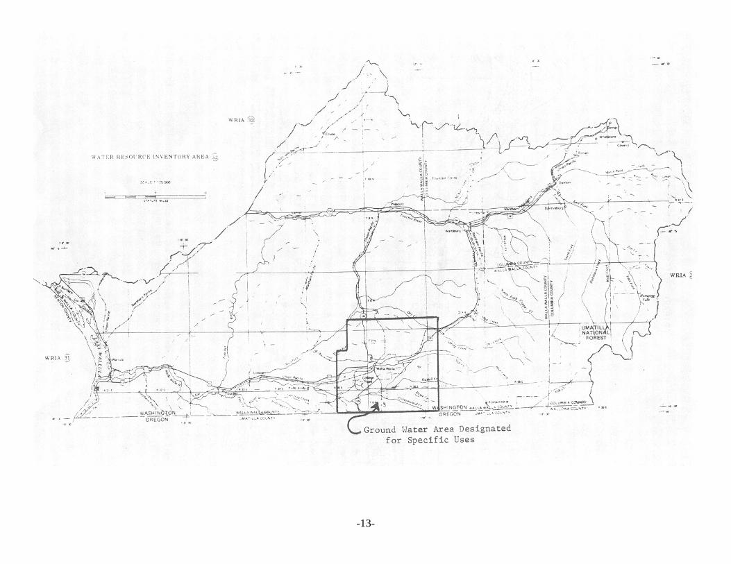
b. In order to insure an adequate ground water supply for futuregrowth of the community, the department has designated portionsof the ground water resource for specific uses. Within the areaoutlined on page 13, ground water in the basalt aquifer is limited toappropriation for municipal water supply systems only, and groundwater in the shallow gravel aquifer is limited to uses other thanmunicipal water supply systems. A municipal water supply systemis defined as a set of facilities including source, treatment, storage,transmission, and distribution facilities whereby water is furnishedfor commercial and/or industrial uses, and public water supplieswith 10 or more connections.
The provisional designation of water in the basalt aquifer formunicipal water supply systems will be effective for a period of 5years beginning on February 1, 1978. After the effective 5-yearperiod all designated waters not appropriated or reserved under
-12-
WAC 173-590, Reservation of water for Future Public WaterSupply, shall be open for appropriation by other users.
The designation of water in the gravel aquifer for users other thanmunicipal water supply systems shall remain indefinitely until thedepartment determines that a change is needed.
B. Policy Governing Administration of Surface Streams
1. Closures
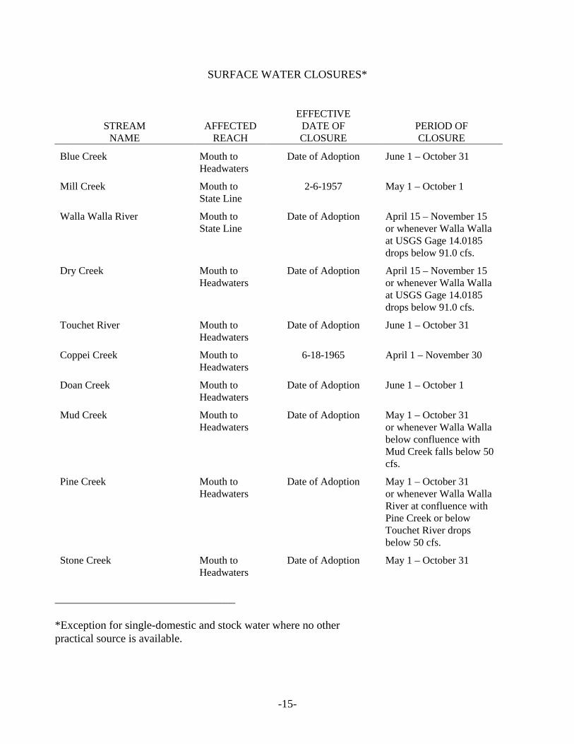
This management program and proposed regulations verify the closure ofbasin streams from further consumptive appropriation. The closed streamsand periods of closure are listed on Page 15.
2. Base Flows
The level of present appropriations precludes the establishment of baseflows under existing conditions.
The only storage facility of any consequence in the Basin is located onMill Creek. This facility is primarily used as a flood water diversion struc-ture and is not large enough to provide waters for maintaining base flows.
When and if storage projects do become a reality, the department willestablish base flow levels which can be included in project benefits andmaintained by storage releases.
C. Conclusions
In conclusion, it would appear that the Walla Walla Basin has a very real potentialfor the development of a conjunctive use program with regard to surface andground waters.
Basin agriculture presently experiences severe drought conditions each yearbecause of its unique hydrology. Surface streams, which experience near floodconditions in the winter and spring, are nearly totally dried up by midsummerwhen precipitation is low and out-of-stream use is high. While these conditionslimit use of surface waters, the high winter-spring flows completely rechargebasin ground water aquifers.
These vast reservoirs have a great potential for further development providedinterference and stream depletion problems can be resolved.
In our opinion, an institutional arrangement which will promote the conjunctiveuse of surface and ground waters is feasible and necessary to the full developmentof basin water resources.
-13-
-14-
-15-
SURFACE WATER CLOSURES*
STREAMNAME
AFFECTEDREACH
EFFECTIVEDATE OFCLOSURE
PERIOD OFCLOSURE
Blue Creek Mouth toHeadwaters
Date of Adoption June 1 – October 31
Mill Creek Mouth toState Line
2-6-1957 May 1 – October 1
Walla Walla River Mouth toState Line
Date of Adoption April 15 – November 15or whenever Walla Wallaat USGS Gage 14.0185drops below 91.0 cfs.
Dry Creek Mouth toHeadwaters
Date of Adoption April 15 – November 15or whenever Walla Wallaat USGS Gage 14.0185drops below 91.0 cfs.
Touchet River Mouth toHeadwaters
Date of Adoption June 1 – October 31
Coppei Creek Mouth toHeadwaters
6-18-1965 April 1 – November 30
Doan Creek Mouth toHeadwaters
Date of Adoption June 1 – October 1
Mud Creek Mouth toHeadwaters
Date of Adoption May 1 – October 31or whenever Walla Wallabelow confluence withMud Creek falls below 50cfs.
Pine Creek Mouth toHeadwaters
Date of Adoption May 1 – October 31or whenever Walla WallaRiver at confluence withPine Creek or belowTouchet River dropsbelow 50 cfs.
Stone Creek Mouth toHeadwaters
Date of Adoption May 1 – October 31
________________________________
*Exception for single-domestic and stock water where no otherpractical source is available.
-16-
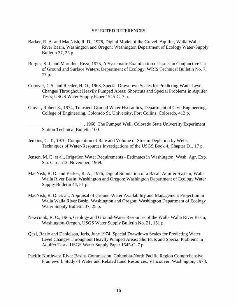
SELECTED REFERENCES
Barker, R. A. and MacNish, R. D., 1976, Digital Model of the Gravel. Aquifer, Walla WallaRiver Basin, Washington and Oregon: Washington Department of Ecology Water-SupplyBulletin 37, 25 p.
Burges, S. J. and Marndon, Reza, 1975, A Systematic Examination of Issues in Conjunctive Useof Ground and Surface Waters, Department of Ecology, WRIS Technical Bulletin No. 7,77 p.
Conover, C.S. and Reeder, H. O., 1963, Special Drawdown Scales for Predicting Water LevelChanges Throughout Heavily Pumped Areas; Shortcuts and Special Problems in AquiferTests; USGS Water Supply Paper 1545-C, 7 p.
Glover, Robert E., 1974, Transient Ground Water Hydraulics, Department of Civil Engineering,College of Engineering, Colorado St. University, Fort Collins, Colorado, 413 p.
________________________, 1968, The Pumped Well, Colorado State University ExperimentStation Technical Bulletin 100.
Jenkins, C. T., 1970, Computation of Rate and Volume of Stream Depletion by Wells,Techniques of Water-Resources Investigations of the USGS Book 4, Chapter D1, 17 p.
Jensen, M. C. et al., Irrigation Water Requirements - Estimates in Washington, Wash. Agr. Exp.Sta. Circ. 512, November, 1969.
MacNish, R. D. and Barker, R. A., 1976, Digital Simulation of a Basalt Aquifer System, WallaWalla River Basin, Washington and Oregon: Washington Department of Ecology WaterSupply Bulletin 44, 51 p.
MacNish, R. D. et. al., Appraisal of Ground-Water Availability and Management Projection inWalla Walla River Basin, Washington and Oregon: Washington Department of EcologyWater Supply Bulletin 37, 25 p.
Newcomb, R. C., 1965, Geology and Ground-Water Resources of the Walla Walla River Basin,Washington-Oregon, USGS Water Supply Bulletin No. 21, 151 p.
Qazi, Razio and Danielson, Jeris, June 1974, Special Drawdown Scales for Predicting WaterLevel Changes Throughout Heavily Pumped Areas; Shortcuts and Special Problems inAquifer Tests; USGS Water Supply Paper 1545-C, 7 p.
Pacific Northwest River Basins Commission, Columbia-North Pacific Region ComprehensiveFramework Study of Water and Related Land Resources, Vancouver, Washington, 1973.
-17-
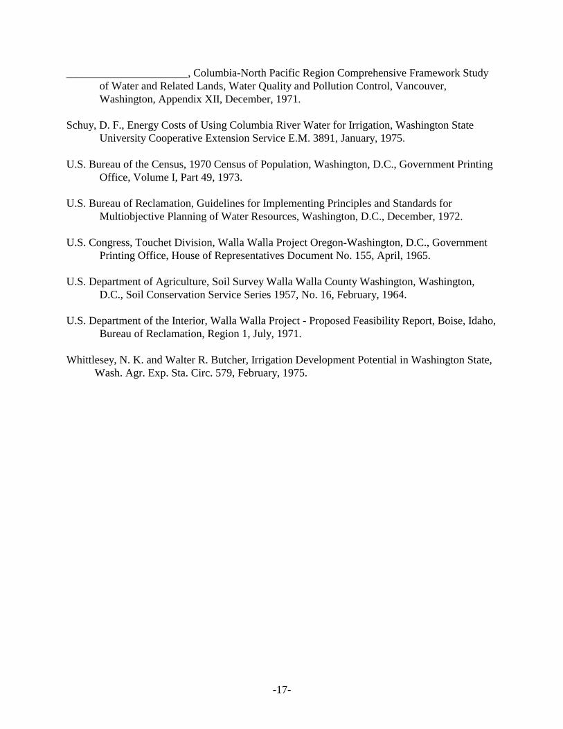
______________________, Columbia-North Pacific Region Comprehensive Framework Studyof Water and Related Lands, Water Quality and Pollution Control, Vancouver,Washington, Appendix XII, December, 1971.
Schuy, D. F., Energy Costs of Using Columbia River Water for Irrigation, Washington StateUniversity Cooperative Extension Service E.M. 3891, January, 1975.
U.S. Bureau of the Census, 1970 Census of Population, Washington, D.C., Government PrintingOffice, Volume I, Part 49, 1973.
U.S. Bureau of Reclamation, Guidelines for Implementing Principles and Standards forMultiobjective Planning of Water Resources, Washington, D.C., December, 1972.
U.S. Congress, Touchet Division, Walla Walla Project Oregon-Washington, D.C., GovernmentPrinting Office, House of Representatives Document No. 155, April, 1965.
U.S. Department of Agriculture, Soil Survey Walla Walla County Washington, Washington,D.C., Soil Conservation Service Series 1957, No. 16, February, 1964.
U.S. Department of the Interior, Walla Walla Project - Proposed Feasibility Report, Boise, Idaho,Bureau of Reclamation, Region 1, July, 1971.
Whittlesey, N. K. and Walter R. Butcher, Irrigation Development Potential in Washington State,Wash. Agr. Exp. Sta. Circ. 579, February, 1975.
1.
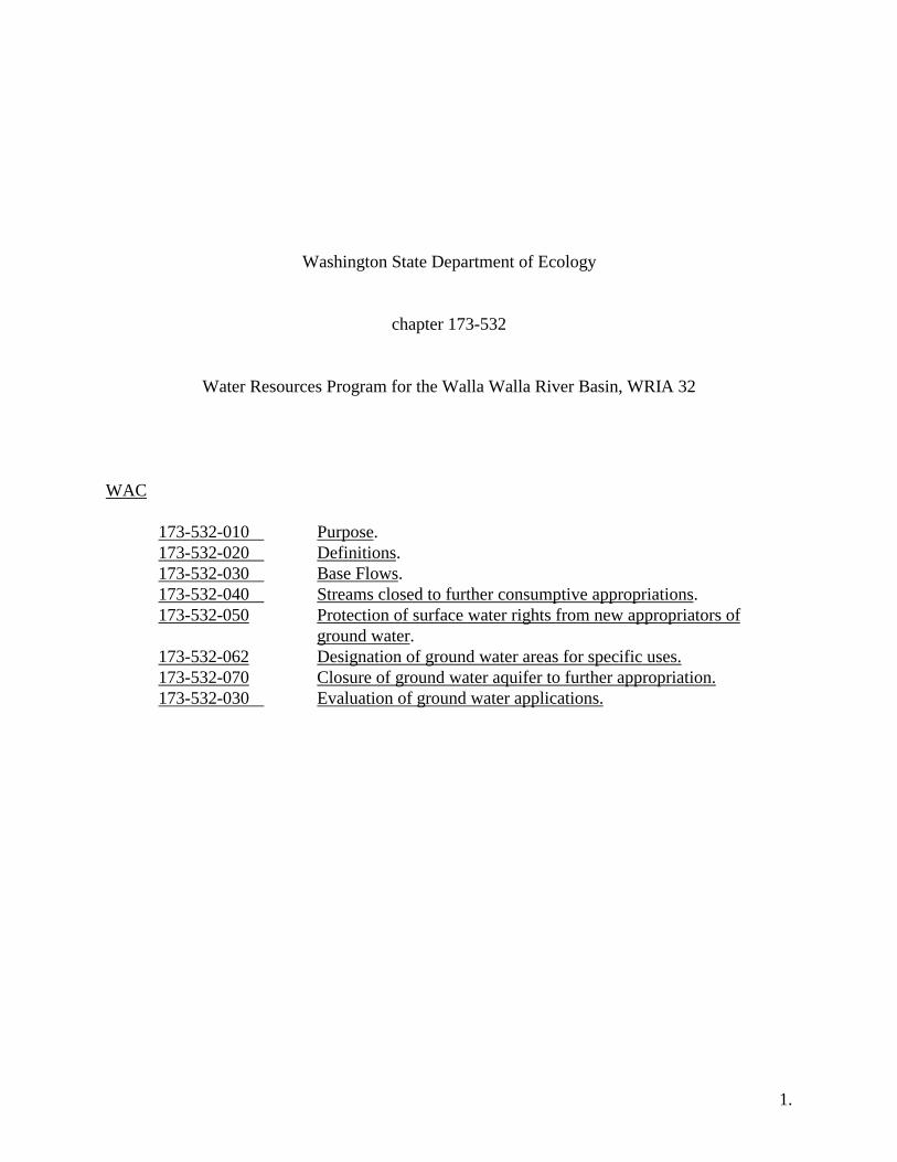
Washington State Department of Ecology
chapter 173-532
Water Resources Program for the Walla Walla River Basin, WRIA 32
WAC
173-532-010 Purpose.173-532-020 Definitions.173-532-030 Base Flows.173-532-040 Streams closed to further consumptive appropriations.173-532-050 Protection of surface water rights from new appropriators of
ground water.173-532-062 Designation of ground water areas for specific uses.173-532-070 Closure of ground water aquifer to further appropriation.173-532-030 Evaluation of ground water applications.
2.
NEW SECTION
WAC 173-532-010 PURPOSE. This regulation is adopted in accordance with the WaterResources Management Regulation, chapter 173-500 WAC, which was promulgated under theauthority of the Water Resources Act of 1971, chapter 90.54 RCA. This chapter, including anyamendments, applies to all waters that lie within or contribute to the Walla Walla River drainagebasin. This chapter sets forth the department's policies to manage the basin's water resources.
NEW SECTION
WAC 173-532-020 DEFINITIONS. For purposes of this chapter, the followingdefinitions shall be used.
(1) "Allocation" means the designating of specific amounts of the water resource forspecific beneficial uses.
(2) "Base Flow" means a level of stream flow established in accordance withProvisions of Chapter 90.54 RCW required in perennial streams to preserve wildlife, fish, scenic,aesthetic, and other environmental and navigational values.
(3) "Consumptive Use" means use of water whereby there is discerniblediminishment of the water source.
(4) "Department" means the Washington State department of ecology.(5) "Director" means the director of the department of ecology.(6) "Domestic Use" means use of water associated with human health and welfare
requirements, including water used for drinking, bathing, sanitary purposes, cooking, laundering,irrigation of not over one-half acre of lawn and garden per dwelling, and other incidentalhousehold uses.
(7) "In-house Domestic Use" means use of water for drinking, cleaning, sanitation,and other uses in a residence, excluding irrigation of lawn and garden.
(8) "Municipal Water Supply System" means a set of facilities including source,treatment, storage, transmission and distribution facilities whereby water is furnished forcommercial and/or industrial uses, and public water supplies with 10 or more connections.
(9) "Nonconsumptive Use" means a type of water use where either there is nodiversion from a source body, or where there is no discernible diminishment of the source.
(10) "Perennial Stream" means a stream with a natural flow which is normallycontinuous at any given location.
3.
(11) "Public Water Supply" means any water supply intended or used for humanconsumption and community uses.
(12) “Water Right” means a right to make beneficial use of public waters of the state.(13) "Zone of Direct Hydraulic Continuity" means that zone of inter action between the
surface water stream and the adjacent ground water whereby a pumping well can effectivelyreduce the flow in the stream to the detriment of surface water users, as determined by thedepartment.
NEW SECTION
WAC 173-532-030 BASE FLOWS. The establishment of base flows for surface streamswill be deferred until such time as storage project or projects become a reality. At present, allsurface streams are totally appropriated during the irrigation season and water is not available forprotection of instream values. With the advent of future storage projects, the department mayestablish base flows which can be included as project benefits and maintained by storagereleases.
NEW SECTION
WAC 173-532-040 STREAMS CLOSED TO FURTHER CONSUMPTIVEAPPROPRIATIONS. The department has determined that no waters are available forconsumptive appropriation through the establishment of water rights for the following streamsfor the periods indicated:
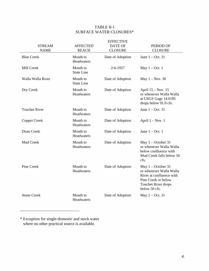
4.
TABLE II-1SURFACE WATER CLOSURES*
STREAMNAME
AFFECTEDREACH
EFFECTIVEDATE OFCLOSURE
PERIOD OFCLOSURE
Blue Creek Mouth toHeadwaters
Date of Adoption June 1 – Oct. 31
Mill Creek Mouth toState Line
2-6-1957 May 1 – Oct. 1
Walla Walla River Mouth toState Line
Date of Adoption May 1 – Nov. 30
Dry Creek Mouth toHeadwaters
Date of Adoption April 15 – Nov. 15or whenever Walla Wallaat USGS Gage 14.0185drops below 91.0 cfs.
Touchet River Mouth toHeadwaters
Date of Adoption June 1 – Oct. 31
Coppei Creek Mouth toHeadwaters
Date of Adoption April 1 – Nov. 1
Doan Creek Mouth toHeadwaters
Date of Adoption June 1 – Oct. 1
Mud Creek Mouth toHeadwaters
Date of Adoption May 1 – October 31or whenever Walla Wallabelow confluence withMud Creek falls below 50cfs.
Pine Creek Mouth toHeadwaters
Date of Adoption May 1 – October 31or whenever Walla WallaRiver at confluence withPine Creek or belowTouchet River dropsbelow 50 cfs.
Stone Creek Mouth toHeadwaters
Date of Adoption May 1 – Oct. 31
_____________________________
* Exception for single-domestic and stock water where no other practical source is available.
5.
NEW SECTION
WAC 173-532-050 PROTECTION OF SURFACE WATER RIGHTS FROM NEWAPPROPRIATORS OF GROUND WATER. New appropriators of ground water will berequired to locate wells outside of the zone of direct hydraulic continuity between the surfacewater stream and the ground water aquifer. The actual limits of the zone of direct hydrauliccontinuity at a specific location will be determined by the department after an individual groundwater application is received. The department will use accepted engineering methods for itsdetermination.
NEW SECTION
WAC 173-532-060 DESIGNATION OF GROUND WATER AREAS FOR SPECIFICUSES. A portion of the ground water resource in the Walla Walla-College Place vicinity isdesignated for the anticipated growth of the community. Within the following area, ground waterin the basalt aquifer is limited to appropriation for municipal water supply systems only, andground water in the shallow gravel aquifer is limited to uses other than municipal water supplysystems:
All the area contained within the following listed sections: Sections 35 and 36, T8N,R35E; Sections 1, 2, 11, 12, 13, 14, 15, 23, 24, 25, 26, 27, 28, 34, 35, and 36, T7N,R35E; Sections 1, 2, 3, 10, 11, 12, and all of 13, 14, and 15 lying within WashingtonState, T6N, R35E; Sections 31, 32, 33, 34, 35, and 36, T8N, R36E; all the area withinT7N, R36E; all the area within T6N, R36E lying within the State of Washington; Section31, T8N, R37E; Sections 6, 7, 18, 19, 30, and 31, T7N, R37E; and Sections 6, 7, and allof Section 18 lying within Washington State, T6N, R37E.
The provisional designation of water in the basalt aquifer for municipal water supplysystems shall be effective for a period of five years beginning on February 1, 1978. After theeffective five-year period all designated waters not appropriated or reserved under WAC 173-590Reservation of Water for Future Public Water Supply, shall be open for appropriations by otherusers as determined by the department.
The designation of water in the gravel aquifer for users other than municipal water supplysystems shall remain indefinitely until changed by the department.
6.
NEW SECTION
WAC 173-532-070 CLOSURE OF GROUND WATER AQUIFER TO FURTHERAPPROPRIATION. When the department determines that annual ground water withdrawalsfrom the basalt aquifer have reached 125,000 acre-feet, which is approximately 95 percent of theaverage annual recharge to that aquifer, the aquifer will be closed to further appropriation.
NEW SECTION
WAC 173-532-080 EVALUATION OF GROUND WATER APPLICATIONS. Eachnew application for ground water appropriation will be evaluated to minimize interference withexisting wells and with adjacent surface water streams. The department will issue permits forground water withdrawal in those cases where senior surface water and ground water rights willnot be adversely affected as determined by the department.
- COMMENTS –
WALLA WALLA RIVER BASIN
WATER RESOURCES MANAGEMENT PROGRAM

December 15, 1977
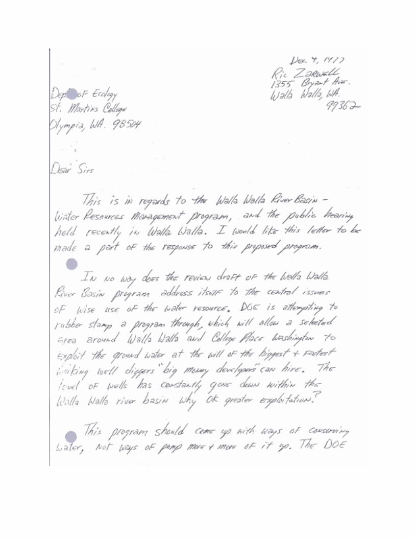
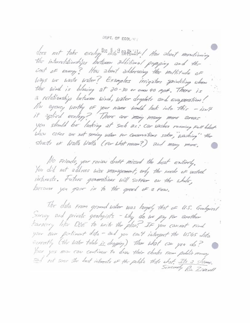
Mr. Ric Zarwell1355 Bryant Ave.Walla Walla, WA 99362
Dear Mr. Zarwell:
Your letter of December 4, 1977, is acknowledged and we do appreciate the fact that you tookthe time to write and express your views on the Walla Walla River Basin Management Program.I am enclosing a copy of the regulation that was signed on December 14, 1977.
You will note that some changes have been made but the regulation still does not cover theprimary areas of your concern. As a matter of clarity, it is pointed out that regulations cannotextend an agency authority beyond what is allowed in the statutes.
Several of your points are well taken and in a desirable category, but there is scant statutoryauthority to implement them and secondly, there is a matter of practical enforcement capability.For example, if there were a law that said, "There shall be no sprinkler irrigation in the State ofWashington when the wind is blowing in excess of ___ miles per hour", please consider for amoment the staff and funding that would be required to monitor and enforce the regulation. Then,too, there would be no significant benefits from such a conservation type regulation in watersurplus years.
In closing I would like to emphasize that we have never contended that our management programwould take care of all the problems in the Walla Walla area -- it is an interim program andsubject to modification as needs and conditions change with time.
I regret that you apparently have seen no positive factors in our efforts to date.
EFW:vhp
Enclosure
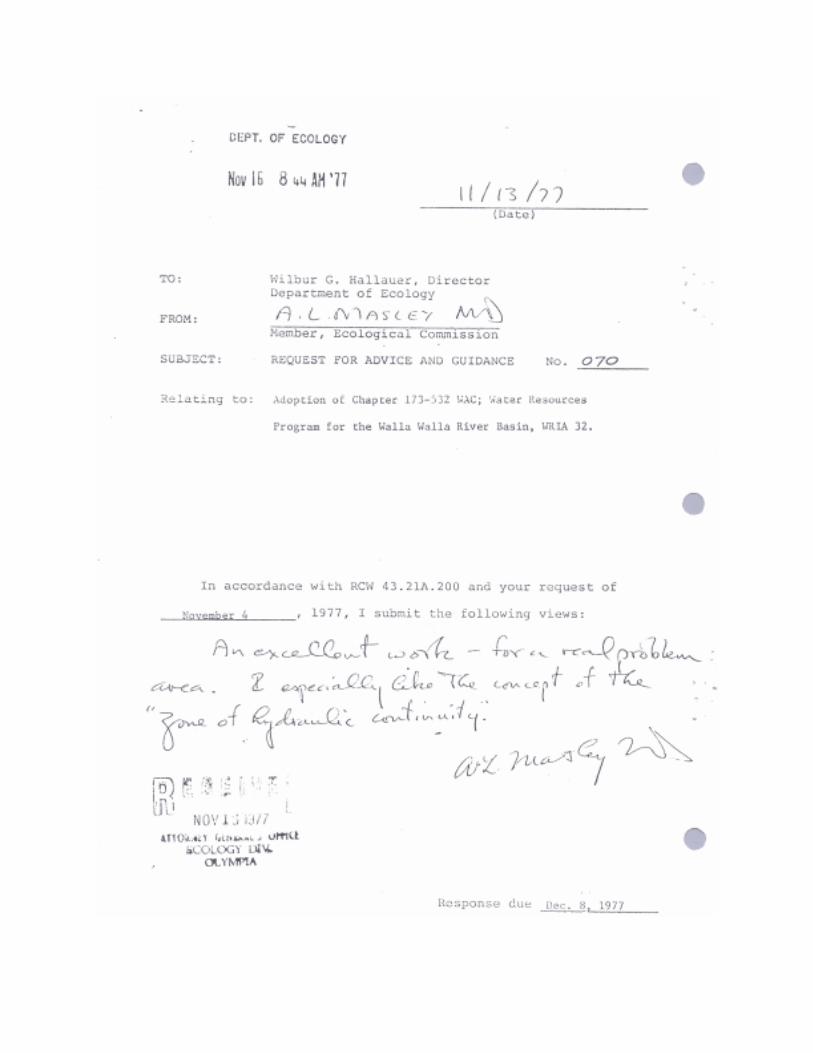
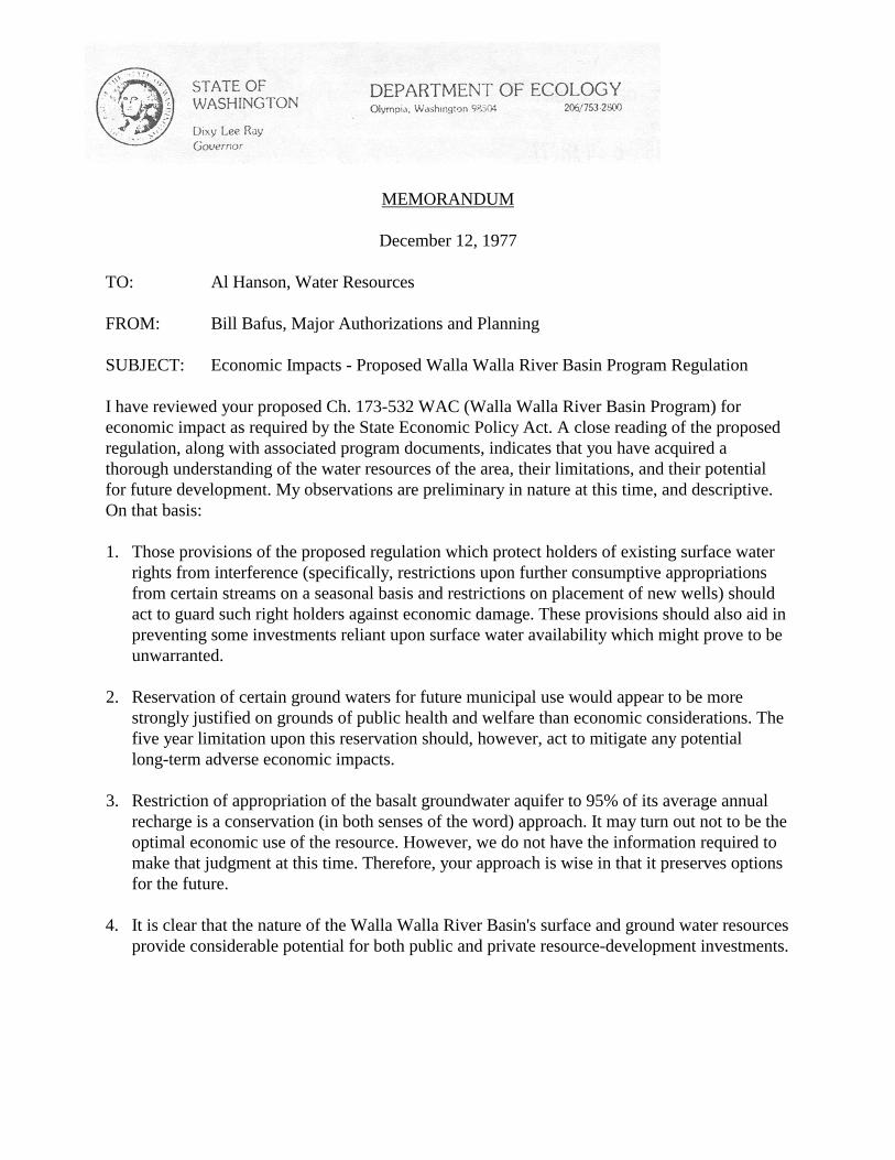
MEMORANDUM
December 12, 1977
TO: Al Hanson, Water Resources
FROM: Bill Bafus, Major Authorizations and Planning
SUBJECT: Economic Impacts - Proposed Walla Walla River Basin Program Regulation
I have reviewed your proposed Ch. 173-532 WAC (Walla Walla River Basin Program) foreconomic impact as required by the State Economic Policy Act. A close reading of the proposedregulation, along with associated program documents, indicates that you have acquired athorough understanding of the water resources of the area, their limitations, and their potentialfor future development. My observations are preliminary in nature at this time, and descriptive.On that basis:
1. Those provisions of the proposed regulation which protect holders of existing surface waterrights from interference (specifically, restrictions upon further consumptive appropriationsfrom certain streams on a seasonal basis and restrictions on placement of new wells) shouldact to guard such right holders against economic damage. These provisions should also aid inpreventing some investments reliant upon surface water availability which might prove to beunwarranted.
2. Reservation of certain ground waters for future municipal use would appear to be morestrongly justified on grounds of public health and welfare than economic considerations. Thefive year limitation upon this reservation should, however, act to mitigate any potentiallong-term adverse economic impacts.
3. Restriction of appropriation of the basalt groundwater aquifer to 95% of its average annualrecharge is a conservation (in both senses of the word) approach. It may turn out not to be theoptimal economic use of the resource. However, we do not have the information required tomake that judgment at this time. Therefore, your approach is wise in that it preserves optionsfor the future.
4. It is clear that the nature of the Walla Walla River Basin's surface and ground water resourcesprovide considerable potential for both public and private resource-development investments.
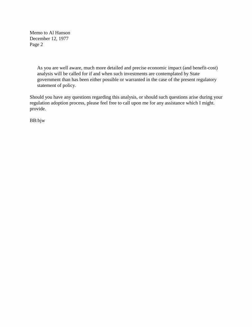
Memo to Al HansonDecember 12, 1977Page 2
As you are well aware, much more detailed and precise economic impact (and benefit-cost)analysis will be called for if and when such investments are contemplated by Stategovernment than has been either possible or warranted in the case of the present regulatorystatement of policy.
Should you have any questions regarding this analysis, or should such questions arise during yourregulation adoption process, please feel free to call upon me for any assistance which I might.provide.
BB:bjw