Embed Size (px)
Citation preview
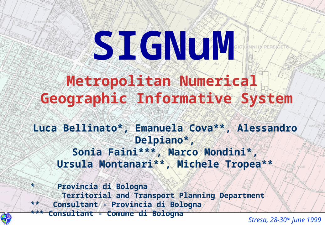
Stresa, 28-30th june 1999
SIGNuMMetropolitan Numerical
Geographic Informative SystemLuca Bellinato*, Emanuela Cova**, Alessandro Delpiano*,
Sonia Faini***, Marco Mondini*,Ursula Montanari**, Michele Tropea**
* Provincia di Bologna Territorial and Transport Planning Department** Consultant - Provincia di Bologna*** Consultant - Comune di Bologna
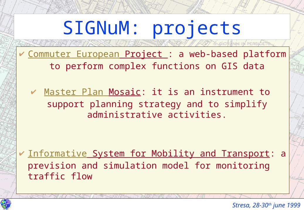
Stresa, 28-30th june 1999
SIGNuM: projects Commuter European Project : a web-based platform to
perform complex functions on GIS data
Master Plan Mosaic: it is an instrument to support planning strategy and to simplify administrative activities.
Informative System for Mobility and Transport: a prevision and simulation model for monitoring traffic flow
Stresa, 28-30th june 1999
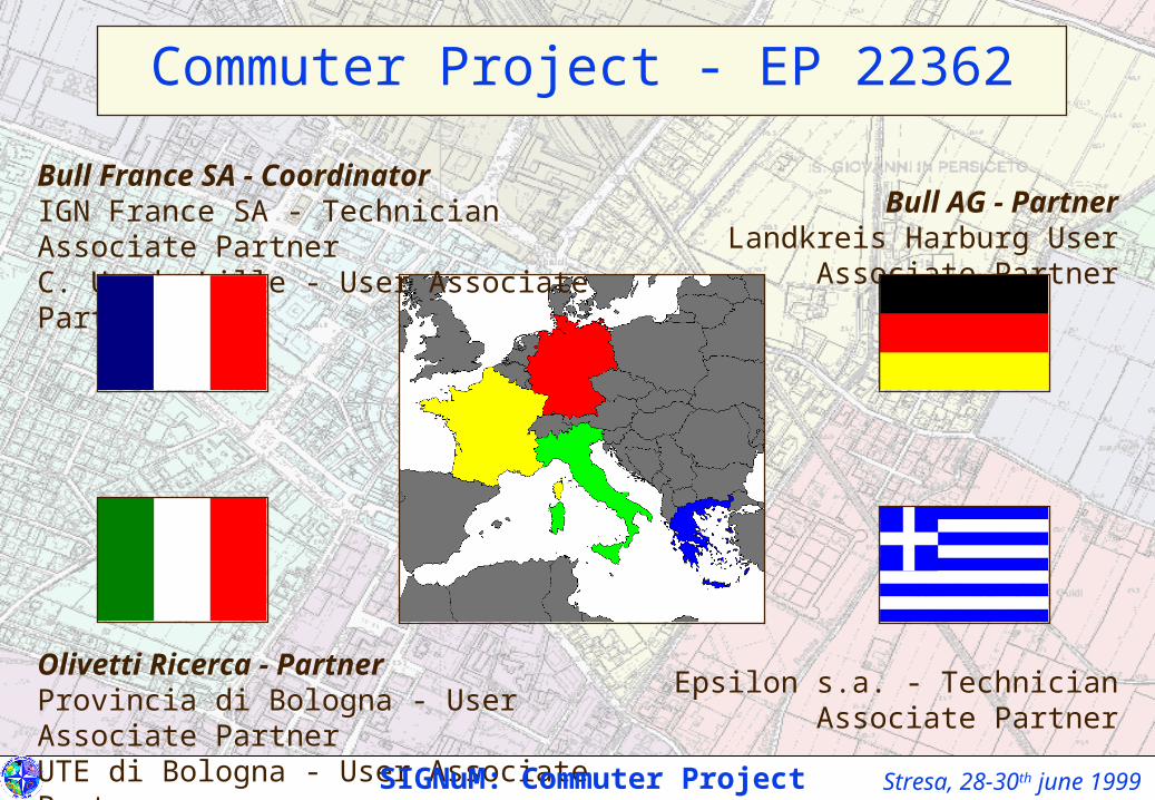
Bull France SA - CoordinatorIGN France SA - Technician Associate PartnerC. U. de Lille - User Associate Partner
Olivetti Ricerca - PartnerProvincia di Bologna - User Associate PartnerUTE di Bologna - User Associate Partner
Bull AG - PartnerLandkreis Harburg User Associate Partner
Epsilon s.a. - Technician Associate Partner
Commuter Project - EP 22362
SIGNuM: Commuter Project
Stresa, 28-30th june 1999
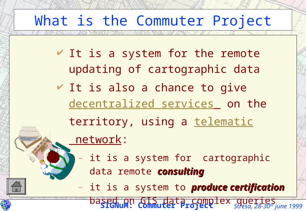
It is a system for the remote updating of
cartographic data
It is also a chance to give decentralized services
on the territory, using a telematic network:
– it is a system for cartographic data remote
consultingconsulting
– it is a system to produce certificationproduce certification based on GIS
data complex queries
SIGNuM: Commuter Project
What is the Commuter Project
Stresa, 28-30th june 1999
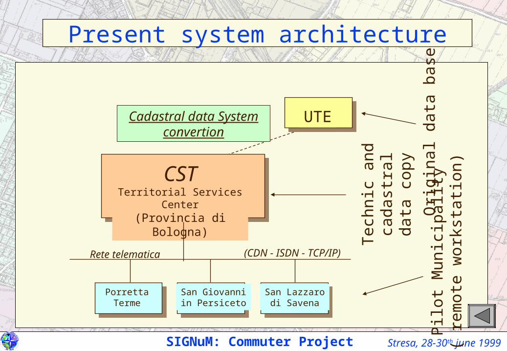
Cadastral data System convertion
Present system architecture
UTE
CSTTerritorial Services Center(Provincia di Bologna)
PorrettaTerme
San Lazzarodi Savena
San Giovanniin Persiceto P
ilot
Mun
icip
alit
y(
rem
ote
wor
ksta
tion
)Ori
gina
l dat
a ba
se
Tec
hnic
and
ca
dast
ral d
ata
copy
Rete telematica (CDN - ISDN - TCP/IP)
SIGNuM: Commuter Project
Stresa, 28-30th june 1999
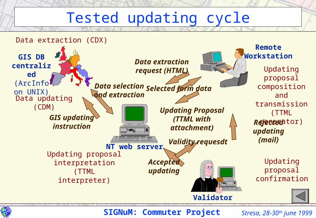
Updating proposal composition and
transmission(TTML generator)
GIS DB centralized(ArcInfo on
UNIX)
Remote Workstation
NT web server
Selected form data
Data extraction request (HTML)
Updating Proposal (TTML with attachment)
Data extraction (CDX)
Data selection and extraction
Updating proposal confirmation
Validity requesdt
Accepted updating
Rejected updating
(mail)
GIS updating instruction
Updating proposal interpretation
(TTML interpreter)
Data updating (CDM)
SIGNuM: Commuter Project
Validator
Tested updating cycle
Stresa, 28-30th june 1999
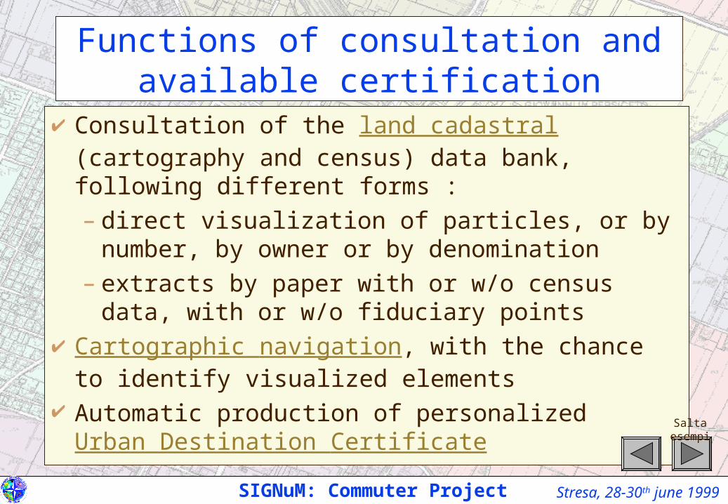
Functions of consultation and available certification
Consultation of the land cadastral (cartography and census) data bank, following different forms :– direct visualization of particles, or by number, by
owner or by denomination– extracts by paper with or w/o census data, with or w/o
fiduciary points Cartographic navigation, with the chance to identify
visualized elements Automatic production of personalized Urban Destination
Certificate
SIGNuM: Commuter Project
Salta esempi
Stresa, 28-30th june 1999
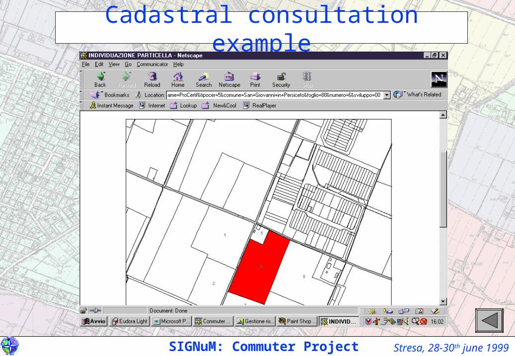
Cadastral consultation example
SIGNuM: Commuter Project
Stresa, 28-30th june 1999
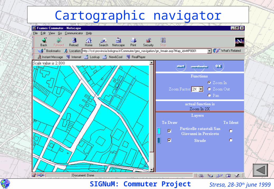
Cartographic navigator
SIGNuM: Commuter Project

Stresa, 28-30th june 1999
Urban destination certificate personalization
SIGNuM: il Commuter Project
HEADER.GIF HEADER.TXT
COMUNE DI SAN GIOVANNI IN PERSICETOProvincia di BolognaSettore Programmazione e Assetto del Territorio
PARTE COMPRESA NEL CODICE
IL DIRIGENTE DEL SETTORE
Vista la richiesta in data 18/03/1999 Prot. n. 1 del sig. NN residente in VV, intesa adottenere il rilascio del certificato di destinazione urbanistica, per l'area di terrenoubicata in questo comune, distinta catastale al N.C.T. al Foglio 88 mappale 6, cosìcome individuata nella planimetria allegata alla richiesta;
DELIB_DESTURB.TXT
Visti i commi 2° e 3° dell'articolo 18 della legge 28/2/1985 n.47;Visto il P.R.G. vigente, adottato con deliberazione del Consiglio Comunale n. 78 del10/3/1995, approvato con deliberazione della Giunta Provinciale n. 96 del 10/2/1997,disciplinato dalle Norme di Attuazione;Vista la Variante 1 approvata con deliberazione del Consiglio Comunale n.175 del28/11/1997, disciplinata dalle Norme di Attuazione;Vista la Variante 2 approvata con deliberazione del Consiglio Comunale n.164 del30/11/1998, disciplinata dalle Norme di Attuazione;
PARTE COMPRESA NEL CODICE
CERTIFICA
che l'immobile sopraindicato è soggetto alle prescrizioni urbanistiche vigentirelativamente alla zona urbanistica:
ZONA URBANISTICA D4 - Zone produttive per attività artigianali eindustriali di nuovo impianto art.20
ZONA URBANISTICA B3 - Zona a verde privato e di pertinenzadell'edificato art.12
ZONA URBANISTICA I - Zone di tutela art.39
ZONA URBANISTICA H - Zone per la mobilità art.38
ZONA URBANISTICA E1 - Zona agricola art.24
I link dei vari articoli rimandano a NTAAPPRO.HTML
VARIANTESI.TXT /VARIANTENO.TXTIl medesimo immobile non è soggetto alle misure di salvaguardia di cui all'art. 55della legge regionale 7 dicembre 1978, n. 47 nei confronti delle varianti adottate con
MAPPA DEL CERTIFICATO DI DESTINAZIONE URBANISTICA
FOOTER_DESURB.TXT
Sull'area oggetto della richiesta devono essere osservate tutte le altre prescrizioni nonespressamente richiamate derivanti dall'applicazione delle Norme di Attuazione del P.R.G. e delRegolamento Edilizio.Il presente certificato conserva validità per un anno dalla data del rilascio a meno di modificazionidegli strumenti urbanistici, i quali sono depositati presso l'Ufficio Tecnico comunale e sonodisponibili per la consultazione.Dall'Ufficio Comunale, lì 18 Marzo 1999
IL DIRIGENTE DEL SETTORE
Stresa, 28-30th june 1999
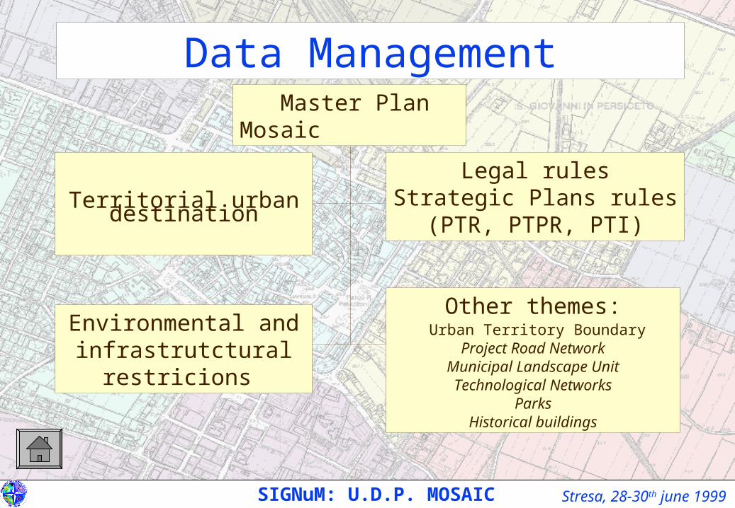
Master Plan Mosaic
Territorial urban destination
Legal rulesStrategic Plans rules(PTR, PTPR, PTI)
Environmental and infrastrutctural restricions
Other themes: Urban Territory Boundary
Project Road NetworkMunicipal Landscape UnitTechnological Networks
ParksHistorical buildings
Data Management
SIGNuM: U.D.P. MOSAIC
Stresa, 28-30th june 1999
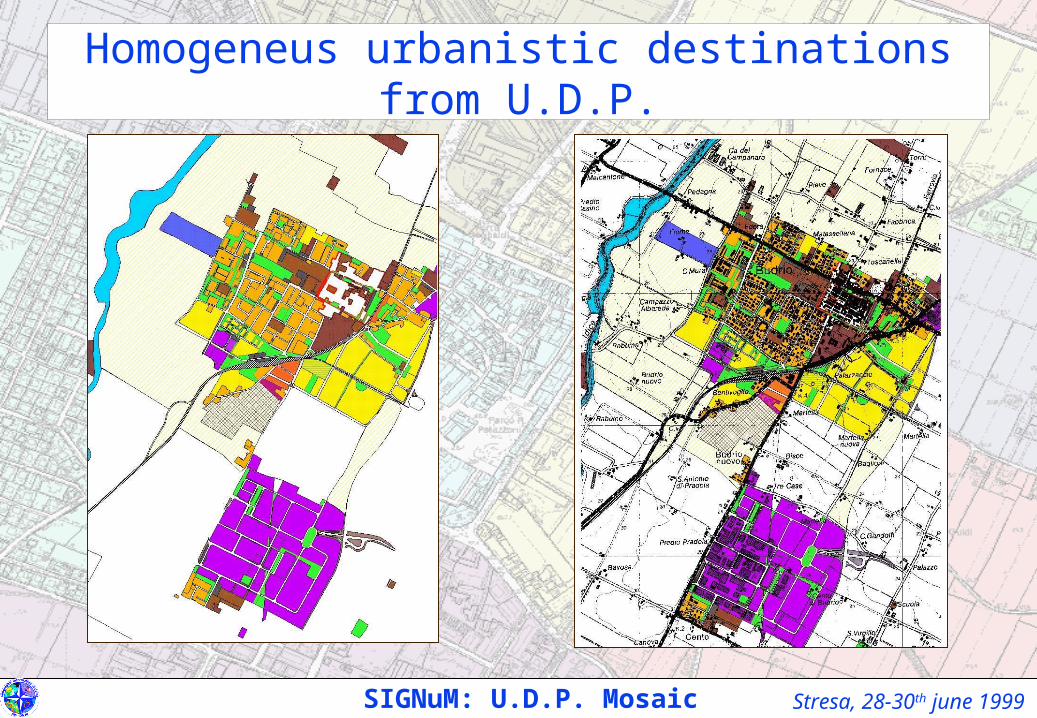
Homogeneus urbanistic destinations from U.D.P.
SIGNuM: U.D.P. Mosaic
Stresa, 28-30th june 1999
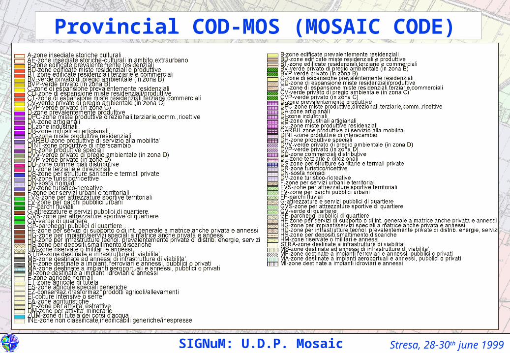
Provincial COD-MOS (MOSAIC CODE)
SIGNuM: U.D.P. Mosaic
Stresa, 28-30th june 1999
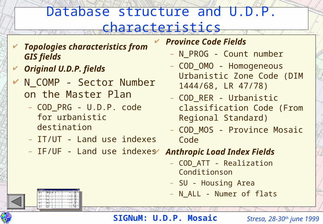
Database structure and U.D.P. characteristics
Topologies characteristics from GIS fields
Original U.D.P. fields
N_COMP - Sector Number on the Master Plan– COD_PRG - U.D.P. code for
urbanistic destination
– IT/UT - Land use indexes
– IF/UF - Land use indexes
Province Code Fields
– N_PROG - Count number
– COD_OMO - Homogeneous Urbanistic Zone Code (DIM 1444/68, LR 47/78)
– COD_RER - Urbanistic classification Code (From Regional Standard)
– COD_MOS - Province Mosaic Code Anthropic Load Index Fields
– COD_ATT - Realization Conditionson
– SU - Housing Area
– N_ALL - Numer of flats
SIGNuM: U.D.P. Mosaic
Stresa, 28-30th june 1999SIGNuM: U.D.P. Mosaic
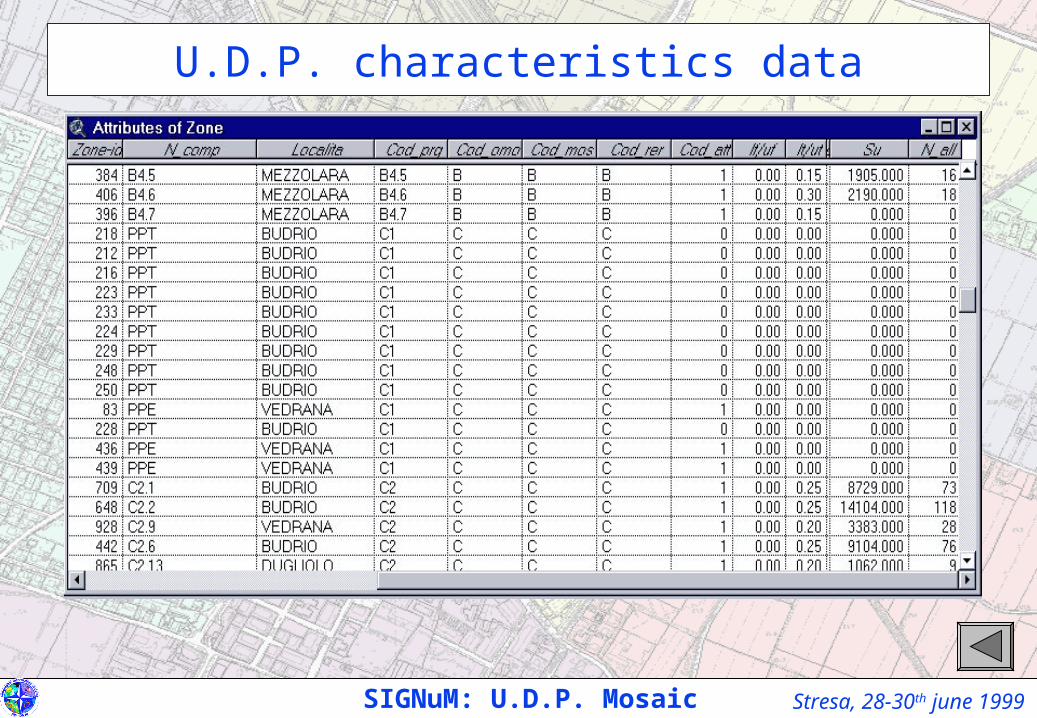
U.D.P. characteristics data
Stresa, 28-30th june 1999
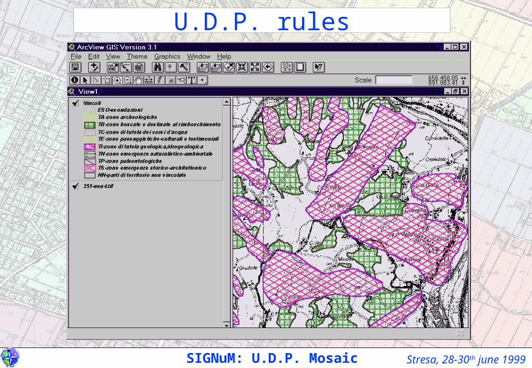
U.D.P. rules
SIGNuM: U.D.P. Mosaic
Stresa, 28-30th june 1999
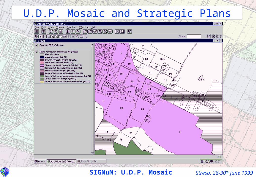
U.D.P. Mosaic and Strategic Plans
SIGNuM: U.D.P. Mosaic

Stresa, 28-30th june 1999
Environmental and infrastrutctural restrictions
SIGNuM: U.D.P. Mosaic

Stresa, 28-30th june 1999SIGNuM: S.I.M.T.
Network and zoning representation
Stresa, 28-30th june 1999SIGNuM: S.I.M.T.
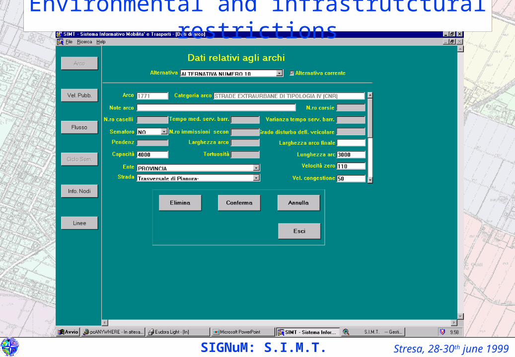
Environmental and infrastrutctural restrictions
Stresa, 28-30th june 1999SIGNuM: S.I.M.T.
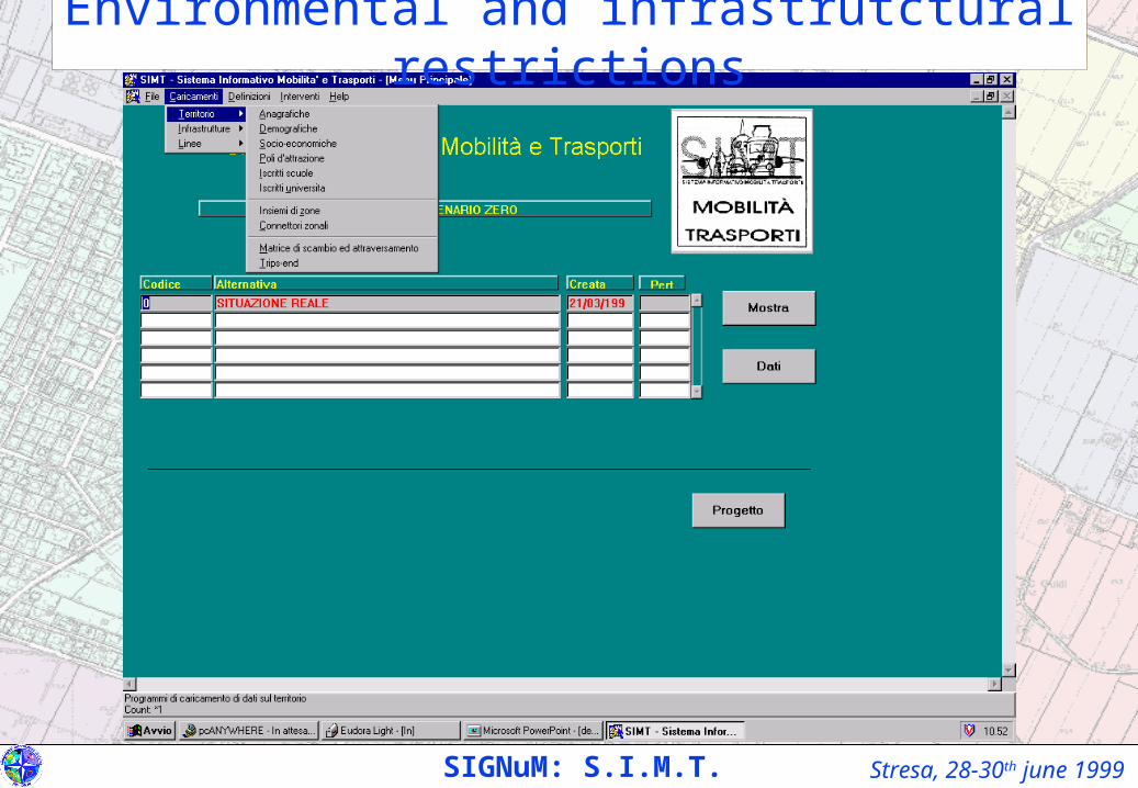
Environmental and infrastrutctural restrictions
Stresa, 28-30th june 1999SIGNuM: S.I.M.T.
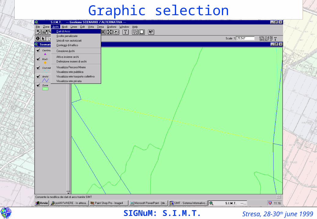
Graphic selection
Stresa, 28-30th june 1999SIGNuM: S.I.M.T.
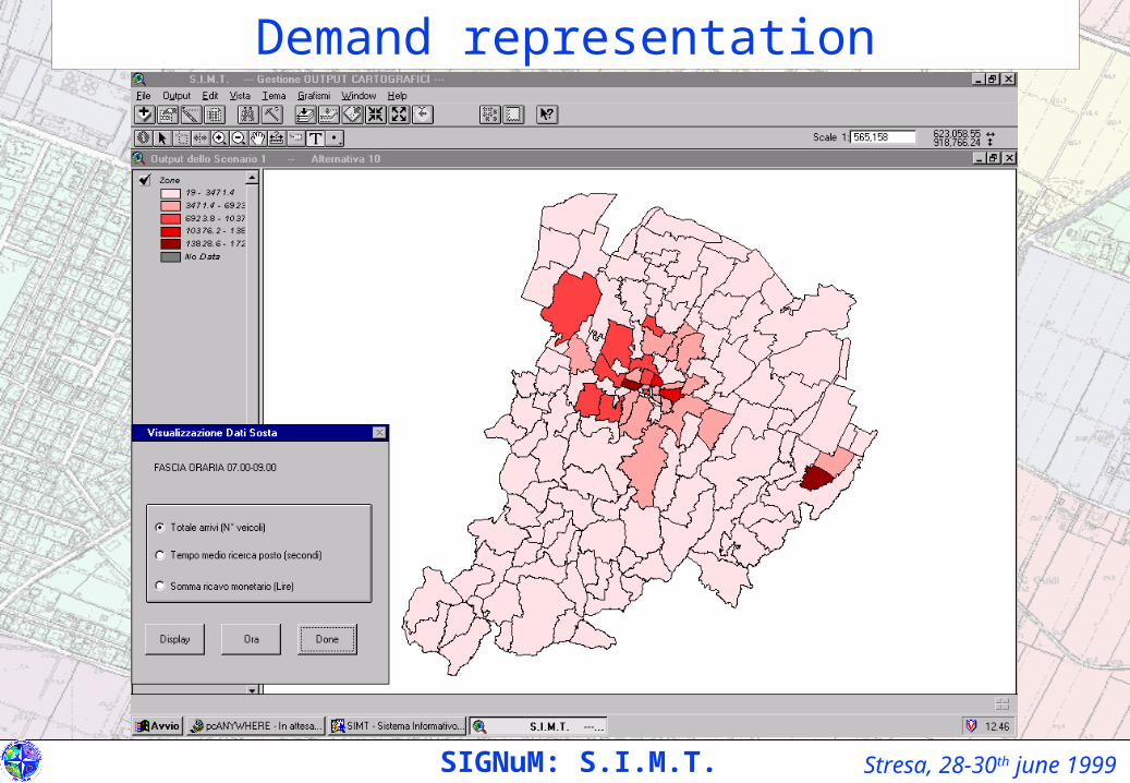
Demand representation
Stresa, 28-30th june 1999SIGNuM: S.I.M.T.
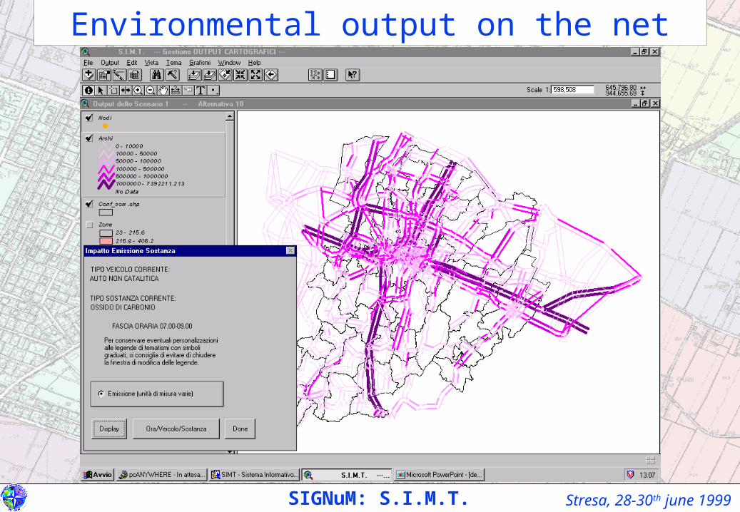
Environmental output on the net
Stresa, 28-30th june 1999
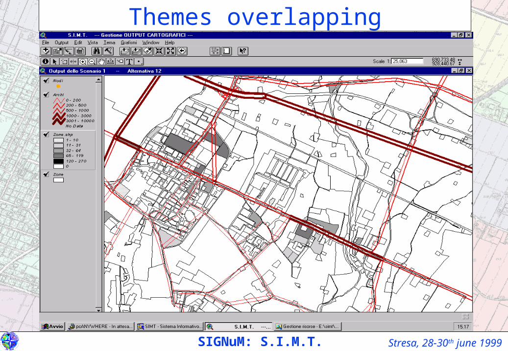
Themes overlapping
SIGNuM: S.I.M.T.
Stresa, 28-30th june 1999SIGNuM: S.I.M.T.
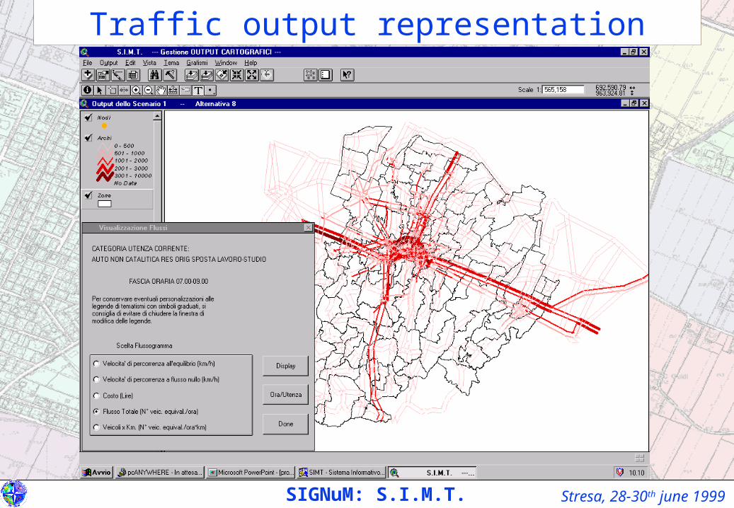
Traffic output representation
Stresa, 28-30th june 1999
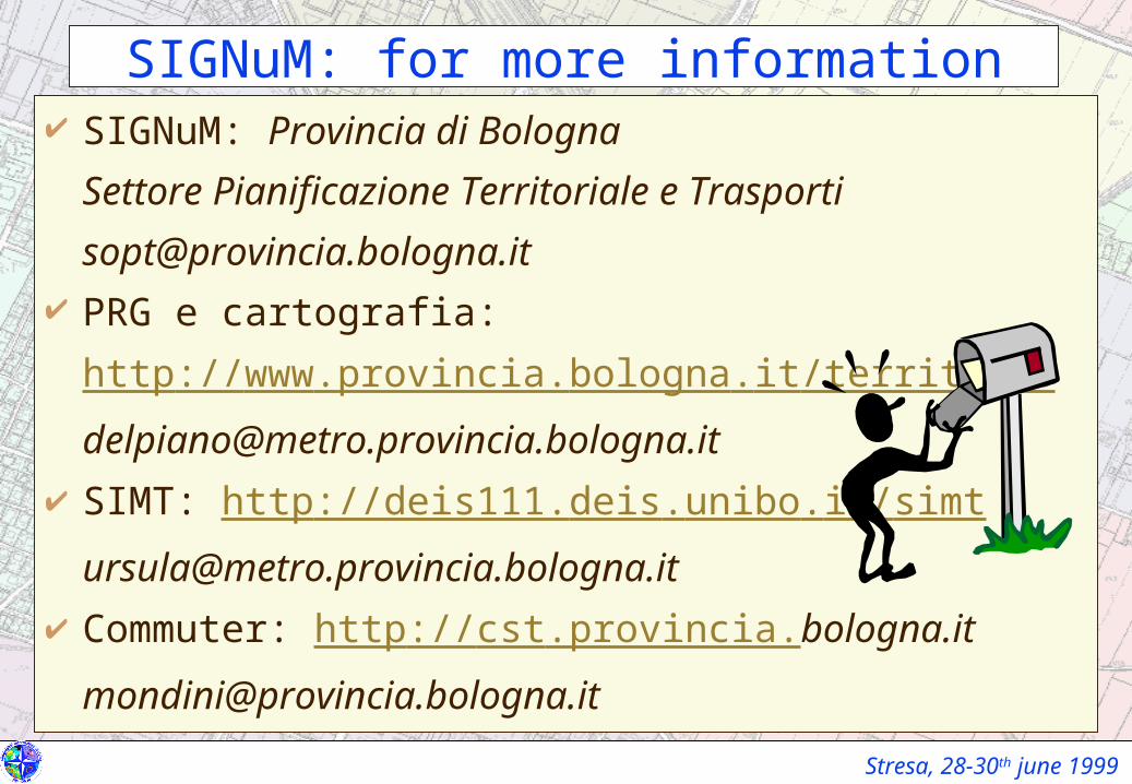
SIGNuM: for more information SIGNuM: Provincia di Bologna
Settore Pianificazione Territoriale e Trasporti
[email protected] PRG e cartografia:
http://www.provincia.bologna.it/territorio
[email protected] SIMT: http://deis111.deis.unibo.it/simt
[email protected] Commuter: http://cst.provincia.bologna.it