Embed Size (px)
Citation preview

ROMAN ROADS IN GAUL: HOW LINES OF COMMUNICATION AND BASING SUPPORT
OPERATIONAL REACH
A Monograph
by
Major Joel P. Gleason United States Army
School of Advanced Military Studies United States Army Command and General Staff College
Fort Leavenworth, Kansas
2013-02
Approved for public release; distribution is unlimited.

Standard Form 298 (Rev. 8-98) Prescribed by ANSI-Std Z39-18
REPORT DOCUMENTATION PAGE Form Approved
OMB No. 0704-0188 Public reporting burden for this collection of information is estimated to average 1 hour per response, including the time for reviewing instructions, searching data sources, gathering and maintaining the data needed, and completing and reviewing the collection of information. Send comments regarding this burden estimate or any other aspect of this collection of information, including suggestions for reducing this burden to Washington Headquarters Service, Directorate for Information Operations and Reports, 1215 Jefferson Davis Highway, Suite 1204, Arlington, VA 22202-4302, and to the Office of Management and Budget, Paperwork Reduction Project (0704-0188) Washington, DC 20503. PLEASE DO NOT RETURN YOUR FORM TO THE ABOVE ADDRESS. 1. REPORT DATE (DD-MM-YYYY) 31-10-2013
2. REPORT TYPE SAMS Monograph
3. DATES COVERED (From - To) January 2013 - December 2013
4. TITLE AND SUBTITLE Roman Roads in Gaul: How Lines of Communication and Basing Support Operational Reach
5a. CONTRACT NUMBER
5b. GRANT NUMBER
5c. PROGRAM ELEMENT NUMBER
6. AUTHOR(S) Major Joel P. Gleason, United States Army
5d. PROJECT NUMBER
5e. TASK NUMBER
5f. WORK UNIT NUMBER
7. PERFORMING ORGANIZATION NAME(S) AND ADDRESS(ES) School of Advanced Military Studies (SAMS) 250 Gibbon Avenue Fort Leavenworth, KS 66027-2134
8. PERFORMING ORGANIZATION REPORT NUMBER
9. SPONSORING/MONITORING AGENCY NAME(S) AND ADDRESS(ES)
10. SPONSOR/MONITOR'S ACRONYM(S)
11. SPONSORING/MONITORING
AGENCY REPORT NUMBER
12. DISTRIBUTION AVAILABILITY STATEMENT Approved for Public Release; Distribution is Unlimited
13. SUPPLEMENTARY NOTES
14. ABSTRACT National militaries extend operational reach through the use of improved lines of communication and basing. Evidence of Roman roads and fortifications in Gaul reveals a history of physical infrastructure extending operational reach in order to increase the Roman Army’s chance of success. Three case studies provide a framework for this study. First, Caesar’s legions used Gallic folkways to fight in Gaul from 58-50 BC. Second, the Romans projected all forces for the invasion of Britain over roads in Gaul in 43 AD. Third, from 19 BC until the fall of Rome in the fifth century AD, along the Germanic frontier. All three periods of Roman operations in Gaul demonstrate the interplay of the components of operational reach. Poor roads and basing restricted Caesar’s potential operational reach in Gaul. The deployment toward Britain over Roman roads in Gaul succeeded due to significant increases in infrastructure. On the static frontiers of the Roman empire, the army greatly reduced the potential momentum of its forces as a trade-off for greater endurance and protection. 15. SUBJECT TERMS Operational Reach, Sustainment, Lines of Communicaiton, Basing, Rome, Caesar, Gaul, Endurance, Momentum, Protection, Roads, Ancient History.
16. SECURITY CLASSIFICATION OF: 17. LIMITATION OF
ABSTRACT (U)
18. NUMBER
OF PAGES 63
19a. NAME OF RESPONSIBLE PERSON John Paganini, COL, US Army
a. REPORT (U)
b. ABSTRACT (U)
c. THIS PAGE (U)
19b. TELEPONE NUMBER (Include area code) 913-758-3302

ii
MONOGRAPH APPROVAL PAGE
Name of Candidate: MAJ Joel P. Gleason Monograph Title: Roman Roads in Gaul: How Lines of Communication and Basing Support
Operational Reach Approved by: , Monograph Director Ricardo A. Herrera, Ph.D. , Seminar Leader John M. Paganini, COL , Director, School of Advanced Military Studies Henry A. Arnold, COL Accepted this 31st day of October 2013 by: , Director, Graduate Degree Programs Robert F. Baumann, Ph.D. The opinions and conclusions expressed herein are those of the student author and do not necessarily represent the views of the U.S. Army Command and General Staff College or any other governmental agency. (References to this study should include the foregoing statement.)

iii
ABSTRACT
ROMAN ROADS IN GAUL: HOW LINES OF COMMUNICATION AND BASING SUPPORT OPERATIONAL REACH, by MAJ Joel P. Gleason, 45 pages.
National militaries extend operational reach through the use of improved lines of
communication and basing. Evidence of Roman roads and fortifications in Gaul reveals a history
of physical infrastructure extending operational reach in order to increase the Roman Army’s
chance of success. This comparison of the Roman roads and basing in ancient Gaul to the modern
concept of operational reach and its components (momentum, endurance, and protection)
emphasizes the impact of infrastructure on military operations.
Three case studies provide a framework for this study. First, Caesar’s legions used Gallic
folkways to fight in Gaul from 58-50 BC, which caused challenges to momentum, endurance, and
protection limiting operations. Second, the Romans projected all forces for the invasion of Britain
over roads in Gaul in 43 AD. Third, from 19 BC until the fall of Rome in the fifth century AD,
the Germanic frontier exchanged almost all possibility of momentum for a substantial increase in
endurance and a significant increase in protection to the greater empire.
All three periods of Roman operations in Gaul demonstrate the interplay of the
components of operational reach. The increase in one element, in most cases, will cause the drop
of another unless technology or infrastructure increases them all. Poor roads and basing restricted
Caesar’s potential operational reach in Gaul. The deployment toward Britain over Roman roads in
Gaul succeeded due to significant increases in infrastructure allowing greater endurance and
momentum. On the static frontiers of the Roman empire, the army greatly reduced the potential
momentum of its forces as a trade-off for greater endurance and protection.

iv
ACKNOWLEDGMENTS
Like any significant project, I was able to accomplish this monograph through teamwork
and assistance and I would be remiss to claim that the citations and bibliography represented all
of the credit that was due to outside sources. First, I want to thank my monograph director, Dr.
Ricardo Herrera, for reading over everything from initial rambling scraps to final drafts and
giving me just the right measure of quality direction, motivation, and feedback. My sense of
history improved immensely under his instruction. I am also grateful to Majors Matthew Blome
and Angelica Martinez who helped to shape my initial question and direction into this final
product. Finally, from the SAMS faculty, I would like to thank Colonels R. Joseph Dixon and
John Paganini whose leadership helped ensure that this project holds a military purpose and not
just an academic one.
There are several influences outside of SAMS that also deserve mention in the
development of this project. Mr. Bob Bayless and Mr. G. Mike Stephenson, both of the CGSOC
faculty, added greatly to my knowledge of operational sustainment and history, respectively,
leading me to this particular topic. Dr. John Hosler, of Morgan State University, was generous
enough to get me started with a list of sources focused on the root of my research question. I must
also give a nod to Anthony Everitt’s The Rise of Rome, which inspired me to look at the roads.
In a personal note, I would like to thank my close friend Major Jake Atkins who helped
me to stay physically tough while acting as a sounding board to much of my research. To close, I
must mention my deepest gratitude to my beautiful wife, Trista, who has certainly given the most
toward the completion of this monograph. In the process of this writing and many others, she has
always offered patient encouragement. Her support throughout my career has made me a better
leader and a better officer.

v
TABLE OF CONTENTS
Page
ILLUSTRATIONS ........................................................................................................................ VI
INTRODUCTION ........................................................................................................................... 1
LITERATURE REVIEW ................................................................................................................ 7
UNDERSTANDING OPERATIONAL REACH ......................................................................... 13
JULIUS CAESAR OVER GALLIC ROADS ............................................................................... 20
TOWARD BRITAIN OVER GALLIC ROADS .......................................................................... 25
THE GERMANIC FRONTIER OVER GALLIC ROADS .......................................................... 32
CONCLUSION: THE OPERATIONAL REACH OF ROME ..................................................... 41
APPENDIX A: MUTUAL SUPPORT ON THE RHINE FRONTIER......................................... 48
APPENDIX B: THE COST OF THE MUSCLE & ANIMAL POWER OF ROME .................... 50
BIBLIOGRAPHY ......................................................................................................................... 52

vi
Illustrations
Page
DIAGRAM OF HOW OPERATIONAL REACH RELATES TO BOUNDARIES .................... 20
MAP OF THE EASTERN ROMAN TERRITORY BEFORE CAESAR’S CONQUEST........... 21
MAP OF THE FOUR MAJOR TRANSPORTATION CORRIDORS IN GAUL ........................ 28
MAP OF THE RHINE FRONTIER, CIRCA 100 AD .................................................................. 33
DISTANCES BETWEEN MUTUALLY SUPPORTING BASES ALONG THE RHINE .......... 48
THE DEPLOYMENT OF ROMAN LEGIONS STATIONED ON THE RHINE FRONTIER ... 49
THE FULLY BURDENED COST OF FODDER (FBCF) ........................................................... 50

1
Introduction
The imperial Roman Army was too small to conquer the enemies of Rome.1 The army
consisted of 28 legions for much of the imperial period, between 4800 to 6000 heavy infantry in
each at its full strength. A roughly equal number of auxiliary troops and a limited fleet supported
the legions making around 270,000 total soldiers and sailors, but these forces were numerically
insufficient to hold back a host of potential enemies.2 Instead of massive forces, the Romans
developed a complex system of all-weather roads with supporting fortifications that allowed them
to extend the operational reach of their small forces to the edges of the empire.3 Durable, all-
weather roads facilitated an increased rate of march for heavy legionary infantry forces, which
increased the Roman Army’s potential reach and defined the boundaries Rome could call its
own.4
In today’s terms, operational reach is the distance and duration possible for a military
force to operate. U.S. Army doctrine further divides reach into terms of endurance, momentum,
and protection.5 Each of these subordinate elements is observable through studying the operations
of the Roman Army. Scholars have estimated the potential endurance that Roman forces
possessed by examining the tempo of their operations and the availability of the resources
1 N.G.L. Hammond and H.H. Scullard, eds., The Oxford Classical Dictionary, 2nd ed.
(Oxford: Oxford University Press, 1970), 591–593; Edward N. Luttwak, The Grand Strategy of the Roman Empire: From the First Century to the Third (Baltimore: The Johns Hopkins University Press, 1976), 13.
2 G.L. Cheesman, The Auxilia of the Roman Imperial Army (Chicago: Ares Publishers, 1914), 53–56.
3 Logan Thompson, “Roman roads,” History Today 47, no. 2 (1997): 21–22; Luttwak, The Grand Strategy of the Roman Empire: From the First Century to the Third, 45, 61–67.
4 Gaius Suetonius (Suetonius) Tranquillus, The Twelve Caesars, ed. T. Forester, trans. Alexander Thomson, Kindle ed., n.d., 155–156; Tacitus, The Complete Tacitus Anthology, Kindle ed. (Bybliotech.org, 2012), Annals 1.9.
5 Department of the Army United States, Army Doctrine Reference Publication 5-0: The Operations Process (Washington, DC: Headquarters, Department of the Army, 2012).

2
required to conduct those operations. By comparing historical records with estimates of the
numbers the Roman Army could have mobilized at one time within the resources and capabilities
of that era, it is possible to estimate Roman operational momentum. Evidence also exists to show
that the Romans used road placement for the protection of their combat power during operations
with extended distance and duration.
Nations can project power and their armed forces can extend operational reach through
the use of improved lines of communication and basing. Evidence of Roman roads and
fortifications in Gaul reveals a history of one military’s use of physical infrastructure to extend its
operational reach in order to increase the Roman Army’s chance of success. Since practice
always precedes the development of good theory, scholars should ask the question, how does
modern doctrine provide for operational reach? A comparison of the Roman roads and basing in
ancient Gaul to the modern concept of operational reach and its components (momentum,
endurance, and protection) emphasizes the impact of infrastructure on military operations.
Examining how the Roman Army operated within the geographic and temporal
boundaries of its potential operational reach prompts a further comparison of the modern U.S.
Army principles of sustainment. Today’s sustainment professional speaks of the principles of
economy, improvisation, survivability and simplicity. The Roman Army demonstrated all of these
concepts. The stations and fortifications along the road network supporting the movement of
troops in any direction at any time provide clear examples of principles that planners today call
responsiveness and anticipation.6
Operational reach is often the deciding factor in establishing the extent of geographic and
temporal boundaries an army can control. The possible distance and duration of prospective
6 Department of the Army United States, Army Doctrine Reference Publication 4-0:
Sustainment (Washington, DC: Headquarters, Department of the Army, 2012), 1–2 – 1–4. The United States Army’s principles of sustainment are integration, anticipation, responsiveness, simplicity, economy, survivability, continuity, and improvisation.
3
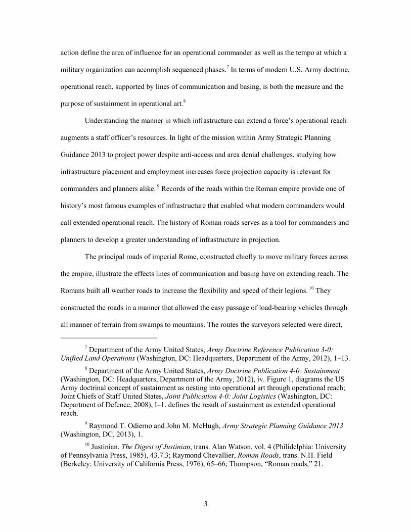
action define the area of influence for an operational commander as well as the tempo at which a
military organization can accomplish sequenced phases.7 In terms of modern U.S. Army doctrine,
operational reach, supported by lines of communication and basing, is both the measure and the
purpose of sustainment in operational art.8
Understanding the manner in which infrastructure can extend a force’s operational reach
augments a staff officer’s resources. In light of the mission within Army Strategic Planning
Guidance 2013 to project power despite anti-access and area denial challenges, studying how
infrastructure placement and employment increases force projection capacity is relevant for
commanders and planners alike. 9 Records of the roads within the Roman empire provide one of
history’s most famous examples of infrastructure that enabled what modern commanders would
call extended operational reach. The history of Roman roads serves as a tool for commanders and
planners to develop a greater understanding of infrastructure in projection.
The principal roads of imperial Rome, constructed chiefly to move military forces across
the empire, illustrate the effects lines of communication and basing have on extending reach. The
Romans built all weather roads to increase the flexibility and speed of their legions. 10 They
constructed the roads in a manner that allowed the easy passage of load-bearing vehicles through
all manner of terrain from swamps to mountains. The routes the surveyors selected were direct,
7 Department of the Army United States, Army Doctrine Reference Publication 3-0:
Unified Land Operations (Washington, DC: Headquarters, Department of the Army, 2012), 1–13. 8 Department of the Army United States, Army Doctrine Publication 4-0: Sustainment
(Washington, DC: Headquarters, Department of the Army, 2012), iv. Figure 1, diagrams the US Army doctrinal concept of sustainment as nesting into operational art through operational reach; Joint Chiefs of Staff United States, Joint Publication 4-0: Joint Logistics (Washington, DC: Department of Defence, 2008), I–1. defines the result of sustainment as extended operational reach.
9 Raymond T. Odierno and John M. McHugh, Army Strategic Planning Guidance 2013 (Washington, DC, 2013), 1.
10 Justinian, The Digest of Justinian, trans. Alan Watson, vol. 4 (Philidelphia: University of Pennsylvania Press, 1985), 43.7.3; Raymond Chevallier, Roman Roads, trans. N.H. Field (Berkeley: University of California Press, 1976), 65–66; Thompson, “Roman roads,” 21.

4
avoiding obstacles and locations of potential ambuscades as well as population centers. Roman
roads often followed straighter lines than surveyors would be capable of making again until the
Renaissance, but even when curved they provided the most direct route the Romans could secure.
The most important Roman roads were not commercial. The laws of Rome defined four
categories of road, the military road being the highest quality. The law defined military roads by
their paved or graveled quality, their public maintenance, and their termination either at the sea or
at an intersection with another military road. Other public roads, private roads, and city roads
were less important in the eyes of the law. Commerce mostly went by sea and barge. For the
protection of commercial traffic, the law prohibited any action that might reduce the navigability
of a waterway, demonstrating the importance of waterborne commerce.11 Lionel Casson, in
Travel in the Ancient World, argues that the exorbitant cost of transporting goods over land when
river and sea transportation were available is evidence against the extensive commercial use of
roads in ancient times.12
The primary purpose of the roads, therefore, was military. Roman commanders used
these roads to project forces inside the empire to extinguish rebellions as well as to transport
troops to the frontiers for conquest and defense.13 In order to extend their reach to the major
rivers, mountain ranges, deserts, and oceans that the Romans considered the natural extent of the
empire, the army constructed way stations and basing along the roads and at the edges of the
11 Justinian, The Digest of Justinian, 4:43.7.3 & 43.7.12–15. 12 Lionel Casson, Travel in the Ancient World (Baltimore: The Johns Hopkins University
Press, 1994), 65, 129–130. 13 Flavius Josephus, The Works of Josephus: New Updated Version Complete and
Unabridged in One Volume, trans. William Whitson (Peabody, MA: Hendrickson Publishers, 1987), Jewish Wars 3.7.3. Josephus provides a clear example of Titus using roads to project forces. In this same campaign, Titus repairs the roads ahead of tactical action in order to march his troops more expediently to battle.

5
frontier.14 The history of Roman Gaul provides ample illustrations of the use of roads and basing
in the conquest of a territory, roads supporting the projection of legions outside and within the
empire, as well as roads supporting the Germanic frontier.15
The first Roman road to extend beyond the Italian peninsula, the Via Amelia Scauri,
crossed the Alps in 107 BC. That road, which followed the Mediterranean coast to Iberia,
eventually acquired the name Via Julia Augusta. These roads and others like them allowed
republican Rome to project forces north into Cisalpine Gaul against invasion as well as to
maintain colonies in Transalpine Gaul and Iberia.16
Before the Roman Army ever constructed the Via Julia Augusta in the Roman style,
Rome had secured the southern reaches of Gaul around Massilia as the province of Narbonensis
to prevent any further invasion along the route Hannibal used during the Second Punic War (218-
201 BC).17 The final conquest and settling of the rest of Gaul began in 58 BC. Roman legions
under Gaius Julius Caesar deployed north of Massilia (modern Marseilles) to begin a series of
battles against the tribes along the Rhone and Rhine rivers that eventually led to the conquest of
all of Gaul. Throughout this conquest, Caesar’s army continued to improve upon the “already
developed river-roads as well as folk-ways, which were mainly dirt tracks.”18 Key parts of the
14 Tacitus, The Complete Tacitus Anthology, Annals 1.9; Tranquillus, The Twelve
Caesars, 155–156; Casson, Travel in the Ancient World, 187. Casson’s discussion of the cursus publicus (public courier) includes a concise explanation of the system of way stations along the military roads for the couriers as well as the army; also see H. Schonberger, “The Roman Frontier in Germany : An Archaeological Survey,” The Journal of Roman Studies 59, no. 1/2 (1969): 144–197.
15 Ibid., 150. 16 The term Cisalpine Gaul refers to the territory that is now the modern Italian Alps. 17 Adrian Keith Goldsworthy, In The Name of Rome: The Men Who Won the Empire
(London: Orion Books, 2003), 32–49. 18 Victor W. Von Hagen and Adolfo Tomeucci, The Roads that Led to Rome (Cleveland,
OH: The World Publishing Company, 1967), 195.

6
narrative of Caesar’s own history regarding the Gallic Wars detail the building of bridges over
swamps and rivers in pursuit of the enemy.19
After conquest, the Roman Army further developed the roads within Gaul ensuring the
legions had improved access to the entire province allowing Rome to suppress potential rebellion
as well as impede the Germanic threat along the Rhine River. Certain early roads supported
Caesar’s return in 50 BC in order to crush a rebellion led by the Gallic warrior Vercingetorix.
Again, in 14 AD the roads of Gaul supported a punitive invasion of Germania. The roads
continued to be a priority to the empire and, by 41 AD, the road network in Gaul was supporting
the movement of troops and supplies from the Mediterranean to the Bay of Biscay and the
English Channel to support the pending invasion and conquest of Britain.20 In addition to legions
and auxiliaries, the army moved grain and other necessary supplies over the roads to support the
projection of Roman forces.
By the second century AD, the Roman Army’s operational reach extended to the limit of
its natural boundaries and the imperial policy became defensive rather than a policy of conquest.21
The Roman Army used the critical infrastructure of the road network to defend the frontier, or
limes, by employing what U.S. doctrine today calls “economy of force.” The road network
allowed the Roman Army to “allocate minimum essential combat power” to the borders and
maintain the defense of an empire over 4000 kilometers across (covering 33 degrees of latitude
and 34 degrees of longitude of the surface of the Earth) with only 28 legions.22 This period of
19 Von Hagen and Tomeucci, The Roads that Led to Rome. Also see Henry O. Forbes,
“The Topography of Cæsar’s Last Campaign against the Bellovaci,” The Geographical Journal 59, no. 3 (1922), 196.
20 Von Hagen and Tomeucci, The Roads that Led to Rome, 213. 21 Luttwak, The Grand Strategy of the Roman Empire: From the First Century to the
Third, 55–60. 22 Department of the Army United States, Field Manual 1-02: Operational Terms and
Graphics (Washington, DC: Headquarters, Department of the Army, 2004), 1–67. The full definition of Economy of Force is, “One of the nine principles of war: Allocate minimum

7
defensive policy informs the modern staff officer about how lines of communication and basing
can best support extended operational reach.
Nations have used lines of communication and basing to extend the operational reach of
their militaries for thousands of years. Although codified doctrine defining the elements of
operational art appears to be a recent development in warfare, many of the ideas behind those
principles were extant long before military theorists and doctrine writers developed precise
definitions. These discernible, categorized principles became an integral part of U.S. Army
doctrine partially because historical evidence demonstrated their usefulness. The extension of an
army’s operational reach through the use of improved lines of communication and basing is at
least as old as the roads of Rome.
Literature Review
In the one-thousand, five-hundred and thirty-seven years since the fall of the Western
Roman empire in 476 AD, many authors have taken up the pen to expound upon the history of
the empire. Even before that time, the Roman people themselves had a rich tradition of writing
history and a government administration with codified laws and documented business
transactions constituting the earliest written evidence of Rome. A scholar, literate in just one
language could spend a lifetime reading and never exhaust himself of scholarly texts on the
subject of Rome. Within this seemingly infinite body of literature, there are many dedicated
essential combat power to secondary efforts.” This should not be confused with the principle of sustainment, “Economy,” which ADRP 4-0: Sustainment (Washington, D.C.: Headquarters, Departement of the Army, 2012) defines as, “providing sustainment resources in an efficient manner that enables the commander to employ all assets to the greatest effect possible.” For more on mapping the geographic span of the Roman Empire at its height, see Walter Scheidel, “Princeton/Stanford Working Papers in Classics: The Shape of the Roman World” (Stanford, 2013), 1–27. For more on the numbers of legions in the Roman Army at various times, see Paul. Erdkamp, A Companion to the Roman Army (Malden, MA; Oxford: Blackwell, 2007), 188–197. At the height of conflict in the late second century, the number of legions increased to 31 for a period but 28 legions supported by the auxiliaries was the extent of the army for most of the imperial period.

8
works on the roads and fortifications that the Roman Army used, and many more with a section
or two addressing the topic. The body of work on the topic requires the scholar to narrow himself
to the best literature.
Starting with the body of Roman writings, Flavius Vegitius Renatus’s, Military
Institutions of the Romans is a classic on an idealized form of the Roman Army. 23 Julius Caesar
wrote two volumes on his own conquests including The Gallic War which recorded his legions’
conquest of Gaul.24 Caesar wrote a the second volume, most likely to influence the political
landscape as he fought a civil war throughout the Mediterranean basin. Other prominent Romans,
especially, Livy, Suetonius, Plutarch, Tacitus, and Polybius wrote histories that include much
about Roman life.25 The works of a great number of Roman contemporary historians and the
records of Roman laws maintained through works like the Theodosian Codex combine with
archaeology and artificats, such as Trajan’s Column, to provide a broad picture from certain
periods of ancient Rome for historians to interpret. 26
A key text on the subject of Roman roads is Raymond Chevallier’s, Roman Roads.27 His
book is a veritable catalogue of details and terms regarding the construction, management and
maintenance of the roads. Victor von Hagen narrated a photographic tour of key archaeological
road sites in The Roads that Led to Rome, capturing details about Roman roads as they showed in
23 Flavius Vegitius (Vegitius) Renatus, Military Institutions of the Romans, ed. Thomas R. Phillips, trans. John Clark (Harrisburg, PA: Stackpole Books, 1944). More commonly, both the author and the work are simply referred to as “Vegetius.”
24 Julius Caesar, The Complete Works of Julius Caesar, trans. W.A. McDevitte and W.S. Bohn, Kindle ed. (Amazon.com: Kindle Public Domain Books, n.d.).
25 Titus (Livy) Livius, The History of Rome: In Three Volumes, trans. D. Spillan, Unexpurgat. (Amazon.com: Halcyon Classics, n.d.); Tranquillus, The Twelve Caesars; Plutarch, Plutarch: Lives of the noble Grecians and Romans, Kindle ed. (Amazon.com: Kindle Public Domain Books, n.d.); Tacitus, The Complete Tacitus Anthology; Polybius, The Complete Histories of Polybius, trans. W.R. Paton, Kindle ed. (Digireads.com Publishing, 2010).
26 Simon Corcoran, ed., Codex Theodosianus: Le code Théodosien V., trans. S. Petrequez-Crogiin, P. Jaillette, and J.M. Poinsotte, vol. 5 (Brepols Publishers, 2009).
27 Chevallier, Roman Roads.

9
physical evidence prior to 1967.28 Apart from these two works, the majority of the English
language scholarship that specifically focuses on the subject of roads is in scholarly journals.29
Most of these articles fall into three types of works focused on the roads: a limited number of
broad and general works; a relatively large collection of works that focus on one or two specific
roads, usually in a specified time-period; and works that develop around a feature of the road or
its traffic.
Although many other sources have secondary information about Roman roads, the best
concentration is in three categories: records of Roman laws; works on the boundaries and maps of
the empire; and works on traffic and logistics. Roman laws provide written evidence of how
Rome intended the army and the roads to function. The boundaries and maps of the empire show
the configuration of the physical infrastructure. Historic assessments of the traffic on the roads
and the logistics of Rome indicate how the lines of communication and basing actually extended
the operational reach of the Roman Army.
Books of Roman law, containing concepts and language that are still reflected in modern
legal documents through their peculiuar phrasing and even their subject matter, offer specific
evidence of how lawmakers intended for the roads to function. The Theodosian Codex, the Digest
of Justinian, and the Institutes of Justinian provide a well-spring of information regarding the
normative expectations the Roman emperor and the senate had about the roads. Roman laws
dictated the building, maintenance, types, and uses of roads. In addition, there are clear
indications of the importance of waterways and highways from laws directly prohibiting their
obstruction. Equally pertinent to a discussion of roads are the laws that governed the public
28 Von Hagen and Tomeucci, The Roads that Led to Rome. 29 Thompson, “Roman roads”; T. Ashby and R.A.L. Fell, “The Via Flaminia,” The
Journal of Roman Studies 11 (1921): 125–190; Ernest Straker and Ivan D. Margary, “Ironworks and Communications in the Weald in Roman Times,” The Geographical Journal 92, no. 1 (1938): 55–60.

10
couriers.30 These laws contribute to a more complete picture of lines of communication from the
seat of government to the army and the frontier.
Stephen L. Dyson’s, Creation of the Roman Frontier, discusses the development of
selected roads in periods of conquest and colonization.31 Likewise, several atlases of the Roman
and ancient world have been useful to this study.32 Scholarly works regarding itineraries
including the Peutinger Table, a twelfth century reproduction of a fourth or fifth century map of
the entire Roman world from Iberia to India, provide insight into how the individual roads served
as a network.33
To end the list of resources, at least in the context of maps, the Stanford Geospatial
Network Model of the Roman World, a modeling website, serves as a useful ancillary tool to any
scholar seeking to study any topic with a connection to Roman transportation.34 The time and
distance calculations possible from this site’s data offer support to a multitude of arguments about
operational reach. This model makes the connection between the Roman roads and ancient
travelers much more tangible.
30 A.M. Ramsay, “The Speed of the Roman Imperial Post,” The Journal of Roman
Studies 15 (1925): 60–74. 31 Stephen L. Dyson, The Creation of the Roman Frontier (Princeton: Princeton
University Press, 1985). 32 Tim Cornell and John Matthews, Atlas of the Roman World, ed. Graham Speake et al.
(New York: Facts on File, 1982); J.A. Talbert, ed., Atlas of Classical History (New York: Macmillan Publishing Company, 1985); Patrick O’Brien, ed., Atlas of World History, 2nd ed. (New York: Oxford University Press, 2002).
33 O.G.S. Crawford, “A Note on the Peutinger Table and the Fifth and Ninth Iters,” The Journal of Roman Studies 14 (1924): 137–141; José Luis Vicente González, “GIS and roman ways research in hispania,” in ESRI European User Conference 2011, 2011, 23, http://evento.esri.es/es/euc/agenda/ponencia/investigacion-de-la-red-viaria-romana-de-hispania-mediante-tecnologias-sig-gis-and-roman-ways-research-in-hispania/; A.N. Sherwin-White, “The Tabula of Banasa and the Constitutio Antoniniana,” The Journal of Roman Studies 63 (1973): 86–98.
34 “ORBIS”, n.d., http://orbis.stanford.edu/#mapping (accessed September 27, 2013); For details on the development of this model, please reference Walter Scheidel, Elijah Meeks, and Jonathan Weiland, ORBIS : The Stanford Geospatial Network Model of the Roman World, 2012.

11
There are more sources on ancient travel than the roads themselves. M. P. Charlesworth’s
Trade-Routes and Commerce of the Roman Empire considers the Roman roads from an economic
perspective.35 Lionel Casson’s Travel in the Ancient World offers a comprehensive survey of all
travel from commercial, to military, to leisurely.36 Many other articles on various modes of
transport and types of traffic combine to build a picture of what the Roman Army’s logistical
support probably looked like.37 Jonathan Roth’s study, Logistics in the Jewish War, largely
supported by the works of ancient Jewish historian, Flavius Josephus, gives his reader an idea of
what logistics probably looked like across the empire.38
Adrian Goldsworthy, in an appendix of The Roman Army at War, argues that historians
cannot discover the actual capacity of carts, wagons, and load-bearing animals from the Roman
era but many scholars, Goldsworthy included, venture to estimate the capability of these
platforms.39 To replicate and verify some estimates scholars rely on data from the late nineteenth
century provided in works like Colonel Garnet J. Wolseley’s, Pocket Book for Field Service.40
Although often not directly addressing the roads, these works help in estimating the constitution
35 M.P. Charlesworth, Trade-Routes and Commerce of the Roman Empire, 2nd ed.
(Cambridge: Cambridge University Press, 1926). 36 Casson, Travel in the Ancient World. 37 Stephen Mitchell, “Requisitioned Transport in the Roman Empire : A New Inscription
from Pisidia,” The Journal of Roman Studies 66 (1976): 106–131; Peter Garnsey, Tom Gallant, and Dominic Rathbone, “Thessaly and the Grain Supply of Rome during the Second Century B. C.,” The Journal of Roman Studies 74 (1984): 30–44; Olwen Brogan, “Trade between the Roman Empire and the Free Germans,” The Journal of Roman Studies 26 (1936): 195–222. These articles provide examples of various studies on the types of traffic on the Roman roads.
38 Jonathan Roth, The Logistics of the Roman Army in the Jewish War (Ann Arbor, MI: UMI Dissertation Services, 1991); Josephus, The Works of Josephus: New Updated Version Complete and Unabridged in One Volume.
39 Adrian Keith Goldsworthy, The Roman Army at War: 100 B.C. - A.D. 200 (Oxford: Oxford University Press, 1996) Appendix A.
40 Garnet J. Wolseley, The Soldier’s Pocket-Book for Field Service, 2nd ed. (London: Macmillan and Co., 1871); Another example is Charles Teague, Gettysburg by the Numbers: The Essential Pocket Compendium of Crucial and Curious Data about the Battle (Gettysburg, PA: Adams County Historical Society, 2006).

12
of the total Roman forces, including logistics and other necessities in order to understand what
limited the Roman Army’s operational reach.
Regarding the constitution of the Roman forces, the evidence available about the Roman
government and legions is adequate and then becomes more scarce as scholars seek information
about the navy, the auxilliary troops, Roman logistics, and the fielded forces of Rome’s enemies.
Edward Luttwak’s, The Grand Strategy of the Roman Empire, focuses on the strategic
employment of the Roman Army.41 Two works partnered together provide a fairly comprehensive
look at the legions and their support considering the available evidence. The first is Brian
Campbell’s, The Roman Army: a Sourcebook, which organizes short quotations, paragraphs,
verses, and sentences from multiple primary sources according to broad topics.42 Second is Paul
Erdkamp’s Companion to the Roman Army, which catalogues and details much of the available
information about the Roman Army in well-researched detail.43 Erdkamp’s text is divided by time
period as well as topic and contains a wealth of information about the organization, equipping,
training and stationing of the Roman Army, especially the legions.
Sure details about the Roman auxilliary forces are regretably less authoritative. George
Cheesman has written a small volume, The Auxilia of the Roman Imperial Army, that is
considered by many the most authoritative work on the subject.44 Outside of this work, the bulk
of the discussion of the auxilliaries or auxilia is contained in chapters within the works on the
Roman Army as a whole. For example, Philip Matyzak, who has published both scholarly and
41 Luttwak, The Grand Strategy of the Roman Empire: From the First Century to the
Third. 42 Brian Campbell, The Roman Army, 31 BC-AD 337: A Sourcebook (London: Routledge,
1994). 43 Erdkamp, A Companion to the Roman Army. 44 Cheesman, The Auxilia of the Roman Imperial Army.

13
popular works on ancient Rome provides a very concise discussion of the life of the auxilliary
soldier in his, Legionary.45
In a manner similar to the auxilliary troops’ coverage, the enemies of Rome are often
grouped under the title “barbarians” and covered in single chapters of other works. One text that
covers the topic in much greater depth is, Rome and the Barbarians, byThomas Burns.46 Burns’
book details the relationship that Rome had with the tribes on its borders in both war and peace
over 500 years. This work and several more detailed scholarly articles provide details about
Rome’s actual and potential enemies.
The history of how Rome, specifically the Roman Army, extended their operational reach
in Gaul through the use of lines of communication and basing will only provide a baseline to
determine how modern doctrine provides for operational reach. Modern U.S. doctrine
publications stand as the remaining literature for defining operational reach. The foremost two
sources are Army Doctrine Reference Publication 3-0: Unified Land Operations, and Army
Doctrine Reference Publication 4-0: Sustainment. These sources are supported by Joint (all
service) publications and other publications in providing definitions and constructs for modern
concepts. The leading references will be those that define operational reach and other principles
that extend the distance and duration of military operations.
Understanding Operational Reach
Modern military thought approaches the question of the distance and duration to which a
commander may employ force from two counterbalanced concepts. The first is operational reach.
Increasing operational reach improves the potential employment of force available to
45 Philip Matyszak, Legionary: The Roman Soldier’s (Unofficial) Manual (London:
Thames & Hudson LTD, 2009). 46 Thomas S. Burns, Rome and the Barbarians: 100 B.C.-A.D. 400 (Baltimore: The Johns
Hopkins University Press, 2003).

14
commanders. U.S. Joint doctrine identifies operational reach as the primary purpose of
sustainment.47 The element countering operational reach is culmination. Culmination identifies
the point where a military force exhausts its operational reach, “that point in time and space at
which a force no longer possesses the capability to continue its current form of operations.”48 The
edge that bounds the full extent of operational reach against the face of culmination is a point of
risk that commanders and staff officers must understand in order to properly resource the desired
end state of an operation.
The edge of reach and culmination then becomes the optimal boundary for an operation
because it represents the maximum potential force without exceeding capabilities. Modern U.S.
Army doctrine defines both operational reach and culmination in terms of distance and duration
(or time and space) which indicates that the boundaries planners can identify by understanding
this edge are both geographic as well as temporal. To apply these modern concepts to an
interpretation of Roman history, one must first comprehend how the Roman military commander,
from emperor to military tribune, saw distance and duration.
Understanding roads the way that the Roman commander saw them requires modern
scholars to forget for a moment the geographically accurate textbook map of the Roman empire.
It is also important to separate the various legionary commanders from the entirety of the Roman
population and to leave discussions about Roman education regarding geography to another
conversation. What the Roman commander understood of geography was more likely in terms of
route itineraries from the edges of the Mediterranean Sea or Rome.49 These itineraries were very
47 United States, Joint Publication 4-0: Joint Logistics, vii, I–1. 48 United States, Army Doctrine Reference Publication 3-0: Unified Land Operations, 4–
8. 49 The words iter and itineraria can both be translated itinerary but can also mean road,
route, and trip. In this instance, it is most clear to use English since the meaning of “itinerary” is not far from its Latin root. For more on the use of itineraries see Casson, Travel in the Ancient World, 186. To read further on the enduring use of itineraries when maps were not readily

15
basic lists of locations along a road that often started at Rome and continued until some natural
terrain feature such as an ocean, mountain range, great desert, or major river stopped them. These
were the boundaries of the Roman empire.
Archaeological sources and the rich tradition of geographic writing from ancient Roman
texts clearly indicate that the Romans had maps. Evidence exists of maps describing greater
portions of the Roman world. The Peutinger Table serves as proof that the Romans understood
graphic representations of the earth’s surface as seen from above.50 Many other remaining or
discovered maps detail local agricultural plots or schemes of cities.51
The evidence of maps as a tool used during land travel, on the other hand, is thin to non-
existent.52 The Roman traveler, civilian or military, used an itinerary to navigate throughout the
empire.53 Envisioning the Roman world in terms of itinerary instead of a modern map begins to
illustrate how important roads were to shaping the perceived geographic boundaries of Roman
reach.
Boundaries identify the confines of military operations. Geographic boundaries are the
most obvious limits to military operations, but temporal boundaries, frequently represented in the
accessible in more recent history, see Randolph B. Marcy, The Prairie Traveler: A Handbook for Overland Expeditions (Washington, DC: Authority of the War Department, 1859). Nicholas Purcell, “The Creation of Provincial Landscape: the Roman Impact on Cisalpine Gaul,” in The Early Roman Empire in the West, ed. Thomas Blagg and Martin Millett (Oxford: Oxbow Books, 2002), 14–15.
50 This phrasing is adapted from the definition of a map that most U.S. Army NCOs memorize to prove their technical competence. Field Manual 3-25.26 Map Reading, 2-1; Also see, Norman J.W. Thrower, Maps & Civilization: Cartography in Culture and Society, Second ed. (Chicago: University of Chicago Press, 1999), 3.
51 Brian Campbell, “Shaping the Rural Environment : Surveyors in Ancient Rome,” The Journal of Roman Studies 86 (1996): 88.
52 Purcell, “The Creation of Provincial Landscape: the Roman Impact on Cisalpine Gaul,” 7–8.
53 Kai Brodersen, “The Presentation of Geographical Knowledge for Travel and Transport in the Roman World: Itineraria non tantum adnotata sed etiam picta,” in Travel and Geography in the Roman Empire, ed. Colin Adams and Ray Laurence (London: Routledge, 2001), 17.

16
form of phases and transitions in modern military operations orders, are equally critical in
extending operational reach and identifying the culminating point. Planners can think of
operational reach as an expression of potential. The physical boundary is the potential in distance
and the temporal boundary expresses the potential in terms of duration.
Roman itineraries provide the modern commander with a model for developing temporal
boundaries in the form of march tables and capability estimates. The key feature of the typical
itinerary was to list the available watering, resting, stopping and animal feeding points along a
route coupled with information regarding the distance between these points. Depending on the
mode of travel, this allowed Roman commanders to determine the time it would take to move
forces between any two locations and the anticipated time it would take for elements of support to
arrive. Based on the mode of transport, commanders could determine the number of troops, siege
engines, or supplies that their forces could move over the available roads.
It is quite likely that the ancient Roman commander observed his roads and resources and
understood something akin to what doctrine calls “tempo” today. Examining tempo, the relative
speed and rhythm of military operations, leads naturally into considerations of momentum and
endurance.54 The momentum of a Roman legion, like any object in the physical world, in simple
scientific terms is its mass multiplied by its speed. The legion’s endurance was its ability to
maintain that mass and speed over time. The Roman road infrastructure provided protection from
attack as well as from environmental delays as a means for the legion to maintain both its mass
and its speed over time.
These three components, momentum, endurance, and protection, are the subordinate
elements of operational reach according to U.S. Army doctrine.55 Through these elements,
54 United States, Army Doctrine Reference Publication 3-0: Unified Land Operations, 4–
7. 55 Ibid., 4–5.

17
operational reach influences the nature of tasks it is possible to accomplish with a given force.
Momentum, being a combination of the mass of the force and the speed, or tempo, of that force’s
operations, goes a long way to determining how quickly that force can overwhelm enemy
resistance. Edward Luttwak discusses the “inevitability” of conquest as a significant factor of the
Roman grand strategy. Rome’s enemies, Luttwak argues, could see the legions approaching at a
deliberate and unstoppable pace and this certainty often caused their capitulation before any
engagement ever occurred.56 When Luttwak calls the victory of the legions inevitable, he is
referring to the fact that the enemy force often believed that nothing they could do would stop the
legions. Whether or not that belief was true, Luttwak’s “inevitability” partially gets at what
momentum brings to the force through operational reach.
The nature of Roman military roads ensured the uninterrupted momentum of the force by
bypassing minor population centers and deliberately linking the network. By law, all military
roads lead to a significant city, another military road, or a seaport. By this design, the Roman
legion could march uninterrupted toward their destination, far less likely to lose momentum at
chokepoints such as villages or lesser roads.
Like momentum, endurance is a critical component to developing operational reach.
Those aspects that ensure that the force can continue to operate, no matter how far they are from
their basing, provide the basic foundation of military endurance. U.S. Army doctrine describes
endurance as the aspect that “makes permanent the transitory effects of other capabilities.”57 The
Romans established logistics in the form of grain supplies, spare horses, and sometimes even
lodging along the routes they anticipated traveling. The provinces and colonies often shouldered
56 Luttwak, The Grand Strategy of the Roman Empire: From the First Century to the
Third, 2. 57 United States, Army Doctrine Reference Publication 3-0: Unified Land Operations, 4–
5.

18
the burden of gathering supplies for the army at the far reaches of the empire. In this manner, the
Romans ensured the endurance of their forces.
The enemies of Rome sought to disrupt the momentum of the legions and reduce the
endurance of the Roman Army. The roads increased the ability of the Roman Army to build and
maintain momentum and endurance through improved protection, the final subcomponent of
operational reach described in U.S. Army doctrine. Protection entails activities designed to
prevent any disruption of operations, whether affected by the environment, the enemy, or an
accident.58
The road was a useful tool in protecting combat power because it allowed for three major
advantages over the enemy. The construction of the Roman roads eliminated delays by taking
advantage of terrain. In flat, open land where an unnoticed ambush was not possible, the Roman
military roads were famously straight in their course. When commanders and their surveyors and
engineers could prevent ambuscades successfully through use of defendable terrain, the roads
clung to the military crests of ridgelines and valleys. In either instance, the engineers kept the
need to be able to easily conduct future reconnaissance in mind when they emplaced the roads.59
In another form of protection, the Romans built the roads for travelers to use in all forms
of weather. When crossing navigable rivers, the engineers planning the roads ensured the free
passage of both the road and the river traffic, equally critical to military operations. When Roman
surveyors selected fording points instead of constructing bridges, they chose crossings upstream
of high water areas to ensure continued usability even during seasonal rains. The builders carved
roads on the sides of mountains with deliberate ruts to keep wheeled traffic from sliding sideways
58 Ibid., 4–6. 59 Josephus, The Works of Josephus: New Updated Version Complete and Unabridged in
One Volume, Jewish War 7.8.3; Goldsworthy, The Roman Army at War: 100 B.C. - A.D. 200, 108.

19
during icy conditions. Even the crowned shape of the road’s surface was a protection against
impasse due to heavy rains.
By the second and third century AD, the Romans augmented the supply stations with a
fort system in some areas, which simplified the protection of their forces while on the march.
These various forts along the roads often started as overnight sites hastily constructed for the
protection of a marching force. In other places, the marching camps of the Roman Army
remained the standard for temporary protection.
In every period of Roman activity in Gaul, the nature of lines of communication and
basing changed the dynamics of operational reach for the Roman Army. When basing and lines of
communication were limited, momentum, endurance, and protection were likewise limited. This,
in turn limited the distances and times that bounded possible operations. When basing and lines of
communication were well established, the potential momentum, endurance, and protection of the
force were not the limiting factors, thereby increasing the potential for operational reach to the
full extent that the army was otherwise capable. In the case of the invasion of Britain, where the
basing and lines of communication in Gaul benefited from the protection offered by the English
Channel, this extended the potential boundary in both time and space. In the case of the frontier,
where protection, or a perceived need for protection, hindered all other operations, the boundaries
were just as influenced.
Operational reach, supported by basing, defines the potential physical and temporal
boundaries of an operation. In addition to physical limitations, boundaries exist in the form of
phasing & transitions (restricted by tempo) along the defined lines of operation or effort (which
move through decisive points toward an end state determined by the center(s) of gravity). The
concept of culmination restricts the extent of these boundaries as a factor of risk that exists along
the edge between operational reach and culmination. Momentum, endurance, and protection
(elements of operational reach) enable the distance and duration of an operation.

20
Diagram of how operational reach relates to boundaries
Julius Caesar over Gallic Roads
The road the Romans would later name Via Julia Augusta was the coastal route along the
edge of the Mediterranean Sea measuring nearly 1300 Roman miles from Rome to the Iberian
peninsula.60 Almost 500 Roman miles of this road stands at the southern edge of Transalpine
Gaul.61 This road was a vital strategic route for maintaining the security and trade of Iberian crops
and Roman-Iberian colonies settled in the fertile lands taken during the Punic Wars. Julius Caesar
was the Proconsul, or Governor, charged by the Roman Senate with maintaining the security and
60 Scheidel, Meeks, and Weiland, ORBIS : The Stanford Geospatial Network Model of the
Roman World calculates these distances at 1924 km from Rome to Carthago Nova on the Spanish coast and 714 miles from the Alps to the Pyrinees; Also see Chevallier, Roman Roads, 39. Chevallier explains the source of the Roman mile in 1000 1.48 meter paces (the latin, mille for one thousand) which places a Roman mile at 0,92 statute miles.
61 Vicente González, “GIS and roman ways research in hispania,” 14. This article provides tables verifying the given distances from modern satellite-map calculations.

21
administration of the entire Roman territory from the border of Cisalpine Gaul past the Strait of
Gibraltar to the Atlantic Ocean.
Caesar was a politician, and as a politician, he wanted the people of Rome to know what
glorious deeds he had accomplished on behalf of Rome. His record of the Gallic Wars, although
eventually collected into the single volume we have today, originally manifested as dispatches
sent to Rome for the public proclamation of his worthy endeavors.62 This fact shapes both the
nature of Caesar’s records and the way in which historians interpret them. It is likely that Caesar
embellished his numbers, overstated his cunning, and underplayed his challenges. One of the
challenges Caesar may have toned down was moving and feeding his army.
Map of the eastern Roman territory before Caesar’s conquest63
62 Stephen Dando-Collins, “Caesar’s Legion: The Epic Saga of Julius Caesar's Elite
Tenth Legion and the Armies of Rome” (Ashland, OR: Blackstone Audio, 2005), 292. 63 Map is the author’s own artwork with reference to: “National Geographic 1: 8,425,000
Scale Map of Europe” (Washington, D.C.: National Geographic Maps, 2011); O’Brien, Atlas of

22
Moving and feeding the Roman Army’s legions during the Gallic Wars fell largely on
levies from local resources. Beyond the border of the Roman province of Narbonensis, the roads
were local tracks suitable for pedestrians, trader’s pack animals, and the occasional light cart.64
Throughout the frontiers of the Roman republic, and later the empire, these small trade tracks
frequently became the primary routes of the Roman Army “on the eve of … conquest.”65 The
majority of commerce within Gaul moved by the many rivers that line the countryside.66
Although Caesar had no trouble conquering Gaul on Gallic roads, his engineers set to
work building causeways, bridges, and roads during the conquest. The very first road he had
rebuilt in the Roman style went from Cisalpine Gaul through the Great St. Bernard Pass to
Geneva starting in 57 BC.67 In Transalpine Gaul, the legionary engineers built causeways over
swamps in the vicinity of Breuil-le-Sec (Oise) in 52 BC and over marshes near Avaricum
(Bourges) by 50 BC in search of greater mobility for the army.68 Caesar may have used the
former of these constructions, two bridges measuring 600 meters in length, to execute a double
envelopment against his enemies, the Bellovaci.69
One of the most famous feats of construction that Caesar’s army ever executed in order to
defeat an enemy was building a temporary bridge over the Rhine in 55 BC at the point where the
modern day city of Coblenz sits.70 According to his autobiographical account, Caesar himself
World History; Cornell and Matthews, Atlas of the Roman World; Talbert, Atlas of Classical History.
64 Von Hagen and Tomeucci, The Roads that Led to Rome, 195. 65 Chevallier, Roman Roads, 15. 66 G.R. Crone, “The Site and Growth of Paris,” The Geographical Journal 98, no. 1
(1941): 35–47. 67 Von Hagen and Tomeucci, The Roads that Led to Rome, 195. 68 Forbes, “The Topography of Cæsar’s Last Campaign against the Bellovaci,” 204. 69 Von Hagen and Tomeucci, The Roads that Led to Rome, 195–196. 70 Chevallier, Roman Roads, 173.

23
designed the bridge to withstand the strong current by placing additional pylons upstream of the
actual bridge supports.71 The bridge, which the legions erected in just ten days, stood for eighteen
days while the legions plundered the far shore and then, once safely back across, Caesar had it
torn down.72 He repeated the feat in 54 BC to demonstrate the power of Rome to the Germans
along with adding even greater publicity to his own name.73
Despite its significant engineering capacity, Caesar’s army relied heavily on levied
supplies from the local friendly tribes as well as some supplies captured or ransomed from
defeated enemies. Caesar’s own accounts of battles almost always begin with an account of how
he managed the feeding of the army and guaranteed their supply before he set out for the
engagement.74 This was a logical priority for the Roman Army so deep in undeveloped territory
and reliant on rough, narrow roadways. They were operating at a great distance from any friendly
basing and over limited lines of communication.
In the winters of 57-52 BC between campaigns, these challenges only increased. Caesar
felt that he could not afford to withdraw his entire army from newly captured territory in northern
Gaul to go into winter quarters in a more preferred location, such as Narbonensis, thus the army
suffered from hastily constructed basing due to this constraint.75 Although sustaining the legions
fell to the local tribes as a sort of punishment for resisting conquest, the legions were far from
being able to mutually support each other in their distant winter quarters in northern Gaul.76
71 Caesar, The Complete Works of Julius Caesar, Gallic Wars 4.17. 72 Kate Gilliver, Adrian Keith Goldsworthy, and Michael Whitby, Rome at War: Caesar
and His Legacy (Oxford: Osprey Publishing Limited, 2005), 46, 55–58. 73 Caesar, The Complete Works of Julius Caesar, Gallic Wars 6.9. 74 Ibid., Gallic Wars 1.16, 23, 37, 49. In each of these instances, Caesar puts his concern
for feeding his army before the rest of his account. This list is by no means exhaustive. 75 Gilliver, Goldsworthy, and Whitby, Rome at War: Caesar and His Legacy, 52, 55. 76 Caesar, The Complete Works of Julius Caesar, Gallic Wars 3.2.

24
The general expense in time, labor, and supplies hindered Caesar’s options no matter how
successful his actual campaigns were in the execution. At each turn, Caesar not only had to
conquer a new enemy but also negotiate a new source of food and supplies. Military historians
often laud Caesar as one of history’s greatest generals. Caesar even makes the great military
theorist, Carl von Clausewitz’s short list of superior commanders that includes Alexander the
Great, Gustavus Adolphus, and Napoleon Bonaparte.77 In that same section, Clausewitz argues
that, for soldiers, hardships overcome are just as challenging as dangers faced. For Caesar, he
deserves a reputation of greatness just as much for overcoming the hardship of supporting his
forces in the far reaches of Gaul, as he deserves one for conquering the many warlike tribes of
that country.
A lack of basing and a nascent network of usable roads and bridges limited the
operational reach of Caesar’s legions in Gaul. Because their operations led them to continually
blaze trails and build bridges or causeways to reach their enemies, the legions had limited
momentum during their operations. They were not able to maintain forward motion in a manner
that always “overwhelmed the enemy’s resistance.”78 The shortfalls in food and supplies often cut
the overall endurance of the force and operations could not begin until Caesar or his subordinate
commanders could feed the army.79
The enemy was often able to threaten the protection of the legions despite their ability to
readily construct hasty fortifications and encampments. The enemy repeatedly circumvented the
basic security measures of the army and Caesar often records instances where his army narrowly
77 Carl Von Clausewitz, On War, trans. Michael Howard and Peter Paret (Princeton:
Princeton University Press, 1976), 189. 78 United States, Army Doctrine Reference Publication 3-0: Unified Land Operations, 4–
5. 79 Caesar, The Complete Works of Julius Caesar, Gallic Wars 1.23.
25
escaped an ambush or hastily defeated an enemy at the gates of their encampments.80 Caesar’s
operations provide a glimpse of how tightly commanders must manage the particular risk that
arises when a force is operating at the edge that exists between operational reach and culmination.
Continual challenges to momentum, endurance, and protection limited Caesar’s ability to
quickly defeat his enemy despite the superior tactics and training of the Roman legions. His
success despite an insufficient system of support stands as a testimony of his generalship. The
limitations that Caesar faced that restricted his potential operational reach disappeared in due time
as all of Gaul became a conquered and settled province of Rome. The legions and other forces of
Rome immediately began improving lines of communication and basing while increased taxation
and economic success led to a greater grain output in Gaul itself.81
Toward Britain over Gallic Roads
Almost a hundred years passed between Caesar’s initial invasion of Britain in 55 BC and
the Claudian conquest begun in 43 AD. During that century the Roman Army, the slaves of the
empire, or other local labor laid hundreds of miles of military, public, and private roads without
much fanfare or significant record keeping. The milestones archaeologists have discovered along
the ancient ruins of Roman roads provide some occasional information about who paid for the
roads and which legions may have labored in their construction. No scholar has ever discovered a
grand design of the Roman roads but many have taken a map and studied how the routes radiate
from key cities or converge on key ports to form an apparent design.82
80 Ibid., 3:6, 19, 25; 6:42; 8:12, 17, 18. 81 J.F. Drinkwater, “For Better or Worse? Towards an Assesment of the Economic and
Social Consequences of the Roman Conquest of Gaul,” in The Early Roman Empire in the West, ed. Thomas Blagg and Martin Millett (Oxford: Oxbow Books, 2002), 211.
82Chevallier, Roman Roads, 81; Luttwak, The Grand Strategy of the Roman Empire: From the First Century to the Third, 96; Casson, Travel in the Ancient World, 122.

26
Two reasons exist for this pattern. First, the natural waterways of Gaul influenced both
the placement of the roads and the locations of the population centers. Where rivers branch or
near each other, there is a logical location for a significant settlement to arise.83 Later, the great
architect of Augustus’s Rome, Marcus Vipsanius Agrippa, did design some of the roadways of
Gaul.84 Caesar Augustus appointed him to the task sometime after the young emperor’s personal
tour of Gaul in 27 BC. Agrippa, who arrived in Gaul on 9 June 19 BC, took the task of
engineering new highways where necessary and incorporating pre-existing roads where he
could.85
Although the general credit goes to Agrippa, the exact record of the construction for the
many Roman roads coursing the avenues into and through Gaul is a difficult puzzle to piece
together. It starts with the history of the general construction of Roman roads. The Roman
engineers were the “inventors and perfecters [sic] of the deep-laid road-bed and the cambered
paved road,” which separates the Roman roads from the pre-existing Gallic roads.86
Several sources document the method of the actual construction that the Romans used.87
The first step the Roman surveyors would undertake was to mark the road’s path with either
stakes or furrows made as straight as possible through the use of line of sight measuring tools.88
Following the setting of the path, the laborers, often legionaries or slaves belonging to the army,
83 Crone, “The Site and Growth of Paris,” 36. Lutetia (Paris) provides just one example of
a settlement influenced by the joining of rivers and land routes. 84 Goldsworthy, In The Name of Rome: The Men Who Won the Empire, 270, 275. 85 Chevallier, Roman Roads, 160; Von Hagen and Tomeucci, The Roads that Led to
Rome, 198. 86 Ibid., 24. 87 I.A. Richmond, “Notes on the History of Ancient Roads and Their Construction by R .
J . Forbes Review,” The Journal of Roman Studies 25 (1935): 113–114; J.B. Ward Perkins, “Etruscan and Roman Roads in Southern Etruria,” The Journal of Roman Studies 47, no. 1 (1957): 139–143; Chevallier, Roman Roads.
88 Cornell and Matthews, Atlas of the Roman World, 184, 100–101.

27
dug a trench that was commonly 1.5 meters deep for the width of the road. Then laborers filled
and packed the trench with material that the engineers had hauled in so as to be of a different
texture and type from the land around it. This ensured the firmness and durability of the substrate.
After laying a base, the Romans applied a layer of gravel or pavestones ensuring that the road had
a camber, or rise in the center, to prevent erosion and make the surface all-weather capable.89
Roman laws directed engineers and surveyors to use the type and straightness of the road
to determine the required width of the constructed surface.90 Archaeological evidence suggests
that the builders rarely constructed the roads to the specifications laid out according to these
decrees. The military roads (ordines maximus here) were supposed to be twelve feet wide and
twenty feet at intersections and junctions. This width would ensure that the army and its baggage
train could march along it without slowing down to manage their various wheeled equipment at
bends in the road and intersections. It is important to remember that the pivoting axle, which
allowed for much narrower turns, was not invented until the Renaissance.91
89 Chevallier, Roman Roads, 83. 90 Ibid., 88. 91 Ibid., 12, 89, 179–181 Chevallier also notes that the wagon wheels were too high above
the frame to allow for easy turning; For more on how the springless, pivotless wagon impacted travel, see Casson, Travel in the Ancient World, 180.

28
Map of the four major transportation corridors in Gaul92
In Gaul, there are four major transportation corridors, mostly following river valleys, that
the Roman Army used to move men, animals, equipment, and supplies along the invasion routes
toward Britain. The Via Julia Augusta, which traced the coast south of the Alps into the ancient
city of Massilia (Marseille) and then on to the colony at Narbo (Narbonne), was the primary
92 Map is the author’s own artwork with reference to: “National Geographic 1: 8,425,000
Scale Map of Europe”; O’Brien, Atlas of World History; Cornell and Matthews, Atlas of the Roman World; Talbert, Atlas of Classical History.

29
artery over which communications from Rome traveled. This route, coupled with other passes
over the Alps, formed a backbone of Narbonensis Province. As the strongest foothold of Rome in
Gaul, it supported the trade and military transport that passed North and West onto the other
avenues.
The next major avenue to consider was the route that followed the Rhone river valley
north through Lugdunum (Lyon) and along the Saone and Mosel rivers to the west bank of the
Rhine. This north-south route cut between the Alps and the Massif Central to establish a link
between the Mediterranean world and the province of Belgica as well as Germania Inferior. Most
of the commercial traffic that traveled this route would have been waterborne for the majority of
the journey. The Romans almost certainly built military roads on top of older Gallic dirt roads
along any of the routes that trace the rivers of Gaul.
In order to reach the sea by road, three routes roughly paralleled the Rhine. The
northernmost was a road along the banks of the Rhine itself, probably used to manage river cargo
as well as to allow for traffic. A central route passed from Durocortorum (Reims) to Gesoriacum
(Calais) which would have been the shortest and most logical for any travel that did not need
rivers. Further south, the Romans built a route to the sea by way of the Seine that passed through
the central hub at Lutetia (Paris) which supported traffic from the Marne as well.
The fourth route that traffic intended for the invasion of Britain traveled was a link south
of the Massif Central from Narbo (Narbonne) to Burdigala (Bordeaux). This route became a
supplementary axis for auxiliary soldiers and supply traffic. Interestingly, the elephants that the
Romans deployed to Britain came along this southern route to keep them from harsher weather
during the preparations.93
93 Von Hagen and Tomeucci, The Roads that Led to Rome, 210–213.

30
The rivers that most of these routes follow carried traffic for hundreds of years before
laborers placed the first pavestone and they continue to do so today.94 The reason that the roads
become interesting is that the legions favored marching to riding in riverboats.95 The costs in both
time and money of shipping soldiers around the empire would have been prohibitive. In addition,
most scholars agree that the generals considered marching part of the training and fitness of their
soldiers.96 Customarily, if Rome’s soldiers used boats in any great numbers, they embarked at a
seaport in order to conduct some form of operation across the sea.
In the case of Gaul, the four major avenues identified not only follow rivers, but they also
head either to major hubs or to the sea. The cities and ports of Gaul, already influenced in their
location by the natural terrain and rivers, may have additionally influenced the apparent patterns
of the road network throughout the provinces.
While most historians accept that there was no deliberate grand scheme for the Roman
roads, any city the Romans built or rebuilt followed a very common and deliberate plan. Many of
the fortified cities of the Roman empire share the same features despite the terrain around them.
These common points, including aqueducts and public baths, almost always fit within a four-wall
square with a gate in the center of each side. These gates, as the only entry and exit points for the
military, population, and commerce forced a certain configuration with roads exiting in a crow’s
foot pattern from each gate.
The ports grew near the mouths of the rivers that the roads followed because those
locations offered both a natural harbor and direct access to the line of commercial and military
traffic. Ports on the Mediterranean were especially important to the empire because without
94 “National Geographic 1: 8,425,000 Scale Map of Europe”; Chevallier, Roman Roads, 160.
95 Casson, Travel in the Ancient World, 130, 164. 96 Renatus, Military Institutions of the Romans, 30–31; Polybius, The Rise of the Roman
Empire, trans. Ian Scott-Kilvert (London: Penguine Books LTD, 1979), 335–338; Goldsworthy, The Roman Army at War: 100 B.C. - A.D. 200, 110.
31
traffic across the inland sea the empire became a giant hollow ring that was virtually impossible
to supply, defend, or communicate within.97
In this manner, the Romans, who did not view themselves as a sea faring people, had the
confidence to reach across the English Channel toward the source of tin that their weapons and
tools required so badly. The Roman roads were in place throughout Gaul and the invasion forces
easily moved work force, equipment, and supplies to northern and western ports in order to
mount an invasion in the summer of 43 AD. Gaul, which started as a region of troublesome tribes
beyond the key province of Narbonensis, had become such an integral part of the Roman empire
in the century after its conquest that it was now a projection platform for invasion into Britain.
Improvements in the basing and lines of communication within Gaul had a direct effect
on the potential operational reach that the Roman legions could gain and maintain from the shores
of Gaul toward operations in Britain. This provides a clear example of how a shift of basing
toward a forward point along the line of operation shifts the potential physical and temporal
boundaries. All-weather Roman roads allowed the legions to maintain their operational endurance
throughout the period leading up to the invasion and the invasion itself. Multiple avenues meant
that Roman commanders could collect their forces quickly from throughout the empire and
ensure that the invasion carried the necessary momentum to quickly overwhelm the peoples of
Britain. The English Channel itself served the function of protection for the basing and lines of
communication within Gaul.
Hence, a more mature infrastructure completely changed the extent of temporal and
physical boundaries in relation to potential operational reach and culmination for forces preparing
to invade Britain. This particular operation moved the boundary of the empire itself and allowed a
97 Adrian Keith Goldsworthy, “Roman Warfare,” NYMAS Friday Evening Talk, 2013,
http://nymas.org/podcasts/AdrianGoldsworthy-RomanWarfare160kbps.mp3 (accessed July 4, 2013).

32
significant gain in both territory and resources; although scholars must also try to understand the
final location at Hadrian’s Wall in relation to factors that influenced the operational reach on the
British isles themselves.98 To better understand the nature of operational reach in relation to a
fixed boundary, the Germanic frontier provides a ready example.
The Germanic Frontier over Gallic Roads
Strategic requirements defined the greater shape of the frontiers of the Roman empire
more often than operational or tactical concerns.99 However, it was at the local tactical and
operational level that the specific location of fortifications and roads both determined and
depended on the operational reach available for logistical support and reinforcement. These
factors often shifted depending on the availability of forces and the policies of the empire while
another influence on the local dynamics of operational reach came from the shape of the frontier.
The Germanic frontier adjacent to Gaul was mostly what scholars know today as the
Rhineland and consisted of Germania Superior and Germania Inferior along the western bank of
the great Rhine River. The Rhine runs from the Swiss Alps north to North Sea. The headwaters of
the Rhine pass less than twenty Roman miles from the headwaters of the Danube, which itself
formed another portion of the imperial frontier. Because the terrain between the Danube and the
Rhine formed an odd corner in the Roman frontier, the locations of the fortifications along this
portion changed occasionally between the first and third centuries. For security purposes, the
Army first expanded the boundary to the eastern side of the Rhine between 73 and 85 AD during
the reigns of Vespian and Domitian.100 This southern portion of the Rhine frontier continued
98 The operational reach of the Roman army on the British isles is a topic to save for
another study. 99 Luttwak, The Grand Strategy of the Roman Empire: From the First Century to the
Third, 104. Luttwak uses Emperor Trajan’s Dacian campaign to illustrate the strategic priority over the tactical in the shape of the frontier.
100 Cornell and Matthews, Atlas of the Roman World, 107; Talbert, Atlas of Classical History, 137; Goldsworthy, In The Name of Rome: The Men Who Won the Empire, 359.

33
downstream until the city of Moguntaicum (Mainz), which sits across from the Main River,
where the provincial boundary became the Rhine River itself. The territory of Germania Superior
ends shortly north of the colony of Confluentes (Coblenz), where the Mosel River’s confluence
still swells the river today.
Map of the Rhine frontier, circa 100 AD101
101 Map is the author’s own artwork with reference to: “National Geographic 1: 8,425,000
Scale Map of Europe”; O’Brien, Atlas of World History; Cornell and Matthews, Atlas of the

34
Germania Inferior begins where the increased volume of the river, so beneficial to the
volume of modern river traffic, added to navigational capacity for transportation in the early
imperial period as well.102 In contrast to the higher possibility for cargo vessels, the challenge of
fording or bridging the wider, faster river increased significantly. The Rhine made a sufficient
border in Germania Inferior due to the significant obstacle it presented any possible enemies. The
river shaped a south-to-north line through the Roman cities of Colonia Agrippina (Koln),
Novaesium (Neuss), and Vetera (Xanten) where it turned west toward the sea.103
Julius Caesar first crossed the Rhine River in 55 BC and forces under Emperor Augustus
first attempted to seize and permanently maintain territory on the eastern side around 15 BC.104
This colonization was initially successful and continued until 9 AD when Arminius, a Germanic
noble who trained in a Roman auxiliary unit and even held Roman citizenship, handily defeated
Publius Quinctilius Varus, a political appointee in command of three legions, at the battle of
Teutoberg Forest, which triggered a change in policy for the empire.105 This significant and
unexpected defeat influenced a change in public and political perspectives in Rome that led to the
establishment of the Rhine River line as the frontier border with tribes of Germania, who the
Roman public then viewed as less malleable than Roman influence could overcome.106
Roman World; Talbert, Atlas of Classical History; Luttwak, The Grand Strategy of the Roman Empire: From the First Century to the Third.
102 Brogan, “Trade between the Roman Empire and the Free Germans,” 195; Straker and Margary, “Ironworks and Communications in the Weald in Roman Times,” 55.
103 Cornell and Matthews, Atlas of the Roman World, 128–129. The map on these two pages provided the all of the place names in the preceding two paragraphs.
104 Talbert, Atlas of Classical History, 139. 105 Jurgen Kunow, “Relations between Roman occupation and the Limesvorland in the
province of Germania Inferior,” in The Early Roman Empire in the West, ed. Thomas Blagg and Martin Millett (Oxford: Oxbow Books, 2002), 88–90; Goldsworthy, In The Name of Rome: The Men Who Won the Empire, 276.
106 H.H. Scullard, From Gracchi to Nero: A History of Rome from 113 B.C. to A.D. 68, 5th ed. (London: Routledge, 1982), 259.

35
The lack of operational reach available without sufficient roads in German terrain limited
Claudius Germanicus Caesar’s (commonly known as Germanicus) subsequent campaigns across
the Rhine in the first century AD. He successfully captured terrain in three consecutive years
between 14 and 16 AD but every time his supply lines, heavily reliant on North Sea shipping,
could not support his legions through the harsh German winter in the face of a hostile enemy.107
After the third attempt, Emperor Tiberius Caesar ordered Germanicus to focus his energies on
securing the frontier of Gaul.108 Tacitus, a premier Roman historian of the early empire,
speculated that jealousy of the younger man’s political fame influenced Tiberius’ decision but
others have argued that the decision saved Rome the remaining eight legions stationed on the
Rhine from utter waste and destruction for land that appeared too costly to the Romans.109
During the reign of Tiberius from 14-37 AD, the boundaries of Rome along eastern Gaul
became fixed in accordance with one of the final enunciations of Caesar Augustus, declaring that
the empire had reached perfection and that his successors should not seek further conquest.110 In
this sense, for at least one of the borders of the Roman empire, scholars can appreciate how
writers such as Tacitus came to view the borders as a reflection of the natural boundary of Rome
“aided by oceans, deserts, and rivers.”111 The shape of the Germanic frontier shifted mildly over
the following centuries, usually toward expansion, but never by any significant amount like the
Danube frontier along Dacia or the territory north of Hadrian’s wall. The fairly static nature of the
107 Tacitus, The Complete Tacitus Anthology, Annals 1.3. 108 Kunow, “Relations between Roman occupation and the Limesvorland in the province
of Germania Inferior,” 90; Scullard, From Gracchi to Nero: A History of Rome from 113 B.C. to A.D. 68, 270–271.
109 Ibid., 271, 279; Caesar, The Complete Works of Julius Caesar, Gallic Wars 4.3. Caesar implies that the territory of Germania was not only difficult to conquer, but also perhaps not worth the effort.
110 Benjamin Isaac, “The Meaning of the Terms Limes and Limitanei,” The Journal of Roman Studies 78 (1988): 125.
111 Scullard, From Gracchi to Nero: A History of Rome from 113 B.C. to A.D. 68, 259.

36
Germanic frontier makes it the ideal location for exploring the type of defensive network the
Romans constructed behind their borders.
Roman generals often accomplished the establishment of frontier fortifications through
military action which Edward Luttwak labeled “engineering offensives.”112 For example,
Vespian’s legions erected fortifications at key points on the banks of the Rhine immediately after
quelling a revolt in 70 AD. The fortifications at Argentorate (Strasbourg) and Monuntiacum
(Mainz) became permanent border fixtures in this manner before they became prominent
colonies.113 This type of engineering operation would have initially appeared very similar to the
way in which the Romans established daily, fortified, marching camps.
This Roman practice, as supported by multiple accounts and archaeological records, was
much like a modern standard operating procedure ensuring that the legion on the march
established a fortified camp at the end of each day’s march.114 Unless pressed by some
extenuating circumstance, the legions almost always formed the marching camp according to the
same general design. The layout required that legionaries level the ground, dig a trench four to
five feet deep using the removed dirt to form a rampart, then erect a temporary four-walled
perimeter fence with gates in roughly the same location every time. The army always erected the
general’s tent and headquarters at the intersection of a T-shaped roadway connecting the three
primary gates inside the camp. Not only did the soldiers’ tents fall into the same pattern in every
marching camp, but it is also highly probable that each individual soldier slept in the same
location within the camp each night, although another twenty to twenty-five Roman miles further
112 Luttwak, The Grand Strategy of the Roman Empire: From the First Century to the
Third, 89. 113 Ibid., 92. 114 Goldsworthy, The Roman Army at War: 100 B.C. - A.D. 200, 111–115; Ernst
Fabricus, “Some Notes on Polybius’s Discription of Roman Camps,” The Journal of Roman Studies 22, no. Part 1 (1932): 78–87; Alan F Leslie, “Roman temporary camps in Britain,” Corpus, 1995, http://theses.gla.ac.uk/789/.

37
down the road.115 Philip Matyzak highlights that the same eight-legionary squad (contubernium)
who shared barracks space together in a permanent fort would have shared a tent in the marching
camp.116
Although multiple specific variations existed, the basic form of most Roman
fortifications in the first centuries of the empire followed the same pattern as the marching
camps.117 Each was generally square with three primary gates (a fourth gate was often hidden)
serviced by a T-shaped road and the headquarters seated at the intersection. This same four-
walled shape formed the basis for early Roman veterans’ colonies and fortified cities established
near the frontier as well.118
The critical link between these fortifications and settlements along the frontier was a
network of roads. The Latin name for the frontier, limes, was originally one of the words used to
designate a military road from ordinary public roads.119 The road network between the various
fortifications and settlements along the frontier line was critical to its successful operation and
may have defined the exact function of various forts along the frontier. Luttwak describes the
tactical operation of the frontier in terms similar to a defense in depth. The various forces on the
actual border watchtowers provided early warning and initial response while forces stationed
behind the actual frontier line served as a reserve. In the case of a great enough hostile force
115 Goldsworthy, The Roman Army at War: 100 B.C. - A.D. 200, 113. 116 Matyszak, Legionary: The Roman Soldier’s (Unofficial) Manual, 117. 117 Campbell, The Roman Army, 31 BC-AD 337: A Sourcebook, 80–81. 118 R.E.M. Wheeler, “The Roman Town-Walls of Arles: and a Note on Other Roman
Town-Walls in Gaul and Britain,” The Journal of Roman Studies 16 (1926): 174–193; Brian Campbell, “Who Were the ‘Viri Militares?’,” The Journal of Roman Studies 65 (1975): 11–31.
119 Isaac, “The Meaning of the Terms Limes and Limitanei,” 126; Tacitus, The Complete Tacitus Anthology, Annals 1.50.

38
breaching the border, commanders could call upon forces from the various fortifications along the
entire frontier within the province to defend the empire.120
The Romans first supported the initial establishment of the frontier line using available
rivers and trading paths for transportation and then began to improve the roads that supplied their
forces on the border. As the roads in Gaul improved over time, the Germanic frontier gained
prominence as both a critical area to support for military security and a significant transportation
link through the Rhine and various other rivers that passed into Gaul and the Alps. Ample all-
weather roads always paralleled these key river routes to support government and military traffic
alongside the commerce on the water.
As the road network developed, the stations supporting the public courier service (which
was only public in the sense that it served the emperor) was a significant foundation for the
support network that grew along the roads.121 Augustus created Rome’s public courier (cursus
publicus) system and it developed into a network of roadhouses that allowed any courier with the
correct documentation to demand food, water, shelter and fresh horses along each road while
carrying messages to or from the emperor.122 As the empire progressed, the authority to use this
network expanded to include messengers serving provincial governors, senators, generals, and a
number of other officials.123 The capacity also expanded to include the movement of cargo and
the availability of entire wagon teams at many of the weigh stations along the routes.124
120 Luttwak, The Grand Strategy of the Roman Empire: From the First Century to the
Third, 61–80. 121 Mitchell, “Requisitioned Transport in the Roman Empire : A New Inscription from
Pisidia,” 129–130. 122 Casson, Travel in the Ancient World, 182–190; Ramsay, “The Speed of the Roman
Imperial Post,” 64–70. 123 Casson, Travel in the Ancient World, 183–184. 124 Ibid., 182–183; F.F. Bruce, The Canon of the Scripture (Downers Grove, IL:
InterVarsity Press, 1988), 203–205. F.F. Bruce retells how Emperor Constantine used the public courier to transport 50 bound copies of the Bible to various churches throughout the empire;

39
The expansion of the public courier is important because its expansion led to an overall
expansion of food and quarters available to soldiers who traveled Rome’s roads as well as an
increase in the movement of supplies for the army over the road network. The army still acquired
most of its food and supplies locally at the provincial level but with the expansion of the courier
network, provincial governors had a double reason to designate a location as a grain store along
the routes both couriers and armies traveled.125
The static army of the frontier primarily conducted two types of tactical actions. First, its
task was to defend the borders against raiding and attacks. Often the raiders, seeking plunder,
would cross the frontier too quickly for the army to stop them, but when the raiding party
attempted to return across the frontier weighed down by loot and plunder, the army was there to
make sure that the invaders left empty handed.126 If cross border raids became a significant issue,
the army was usually prepared to conduct its second most common type of operation, the punitive
expedition. The targets of punitive expeditions were not always raiding tribes but frequently
occurred within the empire against various internal uprisings and rebellions.
These two types of expeditions required a capability for mutual support amongst the
various military fortifications along the frontier lines. Starting in the early first century AD there
were between four and eight legions stationed along the Germanic frontier.127 In addition to this,
Mitchell, “Requisitioned Transport in the Roman Empire : A New Inscription from Pisidia,” 129–130.
125 R. Quick and Stephen J. Simon, “Wheat production and the Romanization of northern Gaul,” The Ancient world 30, no. 1 (1999): 59–62; Kate Britton and Jacqui Huntley, “New evidence for the consumption of barley at Romano-British military and civilian sites, from the analysis of cereal bran fragments in faecal material,” Vegetation History and Archaeobotany 20, no. 1 (2011): 41–52, http://www.springerlink.com/index/10.1007/s00334-010-0245-3; Mitchell, “Requisitioned Transport in the Roman Empire : A New Inscription from Pisidia,” 129–130.
126 Luttwak, The Grand Strategy of the Roman Empire: From the First Century to the Third, 69.
127 Hammond and Scullard, The Oxford Classical Dictionary, 591–593; Matyszak, Legionary: The Roman Soldier’s (Unofficial) Manual, 198; Luttwak, The Grand Strategy of the Roman Empire: From the First Century to the Third, 85, 119–125. Luttwak also explores the

40
archaeological evidence shows that forts manned by locally recruited auxiliary troops filled the
gaps between legionary forts. The legions themselves started out fortified as paired legions to
ensure enough combat power was on the ground.128 Eventually, the necessity to cover more
ground outweighed the risk to the legions and the Romans constructed separate forts for units
smaller than the cohort, which would have been similar in manpower to a modern reinforced
company. This separation was possible because the road network between the various elements
stationed on the frontier improved to the point that swift mutual support was possible.
In this way, the Germanic frontier became the stationary border of the Roman empire.
This period’s application to operational reach may not be as obvious in the first reading, but
operational reach is composed of momentum, endurance, and protection. The Germanic frontier
exchanged almost all possibility of momentum for a substantial increase in endurance and a
significant increase in protection to the greater empire. This allowed Rome to dedicate its
resources to maintaining the borders and policing the interior regions without expending far
greater resources on conquest of lands that were beyond their perceived natural borders.
This look at the Germanic frontier opens the concept of operational reach to a
consideration of the nature of the interplay of its components. The increase in one element, in
most cases, will cause the drop of another unless technology or infrastructure increases them all.
On the static frontiers of the Roman empire, the army greatly reduced the potential momentum of
its forces as a trade-off for greater endurance and protection.
changing structure of the legions that changed the number of men on the line without necessarily effecting the number of legions.
128 Ronald Syme, “Rhine and Danube Legions under Domitian,” The Journal of Roman Studies 18 (1928): 43–44. Syme also offers some other explanations for why the double-legion forts ended. In his view they contributed to the revolts in the late first century.

41
Conclusion: The Operational Reach of Rome
At the height of the empire, circa 250 AD, the taxpayers and officials of Rome
maintained over fifty-three thousand miles of public roads.129 Twenty of these started at the city
of Rome and branched from there into over 300 named roads throughout the provinces,
possessions, and territories of Rome.130 Stanford University’s Geospatial Network Model of the
Roman World indicates that at the height of the road network’s completeness, the mid third
century AD, the legions could reach the greatest distances within the empire during winter in
around sixty days. This estimate assumes the legions sat at the center of the empire, but Rome
kept them deployed to the troubled periphery, which made the necessary travel time even shorter
for the leading reactionary force to arrive in a contested area.
Road networks and the way stations of the public couriers functioned so that couriers
could take messages to and from the emperor in as little as twelve days’ time even to the farthest
reaches such as Hadrian’s Wall.131 Between the dispersion of the army and the communication
capability of the Roman emperors, the Roman road network was critical to the ability of twenty-
eight legions, paired with an auxiliary of similar size, to secure the entire Roman empire from
external and internal threats.132 That these roads were more useful for this task once they were all
weather and purpose-built for the traffic required to sustain warfare supports some important
conclusions about lines of communication in relation to operational reach.
The potential distance and duration, or operational reach, of Julius Caesar’s legions
depended on locally obtained and transported support, which hindered the army’s operations.
129 Von Hagen and Tomeucci, The Roads that Led to Rome, 8–10. 130 Ibid., 13. 131 Scheidel, Meeks, and Weiland, ORBIS : The Stanford Geospatial Network Model of
the Roman World. 132 Luttwak, The Grand Strategy of the Roman Empire: From the First Century to the
Third, 13, 60, 67, 89, 125.
42
Caesar never had enough supplies to gain genuine operational endurance, but the nature of
Roman tactics and the size of his force maintained the advantage of momentum in almost every
battle his army fought in Gaul. This advantage in momentum, far beyond the supply lines of
Narbonensis, actually may have caused the shortfall in endurance because of the distance the
army was able to penetrate. Hence, we find Caesar stopping before every battle to negotiate with
local tribes in order to feed his legionaries. The records of the Gallic Wars also note the critical
importance of the temporary fortifications the legions constructed to protect themselves far from
their provincial base.133 What Caesar and his generals gained in momentum, they sacrificed in
endurance and paid heavily for in terms of protection.
One hundred years later, the conditions had improved as Roman roads, built upon the
pathways of pre-Roman Gaul, offered both protection and endurance to the forces moving toward
the invasion of Britain. The size of these forces may have hindered their speed some but for the
most part the introduction of road construction technology improved all three components of
operational reach demonstrating the effectiveness that armies can gain through improved lines of
communication.134 Specifically, hard surface, all-weather roads organized for swift
communication between major transportation hubs built alongside rivers that were central to the
transportation of supplies increased the total volume and speed of Roman forces possible for
deployment.135 This emphasizes the role that infrastructure plays in an army’s extension of
operational reach.
The same infrastructure, along a series of fixed fortifications also supported the Germanic
frontier. Along the frontier, the mixture of greatly increased endurance and protection combined
133 Carlin A. Barton, “The Price of Peace in Ancient Rome,” in War and Peace in the Ancient World, ed. Kurt A. Raaflaub (Malden, MA: Blackwell Publishing, 2007), 248. Barton illustrates that, though brave and unwilling to surrender, Julius Caesar’s subordinate generals often found themselves far from the immediate aid of their fellow Romans.
134 Von Hagen and Tomeucci, The Roads that Led to Rome, 211. 135 Thompson, “Roman roads,” 22.

43
with a strategically placed restraint on the army to greatly reduce the momentum of the force. It is
difficult to evaluate the potential momentum of the legions along the frontier in comparison with
the actual records of the limited use of momentum by that static force.136 The history of the
frontier indicates that the Romans could have employed a networked series of lines of
communication that increased the protection and endurance of the force for significant
momentum in response to raids, invasions, or rebellions. Admittedly, a question that remains
unexplored is whether this static defense somehow limited the operational reach of later Roman
forces during the periods preceding the fall of Rome in 476 AD.137
Whatever causes led to the later fall of the Roman empire, it is possible to comprehend
from the three periods examined some of the nature of operational reach in Roman Gaul. The
Gallic roads were enough for the initial conquest, but Caesar utilized his forces to construct
additional causeways and bridges for specific tactical purposes. Shortly after Rome consolidated
the province as a formal part of the empire, the Romans began frequent, yet intermittent,
construction and improvement of Gallic trails into true Roman roads. These roads, and the
fortifications that the Romans used to secure them, were vital to the successful conquest of
Britain. Likewise, from the conquest of Gaul until the fall of the empire, the roads, in whatever
condition, supported the frontier both externally and amongst the forces that Rome had stationed
there.
The accounts of the Roman use of Gallic roads and subsequent construction of Roman
roads in Gaul to support the operational reach of the Roman Army form exemplary cases for
136 Syme, “Rhine and Danube Legions under Domitian,” 41–43. Syme’s account shows
the static and garrisoned nature of the legions along the Rhine while Danube regions faced more active enemies. Harald Von Petrikovits, “Fortifications in the North-Western Roman Empire from the Third to the Fifth Centuries,” The Journal of Roman Studies 61 (1971): 192–193. The changes in fortifications support the changes in the temprement of the legions.
137 O’Brien, Atlas of World History, 56–57. An interesting starting point for such an investigation would be to compare the routes of Rome’s invaders witht he existing Roman roads.

44
examining the nature of operational reach. The evolution of operational reach available to Rome
grew with the roads and other lines of communication of the empire. Likewise, as the cities and
ports along the roads began flourishing, they served to extend operational reach as centers of
supply. When granaries that supported the public courier grew to support traveling army units,
operational reach through basing opportunities again increased. Lines of communication and
basing extended the potential reach of Rome even when that reach manifested itself primarily in
the forms of endurance and protection rather than through the momentum of conquest.
In a similar manner, any army can seek to increase its operational reach and further
distance itself from the point of culmination through the establishment of forward basing and
improvement of relevant lines of communication. Roads were the primary lines of
communication for the legions, as were the rivers for their supply lines. In a modern army, the
lines of communication might be by sea, air, rail, or remain road-bound. It is even possible to
conceive of cyber lines of communication. No matter what form they take, improvements to lines
of communication and basing will improve the potential operational reach available to the
commander.
This affirms the relationship of basing and lines of communication to operational reach.
The subordinate elements of momentum, endurance, and protection are also critical to a fully
formed understanding of these concepts. By increasing the momentum of their force, unless
through a technological improvement such as enhanced lines of communication, commanders risk
reducing either the endurance or protection afforded to their forces as they near the culminating
point. Endurance functions in a similar manner. A force that dedicates a significant amount of
resources to increased endurance will carry with it such a tail that it will become more difficult to
maintain momentum and force protection costs will increase. Increasing protection to increase
operational reach is very likely to decrease the momentum of the protected force. The example of
the Germanic frontier shows that this trade is most likely in a defensive position, possibly due to
an external cause such as a strategic boundary.

45
Even when strategic considerations established the borders of the empire, operational
reach determined the boundaries of the legions. Before Tiberius chose to enforce Augustus’
dictated strategic boundary along the Rhine River in 16 AD, Germanicus’ multiple unsuccessful
excursions into Germania began to establish both a physical and temporal boundary of their own.
When Caesar crossed the Rhine and returned two years in a row, it was not because Caesar did
not love conquest. Germania did not offer the same lines of communication to the legions that
would support them in a conquest as those in Gaul. When Publius Quinctilius Varus and his three
legions died at the hands of Arminius, they were in the process of cutting a trail through the
Teutoberg forest. The constrained access to extant and functioning lines of communication
established the physical boundary of Rome.
In Caesar’s conquest, the temporal boundary forced upon a commander by operational
reach is visible through his constant need to find grain to feed the army. Caesar had to stop
frequently to secure food for his army and more nightly to construct marching camps for their
protection. This established a set period of time that the army could expect to operate, whether or
not Caesar and his generals thought of it in these modern terms.
Physical boundaries are easy enough to define on modern battlefields and in current U.S.
Army doctrine.138 Temporal boundaries manifest themselves in the form of phases and
transitions. The distance and duration a force is able to operate according to operational reach
influences both these forms of boundaries. Commanders and staffs who wish to ensure that their
forces are able to operate at their maximum potential without reaching a culmination point need
to understand the interplay between physical boundaries, phases, and operational reach.
Through a thorough examination of the battlefield factors that influence operational reach
on the positive side and culmination from the opposite perspective, commanders and staffs can
138 United States, Field Manual 1-02: Operational Terms and Graphics.

46
determine the appropriate placement of physical boundaries and phase transitions during
operational planning. Technology plays a more ubiquitous role today than it did in antiquity but
the techniques used to construct all-weather roads were a technological advancement. Improved
lines of communication are a proven factor that increases potential operational reach.
Additionally, basing can extend or at least advance the operational reach of the force. These
factors of technology, lines of communication, and basing are the first set of data required to
understand a force’s potential operational reach.
The observable correlation between the three components of operational reach also aids
the commander and his staff in developing a complete understanding of how to apply battlefield
factors to improve operational reach. Although improvements to technology, lines of
communication, and basing will increase all three, if those factors remain constant, there is
interplay between endurance, momentum, and protection that will require acceptable sacrifice in
some areas in order to increase in others. Increases in momentum are likely to result in a
reduction to the potential of both endurance and protection. A priority placed on endurance will
reduce the immediate momentum the force can exert through such concepts as force surges.
Intensification of protection also reduces the momentum of the force and may reduce the
endurance as well, depending on how commanders decide to execute it.
The Roman roads in Gaul served the empire well in maintaining that bountiful province.
They have also served well to illustrate the nature of operational reach. Just like Rome was able
to use a complex network of roads instead of massive forces to maintain the security of a vast
empire, the United States and its allies face problems like anti-access and area denial by enemy
forces with a view to increased operational reach. Technology, lines of communication, and

47
forward basing paired with a deliberate use of momentum, endurance, and protection will greatly
increase the success of the U.S. Army against such challenges.139
139 Any study such as this one raises more questions than it answers. Some of the more
stimulating counterfactuals and points of interest this study brings to mind might be worth further research. With regard to the early conquest, historians could ask the question, would Caesar’s conquest of Gaul have occurred in a shorter period of time or with less Roman casualties if he had been able to travel over Roman-style roads for his entire campaign? Would the pacification of Gaul have been important to Rome if the Via Julia Augusta did not require the security of Narbonensis? Additionally, did the Romans have the capacity to invade and conquer Britain without the Roman roads in Gaul? The first invasion by Caesar in 54 BC seems to indicate that Rome could not have taken Britain without the roads, but the question remains. These are only a selection of research possibilities that remain open.

48
APPENDIX A: Mutual Support on the Rhine Frontier
It is difficult to understand the mutual support of the Roman frontier along the Rhine
without examining the distances between the various fortified cities where Rome stationed the
legions. While the cities of Germania Inferior were mutually supporting, the majority of the
fortifications in Germania Superior were too far to receive support during the initial assault.
Support from Narbonensis or Rome was weeks or months away so the legions stationed on the
Rhine had to be partially self-sufficient. The table on the next page shows legionary deployments.
Distances between mutually supporting bases along the Rhine140
140 Cornell and Matthews, Atlas of the Roman World, 129; “ORBIS.”
0-25
26-50
51-75
76-100
Noviomagus
(Nijmegen, NL)17
101-
125
Vetera
(Xanten, GE)42 35
Novaesium
(Neuss, GE)80 68 42
126-
280
Agrippina
(Cologne, GE)105 96 67 26
281-
600
Bonna
(Bonn, GE)122 110 84 45 18
601-
1200
Moguntiacum
(Mainz, GE)212 201 176 142 111 93
Argentorate
(Strasbourg, FR)316 305 286 243 221 203 124
Vindonissa
(Windisch, SW)420 408 390 350 325 307 227 105
Narbonensis
(Narbonne, FR)790 776 763 727 704 694 668 553 505
Roma
(Rome, IT)1195 1185 1167 1131 1110 1098 1072 950 907 706
Relief in 2 months
Relief in 24 hours
Relief in 2 days
Relief in 3 days
Relief in 4 days
Relief in 5 days
Speed slows to 20
Roman miles/day
Relief in 2 weeks
Relief in 1 month
Nar
bo
ne
nsi
s
Co
logn
e
Bo
nn
Mai
nz
Arg
en
tora
te
Vin
do
nis
a
.
Distances in
Roman miles
Are
nac
um
No
vio
ma
gus
Ve
tera
No
vae
siu
m

49
The deployment of Roman legions stationed on the Rhine frontier141
141 Developed from Hammond and Scullard, The Oxford Classical Dictionary, 591–593.

50
APPENDIX B: The Cost of the Muscle & Animal Power of Rome
Today’s military forces face a challenge in determining the fully burdened cost of supply
items like fuel in austere environments.142 The fully burdened cost of an item includes a
calculation of the ancillary costs associated with transporting the item or material far from its
point of manufacture. Fuel is the most noticeable of these costs since all delivery methods for fuel
also consume fuel. The table below considers the fully burdened cost of fuel (or fodder, in most
cases) that the Roman Army had to contend with in delivering supplies of grain and other goods
to the frontier. The table displays multiple means of transportation and various beasts (including
man) that could haul the necessary goods. The calculation at the end of the table – the fully
burdened cost of fodder (FBCF) – attempts to determine the maximum and minimum possible
distances a method of transport could go if it had to carry all of its own food.
The fully burdened cost of fodder (FBCF)143
142 Pierre Belanger and Alexander Scott Arroyo, “Logistics Islands: The Global Supply
Archipelago and the Topologics of Defense,” Prisim: A Journal of the Center for Complex Operations vol. 3, no. 4 (2012): 65–67.
143 Marcy, The Prairie Traveler: A Handbook for Overland Expeditions; Wolseley, The Soldier’s Pocket-Book for Field Service; Lt Carre, Tentage and Equipage Series Report No. 8: Historical Review of the Load of the Foot Soldier, trans. P. L. Milies (Washington, DC, 1908);
Burdens over Distances Consumption per Day (low/high)
Pa
ck
Pa
ssen
ge
r
2-W
he
el
Ca
rt
4-W
he
el
Wa
go
n
Limita
tion
s
Gra
in (O
ats,
Ba
rley
, etc)
Ha
y/ G
ree
n
Fo
dd
er
Oth
er F
oo
d
Wa
ter
To
tal
FB
CF
(be
st/wo
rst)
Mode
Load 36.2 kg Min .88 kg .62 kg .75 gal 1.5 kg 723 kmDist 30-40 km Max unknown varries 1.7 gal - 965 km
Load 114 kg 1 man
270-500
kg
450-650
kg Min 1.5 kg 5 kg 10 gal 6.5 kg 526 kmDist 30 km 30 km 30 km 30 km Max 4.5 kg 6 kg unknown 10.5 kg 2500 km
Load
363-500
kg
430-650
kg Min 2.5 kg 6 kg 6 gal 8.5 kg 282 kmDist 14 km 14 km Max 7 kg 11 kg 7 gal 18 kg 1070 km
Load 70 kg 1 man 272 kg 454 kg Min 2.5 kg 4.5 kg 6 gal 7 kg 528 kmDist 80 km 30 km 80 km 80 km Max 3.6 kg 7 kg 12 gal 10.6 kg 2500 km
Man
Mule
Ox
Horse
1 day rest /5-
days work
max trip
2500 km
100 km limit
/week
No record of
other foods
required.
Treats
(i.e. sugar,
fruit,
vegatables)
not calculated.
Loose skin makes oxen poor pack
animals or mounts
The bearing of liters or other conveyances does
not qualify for the purpose of cargoN/A

51
The limitations of each means of conveyance tell a lot about the capabilities of any
system that travels on muscle-power alone. When calculating the range of each conveyance one
should consider possible cargo of various boats and vessels that traveled the rivers and seas near
Rome’s roads as well as the availability of a sufficient supply locally. For example, riverboats
often carried the equivalent of 100 mule-loads of olive oil to within pack-animal range.144
Archaeological evidence, believed to be from the third century AD, exists indicating that barley
was locally procured in Britain rather than the Romans shipping in Gallic wheat to feed the
legions.145
The data for this table comes from multiple sources with calculations converted to
kilometers and kilograms for the sake of the potential end user. To convert kilometers into Roman
miles, multiply the quantity in kilometers by 0.675. A Roman mile is 0.92 statute miles. This
table is in kilometers in hopes of immediate usability if military planners are ever seeking
numbers to estimate the future use of beasts of burden in austere environments.
Teague, Gettysburg by the Numbers: The Essential Pocket Compendium of Crucial and Curious Data about the Battle; Goldsworthy, The Roman Army at War: 100 B.C. - A.D. 200, Appendix A.
144 Casson, Travel in the Ancient World, 65. 145 Britton and Huntley, “New evidence for the consumption of barley at Romano-British
military and civilian sites, from the analysis of cereal bran fragments in faecal material.”

52
BIBLIOGRAPHY
Ashby, T., and R.A.L. Fell. “The Via Flaminia.” The Journal of Roman Studies 11 (1921): 125–190.
Barton, Carlin A. “The Price of Peace in Ancient Rome.” In War and Peace in the Ancient World, edited by Kurt A. Raaflaub, 245–255. Malden, MA: Blackwell Publishing, 2007.
Belanger, Pierre, and Alexander Scott Arroyo. “Logistics Islands: The Global Supply Archipelago and the Topologics of Defense.” Prisim: A Journal of the Center for Complex Operations vol. 3, no. 4 (2012): 55–75.
Britton, Kate, and Jacqui Huntley. “New evidence for the consumption of barley at Romano-British military and civilian sites, from the analysis of cereal bran fragments in faecal material.” Vegetation History and Archaeobotany 20, no. 1 (2011): 41–52. http://www.springerlink.com/index/10.1007/s00334-010-0245-3.
Brodersen, Kai. “The Presentation of Geographical Knowledge for Travel and Transport in the Roman World: Itineraria non tantum adnotata sed etiam picta.” In Travel and Geography in the Roman Empire, edited by Colin Adams and Ray Laurence. London: Routledge, 2001.
Brogan, Olwen. “Trade between the Roman Empire and the Free Germans.” The Journal of Roman Studies 26 (1936): 195–222.
Bruce, F.F. The Canon of the Scripture. Downers Grove, IL: InterVarsity Press, 1988.
Burns, Thomas S. Rome and the Barbarians: 100 B.C.-A.D. 400. Baltimore: The Johns Hopkins University Press, 2003.
Caesar, Julius. The Complete Works of Julius Caesar. Translated by W.A. McDevitte and W.S. Bohn. Kindle ed. Amazon.com: Kindle Public Domain Books, n.d.
Campbell, Brian. “Shaping the Rural Environment : Surveyors in Ancient Rome.” The Journal of Roman Studies 86 (1996): 74–99.
———. The Roman Army, 31 BC-AD 337: A Sourcebook. London: Routledge, 1994.
———. “Who Were the ‘Viri Militares?’” The Journal of Roman Studies 65 (1975): 11–31.
Carre, Lt. Tentage and Equipage Series Report No. 8: Historical Review of the Load of the Foot Soldier. Translated by P. L. Milies. Washington, DC, 1908.
Casson, Lionel. Travel in the Ancient World. Baltimore: The Johns Hopkins University Press, 1994.
Charlesworth, M.P. Trade-Routes and Commerce of the Roman Empire. 2nd ed. Cambridge: Cambridge University Press, 1926.
Cheesman, G.L. The Auxilia of the Roman Imperial Army. Chicago: Ares Publishers, 1914.

53
Chevallier, Raymond. Roman Roads. Translated by N.H. Field. Berkeley: University of California Press, 1976.
Clausewitz, Carl Von. On War. Translated by Michael Howard and Peter Paret. Princeton: Princeton University Press, 1976.
Corcoran, Simon, ed. Codex Theodosianus: Le code Théodosien V. Translated by S. Petrequez-Crogiin, P. Jaillette, and J.M. Poinsotte. Vol. 5. Brepols Publishers, 2009.
Cornell, Tim, and John Matthews. Atlas of the Roman World. Edited by Graham Speake, Andrew Lawson, Liz Orrock, Zoe Goodwin, and Jennifer Drake-Brockman. New York: Facts on File, 1982.
Crawford, O.G.S. “A Note on the Peutinger Table and the Fifth and Ninth Iters.” The Journal of Roman Studies 14 (1924): 137–141.
Crone, G.R. “The Site and Growth of Paris.” The Geographical Journal 98, no. 1 (1941): 35–47.
Dando-Collins, Stephen. “Caesar’s Legion: The Epic Saga of Julius Caesar's Elite Tenth Legion and the Armies of Rome”. Ashland, OR: Blackstone Audio, 2005.
Drinkwater, J.F. “For Better or Worse? Towards an Assesment of the Economic and Social Consequences of the Roman Conquest of Gaul.” In The Early Roman Empire in the West, edited by Thomas Blagg and Martin Millett, 210–219. Oxford: Oxbow Books, 2002.
Dyson, Stephen L. The Creation of the Roman Frontier. Princeton: Princeton University Press, 1985.
Erdkamp, Paul. A Companion to the Roman Army. Malden, MA; Oxford: Blackwell, 2007.
Fabricus, Ernst. “Some Notes on Polybius’s Discription of Roman Camps.” The Journal of Roman Studies 22, no. Part 1 (1932): 78–87.
Forbes, Henry O. “The Topography of Cæsar’s Last Campaign against the Bellovaci.” The Geographical Journal 59, no. 3 (1922): 195–206.
Garnsey, Peter, Tom Gallant, and Dominic Rathbone. “Thessaly and the Grain Supply of Rome during the Second Century B. C.” The Journal of Roman Studies 74 (1984): 30–44.
Gilliver, Kate, Adrian Keith Goldsworthy, and Michael Whitby. Rome at War: Caesar and His Legacy. Oxford: Osprey Publishing Limited, 2005.
Goldsworthy, Adrian Keith. In The Name of Rome: The Men Who Won the Empire. London: Orion Books, 2003.
———. “Roman Warfare.” NYMAS Friday Evening Talk, 2013. http://nymas.org/podcasts/AdrianGoldsworthy-RomanWarfare160kbps.mp3 (accessed July 4, 2013).

54
———. The Roman Army at War: 100 B.C. - A.D. 200. Oxford: Oxford University Press, 1996.
Von Hagen, Victor W., and Adolfo Tomeucci. The Roads that Led to Rome. Cleveland, OH: The World Publishing Company, 1967.
Hammond, N.G.L., and H.H. Scullard, eds. The Oxford Classical Dictionary. 2nd ed. Oxford: Oxford University Press, 1970.
Isaac, Benjamin. “The Meaning of the Terms Limes and Limitanei.” The Journal of Roman Studies 78 (1988): 125–147.
Josephus, Flavius. The Works of Josephus: New Updated Version Complete and Unabridged in One Volume. Translated by William Whitson. Peabody, MA: Hendrickson Publishers, 1987.
Justinian. The Digest of Justinian. Translated by Alan Watson. Vol. 4. Philidelphia: University of Pennsylvania Press, 1985.
Kunow, Jurgen. “Relations between Roman occupation and the Limesvorland in the province of Germania Inferior.” In The Early Roman Empire in the West, edited by Thomas Blagg and Martin Millett, 87–96. Oxford: Oxbow Books, 2002.
Leslie, Alan F. “Roman temporary camps in Britain.” Corpus, 1995. http://theses.gla.ac.uk/789/.
Livius, Titus (Livy). The History of Rome: In Three Volumes. Translated by D. Spillan. Unexpurgat. Amazon.com: Halcyon Classics, n.d.
Luttwak, Edward N. The Grand Strategy of the Roman Empire: From the First Century to the Third. Baltimore: The Johns Hopkins University Press, 1976.
Marcy, Randolph B. The Prairie Traveler: A Handbook for Overland Expeditions. Washington, DC: Authority of the War Department, 1859.
Matyszak, Philip. Legionary: The Roman Soldier’s (Unofficial) Manual. London: Thames & Hudson LTD, 2009.
Mitchell, Stephen. “Requisitioned Transport in the Roman Empire : A New Inscription from Pisidia.” The Journal of Roman Studies 66 (1976): 106–131.
O’Brien, Patrick, ed. Atlas of World History. 2nd ed. New York: Oxford University Press, 2002.
Odierno, Raymond T., and John M. McHugh. Army Strategic Planning Guidance 2013. Washington, DC, 2013.
Petrikovits, Harald Von. “Fortifications in the North-Western Roman Empire from the Third to the Fifth Centuries.” The Journal of Roman Studies 61 (1971): 178–218.
Plutarch. Plutarch: Lives of the noble Grecians and Romans. Kindle ed. Amazon.com: Kindle Public Domain Books, n.d.

55
Polybius. The Complete Histories of Polybius. Translated by W.R. Paton. Kindle ed. Digireads.com Publishing, 2010.
———. The Rise of the Roman Empire. Translated by Ian Scott-Kilvert. London: Penguine Books LTD, 1979.
Purcell, Nicholas. “The Creation of Provincial Landscape: the Roman Impact on Cisalpine Gaul.” In The Early Roman Empire in the West, edited by Thomas Blagg and Martin Millett, 7–29. Oxford: Oxbow Books, 2002.
Quick, R., and Stephen J. Simon. “Wheat production and the Romanization of northern Gaul.” The Ancient world 30, no. 1 (1999): 59–62.
Ramsay, A.M. “The Speed of the Roman Imperial Post.” The Journal of Roman Studies 15 (1925): 60–74.
Renatus, Flavius Vegitius (Vegitius). Military Institutions of the Romans. Edited by Thomas R. Phillips. Translated by John Clark. Harrisburg, PA: Stackpole Books, 1944.
Richmond, I.A. “Notes on the History of Ancient Roads and Their Construction by R . J . Forbes Review.” The Journal of Roman Studies 25 (1935): 113–114.
Roth, Jonathan. The Logistics of the Roman Army in the Jewish War. Ann Arbor, MI: UMI Dissertation Services, 1991.
Scheidel, Walter. “Princeton/Stanford Working Papers in Classics: The Shape of the Roman World”. Stanford, 2013.
Scheidel, Walter, Elijah Meeks, and Jonathan Weiland. ORBIS : The Stanford Geospatial Network Model of the Roman World, 2012.
Schonberger, H. “The Roman Frontier in Germany : An Archaeological Survey.” The Journal of Roman Studies 59, no. 1/2 (1969): 144–197.
Scullard, H.H. From Gracchi to Nero: A History of Rome from 113 B.C. to A.D. 68. 5th ed. London: Routledge, 1982.
Sherwin-White, A.N. “The Tabula of Banasa and the Constitutio Antoniniana.” The Journal of Roman Studies 63 (1973): 86–98.
Straker, Ernest, and Ivan D. Margary. “Ironworks and Communications in the Weald in Roman Times.” The Geographical Journal 92, no. 1 (1938): 55–60.
Syme, Ronald. “Rhine and Danube Legions under Domitian.” The Journal of Roman Studies 18 (1928): 41–55.
Tacitus. The Complete Tacitus Anthology. Kindle ed. Bybliotech.org, 2012.
Talbert, J.A., ed. Atlas of Classical History. New York: Macmillan Publishing Company, 1985.

56
Teague, Charles. Gettysburg by the Numbers: The Essential Pocket Compendium of Crucial and Curious Data about the Battle. Gettysburg, PA: Adams County Historical Society, 2006.
Thompson, Logan. “Roman roads.” History Today 47, no. 2 (1997): 21–28.
Thrower, Norman J.W. Maps & Civilization: Cartography in Culture and Society. Second ed. Chicago: University of Chicago Press, 1999.
Tranquillus, Gaius Suetonius (Suetonius). The Twelve Caesars. Edited by T. Forester. Translated by Alexander Thomson. Kindle ed., n.d.
United States, Department of the Army. Army Doctrine Publication 4-0: Sustainment. Washington, DC: Headquarters, Department of the Army, 2012.
———. Army Doctrine Reference Publication 3-0: Unified Land Operations. Washington, DC: Headquarters, Department of the Army, 2012.
———. Army Doctrine Reference Publication 4-0: Sustainment. Washington, DC: Headquarters, Department of the Army, 2012.
———. Army Doctrine Reference Publication 5-0: The Operations Process. Washington, DC: Headquarters, Department of the Army, 2012.
———. Field Manual 1-02: Operational Terms and Graphics. Washington, DC: Headquarters, Department of the Army, 2004.
United States, Joint Chiefs of Staff. Joint Publication 4-0: Joint Logistics. Washington, DC: Department of Defence, 2008.
Vicente González, José Luis. “GIS and roman ways research in hispania.” In ESRI European User Conference 2011, 23, 2011. http://evento.esri.es/es/euc/agenda/ponencia/investigacion-de-la-red-viaria-romana-de-hispania-mediante-tecnologias-sig-gis-and-roman-ways-research-in-hispania/.
Ward Perkins, J.B. “Etruscan and Roman Roads in Southern Etruria.” The Journal of Roman Studies 47, no. 1 (1957): 139–143.
Wheeler, R.E.M. “The Roman Town-Walls of Arles: and a Note on Other Roman Town-Walls in Gaul and Britain.” The Journal of Roman Studies 16 (1926): 174–193.
Wolseley, Garnet J. The Soldier’s Pocket-Book for Field Service. 2nd ed. London: Macmillan and Co., 1871.
“National Geographic 1: 8,425,000 Scale Map of Europe”. Washington, D.C.: National Geographic Maps, 2011.
“ORBIS”, n.d. http://orbis.stanford.edu/#mapping (accessed September 27, 2013).