Embed Size (px)
Citation preview
Recreation Specialist Report Upper Lewis River Watershed Juvenile Salmonid Acclimation Facilities Project January 12, 2012 Prepared by: Kate Parker, Environmental Planner, Mason, Bruce & Girard, Inc.
Recreation Specialist Report i Upper Lewis River Watershed Juvenile Salmonid Acclimation Facilities Project
TABLE OF CONTENTS
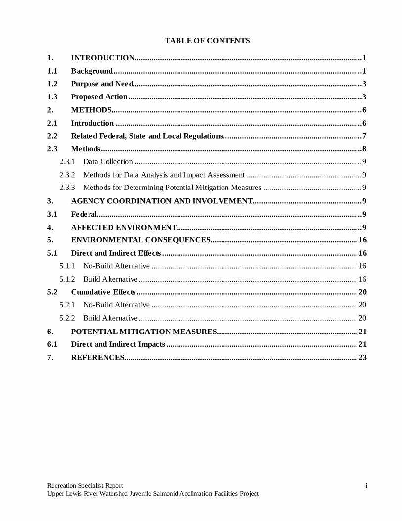
1. INTRODUCTION ............................................................................................................ 1
1.1 Background ...................................................................................................................... 1
1.2 Purpose and Need............................................................................................................. 3
1.3 Proposed Action ............................................................................................................... 3
2. METHODS....................................................................................................................... 6
2.1 Introduction ..................................................................................................................... 6
2.2 Related Federal, State and Local Regulations.................................................................. 7
2.3 Methods ............................................................................................................................ 8
2.3.1 Data Collection ............................................................................................................ 9
2.3.2 Methods for Data Analysis and Impact Assessment ....................................................... 9 2.3.3 Methods for Determining Potential Mitigation Measures ............................................... 9
3. AGENCY COORDINATION AND INVOLVEMENT.................................................... 9
3.1 Federal.............................................................................................................................. 9
4. AFFECTED ENVIRONMENT ........................................................................................ 9
5. ENVIRONMENTAL CONSEQUENCES...................................................................... 16
5.1 Direct and Indirect Effects ............................................................................................. 16
5.1.1 No-Build Alternative .................................................................................................. 16
5.1.2 Build Alternative ........................................................................................................ 16
5.2 Cumulative Effects ......................................................................................................... 20
5.2.1 No-Build Alternative .................................................................................................. 20
5.2.2 Build Alternative ........................................................................................................ 20
6. POTENTIAL MITIGATION MEASURES ................................................................... 21
6.1 Direct and Indirect Impacts ........................................................................................... 21
7. REFERENCES............................................................................................................... 23
Recreation Specialist Report ii Upper Lewis River Watershed Juvenile Salmonid Acclimation Facilities Project
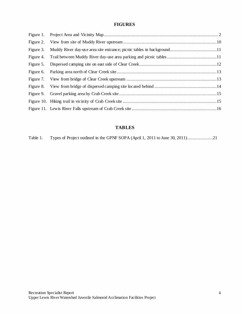
FIGURES
Figure 1. Project Area and Vicinity Map.......................................................................................... 2
Figure 2. View from site of Muddy River upstream ..........................................................................10
Figure 3. Muddy River day-us e area site entrance; picnic tables in background.....................................11
Figure 4. Trail between Muddy River day-use area parking and picnic tables .......................................11
Figure 5. Dispersed camping site on east side of Clear Creek .............................................................12
Figure 6. Parking area north of Clear Creek site ...............................................................................13
Figure 7. View from bridge of Clear Creek upstream .......................................................................13
Figure 8. View from bridge of dispersed camping site located behind .................................................14
Figure 9. Gravel parking area by Crab Creek site .............................................................................15
Figure 10. Hiking trail in vicinity of Crab Creek site ..........................................................................15
Figure 11. Lewis River Falls upstream of Crab Creek site ...................................................................16
TABLES
Table 1. Types of Project outlined in the GPNF SOPA (April 1, 2011 to June 30, 2011) ....................21
Recreation Specialist Report 1 Upper Lewis River Watershed Juvenile Salmonid Acclimation Facilities Project
1. INTRODUCTION This Specialist Report was prepared to meet U.S. Forest Service (USFS) requirements for compliance with the National Environmental Policy Act (NEPA). It provides an analysis of the potential effects associated with the construction, operation, and maintenance of juvenile salmonid acclimation facilities that would be located on lands within the USFS Gifford Pinchot National Forest (GPNF) boundary (the Build alternative). This report compares the potential effects associated with the Build alternative to the potential effects associated with no new action (the No-Build alternative).
1.1 Background The November 2004 Lewis River Settlement Agreement (LRSA) entered into by the Lewis River Project Licensees (PacifiCorp Energy [PacifiCorp], Public Utility District No. 1 of Cowlitz County) and the Lewis River re-licensing stakeholders, of which the USFS is one, requires the establishment of juvenile salmonid acclimation sites in the upper Lewis River watershed to aid the reintroduction of anadromous fish. The Aquatic Coordination Committee (ACC) (technical representatives of the LRSA signatories including the USFS) directs reintroduction and other aquatic resource enhancement projects to be implemented under the LRSA. The LRSA is available for viewing at: http://www.pacificorp.com/content/dam/pacificorp/doc/Energy_Sources/Hydro/Hydro_Licensing/Lewis_River/Lewis_River_Settlement_Agreement_Final.pdf Section 8.8 of the LRSA reads as follows:
8.8 Juvenile Acclimation Sites.
8.8.1 Above Swift No. 1 Dam.
Beginning upon completion of the Swift Downstream Facility, the Licensees shall place juvenile salmonid acclimation sites in areas reasonably accessible to fish hauling trucks and in practical areas in the upper watershed above Swift No. 1 Dam, as determined by the Licensees in Consultation with the Yakama Nation and the ACC [Aquatic Coordination Committee]. The acclimation sites shall consist of fish containment areas that allow juvenile fish to acclimate in natural or semi-natural waterways and allow necessary pre-release juvenile fish management; such sites will not consist of or include concrete-lined ponds or waterways, but may include other concrete structures necessary for facility functionality and structural integrity during the supplementation program.
PacifiCorp is coordinating with the GPNF on facility design and locations for three Lewis River acclimation sites. The three primary sites selected by PacifiCorp and project stakeholders are located on the Muddy River, Clear Creek and the Lewis River at Crab Creek (Figure 1). The Muddy River, Clear Creek, and Crab Creek sites are located on lands within the GPNF and, as such, would require NEPA analysis and a Special Use Permit.
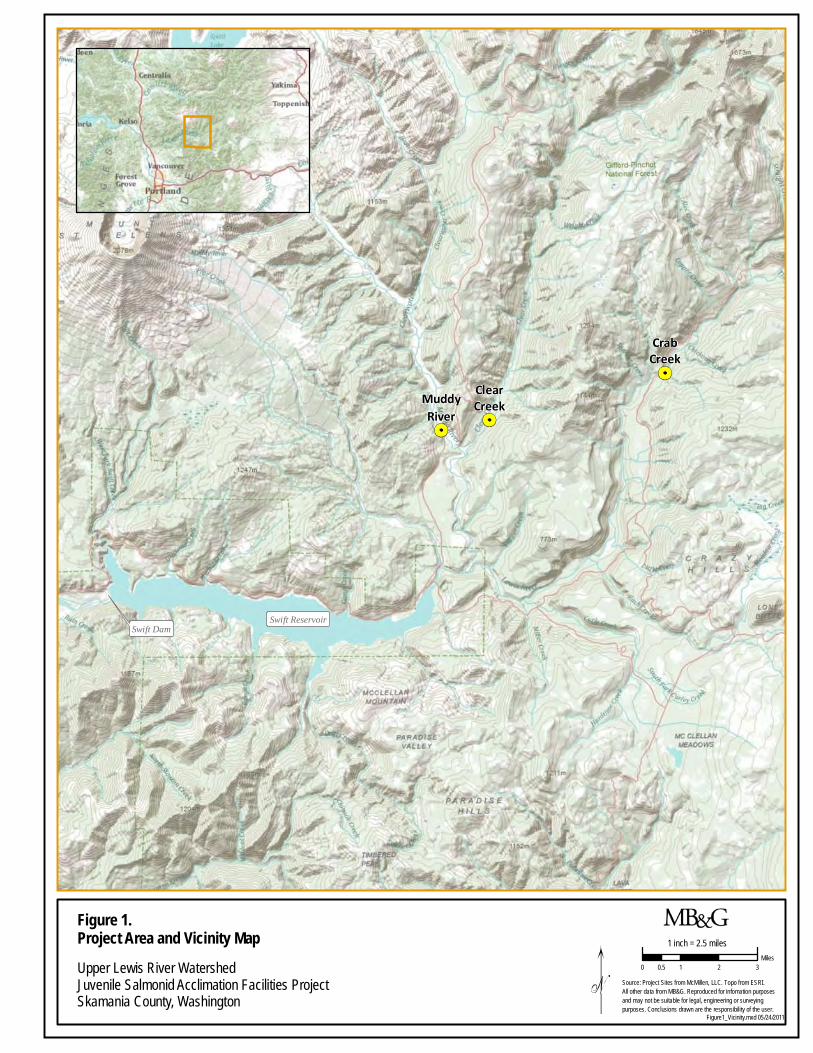
Swift ReservoirSwift Dam
MuddyRiver
ClearCreek
CrabCreek
Source: Project Sites from McMillen, LLC. Topo from ESRI. All other data from MB&G. Reproduced for infomation purposesand may not be suitable for legal, engineering or surveying purposes. Conclusions drawn are the responsibility of the user.
Figure 1. Project Area and Vicinity MapUpper Lewis River WatershedJuvenile Salmonid Acclimation Facilities ProjectSkamania County, Washington
Figure1_Vicinity.mxd 05/24/2011
1 inch = 2.5 miles
0 1 2 30.5Miles
Recreation Specialist Report 3 Upper Lewis River Watershed Juvenile Salmonid Acclimation Facilities Project
1.2 Purpose and Need The purpose of this project is to support reintroduction of anadromous fish in the Upper Lewis River watershed, upstream of Swift Dam. A program to supplement natural spawning is outlined in Section 8.5.1 of the LRSA, which states that, for the purpose of supplementation, Licensees are to provide for the transport of juvenile spring Chinook (Oncorhynchus tshawytscha) and steelhead (Oncorhynchus mykiss) for a period of 15 years, and coho (Oncorhynchus kisutch) for a period of 9 years; both commencing upon completion of the Swift downstream fish facility pursuant to Section 4.4.1 of the LRSA. After the LRSA was signed, the program was modified by the ACC at a meeting on June 8, 2006 to supplement with spring Chinook salmon only and to allow coho and steelhead to colonize the upper watershed naturally. The ACC decided that coho and steelhead adults will likely successfully seed the watershed without additional juvenile supplementation. Supplementation of juvenile spring Chinook salmon may continue beyond the 15-year timeframe depending on the success of the overall reintroduction program.
1.3 Proposed Action The proposed action is the granting of a Special Use Permit to PacifiCorp by the GPNF. The GPNF would grant the Special Use Permit for the project under the direction of the GPNF Plan, as amended by the Northwest Forest Plan. The permit would cover the proposed project which consists of the construction of juvenile salmonid acclimation facilities on lands located within the GPNF boundary. The proposed project area is located in the Upper Lewis River watershed. The following three sites were determined to be biologically and physically suitable for this project by PacifiCorp and the ACC. The proposed construction, maintenance and operation of the proposed projects at these three sites comprise the Build alternative. Muddy River. The Muddy River site is located on GPNF land approximately 5 miles upstream of the confluence with Lewis River and just upstream of the Forest Road 25 bridge crossing. There is a picnic site, the Muddy River Viewpoint, at this location that would provide paved parking and access to the site. This section of the Muddy River has a remnant natural side-channel that passes seepage flow to the Muddy River just upstream of the bridge. The banks of the existing channel are lined with trees and the center of the channel has boulder, gravel and large woody debris (LWD) components already in place. Site construction would modify the channel on the upper end to provide some pass-through water from the main Muddy River using an infiltration gallery located in the bottom of the river and an underground pipeline. The upstream and downstream ends of the acclimation channel would have screened concrete inlet and outlet structures to allow for the containment of the juvenile salmonids in the ponded area. Water would be conveyed from the upper intake to the acclimation pond via an underground pipeline. The acclimation channel would require excavation to provide a constant gradient to the Muddy River for release of the juvenile salmon, and to prevent stranding. The acclimation channel would be maintained in as natural a state as possible with minimal vegetation clearing. The channel would be sized to hold a maximum of 125,000 spring Chinook pre-smolts at about 20-25 fish per pound. Construction. The Muddy River acclimation channel would be constructed between July 5th and October 31st, 2012. All in-water work would be completed between July 15th and August 31st, 2012. There would be no noise-producing activities related to construction prior to July 15th. Activities between July 5th and July 15th would consist only of normal vehicle noise on the roadway consistent with background noise levels as construction materials are dropped off at the site. The picnic site
Recreation Specialist Report 4 Upper Lewis River Watershed Juvenile Salmonid Acclimation Facilities Project
would be used as a construction staging area and closed during construction. A variety of construction equipment would be used during the construction phase including excavators, skid steers, backhoes, dump trucks, and additional small equipment. Construction activities would occur within the Muddy River and within the remnant natural side-channel and adjacent uplands. Maintenance and Operations
. Operation of the Muddy River site would commence in the spring of 2013 and continue annually. Operations would consist of a seasonal start-up, daily operations, and end of season shut-down. Seasonal start-up would commence once the snow level receded sufficiently to allow access to the site, or once the access road has been plowed. Personnel would clean the inlet and outlet structures, remove excess debris from the acclimation channel, backflush the infiltration gallery using a portable motorized pump, and install the screens and stop logs. Personnel would also turn on the water supply and establish flow through the channel.
Daily operations would commence once the fish transport vehicles delivered juvenile Chinook salmon to the acclimation channel via a flexible release pipe extending from the truck parked on the paved day-use parking area. Fish would be placed in the Muddy River acclimation channel sometime between April 1 and May 15 annually and they would be maintained at the site for approximately six weeks. Fish would be fed daily and the acclimation channel intake and outlet structures and pipes would be inspected and maintained. The infiltration gallery would be backflushed as needed during daily operations. The end of season shut-down would be completed once the fish were released from the acclimation channel volitionally via a temporary HDPE pipe outlet laid on top of the ground extending to the river. One week after removal of the screen on the outlet, any fish remaining in the acclimation channel would be coaxed through the outlet using a seine. Screens and stop logs would be removed and transported off-site for cleaning and storage. Structure lids would be closed and locked. Regular maintenance activities would generally be low-noise and non-disruptive to wildlife and there would be minimal vegetation and ground disturbance. Major maintenance activities beyond those associated with normal operations could be needed during the lifetime of the project. These activities could include excavating and repairing the infiltration gallery, pipeline, or structures using an excavator or re-grading the acclimation channel using a skid steer. Clear Creek. The Clear Creek site is located on GPNF land approximately 1.5 miles upstream of the confluence with the Muddy River. This site is located across the river from a dispersed camping site on Forest Road 93. Construction is proposed on the side of the creek opposite the dispersed camping area on the downstream side of the bridge where an active flood side-channel exists. It is anticipated that the site would be excavated to enhance the side-channel gradient. This site would also contain screened concrete inlet and outlet structures. Water would be diverted through the side-channel via a diversion structure consisting of five, three-foot wide boulders and natural streambed material. The channel would be sized to hold 89,000 spring Chinook pre-smolts at about 20-25 fish per pound. Construction. The Clear Creek acclimation channel would be constructed between July 5th and October 31st, 2012. All in-water work would be completed between July 15th and August 31st, 2012. There would be no noise-producing activities from construction prior to July 15th. Activities between July 5th and July 15th would consist only of normal vehicle noise on the roadway consistent with background noise levels as construction materials are dropped off at the site. The dispersed camping site across the river from the proposed acclimation channel would be used as a construction staging
Recreation Specialist Report 5 Upper Lewis River Watershed Juvenile Salmonid Acclimation Facilities Project
area and closed during construction. A variety of construction equipment would be used during the construction phase including excavators, skid steers, backhoes, dump trucks, and additional small equipment. Construction activities would occur within the active natural flood side-channel of Clear Creek and on adjacent uplands. Maintenance and Operations
. Operation of the Clear Creek site would commence in the spring of 2013. Operations would consist of a seasonal start-up, daily operations, and end of season shut-down. Seasonal start-up would commence once the snow level receded sufficiently to allow access to the site, or once the access road has been plowed. Personnel would clean the inlet and outlet structures, remove excess debris from the acclimation channel, install the screens and stop logs, and establish flow through the channel.
Daily operations would commence once the fish transport vehicles delivered juvenile Chinook salmon to the acclimation channel via a flexible release pipe extending from the truck parked on the paved road. Fish would be placed in the Clear Creek acclimation channel sometime between April 1 and May 15 annually, and they would be maintained at the site for approximately six weeks. Fish would be fed daily and the acclimation channel intake and outlet structures and pipes would also be inspected and maintained daily. The end of season shut-down would be completed once the fish were released from the acclimation channel volitionally either directly following removal of the stop logs or through an HDPE pipe extending from the acclimation pond outlet to the creek. One week after removal of the screen on the outlet, any fish remaining in the acclimation channel would be coaxed through the outlet using a seine. Screens and stop logs would be removed and transported off-site for cleaning and storage. Structure lids would be closed and locked. Regular maintenance activities would generally be low-noise and non-disruptive to wildlife and there would be minimal vegetation and ground disturbance. Major maintenance activities beyond those associated with normal operations could be needed during the lifetime of the project. These activities could include excavating and repairing the intake or re-grading the acclimation channel using excavators. Crab Creek. The Crab Creek site is located on GPNF land at the mouth of Crab Creek as it discharges into the Lewis River, approximately 100 feet upstream of the Forest Road 90 bridge crossing. A natural depression at the mouth of Crab Creek forms a side pool to the Lewis River. The pool receives direct flow from Crab Creek and hyporheic flow from the Lewis River. Site construction would involve deepening and widening the existing pool to form an “instream acclimation pond”, such that Lewis River water would infiltrate the gravel at the top end of the pond and flow out the downstream end. Crab Creek water would also continue to enter the ponded area. A net would be placed at the bottom outlet to hold fish for two to six weeks. The pond would be sized to hold 15,000 spring Chinook pre-smolts at about 25 fish per pound. Depending on performance, acclimation would continue at this site for at least 15 years. If this site proves unsuccessful, the same number of pre-smolts and additional adult fish may be directly released into the mainstem Lewis River, at or near the Crab Creek confluence. Approval from the ACC would be required prior to the direct release of fish into the Lewis River.
Recreation Specialist Report 6 Upper Lewis River Watershed Juvenile Salmonid Acclimation Facilities Project
Construction
. The Crab Creek instream acclimation pond would be constructed between July 5th and September 15th, 2012. All in-water work would be completed between July 15th and August 31st , 2012. There would be no noise-producing activities prior to July 15th. Activities between July 5th and July 15th would consist only of normal vehicle noise on the roadway as construction materials are dropped off at the site. The existing off-road gravel parking area at this site would be used as a construction staging area and closed during construction. A variety of construction equipment would be in use during the construction phase including a track excavator, a vibratory plate compactor, a dump truck, and additional small equipment. Construction activities would occur within Crab Creek, the Lewis River, and on adjacent uplands. Construction equipment will access the acclimation pond via a temporary road adjacent to the east side of the bridge. Existing vegetation will be salvaged, protected, and replanted in this area after construction is complete.
Maintenance and Operations
. Operation of the Crab Creek site would commence in the fall of 2013. Operations would consist of a seasonal start-up, daily operations, and end of season shut-down. Seasonal start-up would commence immediately following Labor Day. Personnel would clean excess debris from the pond, verify that the pond boulders are secure, and place a net at the bottom outlet of the instream acclimation pond to hold fish for the acclimation period.
Daily operations would commence once the fish transport vehicles delivered juvenile Chinook salmon to the instream acclimation pond via a flexible release pipe extending from the truck parked on the paved road or bridge. Fish would be placed at the Crab Creek site immediately following Labor Day and released by October 15th. Fish would be fed daily and the instream acclimation pond would be inspected and maintained daily during the fish acclimation period. The end of season shut-down would be completed once the fish were released from the instream acclimation pond. Fish would be volitionally released into the Lewis River by removing the net on the pond outlet. One week after removal of the net on the outlet, any fish remaining in the instream acclimation pond would be coaxed through the outlet using a seine. If the Lewis River experiences elevated flows during the fish acclimation period which causes water to flow over the pond berm, the fish will be released naturally and the acclimation period will end. Regular maintenance activities would generally be low-noise and non-disruptive to wildlife and there would be minimal vegetation and ground disturbance. Major maintenance activities beyond those associated with normal operations could be needed during the lifetime of the project. These activities could include excavating sand and gravel deposited by high flow events and repairing the pond walls using excavators.
2. METHODS
2.1 Introduction All three of the proposed project sites are located in the Lewis Late Successional Reserve and have been used historically for timber production and recreation by the general public. Recreational activities in the area include fishing, hiking, hunting, wildlife viewing, boating, and camping. The following section describes the regulations related to evaluating the proposed project’s effect on recreation and the process by which effects were assessed.
Recreation Specialist Report 7 Upper Lewis River Watershed Juvenile Salmonid Acclimation Facilities Project
2.2 Related Federal, State and Local Regulations Implementation of the Project is governed by Federal laws due to the proposed location of the project on USFS land. The National Environmental Policy Act The NEPA provides an interdisciplinary framework for Federal agencies to ensure that potential impacts to the human environment are taken into account in Federal decision-making. Recreational opportunities are one aspect of the human environment. The USFS has determined that an Environmental Assessment (EA) will be prepared to assess the potential impacts of the proposed acclimation facilities. The EA will identify and disclose whether the proposed project has significant environmental impacts. National Forest Management Act The National Forest Management Act (NFMA) requires the Secretary of Agriculture to manage the national forests for mixed uses, with recreation being one type of use. USFS policies on recreation and related resource management are described in Series 2000 (National Forest Resource Management) of the USFS Manual. Chapter 2330 of the Forest Service Manual establishes three specific objectives for Publicly Managed Recreation Opportunities:
1. “To maximize opportunities for visitors to know and experience nature while engaging in outdoor recreation.
2. To develop and manage sites consistent with the available natural resources to provide a safe, healthful, aesthetic, non-urban atmosphere.
3. To provide a maximum contrast with urbanization at National Forest System sites.” (USFS, 2006a)
Chapter 2350 establishes the following objectives regarding Trails, River and Similar Recreation Opportunities:
1. “Provide recreation-related opportunities for responsible use of national forests and national grasslands.
2. Provide opportunities for a variety of recreational pursuits, with emphasis on activities that harmonize with the natural environment and are consistent with the applicable land management plan.
3. Mitigate adverse impacts of recreational uses on natural, cultural, and historical resources and on other uses through education, outdoor ethics programs, and on-the-ground management, including law enforcement and restoration.” (USFS, 2009)
Individual land and resource management plans (Forest Plans) are required by the NFMA for each National Forest. The Forest Plans establish specific land management “allocations,” identify goals and objectives, and outline standards and guidelines. Each management unit is assigned a Recreation Opportunity Spectrum (ROS) classification that identifies the type of recreational experience that the area should be managed to provide.
Recreation Specialist Report 8 Upper Lewis River Watershed Juvenile Salmonid Acclimation Facilities Project
Gifford Pinchot Forest Plan The Gifford Pinchot Forest Plan was first developed in 1990. A significant amendment to the Gifford Pinchot Forest Plan was conducted in 1995 to incorporate the strategies outlined in the Northwest Forest Plan, which was completed in 1994. The Gifford Pinchot Forest Plan and accompanying maps identify all three of the proposed anadromous fish-acclimation sites within a Scenic Rivers (NA) management area. As such, the ROS classification assigned to this area is Roaded Natural (USFS, 1995).
Wild and Scenic Rivers Act The National Wild and Scenic Rivers Act preserves and protects certain free-flowing rivers and their immediate environments for the enjoyment of present and future generations. Rivers, and river segments, are selected for designation in the National Wild and Scenic Rivers System based on outstandingly remarkable values (ORVs) that may include scenic, recreational, geologic, fish and wildlife, historic, cultural or other similar values (Wild and Scenic Rivers Act, 1968). Rivers can be designated by Congress or by the Secretary of the Interior following application by a state governor. Rivers in the National Wild and Scenic Rivers System are classified as Wild, Scenic, and/or Recreational based on the level of access and amount of development along the river area (Interagency Wild and Scenic Rivers Coordinating Council, 2006). When on federal lands, protective management of the river and its immediate environment begins upon determination that the river is eligible for designation. This proactive management includes not impeding the free-flowing character of the river, protecting the ORVs that contribute to the river’s eligibility, and ensuring that development does not jeopardize the river’s tentative classification as wild, scenic, or recreational (Interagency Wild and Scenic Rivers Coordinating Council, 2006). Within a National Forest, the USFS is responsible for the protection of designated and eligible Wild and Scenic Rivers. Section 7 of the Act specifically prohibits federal agencies from assisting (i.e., licensing, permitting, funding) in the construction of any water resources project that would have a “direct and adverse” effect on a designated river’s ORVs. It also prohibits federal agencies from assisting projects outside the designated river’s corridor that would “invade the area or unreasonably diminish the scenic, recreational, and fish and wildlife values present in the area on the date of designation...” (Wild and Scenic Rivers Act, 1968). Water resources projects are defined as “any dam, water conduit, reservoir, powerhouse, transmission line, or other project works under the Federal Power Act (41 Stat. 1063) as amended, or other construction of developments which would affect the free-flowing characteristics of a Wild and Scenic River or Study River,” (36CFR297.3) and may also include fisheries habitat and watershed restoration/enhancement projects that are federally assisted (Interagency Wild and Scenic Rivers Coordinating Council, 2006).
2.3 Methods This Specialist Report is based on information regarding the proposed project and recreation use and management within the GPNF. A review of available data and an assessment of the proposed project’s effects on recreation was conducted in May 2011. Additional detail on the data and methods used to assess effects to recreation under the Build and No-Build alternatives is provided in the following sections.
Recreation Specialist Report 9 Upper Lewis River Watershed Juvenile Salmonid Acclimation Facilities Project
2.3.1 Data Collection Sixty percent design and construction plans for the proposed project were obtained and discussed with PacifiCorp’s engineering consultant, McMillen, LLC. Information provided in the Lewis River Acclimation Ponds State Environmental Policy Act (SEPA) Checklist and Joint Aquatic Resource Permit Application (JARPA) prepared by McMillen, LLC (McMillen LLC, 2011a) served as additional sources of information about the proposed project. GIS data from the online GPNF GIS Data Dictionary and the Gifford Pinchot Forest Plan were accessed to identify the type of management area in which the proposed project sites are located as well as the recreational sites in the surrounding area. Data on recreational demand were also obtained from the National Visitor Monitoring Survey (NVUM), and the states of Washington and Oregon.
2.3.2 Methods for Data Analysis and Impact Assessment Elements of the proposed project with the potential to affect recreation sites and the experience of recreationists were identified based on the project design. These impacts were then assessed in the context of local demand for outdoor recreational opportunities and site supply. In addition, as the proposed project would occur within a Scenic Rivers management area, the effects of the proposed project were assessed in terms of the USFS standards for a Roaded Natural ROS class.
2.3.3 Methods for Determining Potential Mitigation Measures Potential mitigation measures were determined based on the identification of direct effects to recreationists and the factors that define a Roaded Natural ROS class.
3. AGENCY COORDINATION AND INVOLVEMENT
3.1 Federal As a signatory to the LRSA and member of the ACC, the USFS has been actively involved in the development of the proposed project from its outset. USFS personnel reviewed the 60% design plans (McMillen LLC, 2011b; McMillen LLC, 2011c; McMillen LLC, 2011d) for the proposed project in May 2011 and provided feedback to PacifiCorp regarding final design.
4. AFFECTED ENVIRONMENT
4.1 Gifford Pinchot National Forest The GPNF is a popular recreational area for residents of Washington and the Portland metropolitan area in northwest Oregon. According to the 2006 NVUM survey, 1.4 million people visited GPNF in 2006 (USFS, 2011a). Among all the GPNF Late Successional Reserve areas, there are five designated picnic sites, twelve campgrounds, and multiple dispersed camping sites (USFS, 2005). Within the Lewis Late Successional Reserve portion of the GPNF alone, there are 33 trails totaling 94 miles (USFS, 1997). The primary access for recreationists to access the Lewis Late Successional Reserve is via National Forest Roads 25, 51, and 90. There is high demand in both Washington and Oregon for outdoor recreation opportunities. In Washington State, walking and hiking were the most popular outdoor recreational activities according to a 2006 survey about outdoor recreation, with an estimated 4,567,000 residents taking part in those activities (RCO, 2007). A 2007 survey about all types of recreation conducted for the Washington State Comprehensive Outdoor Recreation Plan (SCORP) also found walking and hiking to be the most popular recreational activities (RCO, 2008). Both the 2007 and 2006 surveys found that nature activities and picnicking were the third and fourth most popular forms of recreation,
Recreation Specialist Report 10 Upper Lewis River Watershed Juvenile Salmonid Acclimation Facilities Project
respectively, while water activities such as boating were ranked sixth in popularity (RCO, 2007). A 2003 survey in Oregon found that after driving/sightseeing for pleasure, nature/wildlife observation was the most common form of outdoor recreation among residents of the Portland metro area (Oregon Parks and Recreation Department, 2003). Walking for pleasure, hiking, and running/walking for exercise were also very popular forms of outdoor recreation among residents of the Portland metro area (Oregon Parks and Recreation Department, 2003).
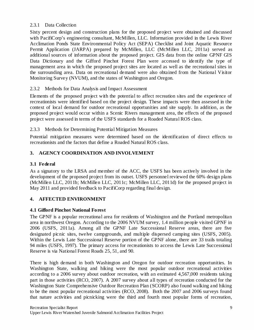
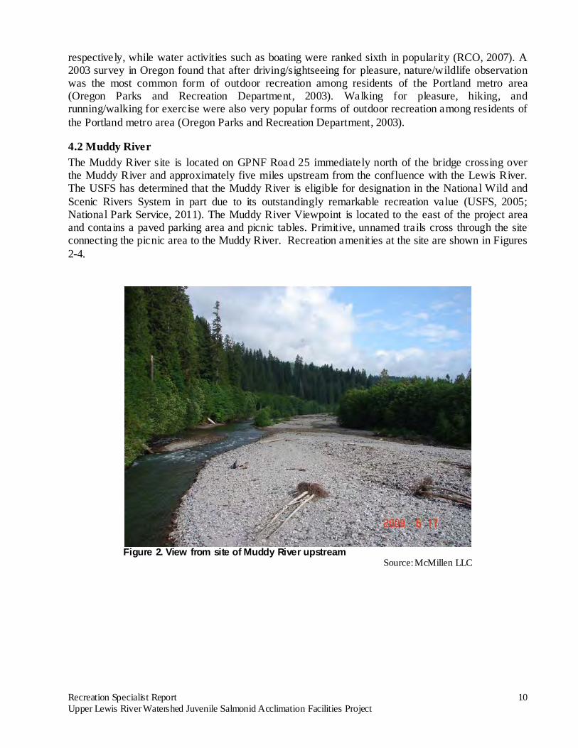
4.2 Muddy River The Muddy River site is located on GPNF Road 25 immediately north of the bridge crossing over the Muddy River and approximately five miles upstream from the confluence with the Lewis River. The USFS has determined that the Muddy River is eligible for designation in the National Wild and Scenic Rivers System in part due to its outstandingly remarkable recreation value (USFS, 2005; National Park Service, 2011). The Muddy River Viewpoint is located to the east of the project area and contains a paved parking area and picnic tables. Primitive, unnamed trails cross through the site connecting the picnic area to the Muddy River. Recreation amenities at the site are shown in Figures 2-4.
Figure 2. View from site of Muddy River upstream
Source: McMillen LLC
Recreation Specialist Report 11 Upper Lewis River Watershed Juvenile Salmonid Acclimation Facilities Project
Figure 3. Muddy River Viewpoint site entrance; picnic tables in background
Source: McMillen LLC
Figure 4. Trail between Muddy River Viewpoint parking and picnic tables
Source: McMillen LLC
Recreation Specialist Report 12 Upper Lewis River Watershed Juvenile Salmonid Acclimation Facilities Project
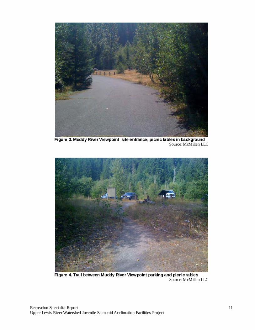
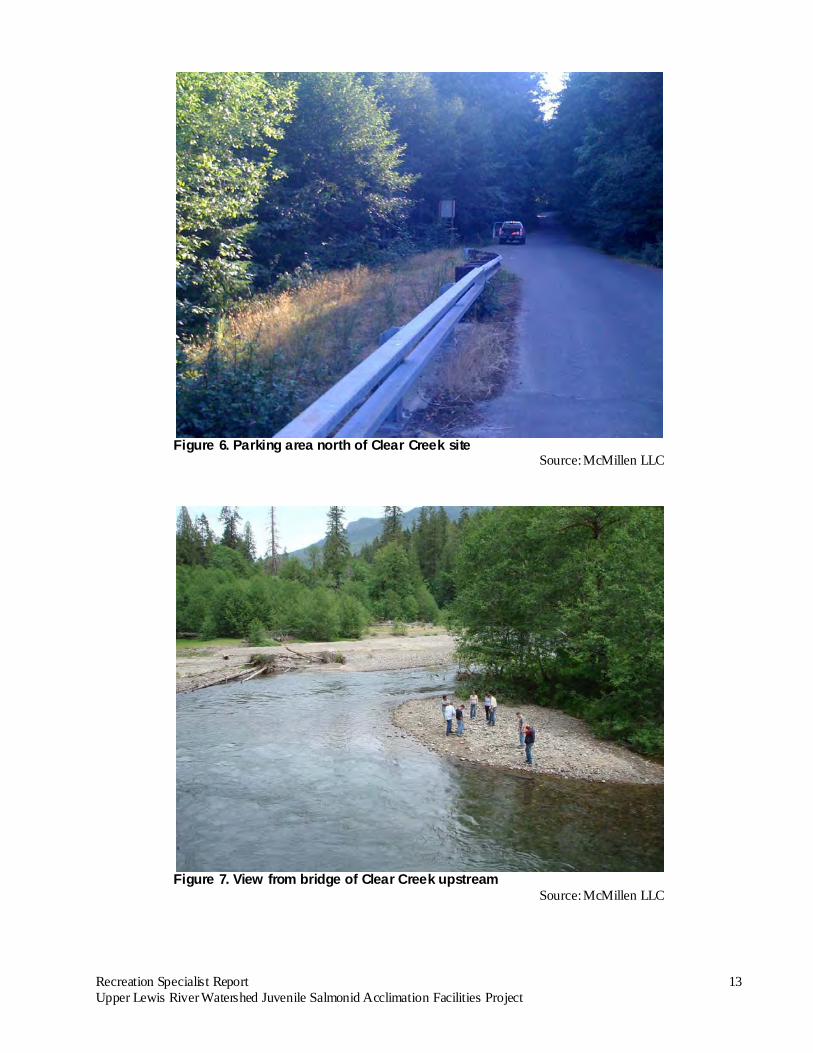
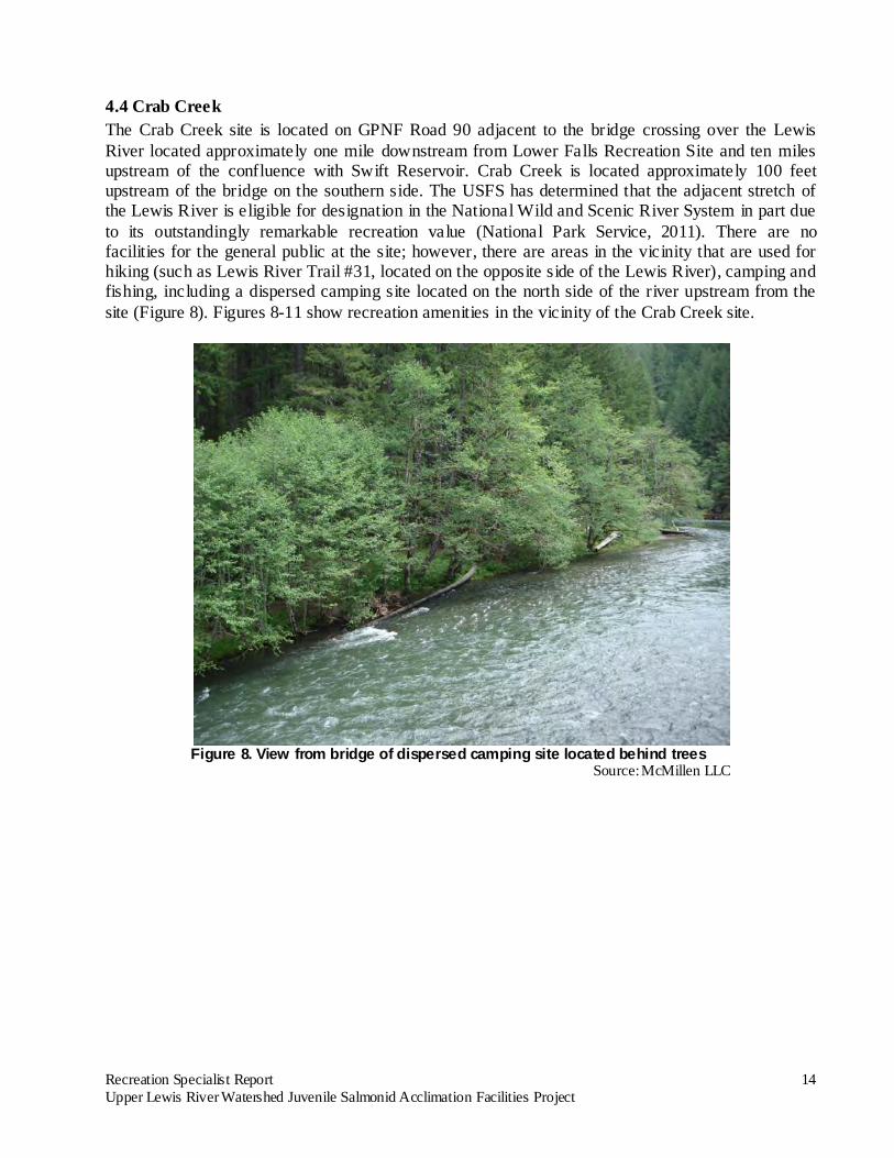
4.3 Clear Creek The Clear Creek site is located on GPNF Road 93 immediately south of the bridge crossing over Clear Creek and approximately 1.5 miles upstream of the confluence with the Muddy River. The site is located on the west side of the creek. The USFS has determined that this portion of the creek is eligible for designation in the National Wild and Scenic Rivers System in part due to its outstandingly remarkable recreation value (USFS, 1995; National Park Service, 2011). There are no facilities at the site for the general public. There are areas in the vicinity that are used for camping and fishing, including a dispersed camping site located on the east side of the Creek (Figure 5). Campers also set up tents along the gravel bars of Clear Creek (Haspiel, 2012). Relative to other areas in the GPNF, the dispersed camping opportunities in this area are not extensive (Uyesugi, 2012); however, it is perhaps the most popular camping area within the Mount St. Helens District (Haspiel, 2012). Figure 6 shows the parking area north of the site and Figure 7 shows an area on Clear Creek north of the bridge.
Figure 5. Dispersed camping site on east side of Clear Creek
Source: McMillen LLC
Recreation Specialist Report 13 Upper Lewis River Watershed Juvenile Salmonid Acclimation Facilities Project
Figure 6. Parking area north of Clear Creek site
Source: McMillen LLC
Figure 7. View from bridge of Clear Creek upstream
Source: McMillen LLC
Recreation Specialist Report 14 Upper Lewis River Watershed Juvenile Salmonid Acclimation Facilities Project
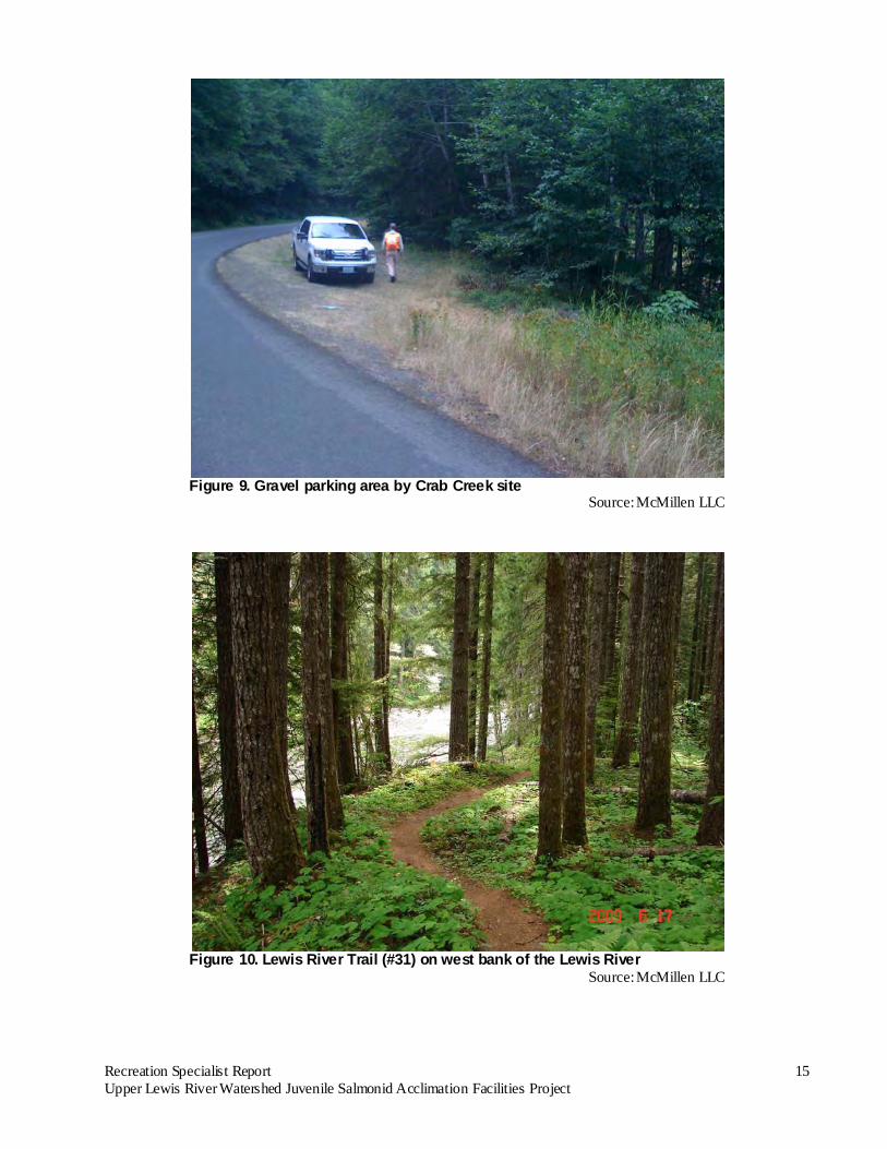
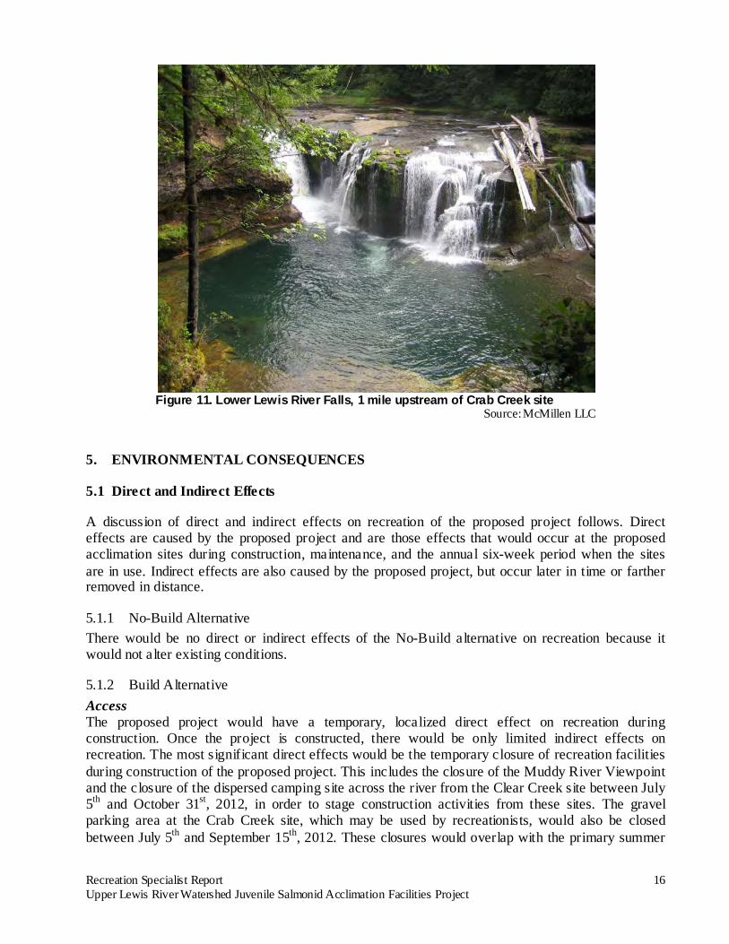
4.4 Crab Creek The Crab Creek site is located on GPNF Road 90 adjacent to the bridge crossing over the Lewis River located approximately one mile downstream from Lower Falls Recreation Site and ten miles upstream of the confluence with Swift Reservoir. Crab Creek is located approximately 100 feet upstream of the bridge on the southern side. The USFS has determined that the adjacent stretch of the Lewis River is eligible for designation in the National Wild and Scenic River System in part due to its outstandingly remarkable recreation value (National Park Service, 2011). There are no facilities for the general public at the site; however, there are areas in the vicinity that are used for hiking (such as Lewis River Trail #31, located on the opposite side of the Lewis River), camping and fishing, including a dispersed camping site located on the north side of the river upstream from the site (Figure 8). Figures 8-11 show recreation amenities in the vicinity of the Crab Creek site.
Figure 8. View from bridge of dispersed camping site located behind trees
Source: McMillen LLC
Recreation Specialist Report 15 Upper Lewis River Watershed Juvenile Salmonid Acclimation Facilities Project
Figure 9. Gravel parking area by Crab Creek site
Source: McMillen LLC
Figure 10. Lewis River Trail (#31) on west bank of the Lewis River
Source: McMillen LLC
Recreation Specialist Report 16 Upper Lewis River Watershed Juvenile Salmonid Acclimation Facilities Project
Figure 11. Lower Lewis River Falls, 1 mile upstream of Crab Creek site
Source: McMillen LLC
5. ENVIRONMENTAL CONSEQUENCES
5.1 Direct and Indirect Effects
A discussion of direct and indirect effects on recreation of the proposed project follows. Direct effects are caused by the proposed project and are those effects that would occur at the proposed acclimation sites during construction, maintenance, and the annual six-week period when the sites are in use. Indirect effects are also caused by the proposed project, but occur later in time or farther removed in distance.
5.1.1 No-Build Alternative There would be no direct or indirect effects of the No-Build alternative on recreation because it would not alter existing conditions.
5.1.2 Build Alternative Access The proposed project would have a temporary, localized direct effect on recreation during construction. Once the project is constructed, there would be only limited indirect effects on recreation. The most significant direct effects would be the temporary closure of recreation facilities during construction of the proposed project. This includes the closure of the Muddy River Viewpoint and the closure of the dispersed camping site across the river from the Clear Creek site between July 5th and October 31st, 2012, in order to stage construction activities from these sites. The gravel parking area at the Crab Creek site, which may be used by recreationists, would also be closed between July 5th and September 15th, 2012. These closures would overlap with the primary summer
Recreation Specialist Report 17 Upper Lewis River Watershed Juvenile Salmonid Acclimation Facilities Project
recreation season. These temporary closures would limit outdoor recreation opportunities at one developed site (Muddy River Viewpoint) out of 17 similar sites (picnic and campground areas in Late Successional Reserves) and at one undeveloped site within the context of the entire GPNF. Visitors will not be permanently displaced as a result of the proposed action and no new access roads will be created. The effects to recreation are anticipated to be minor, temporary and limited to the immediate proposed project locations.
Recreationists displaced from the Muddy River Viewpoint and the dispersed camping site on Clear Creek during the 2012 summer construction periods would potentially travel Forest Road 90 to utilize sites on the North Fork of the Lewis River (Uyesugi, 2012). Individuals looking for an alternative picnic site might choose the Pine Creek Visitor’s Center or the pullout at P ine Creek Boulder (Haspiel, 2012). The Clear Creek dispersed camping site can accommodate two groups at a time and is heavily used in the summer (Haspiel, 2012). Campers displaced from the Clear Creek site may use two other dispersed camping sites in the vicinity that are not heavily used: a site on a turnoff located halfway between Forest Road 93 and 25 and a site that is approximately 450 feet west of the Clear Creek bridge on the north side of the road (Haspiel, 2012). As noted above, campers also set up tents on the gravel bars of Clear Creek (Haspiel, 2012).
There would also be direct, temporary access impacts to recreationists traveling past the Clear Creek and Crab Creek sites on Forest Roads 93 and 90. During construction at these two sites, the contractor would close one lane of traffic and direct motorists with flaggers. This impact would be minimal as one lane of travel would be kept open at all times and delays would not exceed 15 minutes.
During operation of the project, there would potentially be direct impacts to recreationists’ access to Forest Roads 93 and 90 in the spring when PacifiCorp may plow these roads to commence activities at the Clear Creek and Crab Creek sites. Plowing would provide access during times when seasonal conditions would otherwise keep the roads closed, thereby extending the recreation season in certain areas of the GNFP. Pedestrian access to the Muddy River from the picnic area would also be directly affected for approximately six weeks each year. When the acclimation channel is conveying flow it would cross an existing unnamed trail to the Muddy River from the picnic area causing recreationists to walk around the flowing acclimation channel. All other hiking trails in the area would remain unaffected.
Noise Noise associated with construction is a direct effect that would impact visitor’s enjoyment of recreational activities (e.g., hiking, fishing, and hunting) in the area. Escaping the noise of urban areas is a primary reason why people visit outdoor recreation environments, and sounds that interfere with that experience are considered annoying (Kariel, 1990). Maintenance activities that generate noise would be necessary periodically following the construction of the project. However, the project would not produce lasting noise that would affect recreation during fish-acclimation periods or periods of project dormancy.
Boating Opportunities PacifiCorp has applied for a water right to divert up to 3 cfs of water from the Muddy River between April 1 and May 15 each year the acclimation channel is in operation. Diversion of 3 cfs from the Muddy River represents approximately 0.35% of the mean annual flow and approximately 0.24% of the mean flows between April 1 and May 15. Under the lowest flow conditions on record, the 3 cfs
Recreation Specialist Report 18 Upper Lewis River Watershed Juvenile Salmonid Acclimation Facilities Project
withdrawal represents just 0.48% to 0.70% of flows in the Muddy River (MB&G, 2011a). Given the low percentage of stream flow that the project would divert from the Muddy River, there would be no adverse effect on the opportunity to boat on the Muddy River.
PacifiCorp has applied for a water right to divert up to 3 cubic feet per second (cfs) of water for operation of the acclimation pond on Clear Creek. Water would be diverted into the acclimation channel whenever flows in Clear Creek exceeded 25 cfs. It is estimated that Clear Creek has an average annual flow of approximately 287 cfs (MB&G, 2011a). Diversion of 3 cfs from Clear Creek represents approximately 1.04% of the mean annual flow. Based on average water-surface elevations developed using a Hydrologic Engineering Centers River Analysis System (HEC-RAS) one dimensional model (Nelson, 2011), when flows ranging between 25 cfs and 150 cfs are passing adjacent to the site, water depths are less than one foot. Boating conditions are therefore already limited at this stretch of the Creek, and boaters likely only travel this section during higher flow conditions. Given the low percentage of stream flow that the project would divert from Clear Creek, there would be no adverse effect on the existing opportunities to boat on Clear Creek. No water would be diverted from the Lewis River at the Crab Creek site; therefore the proposed project would not adversely affect the opportunity to boat on the Lewis River. Hunting and Fishing Hunting within the GPNF would remain largely unaffected by the proposed project. Areas within the immediate construction activity may be inaccessible in 2012 until after October 31; however all other areas typically accessible to hunters will be available. Elk hunting with modern firearms will be completely unaffected as this hunting season occurs outside the proposed construction activity (November 5th-15th) (WDFW 2011).
Short-term effects to fishing would be temporary, minor and localized to the immediate project area. A long-term indirect effect of the proposed project would opportunities for recreational fishing by increasing populations of anadromous fish in the Upper Lewis River watershed. Roaded Natural ROS class Of the seven factors that contribute to an ROS classification (access, remoteness, naturalness, facilities and site management, social encounters, visitor impacts, and visitor management), remoteness, naturalness, social encounters, and visitor impacts are the indicators that have the potential to be directly affected by the proposed project. The proposed project’s likely effect on each of these factors is described below in the context of the USFS’s standards for a Roaded Natural ROS class.
• Remoteness refers to the perception of being distanced from human development (USFS, 1990). The noise associated with maintenance of the facilities would affect a visitor’s sense of remoteness when visiting the adjacent recreation sites. Remoteness is considered to be of little relevance to the recreation experience afforded by a management area that has a Roaded Natural ROS classification given that, by definition, this type of area has roads that limit remoteness (USFS, 1990).
• The naturalness of a setting is characterized by its Visual Quality Objective (VQO) (USFS, 1990). The VQO for a Scenic Rivers area is Retention, indicating that its existing scenic character should be preserved (USFS, 1995). Although the proposed project would bury the
Recreation Specialist Report 19 Upper Lewis River Watershed Juvenile Salmonid Acclimation Facilities Project
water supply pipe at the Muddy River site and thereby reduce the effect of the structure on the setting, the above ground inlet and outlet structures, and the alteration of the existing side channels to serve as acclimation channels at the Muddy River and Clear Creek would have an effect on the naturalness of the sites. Vegetation clearing at all three sites and the temporary access road at Crab Creek would have temporary impacts to the sites’ naturalness; however, all three sites will be restored to pre-construction condition to the greatest extent practical. It is anticipated that these disturbance activities will not have a permanent effect on the naturalness of the sites.
• The potential for social encounters would increase as a result of personnel accessing the sites for construction and maintenance, as well during the approximately six-week annual fish-acclimation periods when PacifiCorp personnel would travel to and from each acclimation site once a day. “Moderate to high contact on roads and moderate to low contact on trails and developed facilities” is considered the norm in a management area that has a Roaded Natural ROS classification (USFS, 1990). The Muddy River Viewpoint has a capacity of 35 persons at one time and is used by an average of 16.1 visitors a day during the May 1- October 31 season of use (USFS, 2006b). The closure of the Muddy River Viewpoint would temporarily displace these visitors to other areas within GPNF, thereby potentially increasing the concentration of visitors and the number of social encounters.
• Visitor impacts refer to the impact of visitors on the forest environment and the ROS classification provides guidance on the level of site hardening that is appropriate in a given management area (USFS, 1990). Visitors (e.g., hikers, fishers, campers, etc.) are not anticipated to greatly alter the forest environment due to the proposed project. Over time, small increases in fishers utilizing the vicinity may have an indirect impact on this classification; however, “subtle site hardening” is normal and “limited site hardening” is fully compatible with a management area that has a Roaded Natural ROS classification (USFS, 1990).
Outstandingly Remarkable Recreation Resource Values Muddy River, Clear Creek, and Lewis River are eligible for designation in the Wild and Scenic River system in part due to their outstandingly remarkable recreation values. “Fishing, floating, and hunting activities” are noted recreational activities that occur in the vicinity of the proposed project site on the Muddy River (Shank, 1989). As discussed above, the short-term effects on fishing from the proposed project would be temporary, minor and localized; in the long-term, the proposed project would enhance fishing opportunities. The proposed minor diversion on the Muddy River would not adversely affect opportunities for floating. Hunters would not have access to the construction area prior to October 31, 2012 but hunting would otherwise be unaffected by the proposed project. Clear Creek’s outstandingly remarkable recreation value is the solitude offered by the upper section of Clear Creek (JJ’s Forestry Services, 1988). Additional activity levels during construction, maintenance, and the annual fish-acclimation period (approximately six weeks per year) would reduce the opportunity for solitude at the proposed project site. However, this site is adjacent to Forest Road 93 and is not as likely to afford opportunities for solitude as upstream portions of the Creek where the outstanding remarkable values have been noted. Outstandingly remarkable recreational values on the Lewis River include excellent troutfishing and challenging river rafting (USFS, 1995). No water would be diverted from the Lewis River for the proposed project. Therefore, there would be no effect on river rafting. In the short term, bull trout
Recreation Specialist Report 20 Upper Lewis River Watershed Juvenile Salmonid Acclimation Facilities Project
have the potential to be adversely affected by the temporary increases in turbidity and sedimentation associated with construction (MB&G, 2011b). However, in the long-term, adult bull trout would be expected to benefit as a result of increased prey availability in the form of juvenile Chinook salmon (MB&G, 2011b). Therefore, the proposed project is not expected to diminish the troutfishing opportunities that contribute to the Lewis River’s eligibility. In summary, the proposed project would affect factors that contribute to visitors’ recreational experiences. However, with the potential exception of the sites’ naturalness, it would not alter recreation experiences beyond the USFS’s acceptable parameters for a Scenic Rivers management area.
5.2 Cumulative Effects Cumulative effects result from the incremental impact of the proposed project when added to other past, present and reasonably foreseeable future actions, regardless of what agency or person undertakes such other actions.
5.2.1 No-Build Alternative There would be no cumulative effects on recreation from the No-Build alternative because it would not alter existing conditions. Other planned recreation activities in the GPNF would proceed under the No-Build alternative.
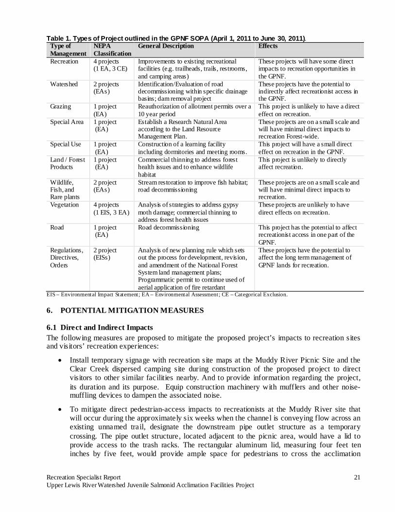
5.2.2 Build Alternative The extent of past, present, and future activities that can potentially add to the proposed project was determined from discussions with GPNF Mount St. Helens District staff and review of the most up-to-date available schedule of proposed actions (SOPA) for the GPNF, which covers the period between April 1, 2011 and June 30, 2011 (USFS, 2011). Staff noted that access to popular dispersed camping sites in the vicinity of the Clear Creek site has been reduced in recent years (Haspiel, 2012; Uyesugi, 2012). Access to dispersed camping from the privately owned Yale IP road, located on the south side of Yale reservoir, was eliminated with the road’s closure in 2010. In 2011, GPNF staff obliterated two roads that had provided access to dispersed camping sites: a road that led to the confluence of Clear Creek and Muddy River and a road on the west side of the Clear Creek bridge that led to the banks of the Creek (Haspiel, 2012). The projects in the SOPA are listed in Table 1. The information available about the activities outlined in this SOPA, which includes four recreation-site improvement projects, coupled with the review of past activities indicates that there would not be any cumulative effects associated with the proposed project that would reach a threshold of significant effect.
Recreation Specialist Report 21 Upper Lewis River Watershed Juvenile Salmonid Acclimation Facilities Project
Table 1. Types of Project outlined in the GPNF SOPA (April 1, 2011 to June 30, 2011). Type of Management
NEPA Classification
General Description Effects
Recreation 4 projects (1 EA, 3 CE)
Improvements to existing recreational facilities (e.g. trailheads, trails, restrooms, and camping areas)
These projects will have some direct impacts to recreation opportunities in the GPNF.
Watershed 2 projects (EAs)
Identification/Evaluation of road decommissioning within specific drainage basins; dam removal project
These projects have the potential to indirectly affect recreationist access in the GPNF.
Grazing 1 project (EA)
Reauthorization of allotment permits over a 10 year period
This project is unlikely to have a direct effect on recreation.
Special Area 1 project (EA)
Establish a Research Natural Area according to the Land Resource Management Plan.
These projects are on a small scale and will have minimal direct impacts to recreation Forest-wide.
Special Use 1 project (EA)
Construction of a learning facility including dormitories and meeting rooms.
This project will have a small direct effect on recreation in the GPNF.
Land / Forest Products
1 project (EA)
Commercial thinning to address forest health issues and to enhance wildlife habitat
This project is unlikely to directly affect recreation.
Wildlife, Fish, and Rare plants
2 project (EAs)
Stream restoration to improve fish habitat; road decommissioning
These projects are on a small scale and will have minimal direct impacts to recreation.
Vegetation 4 projects (1 EIS, 3 EA)
Analysis of strategies to address gypsy moth damage; commercial thinning to address forest health issues
These projects are unlikely to have direct effects on recreation.
Road 1 project (EA)
Road decommissioning This project has the potential to affect recreationist access in one part of the GPNF.
Regulations, Directives, Orders
2 project (EISs)
Analysis of new planning rule which sets out the process for development, revision, and amendment of the National Forest System land management plans; Programmatic permit to continue used of aerial application of fire retardant
These projects have the potential to affect the long term management of GPNF lands for recreation.
EIS – Environmental Impact Statement; EA – Environmental Assessment; CE – Categorical Exclusion.
6. POTENTIAL MITIGATION MEASURES
6.1 Direct and Indirect Impacts The following measures are proposed to mitigate the proposed project’s impacts to recreation sites and visitors’ recreation experiences:
• Install temporary signage with recreation site maps at the Muddy River Picnic Site and the Clear Creek dispersed camping site during construction of the proposed project to direct visitors to other similar facilities nearby. And to provide information regarding the project, its duration and its purpose. Equip construction machinery with mufflers and other noise-muffling devices to dampen the associated noise.
• To mitigate direct pedestrian-access impacts to recreationists at the Muddy River site that will occur during the approximately six weeks when the channel is conveying flow across an existing unnamed trail, designate the downstream pipe outlet structure as a temporary crossing. The pipe outlet structure, located adjacent to the picnic area, would have a lid to provide access to the trash racks. The rectangular aluminum lid, measuring four feet ten inches by five feet, would provide ample space for pedestrians to cross the acclimation
Recreation Specialist Report 22 Upper Lewis River Watershed Juvenile Salmonid Acclimation Facilities Project
channel. Conduct vegetation maintenance activities as needed on newly-established embankments and other disturbed areas and maintain native vegetation to the greatest extent practical to reduce impacts to the naturalness of the sites. Natural succession and diversity of habitat in unmaintained areas would also be encouraged.
• Provide interpretive signage at PacifiCorp’s Eagle Cliff day-use area regarding the upstream fish-acclimation structures and the goal of the reintroducing anadromous fish to the Upper Lewis River watershed to enhance visitors’ experience with the non-natural elements of the sites.
• Issue a press release and sign roads to let visitors know when installation activities are occurring.
• Plantings and other site mitigation mentioned in the report should also be included here. Slash treatment?
• Security of facilities and safety for public?
Recreation Specialist Report 23 Upper Lewis River Watershed Juvenile Salmonid Acclimation Facilities Project
7. REFERENCES Interagency Wild and Scenic Rivers Coordinating Council. 2006. A Compendium of Questions &
Answers Relating to Wild and Scenic Rivers. Revised June 2006. Bureau of Land Management. Washington, D.C.
Haspiel, Adam. 2012. Mount St. Helens National Monument District Fisheries Biologist.
Personal communication with Kate Parker (MB&G) January 11, 2012. JJ’s Forestry Services. 1988. Wild and Scenic River Eligibility Study of Clear Creek on the Gifford
Pinchot National Forest Within Skamania County, Washington. Kariel, H.G. 1990. “Factors Affecting Response to Noise in Outdoor Recreational Environments,”
The Canadian Geographer 34(2), 142-149. Mason, Bruce & Girard (MB&G). 2011a. Water Resources Specialist Report: Upper Lewis River
Watershed Juvenile Salmonid Acclimation Facilities Project. Mason, Bruce & Girard (MB&G). 2011b. Wildlife and Fisheries Biological Evaluation and
Specialist Report Upper Lewis River Watershed Juvenile Salmonid Acclimation Facilities Project.
McMillen, LLC. 2011a. Lewis River Juvenile Salmonid Acclimation Ponds State Environmental
Policy Act (SEPA) Checklist and Joint Aquatic Resources Permit Application (JARPA). McMillen, LLC. 2011b. PacifiCorp Energy Lewis River Crab Creek Acclimation Ponds Volume II-
Preliminary Drawings, ACC Review Submittal. April 2011. McMillen, LLC. 2011c. PacifiCorp Energy Lewis River Clear Creek Acclimation Ponds Volume III-
Preliminary Drawings, ACC Review Submittal. April 2011. McMillen, LLC. 2011d. PacifiCorp Energy Lewis River Muddy River Acclimation Ponds Volume
IV-Preliminary Drawings, ACC Review Submittal. April 2011. National Park Service. Nationwide Rivers Inventory. Accessed May 19, 2011. Available at:
http://www.nps.gov/ncrc/programs/rtca/nri/index.html Nelson, Derek. 2011. Email to Frank Shrier, PacifiCorp. May 20, 2011. Oregon Parks and Recreation Department. 2003. Oregon Statewide Comprehensive Outdoor
Recreation Plan 2003-2007. Available at: http://www.oregon.gov/OPRD/PLANS/scorp_review.shtml
Shank, R. 1989. Green Muddy/Smith Toutle Eligibility Determination.
Recreation Specialist Report 24 Upper Lewis River Watershed Juvenile Salmonid Acclimation Facilities Project
USDA Forest Service and USDI Bureau of Land Management. 2001. Record of Decision and other Standards and Guidelines for Amendments to the Survey and Manage, Protection Buffer, and other Mitigation Measure Standards and Guidelines.
U.S. Forest Service. 2011a. National Visitor Use Monitoring Results. Available
at: http://apps.fs.usda.gov/nrm/nvum/results/Forest.aspx U.S. Forest Service. 2011b. Schedule of P lanned Activities April 1, 2011 to June 30, 2011. Accessed
May 24, 2011. Available at: http://www.fs.fed.us/sopa/components/reports/sopa-110603-2011-04.html
U.S. Forest Service. 2009. Forest Service Manual. “Chapter 2350—Trail, river, and similar
recreation opportunities.” Effective date November 4, 2009. U.S. Forest Service. 2006a. Forest Service Manual. “Chapter 2330—Publicly Managed Recreation
Opportunities.” Effective date May 22, 2006. U.S. Forest Service. 2006b. Recreation Facilities Analysis. U.S. Forest Service. 2005. Gifford Pinchot National Forest Recreation Sites, ESRI Vector Digital
Data. Accessed online May 3, 2011. http://www.fs.fed.us/r6/data-library/gis/gifford-pinchot/index.shtml
U.S. Forest Service. 1997. Late Successional Reserve Assessment. Accessed May 2011 at:
http://www.fs.fed.us/gpnf/04projects/mgtdir/index.shtml U.S. Forest Service. 1995. Gifford Pinchot Forest Plan. Accessed May 2011 at:
http://www.fs.fed.us/gpnf/04projects/mgtdir/index.shtml U.S. Forest Service. 1990. ROS Primer and Field Guide. April 1990. R6-REC-021-90. Washington Department of Fish and Wildlife. 2011. Summary of General Hunting Season Dates.
Available at: http://wdfw.wa.gov/hunting/regulations/summary_hunting_dates.html. Washington State Recreation and Conservation Office (RCO). 2007. 2006 Outdoor Recreation
Survey Final Report. Available at: http://www.rco.wa.gov/documents/rec_trends/2006RecSurveyFull.pdf
Washington State Recreation and Conservation Office (RCO). 2008. Defining and Measuring
Success: The Role of State Government in Outdoor Recreation. A State Comprehensive Outdoor Recreation Planning Document. Available at: http://www.rco.wa.gov/documents/rec_trends/SCORP_2008.pdf
Wild and Scenic Rivers Act of 1968; P.L. 90-542, as amended; (16 U.S.C. 1271-1287, et seq.) Uyesugi, Bill. 2012. Mount St. Helens National Monument District Recreation Staff. Personal
communication with Kate Parker (MB&G). January 10, 2012.