Embed Size (px)
Citation preview
QGIS for Water Utility Management:Getting Started with QGIS for Free
Erik PorseEPA Region 9 Environmental Finance Center (EFC)
Office of Water Programs (OWP) at Sacramento State
August 5, 2020
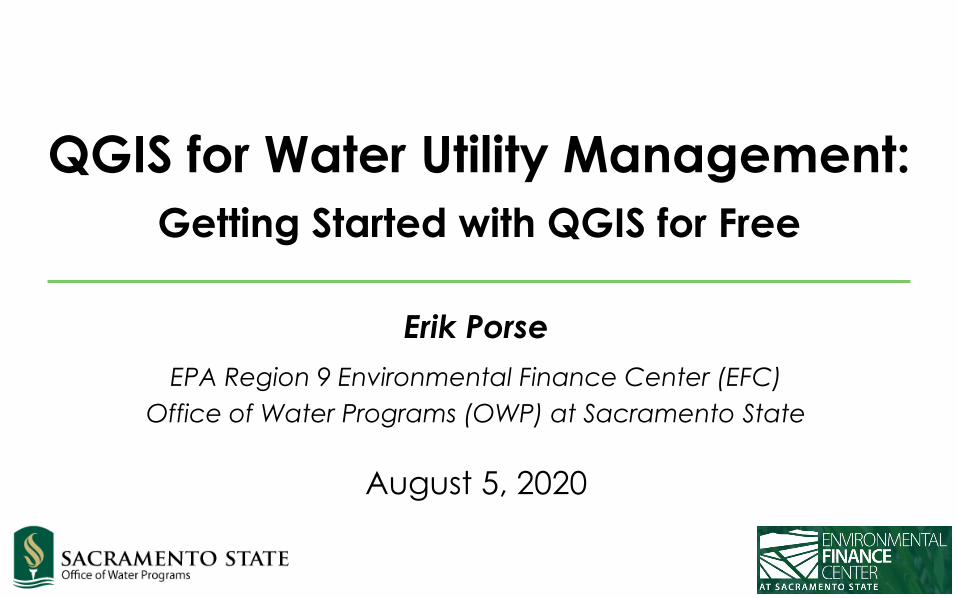
Geographic Information Systems (GIS)
2
• Geographic Information Systems• Software systems for storing and analyzing data with
spatial information
• Many types of GIS• Esri’s ArcGIS is most popular
• Bringing maps to life
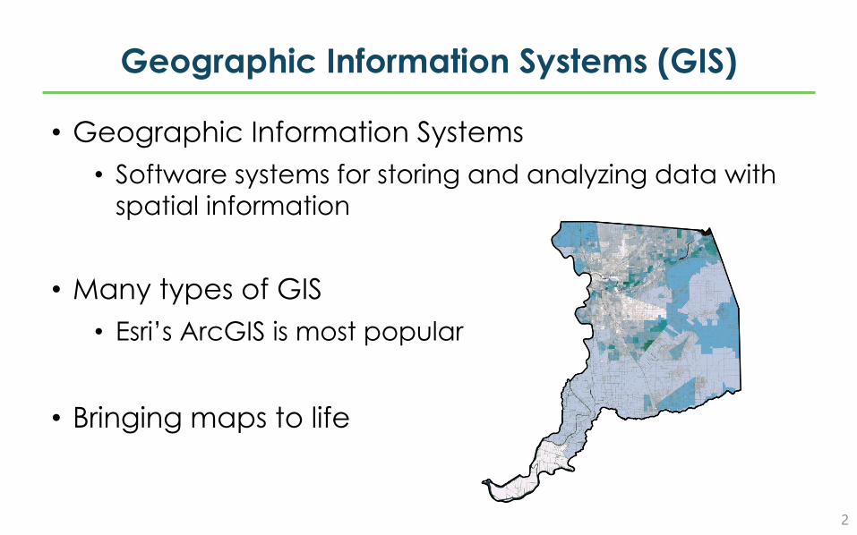
QGIS
3
• A free and open-source version of GIS software• Created over many years by a community of
developers• Under continual improvements
http://qgis.org
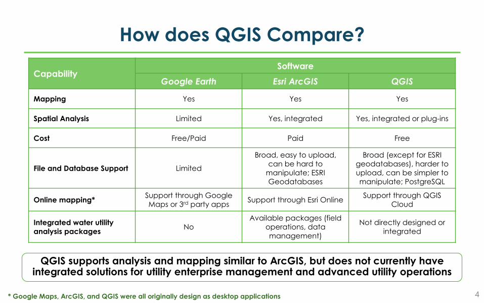
How does QGIS Compare?
4
CapabilitySoftware
Google Earth Esri ArcGIS QGIS
Mapping Yes Yes Yes
Spatial Analysis Limited Yes, integrated Yes, integrated or plug-ins
Cost Free/Paid Paid Free
File and Database Support Limited
Broad, easy to upload, can be hard to
manipulate; ESRI Geodatabases
Broad (except for ESRI geodatabases), harder to upload, can be simpler to manipulate; PostgreSQL
Online mapping* Support through Google Maps or 3rd party apps Support through Esri Online Support through QGIS
Cloud
Integrated water utility analysis packages No
Available packages (field operations, data management)
Not directly designed or integrated
* Google Maps, ArcGIS, and QGIS were all originally design as desktop applications
QGIS supports analysis and mapping similar to ArcGIS, but does not currently have integrated solutions for utility enterprise management and advanced utility operations
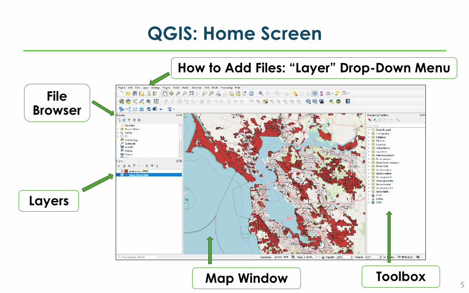
QGIS: Home Screen
5
Layers
File Browser
Map Window
How to Add Files: “Layer” Drop-Down Menu
Toolbox
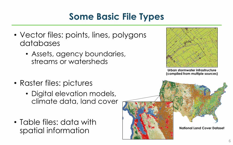
Some Basic File Types
6
• Vector files: points, lines, polygonsdatabases
• Assets, agency boundaries, streams or watersheds
• Raster files: pictures• Digital elevation models,
climate data, land cover
• Table files: data with spatial information National Land Cover Dataset
Urban stormwater infrastructure (compiled from multiple sources)
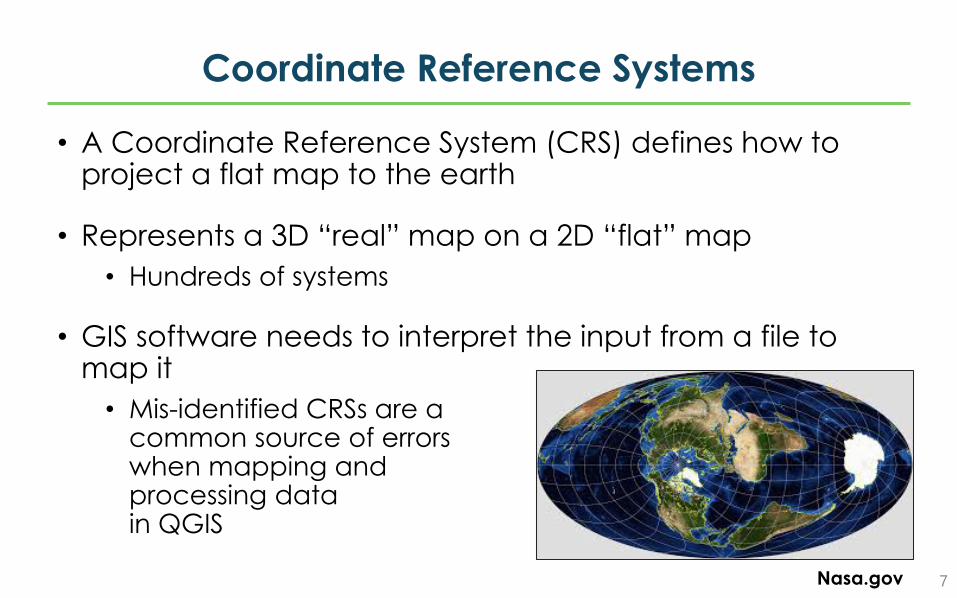
Coordinate Reference Systems
7
• A Coordinate Reference System (CRS) defines how to project a flat map to the earth
• Represents a 3D “real” map on a 2D “flat” map• Hundreds of systems
• GIS software needs to interpret the input from a file to map it
• Mis-identified CRSs are a common source of errors when mapping and processing data in QGIS
Nasa.gov
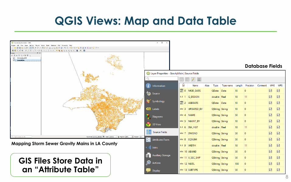
QGIS Views: Map and Data Table
8
Mapping Storm Sewer Gravity Mains in LA County
Database Fields
GIS Files Store Data in an “Attribute Table”
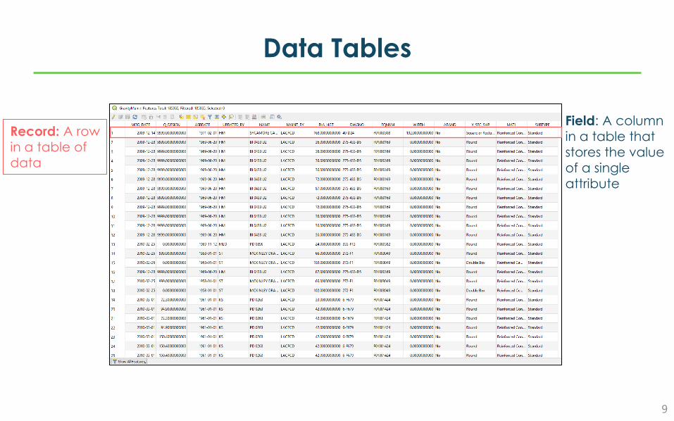
Data Tables
9
Record: A row in a table of data
Field: A column in a table that stores the value of a single attribute
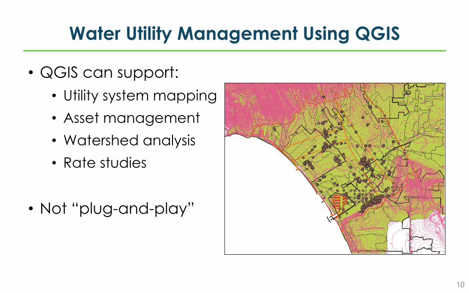
Water Utility Management Using QGIS
10
• QGIS can support:• Utility system mapping• Asset management• Watershed analysis• Rate studies
• Not “plug-and-play”
Add-Ons
11
• QGIS allows its community of developers to build add-on packages for specific needs
• Can become part of the regular functions
• Some recent packages are designed to assist with utility management needs
• Qwater: integration with EPANet, drainage planning• SAGA Terrain Analysis – Hydrology: watersheds• Qfield: Field data collection
Web searches of “QGIS” and keywords for a task can find blogs and posts with solutions from the QGIS community
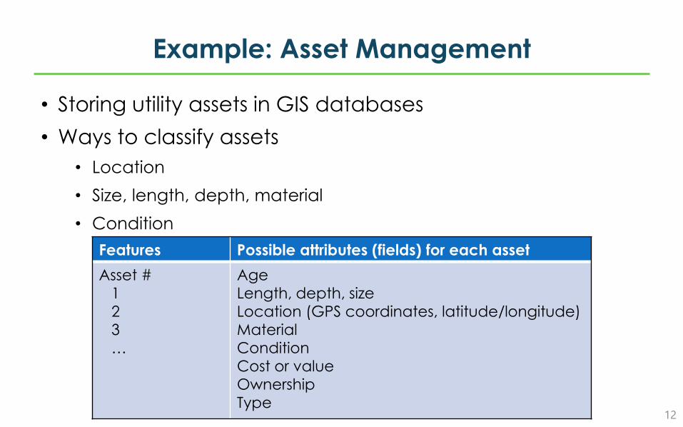
Example: Asset Management
12
• Storing utility assets in GIS databases• Ways to classify assets
• Location• Size, length, depth, material• Condition
Features Possible attributes (fields) for each assetAsset #
123…
AgeLength, depth, sizeLocation (GPS coordinates, latitude/longitude)MaterialConditionCost or valueOwnershipType
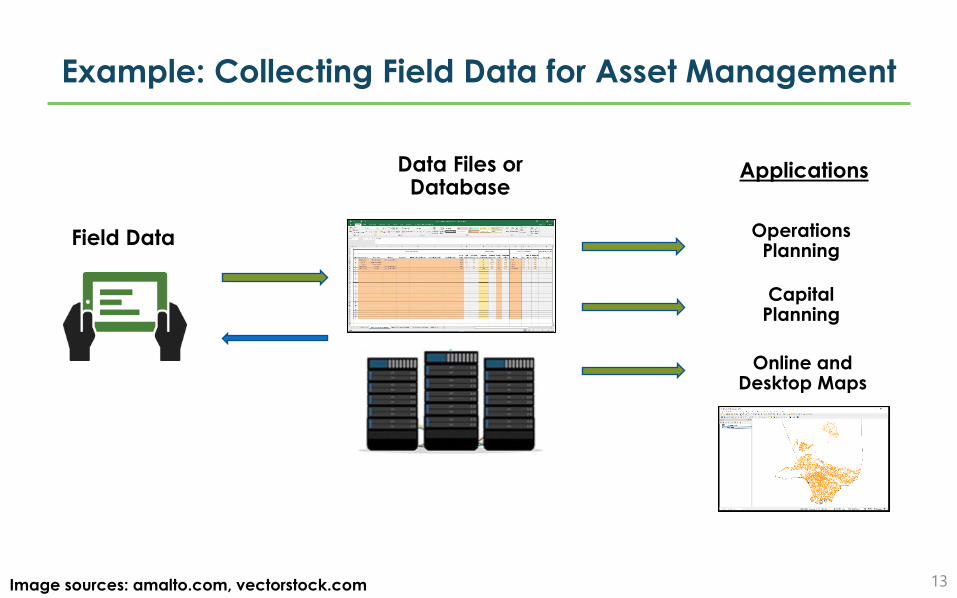
Example: Collecting Field Data for Asset Management
13Image sources: amalto.com, vectorstock.com
Field Data
Data Files or Database
Online and Desktop Maps
Capital Planning
Operations Planning
Applications
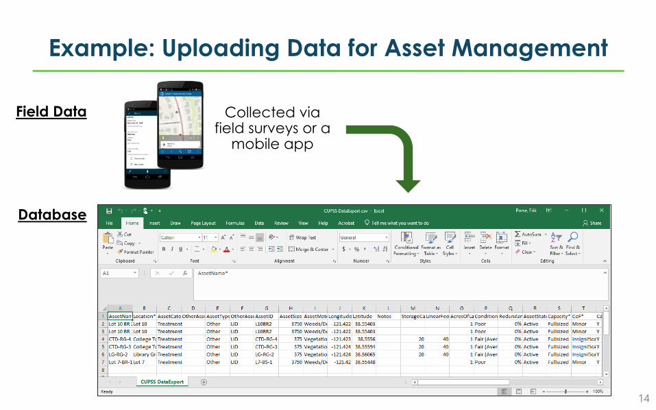
Example: Uploading Data for Asset Management
14
Field Data Collected via field surveys or a
mobile app
Database

Let’s See an Example
Where Can I Find Data?
16
• Local and state GIS repositories• Administrative boundaries (e.g. cities, counties, field divisions, districts, sectors etc…)
• Infrastructure information (e.g. dams, levees, water and wastewater treatment plants)
• US Census Tiger datasets• Census Blocks National Geodatabase
• U.S. federal agencies, such as U.S. Geological Survey• Public-Supply Well Water Quality Results
• Flood inundation maps
• Esri Open Data Hub
Links
EPA Region 9 Environmental Finance Center:http://www.efc.csus.edu
Contact:[email protected]
QGIS:http://qgis.org
https://www.qgistutorials.com/
17