Embed Size (px)
Citation preview
WOIS Training, Spiez, September 2015
Water Observation and Information System
Introduction to WOIS and main outcomes
WOIS Training, Spiez, September 2015
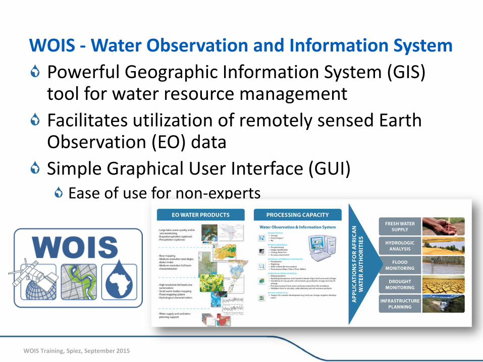
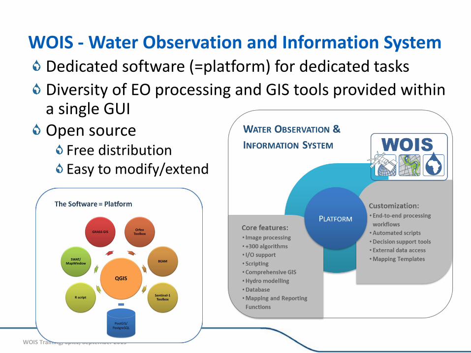
WOIS - Water Observation and Information System
Powerful Geographic Information System (GIS) tool for water resource management
Facilitates utilization of remotely sensed Earth Observation (EO) data
Simple Graphical User Interface (GUI) Ease of use for non-experts
WOIS Training, Spiez, September 2015
WOIS - Water Observation and Information System Dedicated software (=platform) for dedicated tasks
Diversity of EO processing and GIS tools provided within a single GUI Open source
Free distribution Easy to modify/extend
WOIS Training, Spiez, September 2015
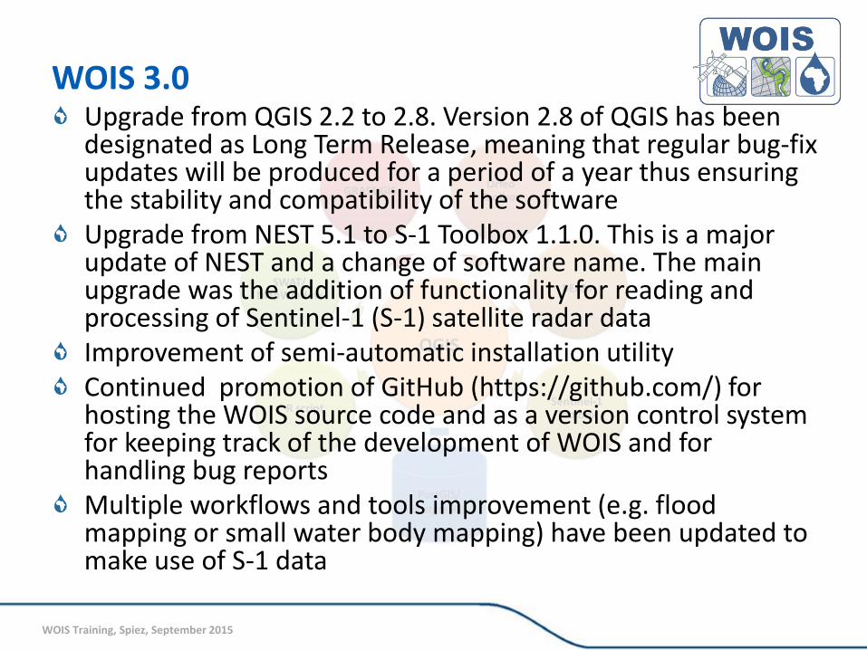
WOIS 3.0 Upgrade from QGIS 2.2 to 2.8. Version 2.8 of QGIS has been designated as Long Term Release, meaning that regular bug-fix updates will be produced for a period of a year thus ensuring the stability and compatibility of the software Upgrade from NEST 5.1 to S-1 Toolbox 1.1.0. This is a major update of NEST and a change of software name. The main upgrade was the addition of functionality for reading and processing of Sentinel-1 (S-1) satellite radar data Improvement of semi-automatic installation utility Continued promotion of GitHub (https://github.com/) for hosting the WOIS source code and as a version control system for keeping track of the development of WOIS and for handling bug reports Multiple workflows and tools improvement (e.g. flood mapping or small water body mapping) have been updated to make use of S-1 data
WOIS Training, Spiez, September 2015
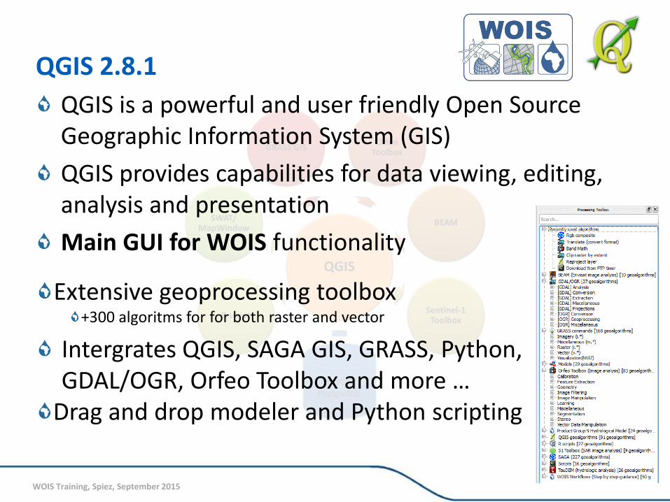
QGIS 2.8.1
QGIS is a powerful and user friendly Open Source Geographic Information System (GIS)
QGIS provides capabilities for data viewing, editing, analysis and presentation
Main GUI for WOIS functionality
Extensive geoprocessing toolbox +300 algoritms for for both raster and vector
Intergrates QGIS, SAGA GIS, GRASS, Python, GDAL/OGR, Orfeo Toolbox and more …
Drag and drop modeler and Python scripting
WOIS Training, Spiez, September 2015
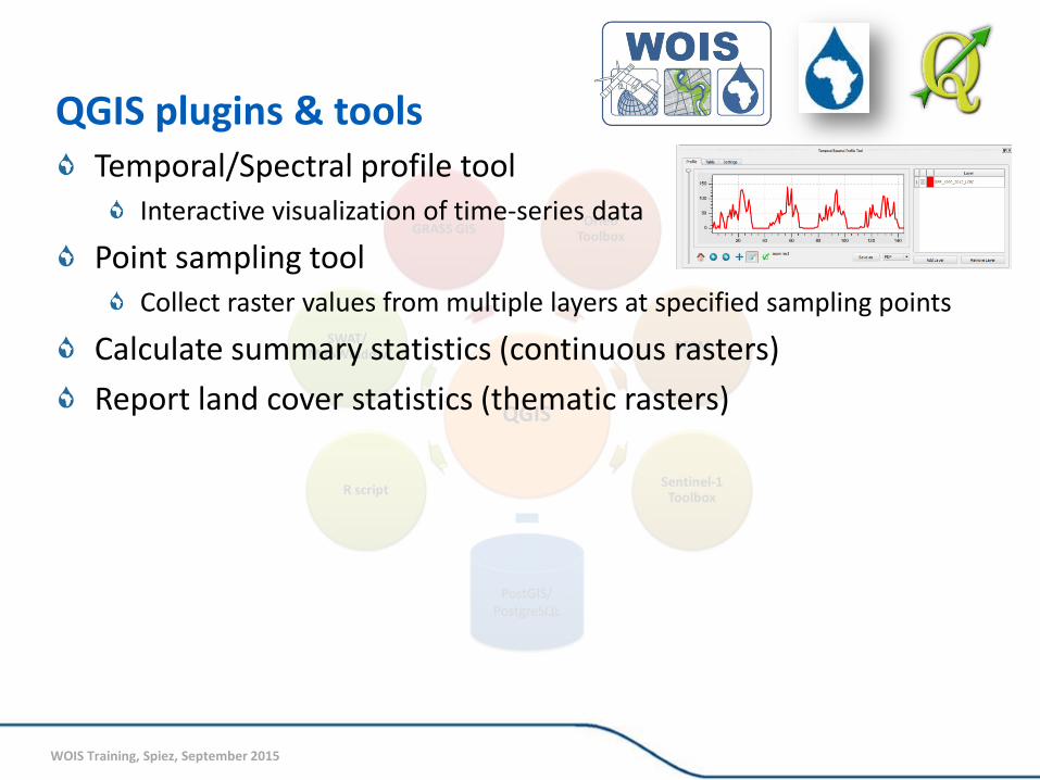
QGIS plugins & tools Temporal/Spectral profile tool
Interactive visualization of time-series data
Point sampling tool Collect raster values from multiple layers at specified sampling points
Calculate summary statistics (continuous rasters)
Report land cover statistics (thematic rasters)
WOIS Training, Spiez, September 2015
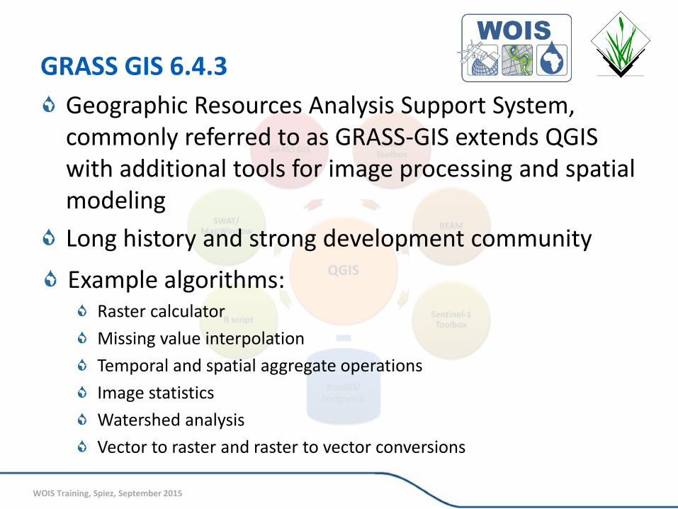
GRASS GIS 6.4.3
Geographic Resources Analysis Support System, commonly referred to as GRASS-GIS extends QGIS with additional tools for image processing and spatial modeling
Long history and strong development community
Example algorithms: Raster calculator
Missing value interpolation
Temporal and spatial aggregate operations
Image statistics
Watershed analysis
Vector to raster and raster to vector conversions
WOIS Training, Spiez, September 2015
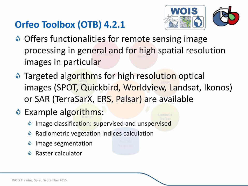
Orfeo Toolbox (OTB) 4.2.1
Offers functionalities for remote sensing image processing in general and for high spatial resolution images in particular
Targeted algorithms for high resolution optical images (SPOT, Quickbird, Worldview, Landsat, Ikonos) or SAR (TerraSarX, ERS, Palsar) are available
Example algorithms: Image classification: supervised and unspervised
Radiometric vegetation indices calculation
Image segmentation
Raster calculator

WOIS Training, Spiez, September 2015
BEAM 5.0
Basic ERS & Envisat (A)ATSR and Meris Toolbox (BEAM)
Open source toolbox for the utilization, viewing and processing of Envisat (and other) remotely sensed data
Envisat image subsetting, reprojecting and format conversion
Water quality and temperature modelling
Band math, classification, etc.
WOIS Training, Spiez, September 2015
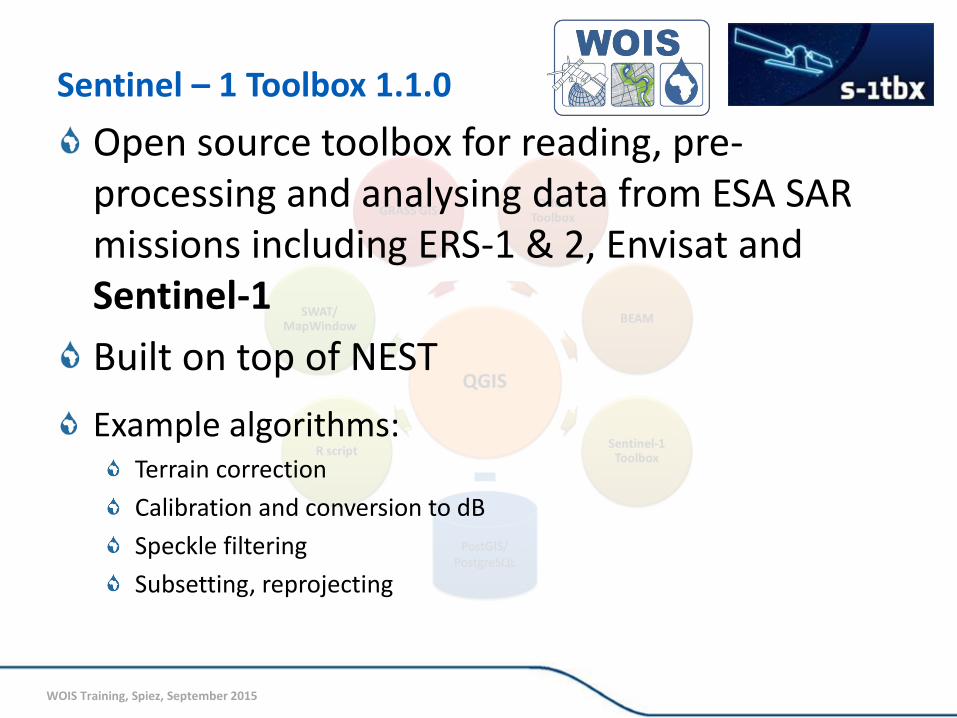
Sentinel – 1 Toolbox 1.1.0
Open source toolbox for reading, pre-processing and analysing data from ESA SAR missions including ERS-1 & 2, Envisat and Sentinel-1
Built on top of NEST
Example algorithms: Terrain correction
Calibration and conversion to dB
Speckle filtering
Subsetting, reprojecting
WOIS Training, Spiez, September 2015
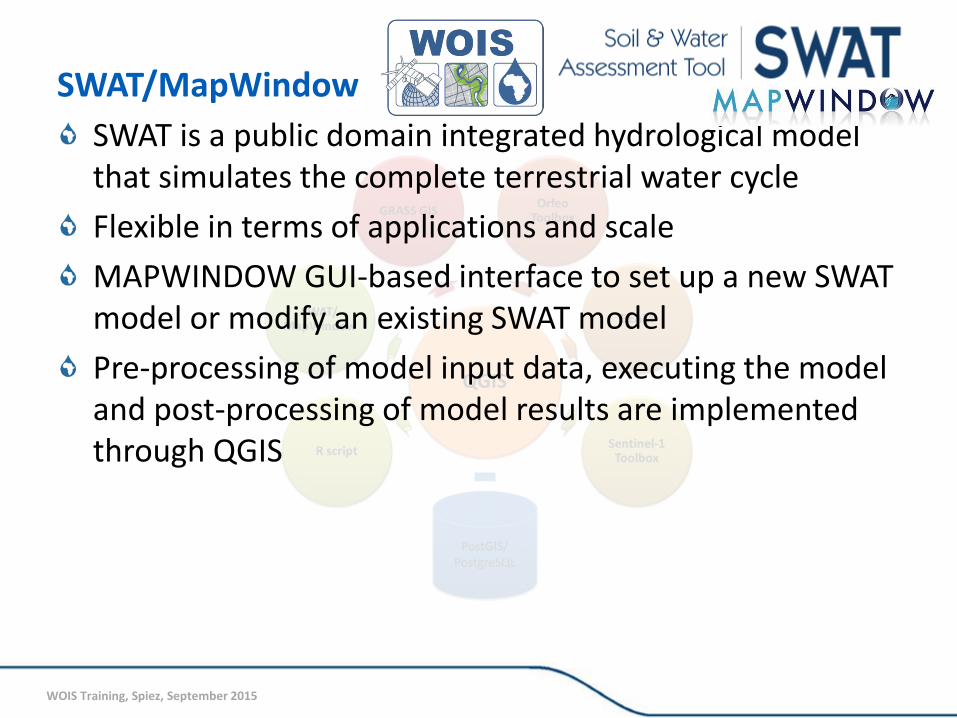
SWAT/MapWindow
SWAT is a public domain integrated hydrological model that simulates the complete terrestrial water cycle
Flexible in terms of applications and scale
MAPWINDOW GUI-based interface to set up a new SWAT model or modify an existing SWAT model
Pre-processing of model input data, executing the model and post-processing of model results are implemented through QGIS
WOIS Training, Spiez, September 2015
R / Python scripts Custom created R and Python scripts
R provides a wide variety of statistical (linear and nonlinear modelling, classical statistical tests, time-series analysis, classification, clustering, ...) and graphical techniques, and is highly extensible
Python scripts use algorithms included in Processing Toolbox to automatize/extend functionality (e.g. time-series processing)
WOIS Training, Spiez, September 2015
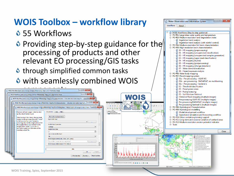
WOIS Toolbox – workflow library 55 Workflows Providing step-by-step guidance for the processing of products and other relevant EO processing/GIS tasks through simplified common tasks
with seamlessly combined WOIS components
WOIS Training, Spiez, September 2015
DESIGN STRENGHTS The diversity of EO processing and GIS tools provided within a single GUI is unique
The ability to sequentially combine algorithms from different providers into workflows is unprecedented
Extensive reporting functionality (e.g. map publishing, time series tool, zonal statistics)
One stop resource for integrated EO processing and GIS analysis
Under TIGER-NET developed, tested and validated for a number of product prototypes
WOIS Training, Spiez, September 2015
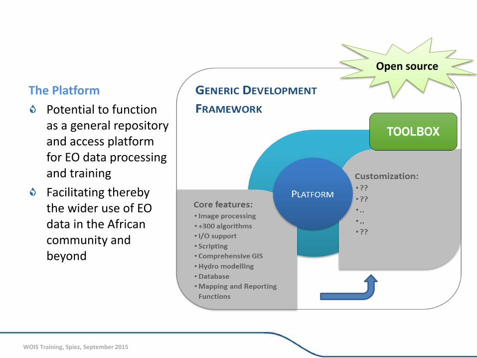
The Platform
Potential to function as a general repository and access platform for EO data processing and training
Facilitating thereby the wider use of EO data in the African community and beyond
Open source
WOIS Training, Spiez, September 2015
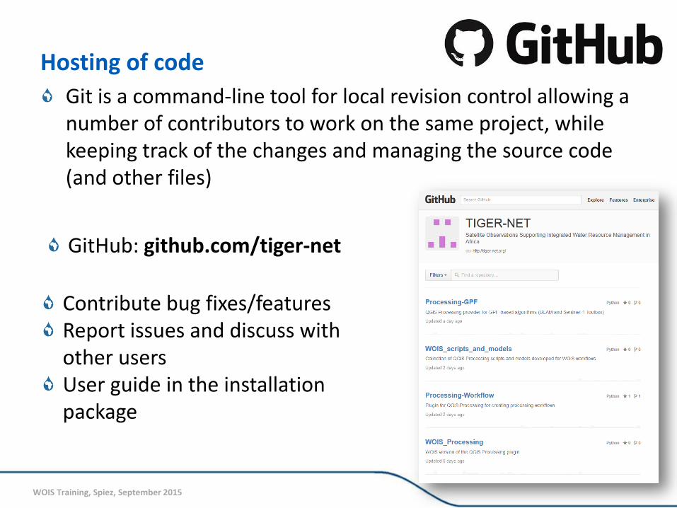
Hosting of code
Git is a command-line tool for local revision control allowing a number of contributors to work on the same project, while keeping track of the changes and managing the source code (and other files)
Contribute bug fixes/features Report issues and discuss with other users User guide in the installation package
GitHub: github.com/tiger-net
WOIS Training, Spiez, September 2015
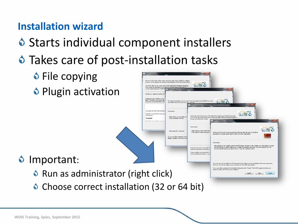
Installation wizard
Starts individual component installers
Takes care of post-installation tasks File copying
Plugin activation
Important:
Run as administrator (right click)
Choose correct installation (32 or 64 bit)
WOIS Training, Spiez, September 2015
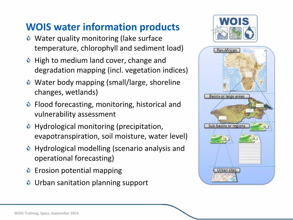
WOIS water information products Water quality monitoring (lake surface temperature, chlorophyll and sediment load)
High to medium land cover, change and degradation mapping (incl. vegetation indices)
Water body mapping (small/large, shoreline changes, wetlands)
Flood forecasting, monitoring, historical and vulnerability assessment
Hydrological monitoring (precipitation, evapotranspiration, soil moisture, water level)
Hydrological modelling (scenario analysis and operational forecasting)
Erosion potential mapping
Urban sanitation planning support
WOIS Training, Spiez, September 2015
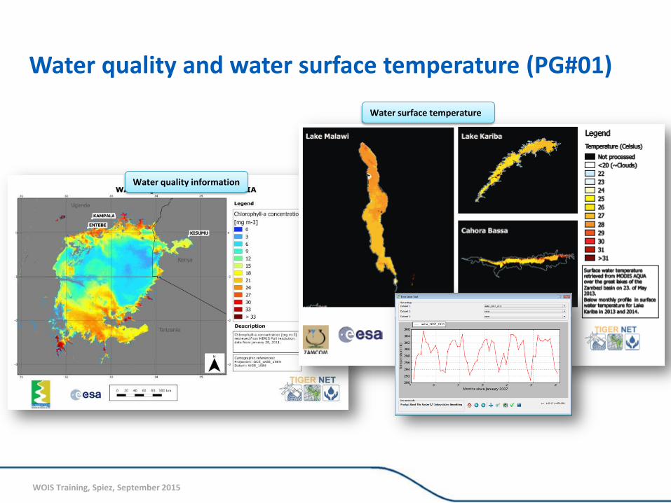
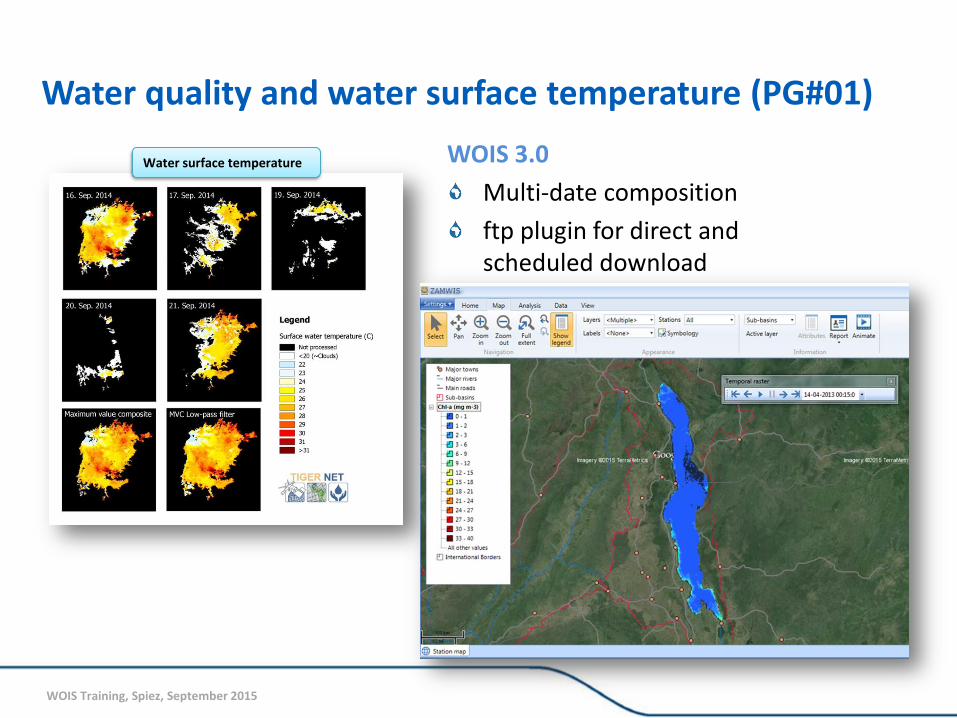
Water quality and water surface temperature (PG#01)
Water quality information
Water surface temperature
WOIS Training, Spiez, September 2015
WOIS 3.0
Multi-date composition
ftp plugin for direct and scheduled download
Water quality and water surface temperature (PG#01)
Water surface temperature
WOIS Training, Spiez, September 2015
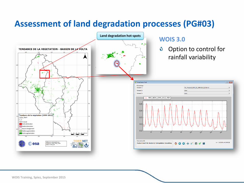
Assessment of land degradation processes (PG#03) Land degradation hot-spots
WOIS 3.0
Option to control for rainfall variability
WOIS Training, Spiez, September 2015
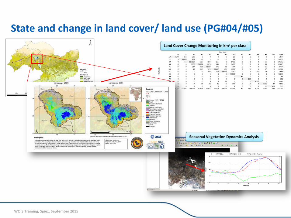
State and change in land cover/ land use (PG#04/#05)
Land Cover Change Monitoring in km² per class
Seasonal Vegetation Dynamics Analysis
WOIS Training, Spiez, September 2015
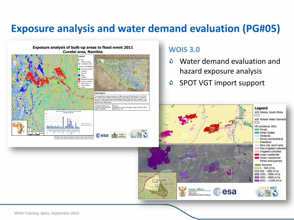
WOIS 3.0
Water demand evaluation and hazard exposure analysis
SPOT VGT import support
Exposure analysis and water demand evaluation (PG#05)
WOIS Training, Spiez, September 2015
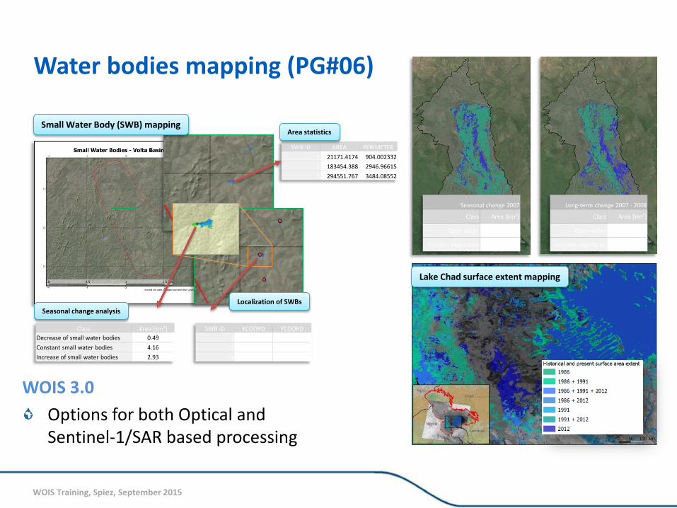
Water bodies mapping (PG#06)
Small Water Body (SWB) mapping
Localization of SWBs
SWB ID XCOORD YCOORD
1 -3.369437 11.990526
2 -3.417772 11.98972
3 -3.416978 11.972579
SWB ID AREA PERIMETER
1 21171.4174 904.002332
2 183454.388 2946.96615
3 294551.767 3484.08552
Area statistics
Class Area [km²]
Decrease of small water bodies 0.49
Constant small water bodies 4.16
Increase of small water bodies 2.93
Seasonal change analysis
Seasonal change 2007
Class Area [km²]
Open water 4077.56
Flooded vegetation -13768.08
Long-term change 2007 - 2008
Class Area [km²]
Open water 4870.10
Flooded vegetation -11605.79
Lake Chad surface extent mapping
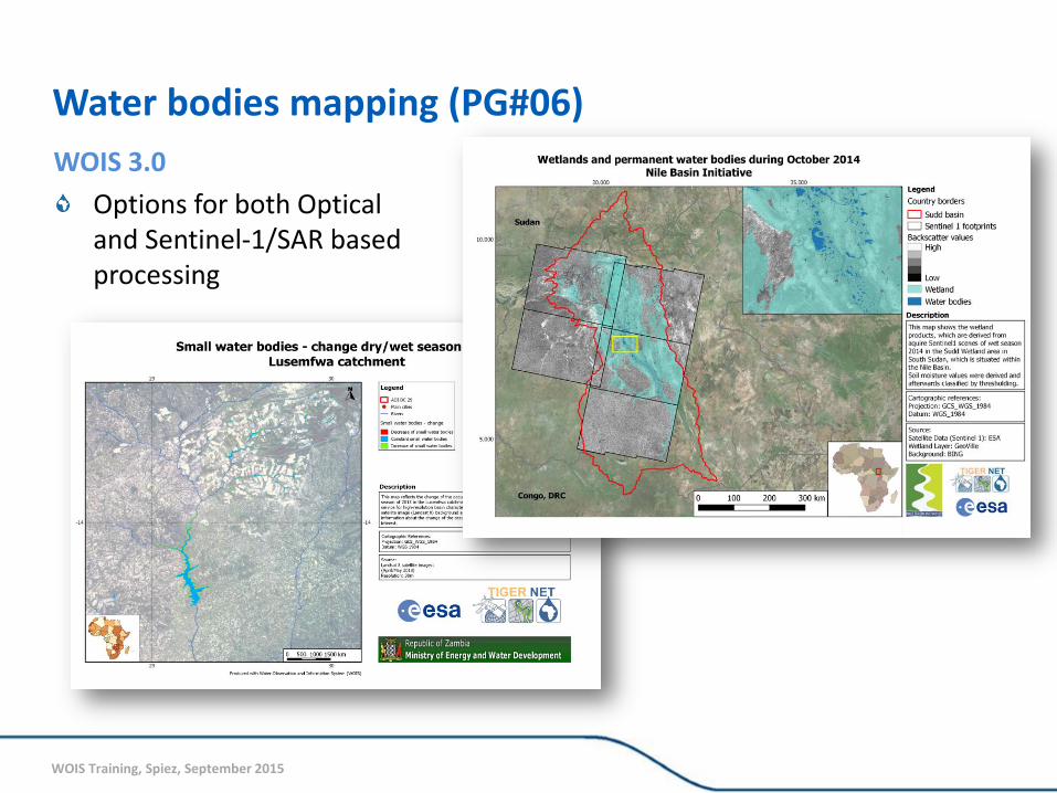
WOIS 3.0
Options for both Optical and Sentinel-1/SAR based processing
WOIS Training, Spiez, September 2015
WOIS 3.0
Options for both Optical and Sentinel-1/SAR based processing
Water bodies mapping (PG#06)
WOIS Training, Spiez, September 2015
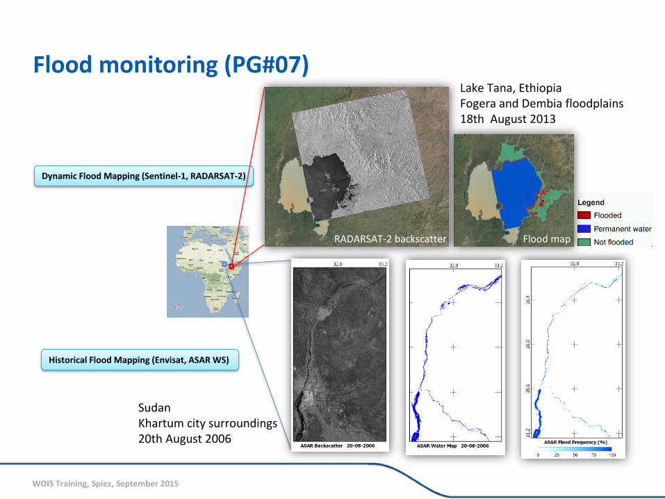
Dynamic Flood Mapping (Sentinel-1, RADARSAT-2)
Historical Flood Mapping (Envisat, ASAR WS)
RADARSAT-2 backscatter Flood map
Lake Tana, Ethiopia Fogera and Dembia floodplains 18th August 2013
Sudan Khartum city surroundings 20th August 2006
Flood monitoring (PG#07)
WOIS Training, Spiez, September 2015
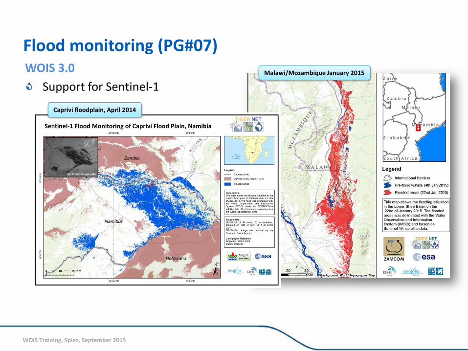
WOIS 3.0
Support for Sentinel-1 Malawi/Mozambique January 2015
Caprivi floodplain, April 2014
Flood monitoring (PG#07)
WOIS Training, Spiez, September 2015
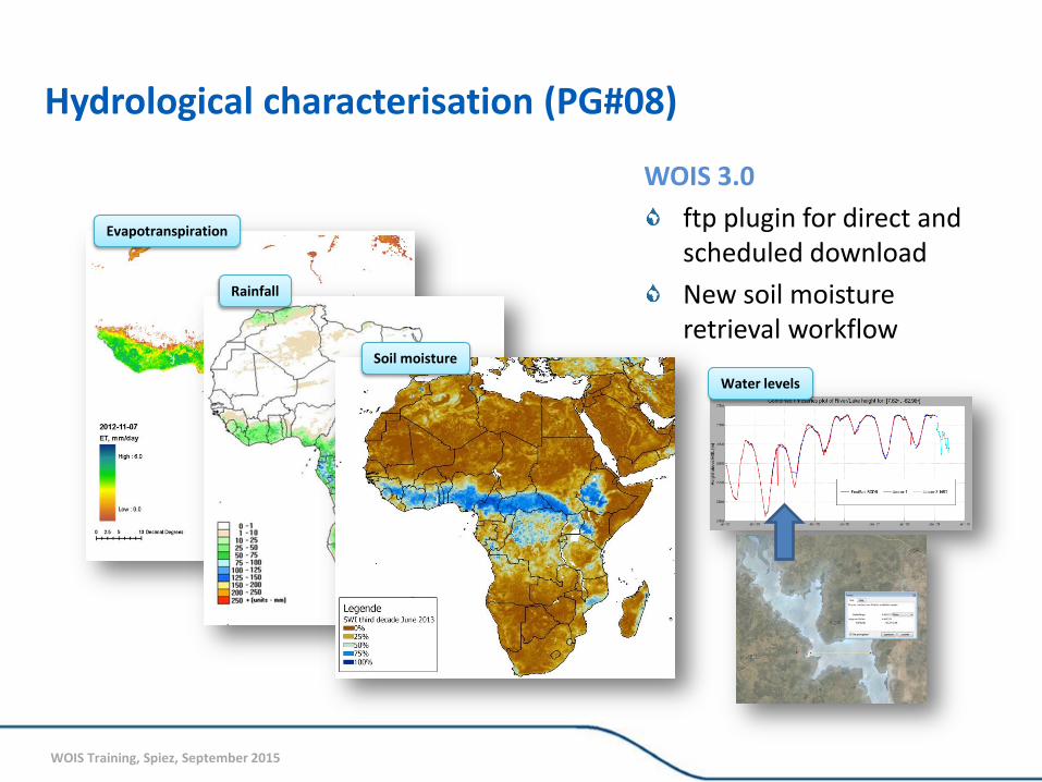
Hydrological characterisation (PG#08)
Evapotranspiration
Rainfall
Soil moisture
WOIS 3.0
ftp plugin for direct and scheduled download
New soil moisture retrieval workflow
Water levels
WOIS Training, Spiez, September 2015
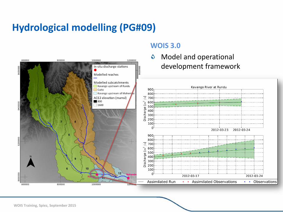
Hydrological modelling (PG#09)
WOIS 3.0
Model and operational development framework
WOIS Training, Spiez, September 2015
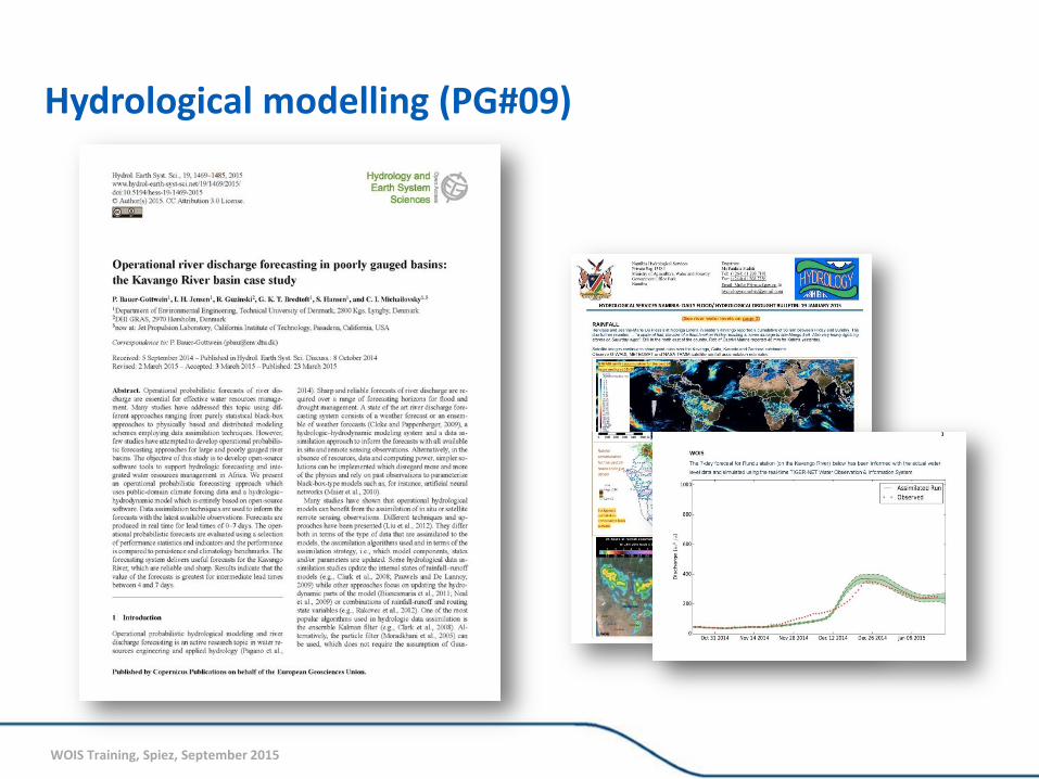
Hydrological modelling (PG#09)
WOIS Training, Spiez, September 2015
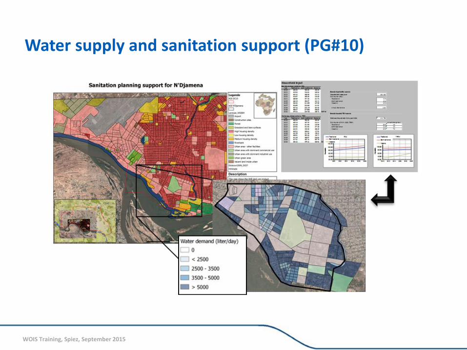
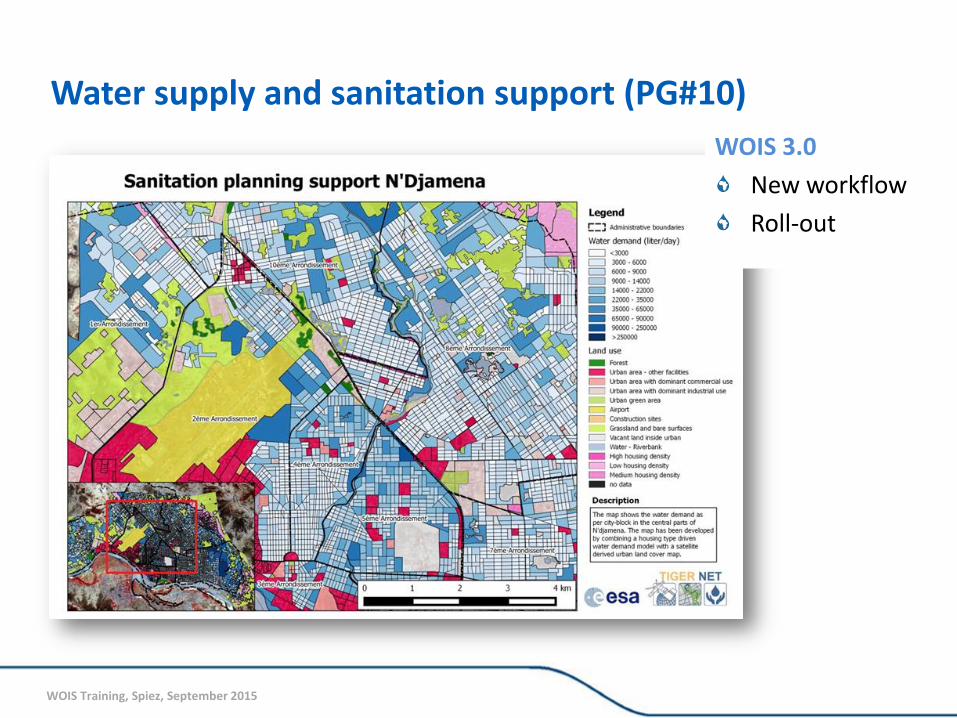
Water supply and sanitation support (PG#10)
WOIS Training, Spiez, September 2015
WOIS 3.0
New workflow
Roll-out
Water supply and sanitation support (PG#10)
WOIS Training, Spiez, September 2015
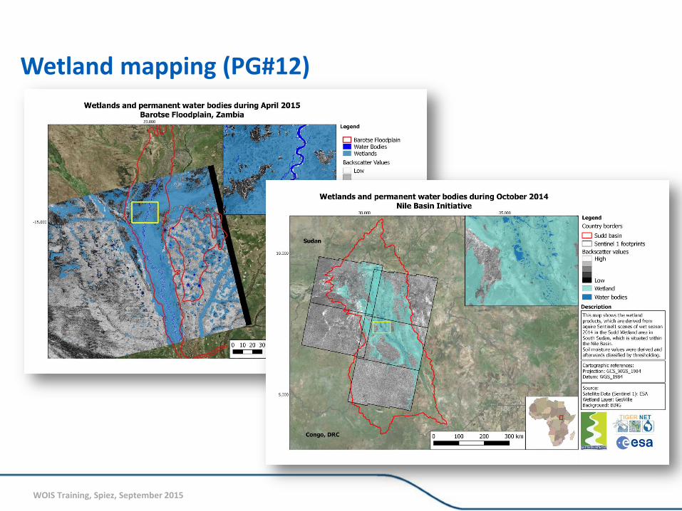
Wetland mapping (PG#12)
WOIS Training, Spiez, September 2015
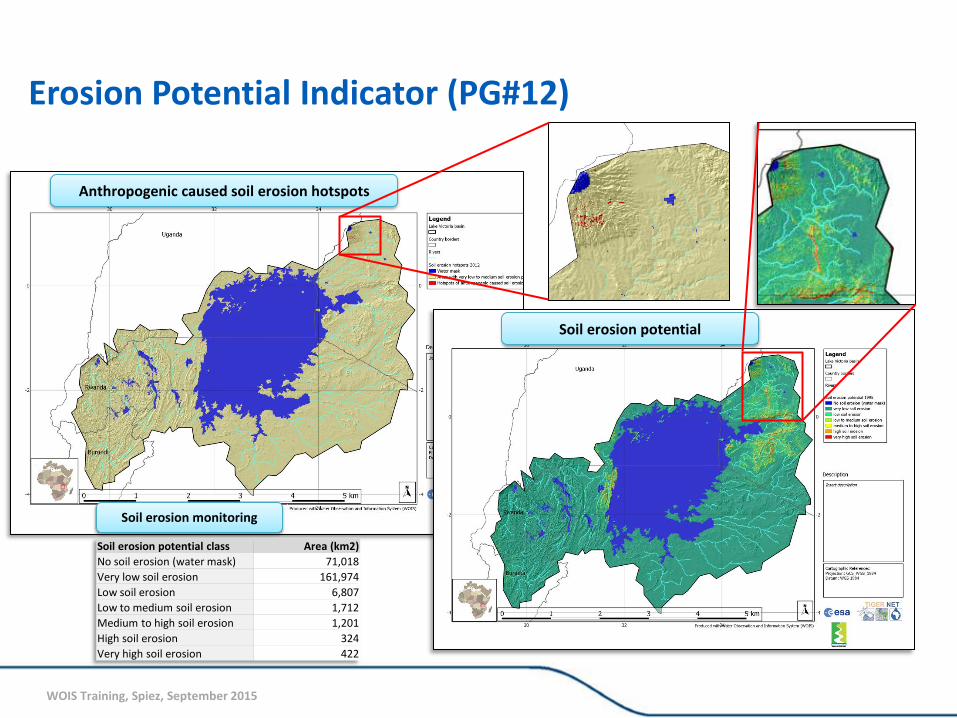
Erosion Potential Indicator (PG#12)
Anthropogenic caused soil erosion hotspots
Soil erosion potential
Soil erosion potential class Area (km2)
No soil erosion (water mask) 71,018
Very low soil erosion 161,974
Low soil erosion 6,807
Low to medium soil erosion 1,712
Medium to high soil erosion 1,201
High soil erosion 324
Very high soil erosion 422
Soil erosion monitoring