Embed Size (px)
DESCRIPTION
A showcase from Ordnance Survey of how the Cartographic Design team is using QGIS to design and style OS vector and raster products.
Citation preview
QGIS and Cartography Scottish UK QGIS User Group meeting
Charley Glynn, Cartographic Design Consultant
19th March 2014
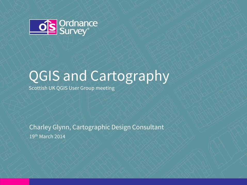
OS and OS
Our Chief Architect, Ian James keynoted at FOSS4G 2013
“…a bias towards open source”
Credit: Jody Garnett (CC BY) image from flickr

OS and QGIS
• Case study on the UK QGIS User Group blog
• OS OnDemand WMS
• OS OpenData Masterclasses
• User Guides (incl. Building Height Attribution)
OS and QGIS
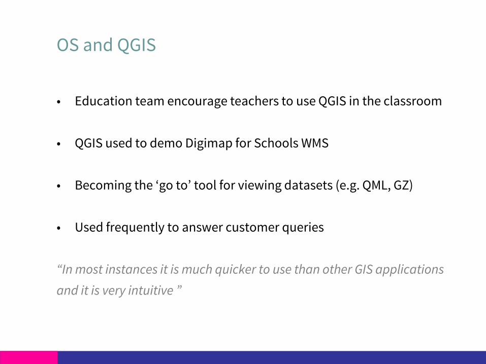
• Education team encourage teachers to use QGIS in the classroom
• QGIS used to demo Digimap for Schools WMS
• Becoming the ‘go to’ tool for viewing datasets (e.g. QML, GZ)
• Used frequently to answer customer queries
“In most instances it is much quicker to use than other GIS applications
and it is very intuitive ”
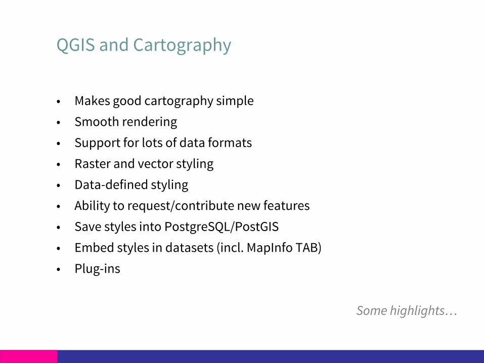
QGIS and Cartography
• Makes good cartography simple
• Smooth rendering
• Support for lots of data formats
• Raster and vector styling
• Data-defined styling
• Ability to request/contribute new features
• Save styles into PostgreSQL/PostGIS
• Embed styles in datasets (incl. MapInfo TAB)
• Plug-ins
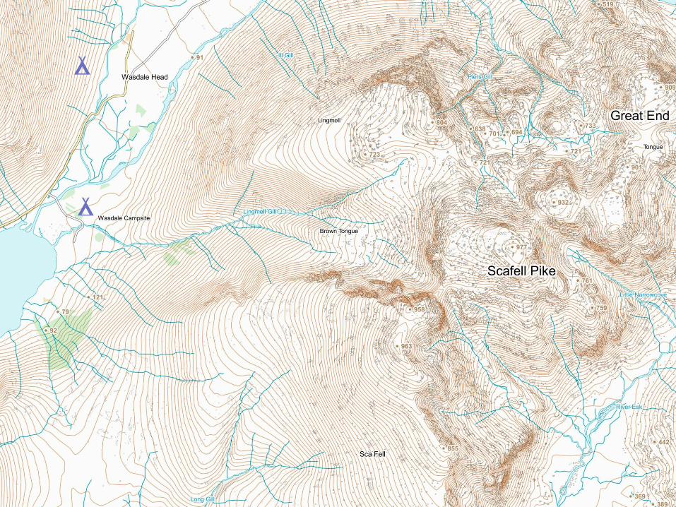
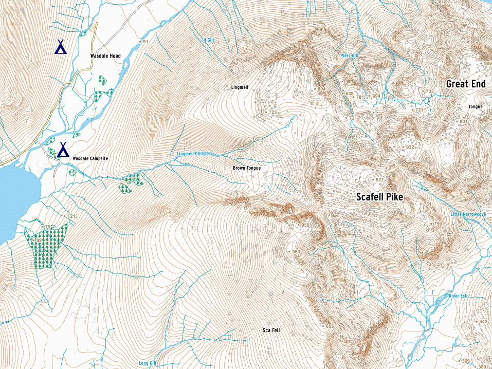
Some highlights…
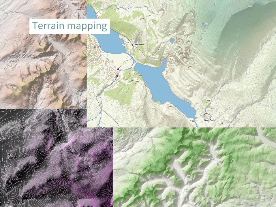
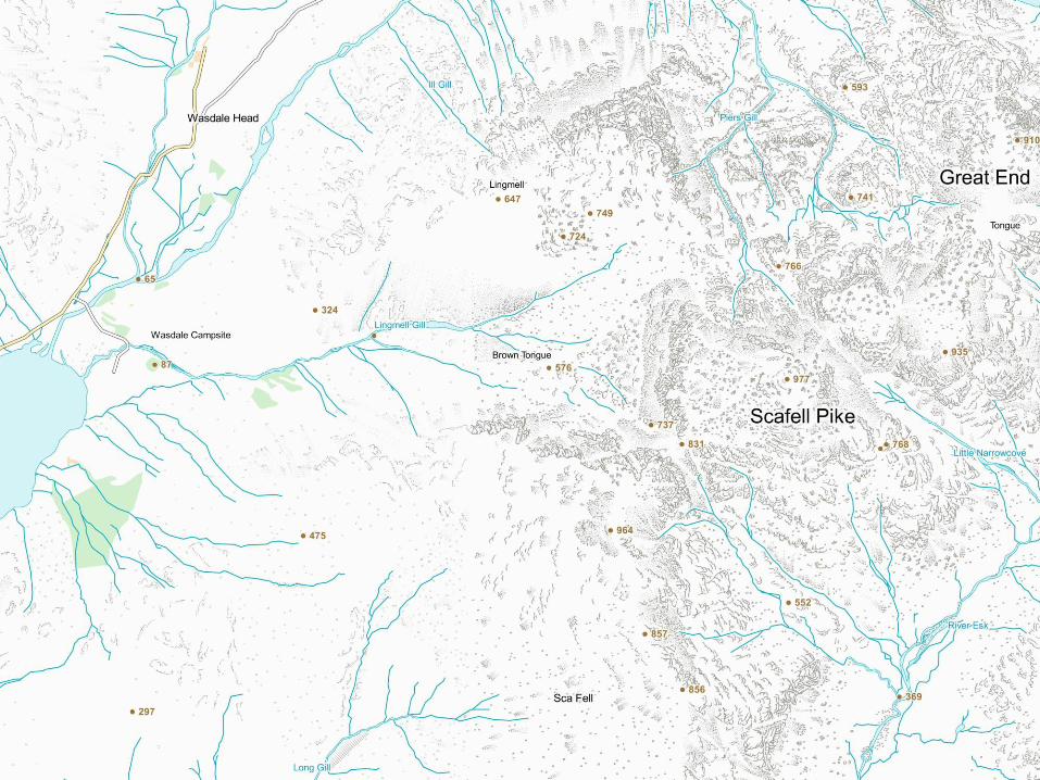
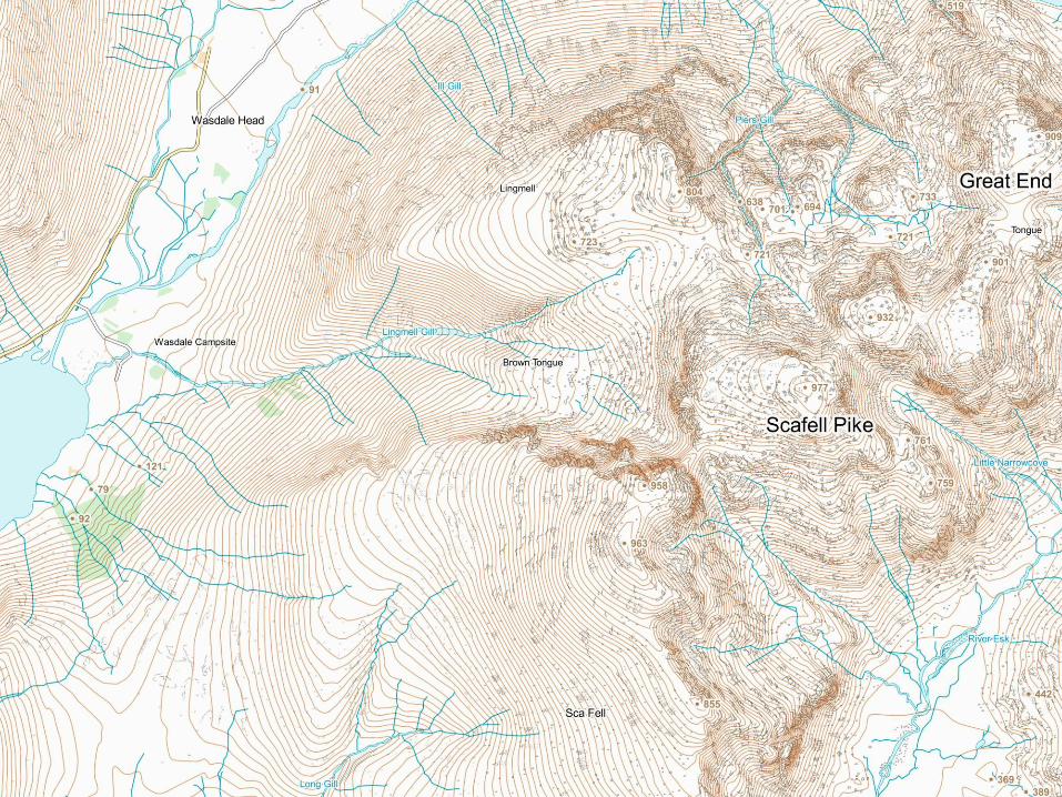
Terrain mapping
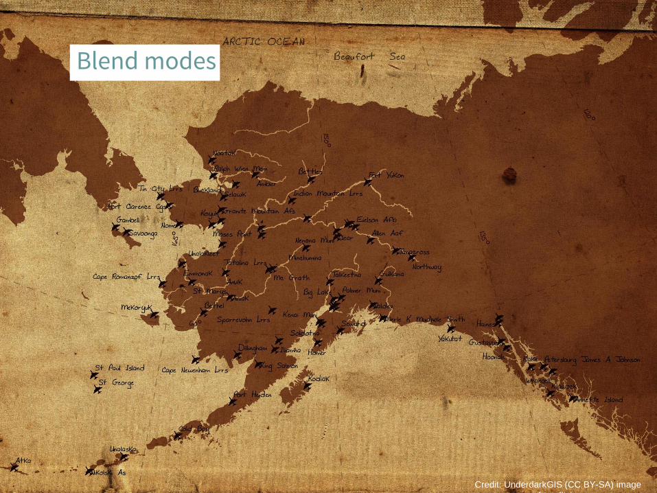
Blend modes
Credit: UnderdarkGIS (CC BY-SA) image
from flickr
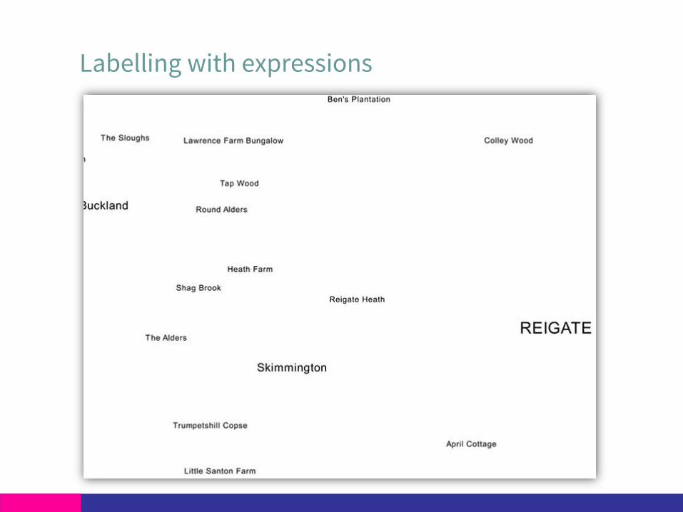
Labelling with expressions

Labelling with expressions

Labelling with expressions

Print composer
Credit: jad99 (CC BY-SA) image from
flickr
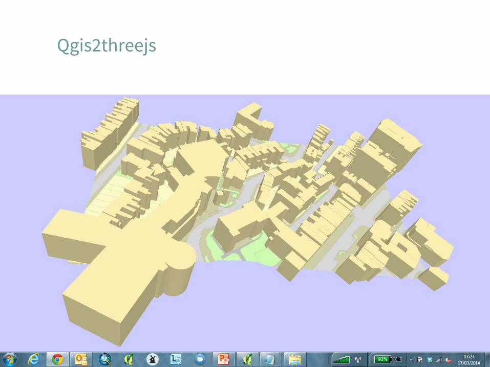
Qgis2threejs

Launching QGIS stylesheets
• QML stylesheets
• OS OpenData
• All on GitHub (quick download also available)
• User guides
• Free to use, customise, share
All things open

Launching QGIS stylesheets
Make the maps that you want
github.com/OrdnanceSurvey

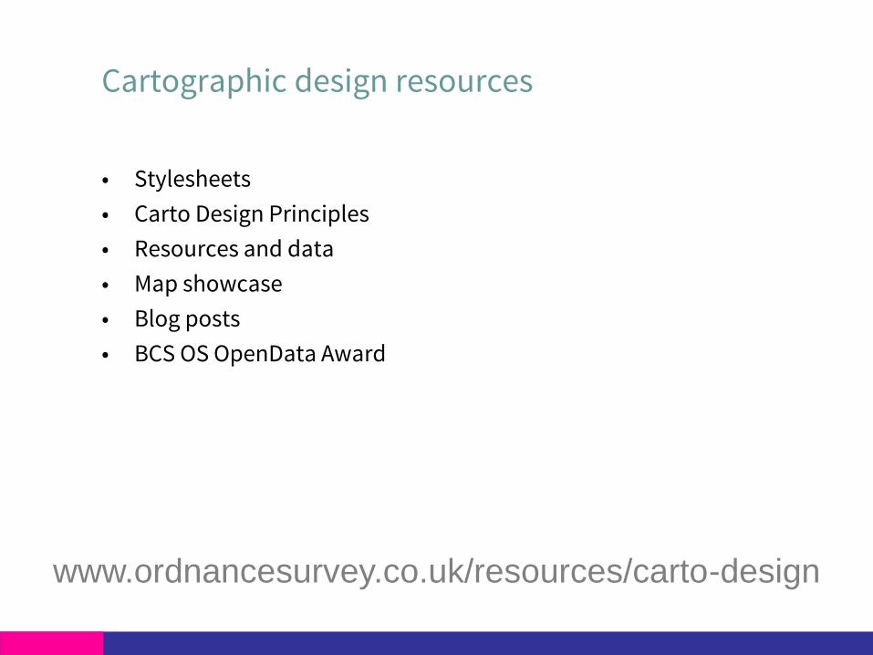
Cartographic design resources
• Stylesheets
• Carto Design Principles
• Resources and data
• Map showcase
• Blog posts
• BCS OS OpenData Award
www.ordnancesurvey.co.uk/resources/carto-design

Lots more to come
• More stylesheets (including OSMM Topo and VML)
Please use them and feedback to us
• Gazetteer search plug-in
• We will continue to play an active role in the User Group