Embed Size (px)
Citation preview
Engineering
Architecture
Design-Build
Surveying
Geomatics
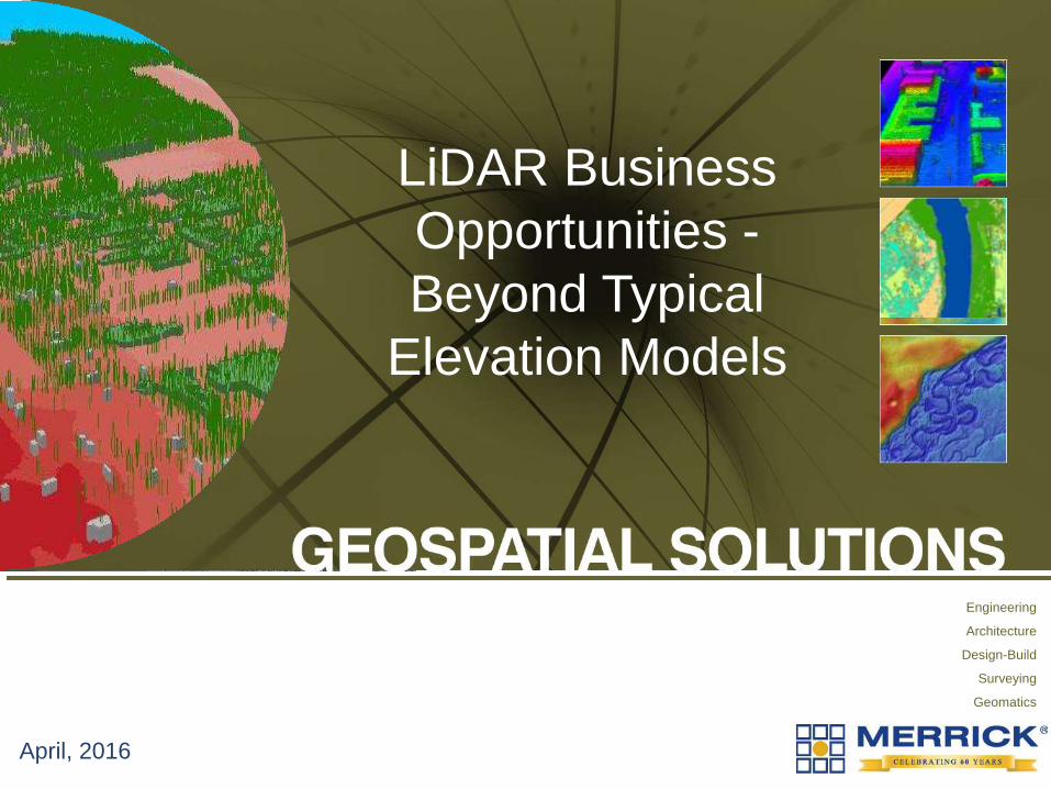
April, 2016
LiDAR Business
Opportunities -
Beyond Typical
Elevation Models
Copyright © 2016 Merrick & Company - All rights reserved.
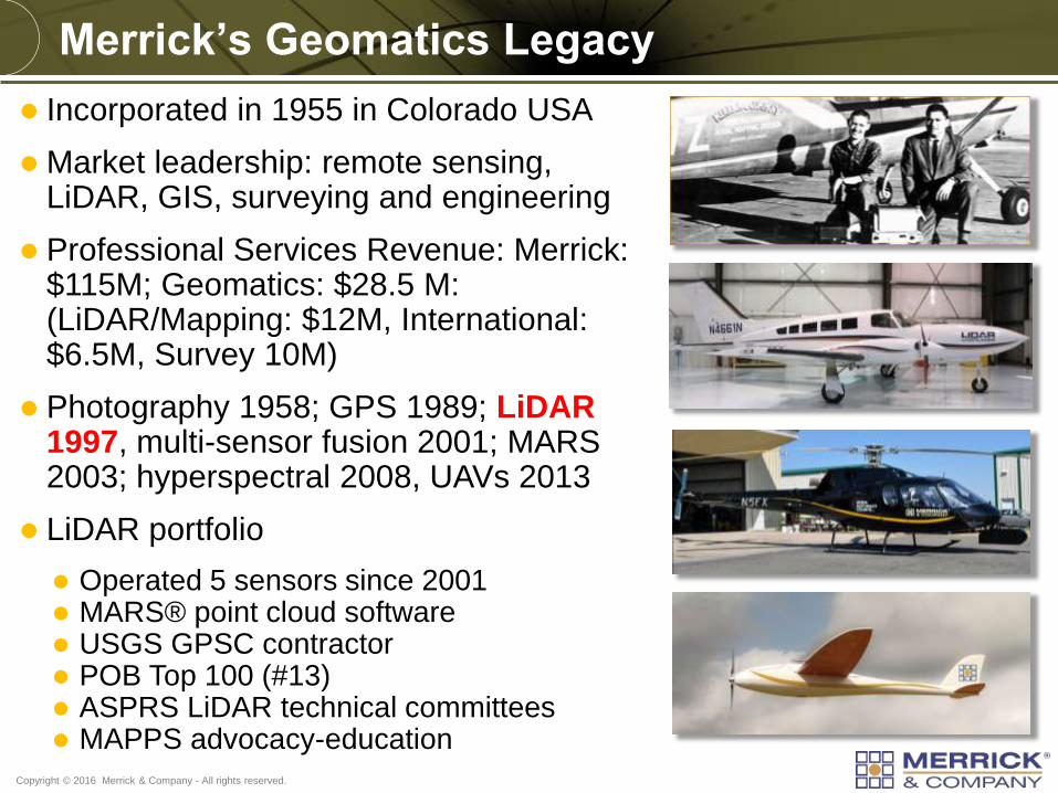
Incorporated in 1955 in Colorado USA
Market leadership: remote sensing, LiDAR, GIS, surveying and engineering
Professional Services Revenue: Merrick: $115M; Geomatics: $28.5 M: (LiDAR/Mapping: $12M, International: $6.5M, Survey 10M)
Photography 1958; GPS 1989; LiDAR 1997, multi-sensor fusion 2001; MARS 2003; hyperspectral 2008, UAVs 2013
LiDAR portfolio
Operated 5 sensors since 2001 MARS® point cloud software USGS GPSC contractor POB Top 100 (#13) ASPRS LiDAR technical committees MAPPS advocacy-education
Merrick’s Geomatics Legacy
Copyright © 2016 Merrick & Company - All rights reserved.
Authoritative Elevation Technology
Copyright © 2016 Merrick & Company - All rights reserved.
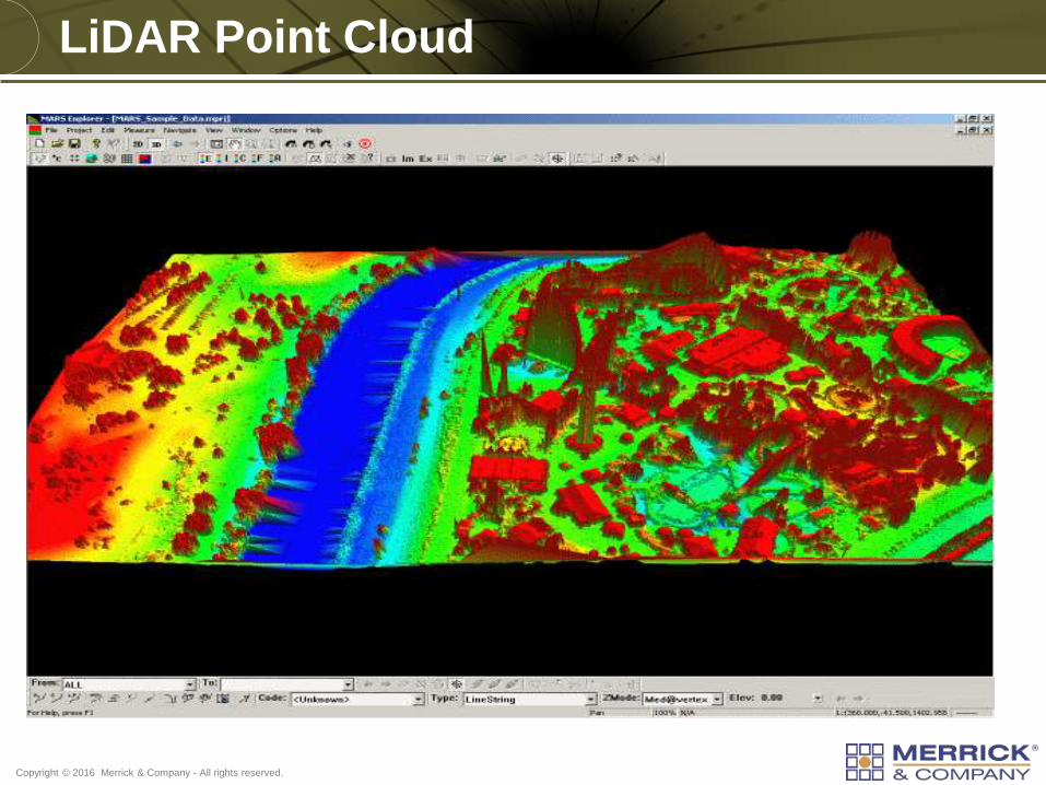
LiDAR Point Cloud
Copyright © 2016 Merrick & Company - All rights reserved.
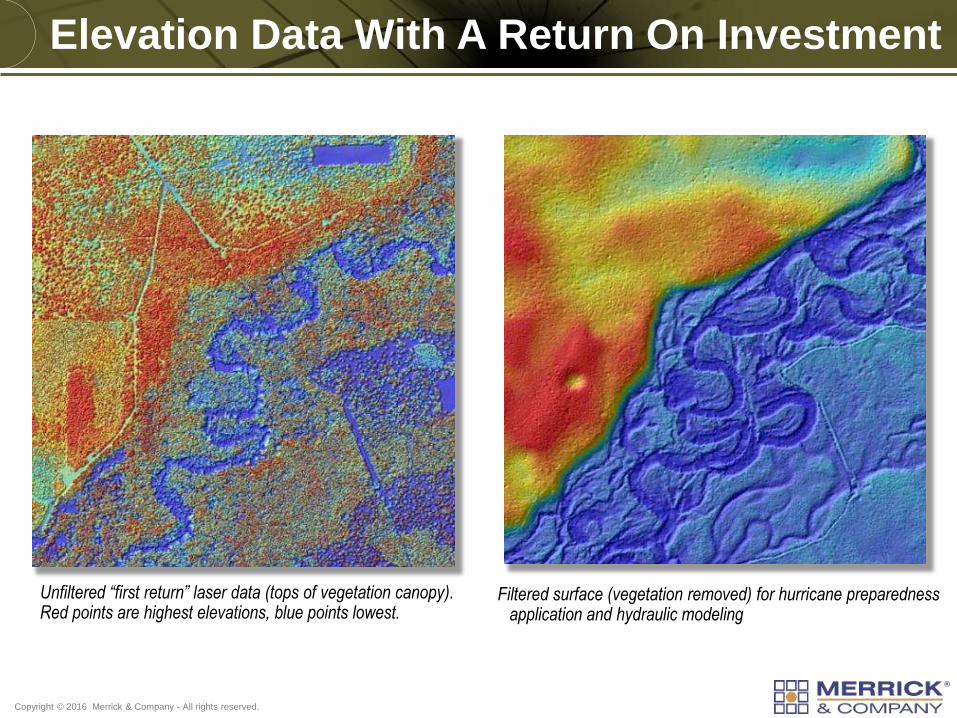
Unfiltered “first return” laser data (tops of vegetation canopy). Red points are highest elevations, blue points lowest.
Filtered surface (vegetation removed) for hurricane preparedness application and hydraulic modeling
Elevation Data With A Return On Investment
Copyright © 2016 Merrick & Company - All rights reserved.
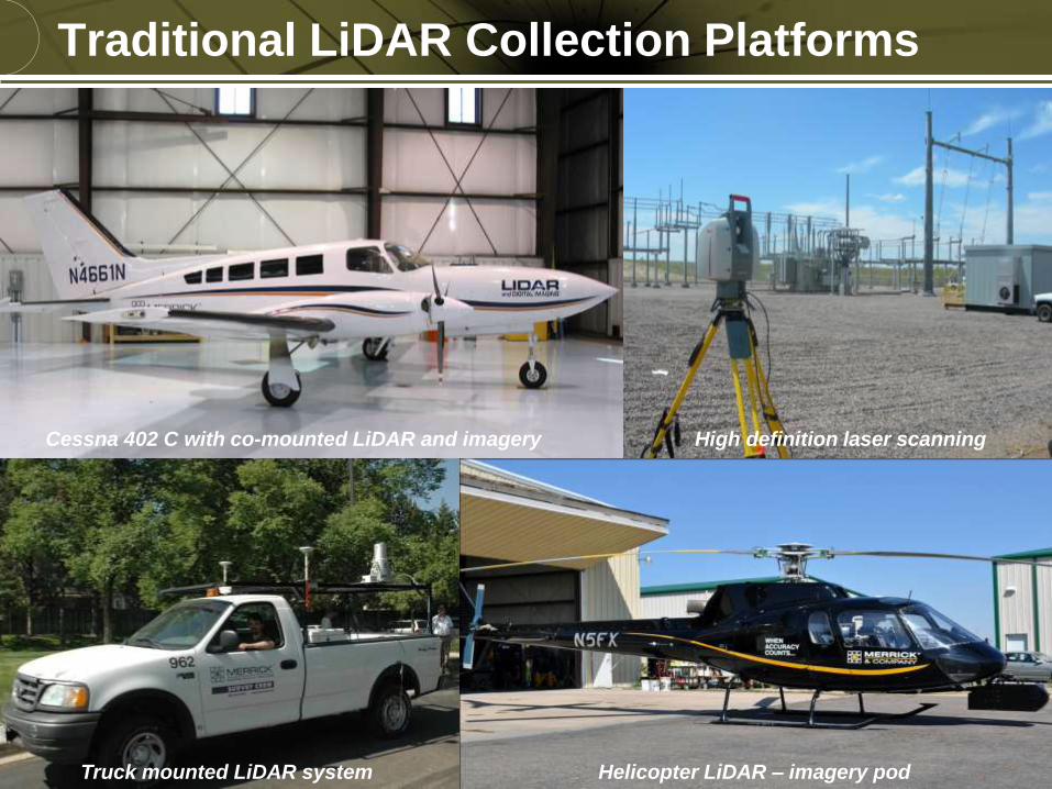
Traditional LiDAR Collection Platforms
Cessna 402 C with co-mounted LiDAR and imagery High definition laser scanning
Truck mounted LiDAR system Helicopter LiDAR – imagery pod
Copyright © 2016 Merrick & Company - All rights reserved.
LiDAR Applications Beyond Elevations
Copyright © 2016 Merrick & Company - All rights reserved.
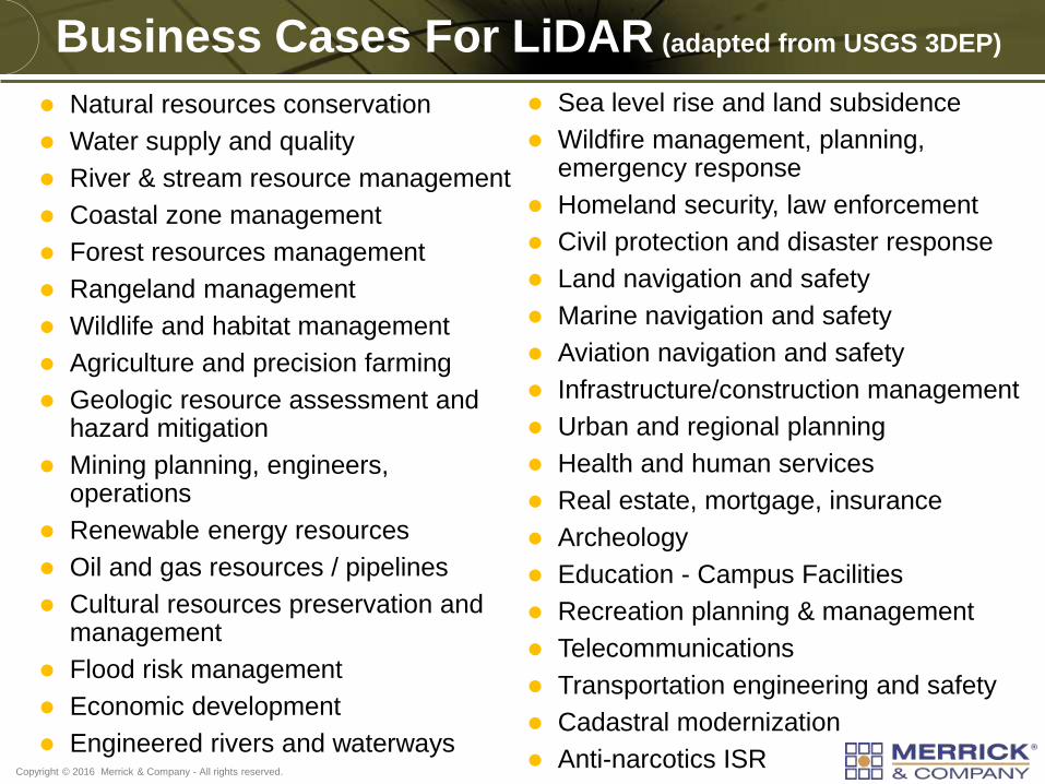
Business Cases For LiDAR (adapted from USGS 3DEP)
Natural resources conservation
Water supply and quality
River & stream resource management
Coastal zone management
Forest resources management
Rangeland management
Wildlife and habitat management
Agriculture and precision farming
Geologic resource assessment and hazard mitigation
Mining planning, engineers, operations
Renewable energy resources
Oil and gas resources / pipelines
Cultural resources preservation and management
Flood risk management
Economic development
Engineered rivers and waterways
Sea level rise and land subsidence
Wildfire management, planning, emergency response
Homeland security, law enforcement
Civil protection and disaster response
Land navigation and safety
Marine navigation and safety
Aviation navigation and safety
Infrastructure/construction management
Urban and regional planning
Health and human services
Real estate, mortgage, insurance
Archeology
Education - Campus Facilities
Recreation planning & management
Telecommunications
Transportation engineering and safety
Cadastral modernization
Anti-narcotics ISR
Copyright © 2016 Merrick & Company - All rights reserved.
U.S. Army Corps
Of Engineers ®
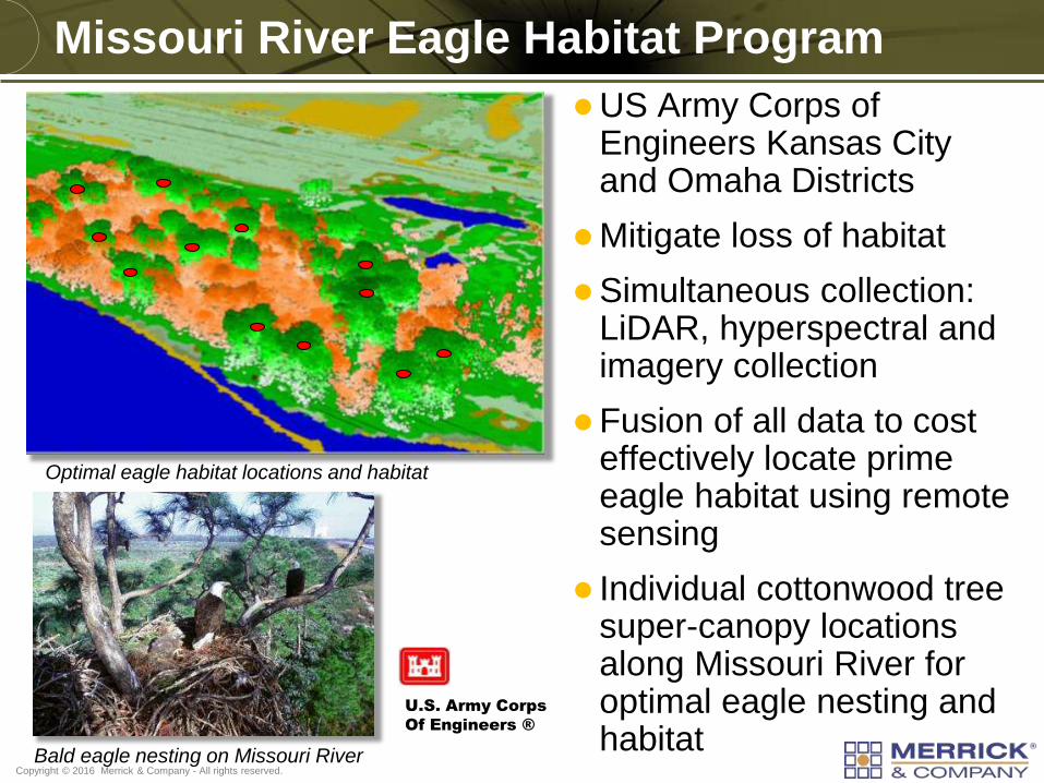
Missouri River Eagle Habitat Program
US Army Corps of Engineers Kansas City and Omaha Districts
Mitigate loss of habitat
Simultaneous collection: LiDAR, hyperspectral and imagery collection
Fusion of all data to cost effectively locate prime eagle habitat using remote sensing
Individual cottonwood tree super-canopy locations along Missouri River for optimal eagle nesting and habitat
Optimal eagle habitat locations and habitat
Bald eagle nesting on Missouri River
Copyright © 2016 Merrick & Company - All rights reserved.
Missouri River Eagle Habitat Program
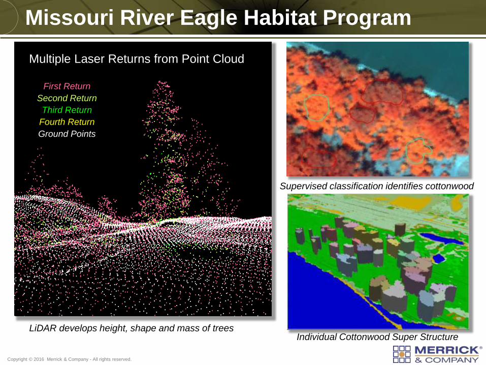
Individual Cottonwood Super Structure
Supervised classification identifies cottonwood
LiDAR develops height, shape and mass of trees
Pe
ne
tratio
n
Ponderosa Pine and Juniper
First Return
Second Return
Third Return
Fourth Return
Ground Points
Multiple Laser Returns from Point Cloud
Copyright © 2016 Merrick & Company - All rights reserved.
Energy Conservation
US Government energy efficiency on military bases
Building heat loss study
Develop facility upgrades and modernization plans
Sensors and software:
Leica LiDAR
ITRES TABI-1800 Thermal Imager
Merrick digital camera
GIS, MARS and ERDAS, ENVI
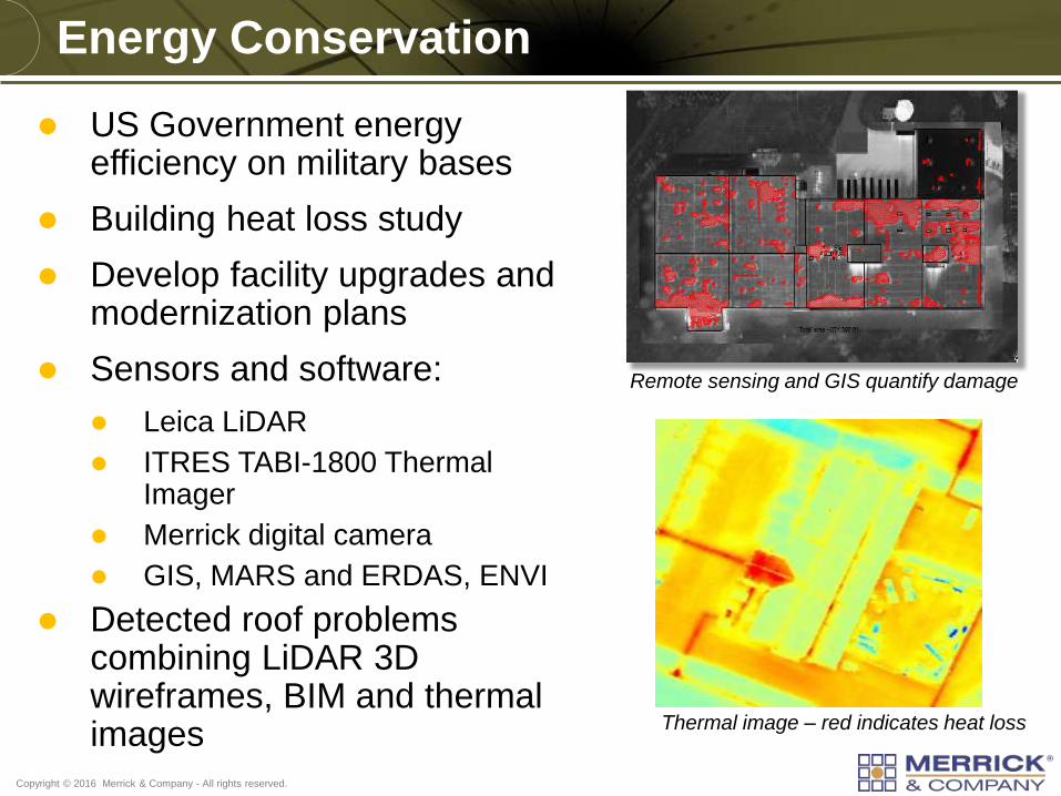
Detected roof problems combining LiDAR 3D wireframes, BIM and thermal images Thermal image – red indicates heat loss
Remote sensing and GIS quantify damage
Copyright © 2016 Merrick & Company - All rights reserved.
Positive Train Control (PTC)
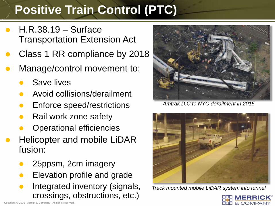
Amtrak D.C.to NYC derailment in 2015
Track mounted mobile LiDAR system into tunnel
H.R.38.19 – Surface Transportation Extension Act
Class 1 RR compliance by 2018
Manage/control movement to:
Save lives
Avoid collisions/derailment
Enforce speed/restrictions
Rail work zone safety
Operational efficiencies
Helicopter and mobile LiDAR fusion:
25ppsm, 2cm imagery
Elevation profile and grade
Integrated inventory (signals, crossings, obstructions, etc.)
Copyright © 2016 Merrick & Company - All rights reserved.
Bathymetric (underwater) LiDAR
Underwater LiDAR systems provide:
Surface elevation Deep water depth Shallow water depth Bottom composition (grass, rock,
sand, etc.) Suspended objects
Business drivers/applications:
Port/harbor engineering Security and surveillance Environmental and ecological Territory demarcation Coastal planning and monitoring Disaster evaluation/planning
Water column scientific analysis
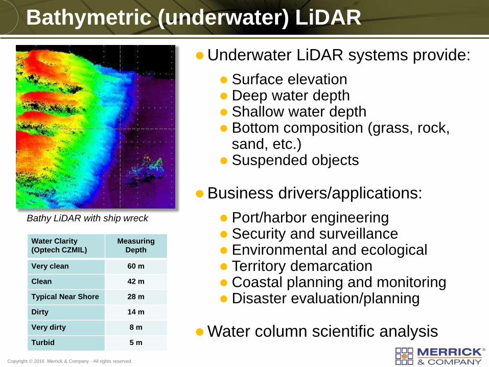
Water Clarity
(Optech CZMIL) Measuring
Depth
Very clean 60 m
Clean 42 m
Typical Near Shore 28 m
Dirty 14 m
Very dirty 8 m
Turbid 5 m
Bathy LiDAR with ship wreck
Copyright © 2016 Merrick & Company - All rights reserved.
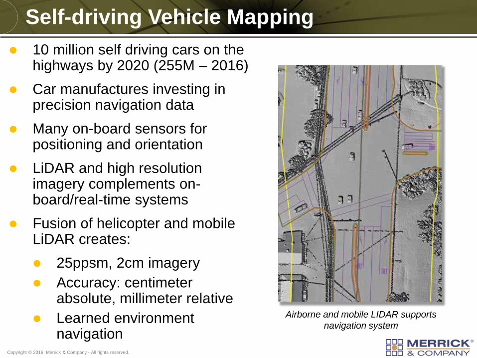
Self-driving Vehicle Mapping
Airborne and mobile LIDAR supports
navigation system
10 million self driving cars on the highways by 2020 (255M – 2016)
Car manufactures investing in precision navigation data
Many on-board sensors for positioning and orientation
LiDAR and high resolution imagery complements on-board/real-time systems
Fusion of helicopter and mobile LiDAR creates:
25ppsm, 2cm imagery
Accuracy: centimeter absolute, millimeter relative
Learned environment navigation
Copyright © 2016 Merrick & Company - All rights reserved.
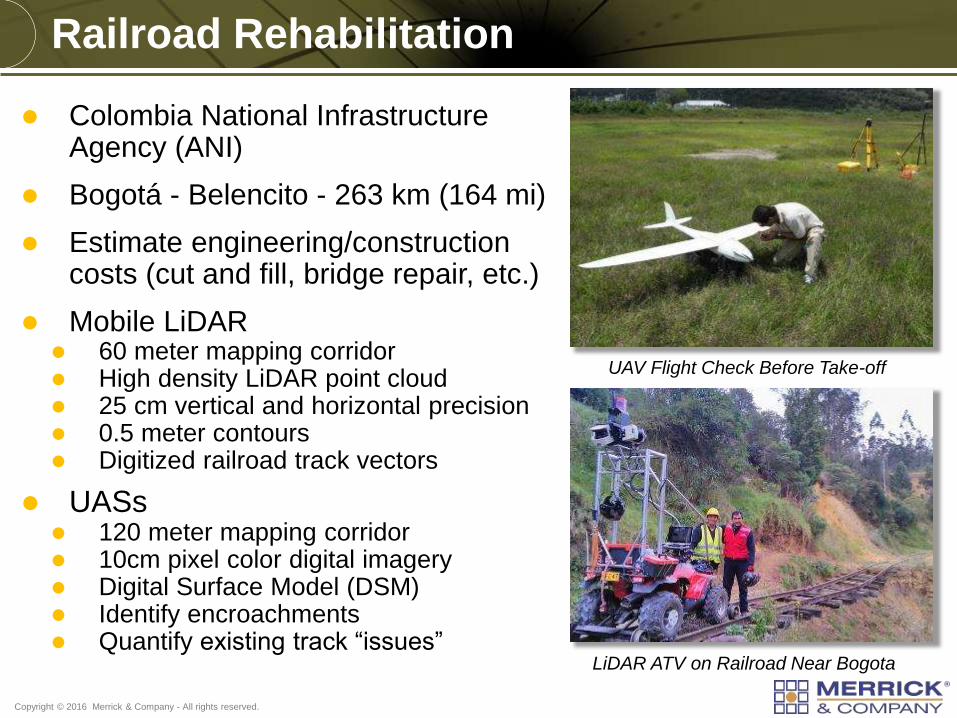
Colombia National Infrastructure Agency (ANI)
Bogotá - Belencito - 263 km (164 mi)
Estimate engineering/construction costs (cut and fill, bridge repair, etc.)
Mobile LiDAR 60 meter mapping corridor High density LiDAR point cloud 25 cm vertical and horizontal precision 0.5 meter contours Digitized railroad track vectors
UASs 120 meter mapping corridor 10cm pixel color digital imagery Digital Surface Model (DSM) Identify encroachments Quantify existing track “issues”
Railroad Rehabilitation
LiDAR ATV on Railroad Near Bogota
UAV Flight Check Before Take-off
Copyright © 2016 Merrick & Company - All rights reserved.
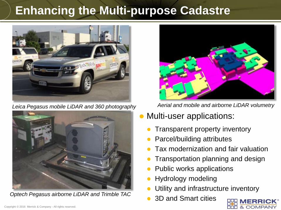
Leica Pegasus mobile LiDAR and 360 photography
Optech Pegasus airborne LiDAR and Trimble TAC
Aerial and mobile and airborne LiDAR volumetry
Enhancing the Multi-purpose Cadastre
Multi-user applications:
Transparent property inventory
Parcel/building attributes
Tax modernization and fair valuation
Transportation planning and design
Public works applications
Hydrology modeling
Utility and infrastructure inventory
3D and Smart cities
Copyright © 2016 Merrick & Company - All rights reserved.
Multi-sensor Configurations
Copyright © 2016 Merrick & Company - All rights reserved.
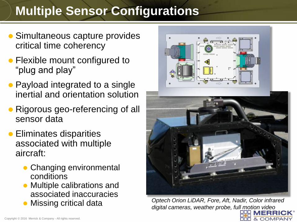
Multiple Sensor Configurations
Simultaneous capture provides critical time coherency
Flexible mount configured to “plug and play”
Payload integrated to a single inertial and orientation solution
Rigorous geo-referencing of all sensor data
Eliminates disparities associated with multiple aircraft:
Changing environmental conditions
Multiple calibrations and associated inaccuracies
Missing critical data Optech Orion LiDAR, Fore, Aft, Nadir, Color infrared
digital cameras, weather probe, full motion video
Copyright © 2016 Merrick & Company - All rights reserved.
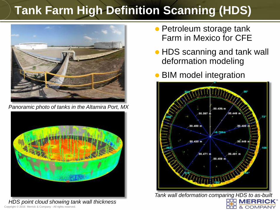
Tank Farm High Definition Scanning (HDS)
Petroleum storage tank Farm in Mexico for CFE
HDS scanning and tank wall deformation modeling
BIM model integration
Tank wall deformation comparing HDS to as-built
HDS point cloud showing tank wall thickness
Panoramic photo of tanks in the Altamira Port, MX
Copyright © 2016 Merrick & Company - All rights reserved.
Alternative Airborne Platforms
Copyright © 2016 Merrick & Company - All rights reserved.
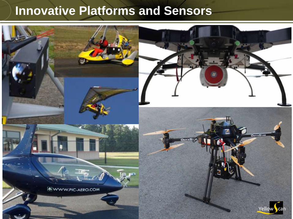
Innovative Platforms and Sensors
Copyright © 2016 Merrick & Company - All rights reserved.
Conclusions
Copyright © 2016 Merrick & Company - All rights reserved.
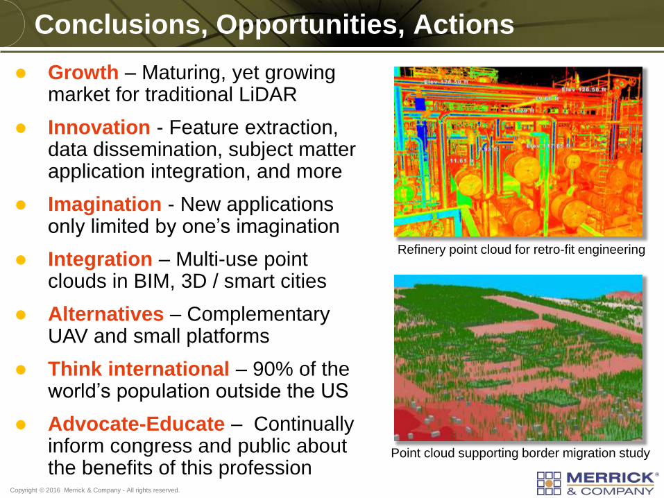
Conclusions, Opportunities, Actions
Growth – Maturing, yet growing market for traditional LiDAR
Innovation - Feature extraction, data dissemination, subject matter application integration, and more
Imagination - New applications only limited by one’s imagination
Integration – Multi-use point clouds in BIM, 3D / smart cities
Alternatives – Complementary UAV and small platforms
Think international – 90% of the world’s population outside the US
Advocate-Educate – Continually inform congress and public about the benefits of this profession
Point cloud supporting border migration study
Refinery point cloud for retro-fit engineering
Copyright © 2016 Merrick & Company - All rights reserved.
Contact Information
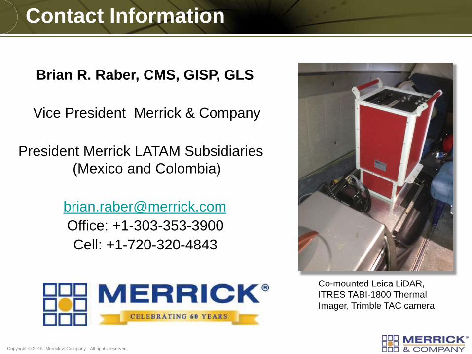
Brian R. Raber, CMS, GISP, GLS
Vice President Merrick & Company
President Merrick LATAM Subsidiaries
(Mexico and Colombia)
Office: +1-303-353-3900
Cell: +1-720-320-4843
Co-mounted Leica LiDAR,
ITRES TABI-1800 Thermal
Imager, Trimble TAC camera