Embed Size (px)
Citation preview
Route details
Start at the car park and head into
Rosewell Village. (The start point can
be cycled from Edinburgh using Na-
tional Cycle Route 1 and the Bon-
nyrigg to Penicuik Cycle Path—Route
196).
Once at the main village junction turn
right. After 400m turn left on to a track
to Thornton Farm then right at farm.
At road junction turn left, then right at
next junction for Stonefieldhill Farm.
Introduction
This is a cycle to save for a good day — it is quite hilly involving a steady climb to the edge of the Moorfoot Hills which is rewarded with fine views across the Lothians to the Pentland Hills. There are no convenient refreshment stops after the village of Rosewell at the start so you may wish to take a picnic.
Cycle
Moorfoot Edge
Distance: 20 miles / 32km
Ascent: 820ft / 250m
Time: 2hrs 30 mins (not in-
cluding stops ) based on 8mph
Terrain – Rough tracks • Tar-
mac • Minor Roads
OS Map: No 66 Edinburgh
Start point: Car Park at
Rosewell on north side of
Peniciuik to Dalkeith Walkway
Grid Reference: NT 28577
62926
For Sat Nav users:
Lat: 55.854221
Long: -3.1424657
Public transport: N/A
Car Parking: Yes (at Rosewell)
Refreshments: No but at vil-
lage of Rosewell there is a
shop.
Routes: JC
Photos: JK
Key Points
of Interest
Arniston House
A magnificent William
Adam, Palladian style mansion
house. Check opening times.
Gladhouse Reservoir
Former water supply reservoir
which is now a site of Special
Scientific Interest.
Temple Kirk
Likely to have been built
by the Knights of St John
soon after they
succeeded the
Templars
in 1312.
Map © Crown copyright and database rights (2015) Ordnance Survey
Licence Number 100023416) www.midlothian.gov.uk
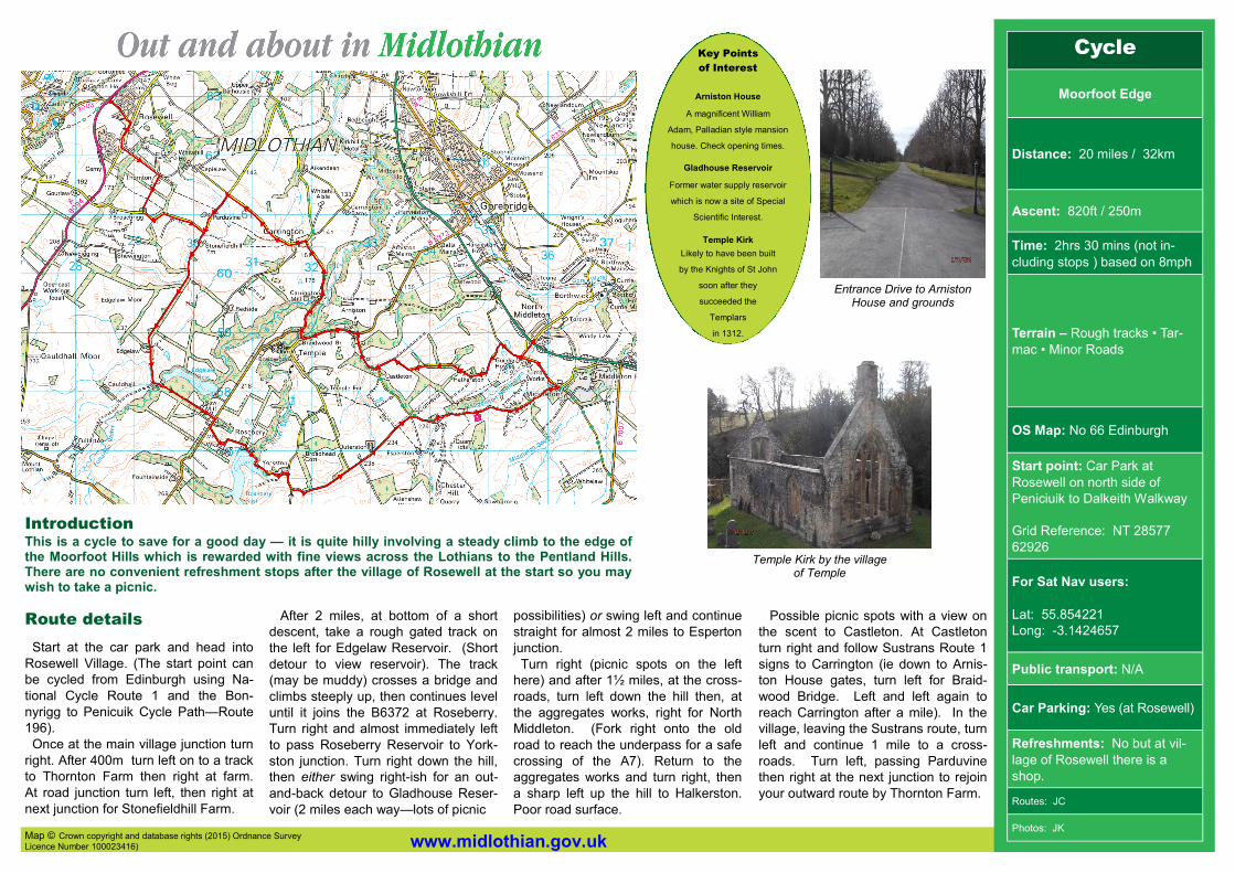
Temple Kirk by the village of Temple
Entrance Drive to Arniston House and grounds
After 2 miles, at bottom of a short
descent, take a rough gated track on
the left for Edgelaw Reservoir. (Short
detour to view reservoir). The track
(may be muddy) crosses a bridge and
climbs steeply up, then continues level
until it joins the B6372 at Roseberry.
Turn right and almost immediately left
to pass Roseberry Reservoir to York-
ston junction. Turn right down the hill,
then either swing right-ish for an out-
and-back detour to Gladhouse Reser-
voir (2 miles each way—lots of picnic
possibilities) or swing left and continue
straight for almost 2 miles to Esperton
junction.
Turn right (picnic spots on the left
here) and after 1½ miles, at the cross-
roads, turn left down the hill then, at
the aggregates works, right for North
Middleton. (Fork right onto the old
road to reach the underpass for a safe
crossing of the A7). Return to the
aggregates works and turn right, then
a sharp left up the hill to Halkerston.
Poor road surface.
Possible picnic spots with a view on
the scent to Castleton. At Castleton
turn right and follow Sustrans Route 1
signs to Carrington (ie down to Arnis-
ton House gates, turn left for Braid-
wood Bridge. Left and left again to
reach Carrington after a mile). In the
village, leaving the Sustrans route, turn
left and continue 1 mile to a cross-
roads. Turn left, passing Parduvine
then right at the next junction to rejoin
your outward route by Thornton Farm.