Embed Size (px)
Citation preview
Introduction to North Carolina
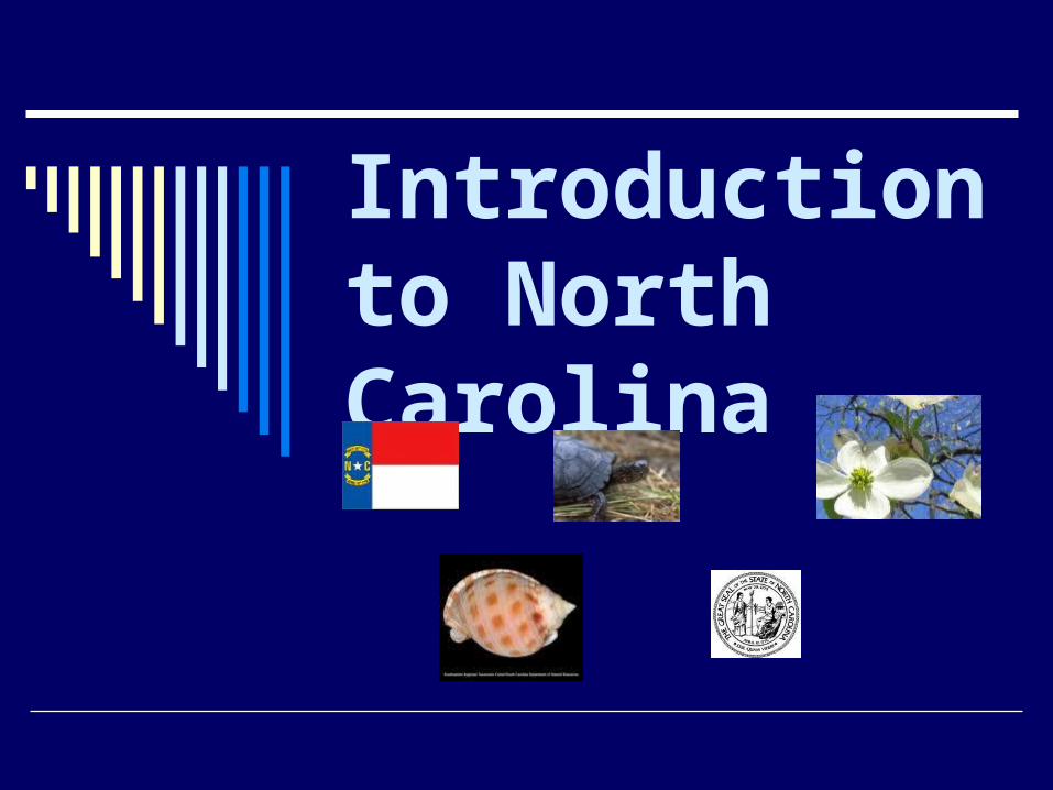
What are the four major regions of NC?
TidewaterCoastal PlainPiedmontMountains
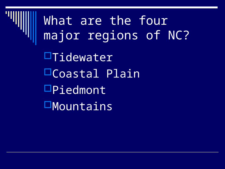
NC Maps
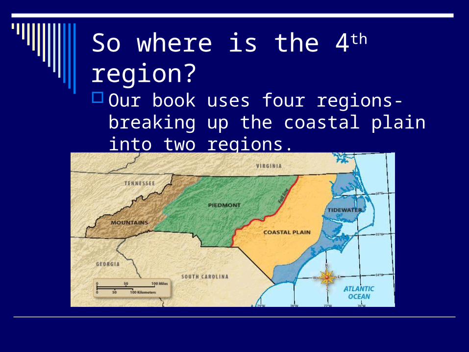
So where is the 4th region?
Our book uses four regions-breaking up the coastal plain into two regions.
Section 1: The Tidewater Section 1: The Tidewater RegionRegion
ESSENTIAL QUESTION What are the major features of the
Tidewater Region? What words do I need to know?
1. sound2. barrier islands3. inlet4. estuary5. pocosin6. Savanna7. sediment
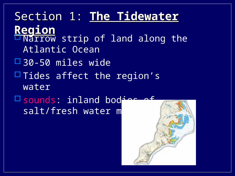
Section 1: Section 1: The Tidewater RegionThe Tidewater Region Narrow strip of land along the Atlantic
Ocean 30-50 miles wide Tides affect the region’s water sounds: inland bodies of salt/fresh water
mix
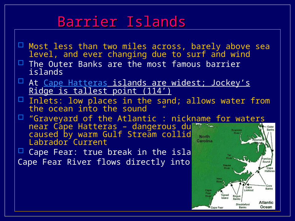
Barrier IslandsBarrier Islands
Most less than two miles across, barely above sea level, and ever changing due to surf and wind
The Outer Banks are the most famous barrier islands At Cape Hatteras islands are widest; Jockey’s Ridge is tallest point
(114’) Inlets: low places in the sand; allows water from the ocean into the
sound “Graveyard of the Atlantic”: nickname for waters near Cape Hatteras
– dangerous due to storms caused by warm Gulf Stream colliding with cold Labrador Current
Cape Fear: true break in the island chain; Cape Fear River flows directly into the Atlantic
The The SoundsSounds
Each sound fed by fresh water river Oldest towns in NC near the sounds Great location for trade along river routes
and ocean Fishing is an important industry Sediment (soil, clay, gravel) is deposited
by the rivers in the sounds – makes them too shallow for large ships
estuaries: salt water wetlands; these marshes are home to shellfish and shrimp
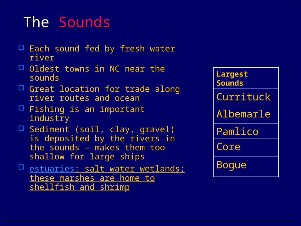
Largest Sounds
Currituck
Albemarle
Pamlico
Core
Bogue
Swamps and LakesSwamps and Lakes pocosins: wetland type; Indian name means “swamp on a
hill” Alligator and Big Pocosin are the largest
savanna: wetland type tall grasses mix with various pines example: Green Swamp (home of Venus Fly Trap)
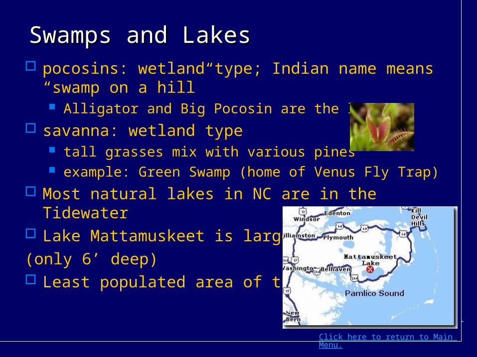
Most natural lakes in NC are in the Tidewater Lake Mattamuskeet is largest
(only 6’ deep) Least populated area of the state
Click here to return to Main Menu.

Section 2: The Coastal Plain Section 2: The Coastal Plain RegionRegion
ESSENTIAL QUESTION What are the major features of
the Coastal Plain Region?
What words do I need to know? crossroads hamletstobacco townsCarolina baysSandhills
Section 2: The Coastal Plain RegionSection 2: The Coastal Plain Region
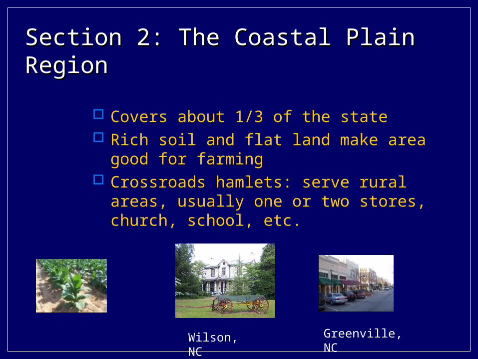
Covers about 1/3 of the state Rich soil and flat land make area good for
farming Crossroads hamlets: serve rural areas,
usually one or two stores, church, school, etc.
Wilson, NC Greenville, NC
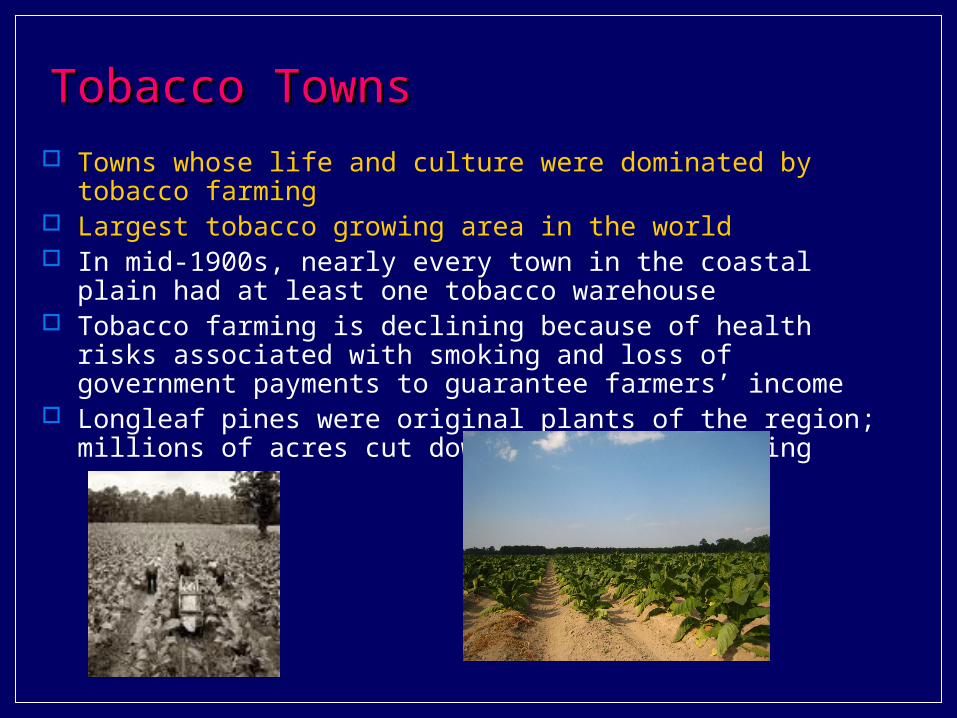
Tobacco TownsTobacco Towns Towns whose life and culture were dominated by tobacco farming Largest tobacco growing area in the world In mid-1900s, nearly every town in the coastal plain had at least one
tobacco warehouse Tobacco farming is declining because of health risks associated with
smoking and loss of government payments to guarantee farmers’ income
Longleaf pines were original plants of the region; millions of acres cut down for tobacco farming
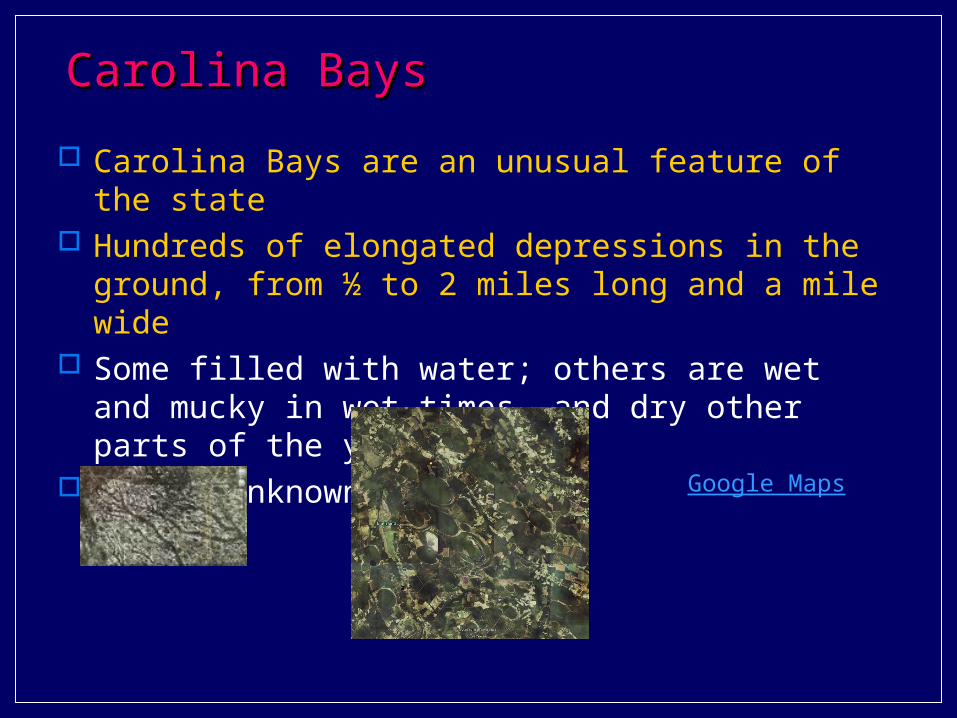
Carolina BaysCarolina Bays
Carolina Bays are an unusual feature of the state Hundreds of elongated depressions in the ground, from
½ to 2 miles long and a mile wide Some filled with water; others are wet and mucky in wet
times, and dry other parts of the year Origin unknown
Google Maps
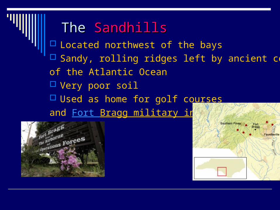
The The SandhillsSandhills Located northwest of the bays Sandy, rolling ridges left by ancient coast
of the Atlantic Ocean Very poor soil Used as home for golf courses
and Fort Bragg military installation

Section 3: The Piedmont RegionSection 3: The Piedmont RegionESSENTIAL QUESTION
What are the major features of the Piedmont Region?
What words do I need to know? fall lineheadwaterssectionalismmill villageNASCARmonadnock
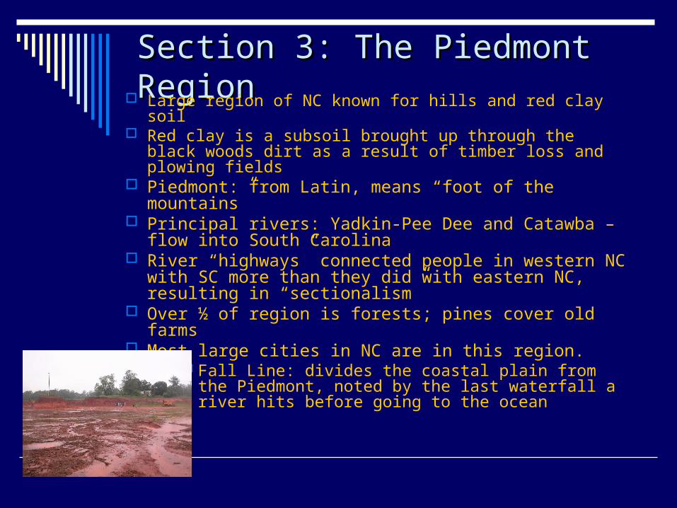
Section 3: The Piedmont RegionSection 3: The Piedmont Region Large region of NC known for hills and red clay soil Red clay is a subsoil brought up through the black woods
dirt as a result of timber loss and plowing fields Piedmont: from Latin, means “foot of the mountains” Principal rivers: Yadkin-Pee Dee and Catawba – flow
into South Carolina River “highways” connected people in western NC with
SC more than they did with eastern NC, resulting in “sectionalism”
Over ½ of region is forests; pines cover old farms Most large cities in NC are in this region.
Fall Line: divides the coastal plain from the Piedmont, noted by the last waterfall a river hits before going to the ocean
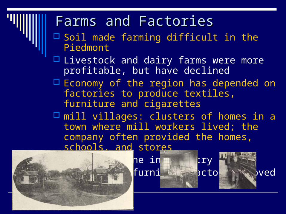
Farms and FactoriesFarms and Factories Soil made farming difficult in the Piedmont Livestock and dairy farms were more profitable, but
have declined Economy of the region has depended on factories
to produce textiles, furniture and cigarettes mill villages: clusters of homes in a town where mill
workers lived; the company often provided the homes, schools, and stores
1990s: decline in industry Textile and furniture factories moved to Asia

Banking and RacingBanking and Racing
Charlotte: national banking center and home to NASCAR, and NASCAR Hall of Fame
Winston-Salem and Durham have grown in medical service industries linked to Wake Forest and Duke Universities
Salisbury: home to grocery industry Research Triangle Park: leader in
pharmaceuticals and computers
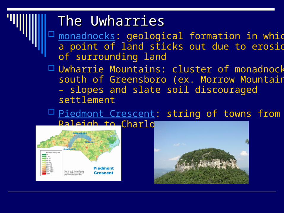
The UwharriesThe Uwharries monadnocks: geological formation in which a point of
land sticks out due to erosion of surrounding land Uwharrie Mountains: cluster of monadnocks south of
Greensboro (ex. Morrow Mountain) – slopes and slate soil discouraged settlement
Piedmont Crescent: string of towns from Raleigh to Charlotte
Section 4: The Mountains Section 4: The Mountains RegionRegion
ESSENTIAL QUESTION What are the major features of
the Mountains Region? What words do I need to know?
1. elevation
2. bald
3. cove
Section 4: The Mountains RegionSection 4: The Mountains Region
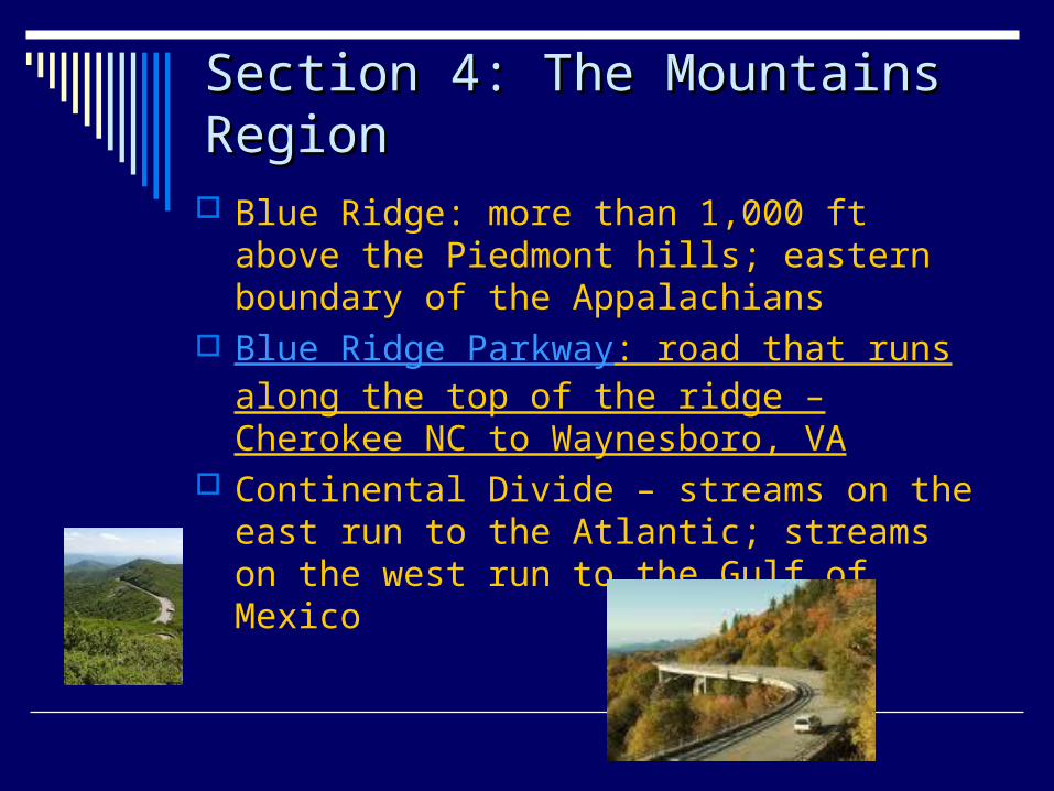
Blue Ridge: more than 1,000 ft above the Piedmont hills; eastern boundary of the Appalachians
Blue Ridge Parkway: road that runs along the top of the ridge – Cherokee NC to Waynesboro, VA
Continental Divide – streams on the east run to the Atlantic; streams on the west run to the Gulf of Mexico
The Blue RidgeThe Blue Ridge
Runs from Pennsylvania to Georgia
One long landform (like the barrier islands) with peaks and gaps
Early settlers depended on gaps to get through the mountains
1870s: tunnels and road beds laid through Swanannoa Gap – near current I-40 from Old Fort to Black Mountain
Run from New York to Alabama 43 peaks in NC over 6,000 feet Mt. Mitchell (6,684 ft): highest point
east of the Rockies Ranges
Black Mountains: known for dark shadows during thunderstorms
Great Smoky Mountains: dew rises in mists creating a smoky effect; tallest peaks are Clingman’s Dome and Mt. Guyot; great variety of plants
Balsams: large number of balds (places where few trees grow)
The Appalachians:
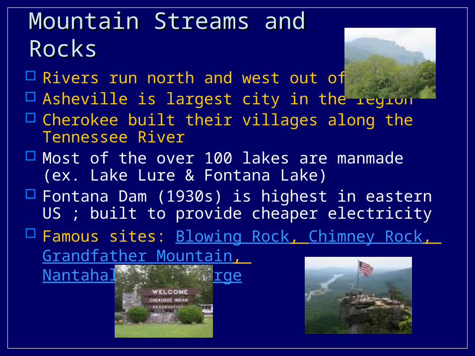
Mountain Streams and RocksMountain Streams and Rocks
Rivers run north and west out of NC Asheville is largest city in the region Cherokee built their villages along the Tennessee River Most of the over 100 lakes are manmade (ex. Lake Lure
& Fontana Lake) Fontana Dam (1930s) is highest in eastern US ; built to
provide cheaper electricity Famous sites: Blowing Rock, Chimney Rock,
Grandfather Mountain, Nantahala River Gorge

The Mountains EconomyThe Mountains Economy Early settlers isolated from others Farming, traveling, trading were more difficult Towns developed in valley areas Known for sales of local plants with medicinal
properties Tourism is a major industry Christmas tree is a new and growing industry;
Fraser firs most popular
Section 5: North Carolina’s Section 5: North Carolina’s Weather and ClimateWeather and Climate
ESSENTIAL QUESTION What are characteristics of North
Carolina’s climate? What words do I need to know?
1. weather2. climate3. westerlies4. humidity5. precipitation6. tornado7. hurricane
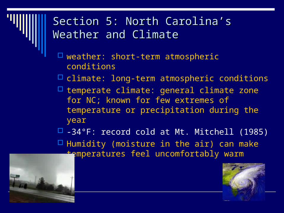
Section 5: North Carolina’s Weather Section 5: North Carolina’s Weather and Climateand Climate
weather: short-term atmospheric conditions climate: long-term atmospheric conditions temperate climate: general climate zone for NC;
known for few extremes of temperature or precipitation during the year
-34°F: record cold at Mt. Mitchell (1985) Humidity (moisture in the air) can make
temperatures feel uncomfortably warm