Embed Size (px)
Citation preview
I n t e g r i t y - S e r v i c e - E x c e l l e n c e
Headquarters U.S. Air Force
1
Gulf Regional Airspace
Strategic Initiative (GRASI)
Landscape Planning Initiative
HON Terry Yonkers
Asst Secretary of Air Force
Installations, Environment & Logistics
This document contains information EXEMPT FROM MANDATORY DISCLOSURE under the Freedom of
Information Act (5 USC 522(b)). This is a draft review document and Exemption 5, deliberative process, applies.
I n t e g r i t y - S e r v i c e - E x c e l l e n c e
Overview
Purpose of GRASI
GRASI Challenge
Landscape Planning Initiative
Next Steps
2
I n t e g r i t y - S e r v i c e - E x c e l l e n c e
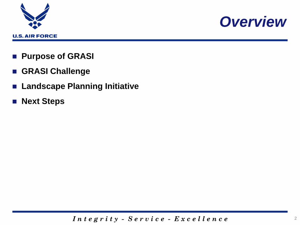
Purpose of GRASI
3
I n t e g r i t y - S e r v i c e - E x c e l l e n c e
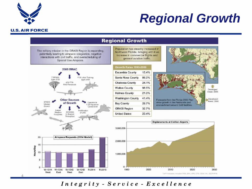
Regional Growth
4
I n t e g r i t y - S e r v i c e - E x c e l l e n c e
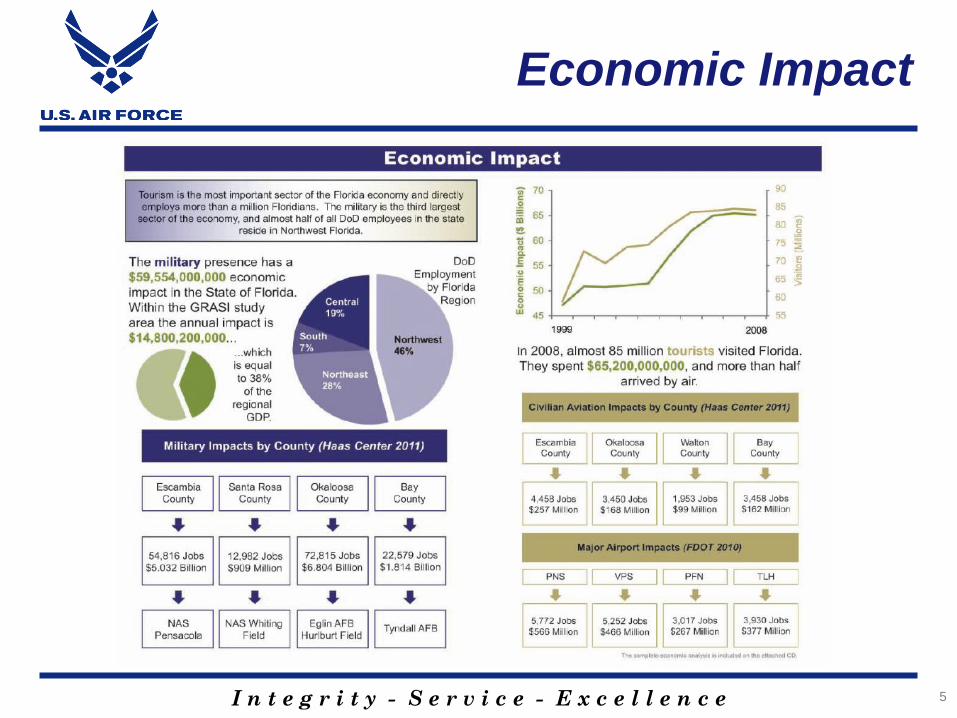
Economic Impact
5
I n t e g r i t y - S e r v i c e - E x c e l l e n c e
GRASI Challenge
Addition of BRAC 2005 missions to existing missions in NW FL
will create mission challenges for all users Gulf Range/Airspace
Currently GRASI area is experiencing a “bathtub” as old F-15
mission is gone and new missions begin to build up in the area
During “bathtub”, AFSOC and other non-BRAC existing missions
have grown adding to the future challenges for all users
Modeling of all future requirements suggest significant impacts
to all range users once all new/existing missions are full up
Northern Gulf of Mexico Region is a biodiversity “hotspot”
Conservation community priorities drive a mutually beneficial
desire to limit commercial/residential development
Creates synergy between military requirements and
conservation priorities…win/win
6
I n t e g r i t y - S e r v i c e - E x c e l l e n c e
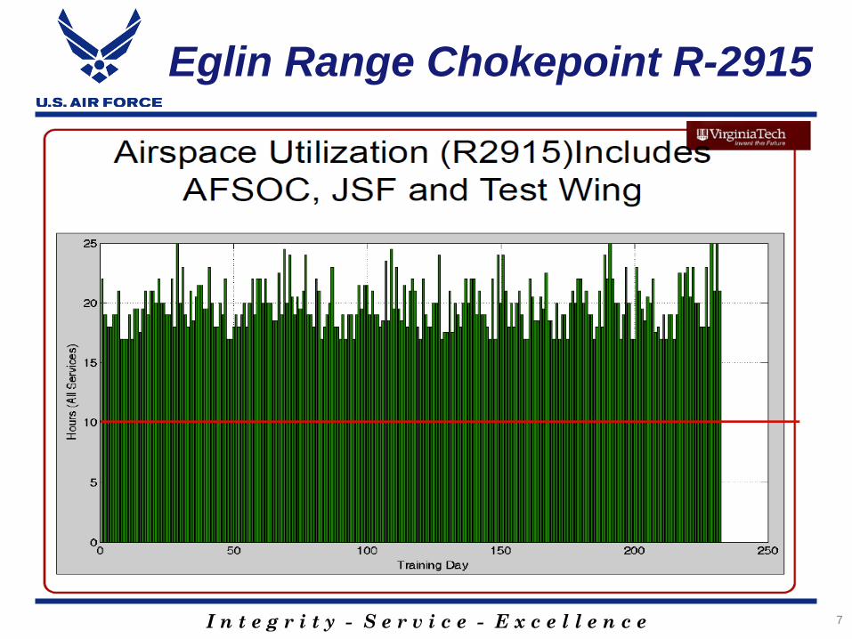
Eglin Range Chokepoint R-2915
7
I n t e g r i t y - S e r v i c e - E x c e l l e n c e
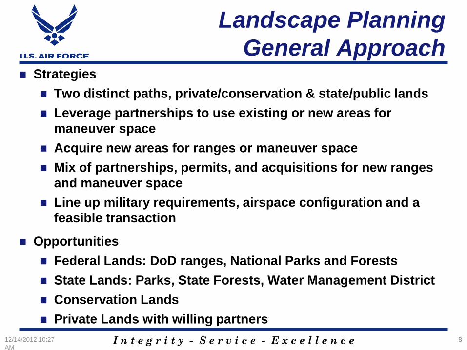
Landscape Planning
General Approach Strategies
Two distinct paths, private/conservation & state/public lands
Leverage partnerships to use existing or new areas for
maneuver space
Acquire new areas for ranges or maneuver space
Mix of partnerships, permits, and acquisitions for new ranges
and maneuver space
Line up military requirements, airspace configuration and a
feasible transaction
Opportunities
Federal Lands: DoD ranges, National Parks and Forests
State Lands: Parks, State Forests, Water Management District
Conservation Lands
Private Lands with willing partners
12/14/2012 10:27
AM
8
I n t e g r i t y - S e r v i c e - E x c e l l e n c e
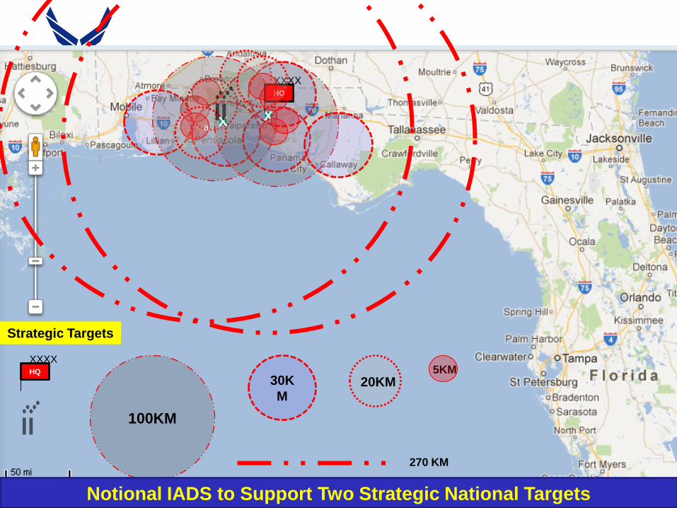
X
XXXX HQ
5KM 30K
M
100KM
a
270 KM
X
XXXX HQ
20KM
Strategic Targets
Notional IADS to Support Two Strategic National Targets
I n t e g r i t y - S e r v i c e - E x c e l l e n c e
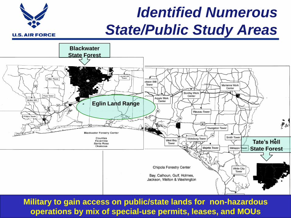
Identified Numerous
State/Public Study Areas
10
Eglin Land Range
Military to gain access on public/state lands for non-hazardous
operations by mix of special-use permits, leases, and MOUs
Blackwater
State Forest
Tate’s Hell
State Forest
I n t e g r i t y - S e r v i c e - E x c e l l e n c e
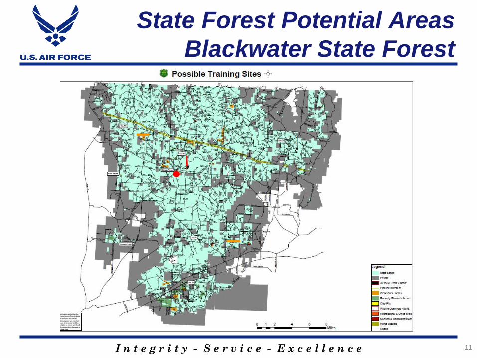
State Forest Potential Areas
Blackwater State Forest
11
I n t e g r i t y - S e r v i c e - E x c e l l e n c e
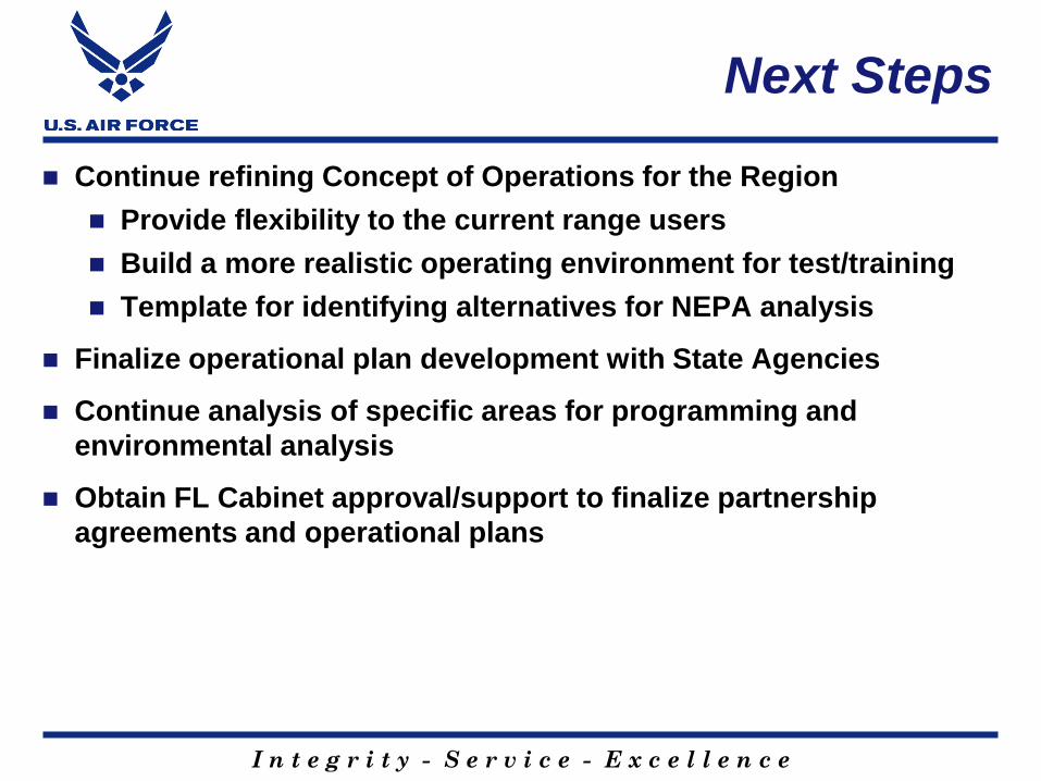
Next Steps
Continue refining Concept of Operations for the Region
Provide flexibility to the current range users
Build a more realistic operating environment for test/training
Template for identifying alternatives for NEPA analysis
Finalize operational plan development with State Agencies
Continue analysis of specific areas for programming and
environmental analysis
Obtain FL Cabinet approval/support to finalize partnership
agreements and operational plans

I n t e g r i t y - S e r v i c e - E x c e l l e n c e
13
I n t e g r i t y - S e r v i c e - E x c e l l e n c e 14
I n t e g r i t y - S e r v i c e - E x c e l l e n c e
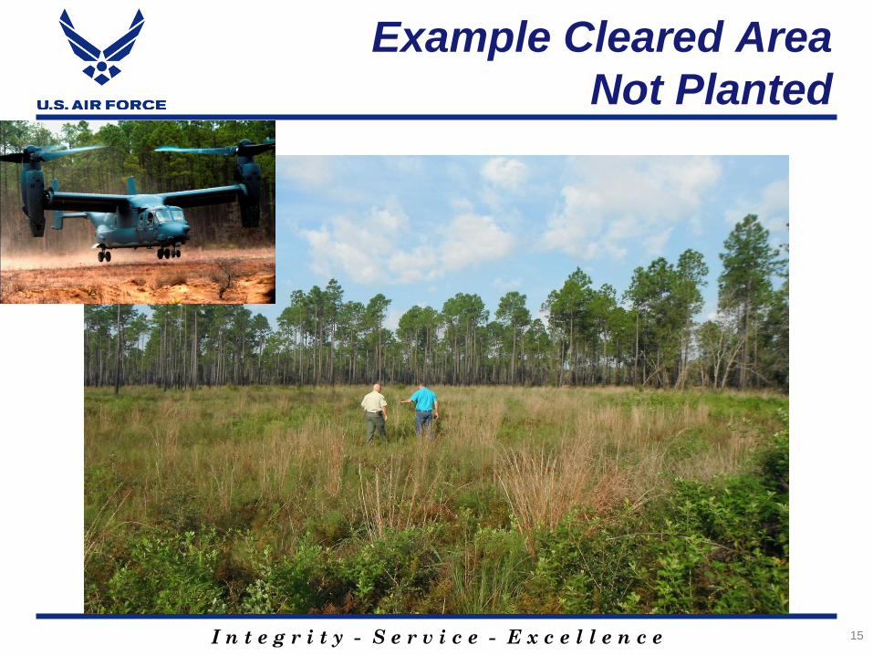
Example Cleared Area
Not Planted
15
I n t e g r i t y - S e r v i c e - E x c e l l e n c e
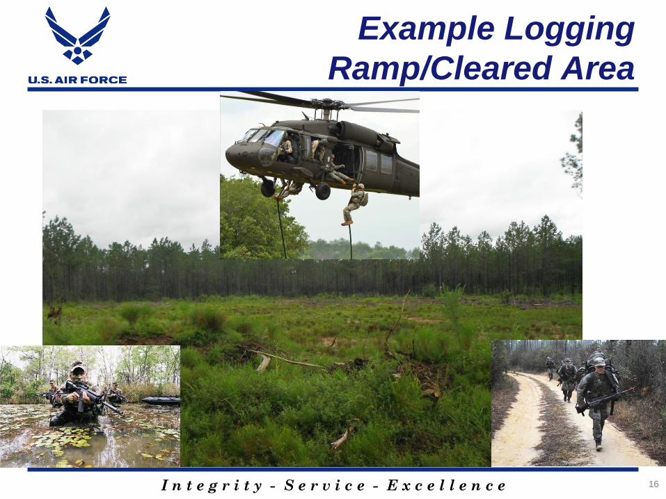
Example Logging
Ramp/Cleared Area
16
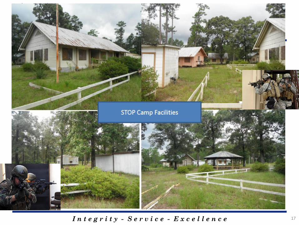
I n t e g r i t y - S e r v i c e - E x c e l l e n c e 17
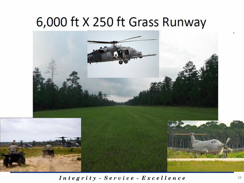
I n t e g r i t y - S e r v i c e - E x c e l l e n c e 18
I n t e g r i t y - S e r v i c e - E x c e l l e n c e
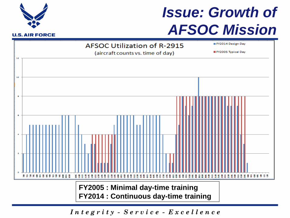
Issue: Growth of
AFSOC Mission
FY2005 : Minimal day-time training
FY2014 : Continuous day-time training