Embed Size (px)
Citation preview
Dr. Agus WibowoHead of Data Division
National Agency for Disaster Management (BNPB)
Geospatial Information System in Indonesian Agency for Disaster
Management (BNPB)
Regional Workshop on Geo-referenced Disaster Risk Management Information System
for South-East and East Asia, and the Pacific, 20-22 February 2013, Un ESCAP, Bangkok
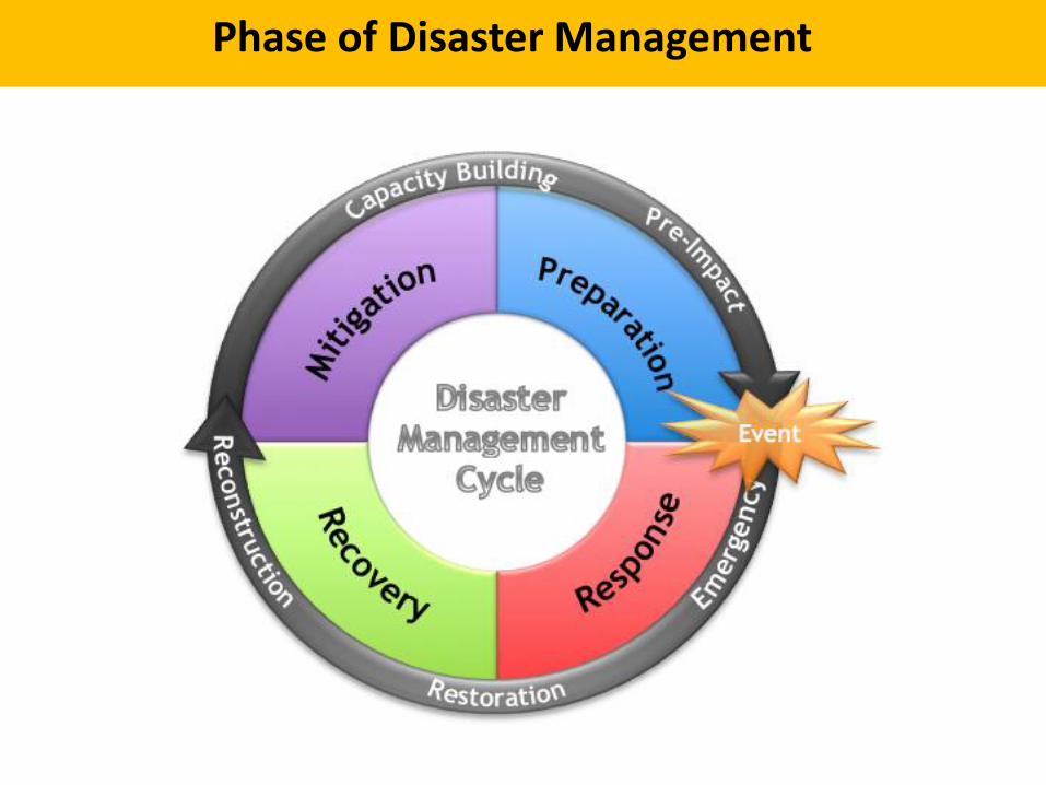
Phase of Disaster Management
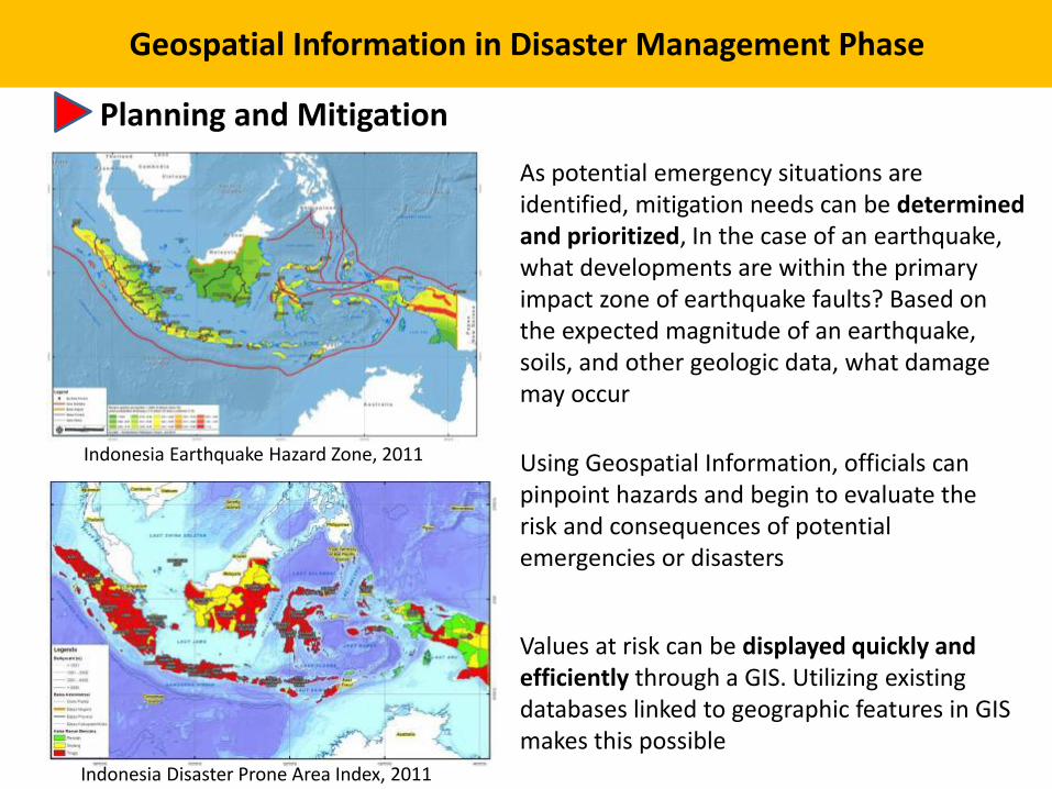
Geospatial Information in Disaster Management Phase
Planning and Mitigation
Indonesia Earthquake Hazard Zone, 2011
Indonesia Disaster Prone Area Index, 2011
Using Geospatial Information, officials can pinpoint hazards and begin to evaluate the risk and consequences of potential emergencies or disasters
As potential emergency situations are identified, mitigation needs can be determined and prioritized, In the case of an earthquake, what developments are within the primary impact zone of earthquake faults? Based on the expected magnitude of an earthquake, soils, and other geologic data, what damage may occur
Values at risk can be displayed quickly and efficiently through a GIS. Utilizing existing databases linked to geographic features in GIS makes this possible
Preparedness
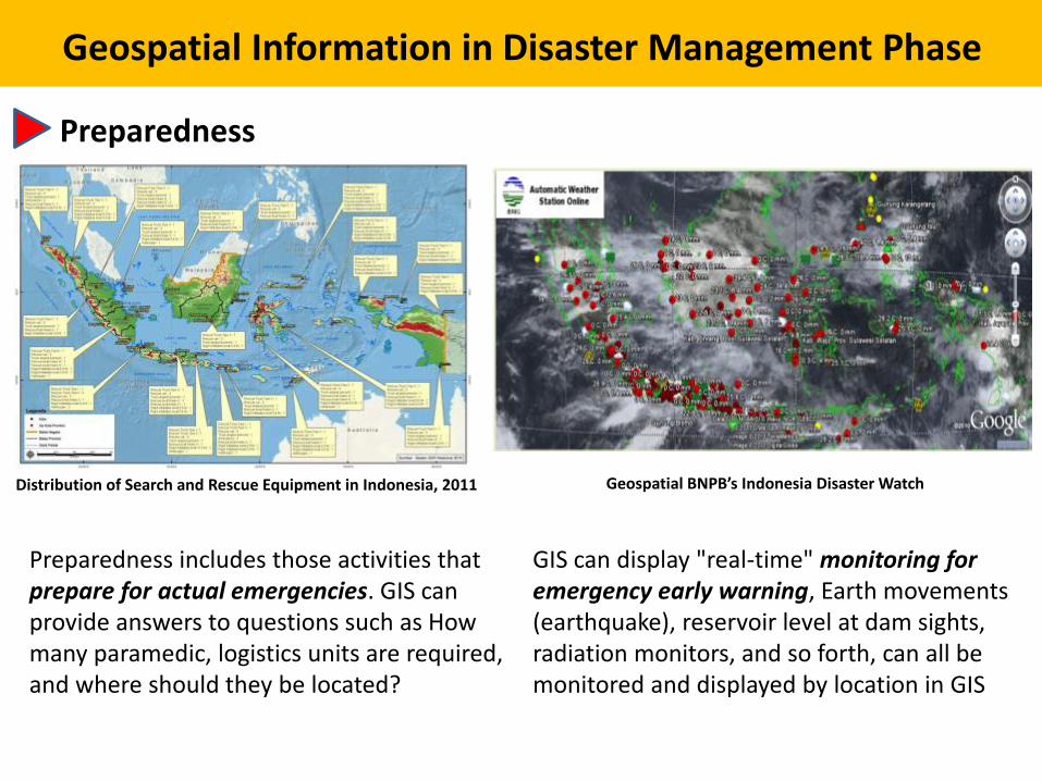
Geospatial Information in Disaster Management Phase
Distribution of Search and Rescue Equipment in Indonesia, 2011
Preparedness includes those activities that prepare for actual emergencies. GIS can provide answers to questions such as How many paramedic, logistics units are required, and where should they be located?
GIS can display "real-time" monitoring for emergency early warning, Earth movements (earthquake), reservoir level at dam sights, radiation monitors, and so forth, can all be monitored and displayed by location in GIS
Geospatial BNPB’s Indonesia Disaster Watch
Geospatial Information in Disaster Management Phase
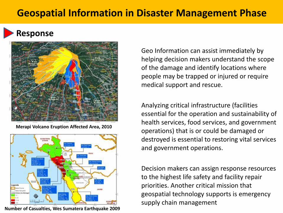
Response
Geo Information can assist immediately by helping decision makers understand the scope of the damage and identify locations where people may be trapped or injured or require medical support and rescue.
Analyzing critical infrastructure (facilities essential for the operation and sustainability of health services, food services, and government operations) that is or could be damaged or destroyed is essential to restoring vital services and government operations.
Merapi Volcano Eruption Affected Area, 2010
Number of Casualties, Wes Sumatera Earthquake 2009
Decision makers can assign response resources to the highest life safety and facility repair priorities. Another critical mission that geospatial technology supports is emergency supply chain management
Geospatial Information in Disaster Management Phase
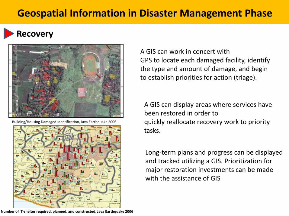
Recovery
A GIS can work in concert withGPS to locate each damaged facility, identify the type and amount of damage, and beginto establish priorities for action (triage).
Building/Housing Damaged Identification, Java Earthquake 2006
A GIS can display areas where services have been restored in order toquickly reallocate recovery work to priority tasks.
Number of T-shelter required, planned, and constructed, Java Earthquake 2006
Long-term plans and progress can be displayed and tracked utilizing a GIS. Prioritization for major restoration investments can be made with the assistance of GIS
The Status of Geospatial Information
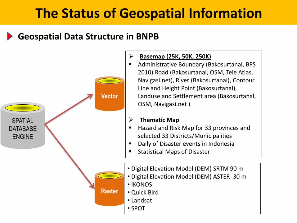
Geospatial Data Structure in BNPB
SPATIAL
DATABASE
ENGINE
Vector
Raster
Basemap (25K, 50K, 250K) Administrative Boundary (Bakosurtanal, BPS
2010) Road (Bakosurtanal, OSM, Tele Atlas, Navigasi.net), River (Bakosurtanal), Contour Line and Height Point (Bakosurtanal), Landuse and Settlement area (Bakosurtanal, OSM, Navigasi.net )
Thematic Map Hazard and Risk Map for 33 provinces and
selected 33 Districts/Municipalities Daily of Disaster events in Indonesia Statistical Maps of Disaster
• Digital Elevation Model (DEM) SRTM 90 m• Digital Elevation Model (DEM) ASTER 30 m• IKONOS• Quick Bird• Landsat• SPOT
Satellite/Airborne Data
• Mostly using available data on internet i.e. Google Earth, Bing Maps, CRISP, etc.
• Provided by Government agencies (i.e. LAPAN), UN Agencies, UNOSAT, Foreign Government, etc.
• UAV
• Airborne oblique photo
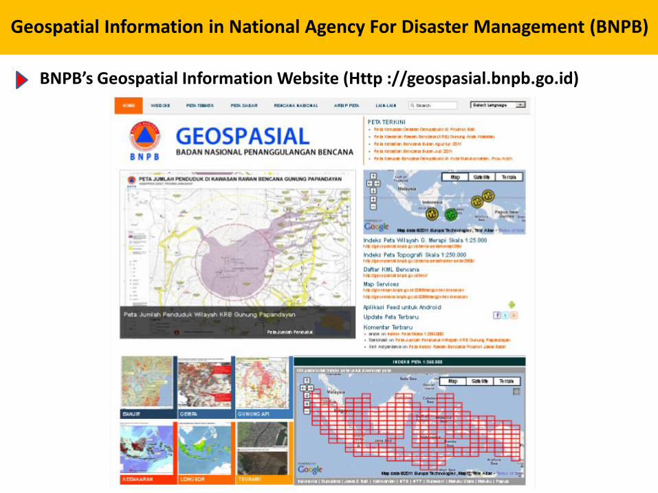
Geospatial Information in National Agency For Disaster Management (BNPB)
BNPB’s Geospatial Information Website (Http ://geospasial.bnpb.go.id)
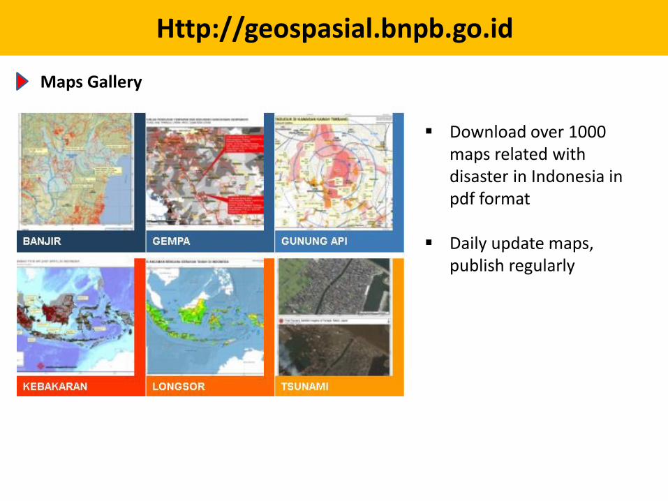
Http://geospasial.bnpb.go.id
Maps Gallery
Download over 1000 maps related with disaster in Indonesia in pdf format
Daily update maps, publish regularly
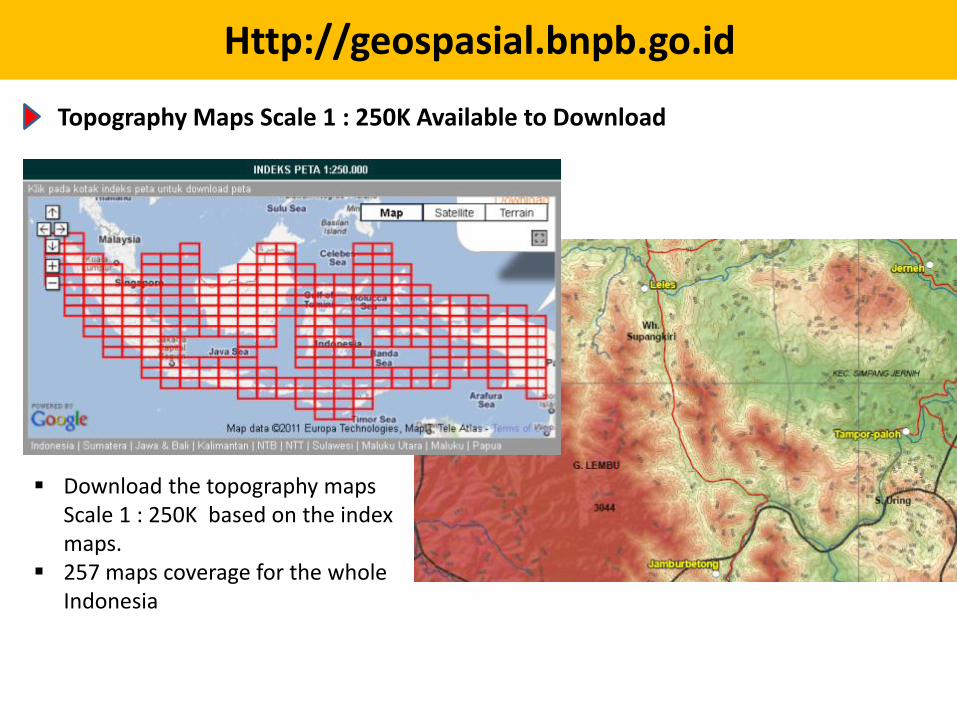
Http://geospasial.bnpb.go.id
Topography Maps Scale 1 : 250K Available to Download
Download the topography maps Scale 1 : 250K based on the index maps.
257 maps coverage for the whole Indonesia
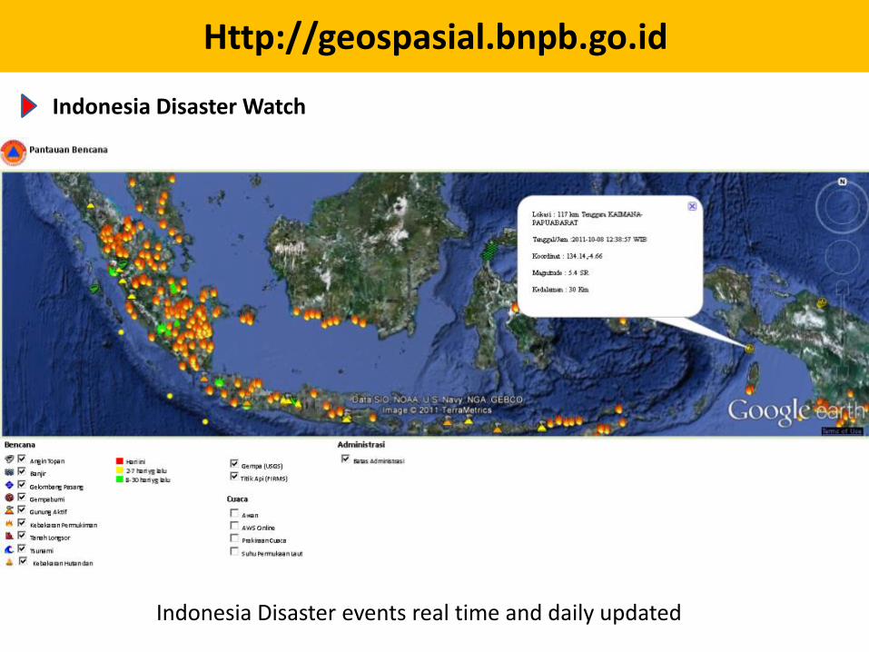
Http://geospasial.bnpb.go.id
Indonesia Disaster Watch
Indonesia Disaster events real time and daily updated
Http://geospasial.bnpb.go.id
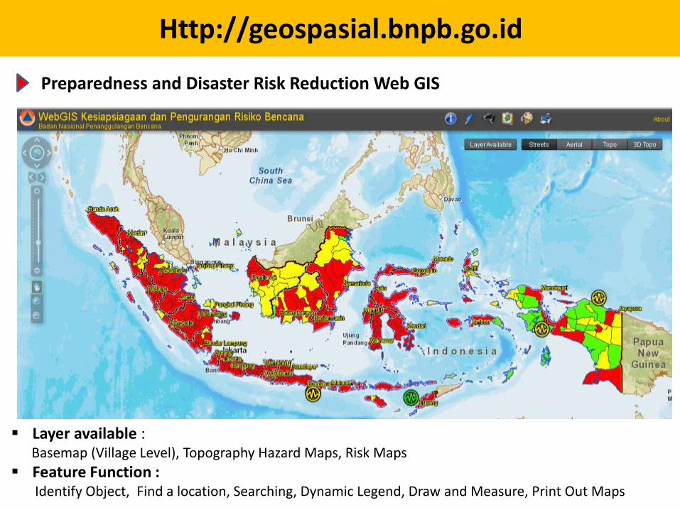
Preparedness and Disaster Risk Reduction Web GIS
Layer available : Basemap (Village Level), Topography Hazard Maps, Risk Maps
Feature Function :Identify Object, Find a location, Searching, Dynamic Legend, Draw and Measure, Print Out Maps
Http://geospasial.bnpb.go.id
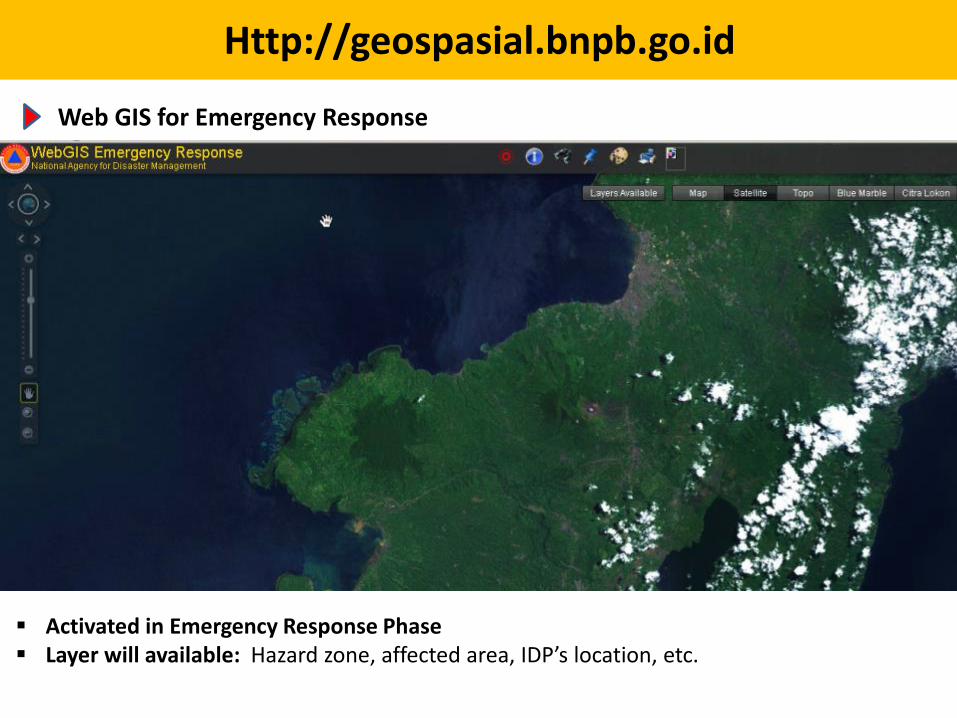
Web GIS for Emergency Response
Activated in Emergency Response Phase Layer will available: Hazard zone, affected area, IDP’s location, etc.
Http://geospasial.bnpb.go.id
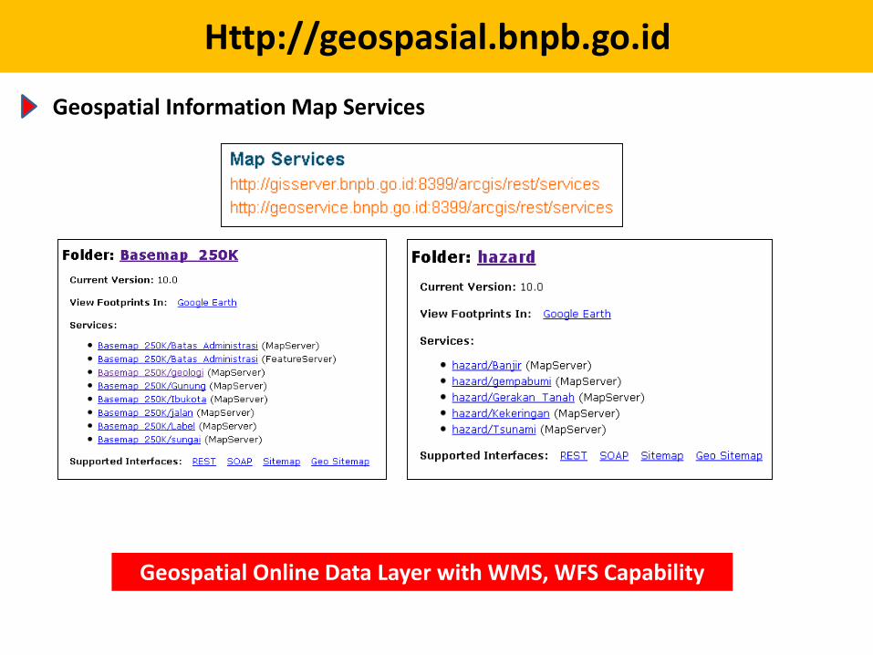
Geospatial Information Map Services
Geospatial Online Data Layer with WMS, WFS Capability

Http://geospasial.bnpb.go.id
BNPB Geospatial Information Via Mobile
Download application for Android:http://geospasial.bnpb.go.id/apps
• BNPB is developing its capacity to simply but realistically model natural disaster scenarios
• These scenarios are then underpinning both response and preparedness planning
• Based on best available science, data and engineering
Modelling Natural Disaster Scenarios
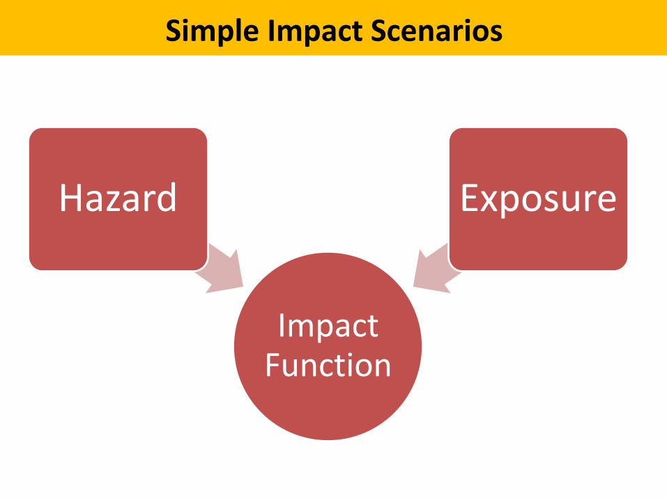
Impact Function
Hazard Exposure
Simple Impact Scenarios
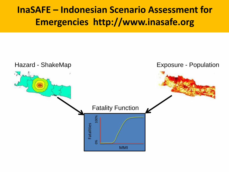
Hazard - ShakeMap Exposure - Population
Fata
litie
s
0%
10
0%
MMI
Fatality Function
InaSAFE – Indonesian Scenario Assessment for Emergencies http://www.inasafe.org
Lessons-learnt
• Database development is supported by multi stage holders i.e. Government agencies, UN Agencies, NGO, Private sectors, etc.
• Experts, hardware and software is supported by SCDRR-UNDP Project.
• It takes 2 years (2009-2010) for developing the database.
• Politically supported by BNPB
Government Policy
• One door data policy – BNPB is become the only one have authority to release disaster data in Indonesia.
• One Map Policy– Basemap is developed and manage by Bakosurtanal /
BIG – Thematic Map is develop and manage by relevant
agencies i.e. Hazard and Risk Map (BNPB), Forest map (Ministry or Forestry), etc.
– Participatory mapping can be done by anyone who has mapping capacity i.e. OSM
• National Spatial Data Infrastructure (NSDI)– Metadata– Web Map Service
Challenges
• Sustaining skilled geospatial experts within organization.
• Data availability:
– Basemap and thematic map
– Satellite data
– Other data
• Data sharing and meta data.
Recommendations
• Capacity building on using geospatial data for common user, operator level, administrator level, mid level manager and top level manager.
• Easy and quick access to satellite data.
• Sharing data: inter agencies and also country to country.
• Sharing knowledge between countries.

THANK YOU