Embed Size (px)
Citation preview
Washington Metropolitan Area Transit Auth
Constructing WMATA’s Enterprise GIS:
Strategy, Action, Issues
Ed Wells, GIS ManagerAnurag Mehta, GIS Architect
ESRI Federal User ConferenceFebruary 23, 2012
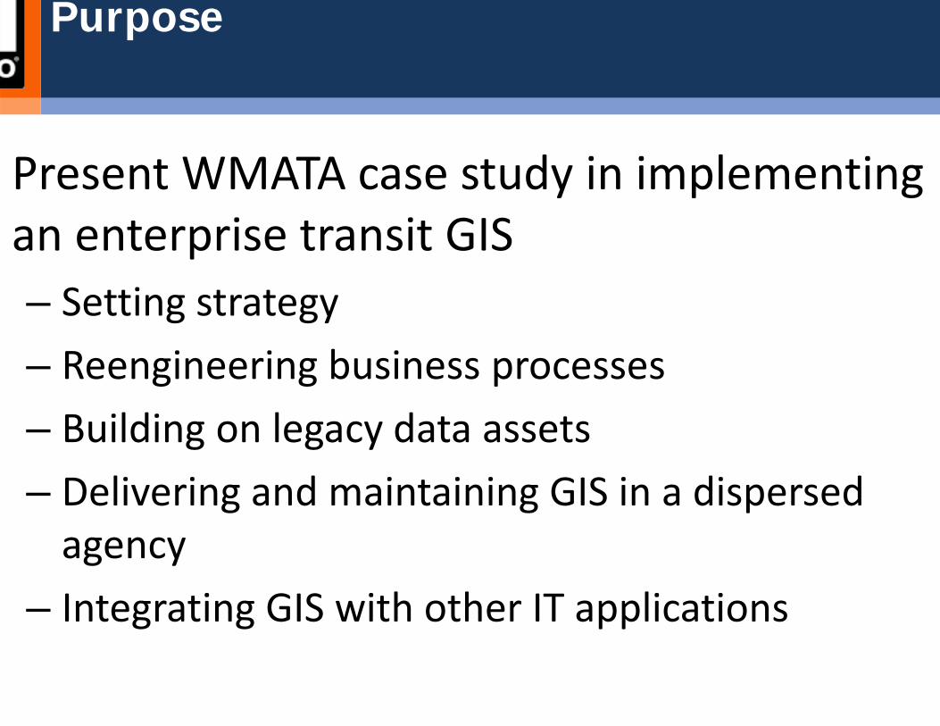
Present WMATA case study in implementing an enterprise transit GIS– Setting strategy– Reengineering business processes– Building on legacy data assets– Delivering and maintaining GIS in a dispersed agency
– Integrating GIS with other IT applications
Purpose
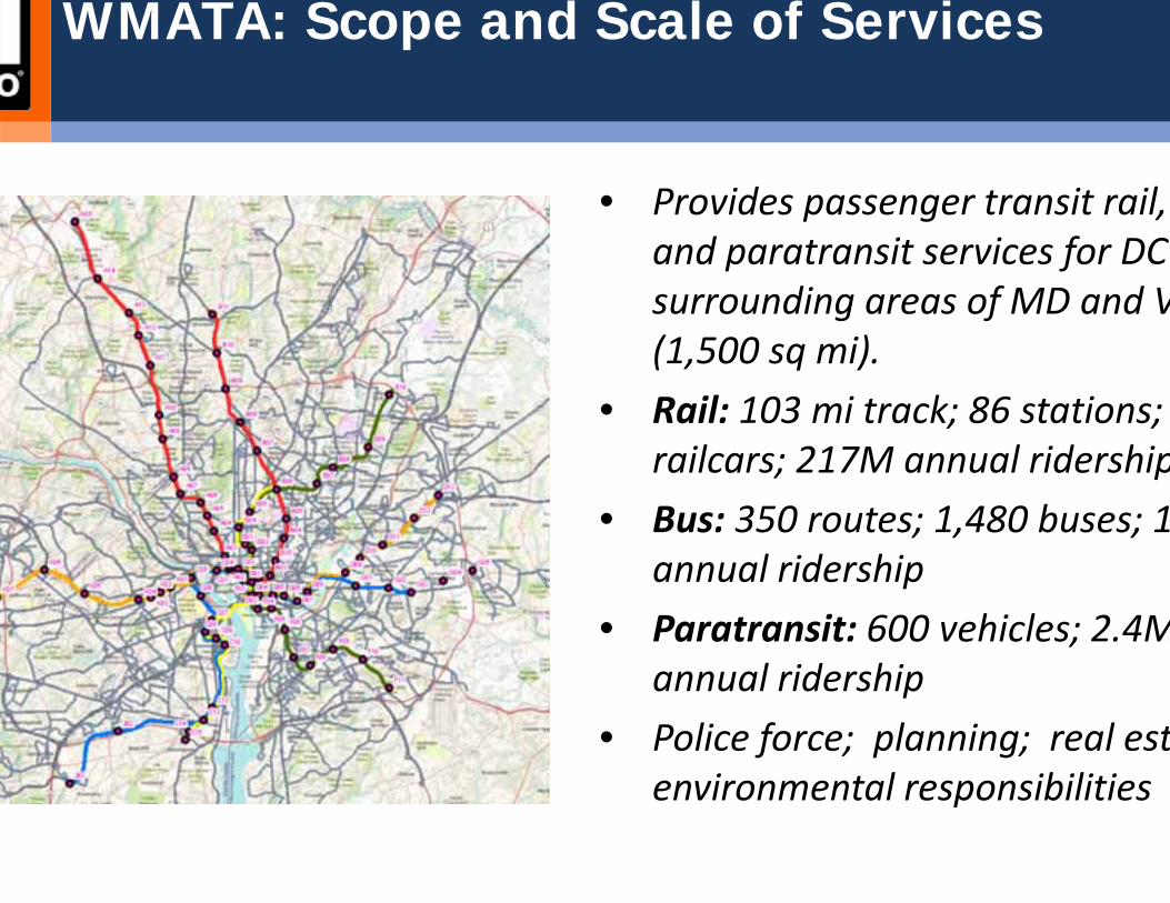
WMATA: Scope and Scale of Services
• Provides passenger transit rail, and paratransit services for DC surrounding areas of MD and V(1,500 sq mi).
• Rail: 103 mi track; 86 stations; railcars; 217M annual ridership
• Bus: 350 routes; 1,480 buses; 1annual ridership
• Paratransit: 600 vehicles; 2.4Mannual ridership
• Police force; planning; real estenvironmental responsibilities
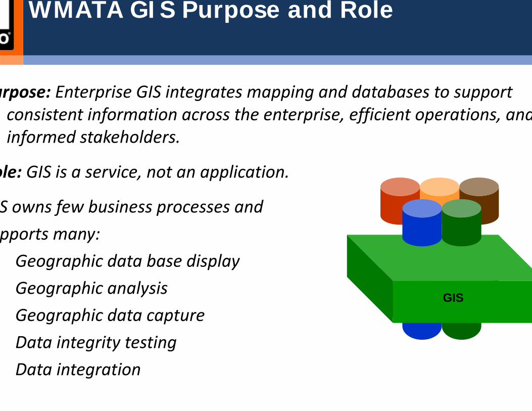
urpose: Enterprise GIS integrates mapping and databases to support consistent information across the enterprise, efficient operations, andinformed stakeholders.
ole: GIS is a service, not an application.
S owns few business processes and pports many:Geographic data base displayGeographic analysisGeographic data captureData integrity testingData integration
WMATA GIS Purpose and Role
GIS

IT Span of GIS
Software – ESRI ArcGIS 9.3.1 (upgrading to 10 this year)Hardware– Production, staging, dev environments; education and map production
environments– Managed storage (SAN and NAS)
ApplicationsDataIntegration – Maximo and Trapeze in progressWeb services – Agency‐wide intranet viewerBusiness processesUser support
GIS Development Chronology 2007-2011
Y08 Strategic plan
Y09 Enterprise ArchitectureEnterprise GIS software installation; as‐is data loading
Y10 WebADF GIS web viewer and core data
Y11 Flex GIS web viewer Integrated bus stop and route databaseBus stop and route data posted to public web site Rail linear referencing system for mainline trackBegan integrating GIS with asset/work order management syste(Maximo)
GIS Development Priorities, 2011-2012
Upgrade to ArcGIS 10/Oracle 11g/Windows 2008GIS‐MMMS integration: design, software implementation; dataConstruct the transit route network and obtain software toolto maintain itAdd data sets and services to the internet viewer; deploy webservices for application integrationShow bus stops and route maps on WMATA’s public website.Map rail station and bus garage interiorsOffer expanded user support, metadata, and training

Setting Strategy: A Portfolio Approach
Parcel Facility Amenity
Rail, Bus, Van, Road Network
40% Fixed Asset Management
40% Transit Operations
• Stops, time points, chain markers, waypoints
• Patterns, routes, lines, transfers
• Performance (vehicles, trips, blocks)
20% Support Operations MTPD, Plan, Real Estate; Environmental, IT
Strategic Portfolio of GIS

Building Alliances Across Departments
ey Principles in Building GIS Relations with User DepartmentsIT is a support departmentKeep the domain expert in charge of information decisionsKeep IT in charge of data and system architecture decisionsDo not start applications unless the data is compiledDo not compile data you are not jointly prepared to maintainMake it easy for the domain expert to feed information to the GIS stafUse the maintenance process to drive business process reengineering
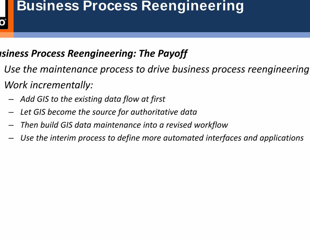
Business Process Reengineering
usiness Process Reengineering: The PayoffUse the maintenance process to drive business process reengineeringWork incrementally: – Add GIS to the existing data flow at first– Let GIS become the source for authoritative data– Then build GIS data maintenance into a revised workflow– Use the interim process to define more automated interfaces and applications
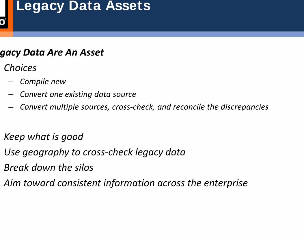
Legacy Data Assets
gacy Data Are An AssetChoices– Compile new– Convert one existing data source– Convert multiple sources, cross‐check, and reconcile the discrepancies
Keep what is goodUse geography to cross‐check legacy dataBreak down the silosAim toward consistent information across the enterprise

Enterprise GIS Construction: Slides Summary
Functional vs Non-Functional Needs
– WMATA GIS needs are atypical
Architecture Strategy
– Upstream vs. Downstream GIS
Tactical View
– Order to “prongs” of Architecture
Snapshot
– High level Architecture through Deployment

Enterprise GIS Construction: Functional Needs
GIS NEED FUNCTIONALITY DESCRIPTION BUSINESS AREA(S) ENTERPRISE GIS OFFE
se – spatial design uction
Provides access to the contents of a geodatabase for data query, extraction, editing and replication.
Planning, Scheduling, MTPD, Environmental, Surveyor
Geodata services, Spatial function S
rencing System Provides a method for interlinking location data referenced to or collected using varying reference systems – e.g., reconciling bus stop locations collected from GPS with those collected as street intersections (On St / At St) and those collected using street addresses.
Planning, Scheduling, MTPD, Environmental, Surveyor
Geodata services
Locating a street address as a Geographic location such as Latitude/Longitude. MTPD, Environmental, Planning, Scheduling, Geocode web service
ccess and publication Publishing or providing authenticated access to the collection of data in a geodatabase via desktop software or as a web service. Access level relates to authentication.
Planning, Scheduling, MTPD, Environmental, Surveyor
Map services
calculations Provides an engine applications for performing geometric calculations such as project, buffer and densify.
Applications / GIS Developers Geometry services
singProvides access to geoprocessing models from either a toolbox or tool layer. Via this capability users or applications can rungeoprocessing activities such as intersects, crosses, within.
Applications / GIS Developers Geoprocessing services, map servic
d services Provides access to the contents of a raster dataset.Planning, Scheduling, MTPD, Environmental, Surveyor
Image services
Uses a map document to create Keyhole Markup Language (KML) features. Applications / GIS Developers Map services
nd map publication to and external users
Publication, query, overlay of WMATA GIS data and maps using commercial web APIs (Google, Yahoo, Virtual Earth)
Applications / GIS DevelopersMap services, Feature services, Geoservices
Provides access to the contents of a map document. Planning, Scheduling, MTPD, Environmental, Surveyor
Map services
a Access Availability of data from a map document to a mobile device. Applications / GIS Developers Map services
nalysisSolves transportation network analysis problems using the Network Analyst extension.
Applications / GIS Developers
Planning, Scheduling, MTPD, Environmental, Surveyor
NA services
Creates a service compliant with the Open Geospatial Consortium Inc (OGC) Web Non ESRI desktop software users such as users Geodata services feature services
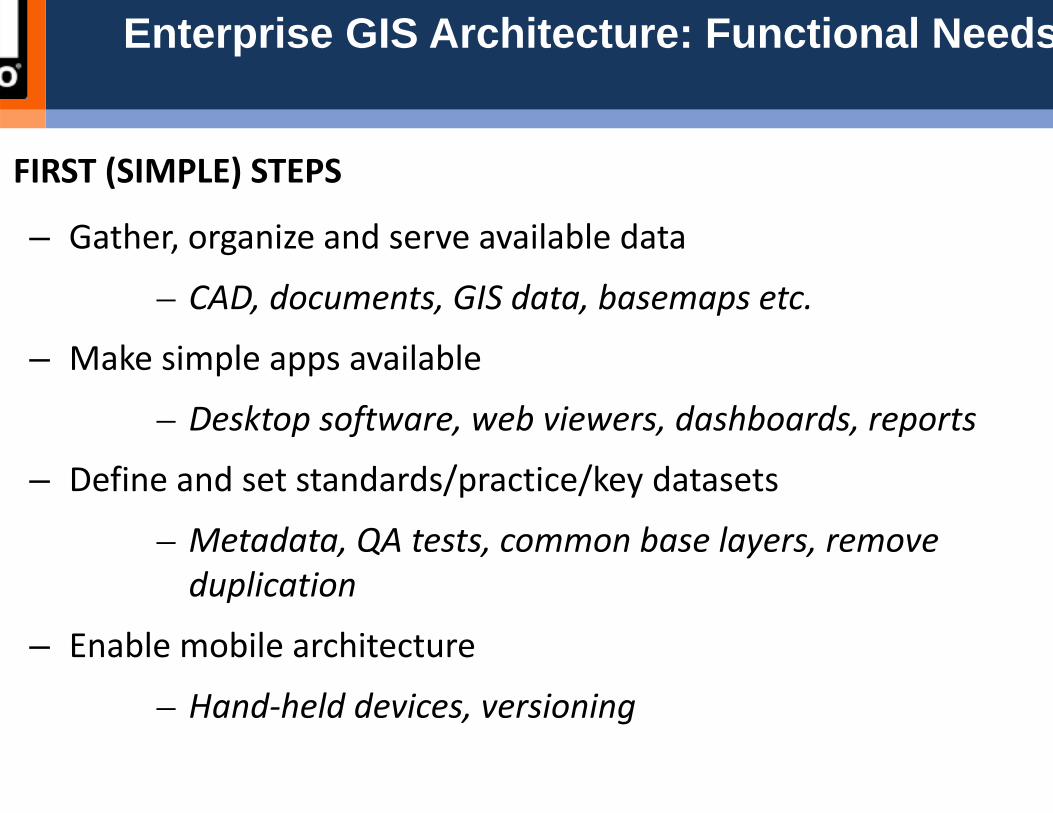
Enterprise GIS Architecture: Functional Needs
FIRST (SIMPLE) STEPS
– Gather, organize and serve available data
– CAD, documents, GIS data, basemaps etc.
– Make simple apps available
– Desktop software, web viewers, dashboards, reports
– Define and set standards/practice/key datasets
– Metadata, QA tests, common base layers, remove duplication
– Enable mobile architecture
– Hand‐held devices, versioning
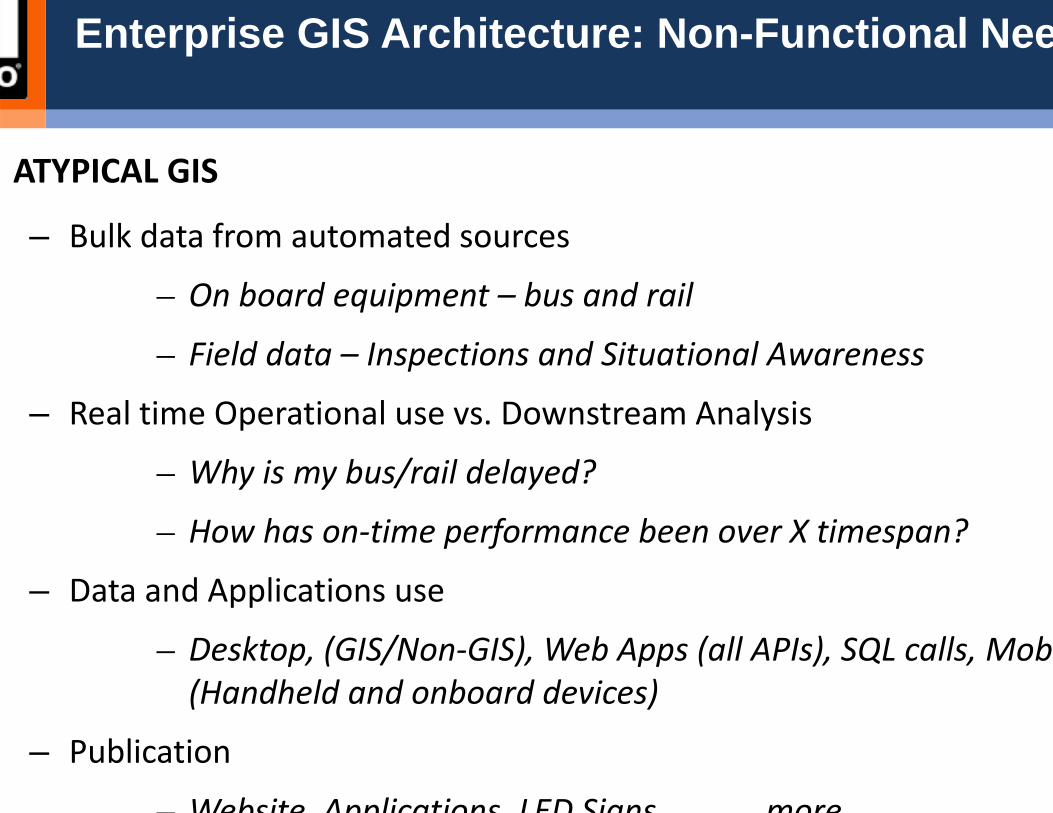
Enterprise GIS Architecture: Non-Functional Nee
ATYPICAL GIS
– Bulk data from automated sources
– On board equipment – bus and rail
– Field data – Inspections and Situational Awareness
– Real time Operational use vs. Downstream Analysis
– Why is my bus/rail delayed?
– How has on‐time performance been over X timespan?
– Data and Applications use
– Desktop, (GIS/Non‐GIS), Web Apps (all APIs), SQL calls, Mob(Handheld and onboard devices)
– Publication
– Website Applications LED Signs more

Enterprise GIS Architecture: Non-Functional Need
DESIGN CONSIDERATIONS
– Low level integration– Oracle SQL Calls: Spatial functions + SQL insert, update etc
– High level integration– Interface to interface: ArcGIS‐Maximo services cross calls
– Systems/Data integration– Data exchange, maintenance, overnight updates, Oracle jobs: AVL, Asset Mgmt.; Document repository upkeep
– Enterprise environment– Automated deployments, patch management, license management
– Nimble application developmentA hi d l / i / i i i
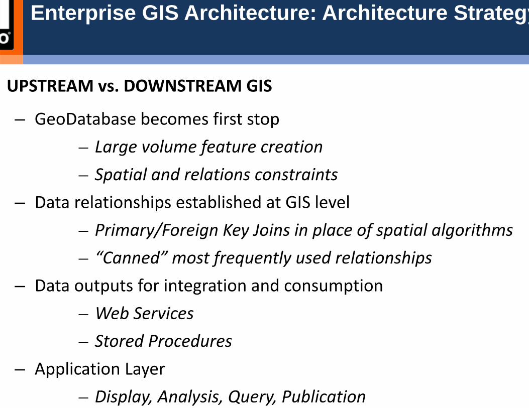
Enterprise GIS Architecture: Architecture Strategy
UPSTREAM vs. DOWNSTREAM GIS
– GeoDatabase becomes first stop– Large volume feature creation– Spatial and relations constraints
– Data relationships established at GIS level– Primary/Foreign Key Joins in place of spatial algorithms– “Canned” most frequently used relationships
– Data outputs for integration and consumption– Web Services– Stored Procedures
– Application Layer– Display, Analysis, Query, Publication

Enterprise GIS Architecture: Architecture Tactics
EA Design Methodology: Order is important
– Architecture Strategy and Design– What are the information flows and standards
– Infrastructure and Systems Architecture– How will physical realization occur, how will users interact
– Data Architecture– What data will be stored, reported, how?
– Process Architecture– How will data be maintained and standards enforced
– Applications Architecture– How will information be used, how will value addition occ
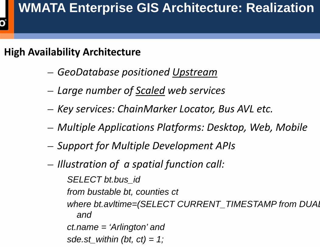
WMATA Enterprise GIS Architecture: Realization
High Availability Architecture
– GeoDatabase positioned Upstream
– Large number of Scaled web services
– Key services: ChainMarker Locator, Bus AVL etc.
– Multiple Applications Platforms: Desktop, Web, Mobile
– Support for Multiple Development APIs
– Illustration of a spatial function call:SELECT bt.bus_idfrom bustable bt, counties ctwhere bt.avltime=(SELECT CURRENT_TIMESTAMP from DUAL
andct.name = ‘Arlington’ and sde.st_within (bt, ct) = 1;
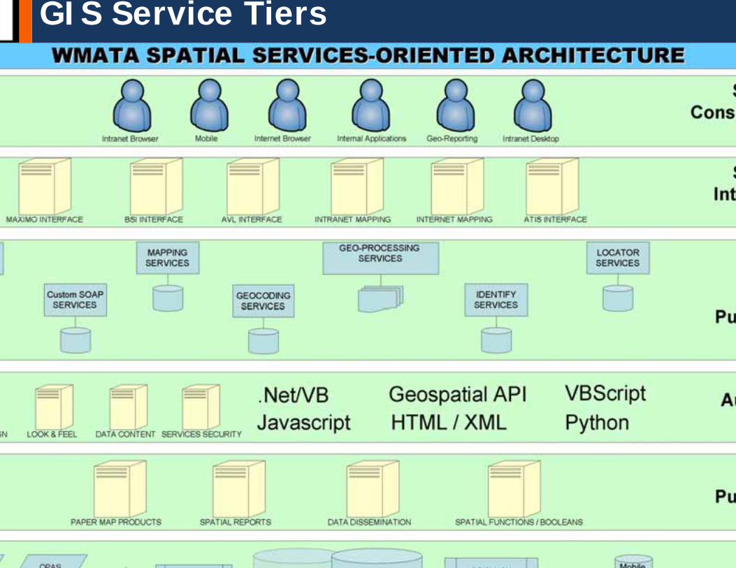
GIS Service Tiers

GIS High Level Design

GIS Data Flow
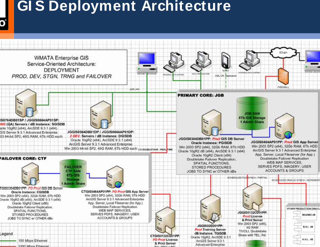
GIS Deployment Architecture
Delivering GIS Across the Enterprise
Web services and Web APIs to make the GIS accessible to nonusers agency‐wide Deploying and administering client ArGIS software for powerusersThe center of the enterprise: – Servers– Storage– Redundancy– Security
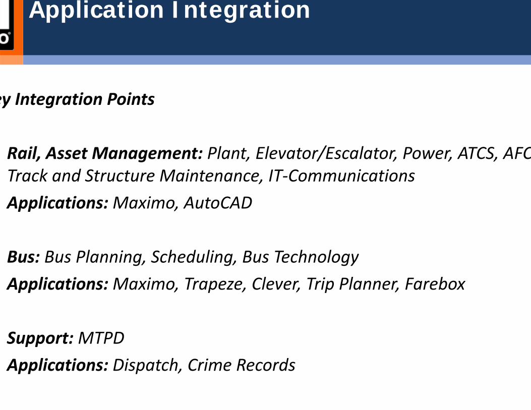
Application Integration
ey Integration Points
Rail, Asset Management: Plant, Elevator/Escalator, Power, ATCS, AFCTrack and Structure Maintenance, IT‐CommunicationsApplications: Maximo, AutoCAD
Bus: Bus Planning, Scheduling, Bus TechnologyApplications:Maximo, Trapeze, Clever, Trip Planner, Farebox
Support: MTPDApplications: Dispatch, Crime Records
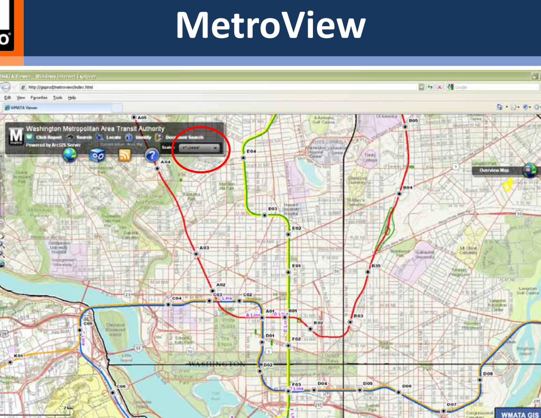
MetroView
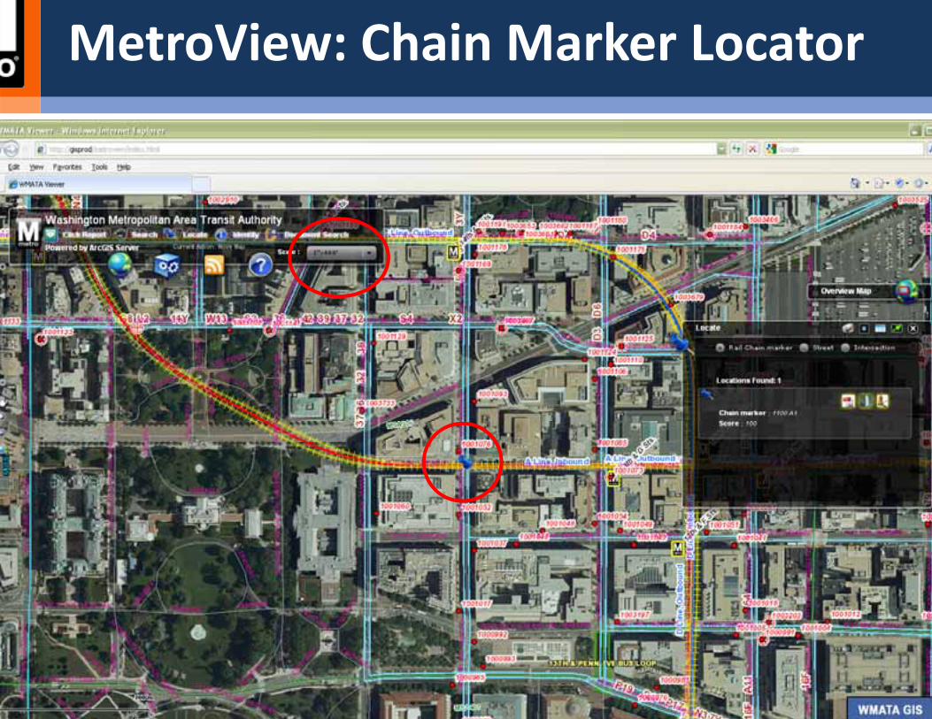
MetroView: Chain Marker Locator
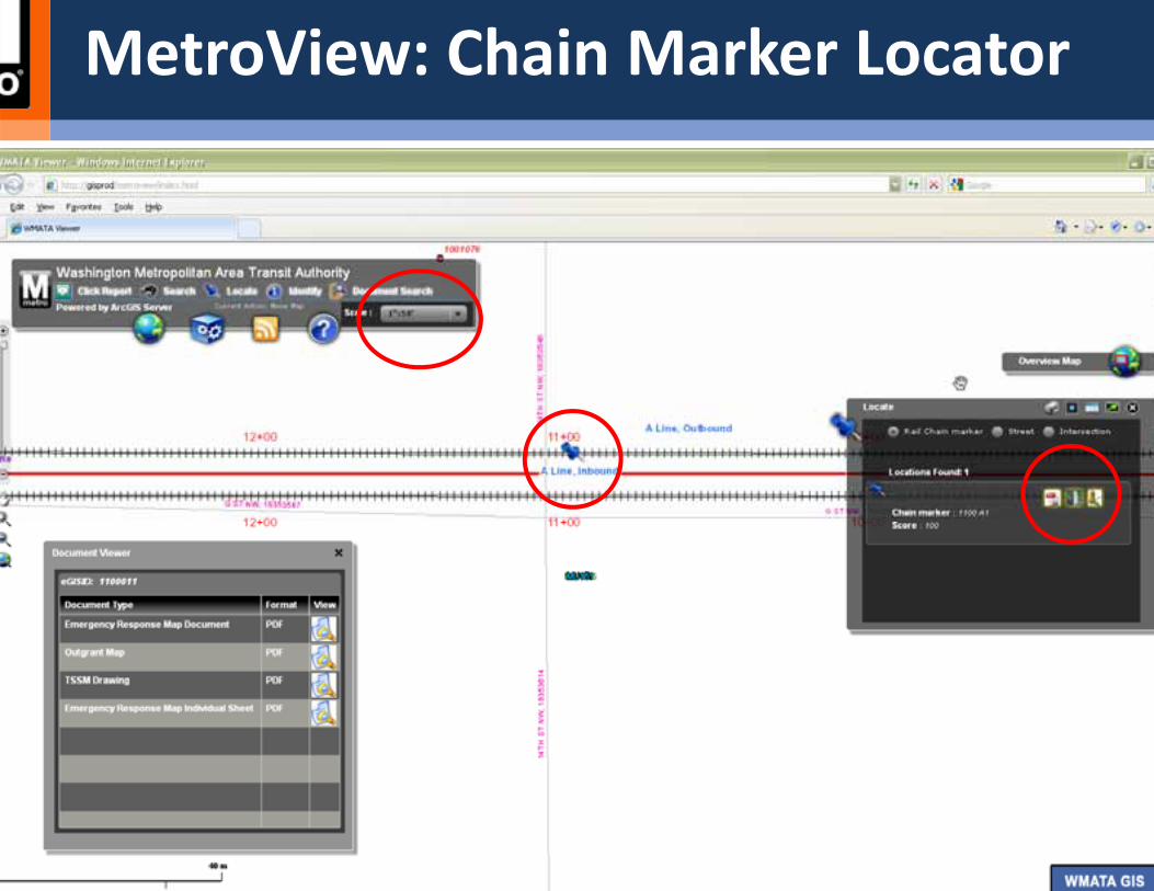
MetroView: Chain Marker Locator
Questions and Discussion
Washington (DC) Metropolitan Area Transit Authority
Ed Wells, [email protected]
Anurag Mehta, [email protected]
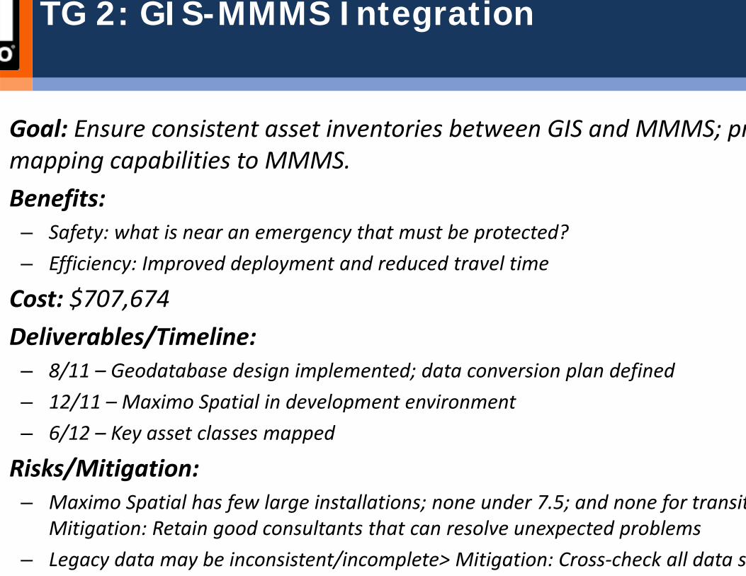
TG 2: GIS-MMMS Integration
Goal: Ensure consistent asset inventories between GIS and MMMS; prmapping capabilities to MMMS.Benefits: – Safety: what is near an emergency that must be protected?– Efficiency: Improved deployment and reduced travel time
Cost: $707,674Deliverables/Timeline:– 8/11 – Geodatabase design implemented; data conversion plan defined– 12/11 – Maximo Spatial in development environment– 6/12 – Key asset classes mapped
Risks/Mitigation: – Maximo Spatial has few large installations; none under 7.5; and none for transit
Mitigation: Retain good consultants that can resolve unexpected problems– Legacy data may be inconsistent/incomplete> Mitigation: Cross‐check all data s
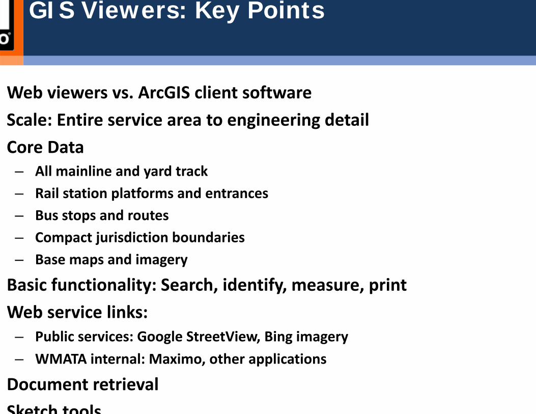
Web viewers vs. ArcGIS client softwareScale: Entire service area to engineering detailCore Data– All mainline and yard track– Rail station platforms and entrances– Bus stops and routes– Compact jurisdiction boundaries– Base maps and imagery
Basic functionality: Search, identify, measure, printWeb service links: – Public services: Google StreetView, Bing imagery– WMATA internal: Maximo, other applications
Document retrievalSketch tools
GIS Viewers: Key Points
Enterprise systemSystem of record and data maintenance– All mapping data– Bus stop and route attributes
System integration driverData integration driverGeographic and RDBMS data integrity enforcement driverData display and analysis tool
GIS Current Role
TG 3: Transit Route Network
Goal: From stop and route data, create a routable network of WMATAand rail servicesBenefits: Supports integrated maintenance and QC of WMATA stop, timepoint, pattern, and route dataCost: $602,534Deliverables/Timeline:– 10/11 – Evaluate/procure available software tools– 12/11 – Linear referencing added to bus routes– 3/12 – Transfer segments added to bus and rail routes– 6/12 – Network topology added to bus and rail routes
Risks/Mitigation: – Linear reference networks are complex to build and require specialized software
to manage. Only one GIS‐based vendor is known. Timing of vendor upgrade to A10 is not known. Mitigation: Be prepared to create tools in house if the product
ti f t t i
TG 4: Intranet Improvements
Goal: Add functionality and data to GIS viewer. Support Silverlight andAPIs. Create web services for application data integrationBenefits: Increased use of GIS viewer within WMATA. Provision of GIS and map controls to other applications. Consistent data across applicaCost: $200,000Deliverables/Timeline:– 9/11 – Bus AVL and train location data shown displayed in web viewer.– 9/11 – Silverlight GIS API is available to other applications– 12/11 – GIS – Trapeze data exchange web service defined and tested
Risks/Mitigation: – Trapeze data exchange capability is untested. Mitigation: Include QC and verifica
data exchange.
TG 5: Public Website Enhancements
Goal: Add bus stop and route maps to wmata.com website.Benefits: Bus system becomes more familiar to the public. Bus stop daaccessible to MetroAccess customers.Cost: $100,000Deliverables/Timeline:– 9/11 ‐ Application available internally– 12/11 – External security and design complete– 3/12 – Internal testing of public application– 6/12 – Application available publicly
Risks/Mitigation: – Public interface testing/marketing approval process is not known. Mitigation: As
the approval process. Hold schedule for technical development, but adjust as neaccommodate approval process.
TG 6: Building Interior Mapping
Goal: Georeference rail station floor plans and site plans and add to GCreate 3‐D imagery and floor plans of bus garages (no plans exist nowBenefits: Provides a base for in‐station infrastructure mapping. Suppomore intelligent crime mapping. Supports better Cost: $609,821Deliverables/Timeline:– 3/12 – Rail station georeferencing procured and completed.– 6/30 – Bus garage mapping procured and completed.
Risks/Mitigation: – AutoCAD files for rail station plans have not been reviewed. Mitigation: if data is
incomplete, determine how best to create or update it.– 3‐D mapping is new technology. Mitigation: one pilot test has been done.– 3‐D data requires a custom data viewing add‐on. Upgrade plans to ArcGIS 10 ar
known. Mitigation: Defer action until WMATA and vendor upgrade plans are kno
TG 7: User Support
Goal: Support GIS use in WMATA departments via tech support, creatmap publications, metadata, and training courses.Benefits: Use justifies WMATA’s investmentsCost: $350,000Deliverables/Timeline:– 12/11 – Bus route map series completed– 3/12 – Training course offered in WMATA GIS resources and use– 6/12 – Training course offered in basic GIS concepts – 6/12 – Complete metadata compiled for all feature classes shown in the web vie
Risks/Mitigation: – Hiring restrictions preclude adding FTEs. Mitigation: Use contract services, and/
adjust goals to fit reduced capacity.
TG 8: Mobile GIS
Goal: Make GIS available to field maintenance and emergency responpersonnelBenefits: Integrates GIS into field operationsCost: $850,000Deliverables/Timeline: – 12/11 – Hire mobile GIS Analyst/PM– 3/12 – Proof of concept test done– 6/12 – Pilot field test done
Risks/Mitigation: – Depends on additional capital funding from rail. Mitigation: If not funded, defer
FY13.– Requires deployment of field devices, servers, and security. Mitigation: Pilot test
scaling up– Requires business process changes and training. Mitigation: involve the users; te
b f li

Strengths, Weakness, Opportunities and Threats (SWOT)
Strengths• Tested, scalable IT architecture and infrastructure• Support from all stakeholders• Rail lines, station entrances, platforms, bus stops and routes are precisely mapped and accessible across the intranet• Rapidly increasing use of GIS and intranet mapping
Weaknesses• Lack of data integration processes across applications• Small team – FTE staff increase is critical to FY12 success• Multiple inconsistent legacy data sources• No documentation of data (metadata)
Opportunities• Map key infrastructure assets for ready access in routine work and emergency response• Integrated management and maintenance of WMATA stop and route data•Provision of GIS data and functions to other applications via web service (for data synchronization) or web APIs (for embedded map controls)• Add data to intranet viewer: AVL, infrastructure• Increase public familiarity with bus system by putting stop and route maps on the public website
Threats• Competing funding priorities• Personnel hiring restrictions• Complexity and interdependencies of ArcGIS 10 upgrade

Questions and Discussion