Embed Size (px)
Citation preview
6/18/2013
1
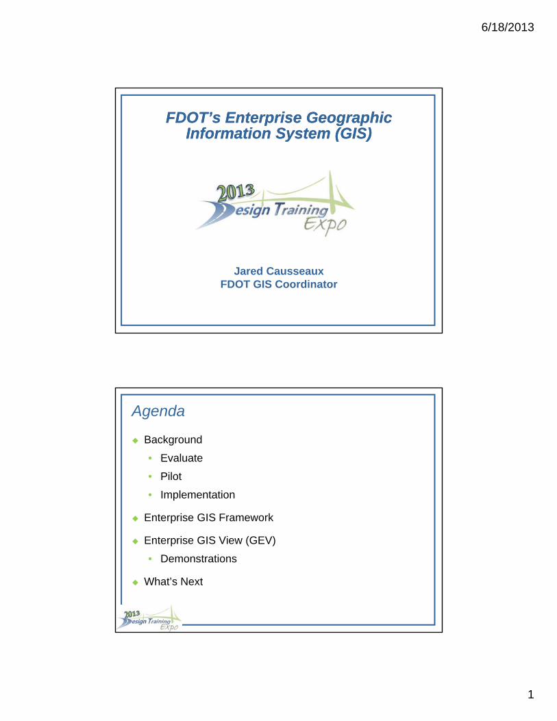
FDOT’s Enterprise Geographic Information System (GIS)
FDOT’s Enterprise Geographic Information System (GIS)
Jared CausseauxFDOT GIS Coordinator
Agenda
Background
• Evaluate
• Pilot
• Implementation
Enterprise GIS Framework
Enterprise GIS View (GEV)
• Demonstrations
What’s Next
6/18/2013
2
Background
Research
• Business Case for Enterprise GIS (2008)
o Phase 1 - Evaluate business case to determine whether to proceed with implementation of Enterprise GIS
o Phase 2 – Formulate Pilots and develop implementation plan detailing steps for successful implementation of Enterprise GIS
o Phase 3 – Implement Enterprise GIS along with documented procedures and policies
Background
Research
• Business Case for Enterprise GIS (2008)
o Phase 1 - Evaluate business case to determine whether to proceed with implementation of Enterprise GIS
– What is Enterprise GIS? “ Enterprise Geographic Information Systems (GIS) is an organization-wide framework for Department communication and collaboration of shared geospatial data and GIS resources that enhances existing business processes and provides an efficient way to plan, analyze, and manage transportation infrastructure and related elements. ”
6/18/2013
3
Background
Research
• Business Case for Enterprise GIS (2008)
o Phase 1 - Evaluate business case to determine whether to proceed with implementation of Enterprise GIS
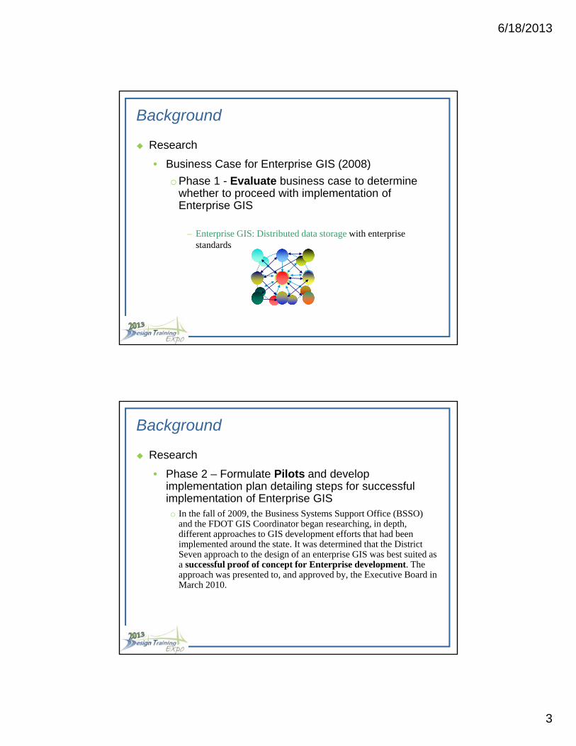
– Enterprise GIS: Distributed data storage with enterprise standards
Background
Research
• Phase 2 – Formulate Pilots and develop implementation plan detailing steps for successful implementation of Enterprise GISo In the fall of 2009, the Business Systems Support Office (BSSO)
and the FDOT GIS Coordinator began researching, in depth, different approaches to GIS development efforts that had been implemented around the state. It was determined that the District Seven approach to the design of an enterprise GIS was best suited as a successful proof of concept for Enterprise development. The approach was presented to, and approved by, the Executive Board in March 2010.
6/18/2013
4
Background
Research
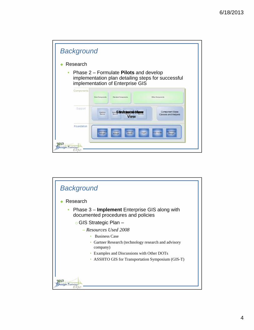
• Phase 2 – Formulate Pilots and develop implementation plan detailing steps for successful implementation of Enterprise GIS
Structural ViewInfrastructure View
Background
Research
• Phase 3 – Implement Enterprise GIS along with documented procedures and policies
o GIS Strategic Plan –
– Resources Used 2008• Business Case
• Gartner Research (technology research and advisory company)
• Examples and Discussions with Other DOTs
• ASSHTO GIS for Transportation Symposium (GIS-T)
6/18/2013
5
Background
Research
• Phase 3 – Implement Enterprise GIS along with documented procedures and policies
o GIS Strategic Plan– Vision
GIS will be a standard tool commonly used throughout the Department to support transportation decision making.
– Mission
Establish an organization-wide framework for the governance of GIS technology that will facilitate effective management, communication and collaboration of shared geospatial data and resources.
Background
Research
• Phase 3 – Implement Enterprise GIS along with documented procedures and policies
o GIS Strategic Plan– Goals
• Increase the use of GIS to improve business processes, increase productivity, enhance decision support, and reduce costs.
• Extend the use of maps and other GIS tools/data to improve communication and the quality of services provided within the Department and to DOT partners, governmental entities, and citizens.
6/18/2013
6
Background
Research
• Phase 3 – Implement Enterprise GIS along with documented procedures and policies
o GIS Strategic Plan– Goals (continued)
• Identify and implement the appropriate technical architecture to best support the local and enterprise GIS needs of the Department.
• Establish and maintain standards and guidelines that leverage department and external geospatial resources to drive efficiencies.
• Establish a cohesive governance model that supports organization-wide management and utilization of geospatial information.
Background
Research
• Phase 3 – Implement Enterprise GIS along with documented procedures and policies
o GIS Policy - Topic No. 000-010-002-a– New GIS Definition:
• A Geographic Information System (GIS) is a computer based system for capturing, storing, integrating, manipulating, analyzing and displaying data related to positions of items on the Earth’s surface (Department of State, Electronic Recordkeeping Rule, Rule No: 1B-26.003 Florida Administrative Code). GIS technology supports graphical analysis of geo-referenced data and enhances the quality of the Department’s information assets.
6/18/2013
7
Background
Research
• Phase 3 – Implement Enterprise GIS along with documented procedures and policieso GIS Policy - highlights
– Investments in GIS technology be leveraged in a cost effective manner
– GIS Strategic Plan in 2009 to serve as a road map– Ensures that GIS is implemented with an enterprise strategy– Management support is always needed– Managed under the direction of the Management Steering
Committee– Recommendations arise from Functional GIS experts in each
District– FDOT GIS Coordinator oversees enterprise initiatives and
chairs a Functional Steering Committee of GIS Experts.
Background
Research
• Phase 3 – Implement Enterprise GIS along with documented procedures and policies
o FDOT Geospatial Data and Metadata Standards (September 2010)
– These elements were derived from the Content Standard for Digital Geospatial Metadata (CSDGM) set by the Federal Geographic Data Committee (FGDC).
– The audience for these GIS standards includes all FDOT staff, and their contractors, who create or manage GIS data.
6/18/2013
8
Background
Research
• Phase 3 – Implement Enterprise GIS along with documented procedures and policies
o FDOT Geospatial Data and Metadata Standards (September 2010)
– Items include
• Projections and Datums
• GIS Data File Formats
• Imagery Data File Formats
• Geospatial Metadata Standards
Enterprise GIS Framework
Objective:
• The GIS Framework exists to provide a service-based
system, framed within today’s enabling technology that
will provide a foundation for future growth within FDOT.
This type of framework will provide FDOT with the
benefits of re-usability, flexibility, and scalability. One
website and is driven by a configuration model that
allows for flexibility in exposing functionality and creating
unique user interfaces.
6/18/2013
9
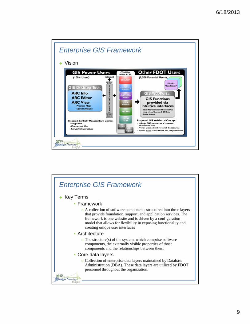
Enterprise GIS Framework
Vision
Enterprise GIS Framework
Key Terms• Framework
o A collection of software components structured into three layers that provide foundation, support, and application services. The framework is one website and is driven by a configuration model that allows for flexibility in exposing functionality and creating unique user interfaces
• Architectureo The structure(s) of the system, which comprise software
components, the externally visible properties of those components and the relationships between them.
• Core data layerso Collection of enterprise data layers maintained by Database
Administration (DBA). These data layers are utilized by FDOT personnel throughout the organization.
6/18/2013
10
Enterprise GIS Framework
Key Terms (cont.)
• Web Serviceso Web Services represent an extension of the concept of off-the-
shelf software to that of software delivered as a service. They are building blocks that enable developers to build and aggregate applications and services from local and remote resources for a range of clients.
• Services Oriented Approacho An approach to architecture design which separates functions
into distinct units, or services, that developers make accessible over a network in order to allow users to combine and reuse them in the production of applications
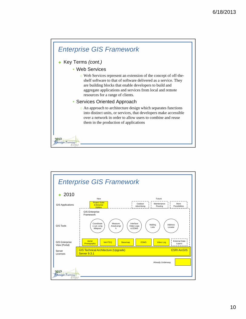
GIS Technical Architecture (Upgrade) ESRI ArcGIS Server 9.3.1
Video LogExternal Data
LayersEDMSNAVTEQ Basemap
Aerial Photography
Project Suite Enterprise
Edition
MorePossibilities
Maintenance Routing
Outdoor Advertising
Coordinates Lat, Long
Milepost
Address Locator
Measure Area/Lengt
h
Interface Video Logs
& EDMS
Mailing Lists
GIS Enterprise Framework
GIS Applications
GIS Tools
GIS Enterprise View (Portal)
Server Licenses
New Future
Already Underway
Enterprise GIS Framework
2010
6/18/2013
11
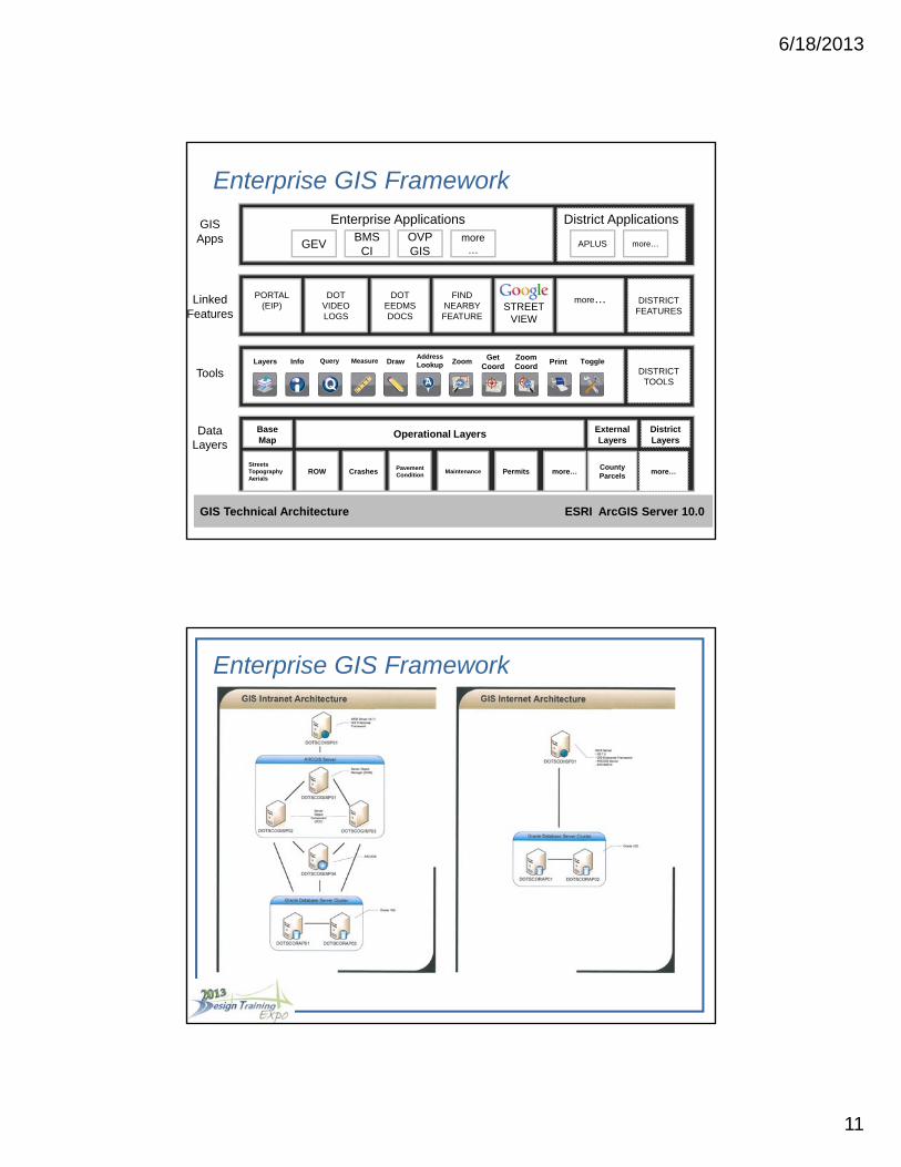
GIS Technical Architecture ESRI ArcGIS Server 10.0
ROWCounty Parcels
StreetsTopographyAerials
more…more…PermitsMaintenancePavementConditionCrashes
BaseMap
Operational Layers ExternalLayers
DistrictLayers
PORTAL(EIP)
Enterprise Applications
DOTVIDEOLOGS
DOTEEDMSDOCS
STREETVIEW
FIND NEARBY FEATURE
DISTRICTFEATURES
District Applications
GEVOVP GIS
BMSCI
more…
APLUS more…
DISTRICTTOOLS
more…
GISApps
LinkedFeatures
Tools
DataLayers
Layers Info Measure DrawAddressLookup Zoom Get
CoordZoom Coord
Print ToggleQuery
Enterprise GIS Framework
Enterprise GIS Framework
6/18/2013
12
Enterprise GIS Framework
Enterprise GIS Framework
• The application architecture upon which all Enterprise GIS applications
will be built.
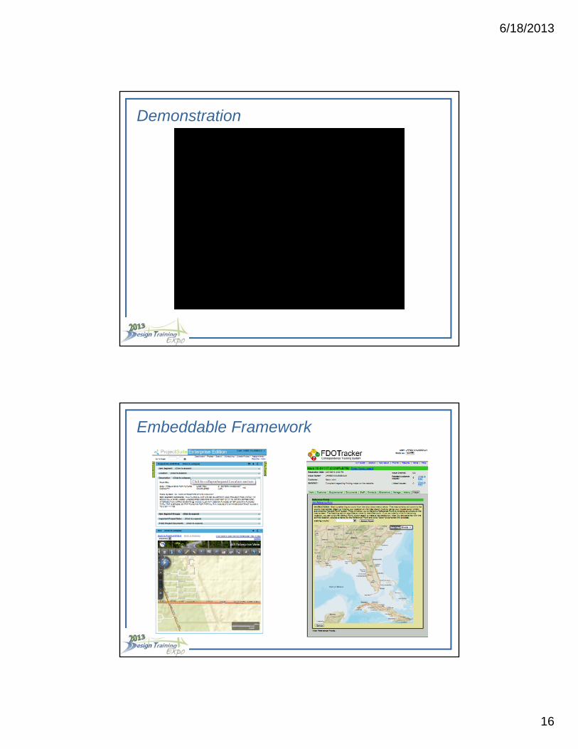
GIS Embeddable Framework
• The application architecture which enables a GIS application built on
the Enterprise GIS Framework to be embedded within a business web
application (examples later in presentation).
GIS District Framework
• District implementation of the Enterprise GIS Framework.
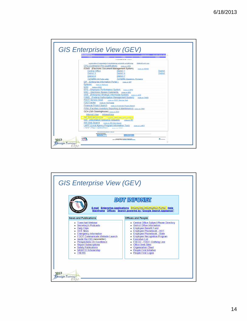
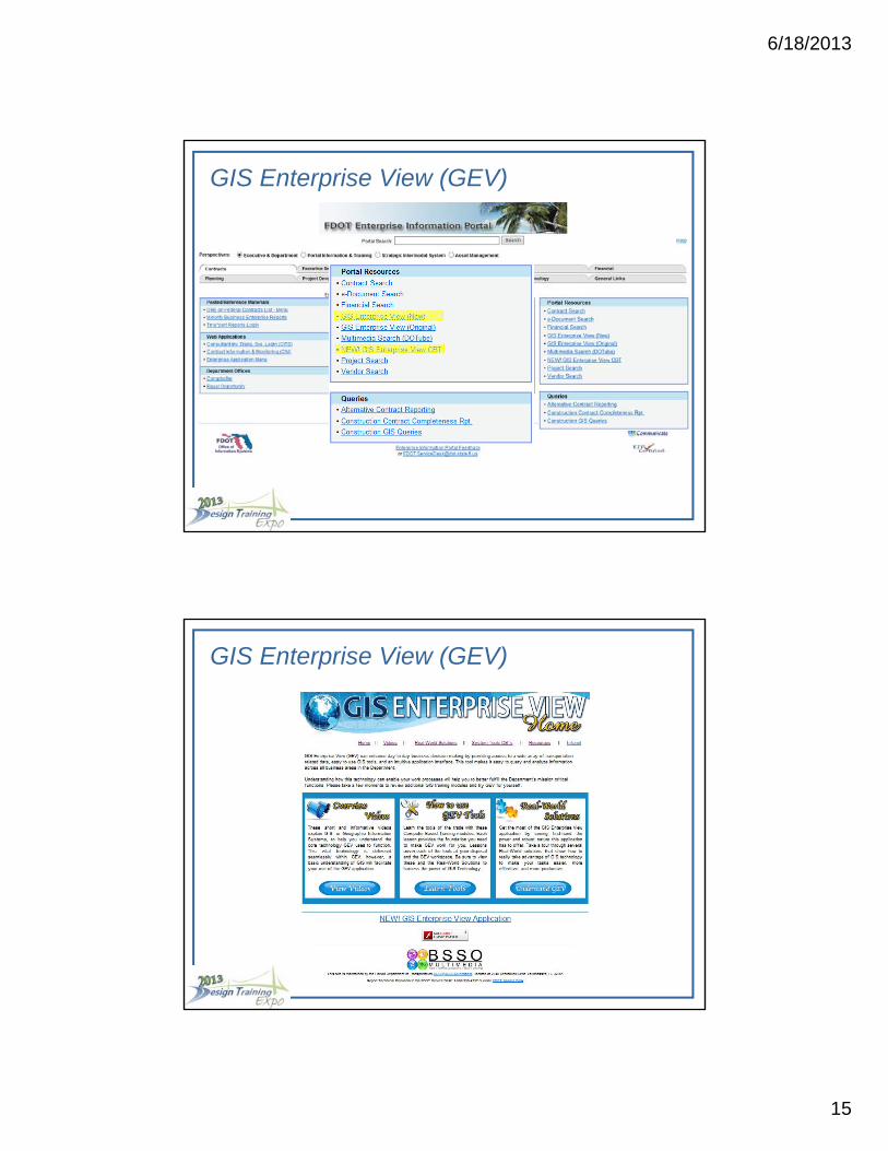
GIS Enterprise View (GEV)
The FIRST GIS web application built on the Enterprise GIS Framework.
The GEV is NOT the Enterprise GIS Framework (big time misconception!)
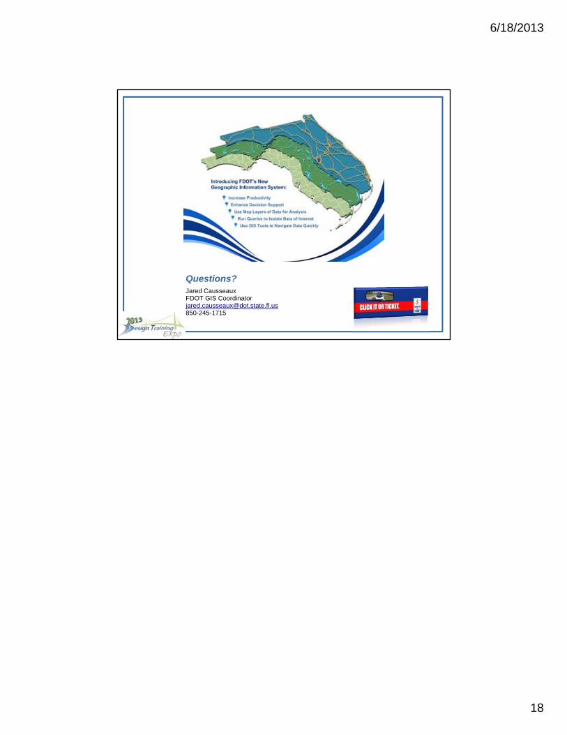
The GIS Enterprise View (GEV) application lets you view, query, and analyze the department’s spatial data. The application contains Safety, Work Program, RCI and more enterprise systems data.
The application also links to other enterprise wide systems such as PSEE, EIP, and Video Log based spatial data.
6/18/2013
13
GIS Enterprise View (GEV)
How do I get to it?
• Internal use only
• Direct link:
http://gisintra.dot.state.fl.us/GISFramework/Default.aspx?appId=gev
• GIS Enterprise View Computer Based Training:
http://cbt.dot.state.fl.us/ois/GEVCBTs/
GIS Enterprise View (GEV)
6/18/2013
14
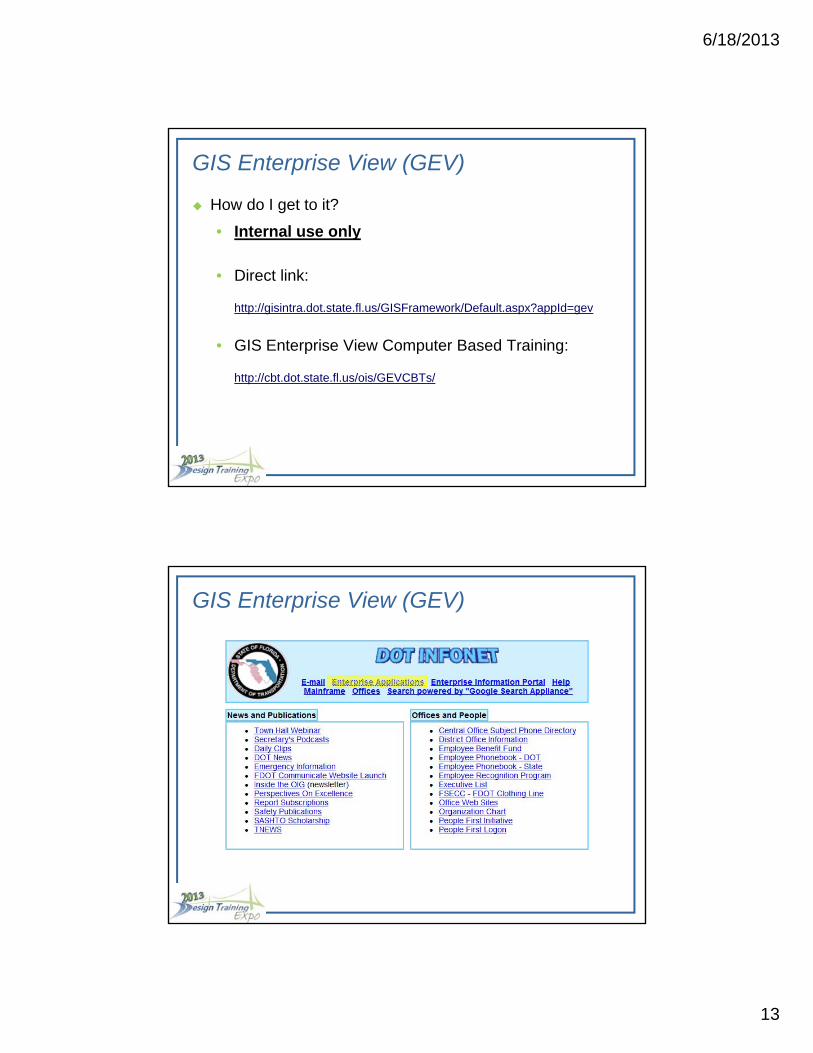
GIS Enterprise View (GEV)
GIS Enterprise View (GEV)
6/18/2013
15
GIS Enterprise View (GEV)
GIS Enterprise View (GEV)
6/18/2013
16
Demonstration
Embeddable Framework
6/18/2013
17
What’s Next
2013 GIS Strategic Plan (pending approval)
• Increase GIS presence on the internet by creating and
maintaining a public facing portal for Department GIS resources
• Research and recommend GIS software licensing options that
provide access to GIS tools at the right level to those who need
it, in the most cost-effective manner.
• Explore requirements needed to implement internet technologies
such as ESRI’s ArcGIS Online
What’s Next
2013 GIS Strategic Plan (pending approval, cont.)
• Explore and adopt mobile devises or mobile mapping capabilities
• Adopt interoperability standards for GIS data to be imported/
exported to other spatial data formats (i.e. CADD).
• Create documentation and\or procedures for consultant
development on GIS web applications via the GIS Enterprise
Framework
• Promote the awareness, education and marketing of FDOT GIS
resources through Department GIS user groups.


![Geographic Information System [GIS]](https://img.pdfslide.us/doc/110x75/56813e57550346895da84a4e/geographic-information-system-gis-568e78fe5e678.jpg)