Embed Size (px)
Citation preview
Arc Hydro Groundwater Data Model
Gil Strassberg, David R. Maidment
Center for Research in Water ResourcesUniversity of Texas at Austin
HydrographyHydrography
Hydro NetworkHydro Network
Channel SystemChannel System
Drainage SystemDrainage System Hydrogeologic unit Borehole
Layers Solid
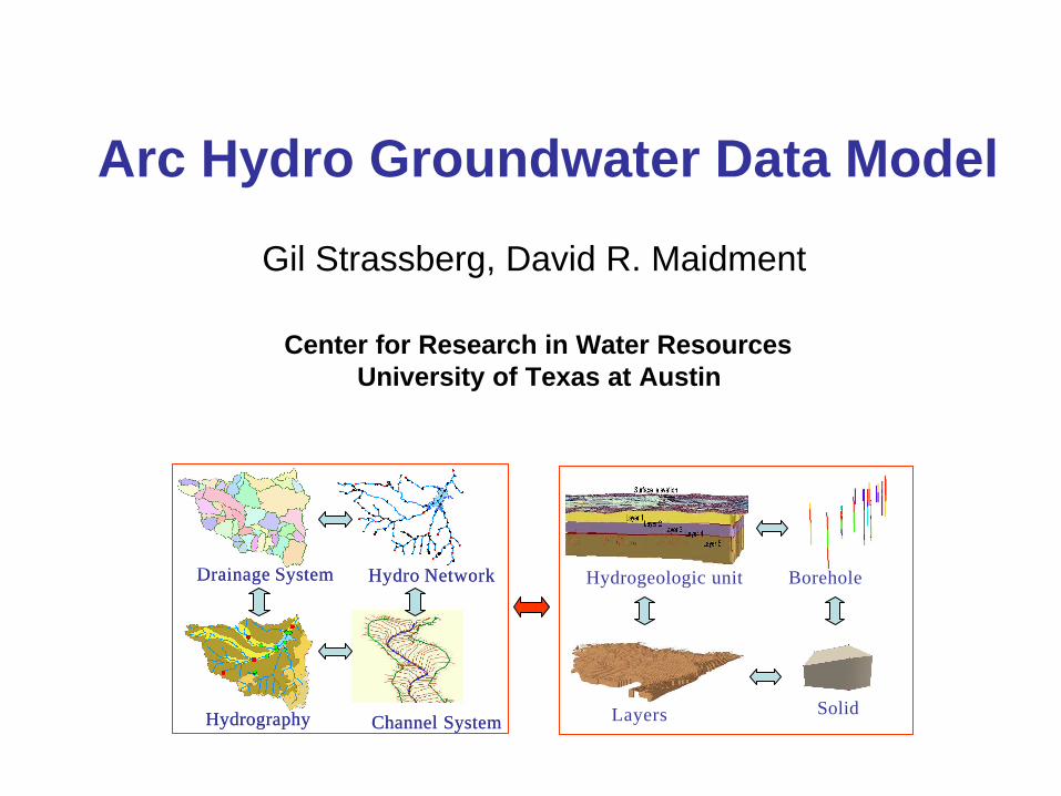
GIS in Water Resources Consortium
• Bringing together these two communities by using a common geospatial data model
• Arc Hydro design took 3 years from 1999 – 2002. Groundwater phase II 2002 - 2005.
GIS
CRWRCRWR
Water Resources
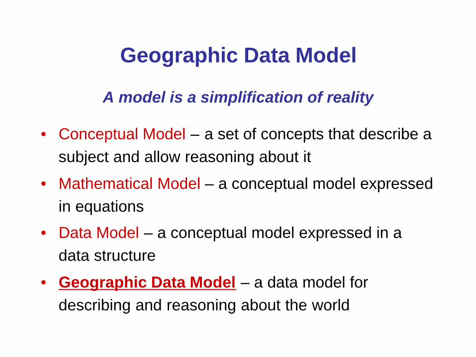
Geographic Data Model
• Conceptual Model – a set of concepts that describe a subject and allow reasoning about it
• Mathematical Model – a conceptual model expressed in equations
• Data Model – a conceptual model expressed in a data structure
• Geographic Data Model – a data model for describing and reasoning about the world
A model is a simplification of reality
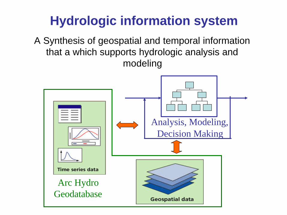
Hydrologic information system
Analysis, Modeling,Decision Making
Arc Hydro Geodatabase
A Synthesis of geospatial and temporal information that a which supports hydrologic analysis and
modeling
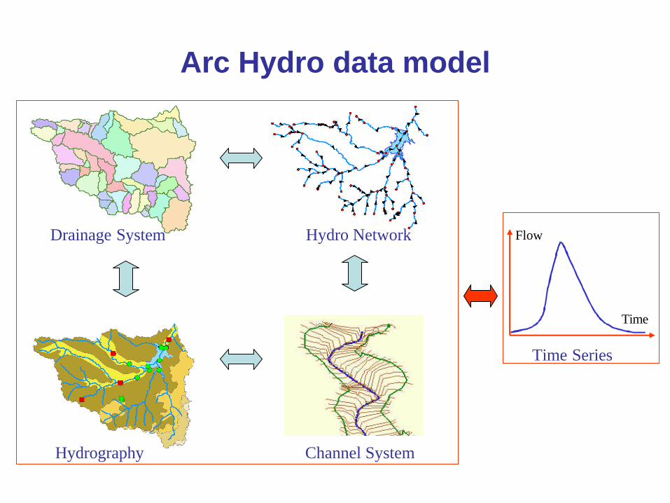
Arc Hydro data model
Flow
Time
Time Series
Hydrography
Hydro Network
Channel System
Drainage System
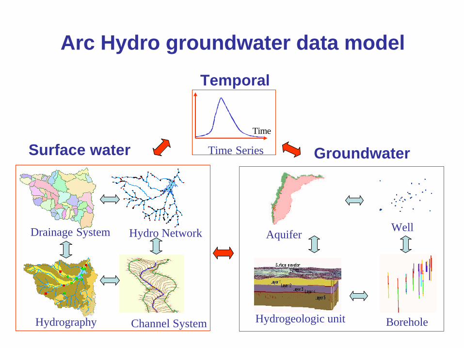
Arc Hydro groundwater data model
Hydrography
Hydro Network
Channel System
Drainage System
Time
Time SeriesSurface water
Temporal
Hydrogeologic unit Borehole
Groundwater
WellAquifer
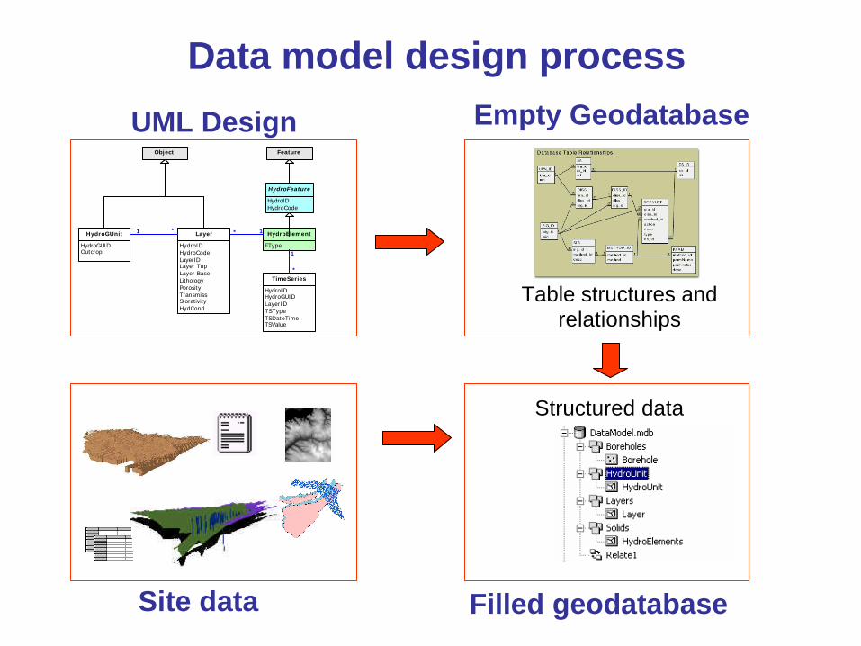
Data model design process
HydroElement
FType
Feature
HydroFeature
HydroIDHydroCode
Layer
HydroIDHydroCodeLayerIDLayer TopLayer BaseLithologyPorosityTransmissStorativityHydCond
HydroGUnit
HydroGUIDOutcrop
Object
TimeSeries
HydroIDHydroGUIDLayerIDTSTypeTSDateTimeTSValue
1*1 *
1
*
UML Design
Site data
Empty Geodatabase
Filled geodatabase
Table structures and relationships
Structured data
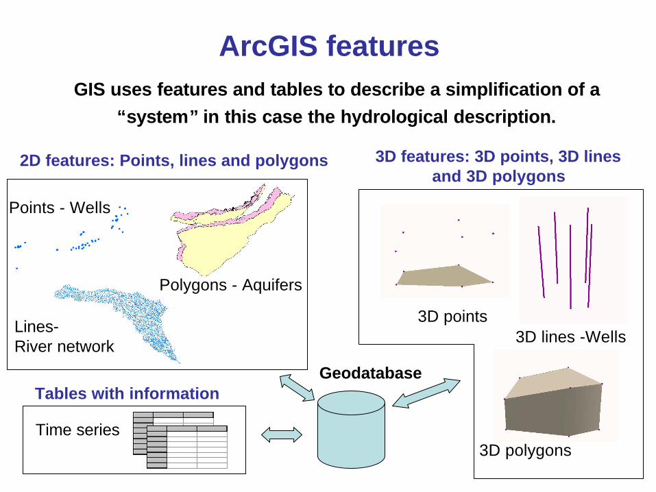
ArcGIS featuresGIS uses features and tables to describe a simplification of a
“system” in this case the hydrological description.
2D features: Points, lines and polygons
Points - Wells
Lines-River network
Polygons - Aquifers
3D features: 3D points, 3D lines and 3D polygons
3D points3D lines -Wells
3D polygons
Tables with information
Time series
Geodatabase
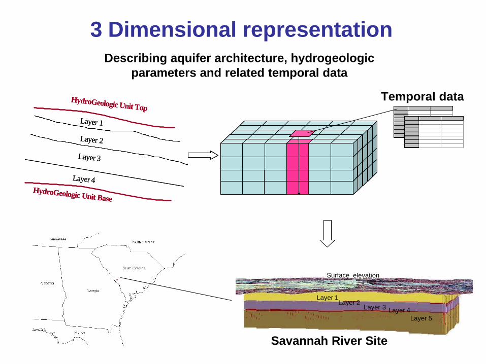
3 Dimensional representation
Layer 1Layer 3
Layer 2Layer 4
Layer 5
Surface elevation
Layer 1Layer 3
Layer 2Layer 4
Layer 5
Surface elevation
Layer 1
HydroGeologic Unit Top
Layer 2
Layer 3
Layer 4HydroGeologic Unit Base
Layer 1
HydroGeologic Unit Top
Layer 2
Layer 3
Layer 4HydroGeologic Unit Base
Describing aquifer architecture, hydrogeologic parameters and related temporal data
Temporal data
Savannah River Site
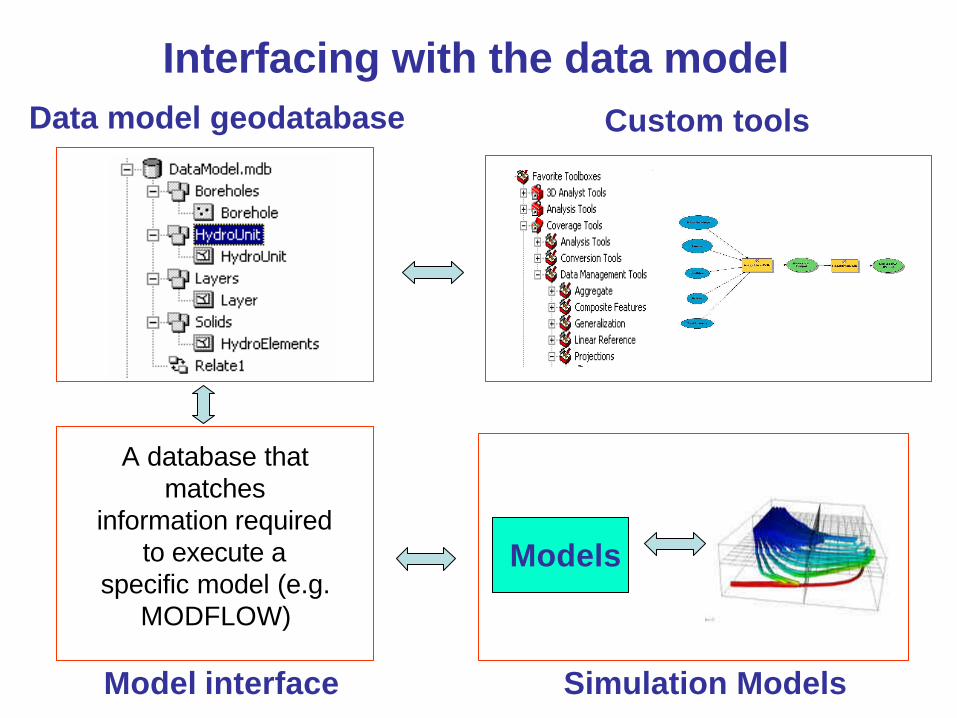
Interfacing with the data modelData model geodatabase Custom tools
Model interface
A database that matches
information required to execute a
specific model (e.g. MODFLOW)
Models
Simulation Models
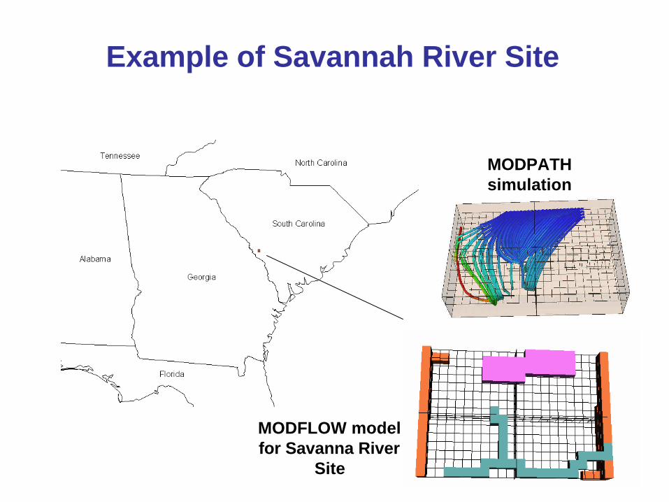
Example of Savannah River Site
MODFLOW model for Savanna River
Site
MODPATH simulation
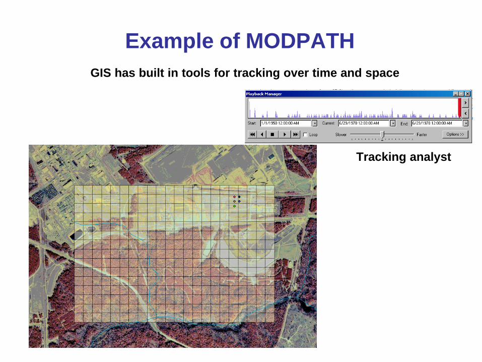
Example of MODPATHGIS has built in tools for tracking over time and space
Tracking analyst

Interfacing surface and groundwater models
HydrographyHydrography
Hydro NetworkHydro Network
Channel SystemChannel System
Drainage SystemDrainage System Hydrogeologic unit Borehole
Layers Solid
Groundwater models
Simulated results
Surface water models
Simulated results
Arc Hydro data model
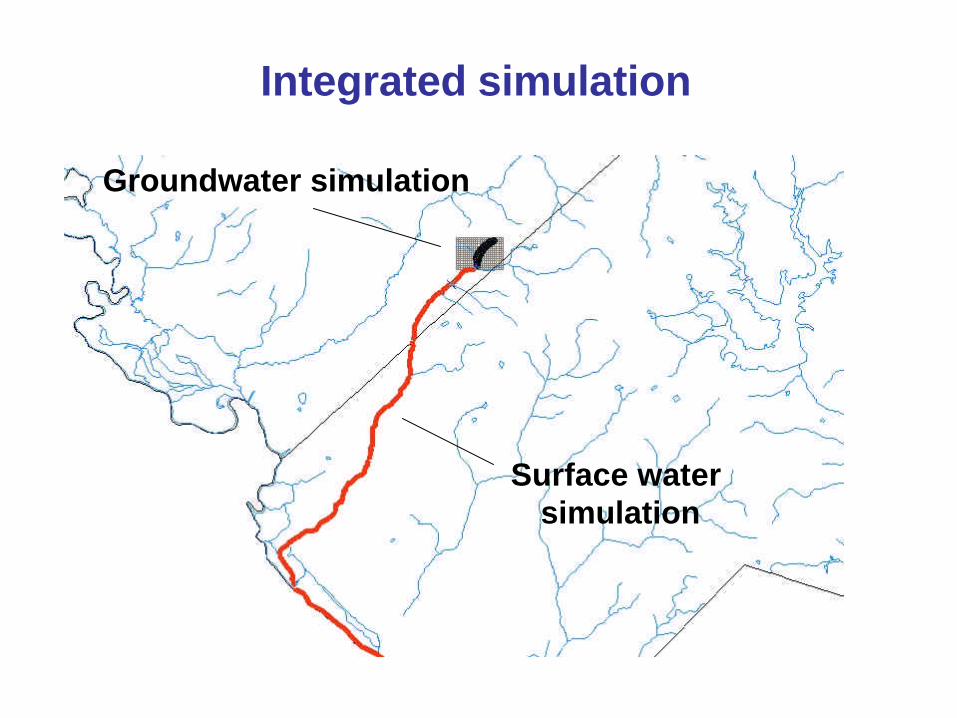
Integrated simulation
Groundwater simulation
Surface water simulation
Key points
• Arc Hydro is a geographic data model – basis for hydrological information system
• Extended to include the main features of groundwater systems
• Provide a data interface between ArcGIS and commonly used groundwater modeling programs
• Integration of models through the data model.