Embed Size (px)
Citation preview

Simple, Inexpensive Aerial Photography Mapping with Balloons or Kites
Engineers Without Borders West Coast Regional Workshop 2011 Patrick Coyle, EWB-‐SFP; Grassroots Mapping, Public Laboratory for Open Technology and Science, Belize Open Source -‐ Sustainable Development
October 22, 2011
Agenda • Why bother? Aerial photomaps can be very useful
• Community, Site and Project Planning; Agricultural/ Ecological planning, evaluaGon
• How? In summary, what’s needed?
• Equipment, SoKware, Supplies, Materials
• Step-‐by-‐step guide • Examples from community of users
• DemonstraGon – let’s fly!
• Stop by aKer – see results, Q&A • Jeff Warren, Grassroots Mapping, produced community maps in Lima, Peru with children and adults
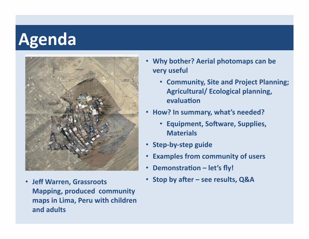
Step-‐by-‐step guide
For example, here is Coyle’s preliminary set of requirements: • Take detailed aerial photos of the Belize Open Source Sustainable Development
40-‐acre property with enough detail that individual trees are clear • Cover the site with overlapping images and use soKware to sGtch them together
into a single photomap and georegister it to Google Earth imagery of the property
• Tag the individual photos with GPS data to geo-‐reference them for viewing on Google Maps, Google Earth, or for use with other applicaGons
• Develop methods to use the photomaps for work planning, tracking progress and communicaGng results to encourage parGcipaGon in the iniGaGve. Document the approach and techniques
• Apply the method to other community mapping iniGaGves and make it available for other users like EWB and schools and communiGes in Belize
• Decide what you want to do, produce and deliver; thinking this through will help to define the requirements
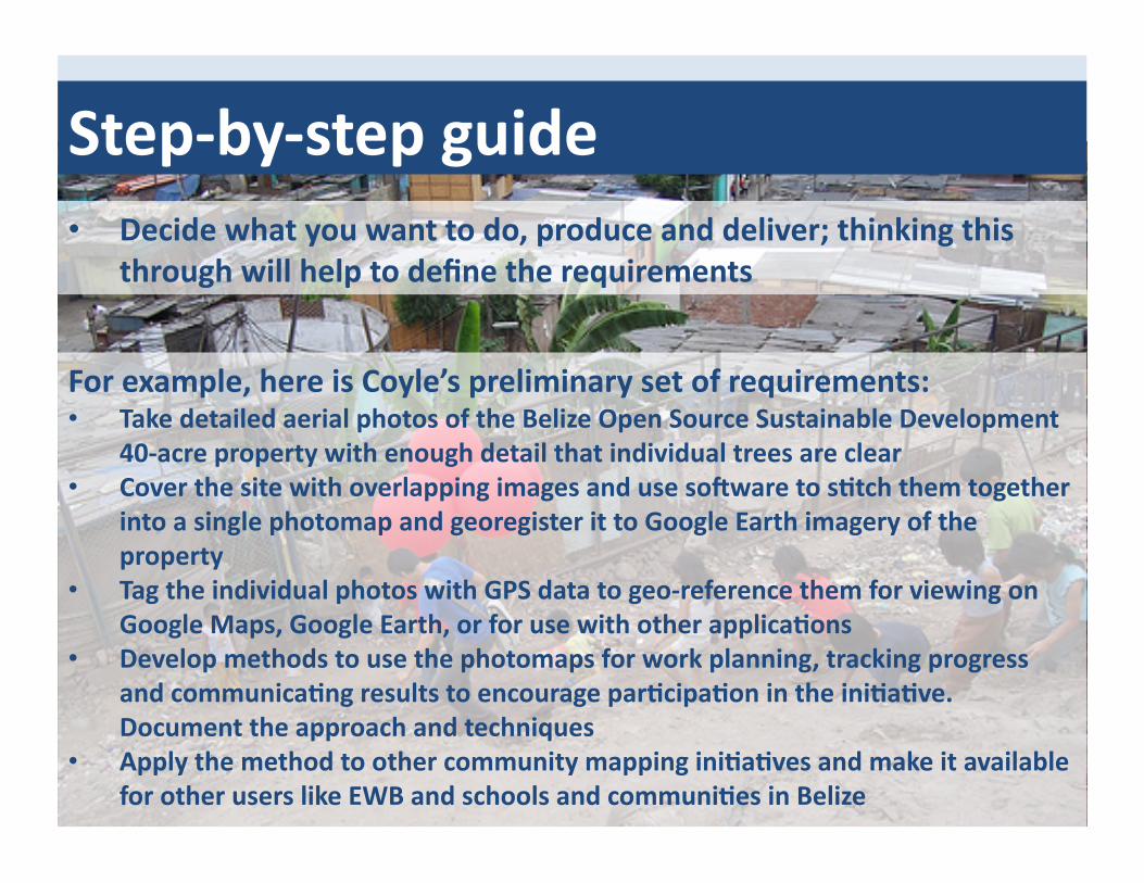
What’s needed?
• Digital camera with ability to take photos automaGcally (at few-‐second intervals or conGnuously (~1 per second))
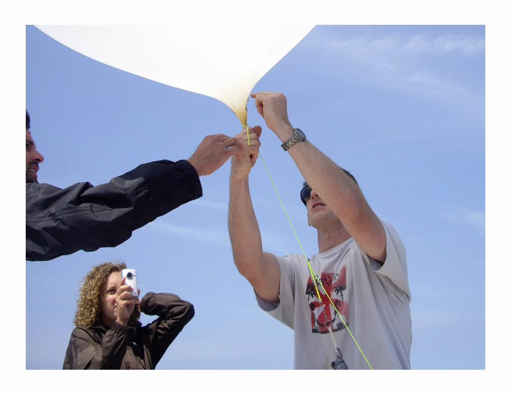
• GPS tracking unit (opGonal, where needed) • Package to house and protect the camera and GPS unit • Balloon or kite with enough liK capability to carry the camera, GPS unit,
housing and sufficient tether line to reach height of interest for the photographs
• Safe area to test the system and process • Safe approach to use the process in the field • Capability to process the data and present the results • Approach to discuss and use the results
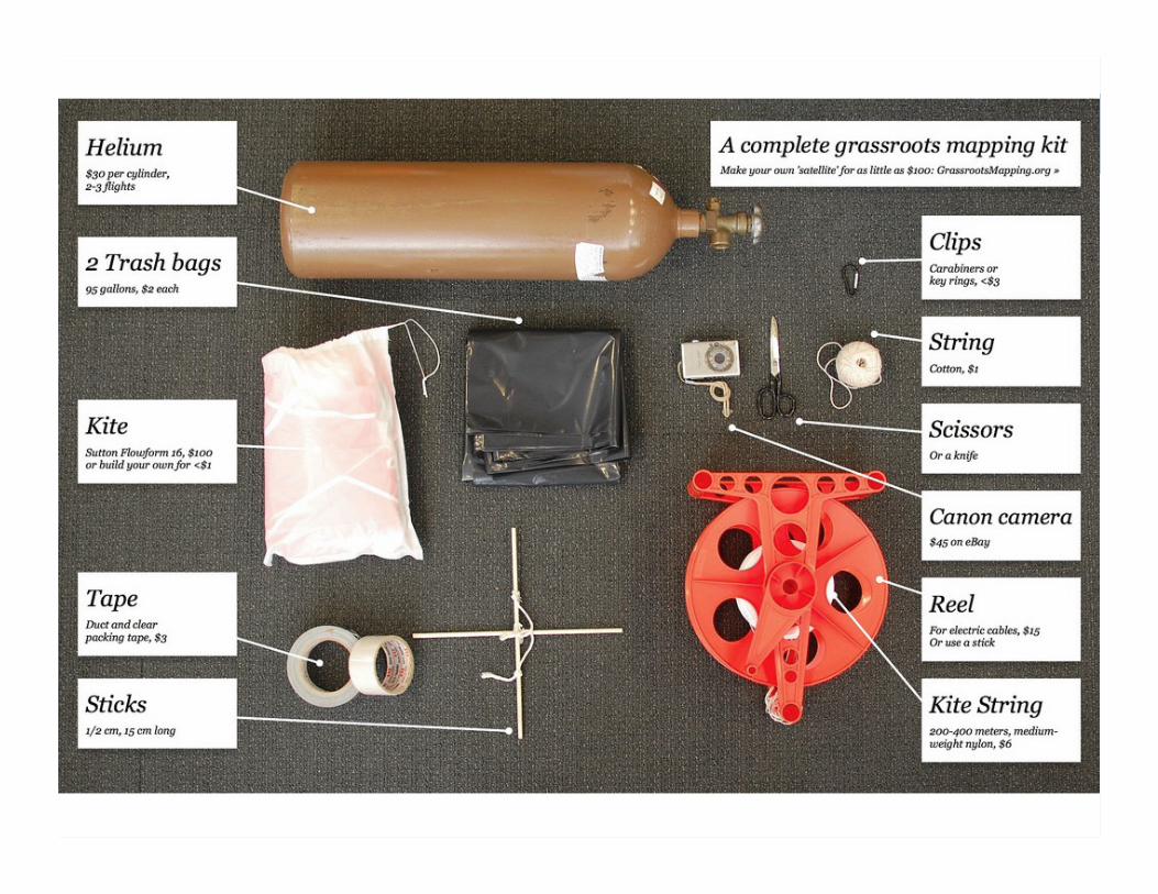
A complete grassroots mapping kit
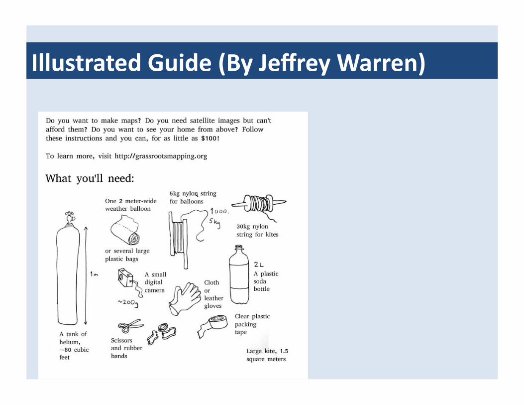
Illustrated Guide (By Jeffrey Warren)
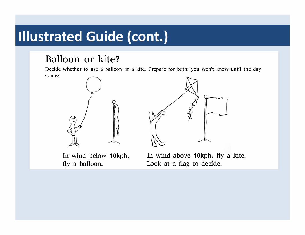
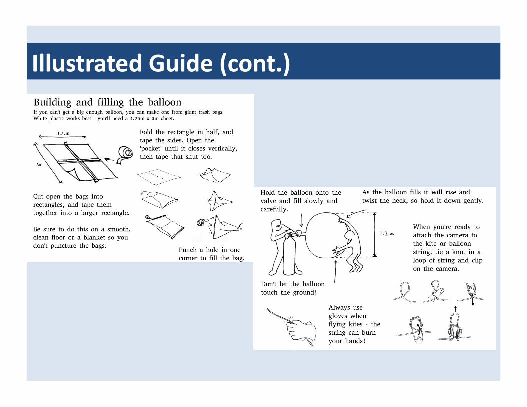
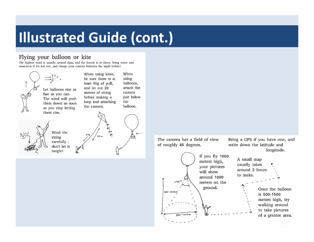
Illustrated Guide (cont.)
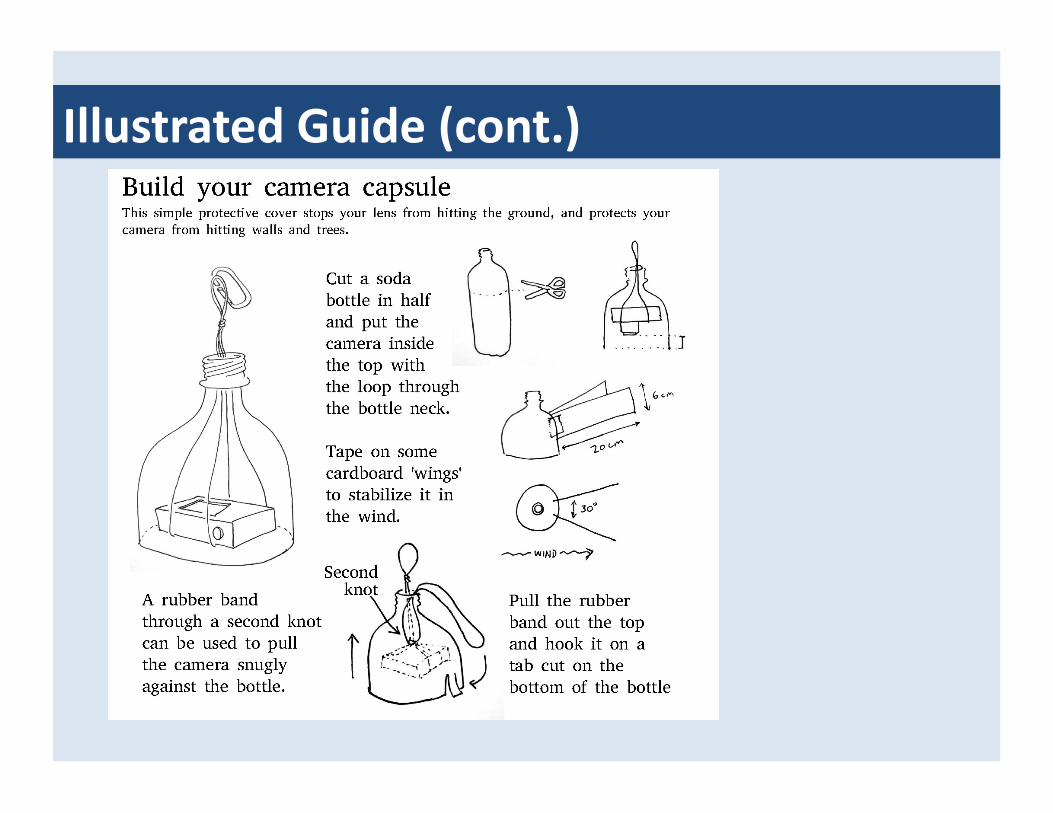
Illustrated Guide (cont.)

Illustrated Guide (cont.)
Illustrated Guide (cont.)
Illustrated Guide (cont.)

“Neogeographic” approach to inexpensive oil spill mapping
• In late April 2010, the Deepwater Horizon oil rig exploded and sank in the Gulf of Mexico, iniGaGng what may be one of the worst environmental disasters in U.S. history
• As the spill grew in size, Jeffrey Warren and Stewart Long collaborated with the Louisiana Bucket Brigade, a New Orleans-‐based environmental non-‐profit group, and began a volunteer-‐led aerial mapping project to document the spill’s effects
• The maps use orthorecGfied photographs of key affected sites processed into GeoTIFFs and Gled map services (TMS) -‐ the public domain photographs, taken from balloons or kites, are among the highest resoluGon imagery available of the spill
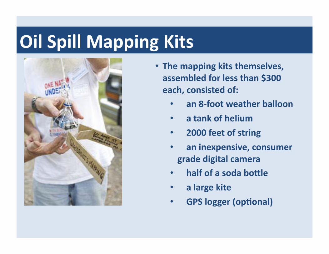
Oil Spill Mapping Kits • The mapping kits themselves, assembled for less than $300 each, consisted of:
• an 8-‐foot weather balloon • a tank of helium
• 2000 feet of string • an inexpensive, consumer grade digital camera
• half of a soda bonle • a large kite • GPS logger (opGonal)

Oil spill mapping approach • ParGcipants visit an affected area, fill a balloon or prepare a kite depending on wind condiGons, and send the camera in its homemade protecGve enclosure up to 2000 feet in the air
• By walking along the beach or moving in a boat, several kilometers of coastline may be imaged in just a few hours
• Some maps, at ~ 2-‐3 cm nominal resoluGon, can count birds, plants and other features, even idenGfy bird species
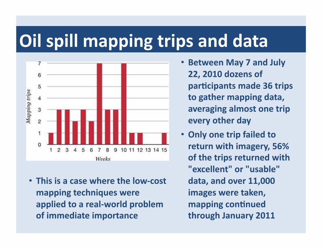
Oil spill mapping trips and data • Between May 7 and July 22, 2010 dozens of parGcipants made 36 trips to gather mapping data, averaging almost one trip every other day
• Only one trip failed to return with imagery, 56% of the trips returned with "excellent" or "usable" data, and over 11,000 images were taken, mapping conGnued through January 2011
• This is a case where the low-‐cost mapping techniques were applied to a real-‐world problem of immediate importance

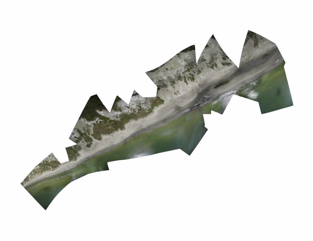
OrthorecGficaGon (sGtching) techniques • Two different manual processing methods have accounted for
the bulk of the mapping for Grassroots Mapping grassrootsmapping.org to date:
• Gonzo Earth Image Processing is a workflow of different commercial off-‐the-‐shelf (COTS) and open-‐source GIS and digital image soKware packages, which has been used to generate dozens of maps from balloons, kites, remote controlled and manned aircraK
• Kniner soKware consists of a free web-‐based interface for users to upload and recGfy images from a web browser
• Both export finished maps in standard formats that can be viewed in common GIS tools and integrated into exisGng workflows
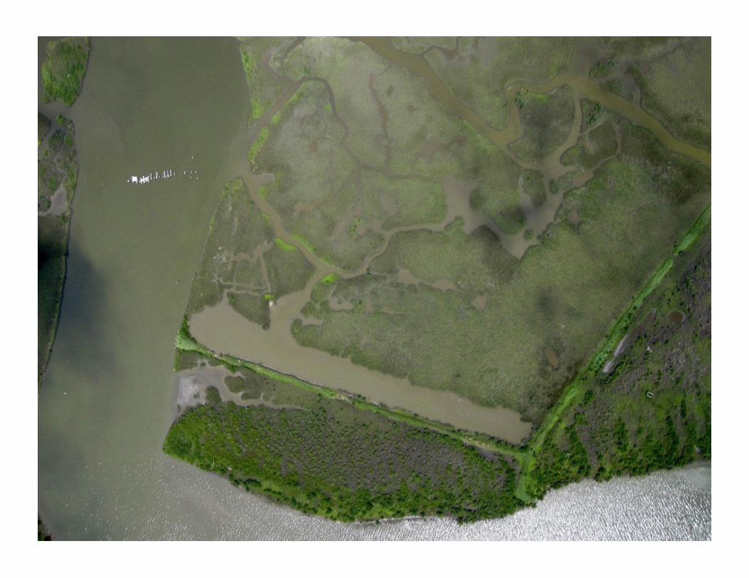

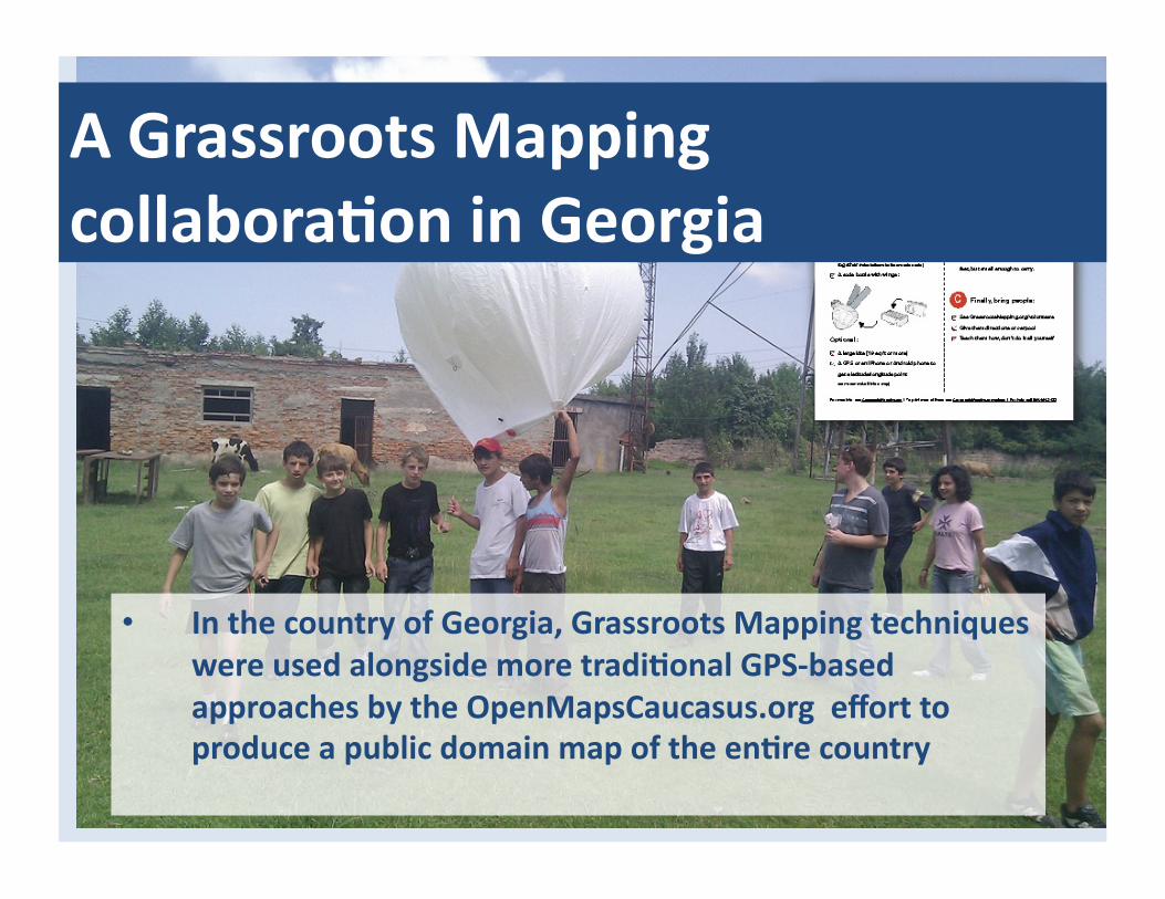
A Grassroots Mapping collaboraGon in Georgia
• In the country of Georgia, Grassroots Mapping techniques were used alongside more tradiGonal GPS-‐based approaches by the OpenMapsCaucasus.org effort to produce a public domain map of the enGre country

• A map of MesGa, in the SvaneG region of Georgia. The map spans 5.5 kilometers and was captured in just 3 days of balloon and kite mapping with local OpenMapsCaucasus staff and parGcipaGng students
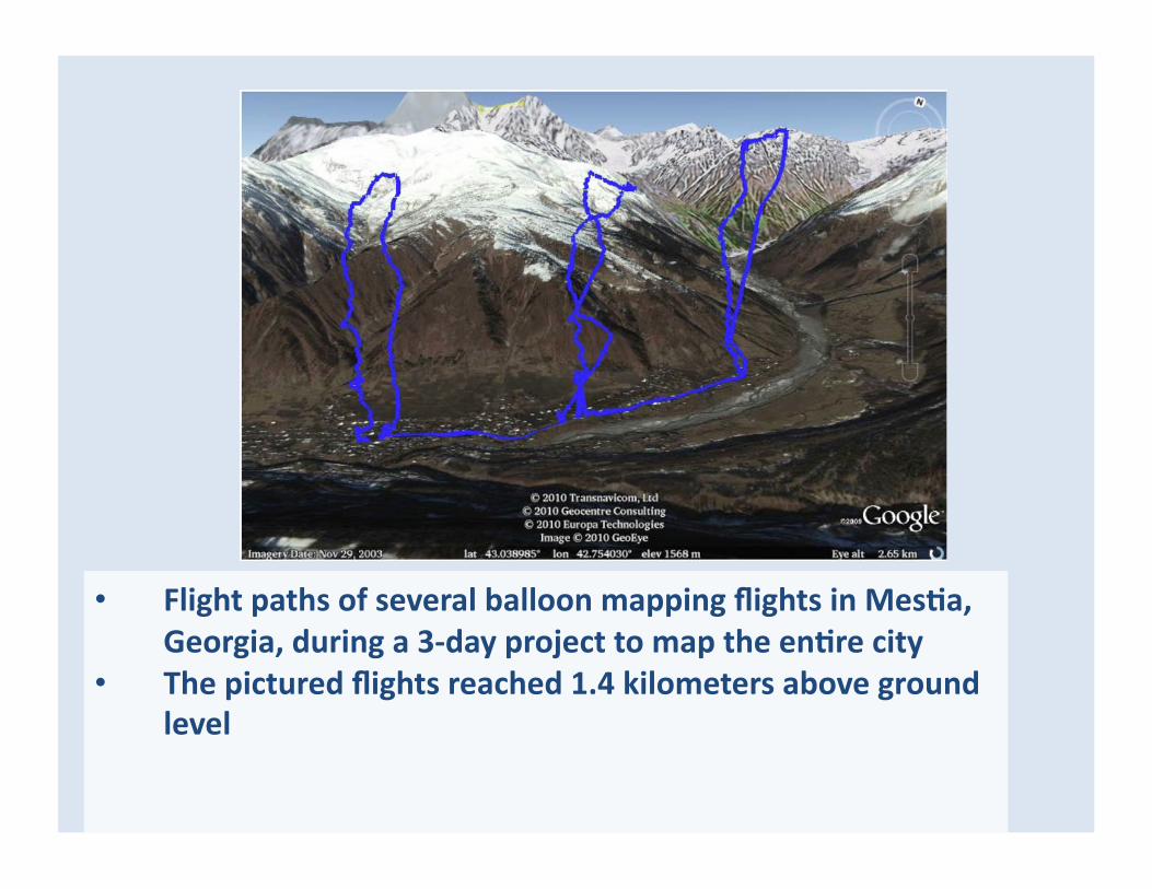
• Flight paths of several balloon mapping flights in MesGa, Georgia, during a 3-‐day project to map the enGre city
• The pictured flights reached 1.4 kilometers above ground level
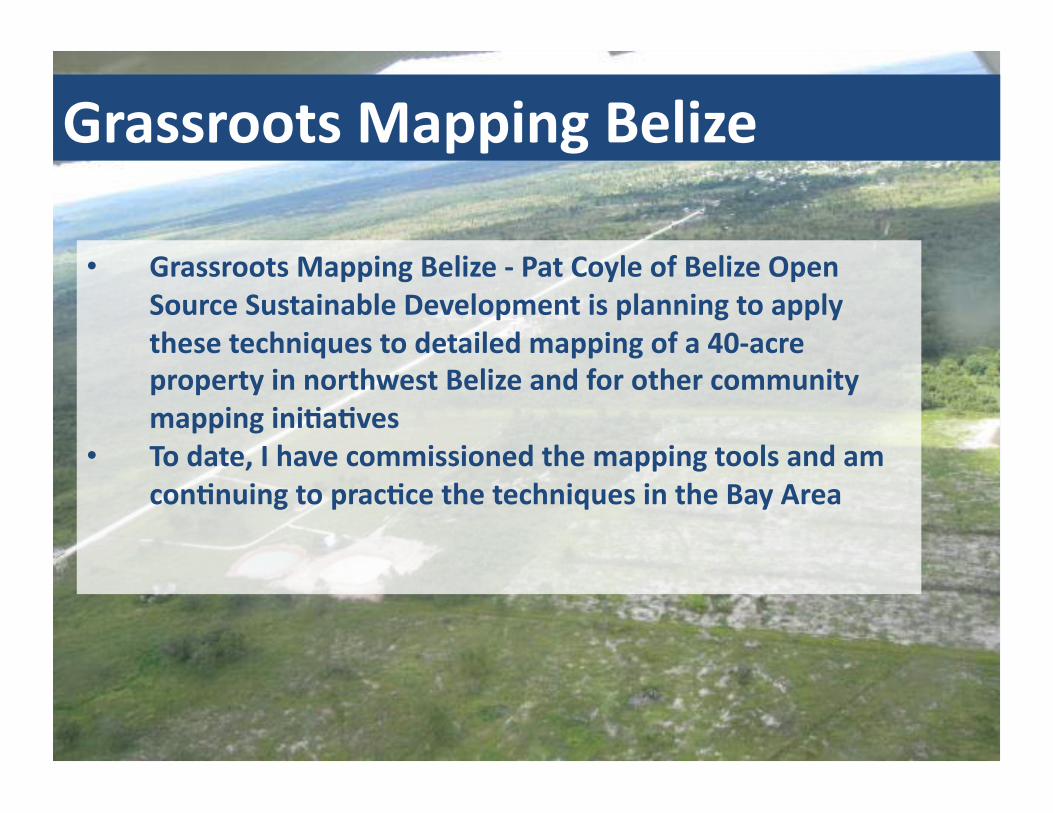
Grassroots Mapping Belize
• Grassroots Mapping Belize -‐ Pat Coyle of Belize Open Source Sustainable Development is planning to apply these techniques to detailed mapping of a 40-‐acre property in northwest Belize and for other community mapping iniGaGves
• To date, I have commissioned the mapping tools and am conGnuing to pracGce the techniques in the Bay Area
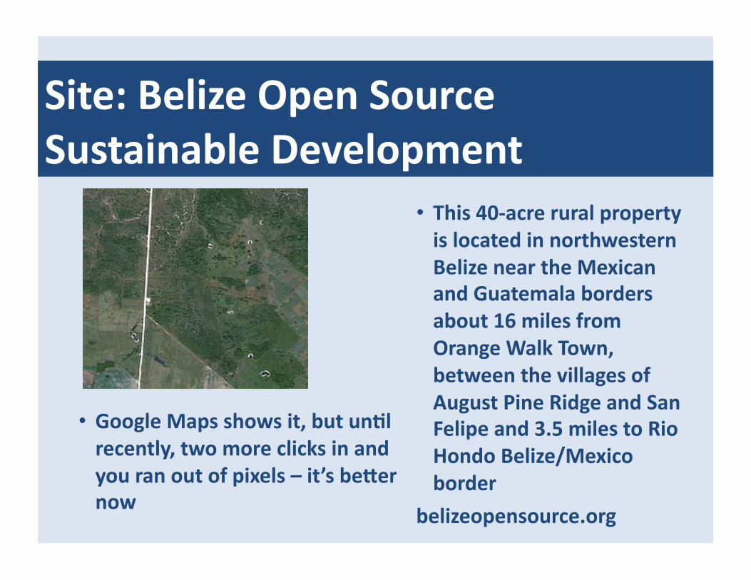
Site: Belize Open Source Sustainable Development
• This 40-‐acre rural property is located in northwestern Belize near the Mexican and Guatemala borders about 16 miles from Orange Walk Town, between the villages of August Pine Ridge and San Felipe and 3.5 miles to Rio Hondo Belize/Mexico border
belizeopensource.org
• Google Maps shows it, but unGl recently, two more clicks in and you ran out of pixels – it’s bener now
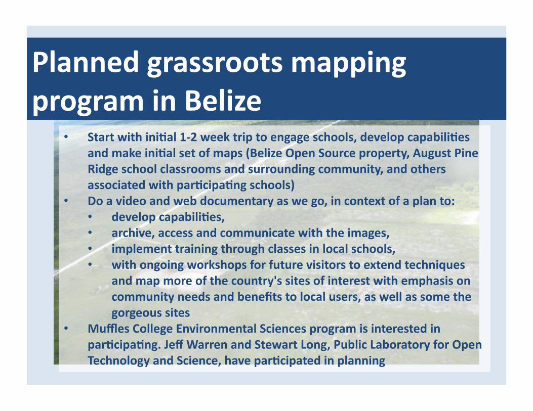
Planned grassroots mapping program in Belize
• Start with iniGal 1-‐2 week trip to engage schools, develop capabiliGes and make iniGal set of maps (Belize Open Source property, August Pine Ridge school classrooms and surrounding community, and others associated with parGcipaGng schools)
• Do a video and web documentary as we go, in context of a plan to: • develop capabiliGes, • archive, access and communicate with the images, • implement training through classes in local schools, • with ongoing workshops for future visitors to extend techniques
and map more of the country's sites of interest with emphasis on community needs and benefits to local users, as well as some the gorgeous sites
• Muffles College Environmental Sciences program is interested in parGcipaGng. Jeff Warren and Stewart Long, Public Laboratory for Open Technology and Science, have parGcipated in planning
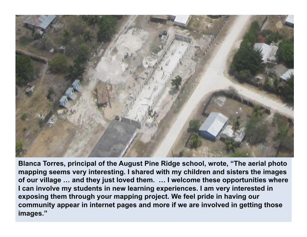
Blanca Torres, principal of the August Pine Ridge school, wrote, “The aerial photo mapping seems very interesting. I shared with my children and sisters the images of our village … and they just loved them. … I welcome these opportunities where I can involve my students in new learning experiences. I am very interested in exposing them through your mapping project. We feel pride in having our community appear in internet pages and more if we are involved in getting those images.”
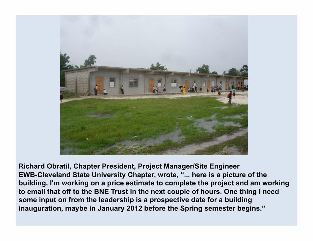
Richard Obratil, Chapter President, Project Manager/Site Engineer EWB-Cleveland State University Chapter, wrote, “... here is a picture of the building. I'm working on a price estimate to complete the project and am working to email that off to the BNE Trust in the next couple of hours. One thing I need some input on from the leadership is a prospective date for a building inauguration, maybe in January 2012 before the Spring semester begins.”
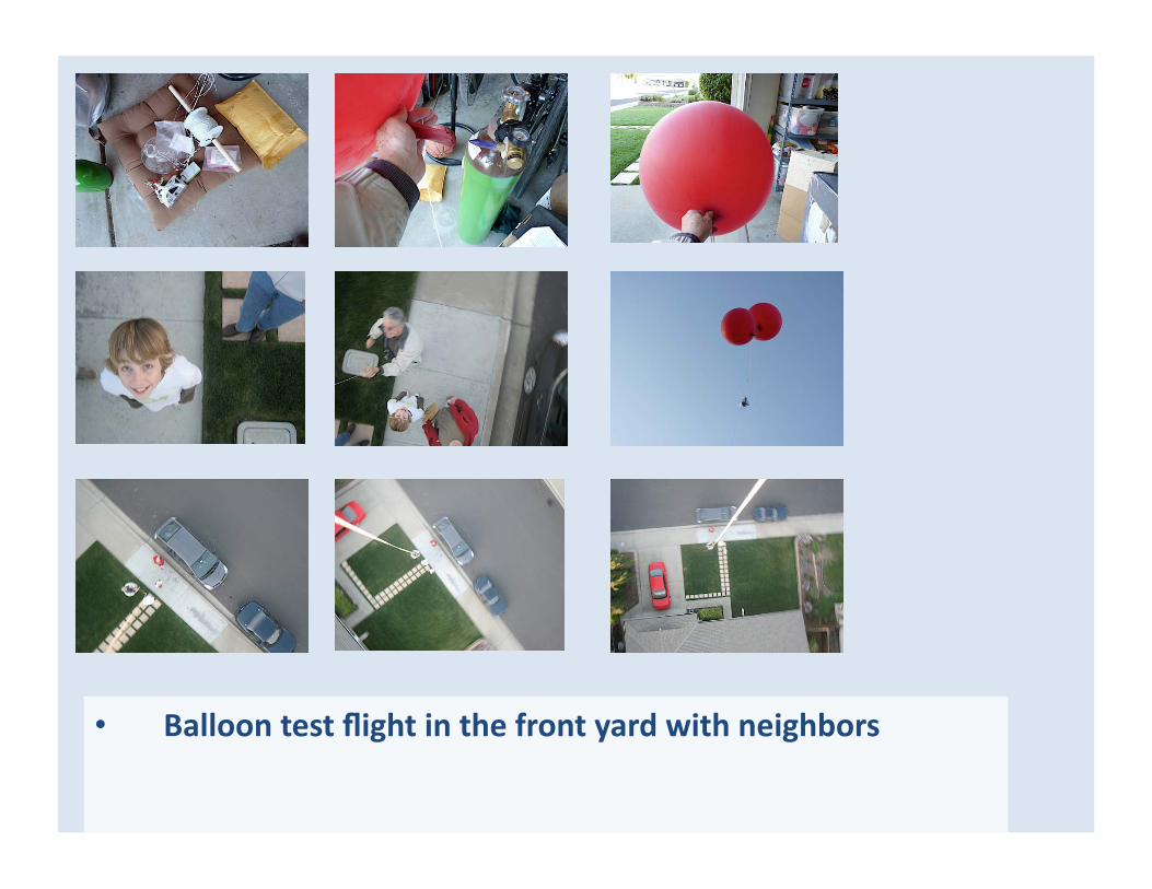
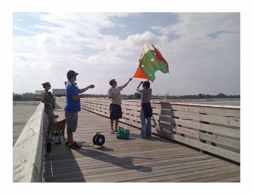
• Balloon test flight in the front yard with neighbors
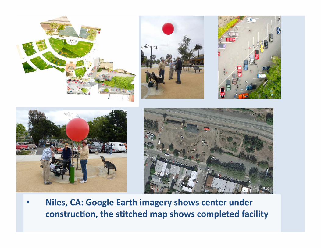
• Niles, CA: Google Earth imagery shows center under construcGon, the sGtched map shows completed facility
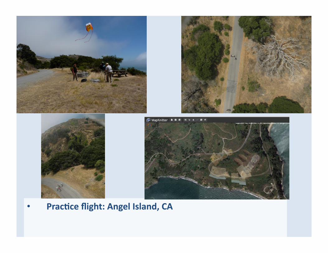
• PracGce flight: Angel Island, CA
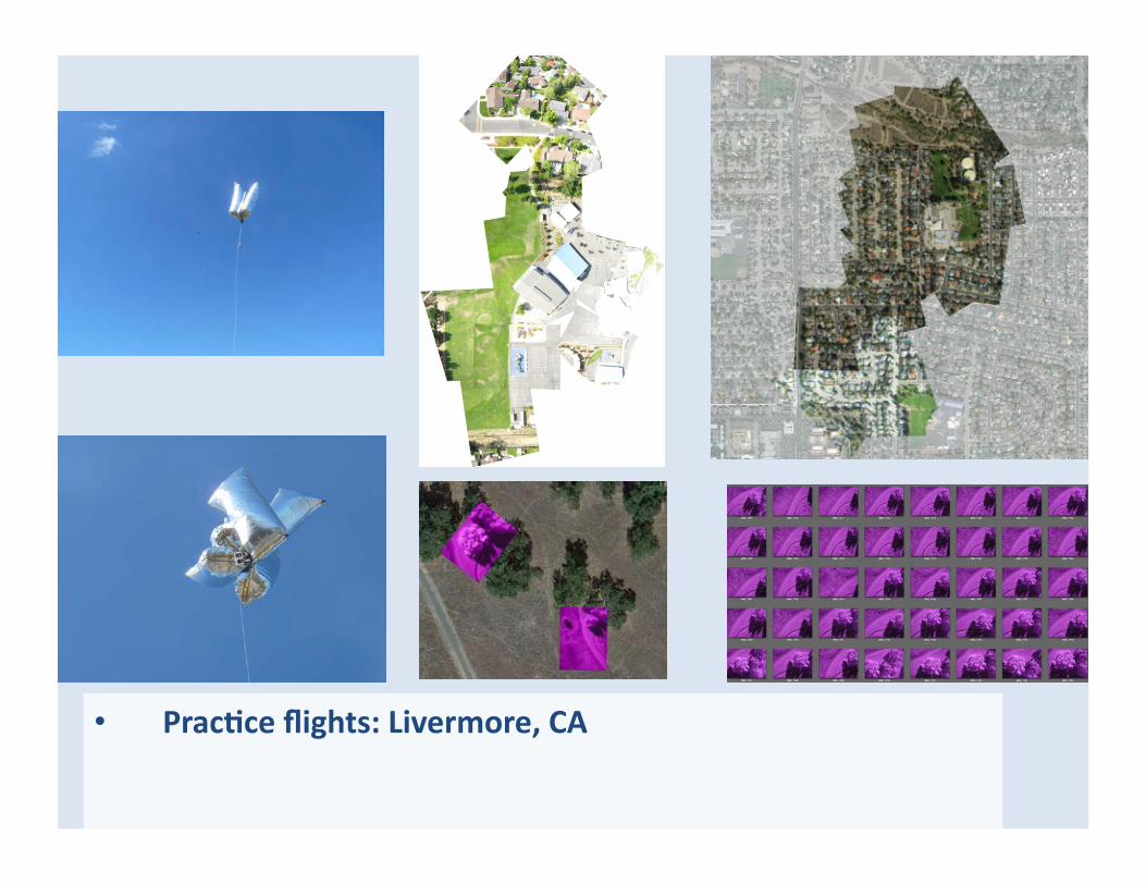
• PracGce flights: Livermore, CA

• Sunol, CA:

R/C aircraft testing in San Diego with pilot John Shultz

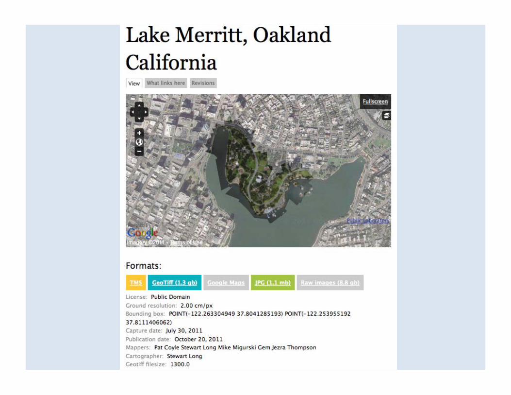
hLp://mapkniLer.org/
• MapKniLer is a free and open source tool for combining and posiQoning images in geographic space into a composite image map
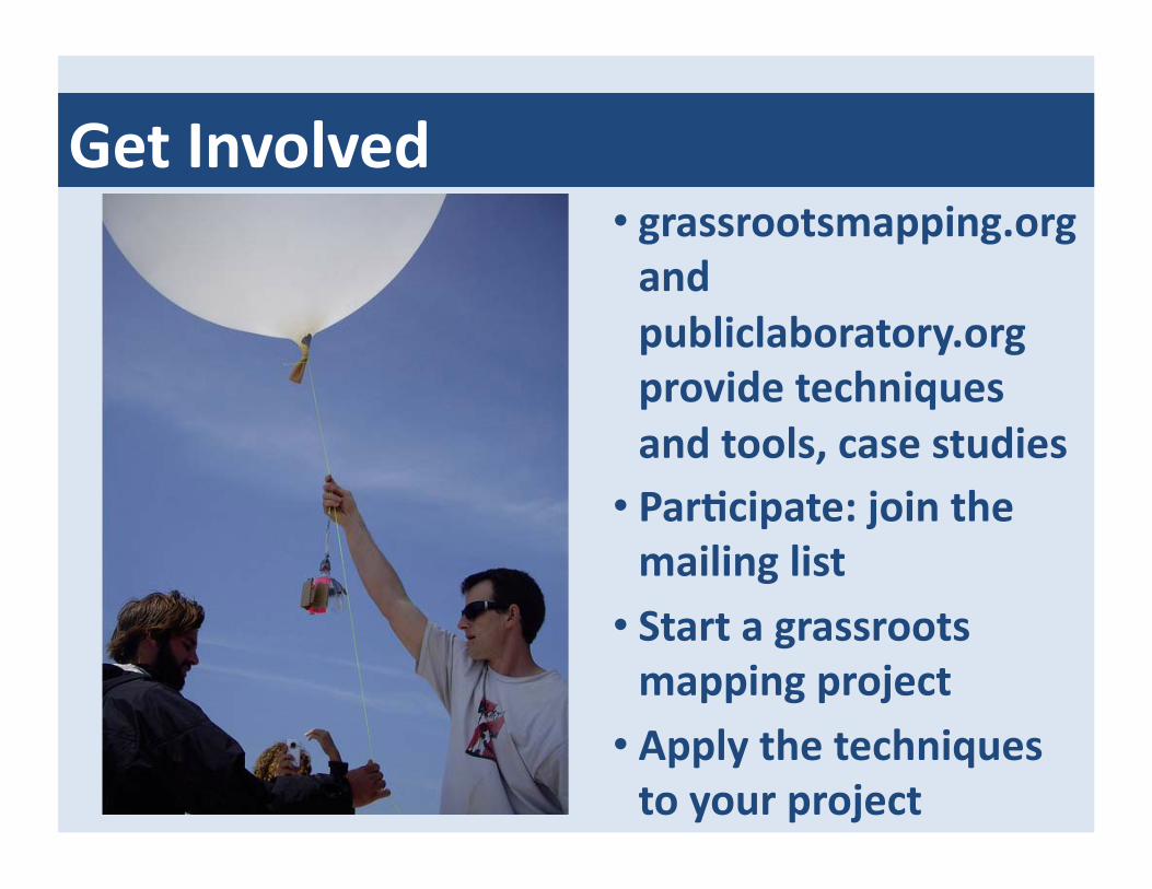
Get Involved • grassrootsmapping.org and publiclaboratory.org provide techniques and tools, case studies
• ParGcipate: join the mailing list
• Start a grassroots mapping project
• Apply the techniques to your project

Grass Roots Mapping Supporters and Collaborators
You The Design Ecology group at the MIT Media Lab
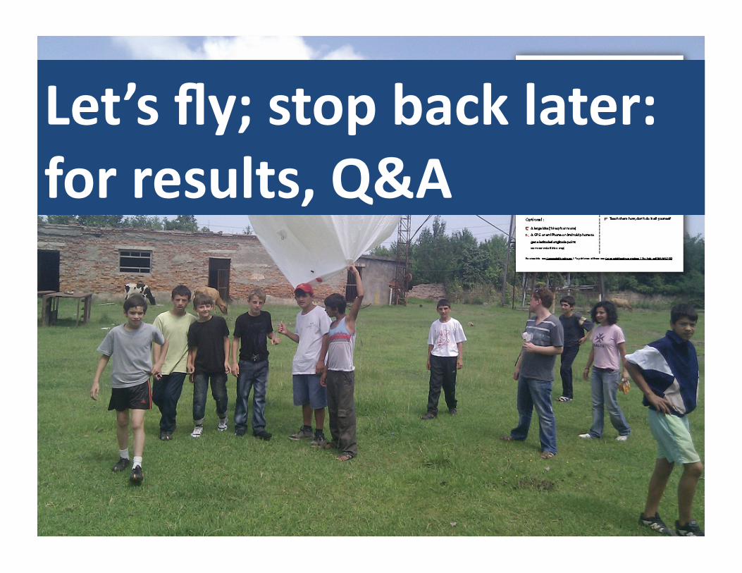
Let’s fly; stop back later: for results, Q&A