Embed Size (px)
Citation preview
#
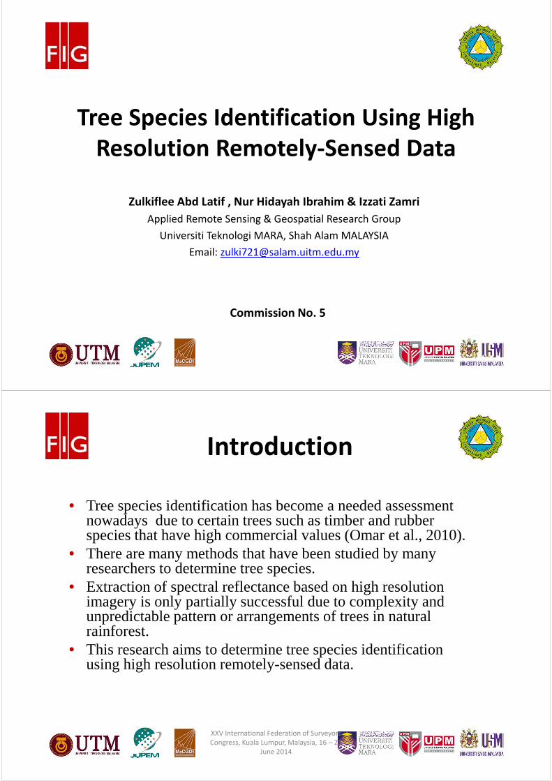
Tree Species Identification Using High
Resolution Remotely-Sensed Data
Commission No. 5
#
Zulkiflee Abd Latif , Nur Hidayah Ibrahim & Izzati Zamri
Applied Remote Sensing & Geospatial Research Group
Universiti Teknologi MARA, Shah Alam MALAYSIA
Email: [email protected]
#
Introduction
• Tree species identification has become a needed assessment nowadays due to certain trees such as timber and rubber species that have high commercial values (Omar et al., 2010).
• There are many methods that have been studied by many researchers to determine tree species.
• Extraction of spectral reflectance based on high resolution imagery is only partially successful due to complexity and unpredictable pattern or arrangements of trees in natural rainforest.
• This research aims to determine tree species identification using high resolution remotely-sensed data.
XXV International Federation of Surveyors
Congress, Kuala Lumpur, Malaysia, 16 – 21
June 2014

#
� Bukit Nanas Forest
Reserve , Kuala Lumpur,
oldest permanent forest
reserve in Malaysia.
�Earlier known as Bucket
Weld Forest Reserve and
was declared as a forest
reserve in 1906.
�Recognized as one of the
protected areas in World
Heritage Program where
the IUCN Management
Category and classified as
“Ia” (Strict Nature
Reserve).
XXV International Federation of Surveyors
Congress, Kuala Lumpur, Malaysia, 16 – 21
June 2014
XXV International Federation of Surveyors
Congress, Kuala Lumpur, Malaysia, 16 – 21
June 2014
#
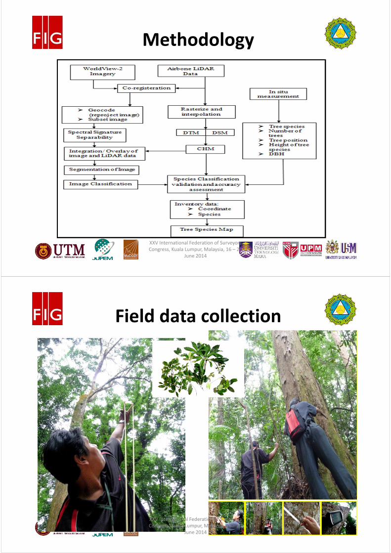
Methodology
XXV International Federation of Surveyors
Congress, Kuala Lumpur, Malaysia, 16 – 21
June 2014
#
Field data collection
XXV International Federation of Surveyors
Congress, Kuala Lumpur, Malaysia, 16 – 21
June 2014
#
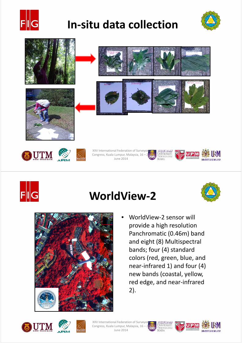
In-situ data collection
XXV International Federation of Surveyors
Congress, Kuala Lumpur, Malaysia, 16 – 21
June 2014
#
• WorldView-2 sensor will
provide a high resolution
Panchromatic (0.46m) band
and eight (8) Multispectral
bands; four (4) standard
colors (red, green, blue, and
near-infrared 1) and four (4)
new bands (coastal, yellow,
red edge, and near-infrared
2).
WorldView-2
XXV International Federation of Surveyors
Congress, Kuala Lumpur, Malaysia, 16 – 21
June 2014
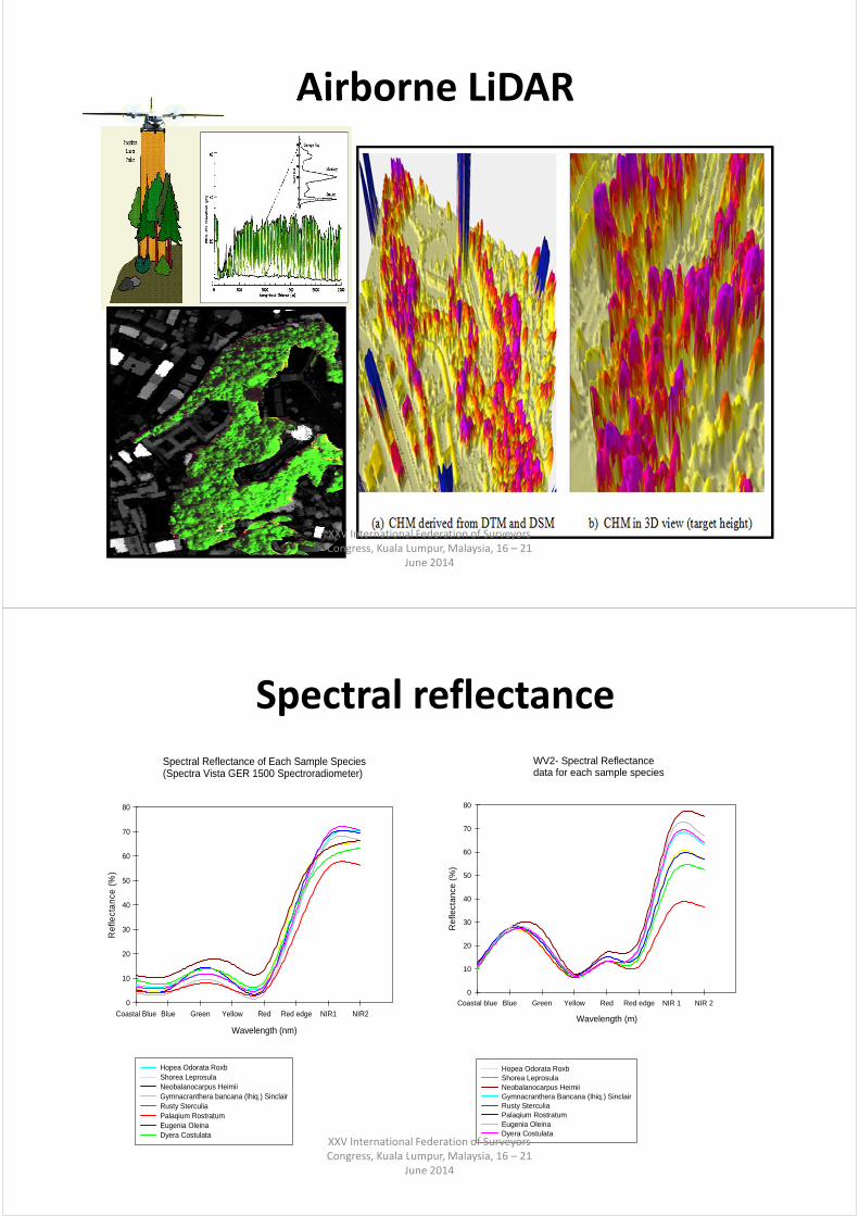
Airborne LiDAR
XXV International Federation of Surveyors
Congress, Kuala Lumpur, Malaysia, 16 – 21
June 2014
Spectral reflectance
WV2- Spectral Reflectance data for each sample species
Wavelength (m)
Coastal blue Blue Green Yellow Red Red edge NIR 1 NIR 2
Ref
lect
ance
(%
)
0
10
20
30
40
50
60
70
80
Hopea Odorata RoxbShorea LeprosulaNeobalanocarpus HeimiiGymnacranthera Bancana (Ihiq.) SinclairRusty SterculiaPalaqium RostratumEugenia OleinaDyera Costulata
Spectral Reflectance of Each Sample Species(Spectra Vista GER 1500 Spectroradiometer)
Wavelength (nm)
Coastal Blue Blue Green Yellow Red Red edge NIR1 NIR2
Ref
lect
ance
(%
)
0
10
20
30
40
50
60
70
80
Hopea Odorata RoxbShorea LeprosulaNeobalanocarpus HeimiiGymnacranthera bancana (Ihiq.) SinclairRusty SterculiaPalaqium RostratumEugenia OleinaDyera Costulata
XXV International Federation of Surveyors
Congress, Kuala Lumpur, Malaysia, 16 – 21
June 2014

#
Scale: 20, Merge: 80
XXV International Federation of Surveyors
Congress, Kuala Lumpur, Malaysia, 16 – 21
June 2014
#
• Total numbers of 188 trees which include the Hopean OdorataRoxb (Merawan Siput Jantan), Shorea Leprosula (MerantiTembaga), Neobalanocarpus Heimii (Cengal), GymnacrantheraBancana (Ihiq) Sinclair (Penarahan), Rusty Sterculia (Kelumpang), Palaqium Rostratum (Nyatoh Putih), Eugenia Oleina (Kelat) and Dyera Costulata (Jelutong).
Field Validation
XXV International Federation of Surveyors
Congress, Kuala Lumpur, Malaysia, 16 – 21
June 2014
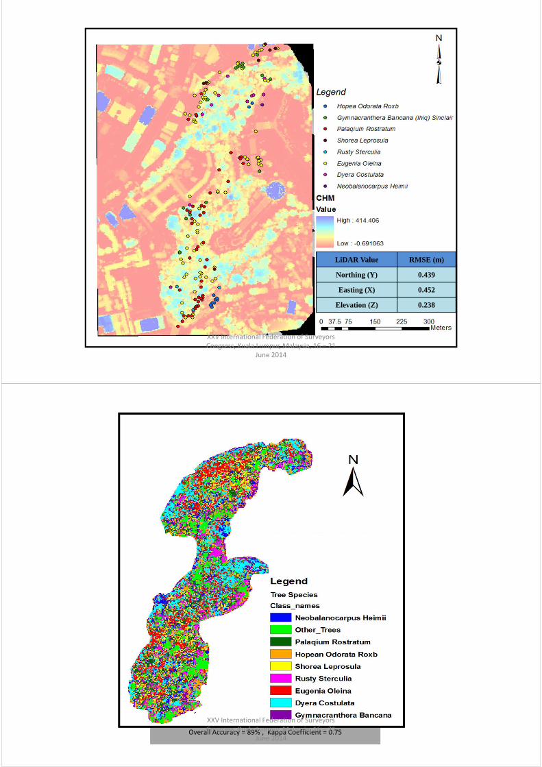
LiDAR Value RMSE (m)
Northing (Y) 0.439
Easting (X) 0.452
Elevation (Z) 0.238
XXV International Federation of Surveyors
Congress, Kuala Lumpur, Malaysia, 16 – 21
June 2014
Overall Accuracy = 89% , Kappa Coefficient = 0.75
XXV International Federation of Surveyors
Congress, Kuala Lumpur, Malaysia, 16 – 21
June 2014

#
Conclusion
• WorldView 2 satellite imagery and airborne LiDARdata provide a very promising remote-sensingsources for determination of tree species of thestudy area.
• In tropical forest, segmentation of individual trees was complex due to the pattern of arrangements of tree species.
• For further research, other field data is needed in order to achieve higher accuracy which can be used in forest tree identification and mapping.
XXV International Federation of Surveyors
Congress, Kuala Lumpur, Malaysia, 16 – 21
June 2014
#
Acknowledgement
• Financial assistance from Malaysian Land
Surveyors Board (LJT).
• Forestry Department, Malaysia.
• Forest Research Institute Malaysia (FRIM).
XXV International Federation of Surveyors
Congress, Kuala Lumpur, Malaysia, 16 – 21
June 2014

#
Thank you for your attention!
Associate Professor Sr Dr. Zulkiflee Abd Latif
Applied Remote Sensing & Geospatial Research Group
Universiti Teknologi MARA, Malaysia
Email: [email protected],
XXV International Federation of Surveyors
Congress, Kuala Lumpur, Malaysia, 16 – 21
June 2014