Embed Size (px)
Citation preview
Use of Geospatial Technologiesand
Bhuvan in Power SectorAnand Shankar, Neeraj Joshi, Pradeep Chauhan and Pankaj Mahata
POWERGRIDWith inputs from
NTPC, NHPC, POSOCO and EESL
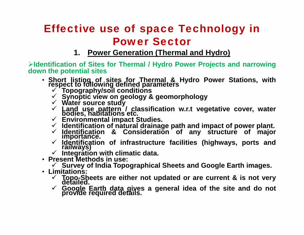
Effective use of space Technology inPower Sector
1. Power Generation (Thermal and Hydro)Identification of Sites for Thermal / Hydro Power Projects and narrowingdown the potential sites
• Short listing of sites for Thermal & Hydro Power Stations, withrespect to following defined parameters Topography/soil conditions Synoptic view on geology & geomorphology Water source study Land use pattern / classification w.r.t vegetative cover, waterbodies, habitations etc. Environmental impact Studies. Identification of natural drainage path and impact of power plant. Identification & Consideration of any structure of majorimportance. Identification of infrastructure facilities (highways, ports andrailways) Integration with climatic data.
• Present Methods in use: Survey of India Topographical Sheets and Google Earth images.
• Limitations: Topo-Sheets are either not updated or are current & is not verydetailed. Google Earth data gives a general idea of the site and do notprovide required details.
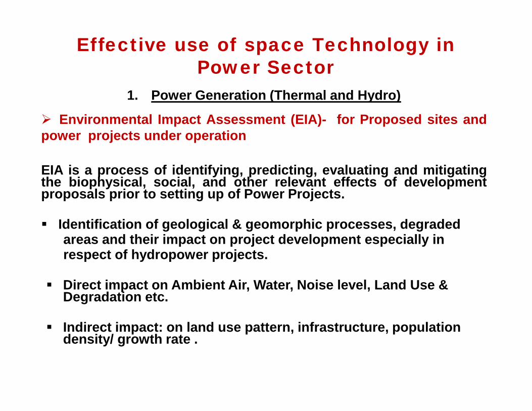
Effective use of space Technology inPower Sector
1. Power Generation (Thermal and Hydro)
Environmental Impact Assessment (EIA)- for Proposed sites andpower projects under operation
EIA is a process of identifying, predicting, evaluating and mitigatingthe biophysical, social, and other relevant effects of developmentproposals prior to setting up of Power Projects.
Identification of geological & geomorphic processes, degradedareas and their impact on project development especially inrespect of hydropower projects.
Direct impact on Ambient Air, Water, Noise level, Land Use &Degradation etc.
Indirect impact: on land use pattern, infrastructure, populationdensity/ growth rate .
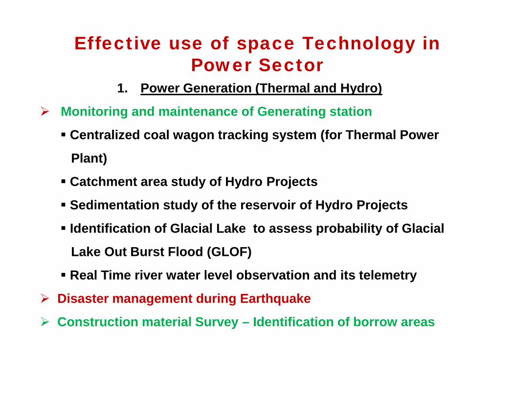
Effective use of space Technology inPower Sector
1. Power Generation (Thermal and Hydro)
Monitoring and maintenance of Generating station
Centralized coal wagon tracking system (for Thermal Power
Plant)
Catchment area study of Hydro Projects
Sedimentation study of the reservoir of Hydro Projects
Identification of Glacial Lake to assess probability of Glacial
Lake Out Burst Flood (GLOF)
Real Time river water level observation and its telemetry
Disaster management during Earthquake
Construction material Survey – Identification of borrow areas
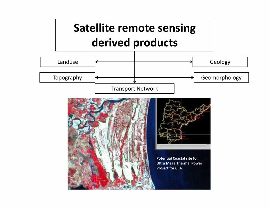
Potential Coastal site forUltra Mega Thermal PowerProject for CEA
Satellite remote sensingderived products
Landuse
Topography
Geology
Geomorphology
Transport Network
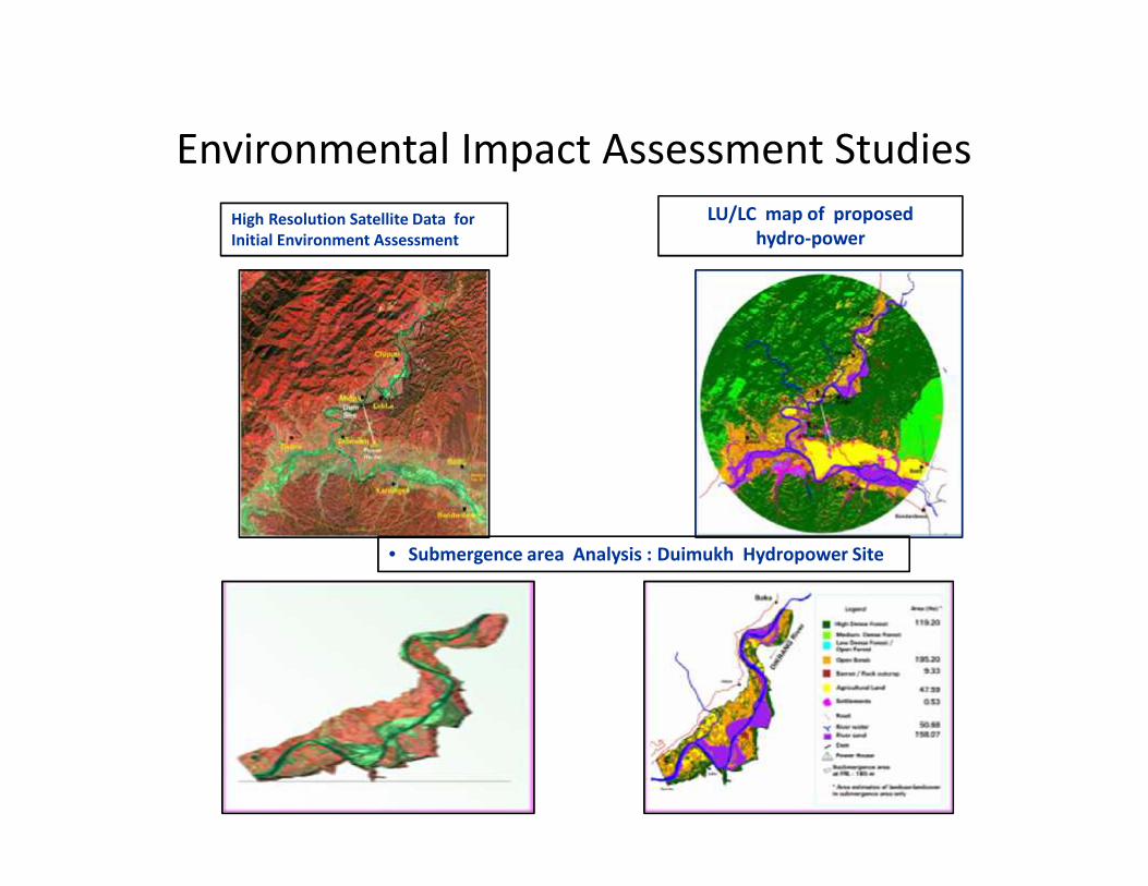
Environmental Impact Assessment StudiesHigh Resolution Satellite Data forInitial Environment Assessment
LU/LC map of proposedhydro-power
• Submergence area Analysis : Duimukh Hydropower Site
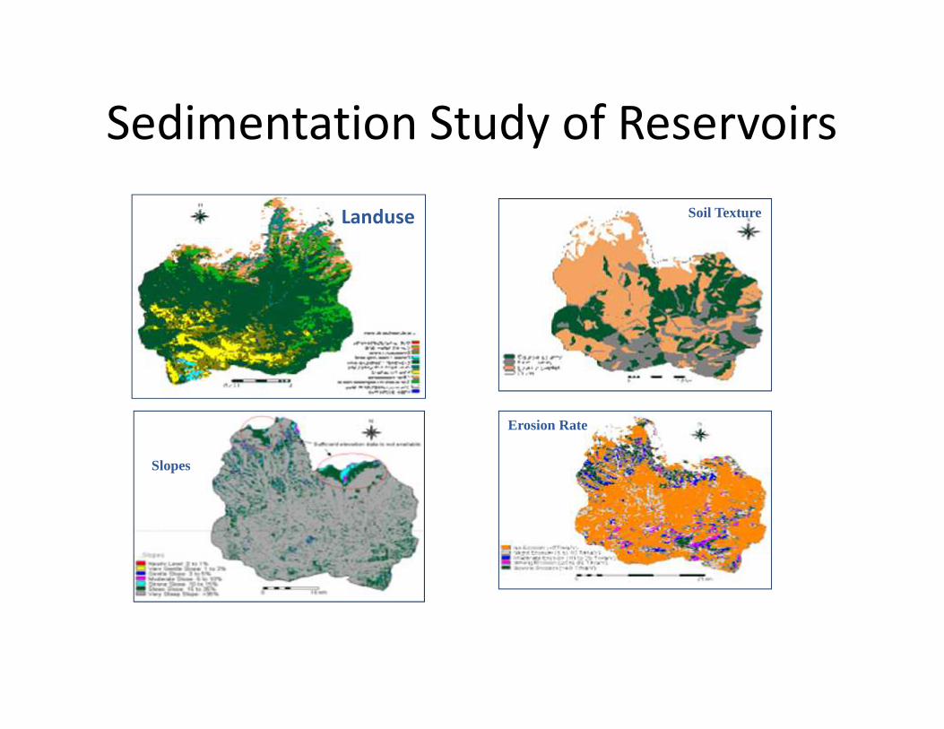
Sedimentation Study of Reservoirs
Slopes
Erosion Rate
Landuse Soil Texture
Use of Space Technology in NHPC Ltd
• R&D Division of NHPC has signed an MOU for Remote SensingBased Studies for Teesta-IV HE Project located in the State ofSikkim with NRSC Hyderabad .
• Scope of Study area is to Generate Spatial Layers onGeological Parameters, Land use, Soil and Topography usingMulti-Temporal Satellite Data and Assess the sediment Load inTeesta-IV HE Catchment Area through a Spatial Soil ErosionModel that will be calibrated & validated for Teesta-V HEProject
Effective use of space Technology inPower Sector
2. Power Transmission System Transmission Line Route Alignment and optimization of route - avoidingforest area / wild life sanctuaries and minimizing crossings like rivers,highways, railway lines etc.
Asset Management• Mapping of Transmission assets on GIS platform
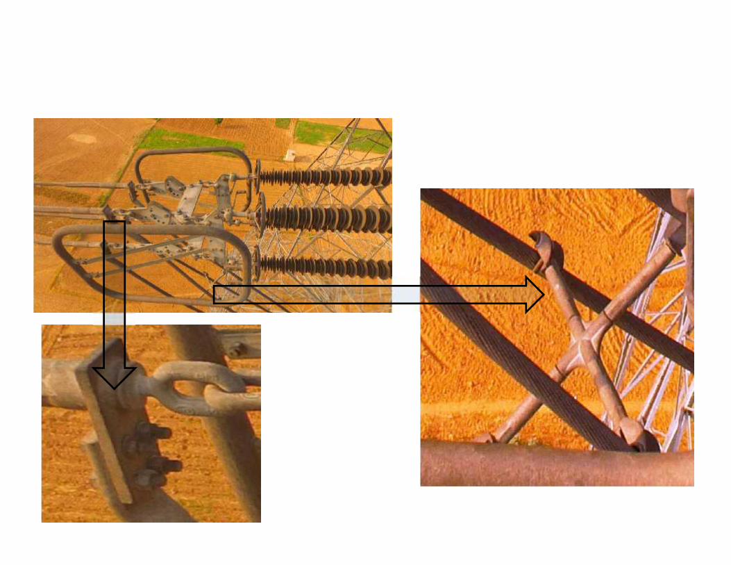
Monitoring and Maintenance• Encroachment in Right of Way(ROW)
[Growth of vegetation, reduction in safety Clearance requirement,monitoring conductor & ground wire sag]
Effect of seasonal weather condition on Transmission asset Pollution Mapping River meandering / Soil erosion – a threat to tower foundations Disaster management - early restoration of Power Supply to the affected
areas Time synchronisation / time stamping of information /data
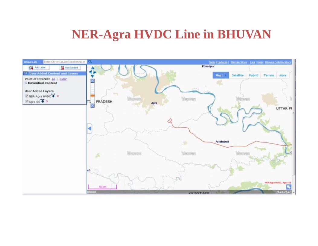
NER-Agra HVDC Line in BHUVAN

Brick Kiln mapping
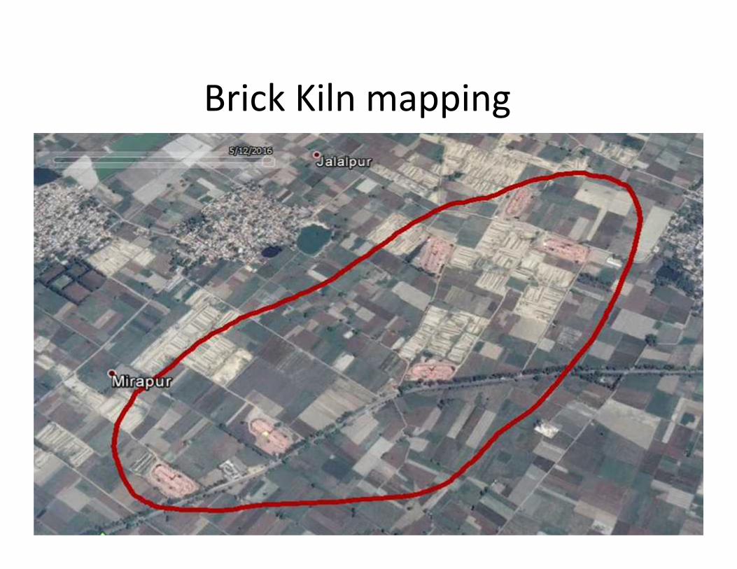
Brick Kiln mapping
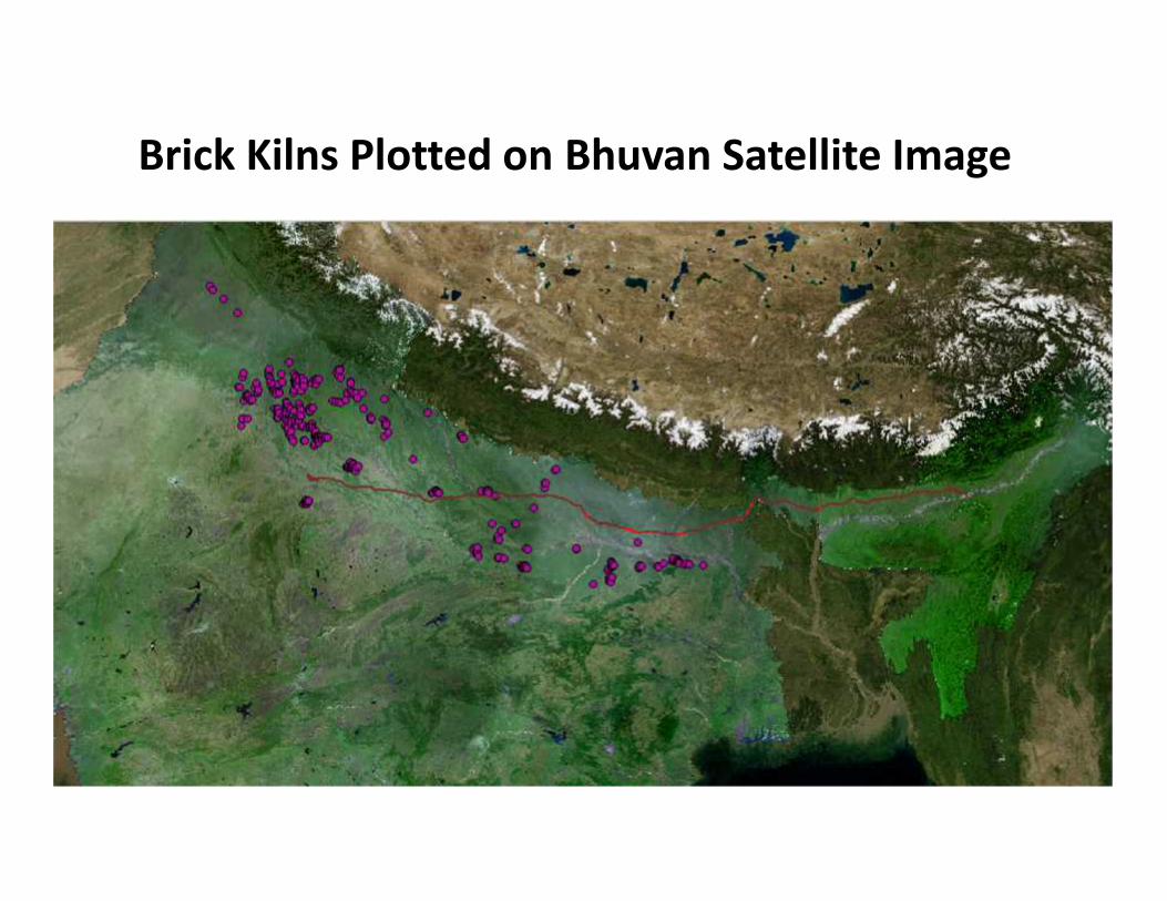
Brick Kilns Plotted on Bhuvan Satellite Image
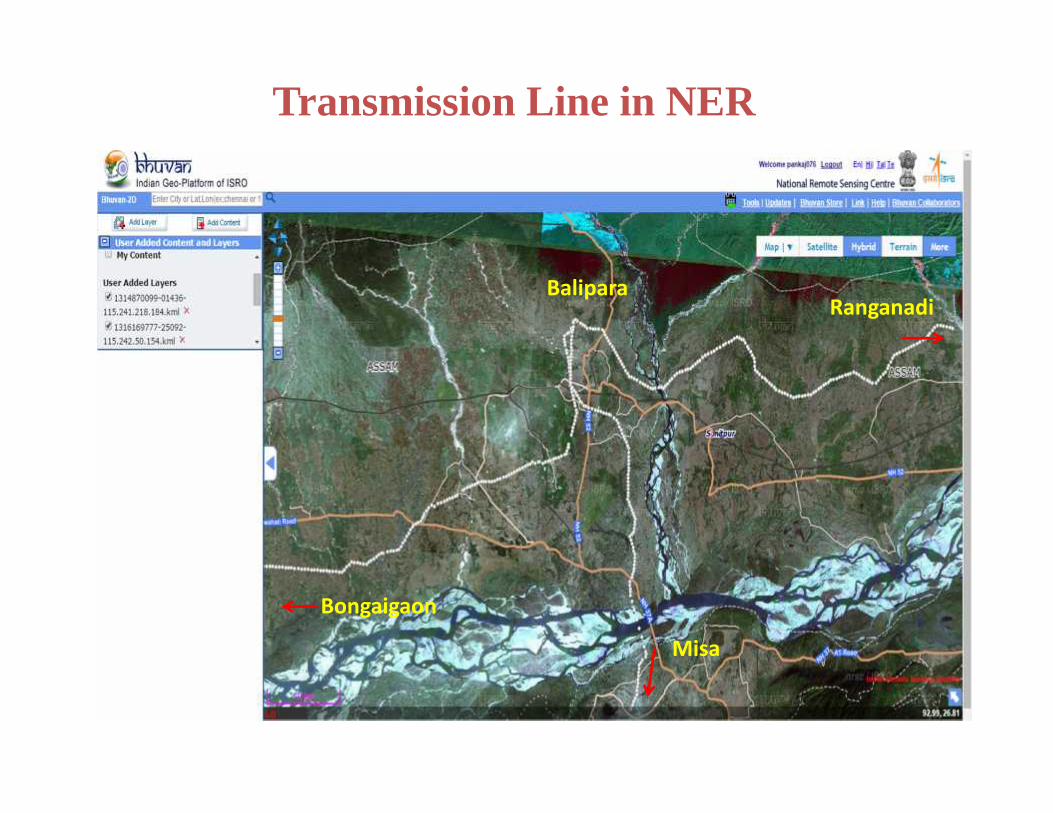
Transmission Line in NER
BaliparaRanganadi
Misa
Bongaigaon
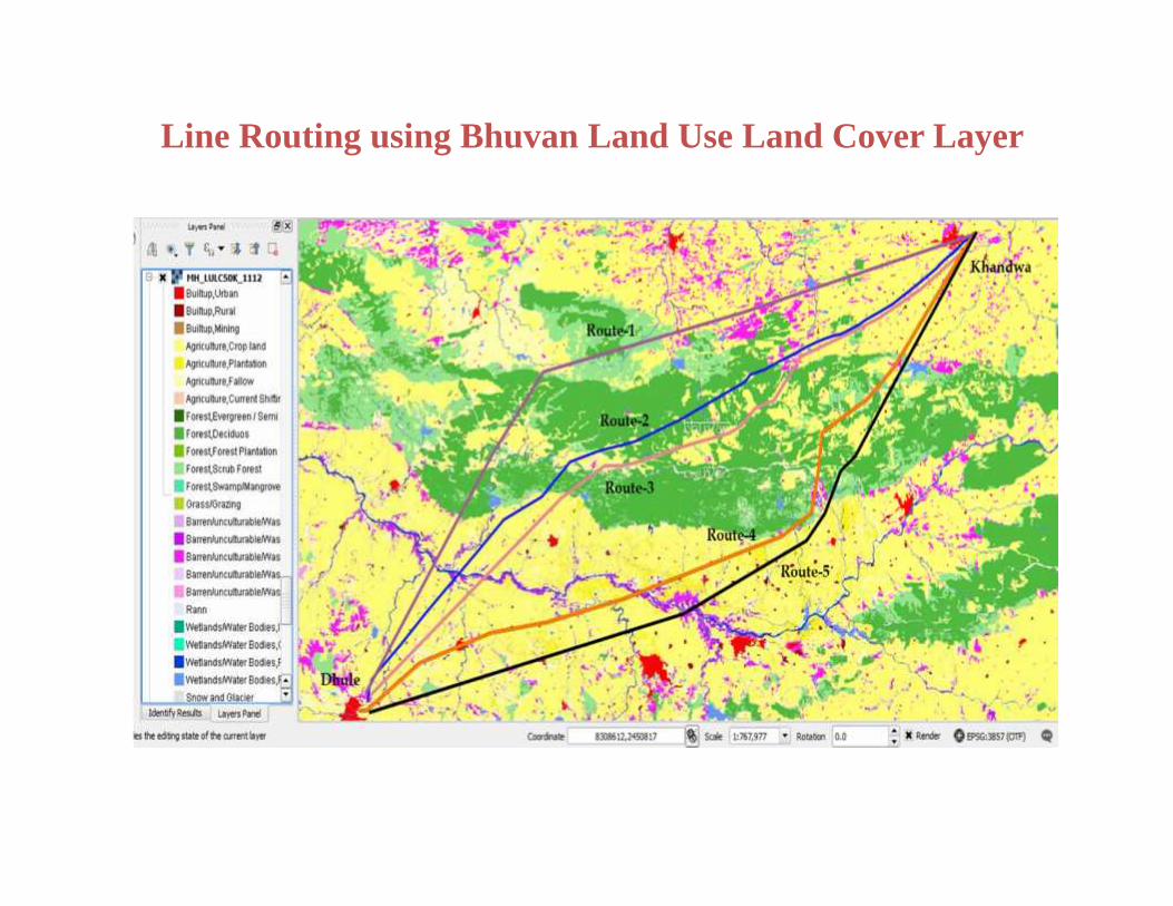
Line Routing using Bhuvan Land Use Land Cover Layer
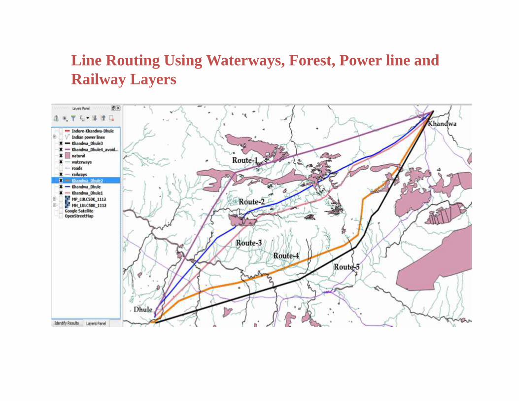
Line Routing Using Waterways, Forest, Power line andRailway Layers
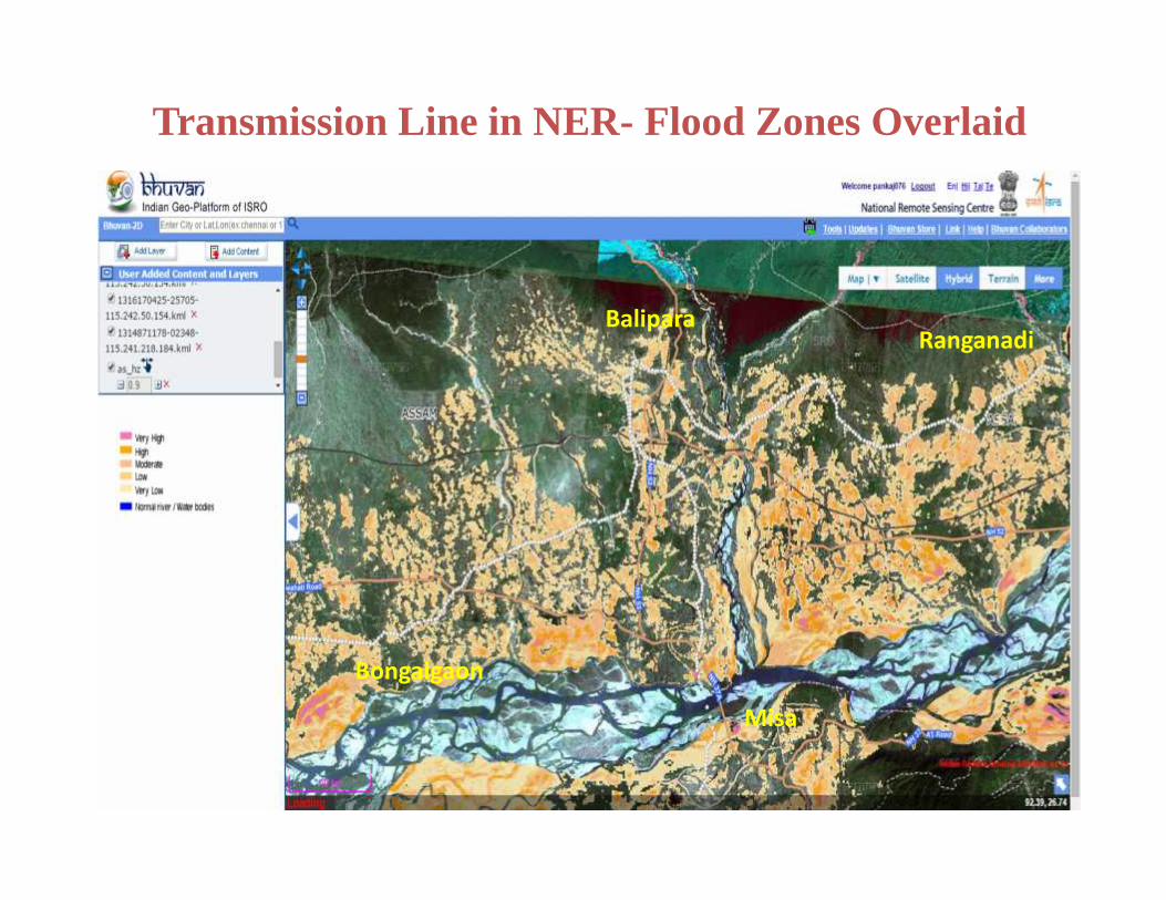
Transmission Line in NER- Flood Zones Overlaid
BaliparaRanganadi
Misa
Bongaigaon
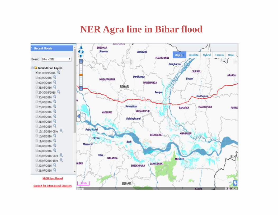
NER Agra line in Bihar flood
Effective use of space Technology inPower Sector
3. Power Distribution System
Asset Management
Mapping of Distribution assets on GIS platform Effective Monitoring and Maintenance – enhanced customer
satisfaction by restoring the supply in a speedy way after thefaults (through use of effective communication system) – betterOutage management.
Disaster management - early restoration of Power Supply to theaffected areas
Time synchronisation / time stamping of information / data
EESL has used NRSC/Bhuvan’s Android based App for Asset Mapping
under their CCMS system wherein concerns about reception of accurate
satellite GPS signals in congested urban areas can be addressed.
Status/Action Taken
A detailed jointed survey was conducted by EESL and NRSC
representatives to identify the parameters of the mobile application
NRSC has provided mobile application to EESL and demonstrated
its application.
For better accuracy GAGAN system is used Mobile App of EESL
EESL
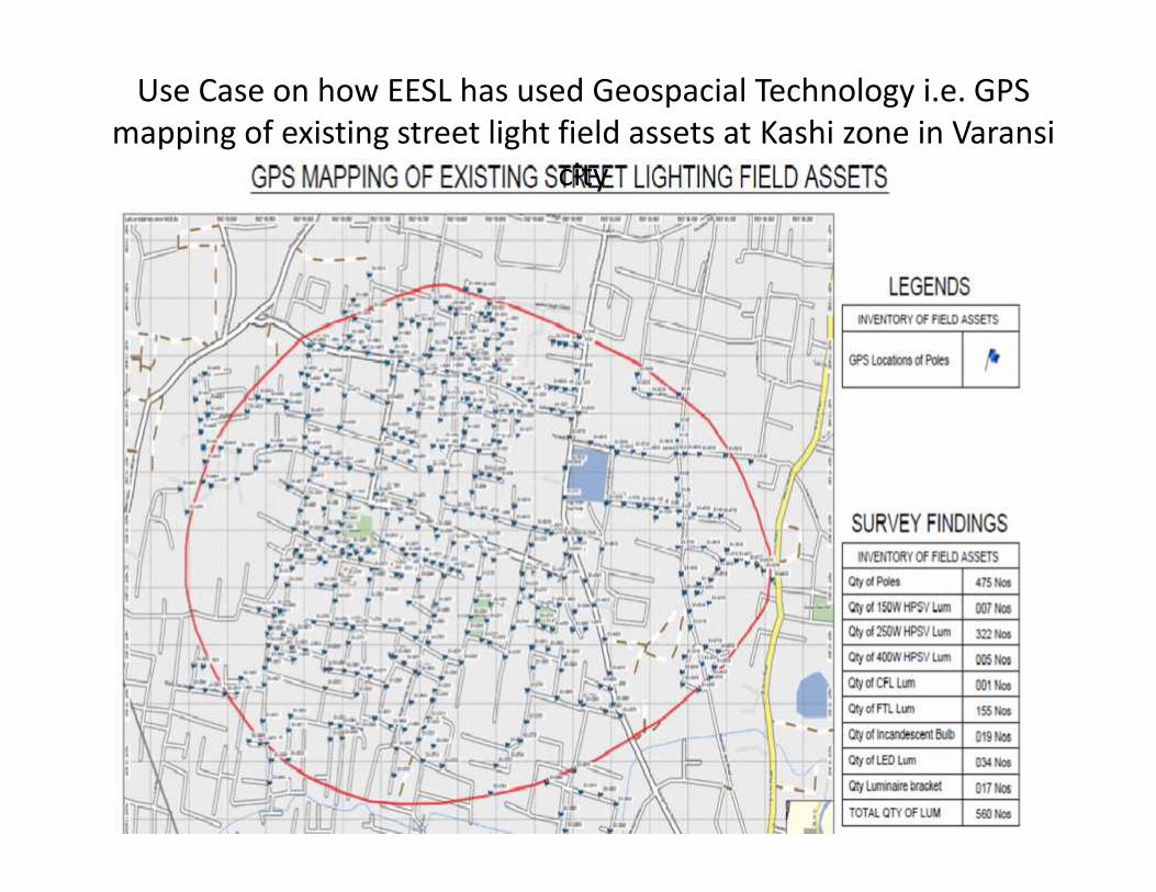
Use Case on how EESL has used Geospacial Technology i.e. GPSmapping of existing street light field assets at Kashi zone in Varansi
city
Effective use of space Technology inPower Sector
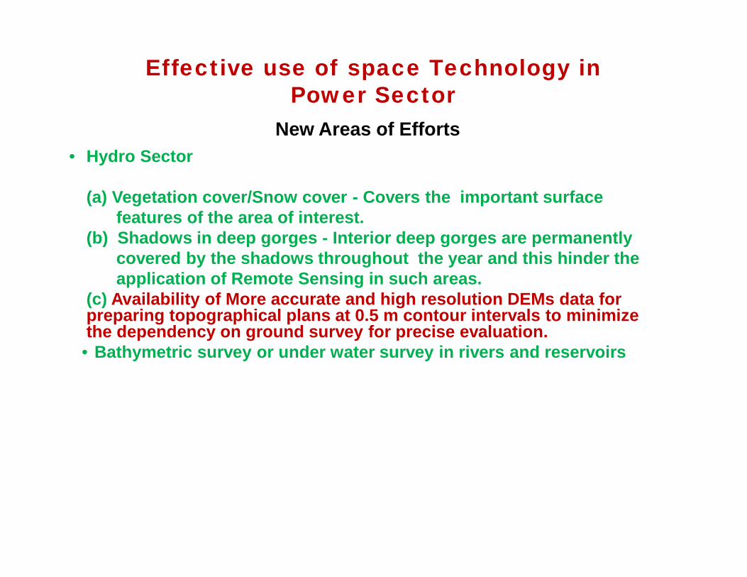
New Areas of Efforts• Hydro Sector
(a) Vegetation cover/Snow cover - Covers the important surfacefeatures of the area of interest.
(b) Shadows in deep gorges - Interior deep gorges are permanentlycovered by the shadows throughout the year and this hinder theapplication of Remote Sensing in such areas.
(c) Availability of More accurate and high resolution DEMs data forpreparing topographical plans at 0.5 m contour intervals to minimizethe dependency on ground survey for precise evaluation.• Bathymetric survey or under water survey in rivers and reservoirs
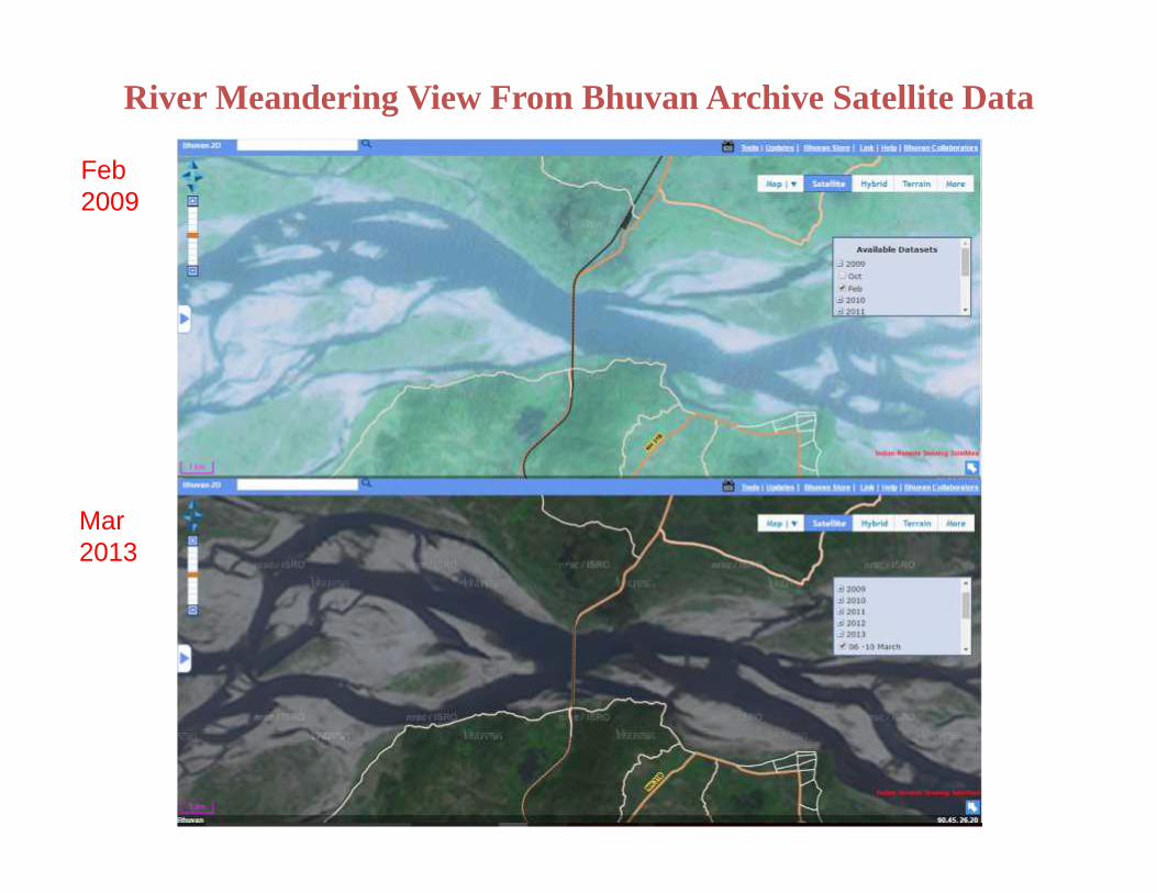
River Meandering View From Bhuvan Archive Satellite Data
Feb2009
Mar2013
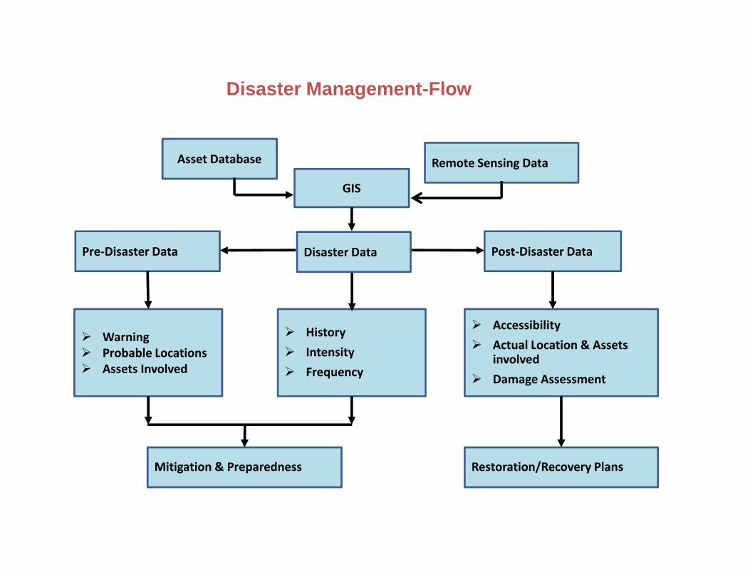
Asset Database Remote Sensing Data
GIS
Pre-Disaster Data Post-Disaster Data
Warning Probable Locations Assets Involved
History Intensity Frequency
Accessibility Actual Location & Assets
involved Damage Assessment
Mitigation & Preparedness Restoration/Recovery Plans
Disaster Data
Disaster Management-Flow Chart
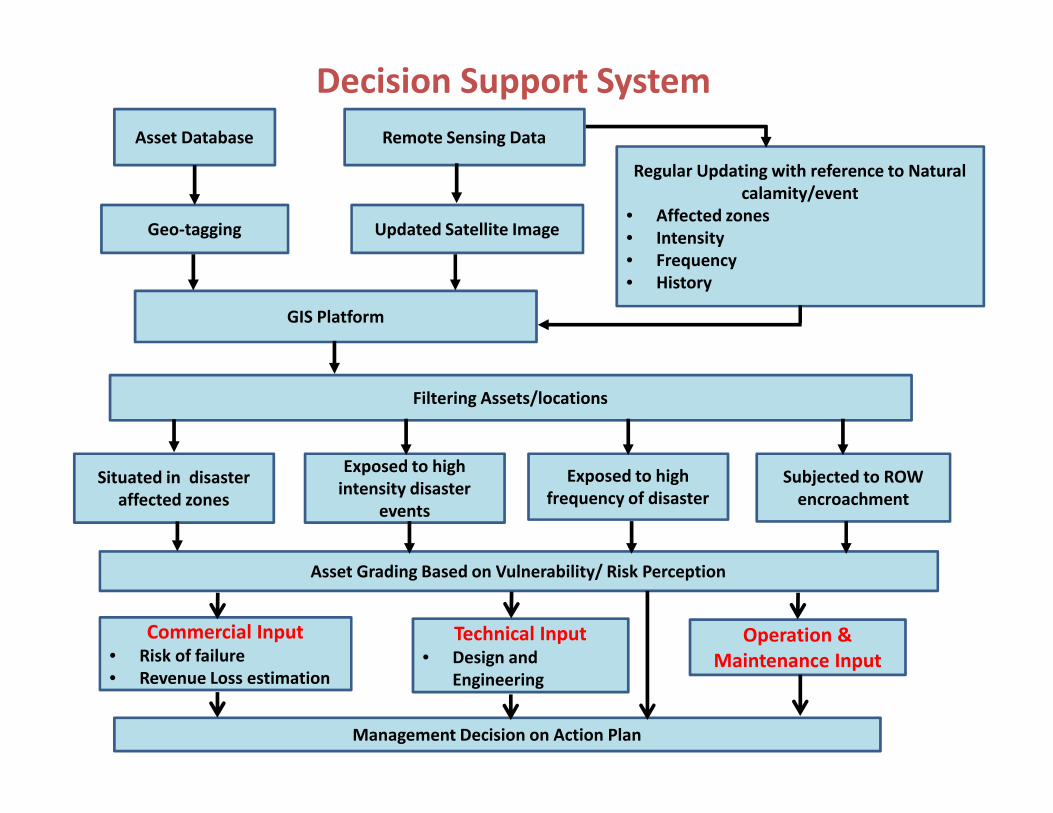
Decision Support System
Regular Updating with reference to Naturalcalamity/event
• Affected zones• Intensity• Frequency• History
Situated in disasteraffected zones
Exposed to highintensity disaster
events
Exposed to highfrequency of disaster
GIS Platform
Asset Database
Updated Satellite ImageGeo-tagging
Subjected to ROWencroachment
Remote Sensing Data
Filtering Assets/locations
Asset Grading Based on Vulnerability/ Risk Perception
Management Decision on Action Plan
Commercial Input• Risk of failure• Revenue Loss estimation
Technical Input• Design and
Engineering
Operation &Maintenance Input
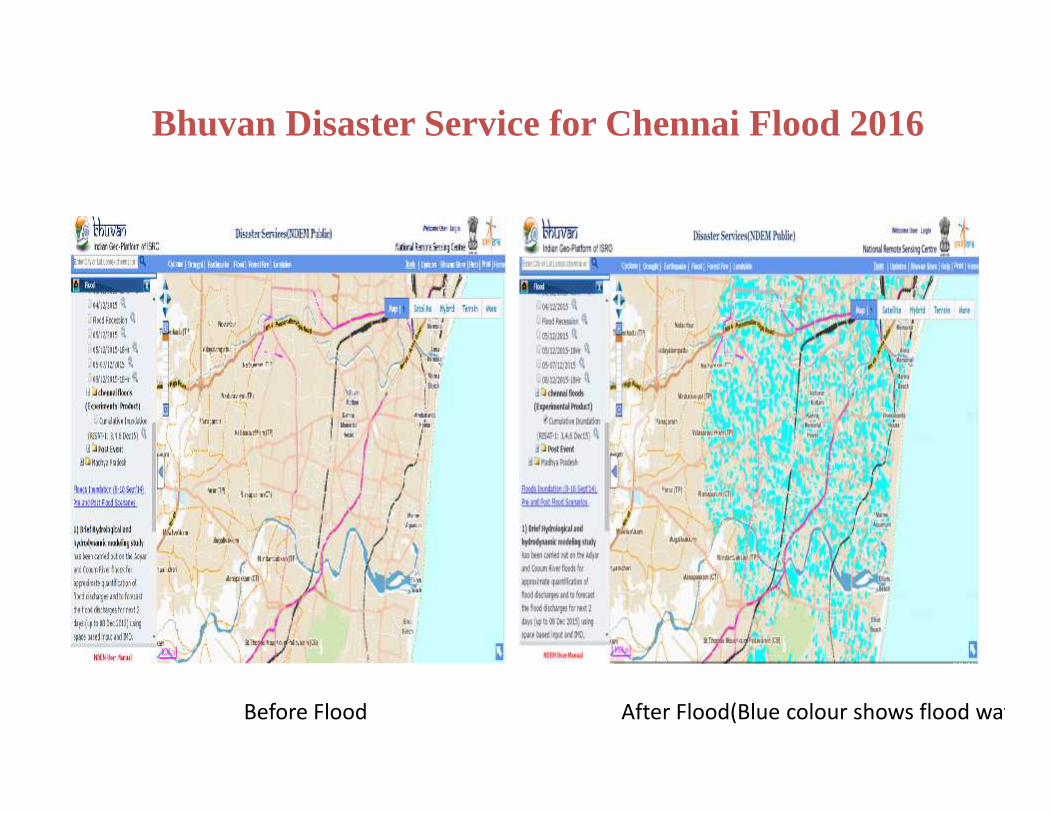
Bhuvan Disaster Service for Chennai Flood 2016
Before Flood After Flood(Blue colour shows flood water)
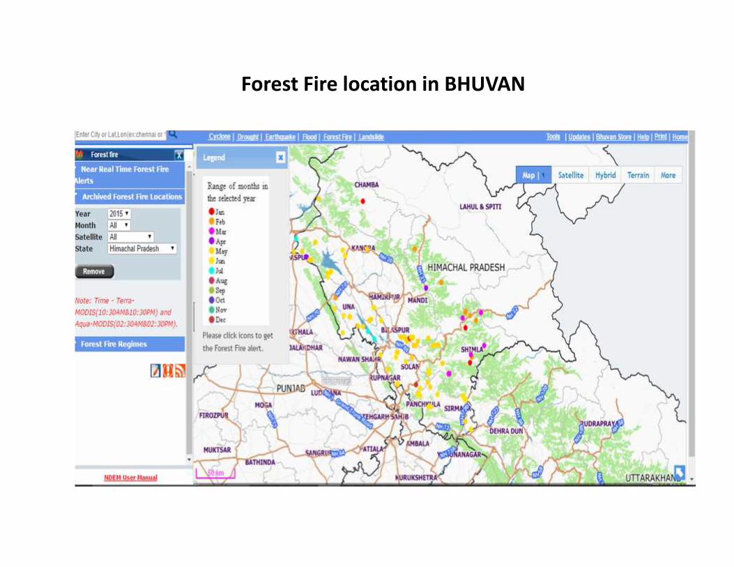
Forest Fire location in BHUVAN
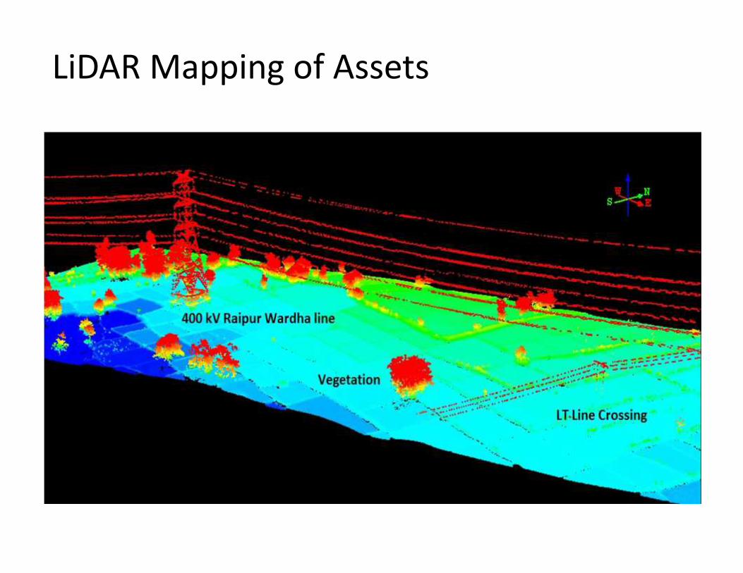
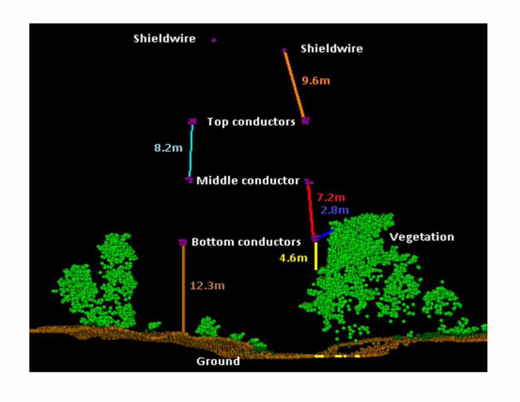
LiDAR Mapping of Assets captured throughLIDAR
IMAGES CAPTURED BY UAV
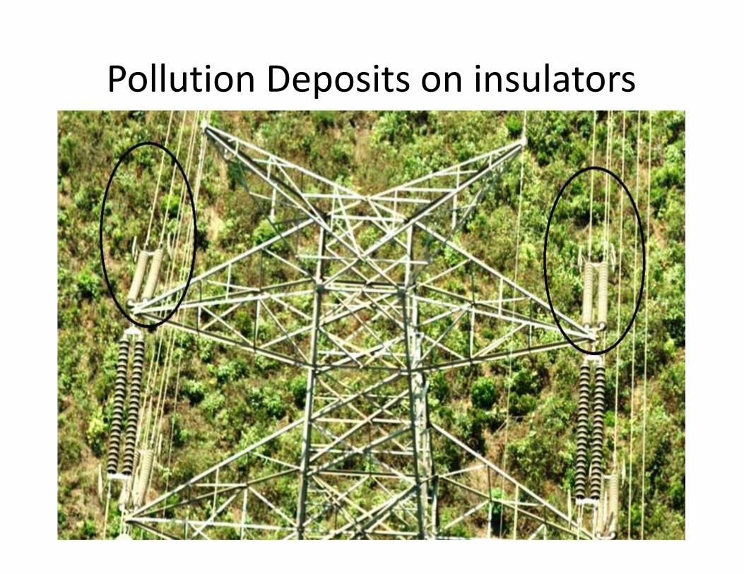
Pollution Deposits on insulators
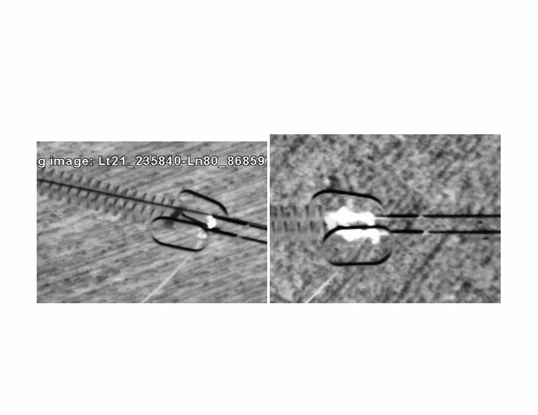
Hotspots
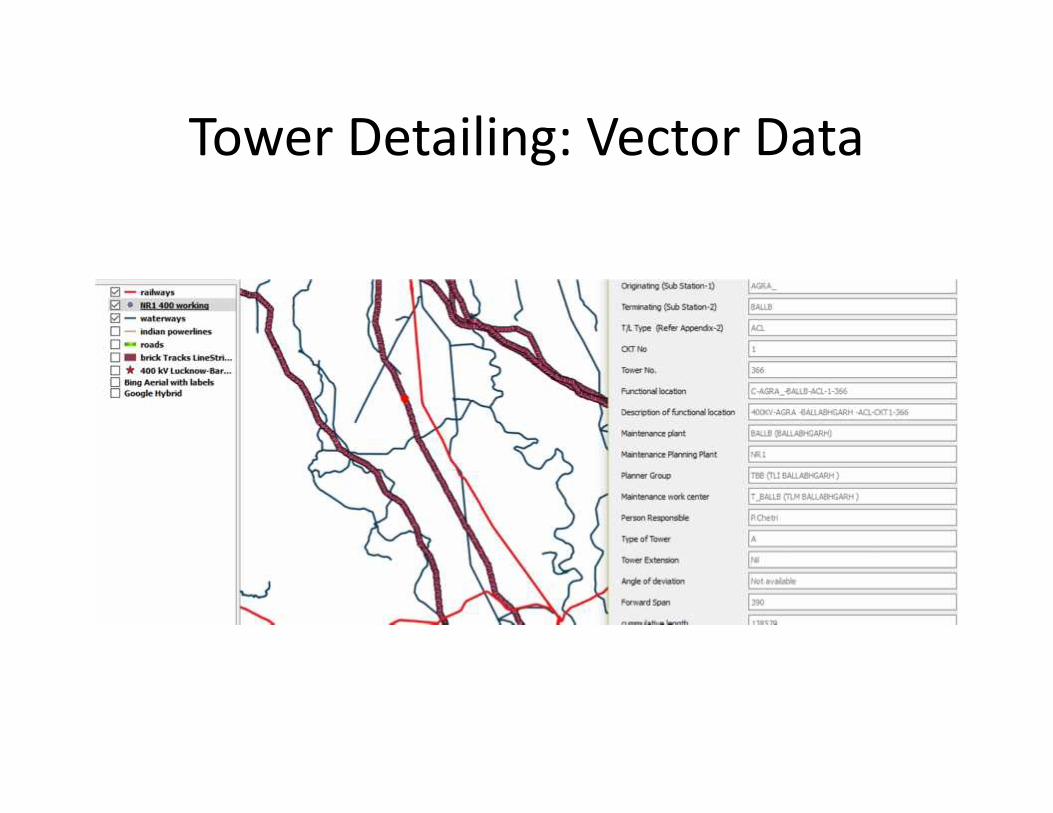
Tower Detailing: Vector Data
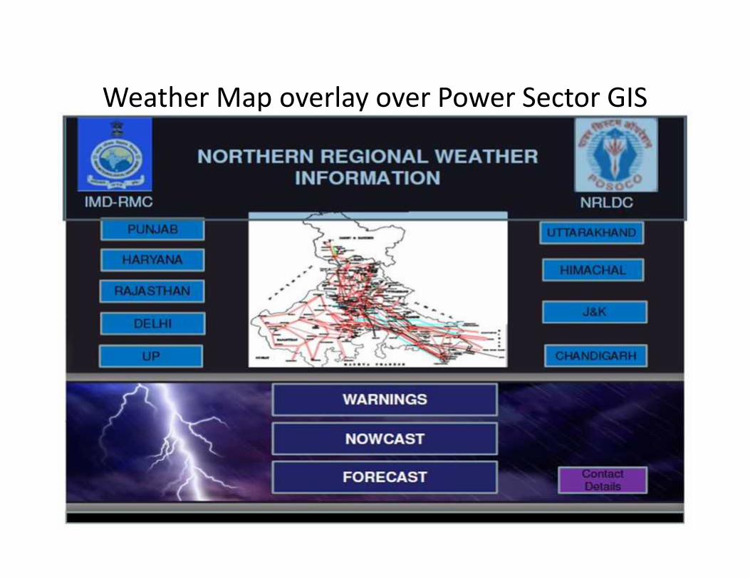
Weather Map overlay over Power Sector GIS

Thank You