Embed Size (px)
Citation preview
Coastal Zone Management
Protecting, restoring, strengthening our coastal ecosystems & economy
Spring/Summer 2006
Virginia
IN THIS ISSUE
“Got Message?” 2
DEQ Director Outlines Path to Collective Success 5
Virginia CZM Partners Propose Five Year Priorities 6
O Oysters 8
Paddling the Seaside 10
Virginia’s Maritime Heritage:The Battle of Hampton Roads 14
Focus on Historic Coastal Places: West Point 18
By Laura McKay, Coastal Program Manager
Virginia Coastal Zone Management Program
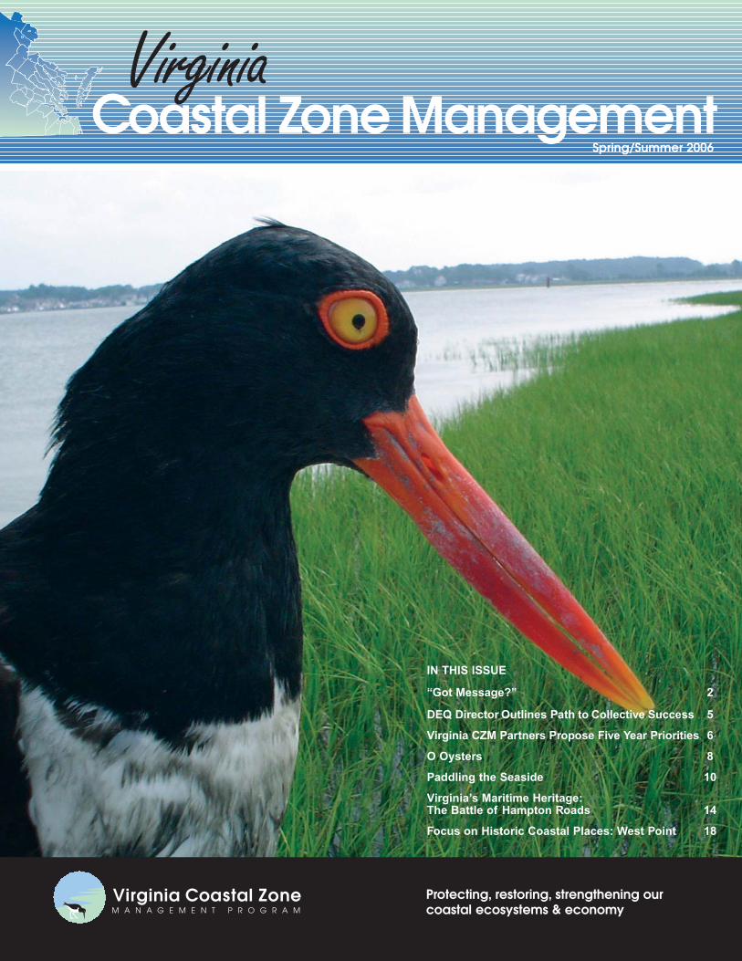
Cover Photo:An Oyster Catcher on Virginia’s Eastern Shore. Photo by Alex Wilke.The Nature Conservancy. See back cover for more details.
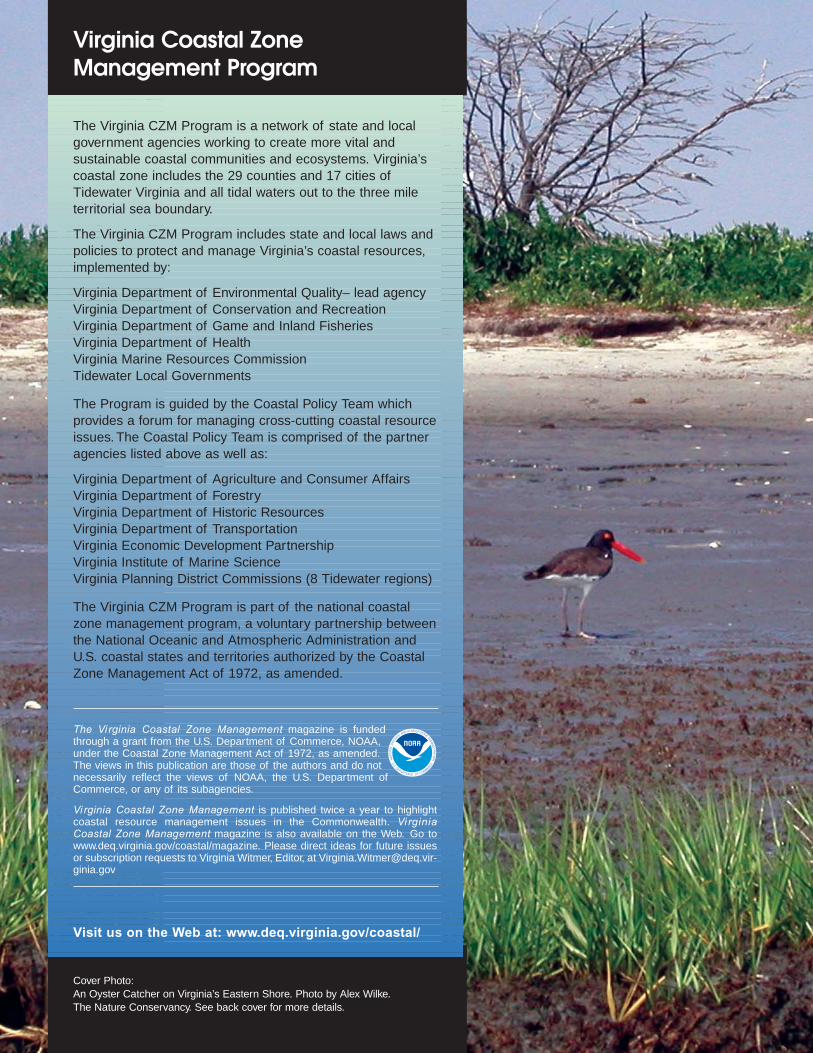
The Virginia CZM Program is a network of state and localgovernment agencies working to create more vital and sustainable coastal communities and ecosystems. Virginia’scoastal zone includes the 29 counties and 17 cities ofTidewater Virginia and all tidal waters out to the three mileterritorial sea boundary.
The Virginia CZM Program includes state and local laws andpolicies to protect and manage Virginia’s coastal resources,implemented by:
Virginia Department of Environmental Quality– lead agencyVirginia Department of Conservation and RecreationVirginia Department of Game and Inland FisheriesVirginia Department of HealthVirginia Marine Resources CommissionTidewater Local Governments
The Program is guided by the Coastal Policy Team whichprovides a forum for managing cross-cutting coastal resourceissues. The Coastal Policy Team is comprised of the partneragencies listed above as well as:
Virginia Department of Agriculture and Consumer AffairsVirginia Department of ForestryVirginia Department of Historic ResourcesVirginia Department of TransportationVirginia Economic Development PartnershipVirginia Institute of Marine ScienceVirginia Planning District Commissions (8 Tidewater regions)
The Virginia CZM Program is part of the national coastalzone management program, a voluntary partnership betweenthe National Oceanic and Atmospheric Administration andU.S. coastal states and territories authorized by the CoastalZone Management Act of 1972, as amended.
The Vi rginia Coastal Zone Management magazine is fundedthrough a grant from the U.S. Department of Commerce, NOAA,under the Coastal Zone Management Act of 1972, as amended.The views in this publication are those of the authors and do notnecessarily reflect the views of NOAA, the U.S. Department ofCommerce, or any of its subagencies.
Virginia Coastal Zone Management is published twice a year to highlightcoastal resource management issues in the Commonwealth. Vi rginiaCoastal Zone Management magazine is also available on the Web. Go towww.deq.virginia.gov/coastal/magazine. Please direct ideas for future issuesor subscription requests to Virginia Witmer, Editor, at [email protected]
Visit us on the Web at: www.deq.virginia.gov/coastal/
Virginia Coastal Zone ManagementVirginia Department of Environmental Quality
629 East Main Street, Richmond, Virginia 23219
David K. Paylor, DirectorVirginia Department of Environmental Quality(804) [email protected]
Michael Murphy Director, Division of Environmental Enhancement(804) [email protected]
Office of the Virginia Coastal Zone Management Program
Laura McKayVirginia Coastal Program Manager(804) [email protected]
Shepard MoonCoastal Planner(804) [email protected]
Kelly PriceCoastal Planner(804) [email protected]
Virginia WitmerOutreach Coordinator(804) [email protected]
Rachel BulleneCoastal Grants Coordinator/ Outreach Specialist(804) [email protected]
Scott Lerberg Coastal Specialist/GIS Coordinator(804) [email protected]
Message from the Program Manager
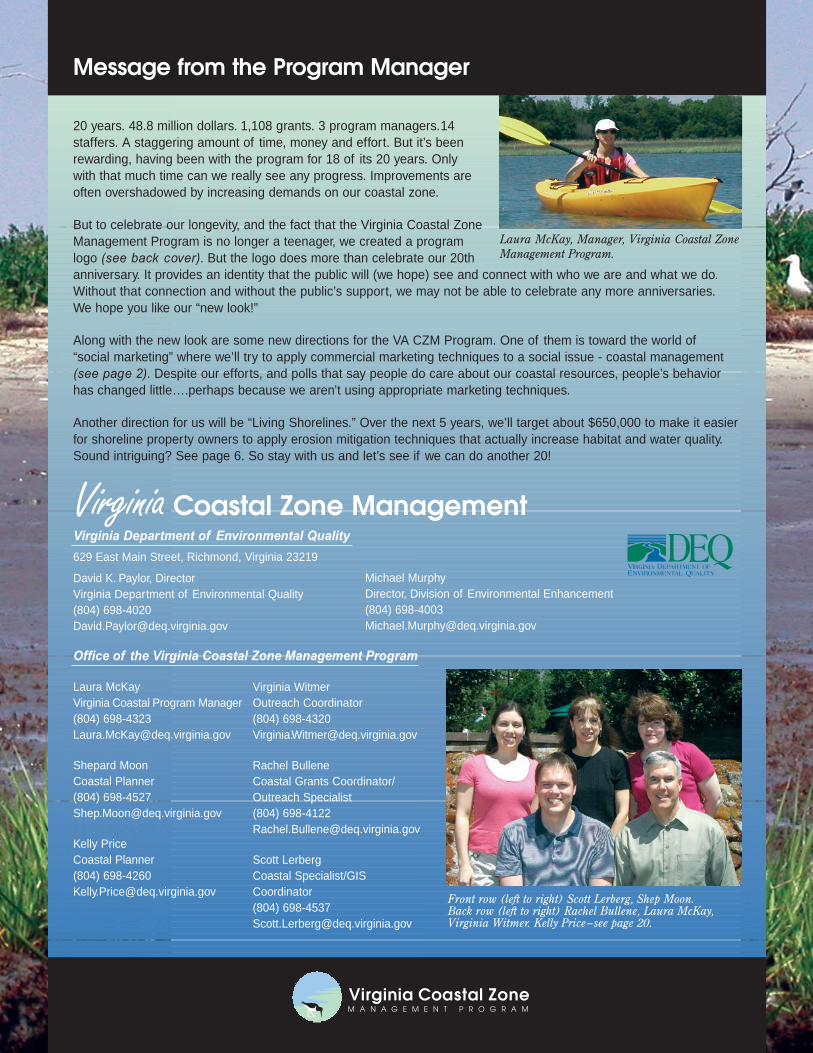
Front row (left to right) Scott Lerberg, Shep Moon. Back row (left to right) Rachel Bullene, Laura McKay, Virginia Witmer. Kelly Price–see page 20.
VIRGINIA OFDEPARTMENTUALITYQNVIRE ONMENTAL
QED
20 years. 48.8 million dollars. 1,108 grants. 3 program managers.14staffers. A staggering amount of time, money and effort. But it’s beenrewarding, having been with the program for 18 of its 20 years. Onlywith that much time can we really see any progress. Improvements areoften overshadowed by increasing demands on our coastal zone.
But to celebrate our longevity, and the fact that the Virginia Coastal ZoneManagement Program is no longer a teenager, we created a programlogo (see back cover). But the logo does more than celebrate our 20thanniversary. It provides an identity that the public will (we hope) see and connect with who we are and what we do.Without that connection and without the public’s support, we may not be able to celebrate any more anniversaries.We hope you like our “new look!”
Along with the new look are some new directions for the VA CZM Program. One of them is toward the world of“social marketing” where we’ll try to apply commercial marketing techniques to a social issue - coastal management(see page 2). Despite our efforts, and polls that say people do care about our coastal resources, people’s behaviorhas changed little….perhaps because we aren’t using appropriate marketing techniques.
Another direction for us will be “Living Shorelines.” Over the next 5 years, we’ll target about $650,000 to make it easierfor shoreline property owners to apply erosion mitigation techniques that actually increase habitat and water quality.Sound intriguing? See page 6. So stay with us and let’s see if we can do another 20!
Laura McKay, Manager, Virginia Coastal ZoneManagement Program.
“Got Message?”
“Selling” Coastal Stewardship Behaviors
McKenzie-Mohr is a pioneer and leader in the rapidly grow-
ing field of “community-based social marketing,” which relies on
research that shows behavior change can be achieved by remov-
ing barriers to an activity, while simultaneously enhancing the
benefits to the individual members of a community. Alan
Andreasen, author of Marketing Social Change, defines social
marketing as “the application of marketing technologies devel-
oped in the commercial sector to the solution of social prob-
lems where the bottom line is behavior change.”
What has made commercial marketers like Nike so suc-
cessful? The answer: commercial marketers are consumer-
focused. They first identify the needs and wants of their target
audience and then frame a marketing strategy around this
knowledge. Buy a pair of Nikes, and get a pair of sneakers that
will spring load you towards “adventure” and “vitality.”
In October 2005, the Virginia CZM Program invited Judy
Landers, a consultant with the Academy for Educational Devel-
opment’s Center for Behavior Change and one of the engi-
neers of the Chesapeake Club, to speak with
coastal resource managers from Maine to Virginia
about this new approach to environmental advocacy
(see text box on next page.)
She illustrated how to develop a consumer
mindset and go beyond raising awareness to affect
what people do and how social marketing cam-
paigns, like the Chesapeake Club, popularize
behaviors to improve the quality of the environment.
How Are Social Marketing Campaigns Different?
Information campaigns assume the missing ingredient is
information and focus on delivering that information,” described
Landers. They focus on the message and the product: what can
we tell them that will achieve the desired result?
Social marketing campaigns on the other hand do not focus
on what people need to know, but focus on learning what people
need and want (blue crab on their plates).
Social marketing campaigns ask who must do what differ-
ently, what can we offer them in exchange, and what barriers or
obstacles are stopping them from doing it. To answer these ques-
tions, it is key to talk and listen to the people you are trying to
Virginia’s coastal area has been undeniably attractive for
centuries and now supports more than 60 percent of our citizens
and our largest cities. This steadily growing population is placing
ever increasing pressure on our coastal resources. Despite the
lessons learned during recent hurricanes, we continue to build on
our shorelines and increase the vulnerability of our communities
to future natural hazards. Despite the successes of regulatory
and voluntary nutrient reduction programs, we continue to
degrade our streams, rivers, the Bay, and
ultimately, our ocean.
This is a bleak picture. But it does not
have to be a snapshot of our future.
Coastal stewardship means finding solu-
tions to the problems of today and plan-
ning better for tomorrow.
Changing Behaviors Is Key toStewardship
Communication and education cam-
paigns have made great strides in spreading aware-
ness about the environmental problems we face. In
fact, in a May 2004 survey conducted by the Chesa-
peake Bay Program, nine out of ten of the citizens
surveyed reported being aware and concerned about
the deterioration of the Bay’s health. Almost half –
48% – described themselves as “very concerned.”
Yet, when it came to the way many residents report-
ed they behave – over-fertilizing lawns, neglecting
septic tank maintenance and leaving pet waste to flow
into the Bay – nothing had changed.
So, why do these and other educated citizens
fail to adopt behaviors that they know will have a positive impact
on the health of our coast?
It may be message fatigue. It may be a fog of apathy. It may
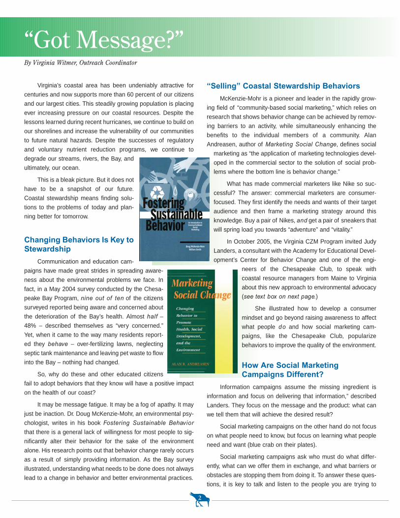
just be inaction. Dr. Doug McKenzie-Mohr, an environmental psy-
chologist, writes in his book Fostering Sustainable Behavior
that there is a general lack of willingness for most people to sig-
nificantly alter their behavior for the sake of the environment
alone. His research points out that behavior change rarely occurs
as a result of simply providing information. As the Bay survey
illustrated, understanding what needs to be done does not always
lead to a change in behavior and better environmental practices.
2
By Virginia Witmer, Outreach Coordinator
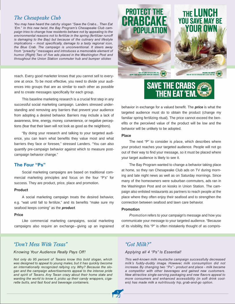
The Chesapeake ClubYou may have heard the catchy slogan “Save the Crabs... Then Eat‘Em.” In this new twist, the Bay Program’s Chesapeake Club cam-paign tries to change how residents behave not by appealing to theenvironmental reasons not to fertilize in the spring (fertilizer runoffis damaging to the Bay) but because of the culinary and lifestyleimplications – most specifically, damage to a tasty regional icon,the Blue Crab. The campaign is unconventional. It steers awayfrom “preachy ” messages and introduces a memorable element ofhumor. (Right) Two of f ive ads placed in the Washington Post andthroughout the Union Station commuter hub and bumper sticker.
“Don’t Mess With Texas”Knowing Your Audience Really Pays Off !
Not only do 95 percent of Texans know this bold slogan, whichwas designed to appeal to young males, but it has quickly becomean internationally recognized rallying cry. Why? Because the slo-gan and the campaign advertisements appeal to the intense prideand spirit of Texans. Any Texan crazy about their home state andwanting the world to know it, picks up their candy wrappers, ciga-rette butts, and fast food and beverage containers.
behavior in exchange for a valued benefit. The price is what the
targeted audience must do to obtain the product (change my
familiar spring fertilizing ritual). The price cannot exceed the ben-
efits or the perceived value of the product will be low and the
behavior will be unlikely to be adopted.
Place
The next “P” to consider is place, which describes where
your product reaches your targeted audience. People will not go
out of their way to find your message, so it must be placed where
your target audience is likely to see it.
The Bay Program wanted to change a behavior taking place
at home, so they ran Chesapeake Club ads on TV during morn-
ing and late night news as well as on Saturday mornings. Since
many of the homeowners were suburban commuters, ads ran in
the Washington Post and on kiosks in Union Station. The cam-
paign also enlisted restaurants as partners to reach people at the
place where they often enjoy their seafood and to strengthen the
connection between seafood and lawn care behavior.
Promotion
Promotion refers to your campaign’s message and how you
communicate your message to your targeted audience. “Because
of its visibility, this “P” is often mistakenly thought of as compris-
reach. Every good marketer knows that you cannot sell to every-
one at once. To be most effective, you need to divide your audi-
ences into groups that are as similar to each other as possible
and to create messages specifically for each group.
This baseline marketing research is a crucial first step in any
successful social marketing campaign. Landers stressed under-
standing and removing any barriers that prevent your audience
from adopting a desired behavior. Barriers may include a lack of
awareness, time, energy, money, convenience, or negative percep-
tions (fear that their lawn will not look as good as the neighbors).
“By doing your research and talking to your targeted audi-
ence, you can learn what benefits they value most and what
barriers they face or foresee,” stressed Landers. “You can also
quantify pre-campaign behavior against which to measure post-
campaign behavior change.”
The Four “Ps”
Social marketing campaigns are based on traditional com-
mercial marketing principles and focus on the four “P’s” for
success. They are product, price, place and promotion.
Product
A social marketing campaign treats the desired behavior,
e.g. “wait until fall to fertilize,” and its benefits “make sure my
seafood keeps coming” as the product.
Price
Like commercial marketing campaigns, social marketing
campaigns also require an exchange– giving up an ingrained
3
“Got Milk?”Applying all 4 “Ps” Is Essential!
This well-known milk mustache campaign successfully decreasedmilk’s fuddy-duddy image. However, milk consumption did notincrease. By changing two “Ps” - product and place - milk becamea competitor with other beverages and gained new customers.New attractive single-serving packaging and new flavors appeal tomore consumers and enhanced accessibility (in soft drink cool-ers) has made milk a nutritiously hip, grab-and-go option.
The Chesapeake Club campaign expanded
its reach in the community by teaming up with
lawn care services (16% of the targeted audi-
ence in the campaign used a lawn service) to
market a bay-friendly service option, an alterna-
tive product. In return, the companies received
free marketing and were listed on the Chesa-
peake Club website and in advertisements. The campaign
received free media coverage when stories appeared highlighting
the “weird” partnerships that had formed between environmental-
ists and lawn services, and the fact that this new approach to an
environmental campaign was gaining attention in the area. The
campaign also expanded its audience, people “actively enjoying”
the Bay, by partnering with local restaurants. The restaurants
used the campaign’s free drink coasters and wait staff were
equipped to answer questions about the campaign. Participating
restaurants were also featured on the Chesapeake Club website.
Know the Competition
Be aware of competing messages pulling on the targeted
audience. The product needs to be more attractive than the other
alternatives. It might just be inaction, which is easier than adopt-
ing a behavior. But other factors can influence an audience’s
reaction to a program, including political changes and news
events that change the context of a message. Work by fellow
environmental organizations may also affect how you should por-
tray a message. Watch for these influences and changes and
make the necessary adjustments to your campaign.
Evaluate Early
Evaluation of a program is critical and should occur through-
out the campaign. It is important to devote time and resources up
front to survey the target audience to measure baseline behavior
(so you can measure behavior changes later on) and attitudes (to
ascertain perceived barriers and benefits to behavior change and
help in designing the campaign). As you develop a campaign, test
and refine products, messages and promotional items with the tar-
get audience before investing in full program implementation.
Invest financial resources wisely. When the campaign is complete,
ing the whole of social marketing, but it is only one piece,”
stressed Landers. The most effective social marketing strate-
gies use a combination of tools to reach their targeted audi-
ence and they pre-test their promotional items on their
audience. When a simple, clear message is repeated in many
places and formats, it is more likely to be seen and remem-
bered. Consistency and continuity are critical to a successful
campaign. Try to stick to one main “look” and slogan, or people
may not realize all the pieces are from your campaign.
The Bay Program promoted their spoofed Chesapeake Club
message on a website with a “Southern Living” flair, paid T.V.,
outdoor and newspaper advertisements and free news coverage.
Get Commitment to That New Behavior
Social marketing experts also strongly suggest securing a
freely-volunteered commitment (written or verbal, in public or a
group) from your targeted audience to engage in the selected
behavior. When individuals agree to a small request, it often alters
the way they perceive themselves and the likelihood that they will
later act consistently with their new attitude, pointed out Landers.
People often forget what behavior is desirable, so provide notice-
able, self-explanatory prompts and post them in as close proxim-
ity as possible to where the action is to be taken.
Working at the grassroots level and developing a visible com-
munity norm were the cornerstones of the Bay Program’s social
marketing campaign. Neighbors can actually see whether you’re
waiting until fall to fertilize, and Chesapeake Club yard signs on
the lawns of residents using bay-friendly lawn care services
served to reinforce the desired behavior. The campaign reframed
the issue as a lifestyle, rather than an environmental, matter.
Consider Unusual Partners
The Chesapeake Club campaign also highlighted the value of
another “p” –partnerships. Environmental issues are complex and
the target audiences vast and varied. Partnering with other agen-
cies or organizations, particularly those with similar goals and with-
in the targeted community, can result in a broader reaching and
effective campaign. You can also bring more attention and credibil-
ity to a campaign by partnering with key people and organizations.
4
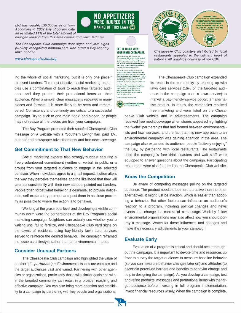
D.C. has roughly 530,000 acres of lawn.According to 2002 Bay Program data,an estimated 11% of the total amount ofnitrogen loading from this area comes from lawn fertilizer.
The Chesapeake Club campaign door signs and yard signs publicly recognized homeowners who hired a Bay-friendlylawn service.
www.chesapeakeclub.org
Chesapeake Club coasters distributed by localrestaurants appealed to the culinary heart ofpatrons. All graphics courtesy of the CBP.
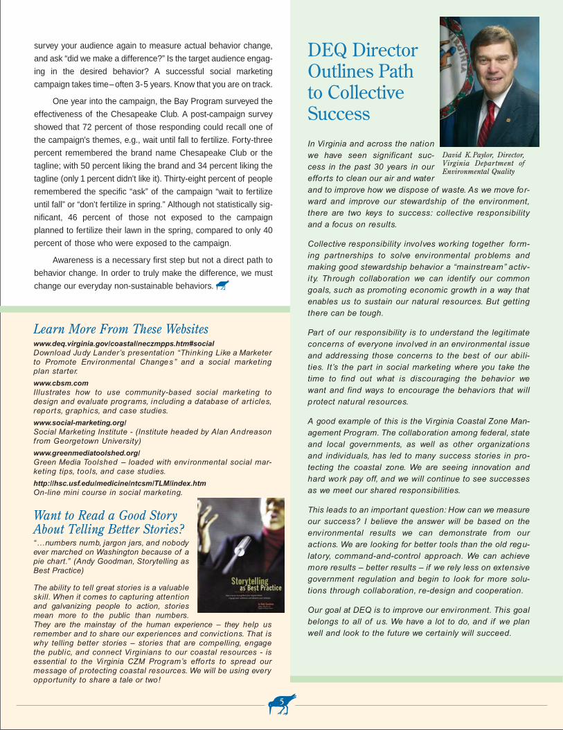
DEQ DirectorOutlines Path to Collective Success In Virginia and across the nationwe have seen significant suc-cess in the past 30 years in ourefforts to clean our air and waterand to improve how we dispose of waste. As we move for-ward and improve our stewardship of the environment,there are two keys to success: collective responsibilityand a focus on results.
Collective responsibility involves working together form-ing partnerships to solve environmental problems andmaking good stewardship behavior a “mainstream” activ-ity. Through collaboration we can identify our commongoals, such as promoting economic growth in a way thatenables us to sustain our natural resources. But gettingthere can be tough.
Part of our responsibility is to understand the legitimateconcerns of everyone involved in an environmental issueand addressing those concerns to the best of our abili-ties. It’s the part in social marketing where you take thetime to find out what is discouraging the behavior wewant and find ways to encourage the behaviors that willprotect natural resources.
A good example of this is the Virginia Coastal Zone Man-agement Program. The collaboration among federal, stateand local governments, as well as other organizationsand individuals, has led to many success stories in pro-tecting the coastal zone. We are seeing innovation andhard work pay off, and we will continue to see successesas we meet our shared responsibilities.
This leads to an important question: How can we measureour success? I believe the answer will be based on theenvironmental results we can demonstrate from ouractions. We are looking for better tools than the old regu-latory, command-and-control approach. We can achievemore results – better results – if we rely less on extensivegovernment regulation and begin to look for more solu-tions through collaboration, re-design and cooperation.
Our goal at DEQ is to improve our environment. This goalbelongs to all of us. We have a lot to do, and if we planwell and look to the future we certainly will succeed.
survey your audience again to measure actual behavior change,
and ask “did we make a difference?” Is the target audience engag-
ing in the desired behavior? A successful social marketing
campaign takes time–often 3-5 years. Know that you are on track.
One year into the campaign, the Bay Program surveyed the
effectiveness of the Chesapeake Club. A post-campaign survey
showed that 72 percent of those responding could recall one of
the campaign’s themes, e.g., wait until fall to fertilize. Forty-three
percent remembered the brand name Chesapeake Club or the
tagline; with 50 percent liking the brand and 34 percent liking the
tagline (only 1 percent didn’t like it). Thirty-eight percent of people
remembered the specific “ask” of the campaign “wait to fertilize
until fall” or “don’t fertilize in spring.” Although not statistically sig-
nificant, 46 percent of those not exposed to the campaign
planned to fertilize their lawn in the spring, compared to only 40
percent of those who were exposed to the campaign.
Awareness is a necessary first step but not a direct path to
behavior change. In order to truly make the difference, we must
change our everyday non-sustainable behaviors.
5
Learn More From These Websiteswww.deq.virginia.gov/coastal/neczmpps.htm#socialDownload Judy Lander’s presentation “Thinking Like a Marketerto Promote Environmental Changes” and a social marketingplan starter.
www.cbsm.comIllustrates how to use community-based social marketing todesign and evaluate programs, including a database of articles,reports, graphics, and case studies.
www.social-marketing.org/Social Marketing Institute - (Institute headed by Alan Andreasonfrom Georgetown University)
www.greenmediatoolshed.org/Green Media Toolshed – loaded with environmental social mar-keting tips, tools, and case studies.
http://hsc.usf.edu/medicine/ntcsm/TLM/index.htm On-line mini course in social marketing.
Want to Read a Good StoryAbout Telling Better Stories?“…numbers numb, jargon jars, and nobodyever marched on Washington because of apie chart.” (Andy Goodman, Storytelling asBest Practice)
The ability to tell great stories is a valuableskill. When it comes to capturing attentionand galvanizing people to action, storiesmean more to the public than numbers.They are the mainstay of the human experience – they help usremember and to share our experiences and convictions. That iswhy telling better stories – stories that are compelling, engagethe public, and connect Vi rginians to our coastal resources - isessential to the Vi rginia CZM Program’s efforts to spread ourmessage of protecting coastal resources. We will be using everyopportunity to share a tale or two!
David K.Paylor, Director,Virginia Department ofEnvironmental Quality
2006-2011 Draft Coastal Strategies
When the Coastal Zone Management Act (CZMA) was reau-
thorized in 1990, a new program was established to provide
voluntary, match-free funding to coastal states to address needs
in nine coastal areas: wetlands, coastal hazards, public access,
marine debris, cumulative and secondary impacts, special area
management planning (SAMPs), ocean resources, energy and
government facility siting, and aquaculture.
The National Oceanic and Atmospheric Administration
(NOAA), which distributes CZMA funds, requires that coastal
states assess changes, progress and new issues in these areas
every five years. This assessment ranks the need in each area as
high, medium, or low priority. Once the high priority areas have
been determined, strategies are developed which must result in
new enforceable coastal policies in each area.
The Virginia CZM Program contracted with the University of
Virginia’s Institute for Environmental Negotiation (IEN) to prepare
Virginia’s draft Coastal Needs Assessment. Numerous interviews
with coastal managers and scientists and an extensive literature
and resource review formed the basis for IEN’s report to Virginia
CZM staff. The assessment was distributed to the Coastal Policy
Team (CPT), which ranked as a “high priority”– wetlands, public
access, SAMPs, aquaculture, coastal hazards, and cumulative
and secondary impacts of growth and development. Three areas
–marine debris, energy facility siting, and ocean resources–
received a “medium priority” ranking. No area was assigned a low
priority by the CPT, reflecting the increasing pressures from
growth and urbanization on our coastal resources.
Late last year and early this year, IEN facilitated focus group
meetings for more in-depth discussions on four of the high prior-
ity areas: coastal hazards, public access, wetlands, and coastal
hazards. The focus groups helped sketch out strategies for
addressing the needs in these areas. Virginia CZM Program staff
solicited comments and drafted strategies for the two remaining
high priority areas: aquaculture and SAMPS. The CPT then gath-
ered to review and rank the 12 proposed strategies developed for
CZMA Section 309 funding over the next five years.
In March, the Virginia CZM Program submitted its 2006-
2011 Coastal Needs Assessment and Strategies report to
NOAA. Preliminary comments from NOAA have suggested that
Virginia reduce the number of strategies it funds to focus atten-
tion and resources on two or three of the high priority areas. The
priority area strategies under consideration are summarized in
6
the table above. Pending NOAA’s approval, the Virginia CZM Pro-
gram anticipates receiving approximately $540,000 each year
over the next five years to implement the selected strategies.
Details of all strategies, including those summarized below, are
available on the Virginia CZM website at www.deq.virginia.gov/
coastal/assess.html.
Public Access Authorities
The local governments of the Middle Peninsula and North-
ern Neck both have been enabled by the General Assembly to
create Public Access Authorities (PAAs). The Middle Peninsula
localities created their PAA in 2004 and since that time have been
very active in identifying priority sites, leveraging funds and
acquiring lands to improve public access in the region. The North-
ern Neck is just getting started. This successful model would ben-
efit the other 6 regions of the coastal zone and places public
access planning where the most expertise exists: at the
local/regional level. This strategy will not only support expanding
the use of PAAs but will also increase the tools these regional
authorities have at their disposal to address public access needs
and resolve use conflicts.
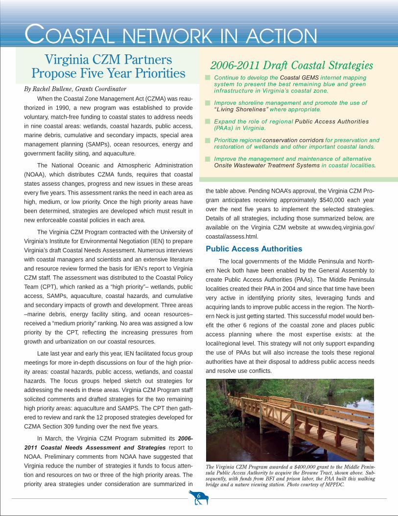
By Rachel Bullene, Grants Coordinator
COASTAL NETWORK IN ACTIONVirginia CZM Partners
Propose Five Year Priorities
The Virginia CZM Program awarded a $400,000 grant to the Middle Penin-sula Public Access Authority to acquire the Browne Tract, shown above. Sub-sequently, with funds from BFI and prison labor, the PAA built this walkingbridge and a nature viewing station. Photo courtesy of MPPDC.
Continue to develop the Coastal GEMS internet mapping system to present the best remaining blue and green infrastructure in Vi rginia’s coastal zone.
Improve shoreline management and promote the use of“L iving Shorelines” where appropriate.
Expand the role of regional Public Access Authorities(PAAs) in Vi rginia.
Prioritize regional conservation corridors for preservation andrestoration of wetlands and other important coastal lands.
Improve the management and maintenance of alternat iveOnsite Wastewater Treatment Systems in coastal localities.
Living Shorelines
As waterfront property is developed, the shoreline is often
“hardened” with revetments and bulkheads. While these methods
provide property owners with erosion protection, they degrade
the ability of the shoreline to provide habitat for aquatic life and
to filter storm water runoff. Many low energy shorelines are being
hardened where less damaging techniques for managing shore-
line erosion could be employed.
The goal of this top ranked strategy is to promote “Living
Shorelines,” a technique that not only stabilizes the shoreline but
provides valuable habitat and improves water quality. Strategy
components will include: a “Living Shoreline” Summit (see side
bar at lower right); revisions to the state’s Wetlands Guidelines;
research to further document the habitat value and refine the
design of living shorelines; and, a protocol for determining the
feasibility of living shorelines on a reach (shoreline segment)
basis. Additional shoreline situation reports and shoreline evolu-
tion studies will better inform local shoreline management deci-
sions and a shoreline planning guidance document will help
localities to proactively address shoreline management issues
and meet the comprehensive planning requirements of the
Chesapeake Bay Preservation Act. Finally, a living shoreline
brochure and website for landowners and a design manual and
training program for contractors will be produced.
Coastal GEMS
The Virginia CZM Program will continue to build the Coastal
Geospatial and Educational Mapping System (Coastal GEMS),
an internet based system which will provide access to a wide
range of coastal resource maps and data, regulatory information
and fact sheets. An important aspect of the strategy would be to
secure agreements with federal, state, and local agencies and
governments to consult Coastal GEMS at key junctures in land7
Implement the Dragon Run Special Area Management Planincluding new zoning and comprehensive plans, sustain-able economic development practices, and public accessand conservation lands management.
Develop a set of Best Management Practices (BMPs) forshellfish farming for all of Virginia’s waters.
Identify suitable areas for shellfish enterprise zones withinpublicly owned bottom.
Revise the Coastal Primary Sand Dunes and Beaches Actand guidelines to better protect dunes and beaches notincluded in the Act.
Develop a Seaside Special Area Management Plan for theseaside of Virginia’s Shore.
use planning and permitting processes to better define and pro-
mote “appropriate development” and to incorporate this concept
into local comprehensive plans and ordinances. The goal will be
to foster stronger linkages between local land use policy and
state water use policy.
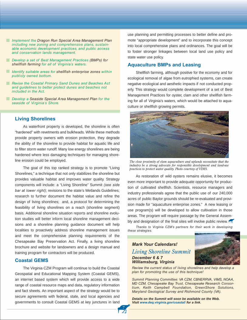
Aquaculture BMPs and Leasing
Shellfish farming, although positive for the economy and for
ecological removal of algae from eutrophied systems, can create
negative ecological and aesthetic impacts if not conducted prop-
erly. This strategy would complete development of a set of Best
Management Practices for oyster, clam and other shellfish farm-
ing for all of Virginia’s waters, which would be attached to aqua-
culture or shellfish growing permits.
As restoration of wild oysters remains elusive, it becomes
even more important to provide adequate opportunity for produc-
tion of cultivated shellfish. Scientists, resource managers and
industry professionals agree that the public use of our 240,000
acres of public Baylor grounds should be re-evaluated and provi-
sion made for “aquaculture enterprise zones.” A new leasing or
use program(s) will be developed to allow cultivation in those
areas. The program will require passage by the General Assem-
bly and designation of the final sites will involve public review.Thanks to Vi rginia CZM’s partners for their work in developing
these strategies.
The close proximity of clam aquaculture and uplands necessitate that theindustry be a strong advocate for responsible development and land-usepractices to protect water quality. Photo courtesy of VIMS.
Mark Your Calendars!
Living Shoreline SummitDecember 6 & 7Williamsburg, VirginiaReview the current status of l iving shorelines and help develop aplan for promoting the use of this technique!
Summit Planning Committee: VA CZM, CBNERRVA, VIMS, NOAA,MD CZM, Chesapeake Bay Trust, Chesapeake Research Consor-tium, Keith Campbell Foundation, GreenShore Solutions,Maryland Geological Survey and Richmond County (VA).
Details on the Summit will soon be available on the Web.Visit www.deq.virginia.gov/coastal/ for a link.
O Oysters!
So what we did was write down, step-by-step what you need
to do. It all boiled down to this:
Step 1. Evaluate the site.
Step 2. Choose a growing strategy.
Step 3. Choose a containment system.
Step 4. Get a permit.(Yes, you need to
do this, but it’s for your own
safety and it’s easy!)
Step 5. Purchase supplies.
Step 6. Set-up and maintain the garden
Step 7. Harvest!
The guide also provides helpful informa-tion such as...
• how oyster gardening can helpimprove your local water quality
• a salinity map showing where oystergrowth is possible
• safety tips for consuming oysters (Dobe careful, contaminated raw oysterscan make you very ill.)
• how best to avoid diseases that can kill oysters
• types of containment systems
• a tear-out permit application
• where to purchase supplies and how much they’ll cost
• garden maintenance tips
• how to donate oysters to sanctuary reefs if you don’t want to eat them
• what kinds creatures will visit your garden, which ones are ben-
eficial, which are harmful
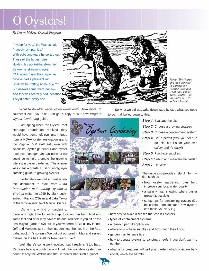
“I weep for you,” the Walrus said:
“I deeply sympathize.”
With sobs and tears he sorted out
Those of the largest size,
Holding his pocket-handkerchief
Before his streaming eyes.
“O Oysters,” said the Carpenter,
“You’ve had a pleasant run!
Shall we be trotting home again?’
But answer came there none—
And this was scarcely odd, because
They’d eaten every one.
What to do after we’ve eaten every one? Grow more, of
course! “How?” you ask. First get a copy of our new Virginia
Oyster Gardening guide.
Last spring when the Oyster Reef
Heritage Foundation realized they
would have some left over grant funds
from a NOAA oyster restoration grant,
the Virginia CZM staff sat down with
scientists, oyster gardeners and oyster
resource managers and asked what we
could do to help promote the growing
interest in oyster gardening. The answer
was clear – create a user-friendly, eye-
catching guide to growing oysters.
Fortunately we had a great scien-
tific document to start from – An
Introduction to Culturing Oysters in
Vi rginia written in 1999 by Mark Luck-
enbach, Francis O’Beirn and Jake Taylor
of the Virginia Institute of Marine Science.
As with any kind of gardening,
there is a right time for each step, location can be critical and
some trial and error may have to be endured before you hit on the
best way to “garden” oysters on your waterfront. But as my friends
Jeff and Marianne say of their garden near the mouth of the Rap-
pahannock, “It’s so easy. We put out our seed in May and served
oysters on the half shell for New Year’s Eve!”
Well, there’s some work involved, but it really isn’t too hard.
Certainly having a guide book will help the would-be oyster gar-
dener. If only the Walrus and the Carpenter had such a guide!
8
By Laura McKay, Coastal Program Manager
From: “The Walrusand the Carpenter”in Through theLooking-Glass andWhat Alice FoundThere. Written andillustrated in 1872by Lewis Carroll.
• 24 website addresses for more information
• 19 email addresses and phone numbers of people who can
answer your oyster gardening questions
Although the Virginia Marine Resources Commission has
only a few hundred oyster gardening permits on file, it is estimat-
ed that there are a few thousand oyster gardens out there.
It’s important to get a permit...
First, to protect your own health.
Many near shore waters are contaminated by human
sewage from leaking septic systems or sewage treatment plant
outfalls. Filing a permit allows your local health department to
track where oysters are being grown and try to ensure that you
don’t consume raw oysters from contaminated waters.
Second, to estimate the positive impacts of oystergardening on water quality.
State and federal agencies have been trying for years to
restore natural oyster reefs. This is not only for their commercial
value, but because oysters filter algae and fine sediment out of
the water and the reefs they form create hiding places for young
finfish and shellfish. This restoration effort has been fraught with
difficulties, so whatever private individuals, as oyster gardeners,
can do to help, may have an impact on our overall oyster restora-
tion efforts. So we need to know how many oysters are being
grown in order to calculate how much water is being filtered.
Third, to help estimate the value of high water quality to people within a particular watershed.
Because the Marine Resources Commission and Local Wet-
lands Boards are always reviewing permit applications for pro-
jects which may result in a degradation of water quality, it’s
important to understand how many people may be negatively
impacted by permitted activities that could degrade water quality.
In that way, these permitting agencies can calculate a more equi-
table balance between the desires of an individual and the com-
mon good.
So, if you, your neighbors, your friends, your employer, or your
school have access to some salty or slightly salty water, start an
oyster garden! The Vi rginia Oyster Gardening guide is
available at www.deq.virginia.gov/coastal. Or just call us at (804)
698-4122 if you need a paper copy. In the case of oyster garden-
ing, cumulative impacts can be very positive for the environment!
9
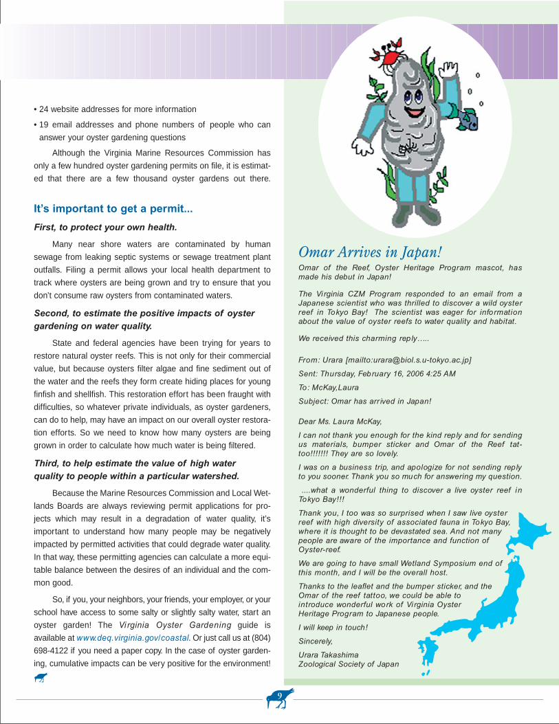
Omar Arrives in Japan!Omar of the Reef, Oyster Heritage Program mascot, hasmade his debut in Japan!
The Vi rginia CZM Program responded to an email from aJapanese scientist who was thrilled to discover a wild oysterreef in Tokyo Bay! The scientist was eager for informationabout the value of oyster reefs to water quality and habitat.
We received this charming reply…..
From: Urara [mailto:[email protected]]
Sent: Thursday, February 16, 2006 4:25 AM
To: McKay,Laura
Subject: Omar has arr ived in Japan!
Dear Ms. Laura McKay,
I can not thank you enough for the kind reply and for sendingus materials, bumper sticker and Omar of the Reef tat-too!!!!!!! They are so lovely.
I was on a business trip, and apologize for not sending replyto you sooner. Thank you so much for answering my question.
....what a wonderful thing to discover a live oyster reef inTokyo Bay!!!
Thank you, I too was so surprised when I saw live oysterreef with high diversity of associated fauna in Tokyo Bay,where it is thought to be devastated sea. And not many people are aware of the importance and function ofOyster-reef.
We are going to have small Wetland Symposium end ofthis month, and I will be the overall host.
Thanks to the leaflet and the bumper sticker, and the Omar of the reef tattoo, we could be able to introduce wonderful work of Vi rginia Oyster Heritage Program to Japanese people.
I will keep in touch!
Sincerely,
Urara TakashimaZoological Society of Japan
and the Boards of Supervisors in both Northampton and Acco-
mack counties have expressed their support for it. And several
businesses have taken hold including Southeast Expeditions
which helped create the 38 paddling routes of the Seaside Water
Trail. Dave Burden of Southeast Expeditions describes the sea-
side as “one of those rare places where world class paddling and
globally unique wildlife come together.”
The key is to help these businesses grow in ways that actu-
ally improve natural resources. One way is to be sure, from the
start, that our Seaside Heritage Program projects, like the new
Seaside Water Trail, are laid out so that paddlers don’t come too
close to sensitive bird colonies or get in the way of commercial
watermen or aquaculture operations.
This is being accomplished through the use of our Geo-
graphic Information System (GIS). By mapping the locations of
important waterbird colonies and shorebird nesting areas, and
even other water uses such as aquaculture and navigation chan-
nels, we can lay out paddling routes and provide time of year
warnings that will help protect the birds and avoid conflicts with
other waterway uses.
Now’s the time to buy yourself a kayak. The weather has
warmed, the birds have returned, the dolphins are frolicking and
we’ve created a brand new Internet guide to 38 different routes
you can paddle on the seaside of Virginia’s Eastern Shore.
This jewel of Virginia’s coastal zone is a paradise for pad-
dlers. But be warned – it’s also a coastal wilderness, complete
with all the dangers, fragility and surprises of a true wilderness.
So why would we want to encourage people to get out there
and risk life and limb? For conservation. Yes, for conservation.
Although the debates continue (“tourism destroys resources”…
“no, ecotourism ultimately protects resources”) the Virginia CZM
Program is continuing its six year, $3 million Seaside Heritage
Program effort, which does, in fact, include promotion of eco-
tourism.
As we spend your federal tax dollars appropriated under the
Coastal Zone Management Act, we undertake projects that pro-
tect and restore coastal resources and that also help coastal-
dependent economic activities. So the Seaside Heritage Program
with its talented partners from a boat load of federal and state
agencies, local governments, universities, Eastern Shore busi-
nesses and non-profits, is restoring underwater grasses, oysters,
healthy marsh vegetation and shorebird habitat. But we are also
working with local industries such as aquaculture and ecotourism
to ensure that they have space to thrive.
Ecotourism takes hold on Eastern Shore
The Eastern Shore of Virginia Tourism Commission has
adopted a new strategic plan that strongly promotes ecotourism
10
By Laura McKay, Coastal Program Manager
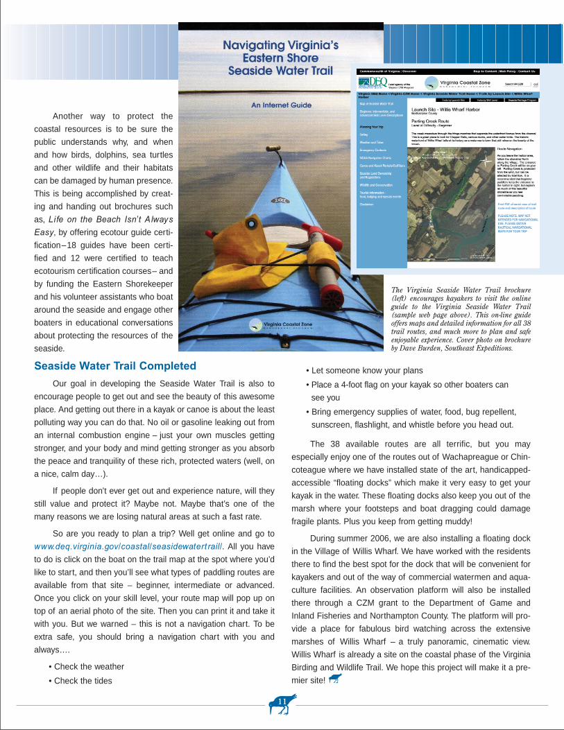
A young kayaker enjoying the site of a Great Blue Heron on one route alongthe Virginia Seaside Heritage Trail. Photo by Dave Burden, Southeast Expeditions.
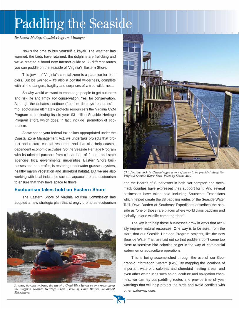
This floating dock in Chincoteague is one of many to be provided along theVirginia Seaside Water Trail. Photo by Elaine Meil.
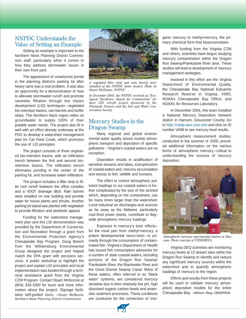
Paddling the Seaside
The Virginia Seaside Water Trail brochure(left) encourages kayakers to visit the onlineguide to the Virginia Seaside Water Trail(sample web page above). This on-line guideoffers maps and detailed information for all 38trail routes, and much more to plan and safeenjoyable experience. Cover photo on brochureby Dave Burden, Southeast Expeditions.
• Let someone know your plans
• Place a 4-foot flag on your kayak so other boaters can
see you
• Bring emergency supplies of water, food, bug repellent,
sunscreen, flashlight, and whistle before you head out.
The 38 available routes are all terrific, but you may
especially enjoy one of the routes out of Wachapreague or Chin-
coteague where we have installed state of the art, handicapped-
accessible “floating docks” which make it very easy to get your
kayak in the water. These floating docks also keep you out of the
marsh where your footsteps and boat dragging could damage
fragile plants. Plus you keep from getting muddy!
During summer 2006, we are also installing a floating dock
in the Village of Willis Wharf. We have worked with the residents
there to find the best spot for the dock that will be convenient for
kayakers and out of the way of commercial watermen and aqua-
culture facilities. An observation platform will also be installed
there through a CZM grant to the Department of Game and
Inland Fisheries and Northampton County. The platform will pro-
vide a place for fabulous bird watching across the extensive
marshes of Willis Wharf – a truly panoramic, cinematic view.
Willis Wharf is already a site on the coastal phase of the Virginia
Birding and Wildlife Trail. We hope this project will make it a pre-
mier site!
Another way to protect the
coastal resources is to be sure the
public understands why, and when
and how birds, dolphins, sea turtles
and other wildlife and their habitats
can be damaged by human presence.
This is being accomplished by creat-
ing and handing out brochures such
as, Life on the Beach Isn’ t A lways
Easy, by offering ecotour guide certi-
fication–18 guides have been certi-
fied and 12 were certified to teach
ecotourism certification courses– and
by funding the Eastern Shorekeeper
and his volunteer assistants who boat
around the seaside and engage other
boaters in educational conversations
about protecting the resources of the
seaside.
Seaside Water Trail Completed
Our goal in developing the Seaside Water Trail is also to
encourage people to get out and see the beauty of this awesome
place. And getting out there in a kayak or canoe is about the least
polluting way you can do that. No oil or gasoline leaking out from
an internal combustion engine – just your own muscles getting
stronger, and your body and mind getting stronger as you absorb
the peace and tranquility of these rich, protected waters (well, on
a nice, calm day…).
If people don’t ever get out and experience nature, will they
still value and protect it? Maybe not. Maybe that’s one of the
many reasons we are losing natural areas at such a fast rate.
So are you ready to plan a trip? Well get online and go to
www.deq.virginia.gov/coastal/seasidewatert rail/. All you have
to do is click on the boat on the trail map at the spot where you’d
like to start, and then you’ll see what types of paddling routes are
available from that site – beginner, intermediate or advanced.
Once you click on your skill level, your route map will pop up on
top of an aerial photo of the site. Then you can print it and take it
with you. But we warned – this is not a navigation chart. To be
extra safe, you should bring a navigation chart with you and
always….
• Check the weather
• Check the tides
11

The Hampton Roads Planning DistrictCommission (HRPDC) has recently com-pleted a Regional Conservation CorridorPlan. Conservation corridors are areas pri-oritized for preservation because of theirimportance as habitat or for protectingwater quality. These areas were previouslyidentified for the southern watersheds areaof Hampton Roads (Back Bay, North Land-ing River and Northwest River) through Vir-ginia CZM’s Southern Watershed AreaManagement Program (SWAMP). The sys-tem proved to be a valuable planning toolfor the cities of Chesapeake and VirginiaBeach and for the state and federal agen-cies working in the southern watersheds.The corridor system has been used in com-prehensive planning efforts, for the cre-ation of a Purchase of Development Rights
program in the City of
area for
Chesapeake, and is the target area for wet-lands mitigation as outlined in a MultipleBenefits Conservation Program Memoran-dum of Agreement used by state, federal,local and private organizations. Because ofthe success of the corridor system in thesouthern watersheds, HRPDC applied forand received Virginia CZM funding toexpand the corridor system to the remainderof the 16 PDC jurisdictions.
The project used GIS modeling toanalyze data from a variety of sources,including the National Land Cover Dataset,the National Wetlands Inventory, and theVirginia Land Conservation Needs Assess-ment. The result is a summary map thatidentifies high priority areas for water qual-ity and habitat protection and opportunities
for connectivity between these areas.Because consensus building was animportant part of the project, stakeholderswere provided multiple opportunities forinvolvement as the project progressed.These included discussions at regularHRPDC Joint Environmental Committeemeetings, a meeting with a conservationspecialist, and meetings with local repre-sentatives. Draft maps were also sent tolocal parks and recreation and planningdepartments for review and comment.
In addition to GIS products, an educa-tional video on the conservation corridorsystem was also developed. The video dis-cusses the concept of conservation corri-dors and encourages business, industry,and individual landowners to help in estab-lishing and maintaining these corridors intheir communities. The video will be provid-ed to local governments for use on cableaccess stations. It may also be useful toother areas of the Coastal Zone interestedin developing a corridor system.
The Coastal Policy Team also deter-mined that conservation corridor planningwas a priority for Section 309 funding underthe Coastal Zone Management Act (seearticle on page 6). Under the draft strategysent to NOAA for approval, Virginia CZMcould provide up to $350,000 during thenext five years for development andapproval of regional conservation corridorsand agreements for management of thesecorridors. –Shep Moon, Vi rginia CZM Program
Crater PDC
Rappahannock Area Development CommissionRichmond Regional PDC
Northern Neck PDC
Middle Peninsula PDC
Northern Virginia Regional Commission
Hampton Roads PDC
Accomack-Northampton PDC
Conservation Corridors HelpDefine Future Protection inSouthern Watersheds
12
NEWS AROUND THE ZONE
NNPDC Understands theValue of Setting an Example
Setting an example is important to theNorthern Neck Planning District Commis-sion staff, particularly when it comes tohow they address stormwater issues intheir own front yard.
The appearance of unwelcome pondsin the planning district’s parking lot afterheavy rains was a real problem. It was alsoan opportunity for a demonstration of howto alleviate stormwater runoff and promoterainwater filtration through low impactdevelopment (LID) techniques – vegetatedbio-retention basins, rain barrels and bufferstrips. The Northern Neck region relies ongroundwater to supply 100% of theirpotable water needs. The project also fit inwell with an effort already underway at thePDC to develop a watershed managementplan for Cat Point Creek, which promotesthe use of LID principles.
The project consists of three vegetat-ed bio-retention basins, with an infiltrationtrench between the first and second bio-retention basins. The infiltration trencheliminates ponding in the center of theparking lot, and increases water infiltration.
The project includes a filter strip to fil-ter roof runoff between the office complexand a VDOT drainage ditch. Rain barrelswere installed on one building and providewater for house plants and shrubs. Anotherparking lot island was planted with vegetationto provide filtration and aesthetic appeal.
Funding for the watershed manage-ment plan and this LID demonstration wasprovided by the Department of Conserva-tion and Recreation through a grant fromthe Environmental Protection Agency’sChesapeake Bay Program. Doug Beischfrom the Williamsburg EnvironmentalGroup designed the project and helpedmatch the EPA grant with pro-bono ser-vices. A public workshop to highlight theproject and explain LID principles and localimplementation was funded through a tech-nical assistance grant from the VirginiaCZM Program. Contact Stuart McKenzie at(804) 333-1900 for tours and more infor-mation about the project. Signage facili-tates self-guided tours. –Stuart McKenzie,Northern Neck Planning District Commission
Mercury Studies in theDragon Swamp
Many regional and global environ-mental water quality issues involve atmos-pheric transport and deposition of specificpollutants – Virginia’s coastal waters are noexception.
Deposition results in acidification ofsensitive streams and lakes, eutrophicationof coastal waters and, mercury accumulationand toxicity to fish, wildlife and humans.
The effort to control atmospheric pol-lutant loadings to our coastal waters is fur-ther complicated by the size of the airshedwhich, depending on the contaminant, canbe many times larger than the watershed.Local industrial air discharges and sourcesas far away as the Midwest, particularlycoal-fired power plants, contribute to Bay-wide atmospheric mercury loadings.
Exposure to mercury’s toxic effects–for the most part from methyl-mercury, apotent developmental neuro-toxin –is pri-marily through the consumption of contam-inated fish. Virginia’s Department of Healthhas issued fish consumption advisories fora number of state coastal waters, includingportions of the Dragon Run Swamp/Piankatank River, the Blackwater River andthe Great Dismal Swamp Canal. Many ofthese waters, often referred to as “blackwater” systems, are considered mercurysensitive due to their relatively low pH, highdissolved organic carbon levels and anaer-obic sediment processes. These conditionsare conducive for the conversion of inor-
ganic mercury to methyl-mercury, the pri-mary chemical form that bioaccumulates.
With funding from the Virginia CZMand others, scientists have begun studyingmercury contamination within the DragonRun Swamp/Piankatank River area. Thesestudies will lead to development of mercurymanagement strategies.
Involved in this effort are the VirginiaDepartment of Environmental Quality,the Chesapeake Bay National EstuarineResearch Reserve in Virginia, VIMS,NOAA’s Chesapeake Bay Office, andNOAA’s Air Resources Laboratory.
In December 2004, this team installeda National Mercury Deposition Networkstation in Harcum, Gloucester County. Goto http://nadp.sws.uiuc.edu and click on IDnumber VA98 to see mercury level results.
Atmospheric measurement studies,conducted in the summer of 2005, provid-ed additional information on the variousforms of atmospheric mercury –critical tounderstanding the sources of mercurydeposition.
Virginia DEQ scientists are monitoringmercury levels at 12 stream sites within theDragon Run Swamp to identify and reduceany significant mercury sources within thewatershed and to quantify atmosphericloadings of mercury to the region.
Efforts and results from these projectswill be used to validate mercury atmos-pheric deposition models for the entireChesapeake Bay. –William Reay, CBNERRVA
13
A vegetated filter strip and rain barrels wereinstalled at the NNPDC demo project. Photo byStuart McKenzie, NNPDC
In December 2005, the NNPDC received an “Eco-logical Excellence Award for Construction” fortheir LID retrofit project sponsored by thePinelands Nursery and the Soil and Water Con-servation Society.
Atmospheric mercury experimental station in Har-cum. Photo courtesy of CBNERRVA.
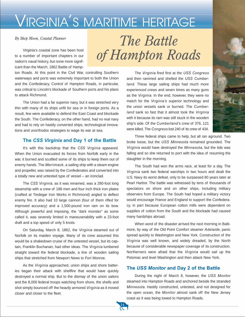
The Virginia fired first at the USS Congress
and then rammed and shelled the USS Cumber-
land. These large sailing ships had much more
experienced crews and seven times as many guns
as the Virginia. In the end, however, they were no
match for the Virginia’s superior technology and
the union vessels sank or burned. The Cumber-
land sank so fast that it almost took the Virginia
with it because its ram was still stuck in the wooden
ship’s side. Of the Cumberland’s crew of 376, 121
were killed. The Congress lost 240 of its crew of 434.
Three federal ships came to help, but all ran aground. Two
broke loose, but the USS Minnesota remained grounded. The
Virginia would have destroyed the Minnesota, but the tide was
falling and so she returned to port with the idea of resuming the
slaughter in the morning.
The South had won the arms race, at least for a day. The
Virginia sank two federal warships in two hours and dealt the
U.S. Navy its worst defeat, only to be surpassed 80 years later at
Pearl Harbor. The battle was witnessed by tens of thousands of
spectators on shore and on other ships, including military
observers from Europe. The South had hoped a military victory
would encourage France and England to support the Confedera-
cy, in part because European cotton mills were dependent on
supplies of cotton from the South and the blockade had caused
many hardships abroad.
When word of the disaster arrived the next morning in Balti-
more, by way of the Old Point Comfort steamer Adelaide, panic
spread quickly to Washington and New York. Construction of the
Virginia was well known, and widely dreaded, by the North
because of considerable newspaper coverage of its construction.
Northerners were afraid that the Virginia would sail up the
Potomac and level Washington and then attack New York.
The USS Monitor and Day 2 of the Battle
During the night of March 8, however, the USS Monitor
steamed into Hampton Roads and anchored beside the stranded
Minnesota. Hastily constructed, untested, and not designed for
the open ocean, the Monitor almost sank off the New Jersey
coast as it was being towed to Hampton Roads.
Virginia’s coastal zone has been host
to a number of important chapters in our
nation’s naval history, but none more signif-
icant than the March, 1862 Battle of Hamp-
ton Roads. At this point in the Civil War, controlling Southern
waterways and ports was extremely important to both the Union
and the Confederacy. Control of Hampton Roads, in particular,
was critical to Lincoln’s blockade of Southern ports and his plans
to attack Richmond.
The Union had a far superior navy, but it was stretched very
thin with many of its ships unfit for sea or in foreign ports. As a
result, few were available to defend the East Coast and blockade
the South. The Confederacy, on the other hand, had no real navy
and had to rely on hastily converted ships, technological innova-
tions and unorthodox strategies to wage its war at sea.
The CSS Virginia and Day 1 of the Battle
It’s with this backdrop that the CSS Vi rginia appeared.
When the Union evacuated its forces from Norfolk early in the
war, it burned and scuttled some of its ships to keep them out of
enemy hands. The Merrimack, a sailing ship with a steam engine
and propeller, was raised by the Confederates and converted into
a totally new and untested type of vessel – an ironclad.
The CSS Vi rginia, as it was renamed, was a 280-foot long
steamship with a crew of 188 men and four inch thick iron plates
(crafted at Tredegar Iron Works in Richmond) angled to deflect
enemy fire. It also had 10 large cannon (four of them rifled for
improved accuracy) and a 1,500-pound iron ram on its bow.
Although powerful and imposing, the “dark monster” as some
called it, was severely limited in maneuverability with a 23-foot
draft and a top speed of only 5 knots.
On Saturday, March 8, 1862, the Virginia steamed out of
Norfolk on its maiden voyage. Many of its crew assumed this
would be a shakedown cruise of the untested vessel, but its cap-
tain, Franklin Buchanan, had other ideas. The Virginia lumbered
straight toward the federal blockade, a line of wooden sailing
ships that stretched from Newport News to Fort Monroe.
As the Virginia approached, union ships and shore batter-
ies began their attack with shellfire that would have quickly
destroyed a normal ship. But to the dismay of the union sailors
and the 8,000 federal troops watching from shore, the shells and
shot simply bounced off the heavily armored Virginia as it moved
closer and closer to the fleet.
14
By Shep Moon, Coastal Planner The Battle of Hampton Roads
VIRGINIA’S MARITIME HERITAGE
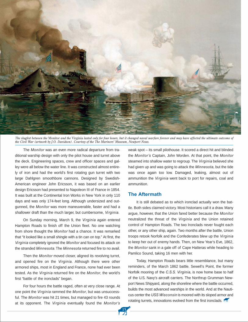
weak spot – its small pilothouse. It scored a direct hit and blinded
the Monitor’s Captain, John Worden. At that point, the Monitor
steamed into shallow water to regroup. The Virginia believed she
had given up and was going to attack the Minnesota, but the tide
was once again too low. Damaged, leaking, almost out of
ammunition the Virginia went back to port for repairs, coal and
ammunition.
The Aftermath
It is still debated as to which ironclad actually won the bat-
tle. Both sides claimed victory. Most historians call it a draw. Many
argue, however, that the Union fared better because the Monitor
neutralized the threat of the Virginia and the Union retained
control of Hampton Roads. The two Ironclads never fought each
other, or any other ship, again. Two months after the battle, Union
troops retook Norfolk and the Confederates blew up the Virginia
to keep her out of enemy hands. Then, on New Year’s Eve, 1862,
the Monitor sank in a gale off of Cape Hatteras while heading to
Pamlico Sound, taking 16 men with her.
Today, Hampton Roads bears little resemblance, but many
reminders, of the March 1862 battle. Sewell’s Point, the former
Norfolk mooring of the C.S.S. Virginia, is now home base to half
of the U.S. Navy’s aircraft carriers. The Northrup Grumman New-
port News Shipyard, along the shoreline where the battle occurred,
builds the most advanced warships in the world. And at the Nauti-
cus center the USS Wisconsin is moored with its sloped armor and
rotating turrets, innovations evolved from the first ironclads.
The Monitor was an even more radical departure from tra-
ditional warship design with only the pilot house and turret above
the deck. Engineering spaces, crew and officer spaces and gal-
ley were all below the water line. It was constructed almost entire-
ly of iron and had the world’s first rotating gun turret with two
large Dahlgren smoothbore cannons. Designed by Swedish-
American engineer John Ericsson, it was based on an earlier
design Ericsson had presented to Napoleon III of France in 1854.
It was built at the Continental Iron Works in New York in only 110
days and was only 174-feet long. Although undersized and out-
gunned, the Monitor was more maneuverable, faster and had a
shallower draft than the much larger, but cumbersome, Virginia.
On Sunday morning, March 9, the Virginia again entered
Hampton Roads to finish off the Union fleet. No one watching
from shore thought the Monitor had a chance. It was remarked
that “it looked like a small shingle with a tin can on top.” At first, the
Virginia completely ignored the Monitor and focused its attack on
the stranded Minnesota. The Minnesota returned fire to no avail.
Then the Monitor moved closer, aligned its revolving turret,
and opened fire on the Virginia. Although there were other
armored ships, most in England and France, none had ever been
tested. As the Virginia returned fire on the Monitor, the world’s
first “battle of the ironclads” began.
For four hours the battle raged, often at very close range. At
one point the Virginia rammed the Monitor, but was unsuccess-
ful. The Monitor was hit 21 times, but managed to fire 43 rounds
at its opponent. The Virginia eventually found the Monitor’s
15
The slugfest between the Monitor and the Virginia lasted only for four hours, but it changed naval warfare forever and may have affected the ultimate outcome ofthe Civil War (artwork by J.O. Davidson). Courtesy of the The Mariners’ Museum, Newport News.
Monitor National MarineSanctuaryOn January 30, 1975, the area around thewreck of the Monitor became the first NationalMarine Sanctuary. The Sanctuary, whichincludes a vertical column of water one mile indiameter, is managed by the National Oceanicand Atmospheric Administration.
The Marine Protection, Research and Sanctuaries Act, passed by Con-gress in 1972, authorized the Secretary of Commerce to designatenational marine sanctuaries. The goal of the National Marine Sanctu-ary Program is to protect the marine resources of designated sanctu-aries through education and research and by encouraging compatibleuses. Thirteen sanctuaries have been designated so far, ranging in sizefrom one to 5,300 square miles. Together they protect a wide range ofecological, historical, recreational and aesthetic resources.
For more information...
National Marine Sanctuaries – www.sanctuaries.noaa.gov
National Marine Sanctuaries – Maritime Heritage Program –www.maritimeheritage.noaa.gov
The USS Monitor
16
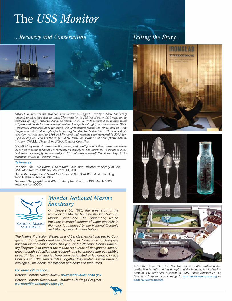
(Above) Remains of the Monitor were located in August 1973 by a Duke Universityresearch vessel using sidescan sonar. The wreck lies in 235 feet of water, 16.1 miles south-southeast of Cape Hatteras, North Carolina. Dives in 1979 recovered numerous smallartifacts and the ship’s unique four-fluked anchor (pictured right) was recovered in 1983.Accelerated deterioration of the wreck was documented during the 1990s and in 1996Congress mandated that a plan for preserving the Monitor be developed. The union ship’spropeller was recovered in 1998 and its turret and cannons were recovered in 2002 dur-ing a 41 day joint effort of the Navy and the National Oceanic and Atmospheric Admin-istration (NOAA). Photos from NOAA Monitor Collection.
(Right) Many artifacts, including the anchor, and small personal items, including silver-ware and condiment bottles are currently on display at The Mariners’ Museum in New-port News. Amazingly the mustard jar still contained mustard! Photos courtesy of TheMariners’ Museum, Newport News.
...Recovery and Conservation
(Directly Above) The USS Monitor Center, a $30 million dollarexhibit that includes a full-scale replica of the Monitor, is scheduled toopen at The Mariners’ Museum in 2007. Photo courtesy of TheMariners’ Museum. For more go to www.marinersmuseum.org orwww.monitorcenter.org
References:
Ironclad, The Epic Battle, Calamitous Loss, and Historic Recovery of the USS Monitor; Paul Clancy, McGraw-Hill, 2006.Damn the Torpedoes! Naval Incidents of the Civil War; A. A. Hoehling,John F. Blair, Publisher, 1989.National Geographic – Battle of Hampton Roads p. 136; March 2006;www.ngm.com/0603.
Telling the Story...
Charles has purchased a one- year state fishing license, so any-
one can fish without needing an individual license.
Attending the ribbon-cutting for the new pier last November
were members of the Cape Charles Town Council, Northampton
County Board of Supervisors, Eastern Shore of Virginia Tourism
Commission, Virginia Marine Resources Commission, Northamp-
ton County Chamber of Commerce, Landmark Design – the firm
that designed and constructed the pier’s addition, and the Virginia
CZM Program.
For more information about the renovation of the Cape
Charles Jetty Pier, please contact Heather Arcos, (757) 331-3259
–Virginia Witmer, Vi rginia CZM Program
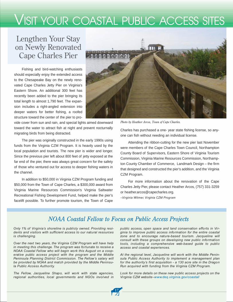
Lengthen Your Stay on Newly Renovated
Cape Charles Pier
Fishing and bird-watching enthusiasts
should especially enjoy the extended access
to the Chesapeake Bay on the newly reno-
vated Cape Charles Jetty Pier on Virginia’s
Eastern Shore. An additional 300 feet has
recently been added to the pier bringing its
total length to almost 1,790 feet. The expan-
sion includes a right-angled extension into
deeper waters for better fishing, a roofed
structure toward the center of the pier to pro-
vide cover from sun and rain, and special lights aimed downward
toward the water to attract fish at night and prevent nocturnally
migrating birds from being distracted.
The pier was originally constructed in the early 1990s using
funds from the Virginia CZM Program. It is heavily used by the
local population and tourists. The new pier is wider and longer.
Since the previous pier left about 800 feet of jetty exposed at the
far end of the pier, there was always great concern for the safety
of those who ventured out for access to deeper fishing waters in
the channel.
In addition to $50,000 in Virginia CZM Program funding and
$50,000 from the Town of Cape Charles, a $300,000 award from
Virginia Marine Resources Commission’s Virginia Saltwater
Recreational Fishing Development Fund, helped make the pier’s
facelift possible. To further promote tourism, the Town of Cape
17
Photo by Heather Arcos, Town of Cape Charles.
Only 1% of Vi rginia’s shoreline is publicly owned. Providing resi-dents and visitors with sufficient access to our natural resourcesis challenging.
Over the next two years, the Vi rginia CZM Program will have helpin meeting this challenge. The program was fortunate to receive aNOAA Coastal Fellow who will begin work this August on a coop-erat ive public access project with the program and the MiddlePeninsula Planning District Commission. The Fellow’s salary willbe provided by NOAA and match provided by the Middle Peninsu-la Public Access Authority.
The Fellow, Jacqueline Shapo, will work with state agencies,regional authorities, local governments and NGOs involved in
public access, open space and land conservation efforts in Vi r-ginia to improve public access information for the entire coastalzone and to encourage nature-based tourism. Jacqueline willconsult with these groups on developing new public informationtools, including a comprehensive web-based guide to publicaccess and coastal experiences.
At the regional level, Jacqueline will work with the Middle Penin-sula Public Access Authority to implement a management planfor the authority’s first acquisition - a 130 acre site in the DragonRun acquired with funding from the Vi rginia CZM Program.
Look for more details on these new public access projects on theVirginia CZM website–www.deq.virginia.gov/coastal/
NOAA Coastal Fellow to Focus on Public Access Projects
VISIT YOUR COASTAL PUBLIC ACCESS SITES
exporting 300,000 to 400,000 bales annually. The Baltimore
Steamship Company bought the Richmond & York River Rail-
road, connecting West Point with other important Chesapeake
Bay ports. International trade boomed. Huge wharfs were built.
Cotton exports continued, and many foreign goods arrived for
transport by rail to Baltimore, New York, Boston, and Providence,
Rhode Island.
This prosperity, however, came to a grinding halt in 1896
when the railroad terminal–now owned by Southern Railway–
shifted to Portsmouth. The effect was devastating. West Point’s
property values fell as much as 50 percent, and the population
declined by 30 percent. Aside from local manufacturing, all that
remained of its transportation sector was rail and steamship pas-
senger services.
Tourism Boosts the Community
The Town was saved from further decline by its reputation as
a summer water resort. In 1887, the 200-room Terminal Hotel
was built on First Street. The hotel featured a Beach Park with
boardwalk, skating rink, dance pavilion, soda fountain, amuse-
ment rides and a smaller hotel for additional accommodations.
By Randy Jones, Department of Historic Resources
West Point is situated on a peninsula where the Pamunkey
and Mattaponi rivers join to form the York River. Shown as
“Cinquoteck” on Captain John Smith’s 1612 “Map of Virginia,”
West Point was originally the site of an Indian Village. Years
before, in 1570, a Spanish expedition of Jesuit priests settled for
a short time in the vicinity of Cinquoteck. The village was part of
the confederacy of Algonquin Indians, headed by paramount
chief Powhatan of the Pamunkey tribe at the time the English set-
tled at Jamestown in 1607.
Access to Coastal Waters Shapes West Point
In 1646, a treaty with the English restricted the Indians to
land upriver and soon after Captain John West was granted 850
acres of land by the Crown and established West Point Planta-
tion. In 1691, the Virginia General Assembly, anxious to develop
towns, authorized the purchase of 50 acres of West’s plantation
to develop a mercantile center and landing for trading ships.
Named Delaware Town in honor of John West’s father, Thomas
West, Earl de la Warr, the town ultimately failed. During the Rev-
olutionary War, however, imported arms and supplies were
shipped through the town, and French troops were quartered at
the site after the British surrender at Yorktown.
With the advent of the railroad in the early 19th century,
commercial interest in the area revived, drawn by the prospect of
connecting Richmond to the York River. In 1859 the building of
the Richmond & York River Railroad spurred the founding of the
new town of West Point in 1860. An iron drawbridge was con-
structed across the Pamunkey River in 1861 to secure the rail-
road’s terminus at a dock in West Point on the Mattaponi River.
The railroad’s timing, however, was ill fated. When the Civil
War erupted in 1861, the rail line became a prime military target.
In 1862, Major General George McClellan captured the area,
putting it under Union control, and in 1863 Union troops burned
the fledgling town and the railroad. (Today, only five antebellum
buildings exist in West Point.)
Town of West Point Incorporated
After the war, investors moved quickly to reestablish the rail-
road. They did so by 1869, and in 1870 West Point was incorpo-
rated, with a population of 75. The town flourished. By 1890, it
had 2,000-plus residents and was a manufacturing and shipping
center. The Town was the fifth largest cotton port in the country,
18
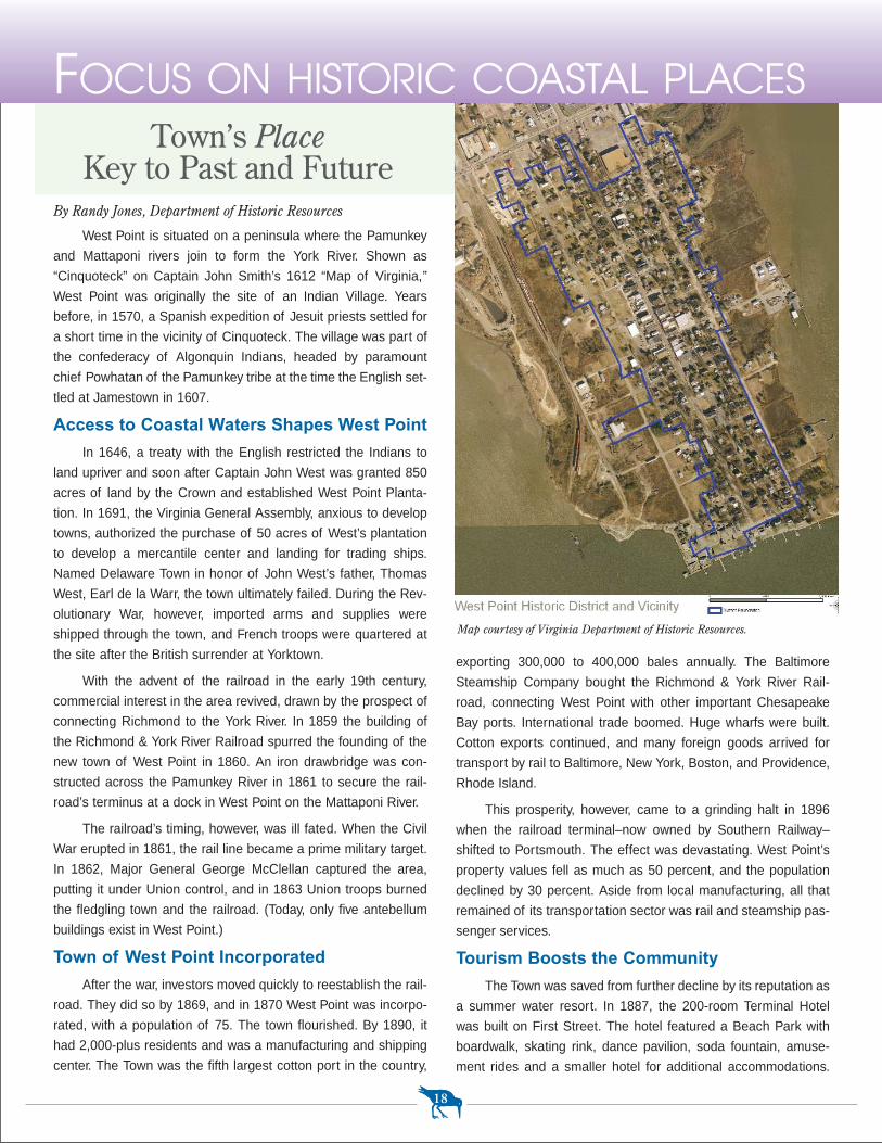
Map courtesy of Virginia Department of Historic Resources.
Town’s PlaceKey to Past and Future
FOCUS ON HISTORIC COASTAL PLACES
Town. The waterfront promotes active and passive pursuits in
a manner that is compatible with the natural quality of the site.”
To implement this vision for their community, the Town has
set out a list of goals and objectives, which guided the creation of
zoning/performance standards and two new zoning districts in the
waterfront Master Plan–a Conservation District and a Mixed-Use
District. Additional Goals are to:
* Construct a Riverwalk trail.
* Link the waterfront to an historic downtown walking tour.
* Build one or more marinas.
* Provide opportunities for mixed-use development.
* Provide additional recreation activities for residents and visitors.
* Include historical and natural interpretation as part ofimprovements.
* Utilize low-impact development techniques for proposedimprovements.
* Restore and protect natural habitat.
If adopted, the West Point Waterfront Master Plan will promote
sustainable development/redevelopment, encourage private invest-
ment, preserve sensitive resources, and capitalize on opportunities
that are compatible with the Town’s vision.
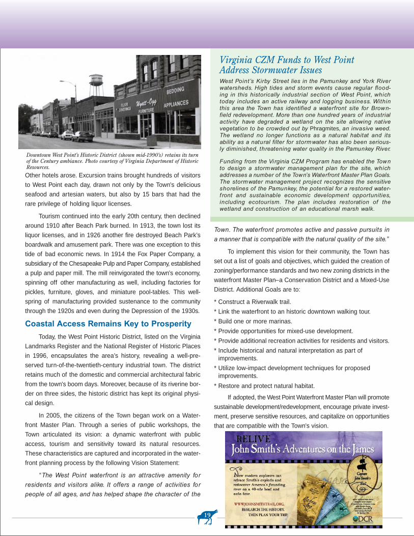
Other hotels arose. Excursion trains brought hundreds of visitors
to West Point each day, drawn not only by the Town’s delicious
seafood and artesian waters, but also by 15 bars that had the
rare privilege of holding liquor licenses.
Tourism continued into the early 20th century, then declined
around 1910 after Beach Park burned. In 1913, the town lost its
liquor licenses, and in 1926 another fire destroyed Beach Park’s
boardwalk and amusement park. There was one exception to this
tide of bad economic news. In 1914 the Fox Paper Company, a
subsidiary of the Chesapeake Pulp and Paper Company, established
a pulp and paper mill. The mill reinvigorated the town’s economy,
spinning off other manufacturing as well, including factories for
pickles, furniture, gloves, and miniature pool-tables. This well-
spring of manufacturing provided sustenance to the community
through the 1920s and even during the Depression of the 1930s.
Coastal Access Remains Key to Prosperity
Today, the West Point Historic District, listed on the Virginia
Landmarks Register and the National Register of Historic Places
in 1996, encapsulates the area’s history, revealing a well-pre-
served turn-of-the-twentieth-century industrial town. The district
retains much of the domestic and commercial architectural fabric
from the town’s boom days. Moreover, because of its riverine bor-
der on three sides, the historic district has kept its original physi-
cal design.
In 2005, the citizens of the Town began work on a Water-
front Master Plan. Through a series of public workshops, the
Town articulated its vision: a dynamic waterfront with public
access, tourism and sensitivity toward its natural resources.
These characteristics are captured and incorporated in the water-
front planning process by the following Vision Statement:
“ The West Point waterfront is an attractive amenity for
residents and visitors alike. It offers a range of activities for
people of all ages, and has helped shape the character of the
19
Downtown West Point’s Historic District (shown mid-1990’s) retains its turnof the Century ambiance. Photo courtesy of Virginia Department of HistoricResources.
Virginia CZM Funds to West Point Address Stormwater IssuesWest Point’s Kirby Street lies in the Pamunkey and York Riverwatersheds. High tides and storm events cause regular flood-ing in this historically industrial section of West Point, whichtoday includes an active railway and logging business. Withinthis area the Town has identified a waterfront site for Brown-field redevelopment. More than one hundred years of industrialactivity have degraded a wetland on the site allowing nat ivevegetation to be crowded out by Phragmites, an invasive weed.The wetland no longer functions as a natural habitat and itsability as a natural filter for stormwater has also been serious-ly diminished, threatening water quality in the Pamunkey River.
Funding from the Vi rginia CZM Program has enabled the Townto design a stormwater management plan for the site, whichaddresses a number of the Town’s Waterfront Master Plan Goals.The stormwater management project recognizes the sensitiveshorelines of the Pamunkey, the potential for a restored water-f ront and sustainable economic development opportunities,including ecotourism. The plan includes restoration of thewetland and construction of an educational marsh walk.
At any given time, staff at the VirginiaCZM Program manages over 100 activegrants to state agencies, local govern-ments, universities and non-profit organi-zations. Working with grantees to makethis process as efficient as possible is crit-ical to meeting NOAA deadlines andreporting requirements.
In February, staff held the first Vir-ginia CZM Program Grantee Workshop to
provide an overview of the grant processto 32 of the program’s current granteesand to provide an opportunity for group discussion and feedback on the process.Grantees received a tour of the VirginiaCZM Program’s comprehensive grantsdatabase and received an easy-referencegrant procedure manual.
Grants acknowledgement wasanother important workshop topic. Prop-erly acknowledging the receipt and valueof Virginia CZM funds is critical to main-taining federal appropriations under theCZMA. Virginia relies entirely on thesefunds to maintain its CZM program. Staffunveiled the new Virginia CZM Programlogo and discussion focused on howgrantees can help improve the program’svisibility through proper acknowledge-ment.
Future grantee workshops will beheld if needed. If you are a grantee andwould like a binder of workshop materials,please contact Rachel Bullene [email protected].
A New Coastal Planner!Kelly Price joins the Virginia CZM
Program as a Coastal Planner on June 26.
Kelly grad-uated from DukeUniversity inNorth Carolinathis spring witha Master’s inCoastal Envi-ronmental Man-agement. Whilefinishing herdegree, Kellyworked with theNC Departmentof Environmentand Natural
Resources, Division of Coastal Manage-ment where she drafted that state’sCoastal and Estuarine Land ConservationProgram plan. Prior to this position, Kellyworked as an intern for the North CarolinaCoastal Federation, where she prepared aSection 319 Quality Assurance ProjectPlan for volunteer fecal coliform monitoringand TMDL assessment.
One of Kelly’s first assignments withthe Virginia CZM Program will be helpingprepare Virginia’s Coastal and EstuarineLand Conservation Program plan. Thisplan will be critical to the Commonwealth’scontinued receipt of funds under this newfederal program for land acquisition.
Welcome to the team, Kelly!
Julie Bixby has left her position asCoastal Planner with the Virginia CZM Pro-gram and moved a coastaway to sunny Santa Bar-bara, California. Julie will behelping the City integratesustainability into their long-range plan.
While with Virginia CZM,Julie made many new friendsand great strides on manycoastal issues. She wasinstrumental in helping draft a SAMP forthe Dragon Run watershed and acquiring
COASTAL CLIPS & CONTRIBUTIONS
The Virginia CZM Program supportedthe 2006 Virginia Clean Commute Day onMay 5th. A Clean Commute Day campaignencouraged the public to travel to and fromwork, school or other locations in modesthat reduce air pollution and reliance on asingle-occupant vehicle. The event alsohelps educate the public on the linkbetween clean air and transportation.
The American Lung Association andthe Virginia CZM Program have beenworking together over the last three yearsto increase the number of Virginians partic-
ipating in the event. Previous media effortsfocused on the Northern Virginia andHampton Roads areas.
This year the Virginia CZM Programfunded signs on buses in the Richmondarea, as well as radio announcements dur-ing Richmond traffic reports. This mediaproject is anticipated to reach 1 millioncentral Virginia residents with a CleanCommute Day message. Perhaps themost important message is that we mustcelebrate Clean Commute Everyday!
sensitive habitat in the area; she madeinroads in dealing with coastal non-point
pollution through her over-sight of numerous pro-jects; and, she wrote theproposal to NOAA thatlead to the Program’srecent receipt of a fellowto address coastal publicaccess issues in the nexttwo years (see page 17.)
We will miss Julie’sdedication, enthusiasm and camaraderie!
Virginia CZM Sponsors Clean Commute Day
Thank You Julie!
First Virginia CZM Grantee Workshop Held
Photo courtesy of the AmericanLung Associationof Virginia
20
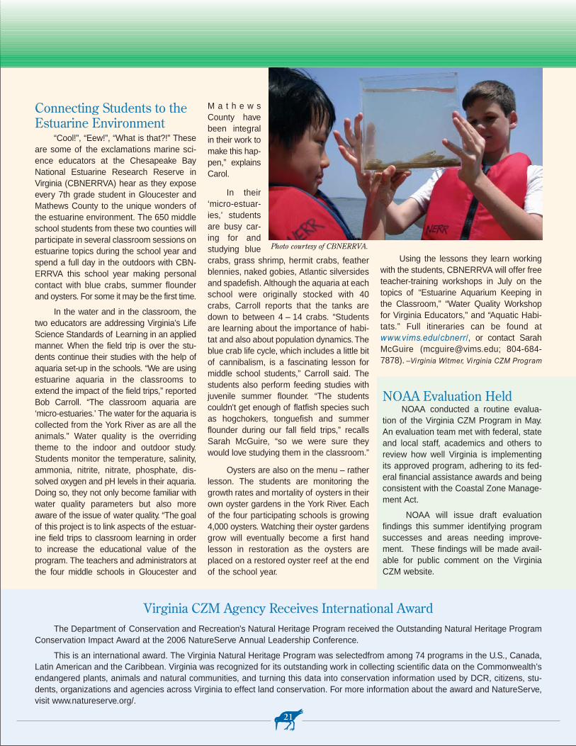
The Department of Conservation and Recreation’s Natural Heritage Program received the Outstanding Natural Heritage ProgramConservation Impact Award at the 2006 NatureServe Annual Leadership Conference.
This is an international award. The Virginia Natural Heritage Program was selectedfrom among 74 programs in the U.S., Canada,Latin American and the Caribbean. Virginia was recognized for its outstanding work in collecting scientific data on the Commonwealth’sendangered plants, animals and natural communities, and turning this data into conservation information used by DCR, citizens, stu-dents, organizations and agencies across Virginia to effect land conservation. For more information about the award and NatureServe,visit www.natureserve.org/.
Virginia CZM Agency Receives International Award
Connecting Students to theEstuarine Environment
“Cool!”, “Eew!”, “What is that?!” Theseare some of the exclamations marine sci-ence educators at the Chesapeake BayNational Estuarine Research Reserve in Virginia (CBNERRVA) hear as they exposeevery 7th grade student in Gloucester andMathews County to the unique wonders ofthe estuarine environment. The 650 middleschool students from these two counties willparticipate in several classroom sessions onestuarine topics during the school year andspend a full day in the outdoors with CBN-ERRVA this school year making personalcontact with blue crabs, summer flounderand oysters. For some it may be the first time.
In the water and in the classroom, thetwo educators are addressing Virginia’s LifeScience Standards of Learning in an appliedmanner. When the field trip is over the stu-dents continue their studies with the help ofaquaria set-up in the schools. “We are usingestuarine aquaria in the classrooms toextend the impact of the field trips,” reportedBob Carroll. “The classroom aquaria are‘micro-estuaries.’ The water for the aquaria iscollected from the York River as are all theanimals.” Water quality is the overridingtheme to the indoor and outdoor study.Students monitor the temperature, salinity,ammonia, nitrite, nitrate, phosphate, dis-solved oxygen and pH levels in their aquaria.Doing so, they not only become familiar withwater quality parameters but also moreaware of the issue of water quality. “The goalof this project is to link aspects of the estuar-ine field trips to classroom learning in order to increase the educational value of the program. The teachers and administrators atthe four middle schools in Gloucester and
M a t h e w sCounty havebeen integralin their work tomake this hap-pen,” explainsCarol.
In their‘micro-estuar-ies,’ studentsare busy car-ing for andstudying bluecrabs, grass shrimp, hermit crabs, featherblennies, naked gobies, Atlantic silversidesand spadefish. Although the aquaria at eachschool were originally stocked with 40crabs, Carroll reports that the tanks aredown to between 4 – 14 crabs. “Studentsare learning about the importance of habi-tat and also about population dynamics.Theblue crab life cycle, which includes a little bitof cannibalism, is a fascinating lesson formiddle school students,” Carroll said. Thestudents also perform feeding studies withjuvenile summer flounder. “The studentscouldn’t get enough of flatfish species suchas hogchokers, tonguefish and summerflounder during our fall field trips,” recallsSarah McGuire, “so we were sure theywould love studying them in the classroom.”
Oysters are also on the menu – ratherlesson. The students are monitoring thegrowth rates and mortality of oysters in theirown oyster gardens in the York River. Eachof the four participating schools is growing4,000 oysters. Watching their oyster gardensgrow will eventually become a first hand lesson in restoration as the oysters areplaced on a restored oyster reef at the endof the school year.
Using the lessons they learn workingwith the students, CBNERRVA will offer freeteacher-training workshops in July on thetopics of “Estuarine Aquarium Keeping inthe Classroom,” “Water Quality Workshopfor Virginia Educators,” and “Aquatic Habi-tats.” Full itineraries can be found atwww.vims.edu/cbnerr/, or contact SarahMcGuire ([email protected]; 804-684-7878). –Virginia Witmer, Vi rginia CZM Program
21
Photo courtesy of CBNERRVA.
NOAA Evaluation HeldNOAA conducted a routine evalua-
tion of the Virginia CZM Program in May.An evaluation team met with federal, stateand local staff, academics and others toreview how well Virginia is implementingits approved program, adhering to its fed-eral financial assistance awards and beingconsistent with the Coastal Zone Manage-ment Act.
NOAA will issue draft evaluationfindings this summer identifying programsuccesses and areas needing improve-ment. These findings will be made avail-able for public comment on the VirginiaCZM website.
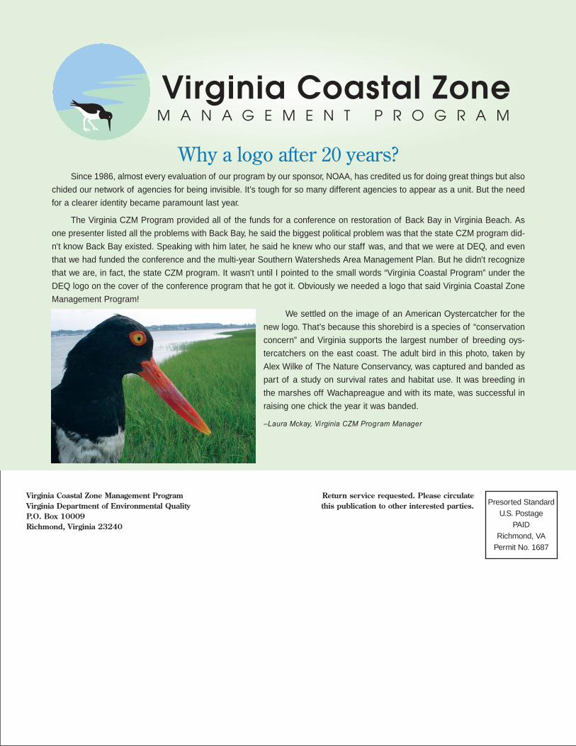
Virginia Coastal Zone Management ProgramVirginia Department of Environmental QualityP.O. Box 10009Richmond, Virginia 23240
Presorted StandardU.S. Postage
PAIDRichmond, VA
Permit No. 1687
Return service requested. Please circulatethis publication to other interested parties.
Why a logo after 20 years?Since 1986, almost every evaluation of our program by our sponsor, NOAA, has credited us for doing great things but also
chided our network of agencies for being invisible. It’s tough for so many different agencies to appear as a unit. But the need
for a clearer identity became paramount last year.
The Virginia CZM Program provided all of the funds for a conference on restoration of Back Bay in Virginia Beach. As
one presenter listed all the problems with Back Bay, he said the biggest political problem was that the state CZM program did-
n’t know Back Bay existed. Speaking with him later, he said he knew who our staff was, and that we were at DEQ, and even
that we had funded the conference and the multi-year Southern Watersheds Area Management Plan. But he didn’t recognize
that we are, in fact, the state CZM program. It wasn’t until I pointed to the small words “Virginia Coastal Program” under the
DEQ logo on the cover of the conference program that he got it. Obviously we needed a logo that said Virginia Coastal Zone
Management Program!
We settled on the image of an American Oystercatcher for the
new logo. That’s because this shorebird is a species of “conservation
concern” and Virginia supports the largest number of breeding oys-
tercatchers on the east coast. The adult bird in this photo, taken by
Alex Wilke of The Nature Conservancy, was captured and banded as
part of a study on survival rates and habitat use. It was breeding in
the marshes off Wachapreague and with its mate, was successful in
raising one chick the year it was banded.
–Laura Mckay, Vi rginia CZM Program Manager