Embed Size (px)
Citation preview
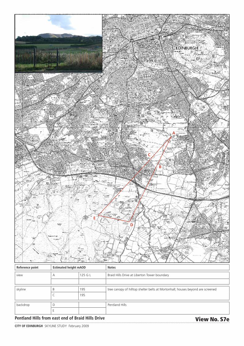
B
C
D
E
A
CITY OF EDINBURGH SKYLINE STUDY February 2009
Reference point Estimated height mAOD Notes
view A 125 G L Braid Hills Drive at Liberton Tower boundary
skyline B 195 tree canopy of hilltop shelter belts at Mortonhall; houses beyond are screened
C 195
backdrop
D Pentland Hills
E
Pentland Hills from east end of Braid Hills Drive View No. S7e