Embed Size (px)
Citation preview
Three real case simulations by Meso-NH
validated against satellite observations
J.-P. Chaboureau and J.-P. PintyLaboratoire d’Aérologie, Toulouse
1. Elbe flood2. BBC shallow clouds3. IMPROVE heavy orographic precipitation
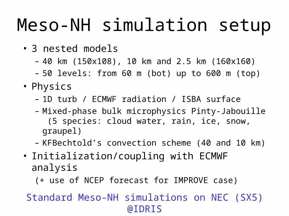
Meso-NH simulation setup• 3 nested models
– 40 km (150x108), 10 km and 2.5 km (160x160)– 50 levels: from 60 m (bot) up to 600 m (top)
• Physics– 1D turb / ECMWF radiation / ISBA surface– Mixed-phase bulk microphysics Pinty-Jabouille
(5 species: cloud water, rain, ice, snow, graupel)– KFBechtold’s convection scheme (40 and 10
km)
• Initialization/coupling with ECMWF analysis(+ use of NCEP forecast for IMPROVE case)
Standard Meso-NH simulations on NEC (SX5) @IDRIS
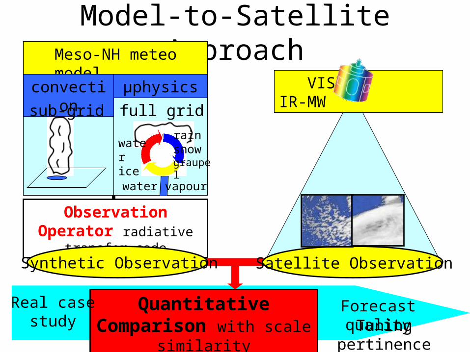
Model-to-Satellite Approach
Observation Operator radiative
transfer codeSatellite ObservationSynthetic Observation
VIS- IR-MW
Quantitative Comparison with scale
similarity
Forecast qualityReal casestudy Tuning
pertinence
Meso-NH meteo model
convection
µphysics
sub-grid full grid
water vapour
water ice
rainsnowgraupel
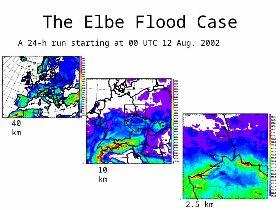
The Elbe Flood CaseA 24-h run starting at 00 UTC 12 Aug. 2002
40 km
10 km
2.5 km
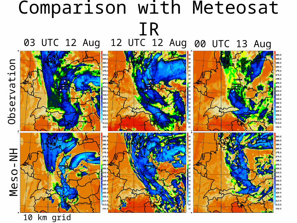
Comparison with Meteosat IR12 UTC 12 Aug 00 UTC 13 Aug
Obse
rvati
on
Meso
-NH
03 UTC 12 Aug
10 km grid
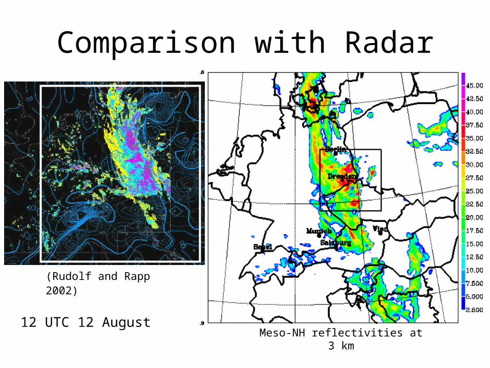
Comparison with Radar
12 UTC 12 August
(Rudolf and Rapp 2002)
Meso-NH reflectivities at 3 km
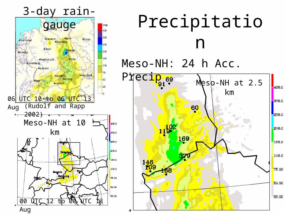
Precipitation3-day rain-
gauge
Meso-NH at 10 km
Meso-NH at 2.5 km
Meso-NH: 24 h Acc. Precip
(Rudolf and Rapp 2002)
00 UTC 12 to 00 UTC 13 Aug
06 UTC 10 to 06 UTC 13 Aug
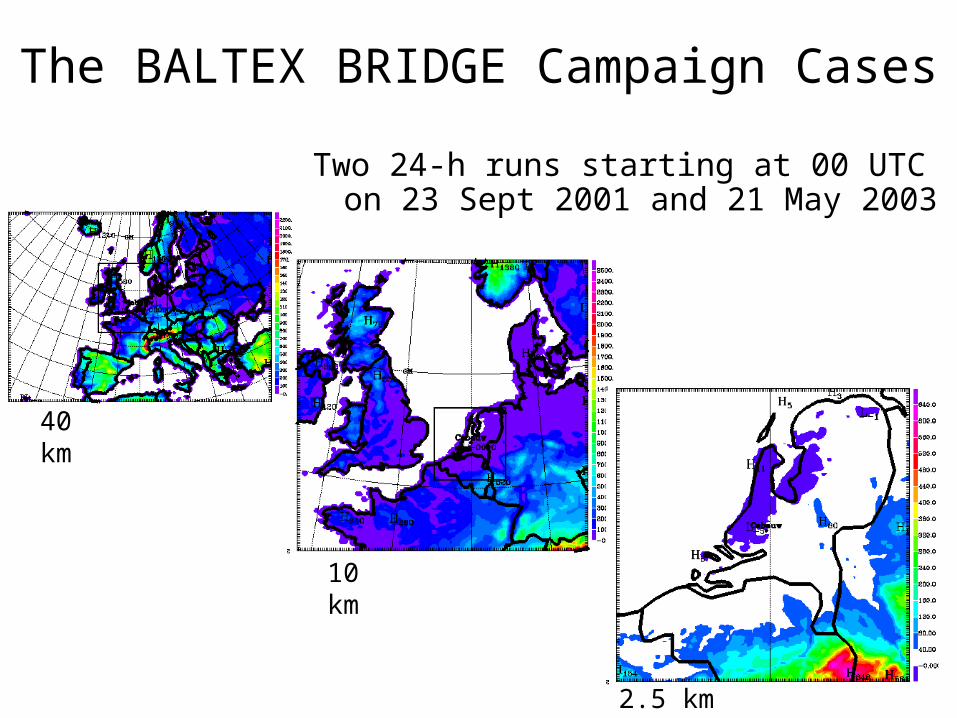
The BALTEX BRIDGE Campaign Cases
Two 24-h runs starting at 00 UTC on 23 Sept 2001 and 21 May 2003
40 km
10 km
2.5 km
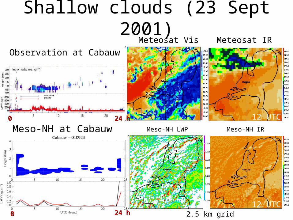
Shallow clouds (23 Sept 2001)Meteosat IR
Meso-NH IR
Observation at CabauwMeteosat Vis
Meso-NH LWPMeso-NH at Cabauw12 UTC
12 UTC
12 UTC
12 UTC00
00 24 h24 h
24 h24 h 2.5 km grid
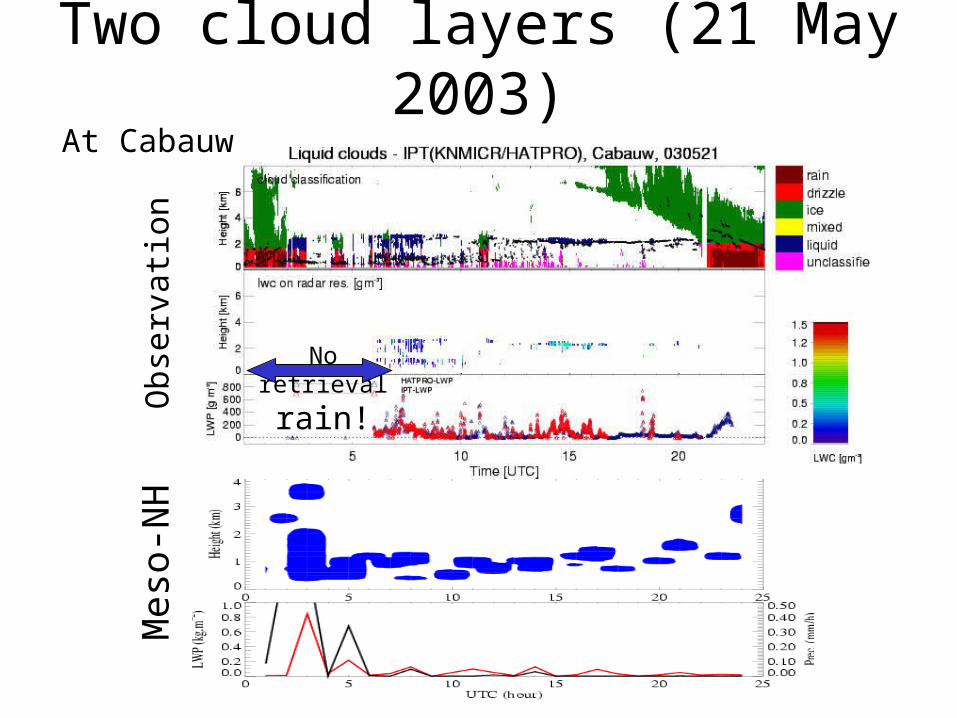
Two cloud layers (21 May 2003)
Meso-NH LWP
12 UTC
12 UTC
12 UTC
Meso
-NH
Obse
rvati
on
No retrieval
rain!
At Cabauw
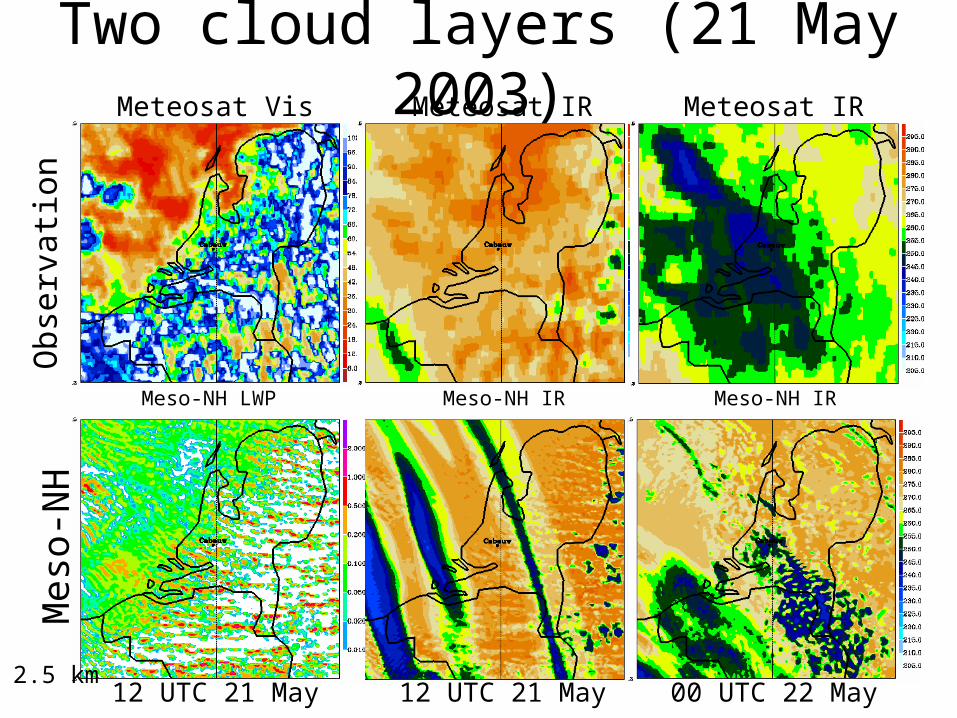
Two cloud layers (21 May 2003)Meteosat IR
Meso-NH IR
Meteosat Vis
Meso-NH LWP
12 UTC 21 May
Obse
rvati
on
Meso
-NH
00 UTC 22 May12 UTC 21 May2.5 km
Meteosat IR
Meso-NH IR
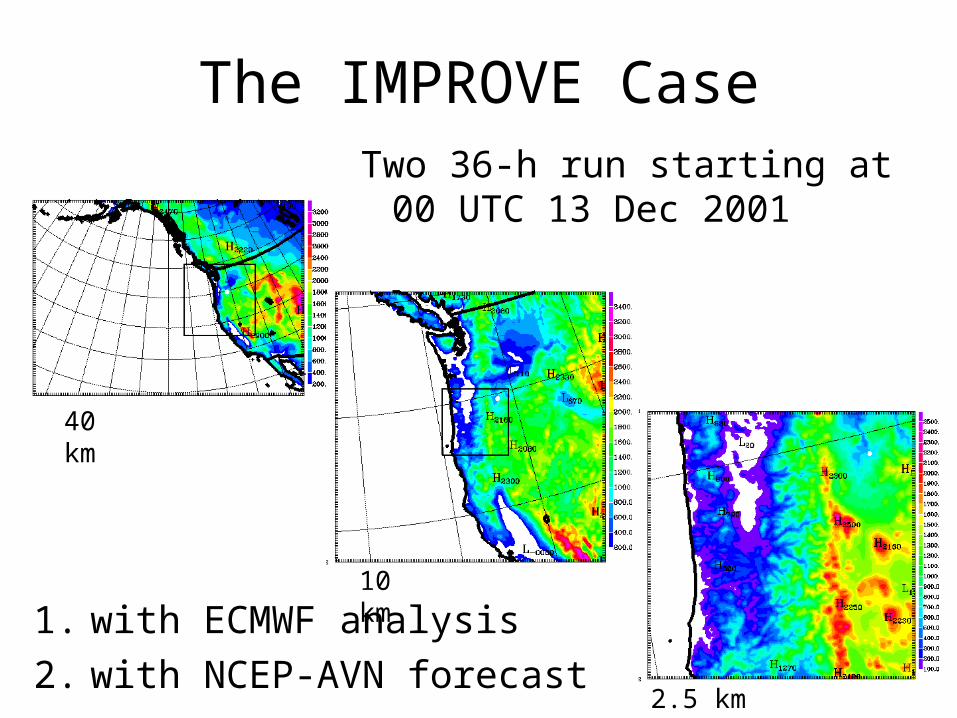
The IMPROVE CaseTwo 36-h run starting at
00 UTC 13 Dec 2001
40 km
10 km
2.5 km
1. with ECMWF analysis2. with NCEP-AVN forecast
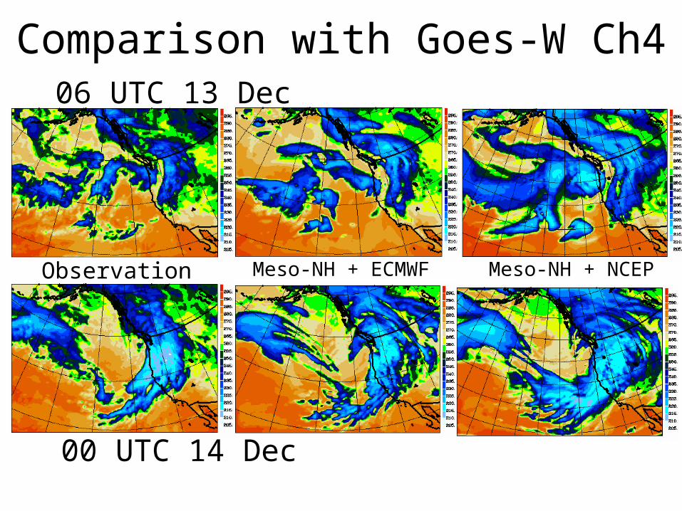
Comparison with Goes-W Ch406 UTC 13 Dec
Observation Meso-NH + ECMWF
00 UTC 14 Dec
Meso-NH + NCEP
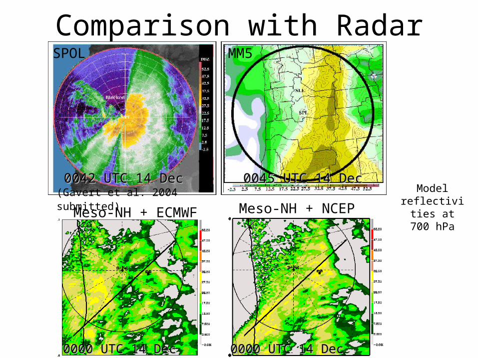
Comparison with Radar
Model reflectivities at 700 hPa
0042 UTC 14 Dec0042 UTC 14 Dec 0045 UTC 14 Dec0045 UTC 14 Dec
Meso-NH + ECMWF Meso-NH + NCEP
0000 UTC 14 Dec0000 UTC 14 Dec
(Gavert et al. 2004 submitted)
0000 UTC 14 Dec0000 UTC 14 Dec
MM5SPOL
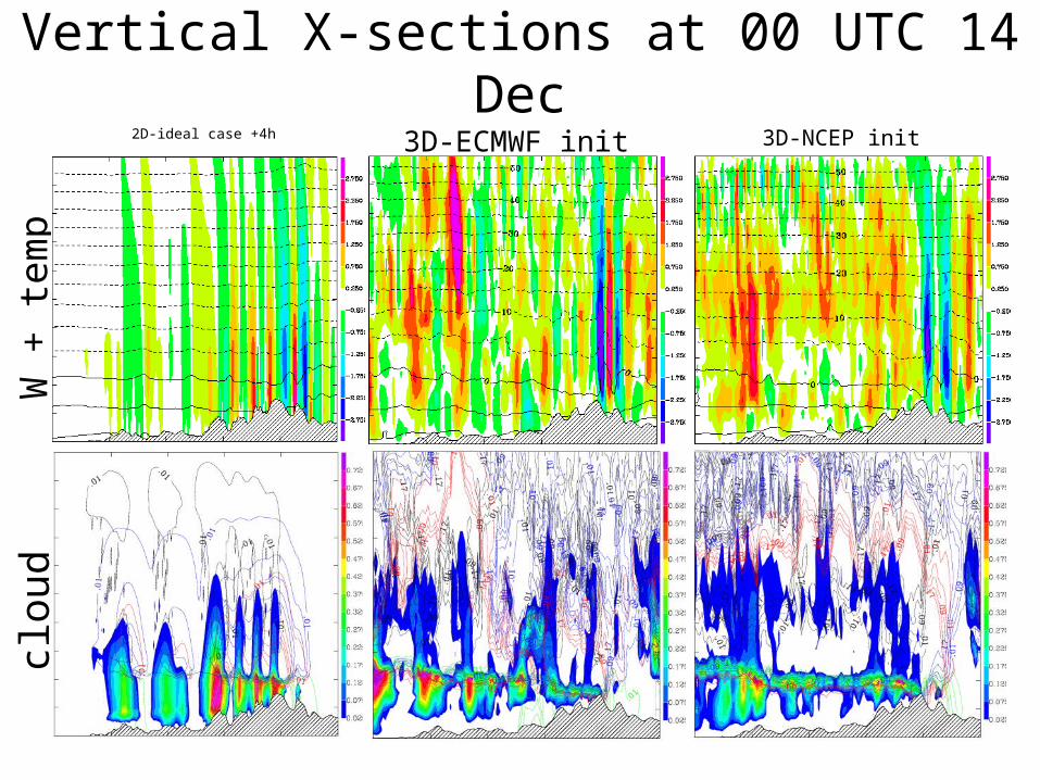
Vertical X-sections at 00 UTC 14 Dec3D-ECMWF init 3D-NCEP init
clou
d
2D-ideal case +4h
W +
tem
p
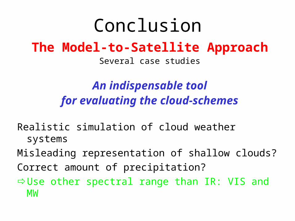
ConclusionThe Model-to-Satellite Approach
Several case studies
An indispensable toolfor evaluating the cloud-schemes
Realistic simulation of cloud weather systemsMisleading representation of shallow clouds?Correct amount of precipitation?Use other spectral range than IR: VIS and MW