Embed Size (px)
Citation preview
The Nature of Geographic Phenomena and the Selection
of Thematic Map Symbols
SP 240 CartographyAlex Chaucer
Spatial Information Technology
Center
Geography Defined
Geography
The science that deals with the analysis of spatially distributed phenomena
Spatial Information Technology
Center
Geography and Geographic Phenomena
Geography• Both a social and physical science• Wide range of research interests• Science of spatial analysis• What? Where? Why?• Geographic inquiry: from architectural to
terrestrial, and everywhere in between
Spatial Information Technology
Center
Geography and Geographic Phenomena
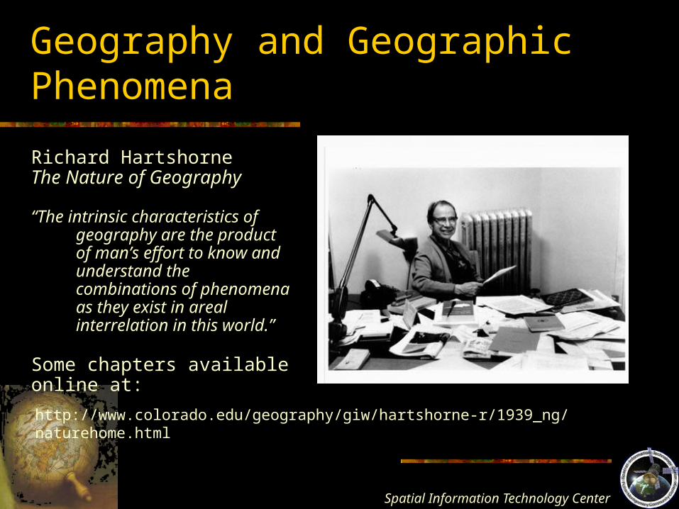
Richard HartshorneThe Nature of Geography
“The intrinsic characteristics of geography are the product of man’s effort to know and understand the combinations of phenomena as they exist in areal interrelation in this world.”
Some chapters availableonline at:
http://www.colorado.edu/geography/giw/hartshorne-r/1939_ng/naturehome.html
Spatial Information Technology
Center
Geography and Geographic Phenomena
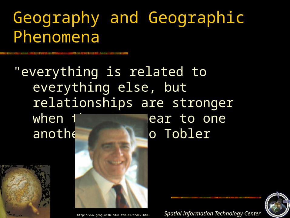
"everything is related to everything else, but relationships are stronger when they are near to one another." Waldo Tobler
http://www.geog.ucsb.edu/~tobler/index.html
Spatial Information Technology
Center
Major Themes in Geographic ResearchAreal or Spatial Association
Study of the functional or causal spatial relation between variables.
E.g. The relation of a floral shop to high rise office buildings.Forms and Processes
Study of the processes that result in spatial distribution.
E.g. The tectonic forces and the distribution and creation of landforms.Spatial Interaction
Study of the interaction/flow of people/goods from place to place.
“forces of attraction” and “friction over distance” are major concepts.
E.g. The development of road networks in response to increases in travel.Distance Decay
Study of the decreasing occurrence of events away from a certain point.
E.g. Influence of a city on a region (nodal area development)
Spatial Information Technology
Center
Key Concepts in Geography
Direction – Absolute: N, S, E, W; Relative: Deep SouthDistance – Usually: Units of Length; Relative: time, costGeographic Scale – Global, Regional, LocalLocation – Absolute: Coordinates; Relative: in relation toDistribution – Points/area; dispersed; agglomeratedLocalization – Spatial ClusteringFunctional Association – Associations cause them to occur
near eachotherSpatial Interaction – one type – spatial diffusion of people,
goods, ideasThe Regional Concept – internal homogeneity sets it apartConcept of Change – geography is dynamic, constant
transformationhttp://www.colorado.edu/geography/gcraft/notes/mapproj/gif/mollweid.gif
Spatial Information Technology
Center
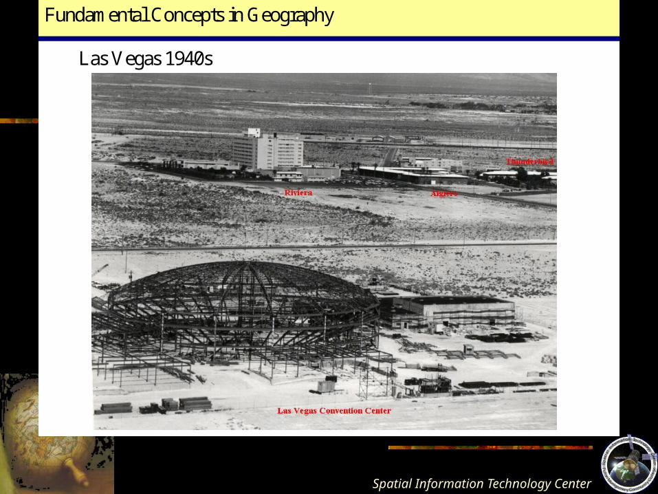
Fundamental Concepts in Geography
Las Vegas 1940s
Spatial Information Technology
Center
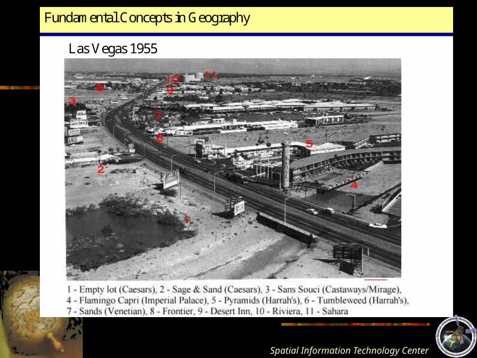
Fundamental Concepts in Geography
Las Vegas 1955
Spatial Information Technology
Center
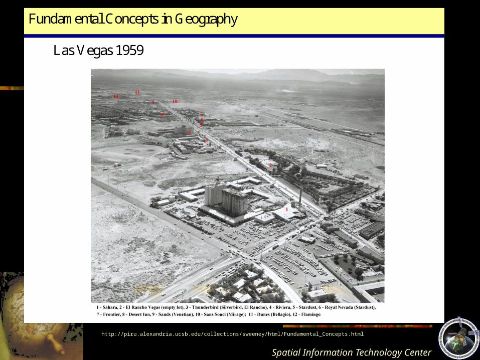
Fundamental Concepts in Geography
Las Vegas 1959
http://piru.alexandria.ucsb.edu/collections/sweeney/html/Fundamental_Concepts.html

Spatial Information Technology
Center
Vegas, baby, Vegas!!!
http://www.directordercenter.com/images/lasvegaspostcards/0180%20Obs%20Las%20Vegas%20Strip%20Sands%20Caesars%20Landmark%20Holidaybg.jpg
Spatial Information Technology
Center
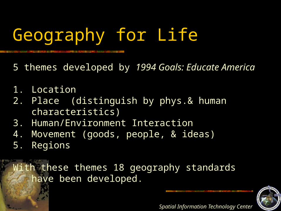
Geography for Life
5 themes developed by 1994 Goals: Educate America
1. Location2. Place (distinguish by phys.& human characteristics)3. Human/Environment Interaction4. Movement (goods, people, & ideas)5. Regions
With these themes 18 geography standards have been developed.
Spatial Information Technology
Center
Measurement in Geography
Geographic phenomena vs. geographic data
Geographic phenomena – elements of reality that have spatial attributes; any spatial phenomena can be the subject of geographical analysis within the limits of scale
Geographic Data – facts about which conclusions can be drawn; chosen to describe geographic phenomena; associated with a spatial dimension
Spatial Information Technology
Center
Spatial Dimensions of Geographic Phenomena
http://en.wikipedia.org/wiki/Image:PetersMap.jpg
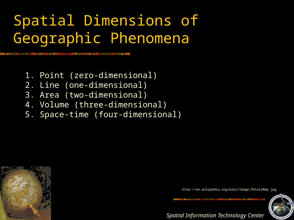
1. Point (zero-dimensional)2. Line (one-dimensional)3. Area (two-dimensional)4. Volume (three-dimensional)5. Space-time (four-dimensional)
Spatial Information Technology
Center
Spatial Dimensions of Geographic Phenomena
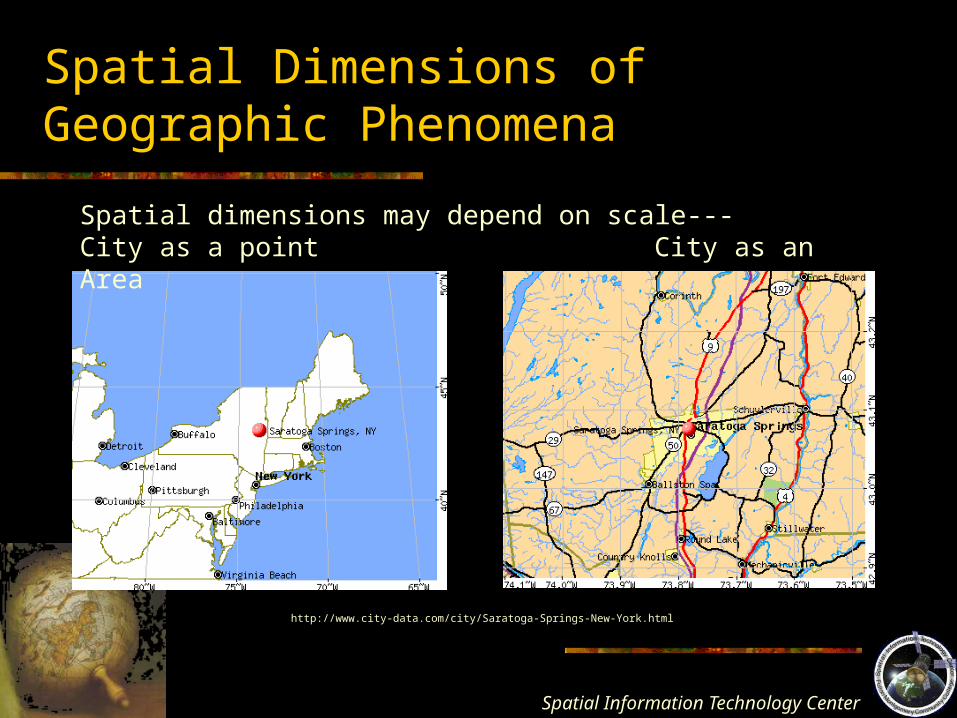
Spatial dimensions may depend on scale---City as a point City as an Area
http://www.city-data.com/city/Saratoga-Springs-New-York.html
Spatial Information Technology
Center
Discrete, Sequential, and Continuous Phenomena
Discrete – do not occur between spatial observations; distinguishable individual entities or counting units
Sequential – lines or linear phenomena; a
series of points or discrete elements. Roads, phone lines, etc.
Continuous – extend unbroken and without interruptions, elevation, temperature, etc.Fractional parts are allowed.
Spatial Information Technology
Center
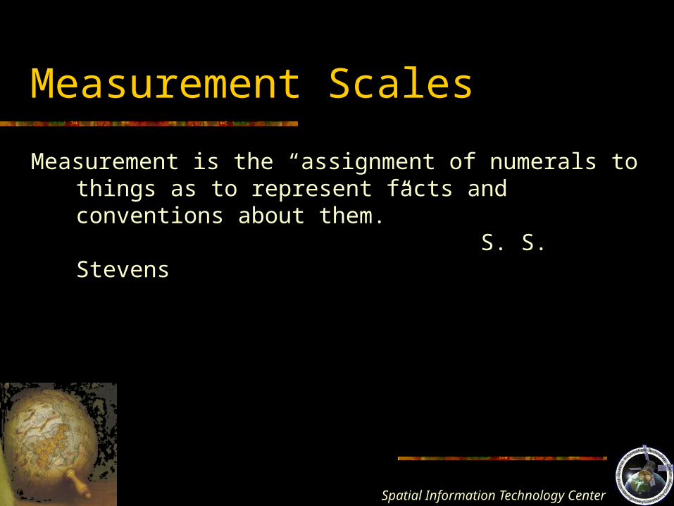
Measurement Scales
Measurement is the “assignment of numerals to things as to represent facts and conventions about them.”
S. S. Stevens
Spatial Information Technology
Center
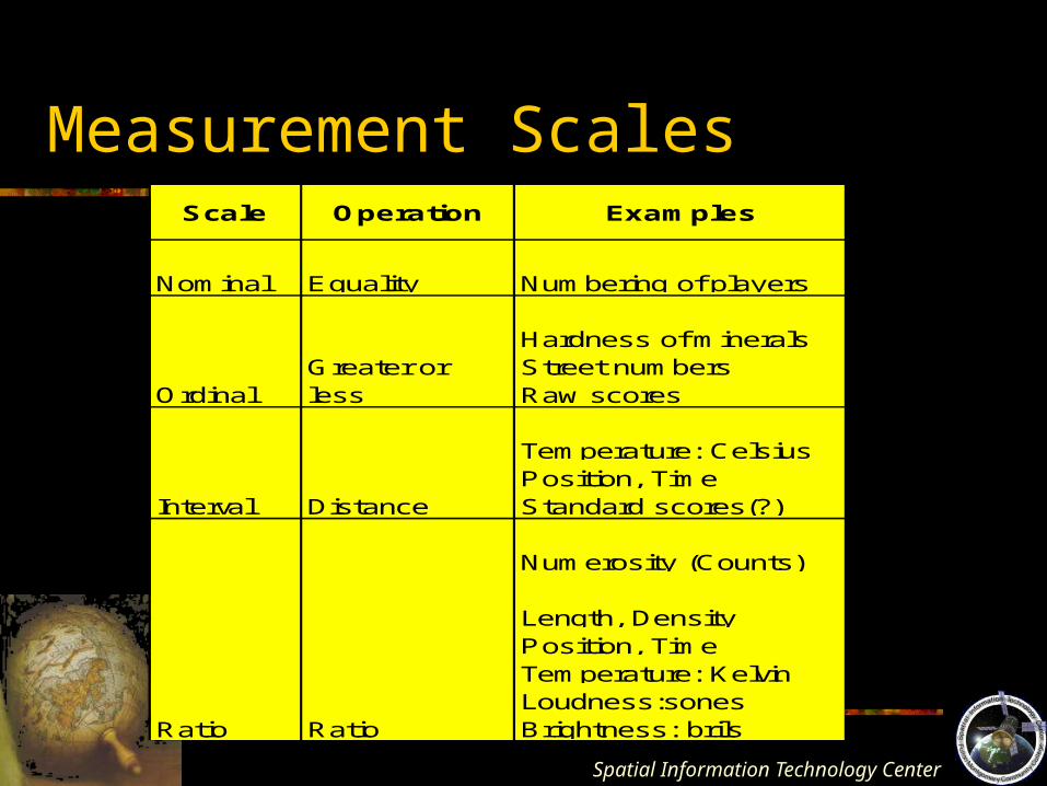
Measurement ScalesScale Operation Examples
Nominal Equality Numbering of players
Hardness of mineralsStreet numbersRaw scores
Temperature: CelsiusPosition, TimeStandard scores(?)
Numerosity (Counts)
Length, DensityPosition, TimeTemperature: KelvinLoudness:sonesBrightness: brils
Interval Distance
OrdinalGreater or less
Ratio Ratio
Spatial Information Technology
Center
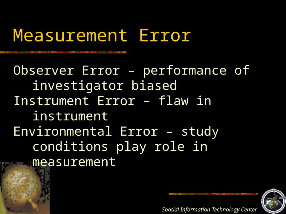
Measurement Error
Observer Error – performance of investigator biased
Instrument Error – flaw in instrumentEnvironmental Error – study conditions play role
in measurement
Spatial Information Technology
Center
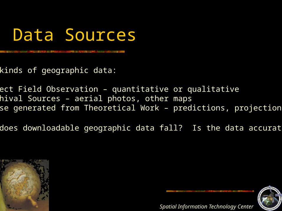
Data Sources
Three kinds of geographic data:
1. Direct Field Observation – quantitative or qualitative2. Archival Sources – aerial photos, other maps3. Those generated from Theoretical Work – predictions, projections, models
Where does downloadable geographic data fall? Is the data accurate?
Spatial Information Technology
Center
The Geographic Areal Unit
http://en.wikipedia.org/wiki/Image:PetersMap.jpg
Natural Areal UnitsGeographic elements in two dimensionsE.g. Lakes, countries, farms, cities
Artificial Areal UnitsImposed by researchers to organize data ans facilitate data collectionE.g. Regions, Metropolitan Statistical Areas (MSAs), and census tracts
Single Areal UnitsCan be used to make inferences about the aggregate
Aggregate Areal UnitsComposed of several singular areal units

Spatial Information Technology
Center
The Multidimensional Characteristic of Thematic Map Symbols
Symbol Selection Wide choices for the cartographer Based on
Logic Geographic phenomena Graphic choices
What symbol best represents what I am to show Limited by
Cartographic convention – may already be a standard symbol Audience limitations – keep it simple
Spatial Information Technology
Center
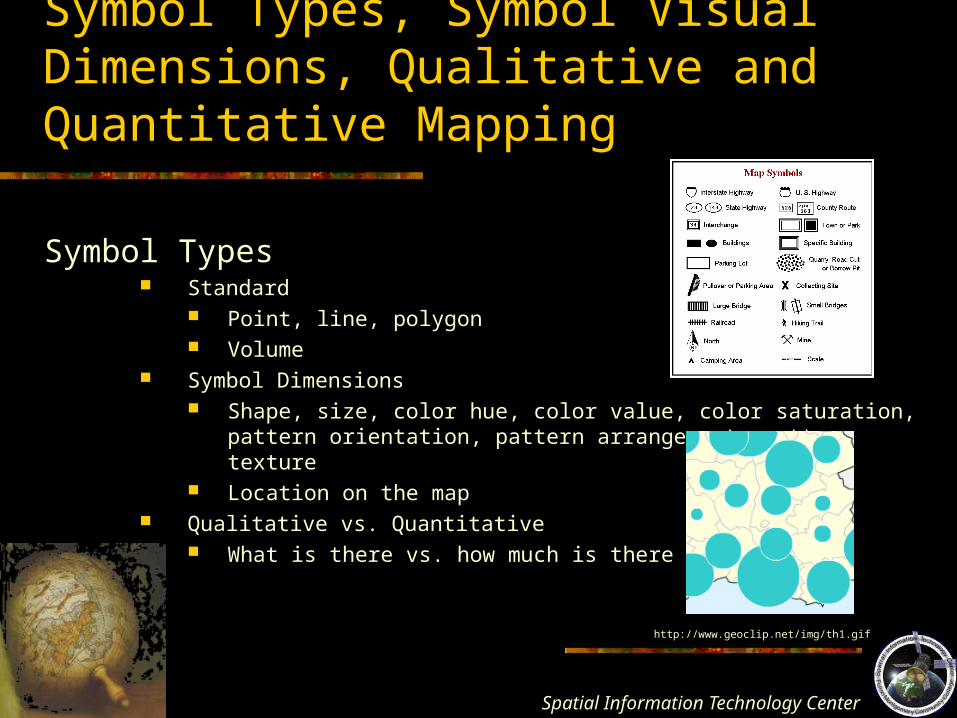
Symbol Types, Symbol Visual Dimensions, Qualitative and Quantitative Mapping
Symbol Types
Standard Point, line, polygon Volume
Symbol Dimensions Shape, size, color hue, color value, color saturation, pattern orientation,
pattern arrangement, pattern texture Location on the map
Qualitative vs. Quantitative What is there vs. how much is there
http://www.geoclip.net/img/th1.gif
Spatial Information Technology
Center
Characteristics of Geographic Phenomena and Symbol Selection
Map symbols The language of maps
“As elements in a constructed view of reality, cartographic symbols mustcommunicate differences among geographic features, functional relationships,
and relative significance” Monmonier
Spatial Information Technology
Center
Characteristics of Geographic Phenomena and Symbol Selection
Functions of map symbols
1. Portray a location and it’s neighbors
2. Causal relationships among features
3. Routes
4. Phenomena with multiple instances
5. Variation in count or magnitude
6. Variation in density
Select a symbolization plan that best portrays the appropriate concept in geography.
Spatial Information Technology
Center
Enumeration Data, Geographical Units, and Census Definitions
• Provided by federal government census• Aggregated data• Tabulated by specific geographic area• What are the geographic units?
Spatial Information Technology
Center
The United States Census
Census of Population and Housing Decennial census Since 1790 “head count” for determining the House of Representatives Single best source to geographic researchers for
broad-based demographic data socioeconomic data
Spatial Information Technology
Center
The United States Census
Census Geography The divisions and descriptions of areal entities, both political and statistical;
used to tabulate census (enumerated) data E.g. Census regions, census divisions, states, metropolitan areas,
counties, minor civil divisions, census tracts, block groups, blocks, etc. Governmental area units – established by law, really exist and are marked on the
landscapeStatistical Area Units – established merely for the convenience of enumeration and
tabulation
What are those above?
Spatial Information Technology
Center
Census Resources Online
www.census.govAmerican Factfinder
NYS Census data:http://www.nylovesbiz.com/nysdc/default.asp
Can download geographic census files and attribute tables for NYS.