Embed Size (px)
Citation preview
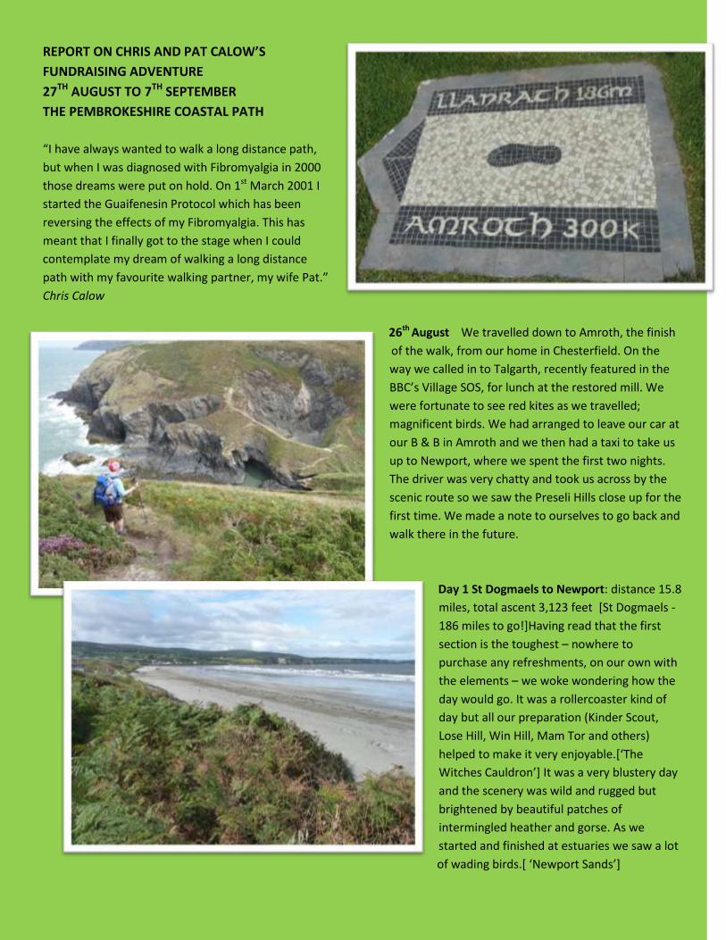
REPORT ON CHRIS AND PAT CALOW’S
FUNDRAISING ADVENTURE
27TH AUGUST TO 7TH SEPTEMBER
THE PEMBROKESHIRE COASTAL PATH
“I have always wanted to walk a long distance path,
but when I was diagnosed with Fibromyalgia in 2000
those dreams were put on hold. On 1st March 2001 I
started the Guaifenesin Protocol which has been
reversing the effects of my Fibromyalgia. This has
meant that I finally got to the stage when I could
contemplate my dream of walking a long distance
path with my favourite walking partner, my wife Pat.”
Chris Calow
26th August We travelled down to Amroth, the finish
of the walk, from our home in Chesterfield. On the
way we called in to Talgarth, recently featured in the
BBC’s Village SOS, for lunch at the restored mill. We
were fortunate to see red kites as we travelled;
magnificent birds. We had arranged to leave our car at
our B & B in Amroth and we then had a taxi to take us
up to Newport, where we spent the first two nights.
The driver was very chatty and took us across by the
scenic route so we saw the Preseli Hills close up for the
first time. We made a note to ourselves to go back and
walk there in the future.
Day 1 St Dogmaels to Newport: distance 15.8
miles, total ascent 3,123 feet [St Dogmaels -
186 miles to go!]Having read that the first
section is the toughest – nowhere to
purchase any refreshments, on our own with
the elements – we woke wondering how the
day would go. It was a rollercoaster kind of
day but all our preparation (Kinder Scout,
Lose Hill, Win Hill, Mam Tor and others)
helped to make it very enjoyable.[‘The
Witches Cauldron’] It was a very blustery day
and the scenery was wild and rugged but
brightened by beautiful patches of
intermingled heather and gorse. As we
started and finished at estuaries we saw a lot
of wading birds.[ ‘Newport Sands’]
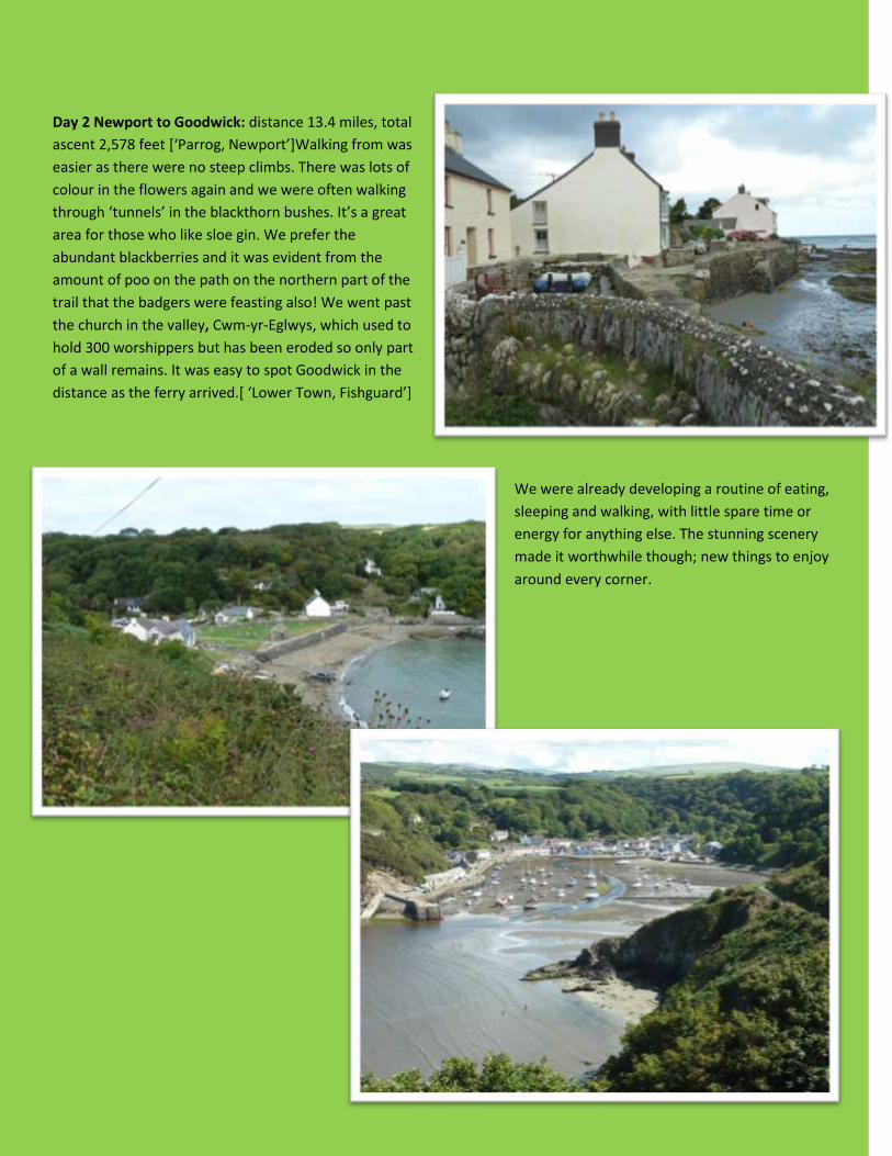
Day 2 Newport to Goodwick: distance 13.4 miles, total
ascent 2,578 feet [‘Parrog, Newport’]Walking from was
easier as there were no steep climbs. There was lots of
colour in the flowers again and we were often walking
through ‘tunnels’ in the blackthorn bushes. It’s a great
area for those who like sloe gin. We prefer the
abundant blackberries and it was evident from the
amount of poo on the path on the northern part of the
trail that the badgers were feasting also! We went past
the church in the valley, Cwm-yr-Eglwys, which used to
hold 300 worshippers but has been eroded so only part
of a wall remains. It was easy to spot Goodwick in the
distance as the ferry arrived.[ ‘Lower Town, Fishguard’]
We were already developing a routine of eating,
sleeping and walking, with little spare time or
energy for anything else. The stunning scenery
made it worthwhile though; new things to enjoy
around every corner.

Day 3 Goodwick to Abercastle: distance 16.7 miles,
total ascent 3,120 feet
We set off later than usual and it was hot and sunny
all day. The cliffs above Goodwick were a carpet of
colour and there was much to see and distract us
(grey seals and pups, numerous different butterflies,
a grasshopper, a pair of choughs).[ ‘Seals relaxing in
the morning sunshine’]Our coffee stop was on Carreg
Goffa which was the scene of the last invasion of
Britain. [ ‘Memorial erected in 1897 to commemorate
landing of the French’]The Lighthouse at Strumble
Head was a good landmark and a popular spot for
birdwatchers. [ ‘Strumble Head’]
We had relaxed and found ourselves behind schedule; only
half the distance covered but in rather more than half the
allotted time. This made for a tough afternoon as
we had to really increase our pace. This was made
more difficult as we could not see Abercastle
[‘Abercastle’] until almost there as it is tucked away
in a small ‘fjord’. Leaving the path we had quite a
walk up to our B & B, as happened most days.

Day 4 Abercastle to St Justinian’s:
distance 15.7 miles, total ascent 2,627
feet
Today was generally cloudy but warm,
with good walking becoming more
difficult towards St David’s Head. We saw
more seal pups and a peregrine falcon. At
Porthgain there is a restored brickworks.
The little harbour was used between 1837
and 1931 for the export of roadstone,
slates and bricks.
Next was Abereiddi where there is a
flooded former quarry, known as the Blue
Lagoon. It was being used by people
practising for coasteering. As we
progressed we came under the shadow of
Penberry, one of three high points on St
David’s Head. On reaching St Justinian’s
we opted to catch the local shuttle bus
into St David’s for our B & B; otherwise it
was a walk of a further two miles along
roads.

Day 5 St Justinian’s to Nolton Haven:
18.1 miles, total ascent 3,044 feet
It was a warm day, sunny in the
morning but cloudy later. By being very
organised, we managed to catch an
early shuttle bus back to the trail at St
Justinian’s. As we walked the path close
to Ramsey Island we could see and hear
the Irish Sea rushing through Ramsey
Sound – exhilarating! We passed
through the very picturesque harbour of
Porth Clais which has two fairly intact
lime kilns. These are a feature of almost
every sheltered inlet where a small
sailing boat could unload.
The lime was burnt and then spread on
the fields. Soon afterwards we came across Ben Fogle and a group of others on the path, all in wetsuits so not walking.
To our surprise we made it as far as Solva for our lunch stop. This is another very picturesque harbour, again reminding
us of a fjord. It is a place we have stayed at several times on family holidays with our sons.
After a while we came to
Newgale where there is
Pembrokeshire’s most
impressive sandy beach –
nearly 2 ½ miles of level sand.
We walked on to Nolton Haven
to shorten the next day’s walk
and were picked up there by a
pre-arranged taxi which took
us to our B & B in Broad Haven
(and back again the next day).
Day 6 Nolton Haven to Marloes
Sands:
16.4 miles, total ascent 2,562 feet
Another day of clear blue sky and
high temperature. This was the
best day for butterflies of all
colours – brown, blue, white,
yellow and orange – some of which
we had never seen before. We had
our lunch near to St Bride’s Castle
(actually a former baronial
residence) and passed several
excellent beaches – Broad Haven,
Little Haven,[‘Little Haven’].
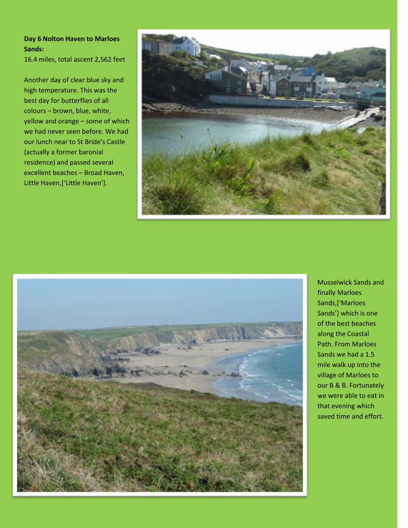
Musselwick Sands and
finally Marloes
Sands,[‘Marloes
Sands’] which is one
of the best beaches
along the Coastal
Path. From Marloes
Sands we had a 1.5
mile walk up into the
village of Marloes to
our B & B. Fortunately
we were able to eat in
that evening which
saved time and effort.
Day 7 Marloes Sands to Sandy Haven:
14 miles, total ascent 2,040 feet
The day started well, being very sunny and warm but
after about six miles Pat had to admit that the thigh
muscle which had been troublesome since setting off
was now so painful that she could not complete this
section. After sending a text to our prayer circle
requesting specific prayer, we slowly made our way
to Dale [St Brides] (Pat having to walk backwards
down into the village) where Pat retired. We
contacted our hosts for that night, who not only
agreed to Pat coming in early but came to pick her up
and gave her such TLC that she was able to resume
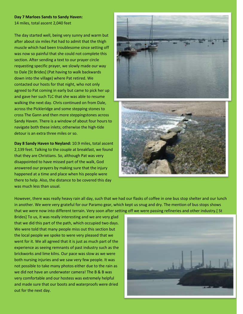
walking the next day. Chris continued on from Dale,
across the Pickleridge and some stepping stones to
cross The Gann and then more steppingstones across
Sandy Haven. There is a window of about four hours to
navigate both these inlets; otherwise the high-tide
detour is an extra three miles or so.
Day 8 Sandy Haven to Neyland: 10.9 miles, total ascent
2,139 feet. Talking to the couple at breakfast, we found
that they are Christians. So, although Pat was very
disappointed to have missed part of the walk, God
answered our prayers by making sure that the injury
happened at a time and place when his people were
there to help. Also, the distance to be covered this day
was much less than usual.
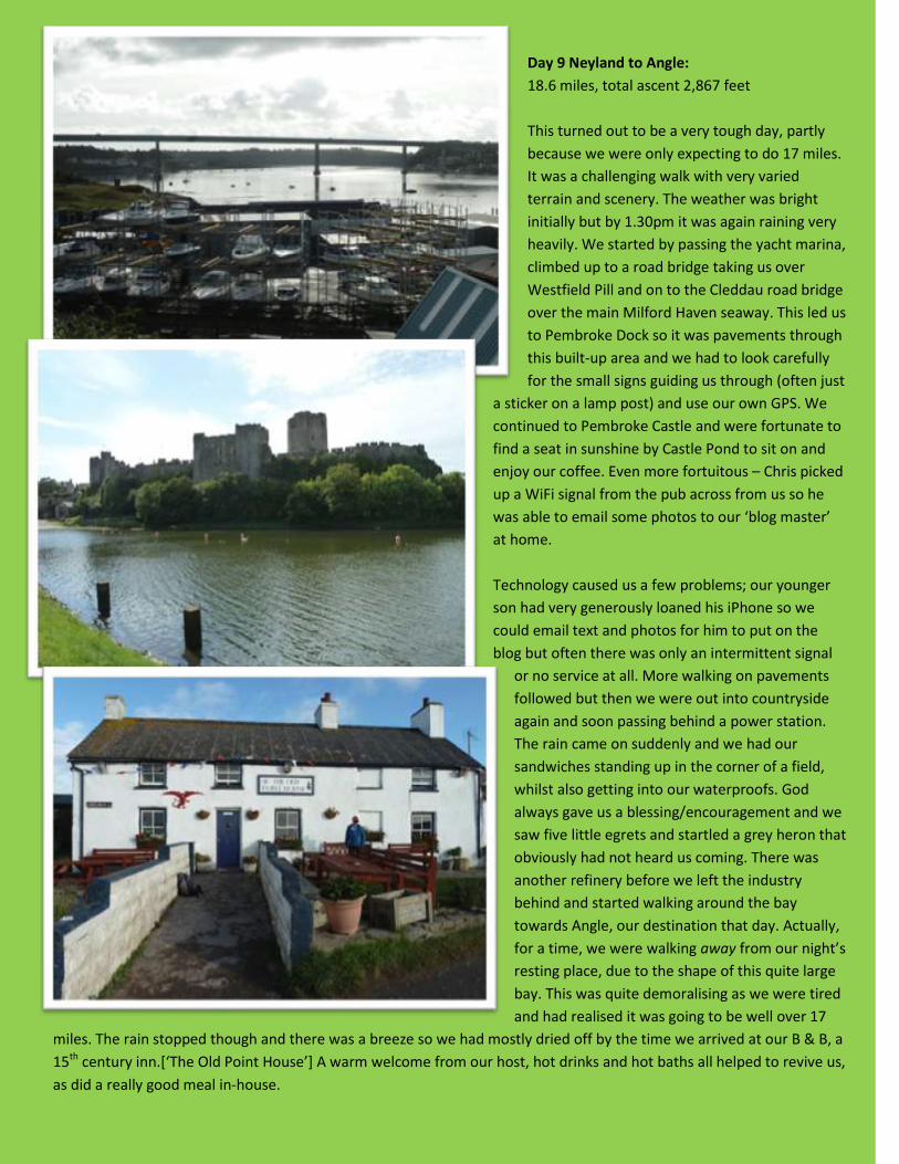
However, there was really heavy rain all day, such that we had our flasks of coffee in one bus stop shelter and our lunch
in another. We were very grateful for our Paramo gear, which kept us snug and dry. The mention of bus stops shows
that we were now into different terrain. Very soon after setting off we were passing refineries and other industry.[ St
Brides] To us, it was really interesting and we are very glad
that we did this part of the path, which occupied two days.
We were told that many people miss out this section but
the local people we spoke to were very pleased that we
went for it. We all agreed that it is just as much part of the
experience as seeing remnants of past industry such as the
brickworks and lime kilns. Our pace was slow as we were
both nursing injuries and we saw very few people. It was
not possible to take many photos either due to the rain as
we did not have an underwater camera! The B & B was
very comfortable and our hostess was extremely helpful
and made sure that our boots and waterproofs were dried
out for the next day.
Day 9 Neyland to Angle:
18.6 miles, total ascent 2,867 feet
This turned out to be a very tough day, partly
because we were only expecting to do 17 miles.
It was a challenging walk with very varied
terrain and scenery. The weather was bright
initially but by 1.30pm it was again raining very
heavily. We started by passing the yacht marina,
climbed up to a road bridge taking us over
Westfield Pill and on to the Cleddau road bridge
over the main Milford Haven seaway. This led us
to Pembroke Dock so it was pavements through
this built-up area and we had to look carefully
for the small signs guiding us through (often just
a sticker on a lamp post) and use our own GPS. We
continued to Pembroke Castle and were fortunate to
find a seat in sunshine by Castle Pond to sit on and
enjoy our coffee. Even more fortuitous – Chris picked
up a WiFi signal from the pub across from us so he
was able to email some photos to our ‘blog master’
at home.
Technology caused us a few problems; our younger
son had very generously loaned his iPhone so we
could email text and photos for him to put on the
blog but often there was only an intermittent signal
or no service at all. More walking on pavements
followed but then we were out into countryside
again and soon passing behind a power station.
The rain came on suddenly and we had our
sandwiches standing up in the corner of a field,
whilst also getting into our waterproofs. God
always gave us a blessing/encouragement and we
saw five little egrets and startled a grey heron that
obviously had not heard us coming. There was
another refinery before we left the industry
behind and started walking around the bay
towards Angle, our destination that day. Actually,
for a time, we were walking away from our night’s
resting place, due to the shape of this quite large
bay. This was quite demoralising as we were tired
and had realised it was going to be well over 17
miles. The rain stopped though and there was a breeze so we had mostly dried off by the time we arrived at our B & B, a
15th century inn.[‘The Old Point House’] A warm welcome from our host, hot drinks and hot baths all helped to revive us,
as did a really good meal in-house.
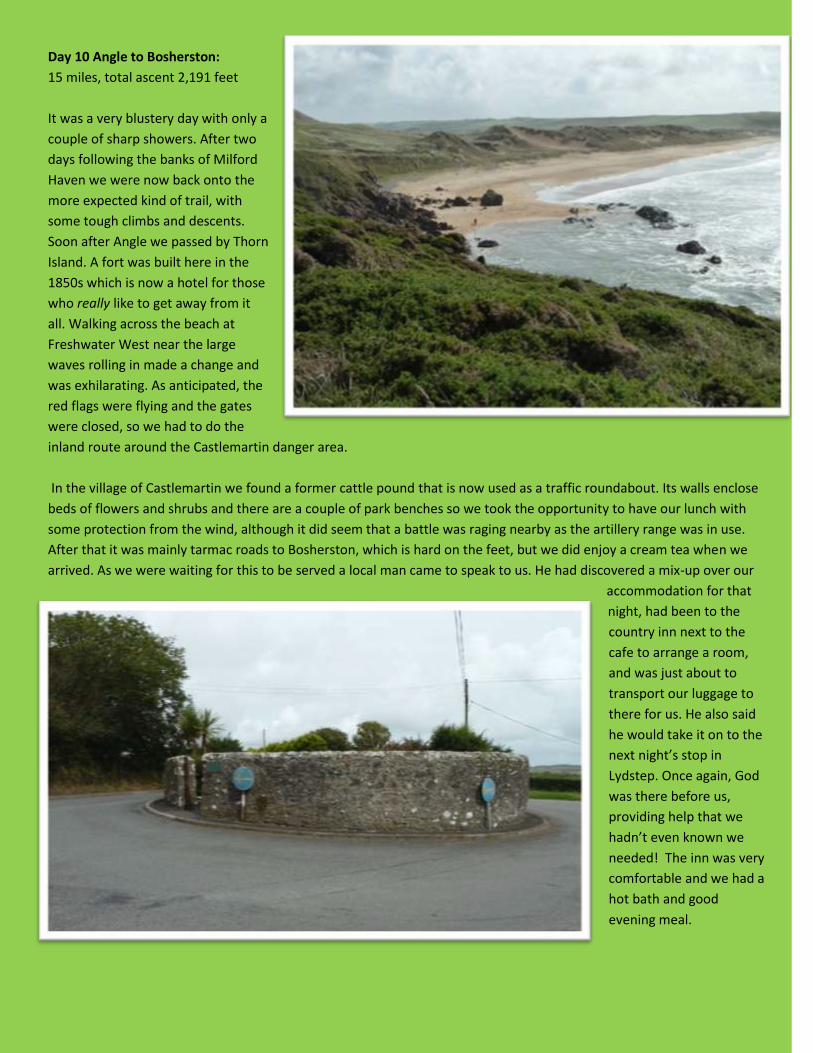
Day 10 Angle to Bosherston:
15 miles, total ascent 2,191 feet
It was a very blustery day with only a
couple of sharp showers. After two
days following the banks of Milford
Haven we were now back onto the
more expected kind of trail, with
some tough climbs and descents.
Soon after Angle we passed by Thorn
Island. A fort was built here in the
1850s which is now a hotel for those
who really like to get away from it
all. Walking across the beach at
Freshwater West near the large
waves rolling in made a change and
was exhilarating. As anticipated, the
red flags were flying and the gates
were closed, so we had to do the
inland route around the Castlemartin danger area.
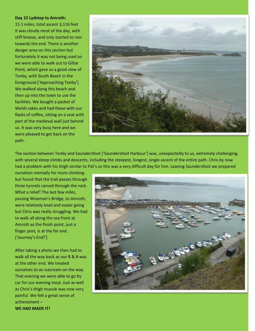
In the village of Castlemartin we found a former cattle pound that is now used as a traffic roundabout. Its walls enclose
beds of flowers and shrubs and there are a couple of park benches so we took the opportunity to have our lunch with
some protection from the wind, although it did seem that a battle was raging nearby as the artillery range was in use.
After that it was mainly tarmac roads to Bosherston, which is hard on the feet, but we did enjoy a cream tea when we
arrived. As we were waiting for this to be served a local man came to speak to us. He had discovered a mix-up over our
accommodation for that
night, had been to the
country inn next to the
cafe to arrange a room,
and was just about to
transport our luggage to
there for us. He also said
he would take it on to the
next night’s stop in
Lydstep. Once again, God
was there before us,
providing help that we
hadn’t even known we
needed! The inn was very
comfortable and we had a
hot bath and good
evening meal.

Day 11 Bosherston to Lydstep:
14.9 miles, total ascent 3,182 feet
There was a very strong wind all day and one
very heavy shower, which came when we were
literally only two minutes from our B & B.
Shouldn’t have taken that extra photo and had
those few more blackberries! We saw two grey
herons and one little egret at Bosherston Lily
Ponds, a beautiful place that we have visited
several times in the past. The waves were
crashing onto the cliffs as we walked along and
then we came around and down into Barafundle
Bay (Pat’s favourite beach) and it was calm and
there was a grey seal looking at us from the
water.
We had coffee and cake at the National Trust’s
Boathouse cafe at Stackpole Quay; what a
treat to have real coffee. Our lunch stop was
more basic – a stile overlooking Swanlake Bay.
Next was Manorbier, where there is a castle
that was used in the BBC’s series of The Lion,
the Witch and the Wardrobe made many years
ago. After that it was not far to Lydstep,
passing Manorbier camp on the way. This was
another challenging day, with many ascents
and descents. We were really looking forward
to completing the final section and then having
a day off!!
Day 12 Lydstep to Amroth:
15.1 miles, total ascent 3,116 feet
It was cloudy most of the day, with
stiff breeze, and only started to rain
towards the end. There is another
danger area on this section but
fortunately it was not being used so
we were able to walk out to Giltar
Point, which gave us a good view of
Tenby, with South Beach in the
foreground.[‘Approaching Tenby’]
We walked along this beach and
then up into the town to use the
facilities. We bought a packet of
Welsh cakes and had these with our
flasks of coffee, sitting on a seat with
part of the medieval wall just behind
us. It was very busy here and we
were pleased to get back on the
path.
The section between Tenby and Saundersfoot [‘Saundersfoot Harbour’] was, unexpectedly to us, extremely challenging,
with several steep climbs and descents, including the steepest, longest, single ascent of the entire path. Chris by now
had a problem with his thigh similar to Pat’s so this was a very difficult day for him. Leaving Saundersfoot we prepared
ourselves mentally for more climbing
but found that the trail passes through
three tunnels carved through the rock.
What a relief! The last few miles,
passing Wiseman’s Bridge, to Amroth,
were relatively level and easier going
but Chris was really struggling. We had
to walk all along the sea front at
Amroth as the finish point, just a
finger post, is at the far end.
[‘Journey’s End!’]
After taking a photo we then had to
walk all the way back as our B & B was
at the other end. We treated
ourselves to an icecream on the way.
That evening we were able to go by
car for our evening meal. Just as well
as Chris’s thigh muscle was now very
painful. We felt a great sense of
achievement –
WE HAD MADE IT!
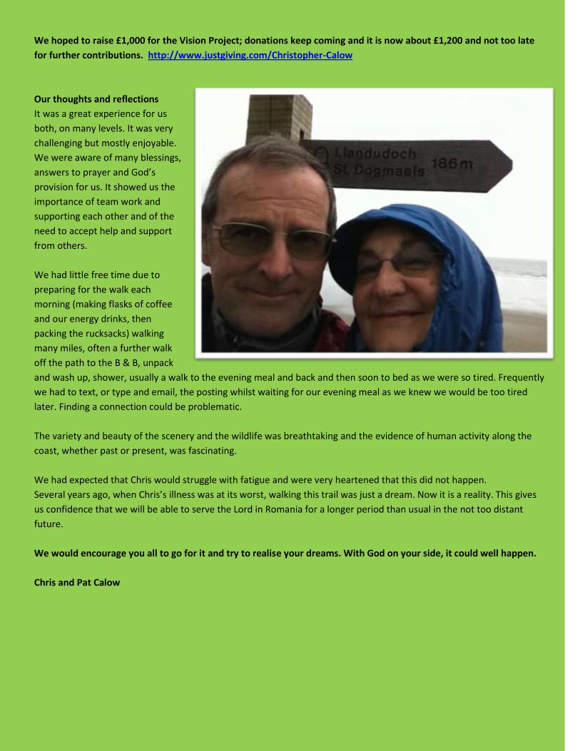
We hoped to raise £1,000 for the Vision Project; donations keep coming and it is now about £1,200 and not too late
for further contributions. http://www.justgiving.com/Christopher-Calow
Our thoughts and reflections
It was a great experience for us
both, on many levels. It was very
challenging but mostly enjoyable.
We were aware of many blessings,
answers to prayer and God’s
provision for us. It showed us the
importance of team work and
supporting each other and of the
need to accept help and support
from others.
We had little free time due to
preparing for the walk each
morning (making flasks of coffee
and our energy drinks, then
packing the rucksacks) walking
many miles, often a further walk
off the path to the B & B, unpack
and wash up, shower, usually a walk to the evening meal and back and then soon to bed as we were so tired. Frequently
we had to text, or type and email, the posting whilst waiting for our evening meal as we knew we would be too tired
later. Finding a connection could be problematic.
The variety and beauty of the scenery and the wildlife was breathtaking and the evidence of human activity along the
coast, whether past or present, was fascinating.
We had expected that Chris would struggle with fatigue and were very heartened that this did not happen.
Several years ago, when Chris’s illness was at its worst, walking this trail was just a dream. Now it is a reality. This gives
us confidence that we will be able to serve the Lord in Romania for a longer period than usual in the not too distant
future.
We would encourage you all to go for it and try to realise your dreams. With God on your side, it could well happen.
Chris and Pat Calow