Embed Size (px)
Citation preview

Page 1 of 61 19 July 2019 Private Route Histories 201 - 225
SYDNEY PRIVATE BUS ROUTES
Brief histories from 1925 to the present of private bus services
in the metropolitan area of Sydney, New South Wales, Australia
Route Histories
Routes 201 – 225
in the 1925 number system
A work in progress. Corrections and comments welcome – [email protected]
All routes in this section have ceased.
Route 201
ROSEVILLE – EAST ROSEVILLE – ROSEVILLE CHASE
Extended from East Roseville to Roseville Baths (selected trips)
(Roseville Baths were located at foot of Babbage Rd, adjacent to old Roseville
Bridge.)
Timeline
As at date of Govt Gazette 13 November 1925: Roseville – Roseville Chase (terminus in Clive St [now Babbage
Rd] at Chase Gates, possibly located near current Babbage Rd/Warrane Rd, East Roseville) being operated by Elias J
Jones.
Later: Extended from Roseville Chase (at Chase Gates) to Roseville Baths.
1 March 1930: Transferred to Royle Bros (Eric & Trevor Royle).
May 1938: Operator incorporated (as Royle Bros Pty Ltd).
By June 1948: Main service was Roseville – Babbage Rd, East Roseville, but selected trips extended to Roseville
Baths.
By December 1953: Selected trips also extended from Babbage Rd to Griffith Av, East Roseville.
By 10 December 1960: Selected trips also extended from Babbage Rd to Warrane Rd, East Roseville.
By 27 January 1962: Griffith Av trips ceased. Partly replaced by new route, 56 Chatswood – Castle Cove.
February 1964: Operator’s name changed to Forest Coach Lines (Royle family).
By 19 May 1964: Roseville Baths extension ceased. Most trips ran Roseville – Warrane Rd, East Roseville.
24 May 1965: Ceased without direct replacement (but 56 continued to run Chatswood – East Roseville and beyond).
Streets
Roseville – Roseville Chase 1925 (Source: Govt Gazette of 13 November 1925)
From Roseville (Lord St at Hill St) via Lord St, Glen St [now Glencroft Av], Bancroft Av, Archbold Rd, Addison Av,
Clive St [now Babbage Rd] to Chase Gates (Roseville Chase).
From Roseville Chase (Clive St [now Babbage Rd] at Chase Gates) via Clive St, Addison Av, Archbold Rd, Bancroft
Av, Hill St, Lord St to near Hill St (Roseville).
Circa 1946 (Source: Gregory’s Street Directory)
From Roseville (station) via Lord St, Glencroft St [now Av], Bancroft Av, Archbold Rd, Addison Av, Babbage Rd
(Roseville Chase).

Page 2 of 61 19 July 2019 Private Route Histories 201 - 225
Roseville – East Roseville 1963 (Source: RGH notes)
From Roseville (Lord St at Hill St) via Lord St, Glencroft Av, Bancroft Av, Archbold Rd, Addison Av, Moore St,
Duntroon Av, Warrane Rd, Babbage Rd, Addison Av to near Babbage Rd (East Roseville).
From East Roseville (Addison Av at Babbage Rd) via Addison Av, Archbold Rd, Bancroft Av, Hill St, Lord St to
near Hill St (Roseville).
Trips via Babbage Rd (not via Warrane Rd): Ex Roseville from Duntroon Av via Babbage Rd to Addison Av.
Roseville Baths extension: Extended from East Roseville via Babbage Rd to Roseville Baths. Reverse on return.
Timetable Summary
September 1925
Destinations Off-peak
trip time Day
First trip Last trip Av day
freq/No
of trips No
tes
From Time From Time
Roseville-
Archbold Rd†
Fr Rose
5A
10C
M-F Archbold Rd 7.48am Roseville 7.22pm 30 B
Sat 7.48am 7.22pm 30 D
Sun Roseville 9.10am Roseville Ch 6.30pm 30-40
Roseville Chase believed to refer to Chase Gates.
† Selected trips extended to Roseville Chase
A – To Archbold Rd.
B – 6 trips extended to Roseville Chase.
C – To Roseville Chase.
D – 10 trips extended to Roseville Chase.
June 1948
Destinations Off-peak
trip time Day
First trip Last trip Av day
freq/No
of trips No
tes
From Time From Time
Roseville-East
Roseville†
Fr Rose
7E
12C
M-F East Roseville 7.43am Roseville 6.40pm 30* A
Sat 7.43am 2.08pm 30
Sun
Roseville Chase believed to refer to Roseville Baths.
* More frequent in peak hours.
† Selected trips extended to Roseville Chase.
A – Gap in service. 2 trips extended to Roseville Chase.
C – To Roseville Chase.
E – To East Roseville.
26 January 1963
Destinations Off-peak
trip time Day
First trip Last trip Av day
freq/No
of trips No
tes
From Time From Time
Roseville-East
Roseville†
Fr Rose
7E
12C
M-F East Roseville 7.35am Roseville 6.38pm 20 A
Sat
Sun
† Selected trips extended to Roseville Baths.
A – Gap in service. 2 trips extended to Roseville Baths. C – To Roseville Chase.
E – To East Roseville.
Route 201
SEVEN HILLS – BAULKHAM HILLS
Timeline
19 January 1981: Commenced by Parramatta Bus Co (Bosnjak family).
14 December 1981: Incorporated into 590 Blacktown – Epping “Red Arrow” (see Private Route Histories – Red
Arrow routes).

Page 3 of 61 19 July 2019 Private Route Histories 201 - 225
Streets
From 19 January 1981 (Source: timetable)
From Seven Hills (shops, south side) via Best St, George St, Olive St, Seven Hills Rd [now Prospect Hwy], Abbott
Rd, Old Windsor Rd, Caroline Chisholm Dr (Winston Hills), Langdon Rd, Gooden Dr, Baulkham Hills Rd, Seven
Hills Rd, Old Northern Rd, Olive St (Baulkham Hills), Windsor Rd, Cook St, Cross St, Cary St, Munro St, Drayton
Av, Excelsior Av, Roxborough Park Rd, Windsor Rd, Olive St, Old Northern Rd, then reverse route to Seven Hills
shops.
Trips terminating at Seven Hills station (peak hours): Ex Baulkham Hills from Seven Hills Rd [now Prospect
Hwy] via Hartley Rd to Seven Hills station (north side). Reverse on return.
Timetable Summary
19 January 1981
Destinations Off-peak
trip time Day
First trip Last trip Av day
freq/No
of trips No
tes
From Time From Time
Seven Hills-
Baulkham Hills
55
round
trip
M-F Baulkham Hills 5.49am Seven Hills 5.35pm 60
Sat
Sun
Route 202
ROSEVILLE – MILSONS POINT
Timeline
As at date of Govt Gazette 13 November 1925: Being operated by R Rees.
By date of Govt Gazette 22 June 1928: Ceased.
Streets
1925 (Source: Govt Gazette of 13 November 1925)
From Roseville (Hill St at station) via Hill St, Boundary St, Darling St, Baldry St, Victoria Av, Hercules St, Johnson
St, Stanley St, Fry St, Sydney St, Laurel St, Penshurst St, Mowbray Rd (Willoughby), Willoughby Rd (Crows Nest),
Lane Cove Rd [now Pacific Hwy], Berry St, Walker St (North Sydney), Mount St, Alfred St, Dind St, Glen St to
Milsons Point tram terminus. Reverse on return.
Timetable Summary
September 1925
Destinations Off-peak
trip time Day
First trip Last trip Av day
freq/No
of trips No
tes
From Time From Time
Roseville-Milsons
Point
40 M-F Roseville 6.37am Milsons Pt 11.34pm 30-60 A
Sat 6.37am 11.34pm 30-60
Sun 9.00am 11.12pm 45-90
A – Extra trips Friday night.
Route 202
PYMBLE – TURRAMURRA via Merrivale Rd
Timeline
1930: Commenced by Wood Bros.
1931: Transferred to Elliott Bros and amalgamated with 226 as 226, Wahroonga – Turramurra – Pymble.

Page 4 of 61 19 July 2019 Private Route Histories 201 - 225
Route 202
GROSE VALE – RICHMOND – LONDONDERRY – PENRITH RICHMOND – UNIVERSITY of WESTERN SYDNEY (Hawkesbury campus)
(University of Western Sydney was rebranded as Western Sydney University in
2015.)
Timeline
February 1966: The Richmond – Londonderry – Penrith (Londonderry – Penrith probably Thursdays-only shopping
service by then?) section of Duffy’s 217 transferred to Howe’s Bus Service (FC (Fred) Howe) and renumbered 202.
April 1972: Howe’s Bus Service transferred to Owen MacPherson.
1 July 1977: Howe’s Bus Service transferred to T (Tom) O’Brien.
Approx 1979: Operator’s name changed to Richmond Bus & Coach Service.
1987-8: Richmond Bus & Coach Service transferred to Richardson, associated with Richardson’s Waste Disposal
Service.
By 21 November 1988:
Extended from Richmond to Grose Vale
Londonderry – Penrith improved from a Thursdays-only shopping service to a regular Monday-Saturday
service.
Route was then Grose Vale – Richmond – Londonderry – Penrith.
By 1991: Operator’s name changed to Richardson’s Bus & Coach Service.
By 31 May 1993: New route, Richmond – University of Western Sydney (Hawkesbury campus), commenced. (Trips
to/from Penrith also diverted via UWS.)
18 January 1994: Transferred to Westbus (Bosnjak family).
31 October 1994: Reorganised and renumbered 677 in the Sydney Region Route Number System (see Private Route
Histories – Contract Region 1). Curtailed from Grose Vale to Richmond, as Westbus’s 680 already ran between
Richmond & Grose Vale.
Timetable Summary
1 March 1967
Destinations Off-peak
trip time Day
First trip Last trip Av day
freq/No
of trips No
tes
From Time From Time
Richmond-
Londonderry
20 M-F Londonderry 6.08am Londonderry 6.14pm 5 trips A
Sat Richmond 8.17am 1.10pm 3 trips
Sun
A – Extra trips on various days (incl Thursday shopping trip to Penrith). Plus school trips.
21 November 1988
Destinations Off-peak
trip time Day
First trip Last trip Av day
freq/No
of trips No
tes
From Time From Time
Grose Vale-
Richmond-
L’donderry-Penrith
64 M-F Grose Vale 7.35am Penrith 4.33pm 7 trips A
Sat 8.00am 12.50pm 3 trips
Sun
A – Plus short-working/s before first trip and after last trip shown.
Route 203
ROSE BAY NORTH – CENTRAL RAILWAY via Old South Head Rd
Timeline
As at date of Govt Gazette 13 November 1925:
Being operated by (1) WW Pope & Sons & (2) Metropolitan Omnibus & Transport Co (FH (later Sir
Frederick) Stewart).
Shared route between Rose Bay North & Central Railway with 209.
By date of Govt Gazette 27 May 1927: Ceased.

Page 5 of 61 19 July 2019 Private Route Histories 201 - 225
Streets
1925 (Source: Govt Gazette of 13 November 1925)
From Rose Bay North (Old South Head Rd at Dudley St) via Old South Head Rd, Birriga Rd (Bellevue Hill),
Victoria Rd, Old South Head Rd, Edgecliff Rd, Queen St (Woollahra), Oxford St (Darlinghurst), Liverpool St,
Elizabeth St, Eddy Av (Central Railway).
From Central Railway (Eddy Av) via Eddy Av, Pitt St, Hay St, Elizabeth St, then reverse route to Rose Bay North.
Alteration
1926 (Source: Govt Gazette of 15 October 1926): Ex Central Railway from Eddy Av via Elizabeth St.
Timetable Summary
September 1925
First operator
Destinations Off-peak
trip time Day
First trip Last trip Av day
freq/No
of trips No
tes
From Time From Time
Rose Bay North-
Central Railway
44 M-F Rose Bay Nth 5.58am Central Rly 12.33am 20-30
Sat 5.58am 12.33am 20-30
Sun 12.04pm 12.33am 20-30
Second operator
Destinations Off-peak
trip time Day
First trip Last trip Av day
freq/No
of trips No
tes
From Time From Time
Rose Bay North-
Central Railway
44 M-F Rose Bay Nth 5.19am Central Rly 11.57pm 30
Sat 5.19am 11.57pm 30
Sun 7.52am 11.57pm 30
Route 203
BONDI JUNCTION – WAVERLEY (Gibson St) via Birrell St
BONDI JUNCTION – TAMARAMA via Birrell St
Timeline
1932: Bondi Junction – Waverley (Alfred St) commenced. By 1933, being run by CAL (Clarrie) Paull (as manager
of Bronte Bus Co?).
By 1935: Being operated by Bronte Bus Co (a Reo Motors/John A Gilbert subsidiary) (Clarrie Paull, manager until
1949?).
By 1938: Extra route, Bondi Junction – Waverley (Gibson St), commenced.
6 February 1938: Bondi Junction – Waverley (Alfred St) extended from Alfred St/Hewlett St to foot of Birrell St,
Tamarama.
September 1945: Transferred to A Small.
1947: Transferred to L Wilson.
By 1948: Bondi Junction – Tamarama ceased and partly replaced by 79 (City – Tamarama), which commenced on 22
March 1948, leaving 203 as Bondi Junction – Waverley (Gibson St).
31 December 1949: L Wilson handed in license and route operated by Department of Road Transport & Tramways
as 244 until J Bowden took over on 26 February 1950.
General note: Bondi Junction – Waverley (Gibson St) reinstated as a private route from 26 February 1950 numbered
244
26 February 1950: 244 Department of Road Transport & Tramways (successor to Department of Road Transport &
Tramways) Bondi Junction – Waverley (Gibson St) transferred to JH (Joe) Bowden & renumbered back to 203.
21 February 1952: Re-transferred to Department of Government Transport and renumbered 313.
Streets
Waverley (Gibson St) – Bondi Junction
Circa 1946 (Source: Gregory’s Street Directory)
From Waverley (Gibson St) via Gibson St, Murray St, Hewlett St, Alfred St, Birrell St, Bronte Rd, Spring St,
Newland St (Bondi Junction).
Page 6 of 61 19 July 2019 Private Route Histories 201 - 225
Circa 1948 (Source: Gregory’s Street Directory)
From Waverley (Gibson St) via Gibson St, Murray St, Hewlett St, Alfred St, Birrell St, Bronte Rd, Ebley St,
Newland St, Spring St (Bondi Junction).
Route 203
PENNANT HILLS – BERRILEE
Timeline
12 August 1974: Commenced by Glenorie Bus Co as a replacement for Hornsby Bus Group’s 103, Hornsby –
Berrilee, which was curtailed to run Hornsby – Hornsby Heights at the same time. Most trips on 203 ran via New
Line Rd, but selected trips ran via Castle Hill.
21 April 1986: As part of general reorganization of Glenorie Bus Co’s routes (60, 184 & 203), renumbered 651 into
the Sydney Region Route Number System (see Private Route Histories – Contract Region 4).
Streets
1974 (Source: RGH notes)
Via New Line Rd From Pennant Hills (Yarrara Rd at station) via Pennant Hills Rd, Boundary Rd, New Line Rd, Old Northern Rd,
Galston Rd (Galston), Arcadia Rd (Arcadia), Bay Rd to Chilcott Rd (Berrilee). Reverse on return
Via Castle Hill From Pennant Hills (Yarrara Rd at station) via Pennant Hills Rd, Castle Hill Rd, Old Northern Rd, Showground Rd,
Pennant St, Castle St (Castle Hill), Old Northern Rd, Galston Rd (Galston), Arcadia Rd (Arcadia), Bay Rd to
Chilcott Rd (Berrilee).
From Berrilee (Bay Rd/Chilcott Rd) via reverse route to Old Northern Rd, then Showground Rd, Pennant St, Castle
St (Castle Hill), Old Northern Rd, Castle Hill Rd, Pennant Hills Rd, Yarrara Rd to Pennant Hills station.
Timetable Summary
14 April 1980
Destinations Off-peak
trip time Day
First trip Last trip Av day
freq/No
of trips No
tes
From Time From Time
Pennant Hills-
Berrilee
40 M-F Berrilee 6.40am Pennant Hills 5.55pm A
Sat
Sun
A – 1 trip (plus school trips) from Berrilee, 6 trips from Pennant Hills.
Route 204
RUSHCUTTERS BAY – CENTRAL RAILWAY via Boundary St
Timeline
As at date of Govt Gazette 13 November 1925: Being operated by JE Curtin.
By date of Govt Gazette 17 December 1926: Ceased.
Streets
1925 (Source: Govt Gazette of 13 November 1925)
From Rushcutters Bay (Beach Rd at end) via Beach Rd, New South Head Rd, Neild Av, Boundary St, Campbell St,
Hopewell St (Paddington), Oxford St (Darlinghurst), Liverpool St, Elizabeth St, Eddy Av (Central Railway).
From Central Railway (Eddy Av) via Eddy Av, Pitt St, Hay St, Elizabeth St, then reverse route to Rushcutters Bay.
Alteration
1926 (Source: Govt Gazette of 15 October 1926): Ex Central Railway from Eddy Av via Elizabeth St.

Page 7 of 61 19 July 2019 Private Route Histories 201 - 225
Timetable Summary
September 1925
Destinations Off-peak
trip time Day
First trip Last trip Av day
freq/No
of trips No
tes
From Time From Time
Rushcutters Bay-
Central Railway
20 M-F Nield Av 6.45am Central Rly 6.00pm 25 A
R’cutters Bay 7.35am
Sat Nield Av 6.45am 10.50pm 25
R’cutters Bay 7.35am
Sun R’cutters Bay 8.30am 10.15pm 50-90
A – Extra trips Tuesday & Friday nights.
Route 204
CREMORNE WHARF – CREMORNE JUNCTION – SPIT JUNCTION – MIDDLE HEAD
(Middle Head was also known as Balmoral Naval Depot.)
Timeline
1932: Cremorne Junction – Raglan St, Mosman commenced by WE (Bill) Nott. Provided a replacement service in
North Cremorne for 236, which had ceased as from 31 October 1931.
14 March 1935: Extended from Raglan St to Georges Heights.
By 1941: Transferred to Mosman Bus Co (Alfred J Richards).
?: Extended from Georges Heights to Middle Head/Balmoral Naval Depot.
November 1949: Transferred to Mosman Bus Service (WFJ (Bill) Read). By post-World War II, buses displayed
“Naval Depot” destination signs when running to Middle Head.
25 May 1952: Extended from Cremorne Junction to Cremorne Wharf, as part of the Government’s Mosman bus/ferry
Co-ordination Scheme.
6 January 1964: Mosman Bus Service transferred to Mrs W Threlfall.
May 1965: Mrs Threlfall died and service transferred to executors of her estate.
30 June 1965: Buses repossessed and service operated by Col Sinclair, on behalf of Associated Securities Ltd
(finance company) until a sale could be arranged.
17 August 1965: Transferred to Cremorne Bus Service (Eric Wenban & EM (Eddie) Hayman)
Later: Eddie Hayman became sole proprietor of Cremorne Bus Service.
19 December 1988: Renumbered 224 in the Sydney Region Route Number System (see Private Route Histories –
Routes transferred to State Transit Authority).
Streets
Cremorne Junction – Middle Head Circa 1946 (Source: Gregory’s Street Directory)
From Cremorne Junction via Macpherson St, Wyong Rd, Countess St, Ourimbah Rd, Cowles Rd, Military Rd (Spit
Junction), Prince Albert St, Military Rd (Mosman), Middle Head Rd, Cobbittee St, Dayrell Av [possibly different
road layout then?], Defence Department Rd [now part of Middle Head Rd] (Middle Head).
Trips from Georges Heights terminating at Spit Junction: From Middle Head Rd via Military Rd, Vista St, Short
St, Cowles Rd, Military Rd, Middle Head Rd.
Circa 1948 (Source: Gregory’s Street Directory)
From Cremorne Junction via Macpherson St, Military Rd, Prince St, Macpherson St, Wyong Rd, Countess St,
Ourimbah Rd, Cowles Rd, Military Rd (Spit Junction), Prince Albert St, Military Rd (Mosman), Middle Head Rd,
Cobbittee St, Dayrell Av [possibly different road layout then?], Defence Department Rd [now part of Middle Head
Rd] (Middle Head).
Cremorne Wharf – Cremorne Junction – Spit Junction – Balmoral Naval Depot 1963 (Source: RGH notes)
From Cremorne Wharf via Milson Rd, Murdoch St, Florence St, Spofforth St, Military Rd (Cremorne Junction),
Macpherson St, Wyong Rd, Countess St, Ourimbah Rd, Cowles Rd, Military Rd (Spit Junction), Middle Head Rd
(Mosman), Gordon St, Wolseley Rd, Methuen Av, Middle Head Rd to Chowder Bay Rd (Balmoral Naval Depot).
From Balmoral Naval Depot (Middle Head Rd at Chowder Bay Rd) via reverse route to Gordon St, then Middle
Head Rd, Military Rd, Gouldsbury St, The Crescent, Myahgah St, Military Rd, Cowles Rd, then reverse route to
Cremorne Wharf.

Page 8 of 61 19 July 2019 Private Route Histories 201 - 225
Trips starting at Cremorne Junction: From Macpherson St at Military Rd via Military Rd, Prince St, Macpherson
St.
Killarney St diversion: From Wyong Rd/Countess St via Wyong Rd, Killarney St, Bullecourt Av to Amiens Av.
Reverse on return.
1986 (Source: RGH notes)
From Cremorne Wharf via Milson Rd, Murdoch St, Military Rd (Cremorne Junction), Macpherson St, Wyong Rd,
Countess St, Ourimbah Rd, Cowles Rd, Military Rd (Spit Junction), Middle Head Rd to Chowder Bay Rd (Balmoral
Naval Depot).
From Balmoral Naval Depot (Middle Head Rd at Chowder Bay Rd) via reverse route to Macpherson St, then
Parraween St, Winnie St, Murdoch St, Milson Rd to Cremorne Wharf.
Timetable Summary
11 December 1949
Destinations Off-peak
trip time Day
First trip Last trip Av day
freq/No
of trips
No
tes
From Time From Time
Cremorne Junction-
Naval Depot
20 M-F Cremorne Jun 7.15am Cremorne Jun 11.30pm 20* A
Sat 7.25am 11.30pm AM 15
PM 20
A
Sun Naval Depot 8.30am 11.30pm 40
* More frequent in peak hours.
A – Plus short-working/s after last trip shown.
25 May 1952
Destinations Off-peak
trip time Day
First trip Last trip Av day
freq/No
of trips No
tes
From Time From Time
Cremorne Wharf-
Naval Depot
Fr N/Dep
20J
28W
M-F Cremorne Jun 7.15amN Cremorne Jun 11.10pmN 20* A
Sat Naval Depot 7.35amJ 11.10pmN AM 15
PM 20
A
Sun 1.20pmJ 10.30pmN 40 B
* More frequent in peak hours.
A – Selected trips extended from Cremorne Junction to Cremorne Wharf mainly in weekday peak hours & Saturday
mornings. Gap in service. Plus short-working/s before first trip and after last trip shown.
B – Plus short-working/s before first trip and after last trip shown. Gap in service.
N – To Naval Depot.
J – To Cremorne Junction.
W – To Cremorne Wharf.
23 September 1965
Destinations Off-peak
trip time Day
First trip Last trip Av day
freq/No
of trips No
tes
From Time From Time
Cremorne Wharf-
Naval Depot
Fr N/Dep
20J
27W
M-F Cremorne Whf 7.18am Naval Depot 6.40pm A
Sat Naval Depot 7.54am 4.30pm B
Sun
* More frequent in peak hours.
A – Peak hours, mainly Cremorne Wharf-Naval Depot. Day, Cremorne Junction-Naval Depot 30, selected trips
extended to Cremorne Wharf. Plus short-working/s before first trip & after last trip shown.
B – Morning, Cremorne Junction-Naval Depot 40, 2 trips extended to Cremorne Wharf. Afternoon, Cremorne Wharf-
Naval Depot 60. Plus short-working/s before first trip & after last trip shown.
J – To Cremorne Junction.
W – To Cremorne Wharf.

Page 9 of 61 19 July 2019 Private Route Histories 201 - 225
November 1979
Destinations Off-peak
trip time Day
First trip Last trip Av day
freq/No
of trips No
tes
From Time From Time
Cremorne Wharf-
Naval Depot
23 M-F Naval Depot 7.22am Cremorne Whf 5.57pm 60* A
Sat Cremorne Whf 9.37am 11.37am 60 A
Sun
* More frequent in peak hours.
A – Plus short-working/s before first trip and after last trip shown.
Route 205
GLADESVILLE – FIELD of MARS CEMETERY – NORTH RYDE (Magdala Rd)
RYDE station – RYDE shops – NORTH RYDE (various termini) – MACQUARIE CENTRE
Extended from North Ryde to Northern Suburbs Cemetery (limited service)
Extended from North Ryde to Fullers Bridge (Saturday afternoons, Sundays &
Public Holidays)
Ryde shops – Field of Mars Cemetery (Sundays)
(The terminus at Ryde shops/Ryde Post Office is also known as Top Ryde.)
(The name of Ryde station was changed to West Ryde on 8 October 1945.)
(The AWA factory was located at the corner of Lane Cove Rd & Talavera Rd, North Ryde.)
Timeline
As at date of Govt Gazette 13 November 1925: Ryde station – Ryde shops – North Ryde (termini at Lane Cove
Rd/Waterloo Rd and Coxs Rd/Cressy Rd) – Northern Suburbs Cemetery being operated by HJ Cooper.
By date of Govt Gazette 22 June 1928:
Extended in North Ryde from Lane Cove Rd/Waterloo Rd to Waterloo Rd/Balaclava Rd (when ceased?).
Extended in North Ryde from Lane Cove Rd/Waterloo Rd to de Burghs Bridge (when ceased?).
Probably on or by 31 October 1931: Curtailed from Ryde station to Ryde shops, as that part of the route would
have been classed as competitive with Government railway or tram services under State Transport (Co-ordination)
Act.
By 30 April 1934: New route, Gladesville – Field of Mars Cemetery, commenced, replacing part of 206 which
ceased on 31 October 1931.
30 April 1934: Gladesville – Field of Mars Cemetery extended from Field of Mars Cemetery to North Ryde
(Magdala Rd).
By October 1935: Transferred to SJ (Syd) Beverley.
By 16 November 1937: Routes were:
Ryde Post Office – North Ryde (Balaclava Rd)
Ryde Post Office – Northern Suburbs Cemetery.
Ryde Post Office – Field of Mars Cemetery (Sunday afternoons).
Late 1930s (after 1937): Transferred to Fred Rohrs.
By 22 July 1945:
Ryde Post Office – North Ryde (Balaclava Rd) curtailed to run Ryde Post Office – North Ryde (Khartoum
Rd) [now in Macquarie Park].
Ryde Post Office – North Ryde night trips on M-F & Sundays through-routed with Gladesville – North Ryde
[renumbered 75 in 1948] as Gladesville – North Ryde – Ryde shops. (By 1961 the through-routing applied to
all trips on 75 & 205 on weeknights, Saturday afternoons & all day Sunday.)
By 1948: Gladesville – North Ryde (Magdala Rd) renumbered 75.
By August 1948:
Base route was Ryde shops – North Ryde (Waterloo Rd/Lane Cove Rd).
Extended from North Ryde to Fullers Bridge on Saturday afternoons, Sundays & Public Holidays (in addition
to selected trips extended from North Ryde to Northern Suburbs Cemetery along a similar route).
By 1949: Transferred to Hunters Hill Bus Co (John A Gilbert family, majority shareholder; CAL (Clarrie) Paull,
manager till 1965, then KA (Ken) Butt).
By early 1950s: Sunday afternoons trips Ryde shops – Field of Mars Cemetery renumbered part of 126.

Page 10 of 61 19 July 2019 Private Route Histories 201 - 225
By 18 July 1951: New route, Ryde shops – North Ryde (Coxs Rd), commenced. Selected trips to Waterloo Rd or
Northern Suburbs Cemetery also ran via Coxs Rd.
By 14 August 1958: Extension from Waterloo Rd to Khartoum Rd ceased.
By 29 May 1961: Extension from Northern Suburbs Cemetery to Fullers Bridge ceased. A limited service continued
to be extended on weekdays from North Ryde to Northern Suburbs Cemetery.
Circa 1965: Selected trips extended in North Ryde from Waterloo Rd to Ryde Caravan Park (Fontenoy Rd/Lane
Cove Rd).
16 January 1967: As a result of the commencement of 43:
Ryde shops – North Ryde (Coxs Rd) and Ryde shops – North Ryde (Waterloo Rd/Lane Cove Rd) routes
absorbed into a single route.
Selected trips continued to be extended to Northern Suburbs Cemetery and to Ryde Caravan Park.
Service reduced to weekday extended peak hours and Saturday mornings. 43 provided an alternative service
at other times.
Through-routing with 75 ceased, due to reduction of 205 to a peak hour and Saturday route.
6 July 1970: Extended from Ryde to West Ryde.
By 18 May 1971:
Extension from North Ryde to Northern Suburbs Cemetery (2 trips per weekday) ceased.
Saturday service ceased.
28 April 1978: Transferred to North & Western Bus Lines (KA (Ken) Butt, proprietor).
By 25 June 1979: Selected peak hour trips extended to North Ryde Industrial Area (Fontenoy Rd/Khartoum Rd).
16 November 1981:
Extended from North Ryde to Macquarie Centre upon its opening, making route West Ryde – Ryde shops –
North Ryde – Macquarie Centre.
Hours of service extended to daytime Mondays to Saturdays.
23 July 1990: As part of general reorganisation of North & Western’s routes, renumbered 533 in the Sydney Region
Route Number System (see Private Route Histories – Routes transferred to State Transit Authority).
Streets
Ryde station – Ryde shops – North Ryde (various extensions/termini) 1925 (Source: Govt Gazette of 13 November 1925)
Trips to Waterloo Rd From Ryde (Ryedale Rd at station) via Ryedale Rd, Herbert St, Hermitage Rd, Parramatta Rd, Glebe St [last two,
now Victoria Rd], Church St (Ryde), Parkes St, Belmore St [last two, now Blaxland Rd], Lane Cove Rd [part now
Goulding Rd], Twin Rd, Wicks Rd, Coxs Rd, Lane Cove Rd to Waterloo Rd (North Ryde).
From North Ryde (Lane Cove Rd at Waterloo Rd) via reverse route to Parramatta [now Victoria] Rd, then Ryedale
Rd to Ryde station.
Trips to Northern Suburbs Cemetery From Ryde (Ryedale Rd at station) via Ryedale Rd, Herbert St, Hermitage Rd, Parramatta Rd, Glebe St [last two,
now Victoria Rd], Church St (Ryde), Parkes St, Belmore St [last two, now Blaxland Rd], Lane Cove Rd [part now
Goulding Rd], Twin Rd, Wicks Rd, Coxs Rd, Lane Cove Rd, Lucknow [now Epping] Rd, Delhi Rd to Northern
Suburbs Cemetery gates [at Plassey Rd].
From Northern Suburbs Cemetery (Delhi Rd [at Plassey Rd]) via Delhi Rd, Lucknow [now Epping] Rd, Allen
[now part of Wicks] Rd, Coxs Rd, Lane Cove Rd, then reverse route to Parramatta [now Victoria] Rd, then Ryedale
Rd to Ryde station.
Trips to Cressy Rd From Ryde (Ryedale Rd at station) via Ryedale Rd, Herbert St, Hermitage Rd, Parramatta Rd, Glebe St [last two,
now Victoria Rd], Church St (Ryde), Parkes St, Belmore St [last two, now Blaxland Rd], Lane Cove Rd [part now
Goulding Rd], Twin Rd, Wicks Rd, Coxs Rd to Cressy Rd (North Ryde).
From North Ryde (Coxs Rd at Cressy Rd) via reverse route to Parramatta [now Victoria] Rd, then Ryedale Rd to
Ryde station.
Trips extended to de Burghs Bridge
Trips extended to Balaclava Rd Alterations
1928 (Source: Govt Gazette of 22 June 1928)
(de Burghs Bridge extension): Extended from Lane Cove Rd/Waterloo Rd, North Ryde via Lane Cove Rd to
south side of [old] de Burghs Bridge. Reverse on return.
Page 11 of 61 19 July 2019 Private Route Histories 201 - 225
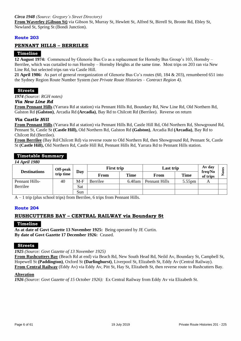
(Balaclava Rd extension): Extended from Lane Cove Rd/Waterloo Rd, North Ryde via Waterloo Rd to
Balaclava Rd. Reverse on return.
Ryde Post Office – North Ryde (Waterloo Rd) (extended to Balaclava Rd) Ryde Post Office – Northern Suburbs Cemetery As at 20 December 1937 (Source: timetable)
Routes not listed.
Ryde Post Office – Northern Suburbs Cemetery trips did not travel via Waterloo Rd, North Ryde.
Selected Ryde Post Office – North Ryde (Waterloo Rd) trips diverted via Cressy Rd.
Ryde shops – North Ryde (Waterloo Rd) (selected trips extended to Northern Suburbs
Cemetery or Ryde Caravan Park) 1963 (Source: RGH notes)
From Ryde (Devlin St at shops) via Blaxland Rd, Lane Cove Rd, Goulding Rd, Twin Rd, Wicks Rd, Waterloo Rd
(North Ryde), Lane Cove Rd, Epping Rd, Wicks Rd, Twin Rd, Goulding Rd, Lane Cove Rd, Devlin St to Ryde
shops.
Northern Suburbs Cemetery extension: Extended from Wicks Rd/Epping Rd via Epping Rd, Delhi Rd to Plassey
Rd. Reverse on return.
1966 (Source: RGH notes)
Ryde Caravan Park extension: Extended from Waterloo Rd/Lane Cove Rd via Lane Cove Rd to Fontenoy Rd.
Reverse on return.
From 16 January 1967
From Ryde (Devlin St at shops) via Blaxland Rd, Lane Cove Rd, Goulding Rd, Twin Rd, Wicks Rd, Coxs Rd, Lane
Cove Rd, Epping Rd, Wicks Rd, Waterloo Rd (North Ryde), Lane Cove Rd, Coxs Rd, Wicks Rd, Twin Rd, Goulding
Rd, Lane Cove Rd, Devlin St to Ryde shops.
Trips direct via Lane Cove Rd: Ex Ryde from Blaxland Rd via Lane Cove Rd to Waterloo Rd. Reverse on return.
Ryde Caravan Park extension: Extended from Waterloo Rd/Lane Cove Rd via Lane Cove Rd to Fontenoy Rd.
Reverse on return.
Northern Suburbs Cemetery extension: Extended from Wicks Rd/Epping Rd via Epping Rd, Delhi Rd to Plassey
Rd. Reverse on return.
Other route variations.
West Ryde – Ryde shops – North Ryde (Waterloo Rd) From 6 July 1970 (Source: RGH notes)
From West Ryde (Ryedale Rd at station) via Victoria Rd, Church St (Ryde), Blaxland Rd, Lane Cove Rd, Goulding
Rd, Twin Rd, Wicks Rd, Coxs Rd, Lane Cove Rd, Epping Rd, Wicks Rd, Waterloo Rd (North Ryde), Lane Cove Rd,
Coxs Rd, Wicks Rd, Twin Rd, Goulding Rd, Lane Cove Rd, Devlin St, Victoria Rd, Hermitage Rd, Herbert St,
Ryedale Rd to West Ryde station.
Alteration
19 May 1979 (Source: N&W notice): Extended to approach West Ryde from Herbert St (West Ryde) via Ryedale Rd,
Marlow Av bridge, West Pde to West Ryde interchange. Return via West Pde, Marlow Av bridge, Ryedale Rd,
Victoria Rd.
West Ryde – Ryde shops – North Ryde – Macquarie Centre From 16 November 1981 (Source: timetable)
From West Ryde (interchange) via West Pde, Marlow St bridge, Ryedale Rd, Victoria Rd, Church St (Ryde),
Blaxland Rd, Lane Cove Rd, Goulding Rd, Twin Rd, Wicks Rd (North Ryde), Coxs Rd, Lane Cove Rd, Fontenoy
Rd, Khartoum Rd, Waterloo Rd, Herring Rd to Macquarie Centre shops.
From Macquarie Centre via reverse route to Goulding Rd, then Lane Cove Rd, Devlin St (Ryde), Victoria Rd,
Hermitage Rd, Herbert St, Ryedale Rd, Marlow St bridge, West Pde to West Ryde interchange.
Ryde shops – North Ryde (Coxs Rd) 1963 (Source: RGH notes)
From Ryde (Devlin St at shops) via Blaxland Rd, Lane Cove Rd, Goulding Rd, Twin Rd, Wicks Rd, Coxs Rd, Lane
Cove Rd to Cooney St (North Ryde).

Page 12 of 61 19 July 2019 Private Route Histories 201 - 225
From North Ryde (Coxs Rd) (Lane Cove Rd at Cooney St) via reverse route to Goulding Rd, then Lane Cove Rd,
Devlin St to Ryde shops.
Timetable Summary
September 1925
Destinations Off-peak
trip time Day
First trip Last trip Av day
freq/No
of trips No
tes
From Time From Time
Ryde station-Ryde
shops-North Ryde†
M-F School of Arts 6.00amS Ryde station 6.02pmL A
Ryde shops 10.30pmW
Sat 6.15amS Ryde station 6.00pmW B
Ryde shops 10.30pmW
Sun Waterloo Rd 8.55amS Ryde station 7.30pmC D
† Extended to Northern Suburbs Cemetery.
A – Day, Ryde station-North Ryde 11 trips, serving School of Arts (1 trip), Cressy Rd (3), Lucknow Rd (4), Northern
Suburbs Cemetery (2) in various combinations. Night, Ryde shops-North Ryde.
B – Day, Ryde station-North Ryde 10 trips, serving Cressy Rd (4 trips), Waterloo Rd (1), Lucknow Rd (3), Northern
Suburbs Cemetery (2) in various combinations. Night, Ryde shops-North Ryde.
C – To North Ryde (Cressy Rd).
D – Day, Ryde station-North Ryde 5 trips, serving Cressy Rd (2 trips), Waterloo Rd (2), Northern Suburbs Cemetery
(2) in various combinations. Night, Ryde shops-North Ryde.
L – To North Ryde (Lucknow Rd).
S – To Ryde station.
W – To North Ryde (Waterloo Rd).
16 November 1937
Destinations Off-peak
trip time Day
First trip Last trip Av day
freq/No
of trips No
tes
From Time From Time
Gladesville-North
Ryde (Magdala Rd)
Fr Glades
10F
19M
M-F Magdala Rd 7.43amG Gladesville 6.23pmM 8 trips
Sat 7.43amG 6.13pmM A
Sun F/Mars Cem 1.51pmG 5.25pmF 20
Hols Magdala Rd 1.03pmG 6.13pmM B
A – Morning, Gladesville-North Ryde (Magdala Rd) 45, afternoon Gladesville-Field of Mars Cemetery 20 (last 2 trips
extended to North Ryde (Magdala Rd)).
B – Base service Gladesville-Field of Mars Cemetery 30 (first 2 and last 2 trips extended to North Ryde (Magdala
Rd)).
F – To Field of Mars Cemetery.
G – To Gladesville.
M – To North Ryde (Magdala Rd).

Page 13 of 61 19 July 2019 Private Route Histories 201 - 225
20 December 1937
Destinations Off-peak
trip time Day
First trip Last trip Av day
freq/No
of trips No
tes
From Time From Time
Ryde Post Office-
North Ryde
(Balaclava Rd)
Fr Ryde
15W
20B
M-F Balaclava Rd 5.48amR Ryde PO 7.32pmB A
Sat 6.22amR 10.45pmB D
Sun 8.49amR 8.50pmB E
Hols 7.58amR 7.30pmC F
Ryde Post Office-
Northern Suburbs
Cemetery
21 M-F Ryde PO 10.20am Nth Subs Cem 4.07pm 4 trips
Sat 10.21am 4.55pm 4 trips
Sun 9.43am 4.55pm 6 trips
Hols 10.00am 5.00pm 4 trips
Ryde Post Office-
Field of Mars
Cemetery
10 M-F
Sat
Sun Ryde PO 2.15pm F/Mars Cem 4.28pm 3 trips
A – Ryde Post Office-North Ryde (Waterloo Rd) 8 trips, Ryde Post Office-North Ryde (Balaclava Rd) 4 trips. Extra
trips Friday night (last trip 10.25pm from Ryde Post Office to North Ryde (Balaclava Rd)). Plus picture bus
Monday & Wednesday nights.
B – To North Ryde (Balaclava Rd).
C – To North Ryde (Cressy Rd).
D – Ryde Post Office-North Ryde (Waterloo Rd) 11 trips, Ryde Post Office-North Ryde (Balaclava Rd) 6 trips
E – Ryde Post Office-North Ryde (Waterloo Rd) 6 trips, Ryde Post Office-North Ryde (Balaclava Rd) 5 trips.
F – Ryde Post Office-North Ryde (Waterloo Rd) 7 trips, Ryde Post Office-North Ryde (Balaclava Rd) 5 trips. Last
trip from Ryde Post Office to North Ryde (Cressy Rd). Plus picture bus.
R – To Ryde Post Office.
W – To North Ryde (Waterloo Rd).
Page 14 of 61 19 July 2019 Private Route Histories 201 - 225
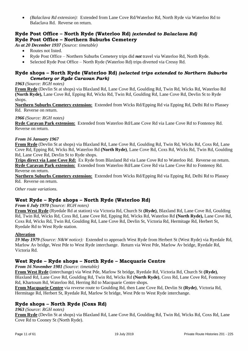
22 July 1945
Destinations Off-peak
trip time Day
First trip Last trip Av day
freq/No
of trips No
tes
From Time From Time
Ryde Post Office-
North Ryde
(Waterloo Rd)†
M-F Ryde PO 5.45amL
6.45amW
Waterloo Rd 7.15pmR A
Lucknow Rd 10.40pmR
Sat 6.45amW Ryde PO 6.15pmK B
Sun 9.45amN Lucknow Rd 10.48pmR D
Gladesville-North
Ryde (Magdala Rd)
M-F Badajoz Rd 6.00amG Gladesville 5.00pmM
11.00pmC
E
Magdala Rd 8.46amG
Sat Badajoz Rd 6.40amG 1.25pmM
6.13pmC
H
Magdala Rd 8.30amG
Sun Gladesville 1.45pmF 10.25pmC I
Ryde Post Office-
Field of Mars
Cemetery
M-F
Sat
Sun Ryde PO 2.15pm F/Mars Cem 4.28pm 3 trips
In this table:
“Lucknow Rd” means Lucknow Rd [now part of Epping Rd]/Lane Cove Rd.
“Badajoz Rd” means Badajoz Rd/Coxs Rd.
† Selected trips extended to Northern Suburbs Cemetery or North Ryde (Khartoum Rd).
A – 21 trips. Day, mostly Ryde Post Office-North Ryde (Waterloo Rd). 5 trips extended to North Ryde (Khartoum
Rd). 4 trips extended to Northern Suburbs Cemetery. Night trips through-routed to Gladesville. Plus picture
bus Wednesday night.
B – 16 trips. Early morning, Ryde Post Office-North Ryde (Waterloo Rd). Day, most trips Ryde Post Office-
Northern Suburbs Cemetery. Plus picture buses to Khartoum Rd & Ryde.
C – To North Ryde (Coxs Rd/Cressy Rd).
D – 12 trips. Day, Ryde Post Office-Northern Suburbs Cemetery. Night, most trips Ryde Post Office-Waterloo Rd,
through-routed to Gladesville.
E – Day, Gladesville-North Ryde (Magdala Rd) 60. Peak hours & night, mainly Gladesville-North Ryde (Cressy Rd).
Night trips through-routed to Ryde Post Office.
F – To Field of Mars Cemetery.
G – To Gladesville.
H – Morning, Gladesville-North Ryde (Magdala Rd) 45. Afternoon, Gladesville-Field of Mars Cemetery 20. Early
morning & late afternoon, Gladesville-North Ryde (Cressy Rd).
I – Afternoon, Gladesville-Field of Mars Cemetery 20. Night, Gladesville-North Ryde (Cressy Rd). Night trips
through-routed to Ryde Post Office.
K – To North Ryde (Khartoum Rd).
L – To North Ryde (Coxs Rd/Lane Cove Rd).
M – To North Ryde (Magdala Rd).
N – To Northern Suburbs Cemetery.
R – To Ryde Post Office.
W – To North Ryde (Waterloo Rd).

Page 15 of 61 19 July 2019 Private Route Histories 201 - 225
12 May 1952
Destinations Off-peak
trip time Day
First trip Last trip Av day
freq/No
of trips No
tes
From Time From Time
Ryde shops-North
Ryde (Waterloo
Rd)†
Fr Ryde
15W
18N
25F
M-F Waterloo Rd 6.10amR Ryde shops 11.40pm A
Ryde shops 9.16amK
10.10amN
Khartoum Rd 5.30pmR
Nth Subs Cem 2.11pmR
Sat Ryde shops 7.30amW
9.15amK
9.55amN
2.30pmF
Waterloo Rd 7.50pmR B
Khartoum Rd 7.48pmR
Fullers Bge 5.00pmR
Ryde shops 11.40pmC
Sun 8.40amF Fullers Bge 6.30pmR D
Ryde shops 10.50pmC
Ryde shops-North
Ryde (Coxs Rd)
10 M-F Ryde shops 10.53am Coxs Rd 2.45pm 2 trips E
Sat G
Sun
* More frequent in peak hours.
† Selected trips extended from North Ryde (Waterloo Rd) to North Ryde (Khartoum Rd), to Northern Suburbs
Cemetery or to Fullers Bridge.
A – Day, base service Ryde shops-North Ryde (Waterloo Rd) 40*, selected trips extended to Khartoum Rd or
Northern Suburbs Cemetery. Night, Ryde shops-North Ryde (North Ryde Park, last trip to Coxs Rd only) &
through-routed to Gladesville via 75. Plus picture bus Wednesday night.
B – Morning, mainly Ryde shops-North Ryde (Waterloo Rd) 40, selected trips extended to Khartoum Rd or Northern
Suburbs Cemetery. Afternoon, mainly Ryde-Fullers Bridge 60. Plus picture buses to Ryde & Khartoum Rd.
C – To North Ryde (Wicks Rd/Coxs Rd), through-routed to Gladesville.
D – Day, Ryde shops-Fullers Bridge. Night, Ryde shops-North Ryde (North Ryde Park, last trip to Coxs Rd only) &
through-routed to Gladesville via 75.
E – Plus diversion of 1 Ryde shops to North Ryde (Waterloo Rd) trip.
F – To Fullers Bridge.
G – Ryde shops-North Ryde (Waterloo Rd) picture buses diverted via Coxs Rd.
K – To North Ryde (Khartoum Rd).
N – To Northern Suburbs Cemetery.
R – To Ryde shops.
W – To North Ryde (Waterloo Rd).
6 March 1964
Destinations Off-peak
trip time Day
First trip Last trip Av day
freq/No
of trips No
tes
From Time From Time
Ryde shops-North
Ryde (Waterloo
Rd)†
Fr Ryde
14W
17N
M-F Waterloo Rd 5.45am Ryde shops 10.30pm 60* A
Sat 7.16am 7.30pm 60
Sun 9.16am 7.30pm 60
Ryde shops-North
Ryde (Coxs Rd)
10 M-F Ryde shops 6.02am Coxs Rd 7.03pm 60
Sat 8.05am Ryde shops 1.30pm 60
Sun
* More frequent in peak hours.
† Extended to Northern Suburbs Cemetery.
A – 2 trips extended to Northern Suburbs Cemetery. Plus short-working/s after last trip shown.
N – To Northern Suburbs Cemetery.
W – To North Ryde (Waterloo Rd).

Page 16 of 61 19 July 2019 Private Route Histories 201 - 225
16 January 1967
Destinations Off-peak
trip time Day
First trip Last trip Av day
freq/No
of trips No
tes
From Time From Time
Ryde shops-Ryde
Caravan Park†
Fr Ryde
18W
20N
M-F Ryde shops 6.32amW
8.48amP
Ryde C’van Pk 6.26pmR Ph
Sat 7.47amW Waterloo Rd 1.26pmR 60 A
Sun
† Selected trips extended from North Ryde to Northern Suburbs Cemetery.
A – 3 trips extended to Ryde Caravan Park.
N – To Northern Suburbs Cemetery.
P – To Ryde Caravan Park.
Ph – Extended peak hours only. 2 trips extended to Northern Suburbs Cemetery.
R – To Ryde shops.
W – To North Ryde (Waterloo Rd).
18 May 1971
Destinations Off-peak
trip time Day
First trip Last trip Av day
freq/No
of trips No
tes
From Time From Time
West Ryde-Ryde
shops-North Ryde
(AWA factory)†
Fr AWA
13R
24W
M-F West Ryde 6.50amA AWA factory 5.05pmW Ph
Sat
Sun
† Selected trips extended to Ryde Caravan Park.
A – To North Ryde (AWA factory).
Ph – Peak hours only, West Ryde or Ryde shops-North Ryde (AWA factory) (1 trip extended to Ryde Caravan Park &
2 trips extended from Ryde Caravan Park). Plus short-working/s after last trip shown.
R – To Ryde shops.
W – To West Ryde.
16 November 1981
Destinations Off-peak
trip time Day
First trip Last trip Av day
freq/No
of trips No
tes
From Time From Time
West Ryde-Ryde
shops-Macquarie
Centre
25 M-F West Ryde 6.45am Macquarie Ctr 6.08pm 30 A
Sat 7.15am 5.25pm AM 30
PM 60
A
Sun
A – Extra trips Thursday night. Plus short-working/s before first trip and after last trip shown.
Route 206
RYDE (Field of Mars Cemetery) – CENTRAL RAILWAY
Timeline
As at date of Govt Gazette 13 November 1925: Being operated by Bruce & Hayes.
31 October 1931: Ceased as competitive with Government railway or tram services under State Transport (Co-
ordination) Act. Later replaced by feeder service, 205 Gladesville-Field of Mars Cemetery.
Streets
1925 (Source: Govt Gazette of 13 November 1925)
From Ryde (Field of Mars Cemetery) (Higginbotham Rd at Cressy Rd) via Higginbotham Rd, Victoria [now
Monash] Rd (Gladesville), Great North Rd, Gladesville bridge, Bridge St (Drummoyne), Weston Rd (Rozelle),
Commercial Rd, Glebe Island Bridge [last six, now Victoria Rd], Banks St, Miller St (Pyrmont), Harris St, George St,
Quay St to Bijou Lane (Central Railway).
From Central Railway (Quay St at Bijou Lane) via Quay St, Ultimo Rd, Harris St, then reverse route to Field of
Mars Cemetery.

Page 17 of 61 19 July 2019 Private Route Histories 201 - 225
Alterations
1926 (Source: Govt Gazette of 15 October 1926): Curtailed from Higginbotham Rd/Cressy Rd to Victoria
[now Monash] Rd at Thompson St (Gladesville).
1928 (Source: Govt Gazette of 22 June 1928): Extended from Victoria [now Monash] Rd/Thompson St via
Higginbotham Rd, Pidding Rd, Quarry Rd to Cressy Rd (Field of Mars Cemetery). Reverse on return.
Timetable Summary
September 1925
Destinations Off-peak
trip time Day
First trip Last trip Av day
freq/No
of trips No
tes
From Time From Time
Ryde (Field of
Mars Cemetery)-
Central Railway
53 M-F F/Mars Cem 6.35am Central Rly 8.45pm 60
Sat 6.35am 8.45pm 60
Sun 1.24pm 10.38pm 120
Route 206
WINDSOR – GLOSSODIA – EAST KURRAJONG WINDSOR – MEEHAN ST [later James Meehan St] WINDSOR – SACKVILLE
WINDSOR – SOUTH WINDSOR
Timeline
20 September 1935: Windsor – South Windsor, an existing (country) service brought under the Transport Act,
operated by AJ Gosper (then or later trading as Gosper’s Windsor Bus Service).
31 October 1937: 207 absorbed into 206.
1954: Transferred to Mr Gosper’s widow, Mrs Vilna Lenore Gosper.
1960s: Routes were:
Windsor – Glossodia – East Kurrajong (terminus at Smiths Corner (Creek Ridge Rd/Putty Rd))
Windsor – Sackville (morning and afternoon workers service, reported to have ceased prior to the mid-1970s,
when it became a school-only service)
Windsor – South Windsor
December 1969: Transferred to JR (Rod) Gosper (son) on death of Mrs Gosper.
1980s: Routes were:
Windsor – Glossodia
Windsor – Meehan St
Windsor – South Windsor
School services also ran to Berkshire Park, Llandilo & Sackville.
Early 1982: Gosper’s Windsor Bus Service transferred to Guild Management Services (N Hepburn), then or soon
after trading as Macquarie Towns Coach Lines.
By February 1985: Renumbered into the Sydney Region Route Number System (see Private Route Histories –
Contract Region 1):
680 Windsor – Penrith (probably school trips only)
682 Windsor – Berkshire Park (school trips only)
683 Windsor – Londonderry
685 Windsor – Bligh Park (new suburb) (extended from South Windsor)
686 Windsor – Meehan St
688 Windsor – Glossodia
689 Windsor – Sackville (school trips only)
Streets
Windsor – South Windsor 1983 (Source: timetable)
From Windsor (George St at Thompson Square) via George St, Argyle St, Macquarie St, Drummond St, Stewart St,
Ham St, Berger Rd, Woods Rd, Stewart St, McKellar Cr (clockwise loop), Stewart St, Collith Av, Woods Rd, George
St, Rickaby St (South Windsor), Church St, Ham St, George St, Campbell St, Cox St, Bell St, George St, Bridge St,
Court St, Arndell St, George St to Thompson Square (Windsor).
Page 18 of 61 19 July 2019 Private Route Histories 201 - 225
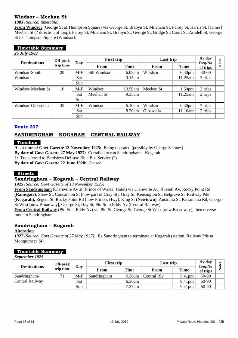
Windsor – Meehan St 1983 (Source: timetable)
From Windsor (George St at Thompson Square) via George St, Brabyn St, Mileham St, Fairey St, Harris St, [James]
Meehan St (? direction of loop), Fairey St, Mileham St, Brabyn St, George St, Bridge St, Court St, Arndell St, George
St to Thompson Square (Windsor).
Timetable Summary
25 July 1983
Destinations Off-peak
trip time Day
First trip Last trip Av day
freq/No
of trips No
tes
From Time From Time
Windsor-South
Windsor
20 M-F Sth Windsor 6.08am Windsor 6.30pm 30-60
Sat 9.15am 11.25am 3 trips
Sun
Windsor-Meehan St 10 M-F Windsor 10.50am Meehan St 1.50pm 2 trips
Sat Meehan St 9.35am 11.25am 2 trips
Sun
Windsor-Glossodia 35 M-F Windsor 6.10am Windsor 6.30pm 7 trips
Sat 8.20am Glossodia 11.10am 2 trips
Sun
Route 207
SANDRINGHAM – KOGARAH – CENTRAL RAILWAY
Timeline As at date of Govt Gazette 13 November 1925: Being operated (possibly by George S Jones).
By date of Govt Gazette 27 May 1927: Curtailed to run Sandringham – Kogarah.
?: Transferred to Bardsleys DeLuxe Blue Bus Service (?).
By date of Govt Gazette 22 June 1928: Ceased.
Streets
Sandringham – Kogarah – Central Railway 1925 (Source: Govt Gazette of 13 November 1925)
From Sandringham (Clareville Av at [Prince of Wales] Hotel) via Clareville Av, Russell Av, Rocky Point Rd
(Ramsgate), Shaw St, Concannon St [now part of Gray St], Gray St, Kensington St, Belgrave St, Railway Pde
(Kogarah), Regent St, Rocky Point Rd [now Princes Hwy], King St (Newtown), Australia St, Parramatta Rd, George
St West [now Broadway], George St, Hay St, Pitt St to Eddy Av (Central Railway).
From Central Railway (Pitt St at Eddy Av) via Pitt St, George St, George St West [now Broadway], then reverse
route to Sandringham.
Sandringham – Kogarah Alteration
1927 (Source: Govt Gazette of 27 May 1927): Ex Sandringham to terminate at Kogarah (station, Railway Pde at
Montgomery St).
Timetable Summary
September 1925
Destinations Off-peak
trip time Day
First trip Last trip Av day
freq/No
of trips No
tes
From Time From Time
Sandringham-
Central Railway
71 M-F Sandringham 6.36am Central Rly 9.41pm 60-90
Sat 6.36am 9.41pm 60-90
Sun 7.37am 9.41pm 60-90

Page 19 of 61 19 July 2019 Private Route Histories 201 - 225
Route 207
MASCOT AERODROME [now Sydney Airport] – MASCOT POST OFFICE
Timeline ?: Commenced.
4 November 1932: Ceased due to lack of patronage.
Route 207
WINDSOR station – WINDSOR township
Timeline
20 September 1935: Existing (country) service brought under the Transport Act, operated by WJ Mortley.
Later: Probably transferred to the Gosper family.
31 October 1937: Absorbed into 206.
Route 208
SANS SOUCI – KOGARAH – CENTRAL RAILWAY
Timeline
As at date of Govt Gazette 13 November 1925: Being operated (possibly by George S Jones).
?: Transferred to Bardsleys DeLuxe Blue Bus Service (?).
By date of Govt Gazette 27 May 1927: Ceased.
Streets
1925 (Source: Govt Gazette of 13 November 1925)
From Sans Souci (Rocky Point Rd at punt [current northern end of Captain Cook Bridge]) via Rocky Point Rd
(Ramsgate), Shaw St, Concannon St [now part of Gray St], Gray St, Kensington St, Belgrave St, Railway Pde
(Kogarah), Regent St, Rocky Point Rd [now Princes Hwy], King St (Newtown), Australia St, Parramatta Rd, George
St West [now Broadway], George St, Hay St, Pitt St to Eddy Av (Central Railway).
From Central Railway (Pitt St at Eddy Av) via Pitt St, George St, George St West [now Broadway], then reverse
route to Sans Souci.
Timetable Summary
September 1925
Destinations Off-peak
trip time Day
First trip Last trip Av day
freq/No
of trips No
tes
From Time From Time
Sans Souci-Central
Railway
71 M-F Sans Souci 6.07am Central Rly 10.41pm 30-60
Sat 6.07am 10.41pm 30-60
Sun 7.07am 10.41pm 30-60
Route 208
PENRITH – JAMISONTOWN – REGENTVILLE
PENRITH – SILVERDALE – WARRAGAMBA
Timeline
1931: Penrith – Silverdale commenced by Grant & O’Connell. (A list dated October 1935 shows the operator as
Wallacia Motor Transport Service.)
1935: Transferred to WJS (Bill) Bale & Sons, then or later trading as Penrith District Bus Service.
1941 or later: 211, Penrith – Wallacia, absorbed into 208.
Late 1940s/1950s (?): Extended from Silverdale to Warragamba. Service probably extended to Warragamba dam
while the dam was under construction from 1948 onwards.
By 1973: Extra route, Penrith – Jamisontown – Regentville, commenced.
17 April 1974: Penrith District Bus Service transferred to Bosnjak family (Roger L Graham, general manager from
1982).
By 1982: Operator’s name changed to Bosnjak Penrith.

Page 20 of 61 19 July 2019 Private Route Histories 201 - 225
16 August 1982: Renumbered into the Sydney Region Route Number System (see Private Route Histories –
Contract Region 1):
794 Penrith – Regentville
795 Penrith – Warragamba.
Streets
Penrith – Regentville 1973 (Source: timetable)
From Penrith Plaza via Jane St, Penrith station, Station St, Jamison Rd, Harris St (Jamisontown), Willoring Cr,
Mulgoa Rd, Glenbrook St, Kay Cl, Lyn Circ, Romsley Rd, Cameron St, Thurwood Av, Henderson Cr, Thurwood Av,
Ikin St, Drake St, Kempsey St, Enfield St, Ikin St, Glenbrook St, Warragamba Cr, Mulgoa Rd, Factory Rd, Gibbes St,
Spencer St to Mulgoa Rd (Regentville).
Timetable Summary
Early 1970s
Destinations Off-peak
trip time Day
First trip Last trip Av day
freq/No
of trips No
tes
From Time From Time
Penrith-
Warragamba
45 M-F Warragamba 5.52am Penrith 6.27pm 6 trips
Sat 7.45am 8.00pm 3 trips
Sun 8.15am 7.12pm 1 trip
Penrith-Regentville 35
round
trip
M-F Regentville 6.20am Penrith 6.27pm 12 trips
Sat
Sun
Route 209
SOUTH HEAD SIGNAL STATION – CENTRAL RAILWAY via Old South Head Rd
(South Head Signal Station is located in the suburb of Vaucluse.)
Timeline
As at date of Govt Gazette 13 November 1925:
Being operated by WW Pope & Sons.
Shared route between Rose Bay North & Central Railway with 203.
By date of Govt Gazette 15 October 1926: Ceased.
Streets
1925 (Source: Govt Gazette of 13 November 1925)
From South Head Signal Station (Old South Head Rd at Cambridge St) via Old South Head Rd, Birriga Rd
(Bellevue Hill), Victoria Rd, Old South Head Rd, Edgecliff Rd, Queen St (Woollahra), Oxford St (Darlinghurst),
Liverpool St, Elizabeth St, Eddy Av (Central Railway)
From Central Railway (Eddy Av) via Eddy Av, Pitt St, Hay St, Elizabeth St, then reverse route to South Head Signal
Station.
Route 209
GRANVILLE – GUILDFORD – OLD GUILDFORD – CHESTER HILL Granville – Villawood (?) (1951-52)
Timeline
1932: Granville – Old Guildford commenced by W Hutchings & WA (Bill) Neely.
6 August 1934: Rerouted via Guildford.
Late 1930s(?): Transferred to JH Moore.
Late 1930s(?): Operated for a period by Derby & Perry.
By 1941: Transferred to George R Sinclair.
?: Ran Granville – Guildford – Miller/Gurney Rds, Chester Hill.
?: Extended from Miller/Gurney Rds to Chester Hill station.
?: Selected trips ran Granville – Villawood (via Excelsior St?).

Page 21 of 61 19 July 2019 Private Route Histories 201 - 225
1947 (either 24 March 1947 or 26 September or between): Route split:
084 Guildford – Chester Hill
209 Granville – Gurney Rd/Miller Rd (selected trips extended to Chester Hill, mostly late at night, at times
when 84 did not run). At least by 21 November 1949, also ran via Guildford station mainly in off-peak &
generally alternate trips on Saturdays, as well as a separate Granville-Guildford station service on Sundays.
210 Granville – Villawood (via Excelsior St) commenced as a separate route.
96 commenced also running via Excelsior St at about the same time.
(?): For a period (at least during 1950), operated by Lew H Wilson.
December 1950: Transferred to RA (Reg) Dryden & Lew H Wilson.
1951: Transferred to WA (Bill) Neely.
1951/2: 210 absorbed back into 209, as Granville – Villawood (?).
September 1952: Absorbed into 186, which became Parramatta – Granville – Villawood.
Streets
Granville – Chester Hill via Woodville Rd Circa 1946 (Source: Gregory’s Street Directory)
From Granville (station) via Railway Pde, South St, William St, The Avenue, Louis St, Excelsior St, Lackey St,
Woodville Rd, Gurney Rd, Miller Rd, Curtis St, Campbell Hill Rd, Virgil Av, Bent St, Waldron Rd, Chester Hill Rd
(Chester Hill).
Circa 1948 (Source: Gregory’s Street Directory)
From Granville (station) via Railway Pde, The Avenue, Louis St, Excelsior St, Lackey St, Woodville Rd, Gurney Rd,
Miller Rd, Curtis St, Campbell Hill Rd, Virgil Av, Bent St, Waldron Rd, Chester Hill Rd (Chester Hill).
Granville – Guildford – Chester Hill (Miller Rd/Gurney Rd) (selected trips extended to
Chester Hill station) By 21 November 1949 (likely route, based on timing points & later 97)
From Granville (station) via Railway Pde, The Avenue, Louis St, Excelsior St, Lackey St, Woodville Rd, McArthur
St, McArthur St, Townsend St, Bursill St, Marian St, Mountford Av, Talbot Rd, Guildford Rd to Railway Tce
(Guildford), then Guildford Rd, Woodville Rd, Gurney Rd to Miller Rd (Chester Hill).
Chester Hill station extension: Extended from Chester Hill (Gurney Rd/Miller Rd) via Miller Rd, Curtis St,
Campbell Hill Rd, Virgil Av, Bent St, Waldron Rd, Chester Hill Rd (Chester Hill station).
Trips via Guildford Rd direct (mainly selected off-peak trips): Ex Granville from Lackey St via Woodville Rd,
Guildford Rd to Guildford station.
Trips via Woodville Rd direct (peak hour & selected trips at other times): Ex Granville from Lackey St via
Woodville Rd, Gurney Rd.
Timetable Summary
24 March 1947
Destinations Off-peak
trip time Day
First trip Last trip Av day
freq/No
of trips No
tes
From Time From Time
Guildford-Chester
Hill
17 M-F Guildford 8.40am Chester Hill 7.00pm 60
Sat 8.13am 2.36pm 60
Sun 9.40am Guildford 8.38pm 60

Page 22 of 61 19 July 2019 Private Route Histories 201 - 225
21 November 1949
Destinations Off-peak
trip time Day
First trip Last trip Av day
freq/No
of trips No
tes
From Time From Time
Granville-Chester
Hill (Gurney
Rd/Miller Rd)†
Fr Gran
26G
31C
M-F Granville 6.00am Gurney Rd 11.37pm 30* A
Sat 6.00am 11.37pm AM 20
PM 30
A
Sun 7.30am 11.37pm B
* More frequent in peak hours.
† Selected trips extended to Chester Hill station.
A – Selected night trips extended from Chester Hill (Gurney Rd/Miller Rd) to Chester Hill station. Plus short-
working/s before first trip & after last trip shown.
B – Day, Granville-Chester Hill (Gurney Rd/Miller Rd) via Woodville Rd direct (not via Guildford station) 60, plus
Granville-Guildford station 60. Selected night trips extended from Chester Hill (Gurney Rd/Miller Rd) to
Chester Hill station. Plus short-working/s after last trip shown.
C – To Chester Hill station.
G – To Chester Hill (Gurney Rd/Miller Rd).
Route 210
SOUTH HEAD SIGNAL STATION – ROSE BAY NORTH – BONDI JUNCTION – CENTRAL RAILWAY via Old South Head Rd
Post 31 October 1931 feeder: WATSONS BAY – ROSE BAY NORTH – BONDI
JUNCTION
(South Head Signal Station is located in the suburb of Vaucluse.)
Timeline
As at date of Govt Gazette 13 November 1925: South Head Signal Station – Rose Bay North – Bondi Junction –
Central Railway being operated by WW Pope & Sons. Possibly also operated by Blue Transit Co (Bardsley &
Warburton families).
By date of Govt Gazette 15 October 1926: Curtailed to run Rose Bay North – Bondi Junction – Central Railway.
31 October 1931: Ceased as competitive with Government railway or tram services under State Transport (Co-
ordination) Act.
1932: Feeder service, Watsons Bay – Rose Bay North – Bondi Junction, commenced by operator unknown.
20 May 1933: Ceased due to competition by Department of Road Transport & Tramways 230, which commenced on
21 March 1933.
Streets
South Head Signal Station – Rose Bay North – Bondi Junction – Central Railway 1925 (Source: Govt Gazette of 13 November 1925)
From South Head Signal Station (Old South Head Rd at Cambridge St) via Old South Head Rd (Rose Bay North),
Birriga Rd (Bellevue Hill), Victoria Rd, Old South Head Rd, Oxford St (Bondi Junction, Paddington,
Darlinghurst), Liverpool St, Elizabeth St, Eddy Av (Central Railway).
From Central Railway (Eddy Av) via Eddy Av, Pitt St, Hay St, Elizabeth St, then reverse route to South Head Signal
Station.
Rose Bay North – Bondi Junction – Central Railway 1926 (Source: Govt Gazette of 15 October 1926)
From Rose Bay North (Old South Head Rd at New South Head Rd) via Old South Head Rd, Birriga Rd (Bellevue
Hill), Victoria Rd, Old South Head Rd, Oxford St (Bondi Junction, Paddington, Darlinghurst), Liverpool St,
Elizabeth St, Eddy Av (Central Railway). Reverse on return.

Page 23 of 61 19 July 2019 Private Route Histories 201 - 225
Timetable Summary
March 1930
Destinations Off-peak
trip time Day
First trip Last trip Av day
freq/No
of trips No
tes
From Time From Time
Rose Bay North-
Central Railway
M-F Central Rly 5.23am Rose Bay Nth 12.16am 7 & 8
Sat 6.30am 12.39am 7 & 8
Sun 8.45am 12.24am 15
Route 210
PENRITH – CRANEBROOK
Timeline
14 February 1938: Skeleton service commenced by operator unknown.
July 1938: Ceased.
Route 210
GRANVILLE – SOUTH GRANVILLE – VILLAWOOD via Excelsior St
Timeline
1947 (either 24 March 1947 or 26 September or between): Commenced as part of splitting 209. Operated by George
R Sinclair.
December 1950: Transferred to RA (Reg) Dryden & Lew H Wilson.
1951: Transferred to WA (Bill) Neely.
1951/2: Absorbed back into 209.
Streets
Circa 1948 (Source: Gregory’s Street Directory)
From Granville (station) via Railway Pde, The Avenue, Louis St, Excelsior St (South Granville), Guildford Rd,
Woodville Rd, River Av (Villawood).
Timetable Summary
Circa 1947
Destinations Off-peak
trip time Day
First trip Last trip Av day
freq/No
of trips No
tes
From Time From Time
Granville-
Villawood
M-F Granville 7.07amV Villawood 4.30pmG A
Sth Granville 6.10pmG
Sat 6.50amV Villawood 1.30pmG 60 B
Sun Granville 8.20amE Granville 9.20pmE C
* More frequent in peak hours.
A – Early morning & late afternoon, Granville-South Granville (Excelsior St/Guildford Rd). Day, Granville-
Villawood 60*. Plus short-working/s before first trip shown.
B – Plus short-working/s after last trip shown.
C – 9 trips from Granville, 8 trips from Excelsior St/Guildford Rd. 4 trips extended to Villawood.
E – To South Granville (Excelsior St/Guildford Rd).
G – To Granville.
V – To Villawood.

Page 24 of 61 19 July 2019 Private Route Histories 201 - 225
17 May 1948
Destinations Off-peak
trip time Day
First trip Last trip Av day
freq/No
of trips No
tes
From Time From Time
Granville-
Villawood
Fr Gran
14V
21G
M-F Granville 7.07am Granville 11.00pm A
Sat 7.07am 11.00pm B
Sun 8.33am Villawood 11.08pm 60 C
* More frequent in peak hours.
A – Day, Granville- Guildford Rd/Woodville Rd 30, Granville-Villawood 60. Night, Granville-Villawood. Plus
short-working/s before first trip shown.
B – Morning, Granville- Guildford Rd/Woodville Rd 30, Granville-Villawood 60. Afternoon, Granville-Villawood
60. Night, Granville-Villawood. Plus short-working/s before first trip shown.
C – Plus short-working/s after last trip shown.
G – To Guildford.
V – To Guildford Rd/Woodville Rd.
20 February 1950
Destinations Off-peak
trip time Day
First trip Last trip Av day
freq/No
of trips No
tes
From Time From Time
Granville-
Villawood
21 M-F Villawood 6.28am Granville 11.00pm 30* A
Sat 6.20am 11.53pm AM 30
PM 60
Sun Granville 8.33am 11.33pm 60
* More frequent in peak hours.
A – Plus short-working/s before first trip shown.
Route 210
PARRAMATTA – PROSPECT – BLACKTOWN via Great Western Hwy PARRAMATTA – SOUTH WENTWORTHVILLE – PROSPECT – BLACKTOWN
Timeline
September 1957: The Blacktown – Prospect section of Ryder’s 211 transferred to George C Weston and renumbered
210.
October 1962: Transferred to Blacktown-Prospect Bus Co (AL Earl & TA Foley).
1969: Transferred to Western Road Bus Services (Col Neyland & Trevor Thornley). Trevor Thornley was sole
proprietor from 1974.
By 20 October 1969:
Many trips on 177 amalgamated with 210 as 210, Parramatta – Prospect – Blacktown via Great Western Hwy.
Selected trips ran Parramatta –South Wentworthville – Prospect – Blacktown via Old Prospect Rd.
Parramatta – South Wentworthville section of this route shared with 179.
By April 1973: All trips on 177 renumbered 210 Parramatta – Prospect – Blacktown.
2 April 1982: As part of general reorganization of Western Road Bus Services’ routes (179 & 210), renumbered into
the Sydney Region Route Number System (see Private Route Histories – Contract Region 4):
700 Parramatta – Blacktown via Great Western Hwy
702 Parramatta – South Wentworthville – Blacktown
703 Parramatta – South Wentworthville (Ringrose Av loop & Boronia St Loop)
Streets
Blacktown – Prospect 1968 (Source: timetable/Collins Street Directory)
From Blacktown via Main St, Blacktown Rd, Wallpark Av, Orana Av, Hayes Rd, Fowler St, Vienna St, Leabons
Lane, Blacktown Rd to Great Western Hwy (Prospect).
Parramatta – Prospect – Blacktown via Great Western Hwy 1969 (Source: RGH notes)
From Parramatta (Argyle St at station) via Wentworth St, Parkes St, Anderson St, Junction St [before Parkes St was
altered to meet Great Western Hwy at Church St], Great Western Hwy (Prospect), Blacktown Rd, Leabons Lane,

Page 25 of 61 19 July 2019 Private Route Histories 201 - 225
Vienna St, Fowler St, Hayes Rd, Orana Av, Wallpark Av, Blacktown Rd, Newton Rd, Patrick St, Main St to
Blacktown station.
From Blacktown (Main St at station) via Main St, Blacktown Rd, Wallpark Av, then reverse route to Great Western
Hwy, then Marsden St, Argyle St to Parramatta station.
Trips direct via Blacktown Rd: Ex Parramatta from Blacktown Rd/Leabons Lane via Blacktown Rd to Wallpark Av
(not via Leabons Lane, Vienna St, Fowler St, Hayes Rd, Orana Av, Wallpark Av).
Parramatta – South Wentworthville – Prospect – Blacktown 1969 (Source: RGH notes)
Same as via Great Western Hwy, but from Great Western Hwy via Old Prospect Rd, Greystanes Rd to Great Western
Hwy. Reverse on return.
Timetable Summary
1960s
Destinations Off-peak
trip time Day
First trip Last trip Av day
freq/No
of trips No
tes
From Time From Time
Blacktown-
Prospect
15 M-F Prospect 5.15am Blacktown 6.30pm 45*
Sat 7.45am 4.00pm 8 trips A
Sun 6.40am 8.00am 1 trip
* More frequent in peak hours.
A – Plus picture bus Saturday night.
Early 1980s
Destinations Off-peak
trip time Day
First trip Last trip Av day
freq/No
of trips No
tes
From Time From Time
Blacktown-
Prospect-
Parramatta
35 M-F Blacktown 5.32am Parramatta 6.05pm 30* A
Sat Parramatta 6.33am Blacktown 5.38pm AM 30
PM 90
A
Sun 8.03am 6.08pm 90
* More frequent in peak hours.
A – Extra trips Thursday night. Plus short-working/s before first trip and after last trip shown.
Route 211
SOUTH BELMORE (various termini) – EARLWOOD – NEWTOWN – CENTRAL RAILWAY via various routes
(Sharp St south of Canterbury Rd is now Kingsgrove Rd.)
Timeline
As at date of Govt Gazette 13 November 1925: South Belmore (Burwood Rd at Canterbury Rd) – Central Railway
via Marrickville being operated by EL Balfour.
By date of Govt Gazette 15 October 1926:
Altered to run via Dulwich Hill (instead of Marrickville). Part of route replaced by 212.
South Belmore terminus altered to William St at Sharp St.
By date of Govt Gazette 17 December 1926: Extended in South Belmore from William & Sharp Sts to Forbes Av &
Sharp St.
1928: Ceased.
Streets
South Belmore (Burwood Rd at Canterbury Rd) – Central Railway via Marrickville 1925 (Source: Govt Gazette of 13 November 1925)
From South Belmore (Burwood Rd at Canterbury Rd) via Burwood Rd, Canterbury Rd, Sharp St, William St, Homer
St (Earlwood), Wardell Rd, Bass Rd, Riverview Rd, Illawarra Rd (Marrickville), Marrickville Rd, Victoria Rd,
Enmore Rd, King St (Newtown), City Rd, George St West [now Broadway], George St, Hay St, Pitt St to Eddy Av
(Central Railway).
From Central Railway (Pitt St at Eddy Av) via Pitt St, George St, George St West [now Broadway], then reverse
route to South Belmore.

Page 26 of 61 19 July 2019 Private Route Histories 201 - 225
South Belmore (William St at Sharp St) – Central Railway via Dulwich Hill 1926 (Source: Govt Gazette of 15 October 1926)
From South Belmore (William St at Sharp St) via William St, Homer St (Earlwood), Wardell Rd, Marrickville Rd
(Dulwich Hill), New Canterbury Rd, Stanmore Rd, Enmore Rd, King St (Newtown), City Rd, George St West [now
Broadway], George St, Hay St, Pitt St to Eddy Av (Central Railway).
From Central Railway (Pitt St at Eddy Av) via Pitt St, George St, George St West [now Broadway], then reverse
route to South Belmore.
South Belmore (Forbes Av near Sharp St) – Central Railway via Dulwich Hill Alteration
1926 (Source: Govt Gazette of 17 December 1926): Extended from William St at Sharp St via Sharp St, Forbes Av to
near Sharp St. Reverse on return.
Timetable Summary
September 1925
Destinations Off-peak
trip time Day
First trip Last trip Av day
freq/No
of trips No
tes
From Time From Time
South Belmore-
Central Railway
55 M-F Sth Belmore 7.02am Central Rly 11.30pm 60-120
Sat 7.02am 11.30pm 60-120
Sun 11.02am 11.30pm 60-120
Route 211
PENRITH – WALLACIA
Timeline
15 February 1933: Classified as an omnibus service in accordance with the Transport Act, 1930 (even though it had
operated for some years). Operated by WJS (Bill) Bale.
1941 or later: Absorbed into 208.
Route 211
BLACKTOWN – DOONSIDE via various routes
Blacktown – Prospect (1950s)
Timeline
1952: Blacktown – Doonside commenced by R Ryder.
?: Also ran Blacktown – Prospect, possibly replacing Blacktown – Prospect section of 180.
November 1953: Transferred to A Ryder.
April 1957: Operator’s name changed to Ryder & Sons.
September 1957: Blacktown – Prospect transferred to George C Weston and renumbered 210, leaving 211 as
Blacktown – Doonside. At about this time route was via Newton & Kildare Rds.
August 1960: Transferred to Tuck-Lee Bros (Roy Tuck-Lee).
By 1962: Services gradually expanded as population increased. Routes were:
Blacktown – Doonside via Kildare St [now Rd]
Blacktown – Doonside/Douglas Rds
Blacktown – Girra/Monash Rds
By 1969: Routes rearranged as:
Blacktown – Doonside via Bungarribee Rd
Blacktown – Doonside via Kildare St [now Rd]
Blacktown – Doonside via Monash Rd
By 1 November 1976: Via Monash Rd & via Bungarribee Rd trips amalgamated as a loop, Blacktown – Rosenthal St
– Blacktown.
September 1977: Transferred to Cleary Bros (Parramatta).
10 August 1981: Transferred to Leslies Omnibus Service (Phil Leslie).

Page 27 of 61 19 July 2019 Private Route Histories 201 - 225
January 1991: Leslies Omnibus Service’s routes, 187 & 211, reorganised and renumbered into the Sydney Region
Route Number System (see Private Route Histories – Contract Region 1):
721 Blacktown – Prospect
722 Blacktown – Timbertop
723 Blacktown – Tallawong Rd
724 Blacktown – Huntingwood
725 Blacktown – Doonside via Kildare Rd
727 Blacktown – Huntington Heights
728 Blacktown – Australia’s Wonderland
Streets
Blacktown – Doonside via Kildare St [now Rd] 1969 (Source: RGH notes)
From Blacktown (Main St at station) via Flushcombe Rd, Alpha St, Patrick St, Kildare St [now Rd], School Pde to
Doonside station.
From Doonside (School Pde at station) via Doonside Rd, Kildare St [now Rd], Main St to Blacktown station.
1984 (Source: timetable)
From Blacktown (Main St at station) via Flushcombe Rd, Alpha St, Patrick St, Kildare Rd, Rosenthal St, Monash Rd
[alignment of current Birdwood St], Mandoo Dr, Kildare Rd, School Pde to Doonside station.
From Doonside (School Pde at station) via Doonside Rd, Kildare Rd, Main St to Blacktown station.
Blacktown – Doonside via Monash Rd 1969 (Source: RGH notes)
From Blacktown (Main St at station) via Flushcombe Rd, Newton Rd, Monash Rd, Doonside Rd, Kildare St [now
Rd], School Pde to Doonside station.
From Doonside (School Pde at station) via Doonside Rd, Monash Rd, Newton Rd, Patrick St, Main St to Blacktown
station.
Blacktown – Doonside via Bungarribee Rd 1969 (Source: RGH notes)
From Blacktown (Main St at station) via Flushcombe Rd, Newton Rd, Lancaster St, Bungarribee Rd, Doonside Rd,
Kildare St [now Rd], School Pde to Doonside station.
From Doonside (School Pde at station) via Doonside Rd, Bungarribee Rd, Lancaster St, Newton Rd, Patrick St, Main
St to Blacktown station.
Blacktown – Doonside (Rosenthal St loop) 1984 (Source: timetable)
From Blacktown (Main St at station) via Flushcombe Rd, Newton Rd, Monash Rd, Rosenthal St (Doonside),
Bungarribee Rd, Lancaster St, Newton Rd, Patrick St, Main St to Blacktown station.
1985 (Source: RGH notes/timetable)
From Blacktown (Main St at station) via Flushcombe Rd, Alpha St, Patrick St, Newton Rd, Monash Rd, Solaris Dr,
Astral Dr, Rosenthal St (Doonside), Bungarribee Rd, Lancaster St, Newton Rd, Patrick St, Main St to Blacktown
station.
Other combinations of route.
Page 28 of 61 19 July 2019 Private Route Histories 201 - 225
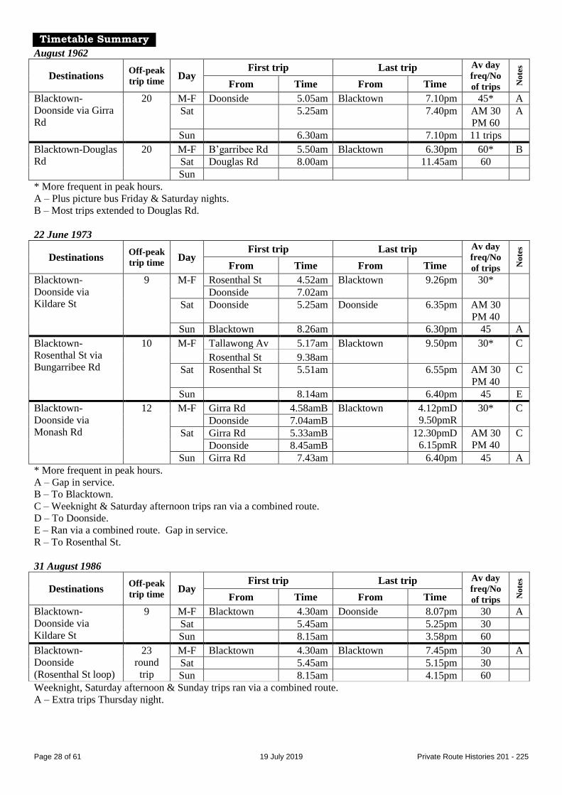
Timetable Summary
August 1962
Destinations Off-peak
trip time Day
First trip Last trip Av day
freq/No
of trips No
tes
From Time From Time
Blacktown-
Doonside via Girra
Rd
20 M-F Doonside 5.05am Blacktown 7.10pm 45* A
Sat 5.25am 7.40pm AM 30
PM 60
A
Sun 6.30am 7.10pm 11 trips
Blacktown-Douglas
Rd
20 M-F B’garribee Rd 5.50am Blacktown 6.30pm 60* B
Sat Douglas Rd 8.00am 11.45am 60
Sun
* More frequent in peak hours.
A – Plus picture bus Friday & Saturday nights.
B – Most trips extended to Douglas Rd.
22 June 1973
Destinations Off-peak
trip time Day
First trip Last trip Av day
freq/No
of trips No
tes
From Time From Time
Blacktown-
Doonside via
Kildare St
9 M-F Rosenthal St 4.52am Blacktown 9.26pm 30*
Doonside 7.02am
Sat Doonside 5.25am Doonside 6.35pm AM 30
PM 40
Sun Blacktown 8.26am 6.30pm 45 A
Blacktown-
Rosenthal St via
Bungarribee Rd
10 M-F Tallawong Av 5.17am Blacktown 9.50pm 30* C
Rosenthal St 9.38am
Sat Rosenthal St 5.51am 6.55pm AM 30
PM 40
C
Sun 8.14am 6.40pm 45 E
Blacktown-
Doonside via
Monash Rd
12 M-F Girra Rd 4.58amB Blacktown 4.12pmD
9.50pmR
30* C
Doonside 7.04amB
Sat Girra Rd 5.33amB 12.30pmD
6.15pmR
AM 30
PM 40
C
Doonside 8.45amB
Sun Girra Rd 7.43am 6.40pm 45 A
* More frequent in peak hours.
A – Gap in service.
B – To Blacktown.
C – Weeknight & Saturday afternoon trips ran via a combined route.
D – To Doonside.
E – Ran via a combined route. Gap in service.
R – To Rosenthal St.
31 August 1986
Destinations Off-peak
trip time Day
First trip Last trip Av day
freq/No
of trips No
tes
From Time From Time
Blacktown-
Doonside via
Kildare St
9 M-F Blacktown 4.30am Doonside 8.07pm 30 A
Sat 5.45am 5.25pm 30
Sun 8.15am 3.58pm 60
Blacktown-
Doonside
(Rosenthal St loop)
23
round
trip
M-F Blacktown 4.30am Blacktown 7.45pm 30 A
Sat 5.45am 5.15pm 30
Sun 8.15am 4.15pm 60
Weeknight, Saturday afternoon & Sunday trips ran via a combined route.
A – Extra trips Thursday night.
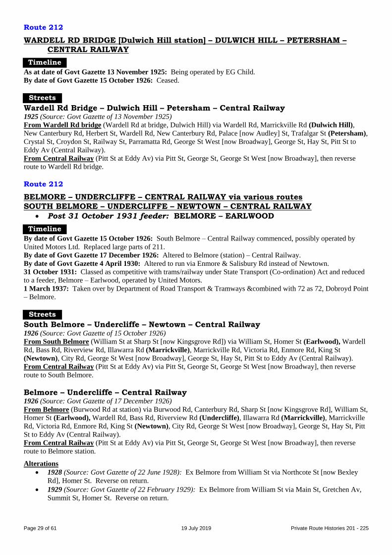
Page 29 of 61 19 July 2019 Private Route Histories 201 - 225
Route 212
WARDELL RD BRIDGE [Dulwich Hill station] – DULWICH HILL – PETERSHAM – CENTRAL RAILWAY
Timeline
As at date of Govt Gazette 13 November 1925: Being operated by EG Child.
By date of Govt Gazette 15 October 1926: Ceased.
Streets
Wardell Rd Bridge – Dulwich Hill – Petersham – Central Railway 1925 (Source: Govt Gazette of 13 November 1925)
From Wardell Rd bridge (Wardell Rd at bridge, Dulwich Hill) via Wardell Rd, Marrickville Rd (Dulwich Hill),
New Canterbury Rd, Herbert St, Wardell Rd, New Canterbury Rd, Palace [now Audley] St, Trafalgar St (Petersham),
Crystal St, Croydon St, Railway St, Parramatta Rd, George St West [now Broadway], George St, Hay St, Pitt St to
Eddy Av (Central Railway).
From Central Railway (Pitt St at Eddy Av) via Pitt St, George St, George St West [now Broadway], then reverse
route to Wardell Rd bridge.
Route 212
BELMORE – UNDERCLIFFE – CENTRAL RAILWAY via various routes
SOUTH BELMORE – UNDERCLIFFE – NEWTOWN – CENTRAL RAILWAY
Post 31 October 1931 feeder: BELMORE – EARLWOOD
Timeline
By date of Govt Gazette 15 October 1926: South Belmore – Central Railway commenced, possibly operated by
United Motors Ltd. Replaced large parts of 211.
By date of Govt Gazette 17 December 1926: Altered to Belmore (station) – Central Railway.
By date of Govt Gazette 4 April 1930: Altered to run via Enmore & Salisbury Rd instead of Newtown.
31 October 1931: Classed as competitive with trams/railway under State Transport (Co-ordination) Act and reduced
to a feeder, Belmore – Earlwood, operated by United Motors.
1 March 1937: Taken over by Department of Road Transport & Tramways &combined with 72 as 72, Dobroyd Point
– Belmore.
Streets
South Belmore – Undercliffe – Newtown – Central Railway 1926 (Source: Govt Gazette of 15 October 1926)
From South Belmore (William St at Sharp St [now Kingsgrove Rd]) via William St, Homer St (Earlwood), Wardell
Rd, Bass Rd, Riverview Rd, Illawarra Rd (Marrickville), Marrickville Rd, Victoria Rd, Enmore Rd, King St
(Newtown), City Rd, George St West [now Broadway], George St, Hay St, Pitt St to Eddy Av (Central Railway).
From Central Railway (Pitt St at Eddy Av) via Pitt St, George St, George St West [now Broadway], then reverse
route to South Belmore.
Belmore – Undercliffe – Central Railway 1926 (Source: Govt Gazette of 17 December 1926)
From Belmore (Burwood Rd at station) via Burwood Rd, Canterbury Rd, Sharp St [now Kingsgrove Rd], William St,
Homer St (Earlwood), Wardell Rd, Bass Rd, Riverview Rd (Undercliffe), Illawarra Rd (Marrickville), Marrickville
Rd, Victoria Rd, Enmore Rd, King St (Newtown), City Rd, George St West [now Broadway], George St, Hay St, Pitt
St to Eddy Av (Central Railway).
From Central Railway (Pitt St at Eddy Av) via Pitt St, George St, George St West [now Broadway], then reverse
route to Belmore station.
Alterations
1928 (Source: Govt Gazette of 22 June 1928): Ex Belmore from William St via Northcote St [now Bexley
Rd], Homer St. Reverse on return.
1929 (Source: Govt Gazette of 22 February 1929): Ex Belmore from William St via Main St, Gretchen Av,
Summit St, Homer St. Reverse on return.

Page 30 of 61 19 July 2019 Private Route Histories 201 - 225
1930 (Source: Govt Gazette of 4 April 1930): Ex Belmore from Enmore Rd via Stanmore Rd, Liberty St,
Railway Av, Cardigan St, Salisbury Rd, University St [now Salisbury Rd], Missenden Rd, Parramatta Rd.
Reverse on return.
Timetable Summary
September 1925
Destinations Off-peak
trip time Day
First trip Last trip Av day
freq/No
of trips No
tes
From Time From Time
Undercliffe-Central
Railway
M-F Undercliffe 6.45am Central Rly 11.23pm 30
Sat 6.45am 12.30am 30
Sun 8.15am 11.23pm 30
Route 212
EPPING (Chesterfield Rd) – EASTWOOD – DENISTONE – RYDE (Bridge Rd)
Timeline
By 2 April 1951: Commenced by Cyril ME Troy/Mrs BL Troy. Timetable dated 2 April 1951 shows route operated
at most times in two parts:
Eastwood – Epping (Chesterfield Rd)
Denistone – Ryde (Bridge Rd)
By January 1953 (date of commencement of service in next entry): Ceased.
Timetable Summary
2 April 1951
Destinations Off-peak
trip time Day
First trip Last trip Av day
freq/No
of trips No
tes
From Time From Time
Eastwood-Epping
(Chesterfield Rd)
11 M-F Chesterf’ld Rd 6.37am Eastwood 6.29pm Ph
Sat 7.15am 12.58pm 30 A
Sun
Denistone-Ryde
(Bridge Rd)
12 M-F Bridge Rd 6.32am Denistone 6.39pm Ph
Sat 7.18am 12.56pm 30 A
Sun
A – Selected trips ran through from Epping (Chesterfield Rd) to Ryde (Bridge Rd).
Ph – Peak hours only.
Route 212
WINDSOR – RICHMOND via RAAF Base
Timeline
January 1953: Windsor – Richmond (? route) commenced by Noel K Lakeman-Fidler.
April 1958: Transferred to MA Duffy & Sons (by 1960s trading as Kurrajong District Bus Service, & later trading as
Duffys Bus Lines) (Mark Duffy).
About 1958: Extended to/rerouted past Richmond RAAF base.
August 1980: Duffys Bus Lines transferred to Guild Management Services (N Hepburn), by 1982 trading as
Macquarie Towns Coach Lines.
By February 1985: Renumbered 690 in the Sydney Region Route Number System (see Private Route Histories –
Contract Region 1).
Streets
Same as or similar to equivalent part of later 690 (see Private Route Histories - Contract Region 1).

Page 31 of 61 19 July 2019 Private Route Histories 201 - 225
Timetable Summary
1 July 1963
Destinations Off-peak
trip time Day
First trip Last trip Av day
freq/No
of trips No
tes
From Time From Time
Windsor-Richmond 15 M-F Richmond 6.45am Windsor 5.10pm 6 trips A
Sat 10.00am 11.50pm 1 trip
Sun
A – Includes some short-workings.
August 1983
Destinations Off-peak
trip time Day
First trip Last trip Av day
freq/No
of trips No
tes
From Time From Time
Windsor-Richmond 15 M-F Richmond 7.02am Windsor 5.50pm 8 trips
Sat RAAF Base 8.17am Richmond 12.06am 4 trips A
Sun
A – Selected trips extended from RAAF Base to Windsor.
Route 213
SOUTH MARRICKVILLE – NEWTOWN – CENTRAL RAILWAY
Timeline
As at date of Govt Gazette 13 November 1925: Being operated by WB Brady.
By date of Govt Gazette 22 June 1928: Ceased.
Streets
1925 (Source: Govt Gazette of 13 November 1925)
From South Marrickville (The Warren, Premier St at McGowen Av) via Premier St, Hampton St (?), Carey St,
Illawarra Rd (Marrickville), Marrickville Rd, Victoria Rd, Enmore Rd, King St (Newtown), City Rd, George St West
[now Broadway], George St, Hay St, Pitt St to Eddy Av (Central Railway).
From Central Railway (Pitt St at Eddy Av) via Pitt St, George St, George St West [now Broadway], then reverse
route to South Marrickville.
Timetable Summary
September 1925
Destinations Off-peak
trip time Day
First trip Last trip Av day
freq/No
of trips No
tes
From Time From Time
South Marrickville-
Central Railway
30 M-F Sth M’ville 7.15am Central Rly 7.49pm 70-80 A
Sat 7.15am 7.49pm 70-80
Sun
A – Extra trip Friday night.
Route 213
BELMORE – EARLWOOD – CENTRAL RAILWAY
Timeline
By date of Govt Gazette 22 February 1929: Commenced, possibly by United Motors (McNicol Bros).
By date of Govt Gazette 4 April 1930: Altered to run via Enmore & Salisbury Rd instead of Newtown.
31 October 1931: Ceased as competitive with Government railway or tram services under State Transport (Co-
ordination) Act.
Streets
1929 (Source: Govt Gazette of 22 February 1929)
From Belmore (Burwood Rd at station) via Burwood Rd, Canterbury Rd, Beamish St, Northcote St [now Kingsgrove
Rd], William St, Homer St (Earlwood), Earlwood Av, Prince Edward Av, Riverview Rd, Illawarra Rd

Page 32 of 61 19 July 2019 Private Route Histories 201 - 225
(Marrickville), Marrickville Rd, Victoria Rd, Enmore Rd, King St (Newtown), Australia St, Parramatta Rd, George
St West [now Broadway], George St, Hay St, Pitt St to Eddy Av (Central Railway).
From Central Railway (Pitt St at Eddy Av) via Pitt St, George St, George St West [now Broadway], then reverse
route to Belmore station.
Alteration
1930 (Source: Govt Gazette of 4 April 1930): Ex Belmore from Enmore Rd via Stanmore Rd, Liberty St, Railway
Av, Cardigan St, Salisbury Rd, University St [now Salisbury Rd], Missenden Rd, Parramatta Rd. Reverse on return.
Route 213
BEXLEY NORTH – EARLWOOD – CAMPSIE
Timeline
23 November 1936: Commenced by United Motors (McNicol Bros).
1 March 1937: Taken over by Department of Road Transport & Tramways & amalgamated with 38, 87 &
Department of Road Transport & Tramways 90, as 90, Drummoyne – Campsie – Earlwood.
Route 213
PARRAMATTA – SOUTH WENTWORTHVILLE (Boronia St Loop) via Old Prospect Rd
Timeline
1947: Commenced by George R Sinclair.
December 1950: Transferred to Western Road Transport Service (FJ (Jack) Spellacy).
At least by 1960s: Off-peak & most Saturday service provided by diversions of 179.
1 April 1968: Transferred to Western Road Bus Services (Col Neyland & Trevor Thornley). Thornley was sole
proprietor from 1974.
By March 1981: Parramatta – Boronia St Loop (179 in off-peak or 213 in peak) & Parramatta – Ringrose Av &
Jersey Rd loop (part of 179) combined as part of 179.
See also Note under December 1957 for Route 174.
Streets
Circa 1969 (Source: RGH notes)
From Parramatta (Argyle St at station) via Wentworth St, Parkes St, Anderson St, Junction St [before Parkes St was
altered to meet Great Western Hwy at Church St], Great Western Hwy, Old Prospect Rd, Boronia St (South
Wentworthville), Chelmsford Rd, Old Prospect Rd, Great Western Hwy, Marsden St, Argyle St to Parramatta station.
Alteration
Later (Source: RGH notes): Ex Boronia St from Old Prospect Rd via Rawson Rd, Great Western Hwy.
Timetable Summary
26 September 1949
Destinations Off-peak
trip time Day
First trip Last trip Av day
freq/No
of trips No
tes
From Time From Time
Parramatta-South
Wentworthville
(Boronia St Loop)
23 M-F Boronia St 6.43am Parramatta 7.30pm 60*
Sat 7.30am 1.15pm 45
Sun
* More frequent in peak hours.
September 1966
Destinations Off-peak
trip time Day
First trip Last trip Av day
freq/No
of trips No
tes
From Time From Time
Parramatta-South
Wentworthville
(Boronia St Loop)
32
round
trip
M-F Boronia St 5.49am Boronia St 6.28pm Ph
Sat 7.23am Parramatta 1.00pm 60 A
Sun
A – Early morning trips run by 213. Service during remainder of Saturday morning (& picture bus) provided by
diversions of 179.
Ph – Peak hours only. Service during M-F off-peak provided by diversions of 179.

Page 33 of 61 19 July 2019 Private Route Histories 201 - 225
Route 214
SPIT JUNCTION – MILSONS POINT
Timeline
As at date of Govt Gazette 13 November 1925: Being operated by White Transit Co (Charles H Hicks).
By date of Govt Gazette 15 October 1926: Ceased.
Streets
1925 (Source: Govt Gazette of 13 November 1925)
From Spit Junction (Myahgah Rd at Military Rd) via Myahgah Rd, Military Rd (Cremorne Junction, Neutral Bay
Junction), Laycock St, Falcon St, Miller St (North Sydney), Berry St, Walker St, Mount St, Alfred St, Dind St, Glen
St to Milsons Point tram terminus.
From Milsons Point (Glen St at tram terminus) via reverse route to Falcon St, then Merlin St, Military Rd, Myahgah
Rd to near Military Rd (Spit Junction).
Timetable Summary
September 1925
Destinations Off-peak
trip time Day
First trip Last trip Av day
freq/No
of trips No
tes
From Time From Time
Spit Junction-
Milsons Point
28 M-F Spit Jun 7.07am Milsons Pt 12.33am 15-20
Sat 7.07am 12.33am 15-20
Sun 9.02am 11.57pm 20-30
Route 214
STRATHFIELD – SOUTH STRATHFIELD
Timeline
Unknown: Strathfield – Wallis Av commenced by JC Moreton.
13 May 1933: 217 absorbed into 214, which became Strathfield – Ada Av & Elsie St [now Shortland Av].
1 March 1937: Taken over by Department of Road Transport & Tramways.
Route 214
MERRYLANDS – WENTWORTHVILLE
Timeline
By 14 November 1949: Commenced by Barklimore Bros (JCB (Jack) & WC (Colin) Barklimore).
By 1960s: Ran either via Centenary Rd or via Jersey Rd.
1 March 1981: Transferred to Baxter’s Bus Lines, later also trading as Baxter’s Holroyd Bus Lines.
27 November 1983: Renumbered 814 in the Sydney Region Route Number System but ran via Jersey Rd only &
extended from Wentworthville to Westmead Hospital (see Private Route Histories – Contract Region 3).
Streets
Circa 1960s (Source: RGH notes)
Via Centenary Rd From Merrylands (Terminal Pl at station) via Pitt St, Merrylands Rd, Centenary Rd (South Wentworthville),
Station St, Dunmore St, Freame St, The Kingsway to Wentworthville station.
From Wentworthville (The Kingsway at station) via Station St, then reverse route to Merrylands Rd, then Terminal
Pl to Merrylands station.
Via Jersey Rd From Merrylands (Terminal Pl at station) via Pitt St, Merrylands Rd, Centenary Rd, Irrigation Rd, Jersey Rd, Old
Prospect Rd, Station St, Dunmore St, Freame St, The Kingsway to Wentworthville station.
From Wentworthville (The Kingsway at station) via Station St, then reverse route to Merrylands Rd, then Terminal
Pl to Merrylands station.

Page 34 of 61 19 July 2019 Private Route Histories 201 - 225
Timetable Summary
14 November 1949
Destinations Off-peak
trip time Day
First trip Last trip Av day
freq/No
of trips No
tes
From Time From Time
Merrylands-
Wentworthville
19 M-F Wentw’thville 6.20am Merrylands 6.21pm 40
Sat 7.18am 12.52pm 40
Sun
November 1981
Destinations Off-peak
trip time Day
First trip Last trip Av day
freq/No
of trips No
tes
From Time From Time
Merrylands-
Wentworthville
17 M-F Merrylands 5.40am Wentw’thville 6.07pm 60*
Sat Wentw’thville 7.30am 12.15pm 60 A
Sun
* More frequent in peak hours.
A – Plus short-working/s before first trip shown.
Route 215
STRATHFIELD – SOUTH STRATHFIELD – BELMORE via The Boulevarde
(The terminus at South Strathfield (The Broadway) is in current Enfield.)
Timeline
As at date of Govt Gazette 13 November 1925: Strathfield – South Strathfield (The Broadway) (selected peak hour
& early Saturday morning trips extended to South Strathfield (Liverpool Rd/Homebush Rd)), being operated by Mrs
AE Rose.
December 1929: Transferred to JC Moreton.
18 October 1936: Combined with 216, as 215 Strathfield – South Strathfield – Belmore, presumably so that the
private route was non-competitive with the extension of DRT&T 88 from South Strathfield to Strathfield on the same
date.
1 March 1937: Taken over by Department of Road Transport & Tramways.
Streets
Strathfield – South Strathfield (The Broadway) (selected peak hour & Saturday
morning trips extended to Homebush Rd/Liverpool Rd) 1925 (Source: Govt Gazette of 13 November 1925)
From Strathfield (The Boulevarde at Bridge Rd [former street, at station]) via The Boulevarde to The Broadway
(South Strathfield). Reverse on return.
South Strathfield (Homebush Rd/Liverpool Rd) extension: From South Strathfield (The Broadway) via Liverpool
Rd [now Hume Hwy], Mintaro Av, Cross St, Liverpool Rd [now Hume Hwy] to Homebush Rd (South Strathfield).
Reverse on return.

Page 35 of 61 19 July 2019 Private Route Histories 201 - 225
Timetable Summary
September 1925
Destinations Off-peak
trip time Day
First trip Last trip Av day
freq/No
of trips No
tes
From Time From Time
Strathfield-South
Strathfield (The
Broadway)†
Fr Strath
9B
11H
M-F Homebush Rd 6.40amS Homebush Rd 6.26pmS 20-30 A
Strathfield 7.20pmB
Sat 6.40amS Homebush Rd 8.06mS 20-30 A
Strathfield 7.20pmB
Sun
† Selected trips extended in South Strathfield from The Boulevarde to Liverpool Rd/Homebush Rd.
A – Base service, Strathfield-South Strathfield (The Boulevarde). Selected peak hour & early Saturday morning trips
extended to South Strathfield (Liverpool Rd/Homebush Rd).
B – To South Strathfield (The Broadway).
H – To South Strathfield (Homebush Rd/Liverpool Rd).
S – To Strathfield.
Route 215
KINGSWOOD – CAMBRIDGE PARK – CRANEBROOK PENRITH – BEL-AIR – KINGSWOOD PARK
PENRITH – CAMBRIDGE GARDENS PENRITH – CAMBRIDGE PARK PENRITH – CRANEBROOK via Castlereagh Rd
PENRITH – CRANEBROOK via Richmond Rd PENRITH – DERBY ST – SECOND AV PENRITH – HORNSEYWOOD
PENRITH – HOSPITAL PENRITH – JAMISON RD – SMITH ST
PENRITH – KINGSWOOD – ORCHARD HILLS PENRITH – LEMONGROVE PENRITH – LLANDILO (shopping service)
PENRITH – LUDDENHAM PENRITH – O’CONNELL ST
PENRITH – ORCHARD HILLS – LUDDENHAM PENRITH – REGENTVILLE (shopping & picture service)
PENRITH – SOUTH PENRITH – KINGSWOOD
PENRITH – ST MARYS PENRITH – WERRINGTON PENRITH – WERRINGTON COUNTY
PENRITH – YORK RD SOUTH
(Hornseywood estate was centred round Derby, Brown & Castlereagh Sts, Penrith.)
Timeline
5 November 1945: Penrith – Kingswood – Orchard Hills commenced by Fragar Bros. Penrith – Hornseywood
probably started at same time.
1949: Extended to St Marys.
During Fragar Bros’ proprietorship (not known whether this list applies before or after April 1950 list below):
Routes were (all limited services):
Penrith – Cambridge Park
Penrith – Hornseywood
Penrith – Hospital
Penrith – Jamison Rd & Bringelly Rd
Penrith – Kingswood
Penrith – Lemongrove
Penrith – O’Connell St
Penrith – St Marys

Page 36 of 61 19 July 2019 Private Route Histories 201 - 225
As at April 1950: Routes were (all limited services):
Penrith – Cambridge Park
Penrith – Hornseywood
Penrith – Hospital
Penrith – Kingswood
Penrith – Llandilo (shopping service Thursdays only)
Penrith – Luddenham
Penrith – O’Connell St
Penrith – Orchard Hills
Penrith – Regentville (river bank) (shopping service Tuesdays & Fridays; picture service Wednesdays)
Penrith – St Marys
June 1961: Transferred to WJS (Bill) Bale & Sons (then or later trading as Penrith District Bus Service). At this
time, route was described in Truck & Bus Transportation, August 1961 as “Penrith, Orchard Hills, Luddenham,
Cambridge Park.”
May 1962: Route described in Truck & Bus Transportation, July 1962 as “Penrith – Hornseywood, Orchard Hills,
etc.”
Circa 1970: Services gradually expanded as population increased. Routes were:
Penrith – Bel-Air – Kingswood Park
Penrith – Cambridge Park
Penrith – Derby St – Second Av
Penrith – Jamison Rd – Smith St
Penrith – South Penrith – Kingswood (see Note § below)
Penrith – St Marys
Penrith – Werrington
Note §: Timetable dated 20 August 1970 shows the Penrith – South Penrith – Kingswood service to be on 3 months’
trial. Trial presumably partially successful, but route curtailed as Penrith – South Penrith by 1973.
Circa 1973: Services continued to expand. Routes were:
Kingswood – Cambridge Park (peak hours)
Penrith – Bel-Air – Kingswood Park
Penrith – Cambridge Gardens
Penrith – Cambridge Park
Penrith – Cranebrook via Castlereagh Rd (limited service)
Penrith – Cranebrook via Richmond Rd
Penrith – Derby St – Second Av
Penrith – Jamison Rd – Smith St
Penrith – South Penrith
Penrith – St Marys
Penrith – Werrington County – Werrington
Penrith – York Rd South
Mid-1970s (?): Kingswood – Cambridge Park (peak hours) extended to Cranebrook.
17 April 1974: Penrith District Bus Service transferred to Bosnjak family (Roger L Graham, general manager from
1982).
By 1982: Operator’s name changed to Bosnjak Penrith.
16 August 1982: Reorganised & renumbered into the Sydney Region Route Number System (see Private Route
Histories – Contract Region 1):
780 Penrith – St Marys
782 Penrith – Werrington via Greenbank Dr
784 Penrith – Werrington via Kingswood
785 Penrith – Cambridge Park
786 Penrith – Cranebrook
788 Penrith – Llandilo (possibly a school service upgraded and/or revival/extension of hours of shopping
service as at April 1950)
790 Penrith – Jamison Rd, South Penrith
791 Penrith – South Penrith loop
792 Penrith – South Penrith (combined loop).

Page 37 of 61 19 July 2019 Private Route Histories 201 - 225
Streets
Kingswood – Cambridge Park Circa 1970 (Source: timetable)
From Cambridge Park (Kareela Av & Caloola Av) via Caloola Av, Illawong Av, Moonbi Rd, Kareela Av, Caloola
Av, Richmond Rd, Oxford St, Wrench St, Cambridge St, Richmond Rd to Kingswood station.
Penrith – St Marys Circa 1973 (Source: timetable)
From Penrith (station) via Riley St, Great Western Hwy [part now High St] (Kingswood), Charles Hackett Dr,
Queen St, Great Western Hwy. [Most trips terminated at Charles Hackett Dr/Queen St, St Marys.]
Alteration
Later (Source: timetable): Extended from Penrith station to Penrith Plaza.
Penrith – Werrington Circa 1970 (Source: timetable)
From Penrith Plaza via Station St, Riley St, Great Western Hwy [part now High St], Parker St, Cox Av, Richmond
Rd (Kingswood), Victoria St, Park Av (Werrington).
Later (Source: timetable)
From Penrith (station) via Jane St to Penrith Plaza, then Jane St, Station St, Henry St, High St, Parker St, Cox Av,
Londonderry [now Richmond] Rd (Kingswood), Victoria St, Heath St, Park Av, Victoria St to Werrington station.
Penrith – Werrington County – Werrington Circa 1973 (Source: timetable)
From Penrith (station) via Jane St to Penrith Plaza, then Jane St, Station St, Henry St, High St, Parker St, Cox Av,
Londonderry [now Richmond] Rd (Kingswood), Victoria St, Wrench St, Herbert St, William St, Wrench St, Rugby
St, John Oxley Dr, Dunheved Rd, Henry Lawson Dr (Werrington County), Ovens St, John Batman Av, Dunheved
Rd, John Oxley Dr, Princess St, Gibson St, Victoria St to Werrington station. Reverse on return.
Penrith – Bel-Air – Kingswood Park Circa 1970 (Source: timetable)
From Penrith (station) via Station St, Great Western Hwy [now High St], Evan St, Macquarie Av, Lemongrove Rd,
Robert St, Sunshine Av, Hillcrest Av, Illawong Av (Kingswood Park), Moonbi Rd, Kareela Av to Coreen Av.
Return via Coreen Av, Arakoon Av, Caloola Av, Illawong Av, then reverse route to Penrith station.
Penrith – Cambridge Gardens Circa 1973 (Source: timetable)
From Penrith (station) via Jane St to Penrith Plaza, then Jane St, Riley St, Henry St, High St, Evan St, Macquarie Av,
Lemongrove Rd, Robert St, Sunshine Av, Hillcrest Av, Hilltop Rd, Arakoon Av, Caloola Av, Illawong Av, Moonbi
Rd, Kareela Av, Brewongle Av, Richmond Rd, Lewis Rd, Trinity Dr, Huntingdon Pde, Priory Av, Summerfield Circ,
Trinity Dr, Newham Dr, Trinity Dr to Richmond Rd (Cambridge Gardens). Reverse on return.
Circa 1974 (Source: timetable)
From Penrith (station) via Jane St to Penrith Plaza, then Jane St, Station St, Henry St, High St, Evan St, Macquarie
Av, Lemongrove Rd, Coreen Av, Bel-air Rd, Sunshine Av, Hillcrest Av, Hilltop Rd, Arakoon Av, Caloola Av,
Illawong Av, Moonbi Rd, Kareela Av, Brewongle Av, Richmond Rd, Lewis Rd, Trinity Dr (Cambridge Gardens),
Huntingdon Pde, Priory Av, Summerfield Circ, Trinity Dr, Newham Dr, Trinity Dr to Richmond Rd. Reverse on
return.
Penrith – Cambridge Park Circa 1973 (Source: timetable)
From Penrith (station) via Station St, Great Western Hwy [now High St], Evan St, Thurston St, Glebe Pl, Parker St,
Cox Av, Richmond Rd, Cambridge St, Wrench St (Cambridge Park), Oxford St, Richmond Rd to Coopers Lane
[now Cooper St] (Cambridge Gardens).

Page 38 of 61 19 July 2019 Private Route Histories 201 - 225
Penrith – Cranebrook via Richmond Rd Circa 1973 (Source: timetable)
From Penrith (station) via Jane St to Penrith Plaza, then Jane St, Station St, Henry St, Great Western Hwy [part now
High St], Evan St, Macquarie Av, Lemongrove Rd, Coreen Av, Parker St, Richmond [now The Northern] Rd,
[possibly Nepean St – now site of reserve between Seaton Cr & Pershore Rd], Pendock Rd, Sherringham Rd to
Heffernan Rd (Cranebrook).
Penrith – Cranebrook via Castlereagh Rd Circa 1973 (Source: timetable)
From Penrith (station) via Jane St to Penrith Plaza, then Jane St, Riley St, Henry St, Lawson St, Great Western Hwy
[now High St], Castlereagh Rd, Cranebrook Rd, Boundary Rd [part now Dulhunty St, Marrett Way, Wagner Pl,
Britten Cl & Debussy Pl] to Richmond [now The Northern] Rd (Cranebrook).
Penrith – South Penrith – Kingswood From 20 August 1970 (Source: timetable)
From Penrith (station) via [Station St (?)], Great Western Hwy [now High St], Castlereagh St, Jamison Rd,
Racecourse Rd, Alkoomie Av, Lorne Av, Grandview St, Keith St, Evan St, Smith St, Fragar Rd, Tania Av (South
Penrith), Hilliger Rd, Mazepa Av, Smith St, Parker St, Jamison Rd, Bringelly Rd to Kingswood. Reverse on return.
Penrith – South Penrith Circa 1973 (Source: timetable)
From Penrith (station) via Riley St, Great Western Hwy [now High St], Castlereagh St, Jamison Rd, Racecourse Rd,
Alkoomie Av, Lorne Av, Grandview St, Keith St, Evan St, Chesterfield Rd, Carinda Av, Stevenson St, Greenaway Dr,
Gamenya Av, Blue Gum Av, Fragar Rd, Tania Av (South Penrith), Hilliger Rd, Mazepa Av, Smith St, Fragar Rd,
Burgess Rd. Return via Burgess Rd, Mazepa Av, then reverse route.
Penrith – Derby St – Second Ave Circa 1970 (Source: timetable)
From Penrith (station) via Station St, Great Western Hwy [now High St], Evan St, Derby St, Doonmore St, Stafford
St, Colless St, Derby St, Somerset St, Rodgers St, Bringelly Rd, Second Av (Kingswood). Reverse on return.
Circa 1973 (Source: timetable)
From Penrith (station) via Station St, Great Western Hwy [now High St], Castlereagh St, Derby St, Doonmore St,
Stafford St, Colless St, Derby St, Somerset St, Rodgers St, Bringelly Rd, Second Av, Morphett St, Anthony Cr
(Kingswood). Reverse on return.
Penrith – Jamison Rd – Smith St Circa 1970 (Source: timetable)
From Penrith (station) via Station St, Great Western Hwy [now High St], Castlereagh St, Jamison Rd, Warwick St,
Stafford St, Evan St, Jamison Rd, Penrose Cr, Smith St, Fragar Rd, Jamison Rd, Bringelly Rd to Smith St
(Kingswood).
Penrith – York Rd South Circa 1973 (Source: timetable)
From Penrith (station) via Station St, Riley St, High St, Castlereagh St, Jamison Rd, York Rd, Denintend Pl, Mosely
Av, Birmingham Rd, York Rd, Enfield St [now part of York Rd] to Price St (South Penrith).

Page 39 of 61 19 July 2019 Private Route Histories 201 - 225
Timetable Summary
April 1950
Destinations Off-peak
trip time Day
First trip Last trip Av day
freq/No
of trips No
tes
From Time From Time
Penrith-
Hornseywood
M-F Penrith 7.35am Hornseywood 6.20pm 7 trips
Sat 7.35am 1.38pm 3 trips
Sun 8.48am 7.53pm 3 trips
Penrith-Orchard
Hills
M-F Orchard Hills 6.40am Penrith 6.30pm 8 trips A
Sat 6.40am 5.30pm 6 trips B
Sun 8.35am 8.30pm 3 trips
Penrith-St Marys M-F Penrith 9.45am St Marys 2.45pm 2 trips
Sat 9.45am 3.00pm 2 trips
Sun 2.20pm 3.00pm 1 trip
Penrith-Luddenham M-F Penrith 6.45am Luddenham 4.05pm 2 trips
Sat 6.45am 2.45pm 2 trips
Sun 6.45am 7.55am 1 trip
Penrith-O’Connell
St
M-F Penrith 9.45am O’Connell St 3.10pm 4 trips
Sat 8.50am 3.05pm 4 trips B
Sun 2.20pm 3.05pm 1 trip
Penrith-Cambridge
Park
M-F Penrith 9.10am Cambridge Pk 9.55am 2 trips C
Sat 9.12am 1.45pm 2 trips B
Sun
Penrith-Hospital M-F Penrith 8.50am Hospital 3.30pm 3 trips D
Sat 8.50am 8.00pm 4 trips
Sun 1.55pm 3.30pm 2 trips
Penrith-Regentville M-F Penrith 2.15pm Regentville 5.25pm 2 trips E
Sat
Sun
A – Plus picture bus Wednesday night.
B – Plus picture bus Saturday night.
C – Extra trip Thursday, extended to Llandilo.
D – Extra trip Wednesday.
E – Tuesday & Friday only. Plus picture bus Wednesday night.

Page 40 of 61 19 July 2019 Private Route Histories 201 - 225
1970s
Destinations Off-peak
trip time Day
First trip Last trip Av day
freq/No
of trips No
tes
From Time From Time
Kingswood-
Cambridge Park
12 M-F Cambridge Pk 5.12am Kingswood 6.35pm Ph
Sat
Sun
Penrith-Kingswood
Park
15 M-F Penrith 9.00am Kingswood Pk 3.05pm 5 trips
Sat 8.45am 11.15am 2 trips
Sun
Penrith-Cambridge
Gardens
25 M-F C’bridge Gdns 7.00am Penrith 6.27pm 60*
Sat 7.55am 12.00nn 60
Sun
Penrith-Cambridge
Park
23 M-F Cambridge Pk 5.52am Penrith 6.27pm 30
Sat 6.55am Cambridge Pk 12.35pm 30
Sun
Penrith-Cranebrook
via Castlereagh Rd
20 M-F Cranebrook 9.05am Penrith 2.30pm 2 trips
Sat
Sun
Penrith-Cranebrook
via Richmond Rd
30 M-F Cranebrook 6.50am Penrith 6.27pm 60
Sat 7.50am 12.05pm 60
Sun
Penrith-Derby St &
Second Av
20 M-F Second Av 5.42am Penrith 6.27pm 90*
Sat 7.40am Second Av 12.30pm 60
Sun
Penrith-Jamison Rd
& Smith St
20 M-F Smith St 5.28am Penrith 6.27pm 60*
Sat 7.05am Smith St 12.35pm 40
Sun
Penrith-South
Penrith
50
round
trip
M-F Sth Penrith 6.57am Penrith 6.27pm 60
Sat 7.50am 12.08pm 60
Sun
Penrith-St Marys 20 M-F Penrith 6.30am St Marys 4.25pm 5 trips
Sat 9.20am 11.50am 3 trips
Sun
Penrith-Werrington 30 M-F Kingswood 5.19am Werrington 6.25pm 60*
Penrith 8.25am
Sat Werrington 7.50am Penrith 12.15pm 60
Sun
Penrith-York Rd
South
22 M-F York Rd Sth 7.00am Penrith 5.36pm 60
Sat 8.00am 12.05pm 60
Sun
* More frequent in peak hours.
Ph – Peak hours only.
Route 216
STRATHFIELD – SOUTH STRATHFIELD – BELMORE via Homebush Rd
STRATHFIELD – SOUTH STRATHFIELD via Homebush Rd
Selected trips extended from South Strathfield to Chullora)
(Parts of Chullora south of Liverpool Rd are now in Greenacre.)
Timeline
As at date of Govt Gazette 13 November 1925: Strathfield – South Strathfield – Chullora via Homebush Rd being
operated by Mrs AE Rose.
December 1929: Transferred to JC Moreton.
2 January 1934: 36 and 216 amalgamated as 216, Strathfield – South Strathfield – Belmore.

Page 41 of 61 19 July 2019 Private Route Histories 201 - 225
18 October 1936: Combined with 215, as 215 Strathfield – South Strathfield – Belmore, presumably coincident with
the extension of Department of Road Transport &Tramways 88 from South Strathfield to Strathfield.
Streets
Strathfield – South Strathfield – Chullora 1925 (Source: Govt Gazette of 13 November 1925)
From Strathfield (The Boulevarde at Bridge Rd [former street, at station]) via The Boulevarde, Redmyre Rd,
Homebush Rd (South Strathfield), Liverpool Rd [now Hume Hwy] to Margaret St (Chullora). Reverse on return.
Timetable Summary
September 1925
Destinations Off-peak
trip time Day
First trip Last trip Av day
freq/No
of trips No
tes
From Time From Time
Strathfield-Chullora 17 M-F Sth Strathfield 8.08am Strathfield 11.50pm 20-30 A
Sat 8.08am 11.50pm 20-30 A
Sun 7.20am 10.18pm 20-60 B
A – Morning, 1 trip extended to Chullora. M-F & Saturday morning peak hours & Saturday afternoon, Strathfield-
Hunter St. At most other times, Strathfield- Liverpool Rd/Homebush Rd. Gap in service.
B – Selected trips diverted via 217.
Route 216
RIVERSTONE – MARAYLYA WINDSOR – MARAYLYA
WINDSOR – RIVERSTONE WINDSOR – SCHEYVILLE
Timeline
1947: Windsor – Scheyville commenced by RM Sanday. (Later reduced to a school service.)
1948: Transferred to J Denzil.
1950: Transferred to Noel K Lakeman-Fidler.
?: New routes commenced:
Riverstone – Maraylya (limited service)
Windsor – Maraylya (mainly school service)
Windsor – Riverstone
June 1958: Transferred to RC (Rob) Kirkpatrick, then or later trading as Hawkesbury Valley Bus Service.
2 November 1990: Hawkesbury Valley Bus Service transferred to Calabro family.
Early 2000: Renumbered into the Sydney Region Route Number System (see Private Route Histories – Contract
Region 1):
661 Windsor – Riverstone
662 Riverstone – Maraylya.
Streets
Riverstone – Maraylya 1989 (Source: timetable)
From Riverstone (Riverstone Pde at station) via Riverstone Pde, Station St, Junction Rd, Windsor Rd, Boundary Rd
to Maraylya.
Windsor – Maraylya 1989 (Source: timetable)
From Windsor (station) via George St, Fitzgerald St, Macquarie St, Kable St, Terrace St, Baker St, Thompson
Square, Bridge St, Windsor Rd, Pitt Town Rd (McGraths Hill), Wolseley Rd, Old Stock Route Rd (Oakville),
Scheyville Rd, Neich Rd, Boundary Rd to Maraylya.
Windsor – Riverstone 1989 (Source: timetable)
From Windsor (station) via George St, Fitzgerald St, Macquarie St, Kable St, Terrace St, Baker St, Thompson
Square, Bridge St, Windsor Rd, Pitt Town Rd, Old Hawkesbury Rd, Andrew Thompson Dr (McGraths Hill), Meares

Page 42 of 61 19 July 2019 Private Route Histories 201 - 225
Rd, Old Hawkesbury Rd, McGraths Rd, Windsor Rd, Level Crossing Rd, Wallace Rd, Bandon Rd (Vineyard),
Chapman Rd, Commercial Rd, Boundary Rd, Windsor Rd, Junction Rd, Crown Rd, Riverstone Pde to Riverstone
station.
Timetable Summary
8 December 1989
Destinations Off-peak
trip time Day
First trip Last trip Av day
freq/No
of trips No
tes
From Time From Time
Windsor-
Riverstone
31 M-F Windsor 5.33am Riverstone 5.43pm 9 trips A
Sat 8.32am 1.03pm 2 trips
Sun
Riverstone-
Maraylya
20 M-F Maraylya 7.05am Riverstone 4.42pm 1 trip
Sat
Sun
A – Plus short-working/s after last trip shown.
Route 217
STRATHFIELD – HOMEBUSH (Albert Rd) [in current Strathfield]
Timeline
As at date of Govt Gazette 13 November 1925: Being operated by Mrs AE Rose.
By date of Govt Gazette 22 June 1928: Extended from Heyde & Albert Rds to Barker & Albert Rds.
December 1929: Transferred to JC Moreton.
13 May 1933: Combined with 214 as 214, Strathfield – Ada Av & Elsie St [now Shortland Av].
Streets
Strathfield – Homebush (Heyde Av & Albert Rd) 1925 (Source: Govt Gazette of 13 November 1925)
From Strathfield (The Boulevarde at Bridge Rd [former street at station]) via The Boulevarde, The Avenue [now
Churchill Av], Oxford Rd, Heyde Av, Albert Rd, Homebush Rd, The Avenue, The Boulevarde to Strathfield station.
Strathfield – Homebush (Barker & Albert Rds) 1927 (Source: Govt Gazette of 27 May 1927)
From Strathfield (The Avenue at The Boulevarde) via The Avenue, Oxford Rd, Todman St, Barker Rd, South St,
Albert Rd, Clarendon Rd, The Boulevarde, The Avenue to near The Boulevarde (Strathfield).
1928 (Source: Govt Gazette of 22 June 1928)
From Strathfield (Clarendon St [now Albert Rd] at station) via Clarendon St, The Boulevarde, The Avenue, Oxford
Rd, Todman St, Barker Rd, South St, Albert Rd, Clarendon Rd to Strathfield station.
Timetable Summary
September 1925
Destinations Off-peak
trip time Day
First trip Last trip Av day
freq/No
of trips No
tes
From Time From Time
Strathfield-
Homebush (Albert
Rd)
11 M-F Albert Rd 7.17am Strathfield 11.50pm 15-30
Sat 7.17am 11.20pm 15-30
Sun 8.20am 10.18pm 15 trips A
A – Most service provided by diversions of 216.
Route 217
RICHMOND – AGNES BANKS – CASTLEREAGH
RICHMOND – LONDONDERRY – PENRITH
Timeline
1942: Richmond – Londonderry – Penrith commenced by RE Nutt.
March 1947: Transferred to JE Sinclair.

Page 43 of 61 19 July 2019 Private Route Histories 201 - 225
1952: Transferred to Noel K Lakeman-Fidler.
September 1956: Transferred to MA Duffy & Sons (by 1960s trading as Kurrajong District Bus Service, & later
trading as Duffys Bus Lines) (Mark Duffy).
28 October 1957: The Richmond – Castlereagh section of 219 transferred from GW Young & renumbered part of
217. For a period, service was operated by MJ Crane & MA Duffy & Sons.
February 1966: Richmond – Londonderry – Penrith (Londonderry – Penrith Thursdays-only shopping service - by
then?) transferred to Howe’s Bus Service (FC Howe) and renumbered 202, leaving 217 as Richmond – Castlereagh
(which, by the 1960s, was a school-only service).
August 1980: Duffys Bus Lines transferred to Guild Management Services (N Hepburn), by 1982 trading as
Macquarie Towns Coach Lines.
By August 1983: Regular route service restored as Richmond – Agnes Banks (including trips to/via William Cox Dr
– new estate), with selected school trips extended to Castlereagh.
By February 1985: Renumbered 693 in the Sydney Region Route Number System (see Private Route Histories –
Contract Region 1).
Streets
Same as or similar to later Route 693 (see Private Route Histories - Contract Region 1).
Timetable Summary
26 June 1959
Destinations Off-peak
trip time Day
First trip Last trip Av day
freq/No
of trips No
tes
From Time From Time
Richmond-
Londonderry
13 M-F Londonderry 6.12am Richmond 6.30pm 7 trips A
Sat Richmond 8.17am 5.20pm 5 trips B
Sun
A – Extra trips Tuesday, Thursday & Friday.
B – Plus picture bus Saturday night.
July 1961
Destinations Off-peak
trip time Day
First trip Last trip Av day
freq/No
of trips No
tes
From Time From Time
Richmond-
Castlereagh
20 M-F Richmond 7.40am Castlereagh 4.10pm 2 trips A
Sat 9.45am 12.25pm 2 trips
Sun
A – Extra trips Tuesday & Friday.
August 1983
Destinations Off-peak
trip time Day
First trip Last trip Av day
freq/No
of trips No
tes
From Time From Time
Richmond-Agnes
Banks
10 M-F Agnes Banks 9.20am Richmond 6.05pm 5 trips
Sat
Sun
Route 218
STRATHFIELD (various termini) – CENTRAL RAILWAY
Timeline
As at date of Govt Gazette 13 November 1925: Strathfield (Chalmers Rd) – Central Railway being operated by CF
Inder.
As at date of Govt Gazette 27 May 1927: Strathfield terminus altered to Coventry St.
Later: Transferred to Metropolitan Omnibus & Transport Co (FH (later Sir Frederick) Stewart).
By date of Govt Gazette 22 June 1928: Ceased.

Page 44 of 61 19 July 2019 Private Route Histories 201 - 225
Streets
Strathfield (Chalmers Rd) – Central Railway 1925 (Source: Govt Gazette of 13 November 1925)
From Strathfield (Chalmers St at Victoria St) via Chalmers Rd, Barker Rd, Oxford Rd, Heyde Av, Dickson St,
Mackenzie St, Bridge St [now Rd] (Homebush), Parramatta Rd (Burwood), George St West [now Broadway],
George St, Hay St, Pitt St to Eddy Av (Central Railway).
From Central Railway (Pitt St at Eddy Av) via Pitt St, George St, George St West [now Broadway], then reverse
route to Strathfield.
Strathfield (Coventry St) – Central Railway Alteration
1927 (Source: Govt Gazette of 27 May 1927): To start from Coventry St at Dickson St, then Coventry St, Mackenzie
St. Reverse on return.
Timetable Summary
September 1925
Destinations Off-peak
trip time Day
First trip Last trip Av day
freq/No
of trips No
tes
From Time From Time
Strathfield
(Chalmers Rd)-
Central Railway
55 M-F Chalmers Rd 6.39am Central Rly 11.28pm 30-60
Sat 6.39am 11.28pm 30-60
Sun 10.15am 11.28pm 30-60
Route 218
WINDSOR – PITT TOWN – MAROOTA – WISEMANS FERRY
Timeline
1946: Windsor – Maroota commenced by W Board.
1948: Transferred to RW Avern.
Later in 1948: Transferred to Noel K Lakeman-Fidler, and extended from Maroota to Wiseman’s Ferry (limited
service at non-school times).
May 1953: Transferred to Ronald V & Phyllis E Clarkson (later also other family members), later trading as
Clarksons Bus Service.
February 1984: Transferred to Hawkesbury Valley Bus Service (RC (Rob) Kirkpatrick).
By 1989: More frequent non-school service provided, Windsor – Pitt Town.
2 November 1990: Hawkesbury Valley Bus Service transferred to Calabro family.
Early 2000: Renumbered 663 in the Sydney Region Route Number System (see Private Route Histories – Contract
Region 1).
Streets
Windsor – Pitt Town 1989 (Source: timetable)
From Windsor (station) via George St, Fitzgerald St, Macquarie St, Kable St, Terrace St, Baker St, Thompson
Square, Bridge St, Windsor Rd, Pitt Town Rd, Old Hawkesbury Rd, Meares Rd, Andrew Thompson Dr (McGraths
Hill), Pitt Town Rd, Wolseley Rd, Old Stock Route Rd, Scheyville Rd, Old Pitt Town Rd, Old Stock Route Rd, Glebe
Rd, Bathurst Rd, Chatham St, Eldon St, Bathurst Rd, Hall St (Pitt Town), Hawkesbury St, Johnston St, Bathurst Rd,
Eldon St, Bathurst Rd, Glebe Rd, Old Stock Route Rd, Old Pitt Town Rd, Scheyville Rd, Old Stock Route Rd,
Wolseley Rd, Pitt Town Rd, Old Hawkesbury Rd, Meares Rd, Andrew Thompson Dr (McGraths Hill), Pitt Town Rd,
Windsor Rd, Bridge St, Macquarie St, Kable St, Terrace Rd, Fitzgerald St, George St to Windsor station.
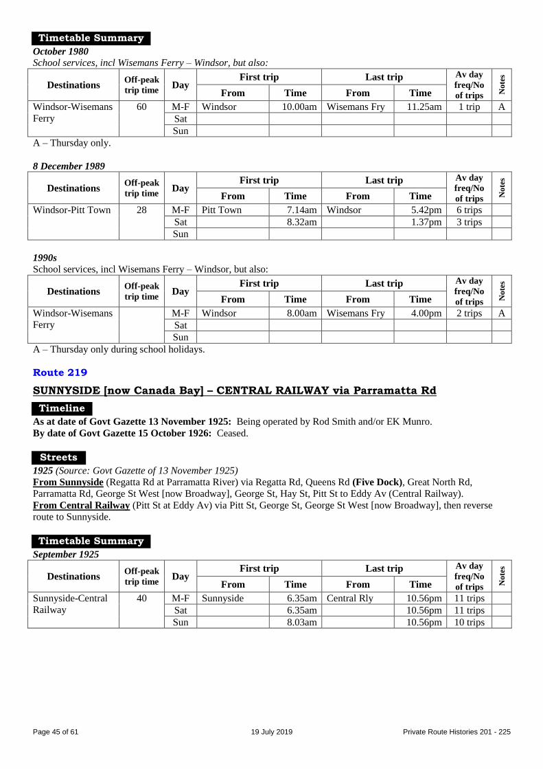
Page 45 of 61 19 July 2019 Private Route Histories 201 - 225
Timetable Summary
October 1980
School services, incl Wisemans Ferry – Windsor, but also:
Destinations Off-peak
trip time Day
First trip Last trip Av day
freq/No
of trips No
tes
From Time From Time
Windsor-Wisemans
Ferry
60 M-F Windsor 10.00am Wisemans Fry 11.25am 1 trip A
Sat
Sun
A – Thursday only.
8 December 1989
Destinations Off-peak
trip time Day
First trip Last trip Av day
freq/No
of trips No
tes
From Time From Time
Windsor-Pitt Town 28 M-F Pitt Town 7.14am Windsor 5.42pm 6 trips
Sat 8.32am 1.37pm 3 trips
Sun
1990s
School services, incl Wisemans Ferry – Windsor, but also:
Destinations Off-peak
trip time Day
First trip Last trip Av day
freq/No
of trips No
tes
From Time From Time
Windsor-Wisemans
Ferry
M-F Windsor 8.00am Wisemans Fry 4.00pm 2 trips A
Sat
Sun
A – Thursday only during school holidays.
Route 219
SUNNYSIDE [now Canada Bay] – CENTRAL RAILWAY via Parramatta Rd
Timeline
As at date of Govt Gazette 13 November 1925: Being operated by Rod Smith and/or EK Munro.
By date of Govt Gazette 15 October 1926: Ceased.
Streets
1925 (Source: Govt Gazette of 13 November 1925)
From Sunnyside (Regatta Rd at Parramatta River) via Regatta Rd, Queens Rd (Five Dock), Great North Rd,
Parramatta Rd, George St West [now Broadway], George St, Hay St, Pitt St to Eddy Av (Central Railway).
From Central Railway (Pitt St at Eddy Av) via Pitt St, George St, George St West [now Broadway], then reverse
route to Sunnyside.
Timetable Summary
September 1925
Destinations Off-peak
trip time Day
First trip Last trip Av day
freq/No
of trips No
tes
From Time From Time
Sunnyside-Central
Railway
40 M-F Sunnyside 6.35am Central Rly 10.56pm 11 trips
Sat 6.35am 10.56pm 11 trips
Sun 8.03am 10.56pm 10 trips

Page 46 of 61 19 July 2019 Private Route Histories 201 - 225
Route 219
TURRAMURRA – SOUTH TURRAMURRA (loop via Catalpa Cr & Warragal Rd)
Timeline
1 May 1939: Commenced by Turramurra & Kuring-gai Motor Bus & Transport Co (WS (Bill) King).
By March 1941: Ceased.
General note: After World War II, 166 served part of 219’s route, as well as extending further into South
Turramurra.
Timetable Summary
1 May 1939
Destinations Off-peak
trip time Day
First trip Last trip Av day
freq/No
of trips No
tes
From Time From Time
Turramurra-South
Turramurra loop
10
round
trip
M-F Turramurra 6.56am Turramurra 6.42pm 15-20 A
Sat 7.50am 1.22pm 30-40
Sun
A – Gaps in service.
Route 219
RICHMOND – CASTLEREAGH – CRANEBROOK – PENRITH
Timeline
1947: Richmond – Penrith commenced by JE (Jack) Sinclair.
By December 1952: Transferred to Geoffrey W Young
By February 1953: Trading as Richmond-Penrith Bus Service.
28 October 1957:
Richmond – Castlereagh transferred to MJ Crane & MA Duffy & Sons and renumbered 217, leaving 219 as
Penrith – Castlereagh.
Operator’s trading name changed to Castlereagh-Penrith Bus Service.
June 1960: Penrith – Cranebrook – Castlereagh transferred to WJS (Bill) Bale & Sons (then or later trading as
Penrith District Bus Service).
By 1973: Curtailed to Penrith – Cranebrook (or may have been renumbered part of 215?).
17 April 1974: Penrith District Bus Service transferred to Bosnjak family (Roger L Graham, general manager from
1982).
By 1982: Operator’s name changed to Bosnjak Penrith.
16 August 1982:
By this time ran school days only.
Renumbered part of 788 in the Sydney Region Route Number System (see Private Route Histories – Contract
Region 1).
Streets
Penrith – Cranebrook 1973 (Source: timetable)
From Penrith (station) via Jane St to Penrith Plaza, then Jane St, Riley St, Henry St, Lawson St, Great Western Hwy
[now High St], Castlereagh Rd, Cranebrook Rd, Boundary Rd to Richmond [now The Northern] Rd (Cranebrook).
Timetable Summary
March 1951
Destinations Off-peak
trip time Day
First trip Last trip Av day
freq/No
of trips No
tes
From Time From Time
Richmond-Penrith 45 M-F Penrith 7.35am Penrith 6.15pm 3 trips A
Sat Richmond 8.30am 12.39pm 2 trips B
Sun
A – Plus short-working/s before first trip and after last trip shown.
B – Plus short-working/s before first trip and after last trip shown. Plus picture buses to Penrith & Richmond
Saturday night.
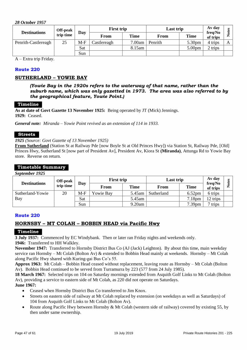
Page 47 of 61 19 July 2019 Private Route Histories 201 - 225
28 October 1957
Destinations Off-peak
trip time Day
First trip Last trip Av day
freq/No
of trips No
tes
From Time From Time
Penrith-Castlereagh 25 M-F Castlereagh 7.00am Penrith 5.30pm 4 trips A
Sat 8.15am 5.00pm 2 trips
Sun
A – Extra trip Friday.
Route 220
SUTHERLAND – YOWIE BAY
(Yowie Bay in the 1920s refers to the waterway of that name, rather than the
suburb name, which was only gazetted in 1973. The area was also referred to by the geographical feature, Yowie Point.)
Timeline
As at date of Govt Gazette 13 November 1925: Being operated by JT (Mick) Jennings.
1929: Ceased.
General note: Miranda – Yowie Point revived as an extension of 114 in 1933.
Streets
1925 (Source: Govt Gazette of 13 November 1925)
From Sutherland (Station St at Railway Pde [now Boyle St at Old Princes Hwy]) via Station St, Railway Pde, [Old]
Princes Hwy, Sutherland St [now part of President Av], President Av, Kiora St (Miranda), Attunga Rd to Yowie Bay
store. Reverse on return.
Timetable Summary
September 1925
Destinations Off-peak
trip time Day
First trip Last trip Av day
freq/No
of trips No
tes
From Time From Time
Sutherland-Yowie
Bay
20 M-F Yowie Bay 5.45am Sutherland 6.52pm 6 trips
Sat 5.45am 7.18pm 12 trips
Sun 9.20am 7.39pm 7 trips
Route 220
HORNSBY – MT COLAH – BOBBIN HEAD via Pacific Hwy
Timeline
3 July 1937: Commenced by EC Windybank. Then or later ran Friday nights and weekends only.
1946: Transferred to HH Walkley.
November 1947: Transferred to Hornsby District Bus Co (AJ (Jack) Leighton). By about this time, main weekday
service ran Hornsby – Mt Colah (Bolton Av) & extended to Bobbin Head mainly at weekends. Hornsby – Mt Colah
along Pacific Hwy shared with Kuring-gai Bus Co’s 55.
Approx 1963: Mt Colah – Bobbin Head ceased without replacement, leaving route as Hornsby – Mt Colah (Bolton
Av). Bobbin Head continued to be served from Turramurra by 223 (577 from 24 July 1985).
18 March 1967: Selected trips on 104 on Saturday mornings extended from Asquith Golf Links to Mt Colah (Bolton
Av), providing a service to eastern side of Mt Colah, as 220 did not operate on Saturdays.
June 1967:
Ceased when Hornsby District Bus Co transferred to Jim Knox.
Streets on eastern side of railway at Mt Colah replaced by extension (on weekdays as well as Saturdays) of
104 from Asquith Golf Links to Mt Colah (Bolton Av).
Route along Pacific Hwy between Hornsby & Mt Colah (western side of railway) covered by existing 55, by
then under same ownership.

Page 48 of 61 19 July 2019 Private Route Histories 201 - 225
Streets
Hornsby – Mt Colah – Bobbin Head Circa 1946 (Source: Gregory’s Street Directory)
From Hornsby (station) via Memorial Pde [now Station St at station entrance?], Pacific Hwy, Colah Rd [assume
current Ku-ring-gai Chase Rd] (Mt Colah).
1963 (Source: RGH notes)
From Hornsby (Pacific Hwy at station) via Pacific Hwy, railway overbridge, Belmont Pde (Mt Colah), Kuring-gai
Chase Rd to Bobbin Head.
From Bobbin Head via reverse route to Pacific Hwy, then Coronation St, Station St to Hornsby station.
Hornsby – Mt Colah (Bolton Av) 1963 (Source: RGH notes)
From Hornsby (Pacific Hwy at station) via Pacific Hwy, railway overbridge, Belmont Pde, Kuring-gai Chase Rd,
Bolton Av (Mt Colah), Gray St, Cowan Rd, Belmont Pde, railway overbridge, Pacific Hwy, Coronation St, Station St
to Hornsby station.
Timetable Summary
1940s(?)
Destinations Off-peak
trip time Day
First trip Last trip Av day
freq/No
of trips No
tes
From Time From Time
Hornsby-Bobbin
Head
30 M-F Hornsby 7.50pm 1 trip A
Sat 7.18am Bobbin Head 6.27pm 3 trips
Sun 9.00am 6.27pm 2 trips
A – From Hornsby to Bobbin Head on Fridays only.
13 September 1960
Destinations Off-peak
trip time Day
First trip Last trip Av day
freq/No
of trips No
tes
From Time From Time
Hornsby-Mt Colah-
Bobbin Head
Fr Horns
12M
25B
M-F Bolton Av 7.24am Bolton Av 6.08pm 10 trips A
Sat Hornsby 9.36am Bobbin Head 4.55pm 4 trips
Sun 9.20am 5.45pm 7 trips
A – Other than Christmas school holidays, Hornsby-Mt Colah (Bolton Av). Gap in service. Christmas school
holidays, extra trips Hornsby-Bobbin Head.
B – To Bobbin Head.
M – To Mt Colah (Bolton Av).
Mid 1960s
Destinations Off-peak
trip time Day
First trip Last trip Av day
freq/No
of trips No
tes
From Time From Time
Hornsby-Mt Colah
(Bolton Av)
12 M-F Bolton Av 7.24am Bolton Av 6.08pm 10 trips A
Sat
Sun
A – Gap in service.
Route 221
SYDENHAM – MARRICKVILLE – SUMMER HILL
Timeline
As at date of Govt Gazette 13 November 1925: Being operated by (1) Vincent J Siebert & (2) Mick Fitzgibbons
(also trading as White Deluxe Bus Service).
31 October 1931: Ceased as competitive with Government railway or tram services under State Transport (Co-
ordination) Act.
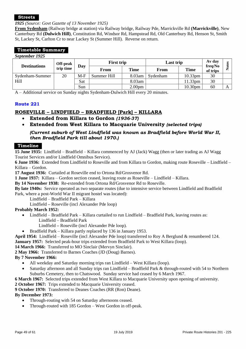
Page 49 of 61 19 July 2019 Private Route Histories 201 - 225
Streets
1925 (Source: Govt Gazette of 13 November 1925)
From Sydenham (Railway bridge at station) via Railway bridge, Railway Pde, Marrickville Rd (Marrickville), New
Canterbury Rd (Dulwich Hill), Constitution Rd, Windsor Rd, Hampstead Rd, Old Canterbury Rd, Henson St, Smith
St, Lackey St, Carlton Cr to near Lackey St (Summer Hill). Reverse on return.
Timetable Summary
September 1925
Destinations Off-peak
trip time Day
First trip Last trip Av day
freq/No
of trips No
tes
From Time From Time
Sydenham-Summer
Hill
20 M-F Summer Hill 8.03am Sydenham 10.33pm 30
Sat 8.03am 11.33pm 30
Sun 2.00pm 10.30pm 60 A
A – Additional service on Sunday nights Sydenham-Dulwich Hill every 20 minutes.
Route 221
ROSEVILLE – LINDFIELD – BRADFIELD [Park] – KILLARA
Extended from Killara to Gordon (1936-37)
Extended from West Killara to Macquarie University (selected trips)
(Current suburb of West Lindfield was known as Bradfield before World War II,
then Bradfield Park till about 1970.)
Timeline
15 June 1935: Lindfield – Bradfield – Killara commenced by AJ (Jack) Wagg (then or later trading as AJ Wagg
Tourist Services and/or Lindfield Omnibus Service).
6 June 1936: Extended from Lindfield to Roseville and from Killara to Gordon, making route Roseville – Lindfield –
Killara – Gordon.
17 August 1936: Curtailed at Roseville end to Ortona Rd/Grosvenor Rd.
1 June 1937: Killara – Gordon section ceased, leaving route as Roseville – Lindfield – Killara.
By 14 November 1938: Re-extended from Ortona Rd/Grosvenor Rd to Roseville.
By late 1940s: Service operated as two separate routes (due to intensive service between Lindfield and Bradfield
Park, where a post-World War II migrant hostel was located):
Lindfield – Bradfield Park – Killara
Lindfield – Roseville (incl Alexander Pde loop)
Probably March 1952:
Lindfield – Bradfield Park – Killara curtailed to run Lindfield – Bradfield Park, leaving routes as:
Lindfield – Bradfield Park
Lindfield – Roseville (incl Alexander Pde loop).
Bradfield Park – Killara partly replaced by 136 in January 1953.
April 1954: Lindfield – Roseville (incl Alexander Pde loop) transferred to Roy A Berglund & renumbered 124.
January 1957: Selected peak-hour trips extended from Bradfield Park to West Killara (loop).
14 March 1966: Transferred to MO Sinclair (Mervyn Sinclair).
2 May 1966: Transferred to Barnes Coaches (JD (Doug) Barnes).
By 7 November 1966:
All weekday and Saturday morning trips ran Lindfield – West Killara (loop).
Saturday afternoon and all Sunday trips ran Lindfield – Bradfield Park & through-routed with 54 to Northern
Suburbs Cemetery, then to Chatswood. Sunday service had ceased by 6 March 1967.
6 March 1967: Selected trips extended from West Killara to Macquarie University upon opening of university.
2 October 1967: Trips extended to Macquarie University ceased.
9 October 1970: Transferred to Deanes Coaches (RR (Ron) Deane).
By December 1973:
Through-routing with 54 on Saturday afternoons ceased.
Through-routed with 185 Gordon – West Gordon in off-peak.
Page 50 of 61 19 July 2019 Private Route Histories 201 - 225
18 November 1981: Upon opening of Macquarie Centre:
Selected trips re-extended from West Killara to Macquarie University via Macquarie Centre.
Through-routed with 124, Lindfield – Roseville – Chatswood (west side).
Through-routing with 185 ceased.
12 November 1982: Through-routing with 124 ceased.
1 July 1987: Renumbered 565 in the Sydney Region Route Number System (see Private Route Histories – Contract
Region 12).
Streets
Roseville – Lindfield – Bradfield Park – Killara Circa 1946 (Source: Gregory’s Street Directory)
From Roseville (station) via Pacific Hwy, Shirley Rd, Cluses Av [now part of Abingdon Rd], Abingdon [now
Westbourne] Rd, Ortona Rd, Grosvenor Rd, Bent St, Napier St, Norwood Av, Gladstone Pde, Pacific Hwy
(Lindfield), Bent St, Wallace Pde, Ignatius [now Highfield] Rd, Cook Rd, Provincial Rd, Primula St, Highfield Rd,
Lady Game Dr (Bradfield Park), Fiddens Wharf Rd, Golf Links Rd, Mildura St, Norfolk St, Spencer Rd, Pacific
Hwy, Marion St, Culworth Av (Killara station).
Lindfield – Bradfield Park (extended to West Killara in peak hours) 1963 (Source: RGH notes)
From Lindfield (Lindfield Av at station) via Lindfield Av, Havilah Rd, Pacific Hwy, Highfield Rd, Cook Rd,
Provincial Rd, Bradfield Rd to Bradfield Park Migrant Hostel [terminus approximately at site of current Queen
Elizabeth Reserve].
From Bradfield Park (Bradfield Rd at Migrant Hostel) via reverse route to Pacific Hwy, then Strickland Av,
Lindfield Av to Lindfield station.
West Killara (loop) extension: Extended from Bradfield Park (Bradfield Rd/Moore Av) via Moore Av, Beaumont
Rd, Eustace Pde, Terrace Rd, Charles St to Bradfield Rd.
Lindfield – Bradfield Park – West Killara 1966 (Source: timetable)
From Lindfield (Lindfield Av at station) via Lindfield Av, Havilah Rd, Pacific Hwy, Highfield Rd, Cook Rd,
Provincial Rd, Bradfield Rd (Bradfield Park), Moore Av, Beaumont Rd, Manning Rd (West Killara), Terrace Rd,
Charles St, Bradfield Rd, then reverse route to Pacific Hwy, then Strickland Av, Lindfield Av to Lindfield station.
Lindfield – Bradfield Park – West Killara (selected trips extended to Macquarie
University) 1967 (Source: RGH notes)
Macquarie University extension: Extended from Bradfield Park (Beaumont Rd) via De Burgh Rd, Lady Game Dr,
Ryde Rd, Lane Cove Rd, Waterloo Rd to Macquarie University. Reverse on return.
Lindfield – West Lindfield – West Killara (off-peak trips through-routed with 185) June 1978 (Source: timetable)
Weekday mornings From Lindfield (Lindfield Av at station) via Lindfield Av, Havilah Rd, Pacific Hwy, Highfield Rd, Cook Rd,
Provincial Rd, Lady Game Dr, Bradfield Rd, Carramar Rd (West Lindfield), Edmund St, Knox St, Johnson St,
Charles St, Terrace Rd, Manning Rd (West Killara), Beaumont Rd, Moore Av, Bradfield Rd, Lady Game Dr,
Provincial Rd, Cook Rd, Highfield Rd, Pacific Hwy, Strickland Av, Lindfield Av to Lindfield station.
Trips direct via Highfield Rd (morning peak hour): Ex Lindfield from Highfield Rd/Cook Rd via Highfield Rd,
Bradfield Rd, Carramar Rd.
Weekday afternoons & Saturdays From Lindfield (Lindfield Av at station) via Lindfield Av, Havilah Rd, Pacific Hwy, Highfield Rd, Cook Rd,
Provincial Rd, Lady Game Dr, Bradfield Rd, Moore Av, Beaumont Rd, Manning Rd (West Killara), Terrace Rd,
Charles St, Johnson St, Knox St, Edmund St, Carramar Rd (West Lindfield), Bradfield Rd, Lady Game Dr, Provincial
Rd, Cook Rd, Highfield Rd, Pacific Hwy, Strickland Av, Lindfield Av to Lindfield station.
Trips through-routed with 185 to Gordon (off-peak): From Lindfield via “weekday mornings” route to Moore Av,
then Fiddens Wharf Rd, Lady Game Dr, Ryde Rd, Wyuna Rd, Bolwarra Av (West Gordon), Bandalong Av, Dunoon
Av, Kiparra St (south leg), Ryde Rd, Pacific Hwy, St Johns Av to Gordon station. Return from Gordon via Henry St,
Ravenswood Av, Pacific Hwy, then reverse route to Fiddens Wharf Rd, then Moore Av, then “weekday afternoons”
route to Lindfield.

Page 51 of 61 19 July 2019 Private Route Histories 201 - 225
Lindfield – West Lindfield – West Killara (selected trips extended to Macquarie
University) 1984 (Source: timetable)
Macquarie University extension (selected trips): Extended from West Killara (Beaumont Rd/Fiddens Wharf Rd) via
Fiddens Wharf Rd, Lady Game Dr, Ryde Rd, Lane Cove Rd, Waterloo Rd, Herring Rd, Macquarie Centre bus
terminal, Waterloo Rd, University Av, Macquarie Dr to Macquarie University bus terminal. Return via Macquarie Dr,
University Av, Waterloo Rd, Herring Rd to Macquarie Centre bus terminal, then Waterloo Rd, then reverse route to
Beaumont Rd/Fiddens Wharf Rd.
Lindfield – Roseville
Late 1940s (Source: RGH notes)
From Lindfield (Pacific Hwy at station) via Pacific Hwy, Gladstone Pde, Norwood Av, Napier St, Bent St,
Grosvenor Rd, Ortona Rd, Westbourne Rd, Abingdon Rd, Shirley Rd, Pacific Hwy, Boundary St, Hill St to Roseville
station.
From Roseville (Hill St at station) via Hill St, Clanville Rd, Pacific Hwy, Shirley Rd, then reverse route to Gladstone
Pde, then Strickland Av, Lindfield Av, Havilah Rd, Pacific Hwy to Lindfield station.
Alexander Pde loop: Ex Lindfield from Pacific Hwy/Corona Av via Corona Av, Kings Av, Alexander Pde, Findlay
Av, Pacific Hwy to Boundary St.
Alteration
By 1950s: Ex Lindfield from Ortona Rd via Eton Rd, Abingdon Rd. Reverse on return.
Timetable Summary
Late 1940s/early 1950s
Destinations Off-peak
trip time Day
First trip Last trip Av day
freq/No
of trips No
tes
From Time From Time
Lindfield-Bradfield
Park-Killara
Fr Lind
12B
18K
M-F Bradfield Pk 6.03amL Bradfield Pk 11.50pmL 45* C Sat 6.03amL 11.50pmL AM 20
PM 30
C
Sun 6.50amL 11.50pmL 30
Lindfield-Roseville Fr Lind
15R
20A
M-F Lindfield 7.38am Roseville 6.27pm 60* D
Sat 7.40am 12.45pm 40 D
Sun
* More frequent in peak hours.
A – To Roseville (Alexander Pde).
B – To Bradfield Park.
C – Trips extended from Bradfield Park to Killara: M-F 14, Saturday 8.
D – Trips extended from Roseville to Alexander Pde loop: M-F 4, Saturday 1.
K – To Killara.
L – To Lindfield.
R – To Roseville station.
23 February 1959
Destinations Off-peak
trip time Day
First trip Last trip Av day
freq/No
of trips No
tes
From Time From Time
Lindfield-Bradfield
Park†
12 M-F Bradfield Pk 5.45am Lindfield 11.42pm 30* A
Sat 6.08am Bradfield Pk 11.53pm 30
Sun 6.45am Lindfield 11.42pm 30
* More frequent in peak hours.
† Selected trips extended to West Killara (loop).
A – Selected peak hour trips extended to West Killara (loop).

Page 52 of 61 19 July 2019 Private Route Histories 201 - 225
6 March 1967
Destinations Off-peak
trip time Day
First trip Last trip Av day
freq/No
of trips No
tes
From Time From Time
Lindfield-West
Killara†
Fr Lind
12W
16M
M-F West Killara 5.58am Lindfield 6.45pm 30* A
Sat 7.05am 6.41pm AM 25
PM 60
Sun
* More frequent in peak hours.
† Selected trips extended to Macquarie University.
A – 4 trips extended to Macquarie University.
M – To Macquarie University.
W – To West Killara
April 1976
Destinations Off-peak
trip time Day
First trip Last trip Av day
freq/No
of trips
No
tes
From Time From Time
Lindfield-West
Killara
10 M-F West Killara 6.52am Lindfield 6.39pm 60*
Sat 8.31am 12.43pm 60
Sun
* More frequent in peak hours.
Route 222
TAMBOURINE BAY RD, LANE COVE – MILSONS POINT
Timeline
As at date of Govt Gazette 13 November 1925: Being operated by George H Newman.
31 December 1926 (as noted in Govt Gazette 27 May 1927): Ceased, when regulations prohibited buses from having
solid tyres and perimeter seating.
Streets
1925 (Source: Govt Gazette of 13 November 1925)
From Tambourine Bay Rd, Lane Cove (at River Rd) via Tambourine Bay Rd, Burns Bay Rd, Longueville Rd, Lane
Cove Rd [now Pacific Hwy] (Crows Nest), Berry St, Miller St (North Sydney), Blues Point Rd, Lavender St, Alfred
St, Dind St, Glen St to Milsons Point tram terminus. Reverse on return.
Timetable Summary
September 1925
Destinations Off-peak
trip time Day
First trip Last trip Av day
freq/No
of trips No
tes
From Time From Time
Tambourine Bay
Rd, Lane Cove-
Milsons Point
35 M-F Tamb Bay Rd 7.01am Milsons Pt 11.26pm 30-40
Sat 7.01am 11.26pm 30-40
Sun 8.45am 10.49pm 30-50
Unknown date
Destinations Off-peak
trip time Day
First trip Last trip Av day
freq/No
of trips No
tes
From Time From Time
Tambourine Bay
Rd, Lane Cove-
Milsons Point
M-F Tamb Bay Rd 7.15am Milsons Pt 7.15pm 30 A
Sat 7.15am 7.15pm 30
Sun
A – Extra trips Friday night (last trip 9.30pm from Milsons Point).

Page 53 of 61 19 July 2019 Private Route Histories 201 - 225
Route 222
SYDENHAM – PETERSHAM – CENTRAL RAILWAY SYDENHAM – STANMORE – LEWISHAM
Post 31 October 1931 feeder: SYDENHAM – LEWISHAM – DULWICH HILL
Timeline
By date of Govt Gazette 22 February 1929: Central Railway – Sydenham commenced by T Brien.
31 October 1931: Ceased as competitive with trams under State Transport (Co-ordination) Act, but immediately
relicensed as a feeder, Sydenham – Dulwich Hill (Fiveways), operated by Mrs Priscilla Brien, then or later trading as
Sydenham Bus Service.
By June 1933: Extended in Dulwich Hill from Fiveways to tram terminus.
1934: Mrs Brien remarried to become Mrs Warren.
17 September 1937: New route, Sydenham – Stanmore – Petersham, commenced.
22 August 1938: Sydenham – Petersham service extended to Lewisham.
1953: Sydenham – Stanmore – Petersham – Lewisham curtailed to Sydenham – Stanmore & renumbered 227.
4 November 1967: Mrs Warren died and service run by her estate.
January 1969: Transferred to Marrickville Bus Lines (Barry D Barton).
Early 1974: Marrickville Bus Lines transferred to Max Holman.
16 May 1977: Transferred to Orana Tours (Bob Wood).
January 1979: Transferred to BJ (Ben) Rachwal, who resumed use of name Marrickville Bus Lines.
16 November 1987: Renumbered 448 in the Sydney Region Route Number System coincident with the opening of
Marrickville Metro shopping centre & off-peak journeys altered to run to Marrickville Metro instead of Sydenham
(see Private Route Histories – Routes transferred to State Transit Authority).
Streets
Sydenham – Petersham – Central Railway 1929 (Source: Govt Gazette of 22 February 1929)
From Sydenham (ramp on west side of station [now Railway Pde]) via Marrickville Rd, Railway [now Buckley] St,
Sydenham Rd, Livingstone Rd, New Canterbury Rd, Crystal St (Petersham), Douglas St, Percival Rd (Stanmore),
Salisbury Rd, University St [now Salisbury Rd], Mallett St, Parramatta Rd, George St, Hay St, Pitt St to Eddy Av
(Central Railway).
From Central Railway (Pitt St at Eddy Av) via Pitt St, George St, George St West [now Broadway], then reverse
route to Sydenham Rd, then ramp on west side of station [now Railway Pde] to Sydenham station.
Sydenham – Petersham Circa 1946 (Source: Gregory’s Street Directory)
From Sydenham (station) via Railway Pde, Sydenham Rd, Fitzroy Rd, Edinburgh Rd, Edgeware Rd, Stanmore Rd,
Merchant St, Cambridge St, Holt St, Stanmore Rd, Crystal St, Fisher St, Regent St, Trafalgar St (Petersham), Palace
St [now Audley St], New Canterbury Rd, Gordon St, Railway Tce, Hunter St.
Sydenham – Lewisham – Dulwich Hill Circa 1948 (Source: Gregory’s Street Directory)
From Sydenham (station) via Railway Pde, Sydenham Rd, Livingstone Rd, Gordon St, Railway Tce (Lewisham),
Hunter St, Denison Rd, Toothill St, Old Canterbury Rd, Windsor Rd, Constitution Rd, New Canterbury Rd, Dulwich
St (Dulwich Hill).
1969 (Source: RGH notes)
From Sydenham (Railway Pde at station) via Railway Pde, Sydenham Rd, Livingstone Rd, Gordon St, Railway Tce
(Lewisham), Victoria St, Toothill St, Old Canterbury Rd, Windsor Rd, Constitution Rd, New Canterbury Rd,
Dulwich St to near New Canterbury Rd (Dulwich Hill).
From Dulwich Hill (Dulwich St at New Canterbury Rd) via Dulwich St, Denison St, Constitution Rd, then reverse
route to Toothill St, then Denison St, Hunter St, Railway Tce, then reverse rout to Sydenham Rd, then Railway Pde to
Sydenham station.
Alteration
1986 (Source: RGH notes): Ex Sydenham from Livingstone Rd via New Canterbury Rd, Hunter St, Railway Tce. Ex
Dulwich Hill from Toothill St via reverse route to Sydenham Rd, then Railway Pde to Sydenham station.

Page 54 of 61 19 July 2019 Private Route Histories 201 - 225
Timetable Summary
Circa 1960
Destinations Off-peak
trip time Day
First trip Last trip Av day
freq/No
of trips No
tes
From Time From Time
Sydenham-Dulwich
Hill
16 M-F Dulwich Hill 5.55am Sydenham 6.25pm 40* A
Sat 7.20am Dulwich Hill 4.20pm AM 40
PM 60
Sun
* More frequent in peak hours.
A – Plus short-working/s after last trip shown.
22 January 1979
Destinations Off-peak
trip time Day
First trip Last trip Av day
freq/No
of trips No
tes
From Time From Time
Sydenham-Dulwich
Hill
15 M-F Dulwich Hill 6.00am Sydenham 5.40pm 60* A
Sat
Sun
* More frequent in peak hours.
A – Gap in service.
Route 223
TURRAMURRA – NORTH TURRAMURRA – BOBBIN HEAD
TURRAMURRA – PYMBLE via Bannockburn Rd
(Lady Davidson’s Red Cross Home is now known as Lady Davidson Hospital.)
Timeline
As at date of Govt Gazette 13 November 1925:
Turramurra – Lady Davidson’s Red Cross Home, North Turramurra – Kuring-gai Chase (terminus at top of
Bobbin Hill) being operated by WS (Bill) King.
The “Complete” timetable of September 1925 (see “Timetable Summaries” below) shows selected trips
extended from Kuring-gai Chase Gates to Bobbin Head, but this is not reflected in Government Gazettes of
the 1920s. Other trips terminated at Kuring-gai Chase Gates (destination sign then or later “Chase Gates”).
By 1927: Operator incorporated as Turramurra & Kuring-gai Motor Bus & Transport Co. An undated timetable of
about this era shows the proprietors as Wood Bros & King.
Late 1920s/1930s: An increasing number of trips, particularly at weekends, were extended from Kuring-gai Chase
Gates to Bobbin Head, following opening of new, better graded road to Bobbin Head on 20 May 1929.
July 1949: Transferred to JT Ford.
1940s/1950s (by the time of, or during Ford’s proprietorship):
Extra route, Turramurra – Pymble via Bannockburn Rd, commenced. This route may have commenced as
Turramurra – Crossroads [Burns Rd/The Chase Rd] via Katina St.
Extra route, Turramurra – Bobbin Head Rd (location of terminus?) via Turuga St, Warrangi St, Berrilee Rd
[now St], commenced (when ceased?).
January 1961: Transferred to RR (Ron) Deane.
By July 1962: Operator’s name changed to Turramurra-Bobbin Head Bus Co (Deane family).
By 27 May 1963: Turramurra – Pymble via Bannockburn Rd diverted via Merrivale Rd in off-peak to cover parts of
63, when the latter was reduced to a peak hour service.
By 1 October 1968: Turramurra – Pymble via Bannockburn Rd extended via Normurra Av, North Turramurra.
1975/6: Operator’s name changed to Deane’s Coaches (a name already in use for Deane’s Lane Cove operation).
24 July 1985:
Renumbered into the Sydney Region Route Number System (see Private Route Histories – Contract Region
12):
577 Turramurra – Bobbin Head
578 Turramurra – Pymble via Bannockburn Rd.
New 576, which covered some of Turramurra – Bobbin Head route at night and weekends, also commenced.

Page 55 of 61 19 July 2019 Private Route Histories 201 - 225
Streets
Turramurra – Kuring-gai Chase 1925 (Source: Govt Gazette of 13 November 1925)
From Turramurra (Rohini St at station) via Rohini St, Lane Cove Rd [now Pacific Hwy], Kuring-gai [Chase] Av,
Boomerang St, Bobbin Head Rd [including current Nambucca St, Burns Rd], Kuring-gai Chase Rd [also known as
The Chase Rd, now part of Bobbin Head Rd] (North Turramurra) to top of Bobbin Hill near “Caution – drive
slowly” notice (Kuring-gai Chase). Reverse on return.
Turramurra – North Turramurra – Bobbin Head Circa 1946 (Source: Gregory’s Street Directory)
From Turramurra via Rohini St, Pacific Hwy, Kuring-gai Av, Boomerang St, Bobbin Head Rd [including current
Nambucca St, Burns Rd], Kuring-gai Chase Rd (North Turramurra), Farrar Av [last two now part of Bobbin Head
Rd] (Bobbin Head).
1963 (Source: RGH notes)
From Turramurra (Rohini St at station) via Pacific Hwy, Kuring-gai Av, Boomerang St, Bobbin Head Rd (North
Turramurra) to Bobbin Head.
From Bobbin Head via Bobbin Head Rd, Boomerang St, Brentwood Av, Eastern Rd, Rohini St to Turramurra
station.
1968 (Source: RGH notes)
Ellalong Rd diversion: Ex Turramurra from Bobbin Head Rd via Apps Av, Ellalong Rd, Allara Av, Miowera Rd,
Normurra Av to Bobbin Head Rd. Reverse on return.
Turramurra – Pymble via Bannockburn Rd 1963 (Source: RGH notes)
From Turramurra (Rohini St at station) via Pacific Hwy, Turramurra Av, Karuah Rd, Katina St, The Chase Rd,
Burns Rd, Bannockburn Rd, Pacific Hwy, railway bridge, Grandview St to Pymble station.
From Pymble (Grandview St at station) via Pacific Hwy, Bannockburn Rd, then reverse route to Karuah Rd, then
Eastern Rd, Rohini St to Turramurra station.
Merrivale Rd diversion (off-peak): Ex Turramurra from Bannockburn Rd via Princes St, Buckra St, Charlton Av,
Pentecost Av, Merrivale Rd, Selwyn St to Bannockburn Rd. Reverse on return.
Alterations
1968 (Source: timetable)
Normurra Av, North Turramurra extension/diversion: Either direction, extended from Bobbin Head Rd
via Apps Av, Ellalong Rd, Allara Av, Miowera Rd, Normurra Av to Bobbin Head Rd. Reverse on return.
1979 (Source: timetable): Ex Pymble from Pacific Hwy via Telegraph Rd, Merrivale Rd, Selwyn St, to
Bannockburn Rd.
1983 (Source: timetable): Ex Pymble from Grandview St via Station St, Telegraph Rd (instead of Pacific
Hwy).
Timetable Summary
September 1925
Destinations Off-peak
trip time Day
First trip Last trip Av day
freq/No
of trips No
tes
From Time From Time
Turramurra-Bobbin
Head
Fr T’murra
18C
28B
M-F Turramurra 7.07am Chase Gates 10.51pm 8 trips A
Sat 7.07am 12.27am 9 trips D
Sun 7.40am 11.00pm 8 trips D
A – 2 trips extended from Kuring-gai Chase Gates to Bobbin Head. Extra trip Wednesday night.
B – To Bobbin Head.
C – To Kuring-gai Chase Gates.
D – 2 trips extended from Kuring-gai Chase Gates to Bobbin Head.

Page 56 of 61 19 July 2019 Private Route Histories 201 - 225
1 October 1938
Destinations Off-peak
trip time Day
First trip Last trip Av day
freq/No
of trips No
tes
From Time From Time
Turramurra-Bobbin
Head
Fr T’murra
18C
28B
M-F Chase Gates 6.47amT Turramurra 6.53pmB
10.07pmC
8 trips A
Bobbin Head 8.52amT
Sat Chase Gates 6.47amT 12.12amC 11 trips D
Sun 7.42amT 10.22pmC 60 D
A – Base service Turramurra-Kuring-gai Chase Gates. 4 trips extended to Bobbin Head.
B – To Bobbin Head.
C – To Kuring-gai Chase Gates.
D – Most trips extended from Kuring-gai Chase Gates to Bobbin Head.
T – To Turramurra.
20 September 1948
Destinations Off-peak
trip time Day
First trip Last trip Av day
freq/No
of trips No
tes
From Time From Time
Turramurra-Bobbin
Head
Fr T’murra
18C
28B
M-F Chase Gates 7.35amT Turramurra 7.02pmB
11.58pmC
60 A
Bobbin Head 8.37amT
Sat Chase Gates 7.35amT 11.58pmC 60 D
Sun Turramurra 8.32amB Bobbin Head 8.06pmT 30 E
A – Base service Turramurra-Kuring-gai Chase Gates. 4 trips extended to Bobbin Head.
B – To Bobbin Head.
C – To Kuring-gai Chase Gates.
D – Most trips extended from Kuring-gai Chase Gates to Bobbin Head.
E – Plus later trip Turramurra-Chase Gates.
T – To Turramurra.
November 1978
Destinations Off-peak
trip time Day
First trip Last trip Av day
freq/No
of trips No
tes
From Time From Time
Turramurra-Bobbin
Head
Fr T’murra
16C
26B
M-F Turramurra 6.25am Chase Gates 7.06pm 60* A
Sat 7.12am Bobbin Head 4.18pm 60 D
Sun 9.05am 5.18pm 60
* More frequent in peak hours.
A – Base service Turramurra-Kuring-gai Chase Gates. 3 trips extended to Bobbin Head.
B – To Bobbin Head.
C – To Kuring-gai Chase Gates.
D – Plus short-working/s before first trip shown.
1 March 1964
Destinations Off-peak
trip time Day
First trip Last trip Av day
freq/No
of trips No
tes
From Time From Time
Turramurra-Pymble
via Bannockburn
Rd
17 M-F Pymble 6.45am Pymble 6.23pm 60* A
Sat Turramurra 7.58am 12.32pm 40 B
Sun
* More frequent in peak hours.
A – Plus short-working/s before first trip and after last trip shown.
B – Plus short-working/s before first trip shown.

Page 57 of 61 19 July 2019 Private Route Histories 201 - 225
Route 224
CITY (Wynyard) – NORTHWOOD – LONGUEVILLE TAMBOURINE BAY – LANE COVE – NORTHWOOD
Extended from Northwood to St Leonards (1950)
Riverview College – Artarmon (infrequent service, 1933-40)
Timeline
24 October 1930: Tambourine Bay – Lane Cove – Northwood commenced by FR (Frank) Ritchie and Mr Gibbons.
June 1931: Partnership altered to FR (Frank) Ritchie and Percy Stiddig.
10 March 1933: Infrequent Riverview College – Artarmon trips (formerly 228) renumbered as part of 224.
1935: Percy Stiddig withdrew from partnership, leaving Frank Ritchie as sole proprietor.
1938/9: Transferred to WE (Bill) Nott.
1940: For a short time Nott re-incorporated his business as Northwood Transport, but soon reverted to the former
name.
12 July 1940: Infrequent Riverview College – Artarmon trips transferred to 53.
27 April 1945: Transferred to WA (Bill) & JC (Cec) Johnson.
14 October 1946: Transferred to JH (Jack) Hales.
23 December 1946: Extra route, City (Wynyard) – Northwood, commenced, in response to cancellation of Circular
Quay-Figtree ferry. Service originally ran during weekday off-peak and Saturday & Sunday afternoons, but gradually
expanded to full time by 1 May 1950.
1 May 1950: Tambourine Bay – Lane Cove – Northwood extended from Northwood to St Leonards.
13 November 1950: Most Tambourine Bay – Lane Cove – Northwood – St Leonards trips reverted to running
Tambourine Bay – Lane Cove – Northwood when the Department of Road Transport & Tramways commenced its
295, City (Wynyard) – Lane Cove West (Cope St) via St Leonards & River Rd. (The final two peak-hour trips on 224
to St Leonards continued running between there & Lane Cove West (Mars Rd) until 1971.)
By 1960s:
Selected Lane Cove – Tambourine Bay (224) and Lane Cove – Lane Cove West (Mars Rd) (169) trips ran in a
combined loop 169/224 Lane Cove – Tambourine Bay – Lane Cove West (Mars Rd) – Lane Cove or reverse
(see combined routes 169/224 following Route 169).
Many City (Wynyard) – Northwood trips extended from Northwood to Lane Cove.
13 April 1966: Transferred to Barnes Coaches (JD (Doug) Barnes).
9 October 1970: Transferred to Deane’s Coaches (RR (Ron) Deane).
19 July 1971: As 127, 169 & 224 were under common ownership:
Selected night and Saturday City (Wynyard) – Longueville trips (127) diverted via Northwood.
Combined 169/224, Lane Cove – Tambourine Bay – Lane Cove West (Mars Rd) – Lane Cove loop, became
standard route for weekday daytime trips in that area.
Most City (Wynyard) – Northwood trips extended from Northwood to Lane Cove, and peak hour trips further
extended from Lane Cove to Tambourine Bay (224).
By 1 September 1974: Weekday off-peak City (Wynyard) – Northwood – Lane Cove (224) trips extended from Lane
Cove to Lane Cove West (Mars Rd) (169) via Tambourine Bay.
7 December 1977: Transferred to Lane Cove Bus Service (Bernie Best).
February 1983: Use of route numbers 127, 169 & 224 rearranged to reflect actual usage as:
127 Northwood – Longueville – Chatswood
169 City (Wynyard) – Lane Cove – Tambourine Bay – Lane Cove West (Mars Rd)
224 City (Wynyard) – Northwood – Longueville.
127 & 224 through-routed during weekday off-peak and Saturday mornings.
30 July 1985: Lane Cove Bus Service transferred to Macquarie Towns Coach Lines.
7 September 1987: 52, 127, 169 & 224 renumbered into the Sydney Region Route Number System (see Private
Route Histories – Routes transferred to State Transit Authority):
261 City (Wynyard) – Northwood – Longueville – Lane Cove
264 Chatswood – Longueville.
Streets
Tambourine Bay – Northwood Circa 1946 (Source: Gregory’s Street Directory)
From Tambourine Bay via Hamilton St, Pengilly St, Fox St, River Rd, Trouve St, Bridge St, Ross Smith Pde, Burns
Bay Rd, Gentle St, CentennialAv, Sutherland St, Burns Bay Rd (Lane Cove), Longueville Rd, Northwood Rd
(Northwood).

Page 58 of 61 19 July 2019 Private Route Histories 201 - 225
Circa 1948 (Source: Gregory’s Street Directory)
From Tambourine Bay via Hamilton St, Pengilly St, Fox St, River Rd, Trouve St, Bridge St, Ross Smith Pde, Burns
Bay Rd, Gentle St, Hallam Av, Garling St, Sutherland St, Burns Bay Rd (Lane Cove), Longueville Rd, Northwood
Rd (Northwood).
Circa 1963 (Source: RGH Notes)
From Northwood (Point Rd) via Northwood Rd, Longueville Rd, Burns Bay Rd (Lane Cove), Tambourine Bay Rd,
Hamilton St (Tambourine Bay), Pengilly St, Fox St, Trouve St, Bridge St, Ross Smith Pde, Burns Bay Rd, Gentle St,
Hallam Av, Garling St, Sutherland St, Burns Bay Rd (Lane Cove), Longueville Rd, Northwood Rd, Cliff Rd, Eva St,
Point Rd (Northwood).
City (Wynyard) – Northwood 1968 (Source: RGH notes)
From City (Wynyard) (York St at Margaret St) via York St, Erskine St, Clarence St, Bradfield Hwy [Sydney
Harbour Bridge], Pacific Hwy, Shirley Rd (Crows Nest), River Rd, Northwood Rd to Blaxlands Cnr, then Northwood
Rd, Cliff Rd, Eva St, Point Rd (Northwood).
From Northwood (Point Rd) via Northwood Rd to Blaxlands Cnr, then Northwood Rd, River Rd, Shirley Rd, Pacific
Hwy, Bradfield Hwy [Sydney Harbour Bridge], York St to Margaret St (Wynyard, City).
City (Wynyard) – Northwood – Lane Cove (peak hour trips extended to Tambourine
Bay) 1971 (Source: RGH notes)
From City (Wynyard) (Barrack St) via York St, Erskine St, Clarence St, Bradfield Hwy [Sydney Harbour Bridge],
Pacific Hwy, Shirley Rd (Crows Nest), River Rd, Northwood Rd, Cliff Rd, Eva St, Point Rd (Northwood),
Northwood Rd, Longueville Rd to Burns Bay Rd (Lane Cove).
From Lane Cove (Longueville Rd at Burns Bay Rd) via Longueville Rd, Northwood Rd, Cliff Rd, Eva St, Point Rd
(Northwood), Northwood Rd, River Rd, Shirley Rd, Pacific Hwy, Arthur St, Mount St, Warringah Fwy, Bradfield
Hwy [Sydney Harbour Bridge], York St, Barrack St (Wynyard, City).
Tambourine Bay extension (peak hours): Extended from Lane Cove (Longueville Rd at Burns Bay Rd) via Burns
Bay Rd, Tambourine Bay Rd, Hamilton St, Pengilly St, Fox St, River Rd, Bridge St, Ross Smith Pde, Burns Bay Rd
to Longueville Rd.
Timetable Summary
Late 1930s
Destinations Off-peak
trip time Day
First trip Last trip Av day
freq/No
of trips No
tes
From Time From Time
Tambourine Bay-
Northwood
29
round
trip
M-F Tamb Bay 6.22am Northwood 7.20pmT
9.56pmL
30* A
Sat 6.22am 7.46pm AM 30
PM 40
A
Sun
* More frequent in peak hours.
A – Day, Tambourine Bay-Northwood. Night, Lane Cove-Northwood. Plus picture bus Monday-Saturday.
L – To Lane Cove tram terminus.
T – To Tambourine Bay.
1945/6
Destinations Off-peak
trip time Day
First trip Last trip Av day
freq/No
of trips No
tes
From Time From Time
Tambourine Bay-
Northwood
29
round
trip
M-F Tamb Bay 6.08am Northwood 11.08pm 30
Sat 7.08am 11.08pm AM 30
PM 40
Sun 6.40am 9.25pm 40

Page 59 of 61 19 July 2019 Private Route Histories 201 - 225
1 May 1950
Destinations Off-peak
trip time Day
First trip Last trip Av day
freq/No
of trips No
tes
From Time From Time
Tambourine Bay-
Northwood-St
Leonards
50
round
trip
M-F Tamb Bay 6.05amL
7.08amS
St Leonards 9.08pmT 30* A
Sat 6.40amN
7.20amS
7.55pmT 20** A
Sun 6.38am 10.36am 7 trips A
City (Wynyard)-
Northwood
25 M-F Northwood 7.00am Wynyard 11.45pm 60*
Sat 7.00am 11.30pm 60
Sun 1.15pm 9.45pm 60
* More frequent in peak hours.
** Less frequent in afternoon.
A – Some trips ran Tambourine Bay-Northwood (not to St Leonards). Gap in service Saturday. Plus picture bus
Monday-Saturday.
L – To Lane Cove tram terminus.
N – To Northwood.
S – To St Leonards.
T – To Tambourine Bay.
Early 1960s
Destinations Off-peak
trip time Day
First trip Last trip Av day
freq/No
of trips No
tes
From Time From Time
Lane Cove-
Tambourine Bay
13
round
trip
M-F Tamb Bay 6.15am Tamb Bay 7.10pm 40* A
Sat 8.45am 11.19am 40
Sun 6.38am 9.28am 4 trips
City (Wynyard)-
Northwood
25 M-F Northwood 6.15am Wynyard 8.05pm 60*
Sat 8.08am 12.45pm 60
Sun
* More frequent in peak hours.
A – Gap in service.
7 February 1983
Destinations Off-peak
trip time Day
First trip Last trip Av day
freq/No
of trips No
tes
From Time From Time
City (Wynyard)-
Northwood-Lane
Cove
40 M-F Lane Cove 6.10am Wynyard 8.30pm 60* A
Sat 7.40am 5.15pm 60 B
Sun
* More frequent in peak hours.
A – Extra trip Thursday night.
B – Afternoon trips ran Wynyard-Longueville only (not via Northwood).
Route 225
TURRAMURRA – WAHROONGA SANITARIUM – FOX VALLEY
WARRAWEE – WAHROONGA SANITARIUM – FOX VALLEY
(Wahroonga Sanitarium is now known as Sydney Adventist Hospital, but continues
to be popularly known as the “San”, an abbreviation of previous name.)
Timeline
As at date of Govt Gazette 13 November 1925: Warrawee – Wahroonga Sanitarium (terminus within grounds)
being operated by Donald R Limback.
By the 1930s: Transferred to JG (Vince) Farrell, then or later trading as Warrawee Bus Service.
1950s(?): Extended from Wahroonga Sanitarium to Fox Valley (new residential area) (initially in peak hours, later
full time).
December 1962: Transferred to Turramurra-Bobbin Head Bus Co (Deane family), following death of Mr Farrell.

Page 60 of 61 19 July 2019 Private Route Histories 201 - 225
Early 1963: Off-peak trips altered to run Turramurra – Wahroonga Sanitarium – Fox Valley (peak hour trips
remained as Warrawee – Wahroonga Sanitarium – Fox Valley).
By 26 February 1973: Selected off-peak trips diverted via Warrawee Valley to cover 160.
1975/6: Operator’s name changed to Deane’s Coaches (a name already in use for Deane’s Lane Cove operation).
24 July 1985: 160 & 225 renumbered into the Sydney Region Route Number System (see Private Route Histories –
Contract Region 12):
573 Turramurra – Warrawee Valley
574 Turramurra – Wahroonga Sanitarium – Fox Valley
574 Warrawee – Wahroonga Sanitarium – Fox Valley
Streets
Warrawee – Wahroonga Sanitarium 1925 (Source: Govt Gazette of 13 November 1925)
From Warrawee (Heydon Av at station) via Heydon Av, Lane Cove Rd [now Pacific Hwy], Fox Valley Rd to
Wahroonga Sanitarium. Reverse on return.
Circa 1946 (Source: Gregory’s Street Directory)
From Warrawee (station) via Heydon Av, Pacific Hwy, Fox Valley Rd (Wahroonga Sanitarium).
Warrawee – Wahroonga Sanitarium – Fox Valley Early 1960s (Source: RGH Notes)
From Warrawee (Heydon Av at station) via Heydon Av, Pacific Hwy, Fox Valley Rd (diverting into Wahroonga
Sanitarium grounds), The Broadway, Leuna Av to Morona Av (Fox Valley).
From Fox Valley (Leuna Av at Morona Av) via Leuna Av, The Broadway, Fox Valley Rd (diverting into
Wahroonga Sanitarium grounds), Pacific Hwy, Borambil St to Warrawee station.
Turramurra – Wahroonga Sanitarium – Fox Valley 1963 (Source: RGH notes)
From Turramurra (William St at station) via William St, Pacific Hwy, Fox Valley Rd (diverting into Wahroonga
Sanitarium grounds), The Broadway, Leuna Av to Morona Av (Fox Valley). Reverse on return.
Alteration
1970 (Source: timetable): Ceased to divert into Wahroonga Sanitarium grounds.
Timetable Summary
September 1925
Destinations Off-peak
trip time Day
First trip Last trip Av day
freq/No
of trips No
tes
From Time From Time
Warrawee-
Wahroonga
Sanitarium
12 M-F Sanitarium 8.06am Warrawee 9.24pm 30-120
Sat 8.06am 9.24pm 30-120
Sun 9.07am 9.11pm 10 trips
Circa 1950s
Destinations Off-peak
trip time Day
First trip Last trip Av day
freq/No
of trips No
tes
From Time From Time
Warrawee-
Wahroonga
Sanitarium
12 M-F Warrawee 7.30am Sanitarium 9.05pm 30
Sat 8.31am 8.05pm AM 60
PM 30
Sun 10.24am 8.05pm AM 60
PM 30

Page 61 of 61 19 July 2019 Private Route Histories 201 - 225
Early 1960s
Destinations Off-peak
trip time Day
First trip Last trip Av day
freq/No
of trips No
tes
From Time From Time
Warrawee-
Wahroonga
Sanitarium†
M-F Warrawee 7.25am Sanitarium 8.05pm§ 30 A
Sat
Sun
† Selected trips extended to Fox Valley.
§ Estimated time.
A – Gap in service. 4 trips extended from Wahroonga Sanitarium to Fox Valley.
October 1976
Destinations Off-peak
trip time Day
First trip Last trip Av day
freq/No
of trips No
tes
From Time From Time
Turramurra-Fox
Valley
9 M-F Fox Valley 9.07am Turramurra 3.00pm 60
Sat
Sun
Warrawee-Fox
Valley
11 M-F Fox Valley 6.51am Warrawee 6.53pm Ph
Sat
Sun
Ph – Peak hours only (both directions).


![SYDNEY BUS ROUTESsydneybusroutes.com/images/PDFs/pindex of suburbs priv... · 2020. 1. 28. · Claymore – 93, 877, 878, 880 [Region 15] Clifford & McIntosh Sts, Gordon – 191,](https://img.pdfslide.us/doc/110x75/6129f3967735990dd676cd6e/sydney-bus-r-of-suburbs-priv-2020-1-28-claymore-a-93-877-878-880.jpg)