Embed Size (px)
Citation preview
Subject: COASTAL STRATEGY FOR WINTERTON TO GREAT YARMOUTH Report to: EMT 29th September 2016
Environment Committee 12th October 2016 Report by: Jane Beck Director of Customer Services
SUBJECT MATTER/RECOMMENDATIONS The proposed delivery of a Coastal Management Review of the coastline from Winterton to South Denes Great Yarmouth. This is intended to be an inclusive project engaging with coastal communities, all relevant authorities and bodies to develop a pathway for managing coastal change going forward. Recommendation To seek member approval, subject to external funding being identified, to deliver the Winterton to Great Yarmouth Coastal Management Review.
1. INTRODUCTION/BACKGROUND
1.1. The Borough Council has permissive powers under the Coast Protection Act
1949 to carry out works along this section of coastline
1.2. The Coastal Management Review will consider the coastline’s existing natural processes and how this interacts with communities and their aspirations for the future.
1.3. It will look at the existing natural and manmade defences together with the
environmental designated sites.
1.4. It will, in consultation with others, develop a plan for the short, medium and long term management of this area of the coastline.
1.5. This action aligns with the Shoreline Management Plan (SMP) action plan.
2. COASTAL MANAGEMENT REVIEW
2.1. The attached appendix A outlines the current position. The existing Shoreline
Management Plan which was adopted in 2012 identifies the policies and management methods for Winterton to Great Yarmouth. A significant amount of change has occurred along this length of coastline and a review of the 2012
plan is therefore recommended.
3. FINANCIAL IMPLICATIONS
3.1. We will be seeking grant to cover this costs of this project.
4. RISK IMPLICATIONS
4.1. Implications from any changes in the management of the Winterton to Great Yarmouth coastline could result in having a future impact on the community.
5. CONCLUSIONS
5.1. The previous Shoreline Management Plan was adopted in 2012 changes to the coastline indicate the need to review the position and this report and attached appendices support this position.
6. RECOMMENDATIONS
6.1. Committee to endorse the requirement to undertake a review of the Winterton to Great Yarmouth Shoreline Management Plan subject to subject to suitable external funding being identified.
7. BACKGROUND PAPERS
7.1. Shoreline Management Plan 2012
Areas of consideration: e.g. does this report raise any of the following issues and if so how have these been considered/mitigated against? Area for consideration Comment Monitoring Officer Consultation: Section 151 Officer Consultation: Existing Council Policies: Financial Implications: Legal Implications (including human rights):
Risk Implications: Equality Issues/EQIA

assessment: Crime & Disorder: Every Child Matters:
1
Outline of coastal conditions and bases of requirements for Coastal Management review for Winterton to Great Yarmouth
Executive Summary
Great Yarmouth Borough Council became the maritime authority for the parishes in the northern part of the borough following the Local Government re-organisation in 1974 and inherited a varied coastline. Some areas have natural dune, soft cliffs and others, some form of manmade defence. The Council adopted the current Shoreline Management Plan (SMP) in 2012. This sets out the high level policy aims for the coastline from North Norfolk to Waveney including Great Yarmouth. With a changing coastline there is a need, from time to time, to review the policies and management methods. This report sets out the reasons that a review is appropriate and is consistent with the SMP.
General details
Coastline length (this area) 16.8km
Defences (this area) 13.3km
Properties at risk with existing SMP policies up to 2105
Winterton to Scratby 150
California to Caister 130
Caister-on-sea 50
Great Yarmouth nil
Total 330
Winterton/Hemsby
Winterton through Hemsby up to the north part of Scratby are fronted by vegetated soft dunes part of which is designated a Site of Special Scientific Interest (SSSI), Special Area of Conservation (SAC) and Special Protection Area (SPA). Substantial rates of erosion have occurred following a period of adverse conditions including the 2013 tidal surge; this has generated concern from the community. In response to the loss of homes and the community concerns a trial section of dune defence has been approved by GYBC and the Save Hemsby Coastline group have funded and constructed this. In order to consider the changes happening along the greater frontage, it is proposed to undertake a coastal management review to include this trial and any planned future works to understand how they integrate both with coastal processes and community aspirations for the long term. This will encompass consultation with other authorities, agencies and the wider communities.
2
Scratby/California
The northern section is fronted by soft low dunes behind which are a soft sand/clay soil cliffs of about 17m high. Dune protection has recently been installed to the seaward side of the low dunes which connects the trial at Newport Cottages to the north and rock berm at California to the south. This defence is deemed an interim measure (20 years) until a long term solution can be found. The proposed coastal management review will engage with the community, following on from the work of the Pathfinder project, to determine how best to manage the coast into the long term.
Caister
The coastal frontage along the village of Caister has been defended for some time and the present defences are in a good condition with one exception that is a part of the concrete sea wall sloping apron and wave return wall was not constructed at the time. Beach levels are variable along this section, at this time they remain high at the back of the beach but, towards the southern section, the low and high water marks have moved further up the beach. The northern section is shown in the SMP as a potential erosion area in the long term and the proposed study will look at options to manage this part of the coastline.
Great Yarmouth
The beaches along the majority of Great Yarmouth’s frontage have been accreting for last forty years or so and it is not predicted to change in the near future. The sea walls were constructed over a prolonged time period and probably to differing designs. Areas that can be accessed are shown to be fair condition although there are sections where the coping has failed and will require repairs. It is intended to include this frontage to consider changes to sea level rise and to complete management plan for the Great Yarmouth borough coastline.
3
Report Body
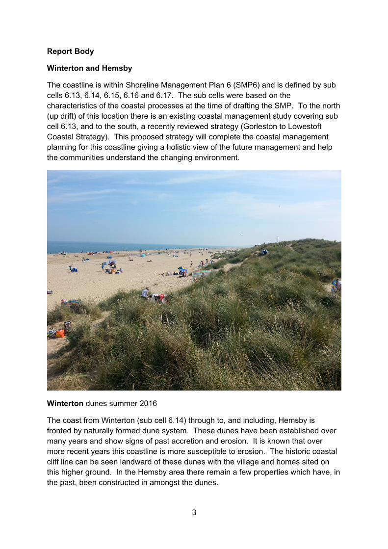
Winterton and Hemsby
The coastline is within Shoreline Management Plan 6 (SMP6) and is defined by sub cells 6.13, 6.14, 6.15, 6.16 and 6.17. The sub cells were based on the characteristics of the coastal processes at the time of drafting the SMP. To the north (up drift) of this location there is an existing coastal management study covering sub cell 6.13, and to the south, a recently reviewed strategy (Gorleston to Lowestoft Coastal Strategy). This proposed strategy will complete the coastal management planning for this coastline giving a holistic view of the future management and help the communities understand the changing environment.
Winterton dunes summer 2016
The coast from Winterton (sub cell 6.14) through to, and including, Hemsby is fronted by naturally formed dune system. These dunes have been established over many years and show signs of past accretion and erosion. It is known that over more recent years this coastline is more susceptible to erosion. The historic coastal cliff line can be seen landward of these dunes with the village and homes sited on this higher ground. In the Hemsby area there remain a few properties which have, in the past, been constructed in amongst the dunes.
4
The area to the north has evolved as a succession of tall vegetated dunes separated by valleys. The southern section, although of similar formation, is narrower and has fewer dune/valley profiles. Sections of this area have various national and international environmental designations,
Winterton Dune Special Area of Conservation (SAC) Great Yarmouth North Denes Special Protection Area (SPA) Winterton Horsey Dunes Site of Special Scientific Interest (SSSI)
There are no manmade coastal defences along this length of coastline and the area has been able to evolve using natural processes without restriction other than minor dune conservation work at Hemsby.
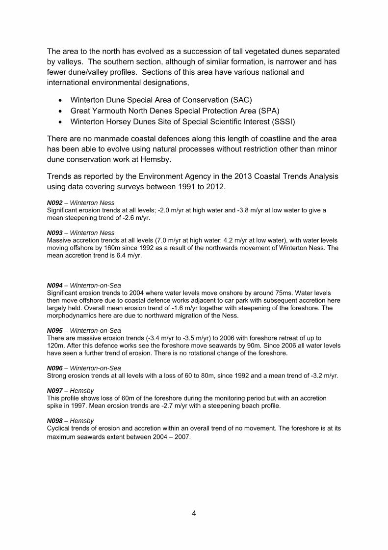
Trends as reported by the Environment Agency in the 2013 Coastal Trends Analysis using data covering surveys between 1991 to 2012.
N092 – Winterton Ness Significant erosion trends at all levels; -2.0 m/yr at high water and -3.8 m/yr at low water to give a mean steepening trend of -2.6 m/yr. N093 – Winterton Ness Massive accretion trends at all levels (7.0 m/yr at high water; 4.2 m/yr at low water), with water levels moving offshore by 160m since 1992 as a result of the northwards movement of Winterton Ness. The mean accretion trend is 6.4 m/yr. N094 – Winterton-on-Sea Significant erosion trends to 2004 where water levels move onshore by around 75ms. Water levels then move offshore due to coastal defence works adjacent to car park with subsequent accretion here largely held. Overall mean erosion trend of -1.6 m/yr together with steepening of the foreshore. The morphodynamics here are due to northward migration of the Ness. N095 – Winterton-on-Sea There are massive erosion trends (-3.4 m/yr to -3.5 m/yr) to 2006 with foreshore retreat of up to 120m. After this defence works see the foreshore move seawards by 90m. Since 2006 all water levels have seen a further trend of erosion. There is no rotational change of the foreshore. N096 – Winterton-on-Sea Strong erosion trends at all levels with a loss of 60 to 80m, since 1992 and a mean trend of -3.2 m/yr. N097 – Hemsby This profile shows loss of 60m of the foreshore during the monitoring period but with an accretion spike in 1997. Mean erosion trends are -2.7 m/yr with a steepening beach profile. N098 – Hemsby Cyclical trends of erosion and accretion within an overall trend of no movement. The foreshore is at its maximum seawards extent between 2004 – 2007.
5
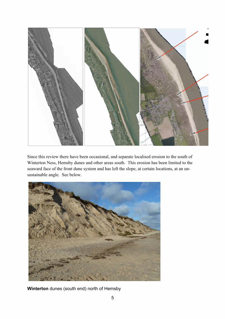
Since this review there have been occasional, and separate localised erosion to the south of Winterton Ness, Hemsby dunes and other areas south. This erosion has been limited to the seaward face of the front dune system and has left the slope, at certain locations, at an un-sustainable angle. See below.
Winterton dunes (south end) north of Hemsby
6
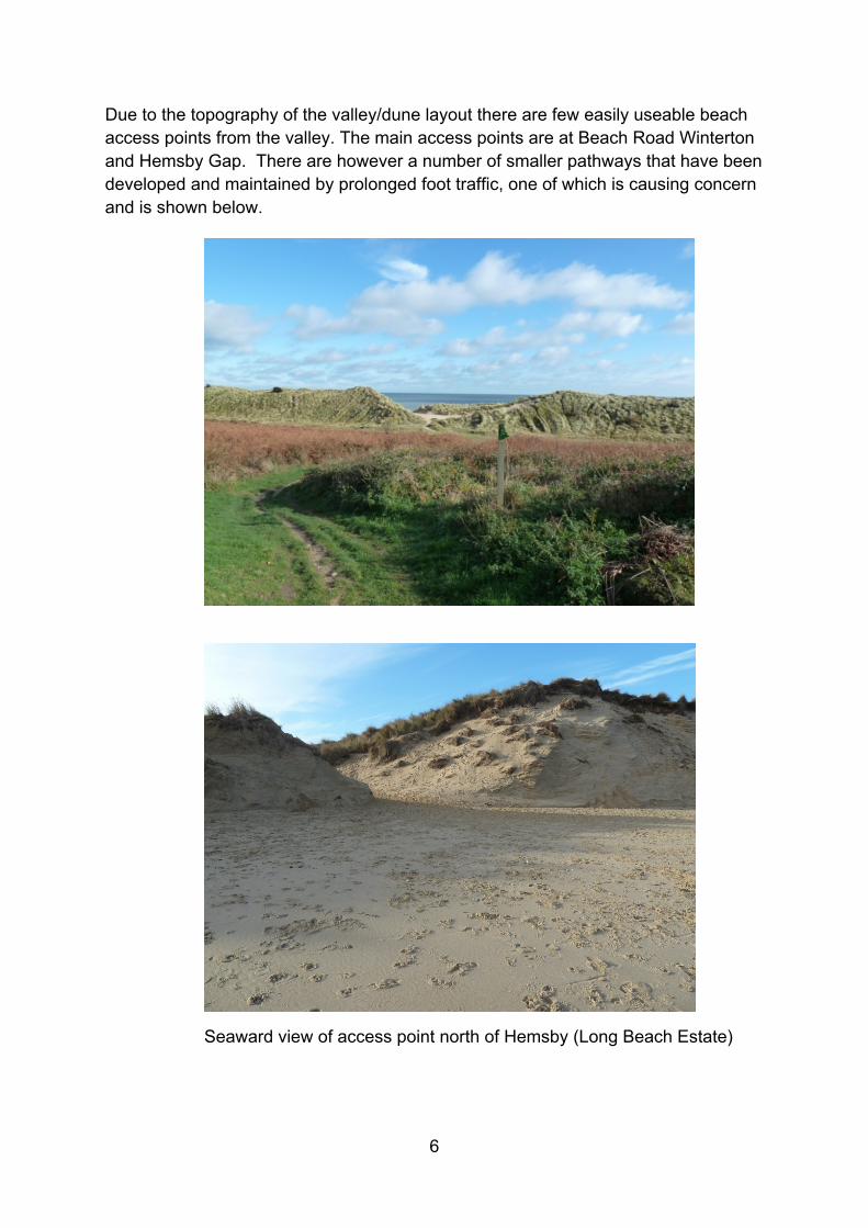
Due to the topography of the valley/dune layout there are few easily useable beach access points from the valley. The main access points are at Beach Road Winterton and Hemsby Gap. There are however a number of smaller pathways that have been developed and maintained by prolonged foot traffic, one of which is causing concern and is shown below.
Seaward view of access point north of Hemsby (Long Beach Estate)
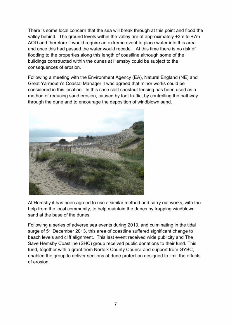
7
There is some local concern that the sea will break through at this point and flood the valley behind. The ground levels within the valley are at approximately +3m to +7m AOD and therefore it would require an extreme event to place water into this area and once this had passed the water would recede. At this time there is no risk of flooding to the properties along this length of coastline although some of the buildings constructed within the dunes at Hemsby could be subject to the consequences of erosion.
Following a meeting with the Environment Agency (EA), Natural England (NE) and Great Yarmouth’s Coastal Manager it was agreed that minor works could be considered in this location. In this case cleft chestnut fencing has been used as a method of reducing sand erosion, caused by foot traffic, by controlling the pathway through the dune and to encourage the deposition of windblown sand.
At Hemsby it has been agreed to use a similar method and carry out works, with the help from the local community, to help maintain the dunes by trapping windblown sand at the base of the dunes.
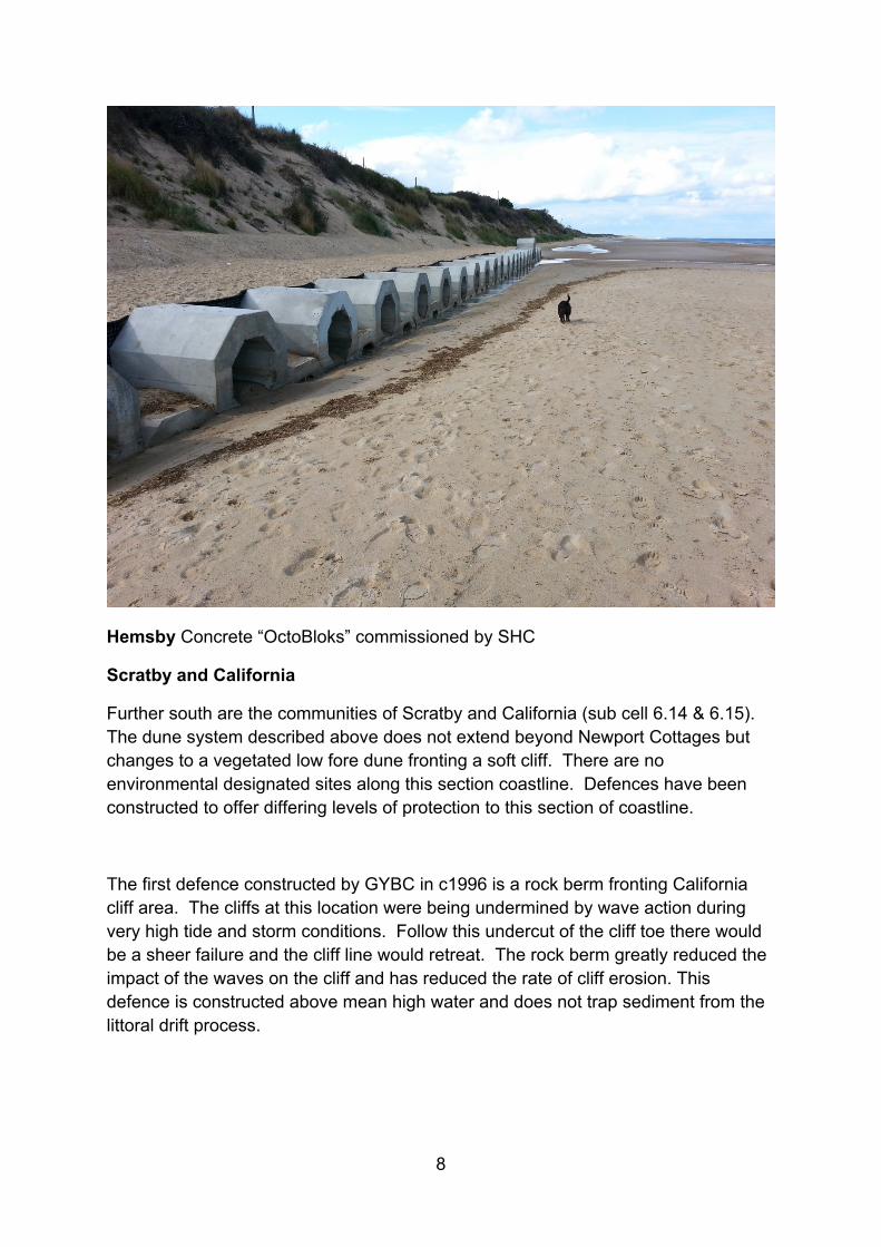
Following a series of adverse sea events during 2013, and culminating in the tidal surge of 5th December 2013, this area of coastline suffered significant change to beach levels and cliff alignment. This last event received wide publicity and The Save Hemsby Coastline (SHC) group received public donations to their fund. This fund, together with a grant from Norfolk County Council and support from GYBC, enabled the group to deliver sections of dune protection designed to limit the effects of erosion.
8
Hemsby Concrete “OctoBloks” commissioned by SHC
Scratby and California
Further south are the communities of Scratby and California (sub cell 6.14 & 6.15). The dune system described above does not extend beyond Newport Cottages but changes to a vegetated low fore dune fronting a soft cliff. There are no environmental designated sites along this section coastline. Defences have been constructed to offer differing levels of protection to this section of coastline.
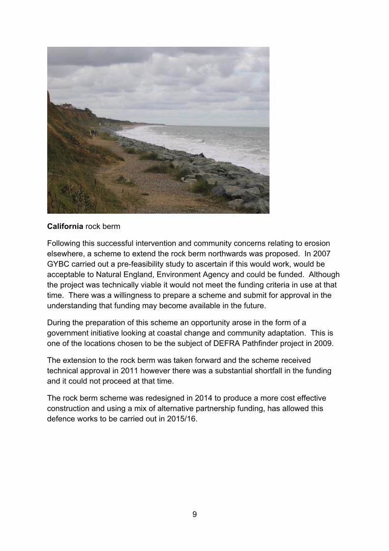
The first defence constructed by GYBC in c1996 is a rock berm fronting California cliff area. The cliffs at this location were being undermined by wave action during very high tide and storm conditions. Follow this undercut of the cliff toe there would be a sheer failure and the cliff line would retreat. The rock berm greatly reduced the impact of the waves on the cliff and has reduced the rate of cliff erosion. This defence is constructed above mean high water and does not trap sediment from the littoral drift process.
9
California rock berm
Following this successful intervention and community concerns relating to erosion elsewhere, a scheme to extend the rock berm northwards was proposed. In 2007 GYBC carried out a pre-feasibility study to ascertain if this would work, would be acceptable to Natural England, Environment Agency and could be funded. Although the project was technically viable it would not meet the funding criteria in use at that time. There was a willingness to prepare a scheme and submit for approval in the understanding that funding may become available in the future.
During the preparation of this scheme an opportunity arose in the form of a government initiative looking at coastal change and community adaptation. This is one of the locations chosen to be the subject of DEFRA Pathfinder project in 2009.
The extension to the rock berm was taken forward and the scheme received technical approval in 2011 however there was a substantial shortfall in the funding and it could not proceed at that time.
The rock berm scheme was redesigned in 2014 to produce a more cost effective construction and using a mix of alternative partnership funding, has allowed this defence works to be carried out in 2015/16.
10
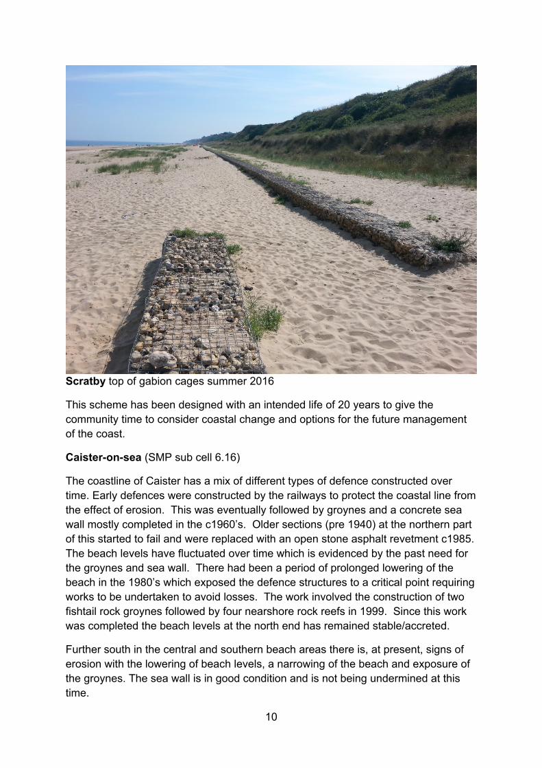
Scratby top of gabion cages summer 2016
This scheme has been designed with an intended life of 20 years to give the community time to consider coastal change and options for the future management of the coast.
Caister-on-sea (SMP sub cell 6.16)
The coastline of Caister has a mix of different types of defence constructed over time. Early defences were constructed by the railways to protect the coastal line from the effect of erosion. This was eventually followed by groynes and a concrete sea wall mostly completed in the c1960’s. Older sections (pre 1940) at the northern part of this started to fail and were replaced with an open stone asphalt revetment c1985. The beach levels have fluctuated over time which is evidenced by the past need for the groynes and sea wall. There had been a period of prolonged lowering of the beach in the 1980’s which exposed the defence structures to a critical point requiring works to be undertaken to avoid losses. The work involved the construction of two fishtail rock groynes followed by four nearshore rock reefs in 1999. Since this work was completed the beach levels at the north end has remained stable/accreted.
Further south in the central and southern beach areas there is, at present, signs of erosion with the lowering of beach levels, a narrowing of the beach and exposure of the groynes. The sea wall is in good condition and is not being undermined at this time.
11
Great Yarmouth (SMP sub cell 6.17)
Over the last 40 years the beaches at Great Yarmouth have been steadily accreting to the point where the ends of the two piers are now above the high water mark. The North Denes area, a SSSI and SPA, has also been accreting from a point where the tide was up against the sea wall to now where high water mark is some 440m from the wall. The build date of the walls along the frontage of Great Yarmouth is not confirmed but there is evidence for work c1920-27. In general the walls are in a fair condition and provided the beach remains high or continues to accrete there will not be cause for concern. There are sections where the coping is damaged and this will require work to repair or replace it. Also the face of the wall, at some location is showing signs of aging and will require some form of surface treatment but this is not a structural problem.