Embed Size (px)
Citation preview
apasa.com.au
Operational Drift Forecast Modelling in
Support of the AMSA Search for Malaysia
Airlines MH370 *Ben Brushett1 , *David Griffin2, Sasha Zigic1, Murray Burling1, Ryan Alexander1, David Wright1, and Neal Moodie3 1RPS APASA, 2CSIRO, 3BOM
1
Forum for Operational Oceanography Fremantle – July 2015
apasa.com.au
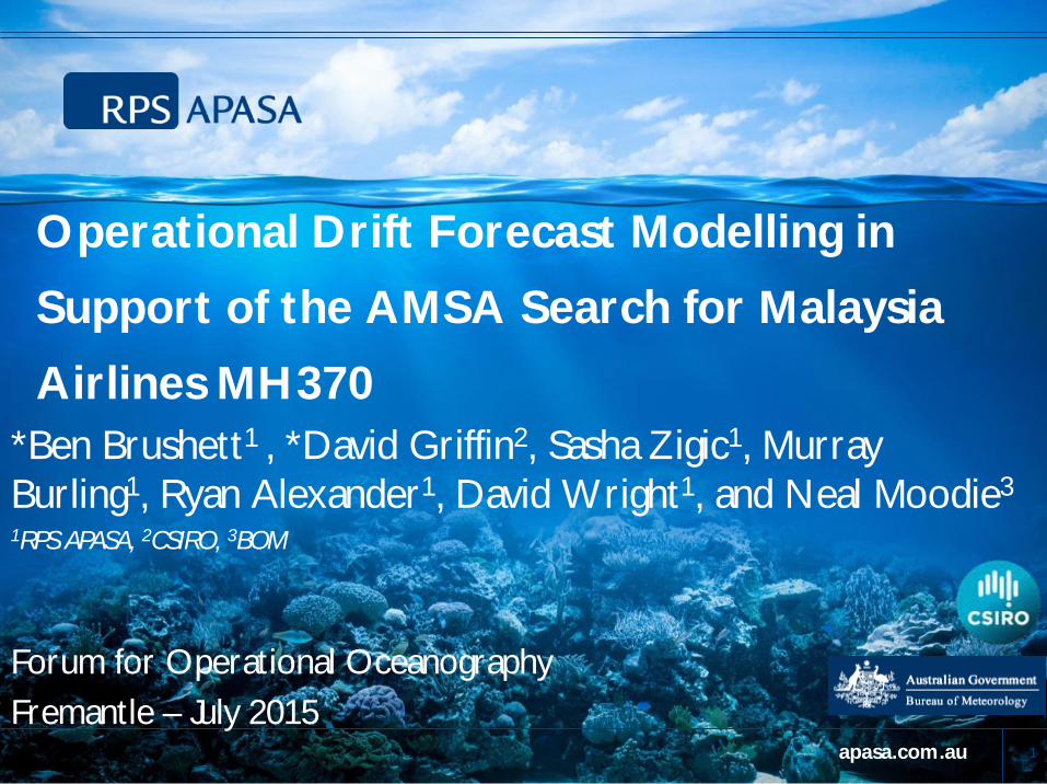
Overview of Presentation § Introduction of the incident and drift planning working group
§ SARMAP and the COASTMAP EDS
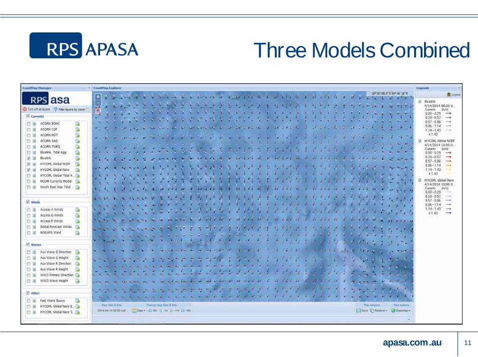
§ Ocean currents in the search area – based on three different ocean
forecast models (BLUElink, HYCOM NCEP and HYCOM Navy) § Best practice consensus forecasting using all three ocean models
§ Comparisons using SLDMB drifters to assess each of the ocean
model’s performance throughout the incident
2
apasa.com.au
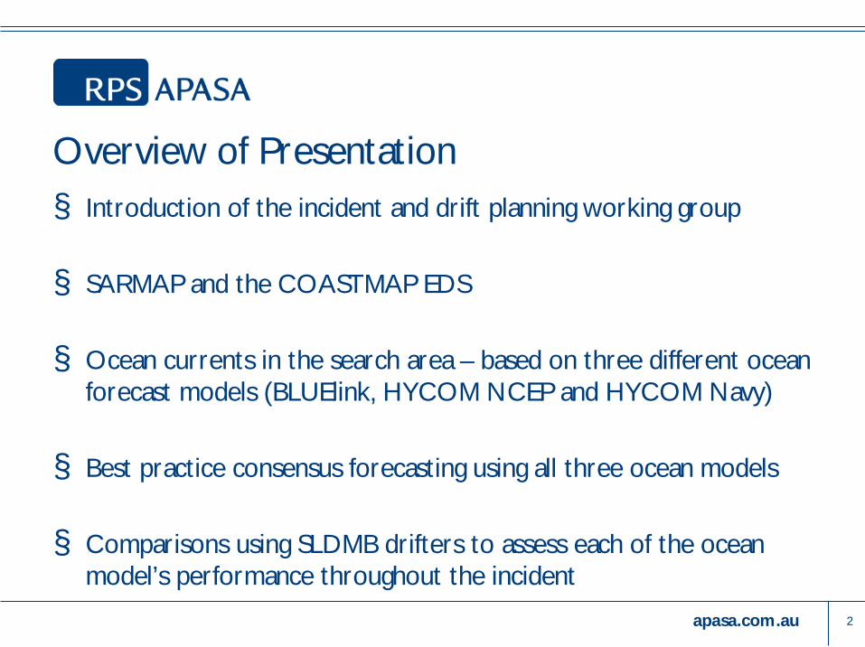
Background § Malaysian Airlines flight MH370 went missing on the 8th of March
2014 whilst en route from Kuala Lumpur, Malaysia to Beijing, China § The Australian Maritime Safety Authority (AMSA) became involved
in the drift planning once the search area was focussed on waters within the Australian SRR § Due to the difficulties in the scenario, AMSA established a drift
planning working group to ensure international best practice was carried out in this complex incident
3
apasa.com.au
The Drift Planning Working Group § Members of the drift planning working group included specialists
from several organisations including:
» AMSA – RCC » RPS APASA » CSIRO » BoM » US Coast Guard » GEMS
4
apasa.com.au
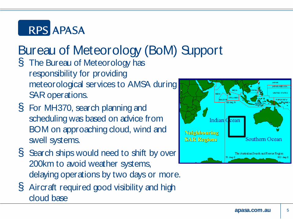
Bureau of Meteorology (BoM) Support § The Bureau of Meteorology has
responsibility for providing meteorological services to AMSA during SAR operations. § For MH370, search planning and
scheduling was based on advice from BOM on approaching cloud, wind and swell systems. § Search ships would need to shift by over
200km to avoid weather systems, delaying operations by two days or more. § Aircraft required good visibility and high
cloud base 5
apasa.com.au
SARMAP and the COASTMAP EDS § Drift modelling software – SARMAP
» Lagrangian particle trajectory model » Uses large number of particles to simulate the potential
trajectories and dispersion of SAR objects » Ocean current forecasts and wind forecasts from the COASTMAP
EDS are used to provide environmental forcing to the model
» Rather than focussing on any single ocean forecast – use as many forecast models as are available
6
apasa.com.au
Metocean datasets used throughout the event: § Australian Bureau of Meteorology (BoM):
» BLUElink OceanMAPS forecast ocean currents » ACCESS-R winds
§ US NOAA/NCEP » HYCOM-NCEP forecast ocean currents » GFS winds
§ US Navy » HYCOM-Navy forecast ocean currents
§ CSIRO » Gridded Sea Level Anomaly (GSLA) geostrophic currents
7
apasa.com.au
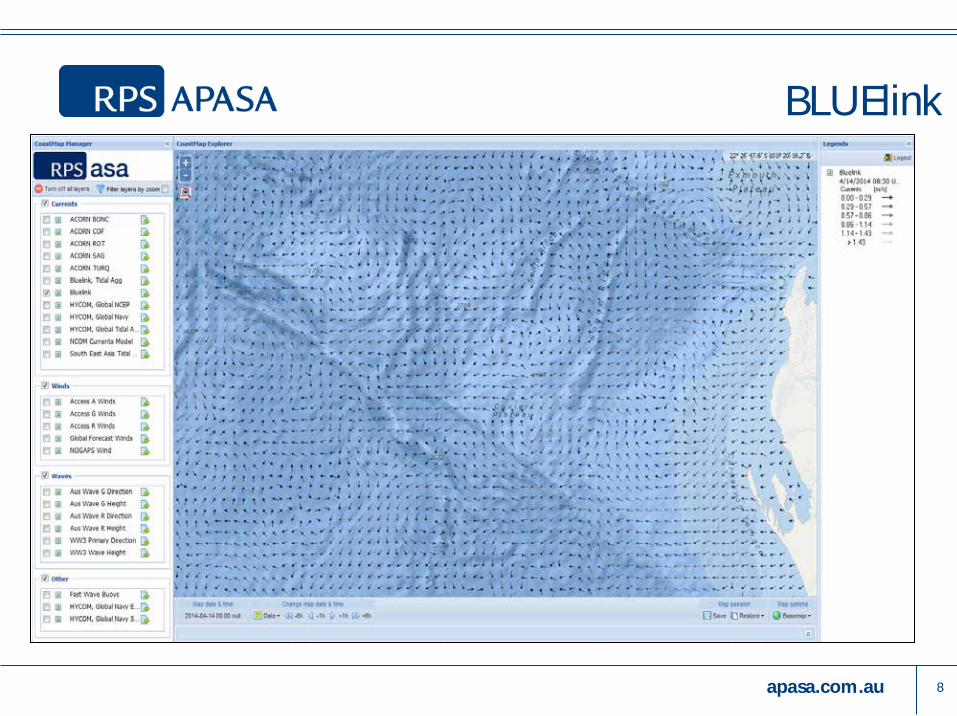
BLUElink
8
apasa.com.au 9
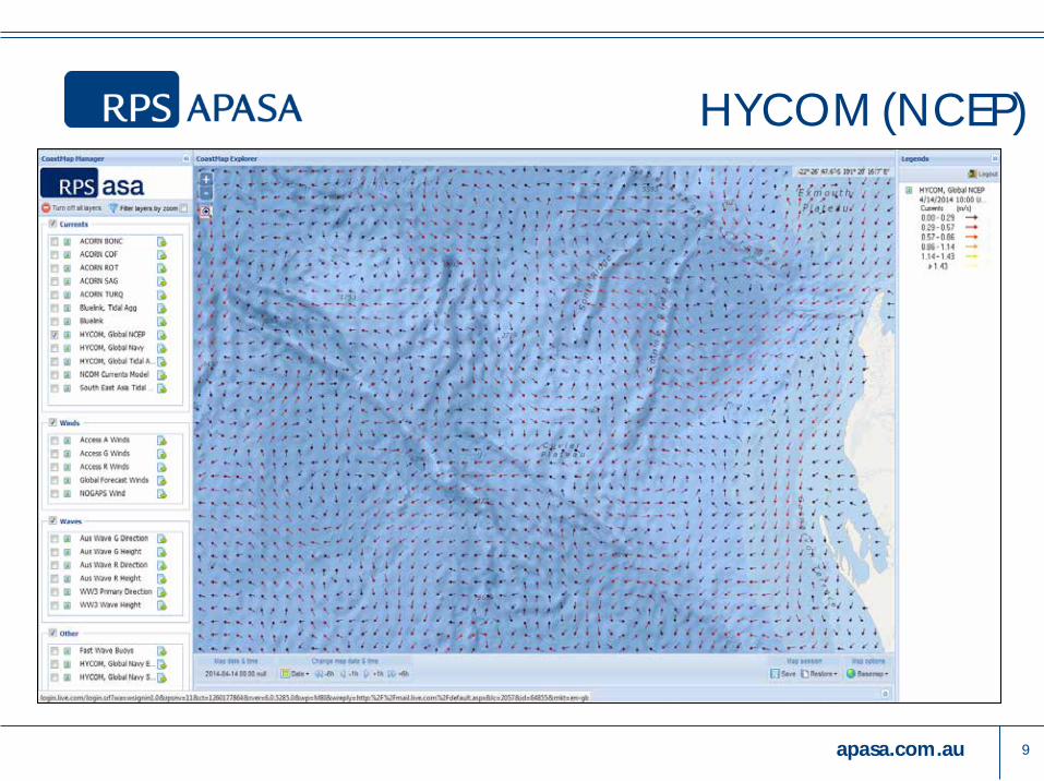
HYCOM (NCEP)
apasa.com.au
10
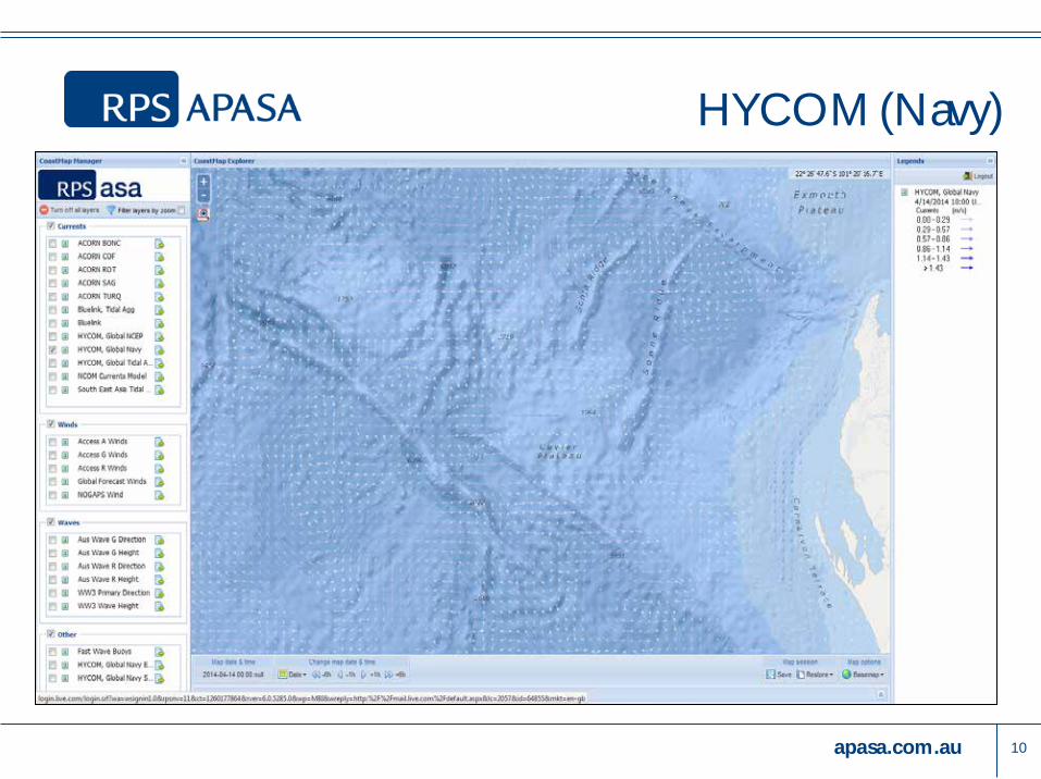
HYCOM (Navy)
apasa.com.au 11
Three Models Combined
apasa.com.au
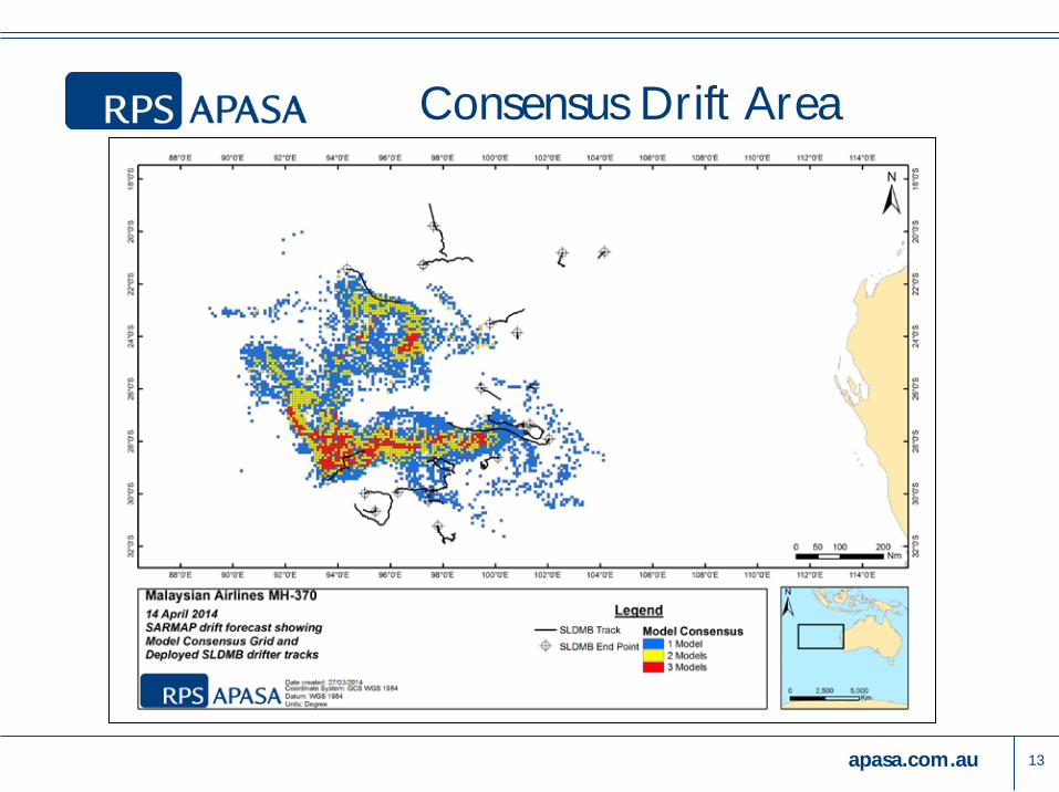
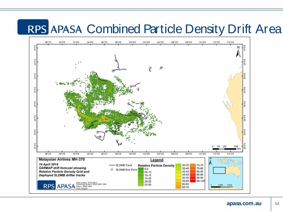
Consensus Forecasting
§ Consensus forecasting was carried out to: » Account for more variability than any single ocean model could represent
» Provide higher likelihood zones where multiple forecasts overlapped
12
apasa.com.au
Consensus Drift Area
13
apasa.com.au
Combined Particle Density Drift Area
14
apasa.com.au
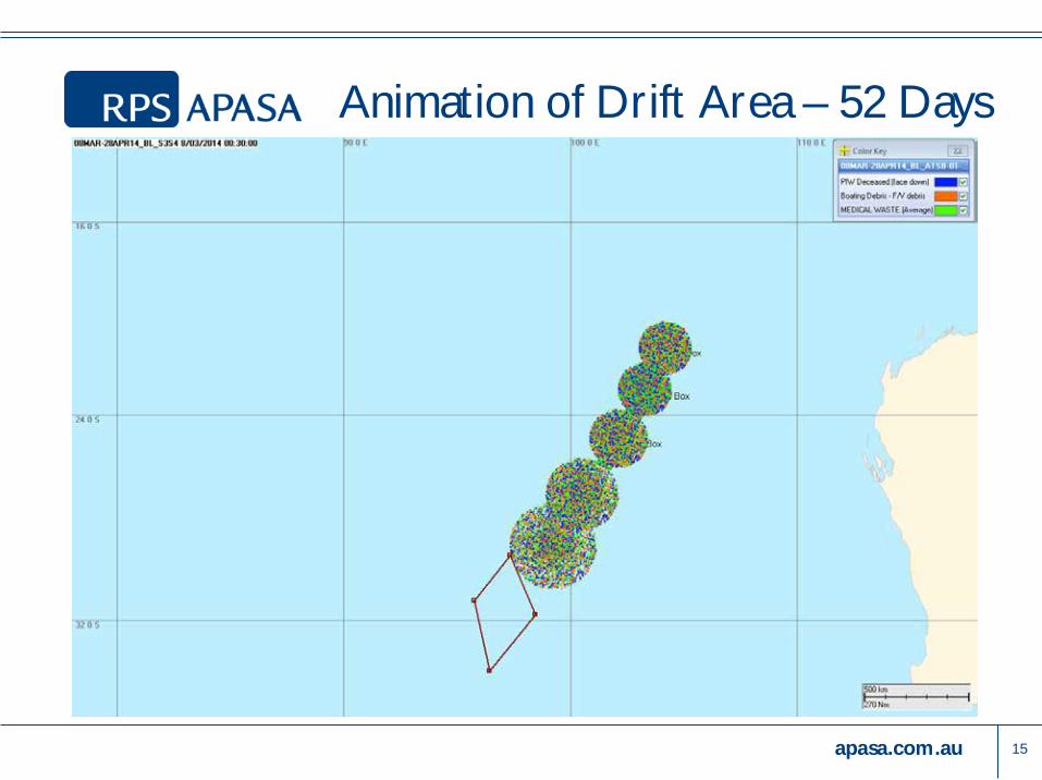
Animation of Drift Area – 52 Days
15
apasa.com.au
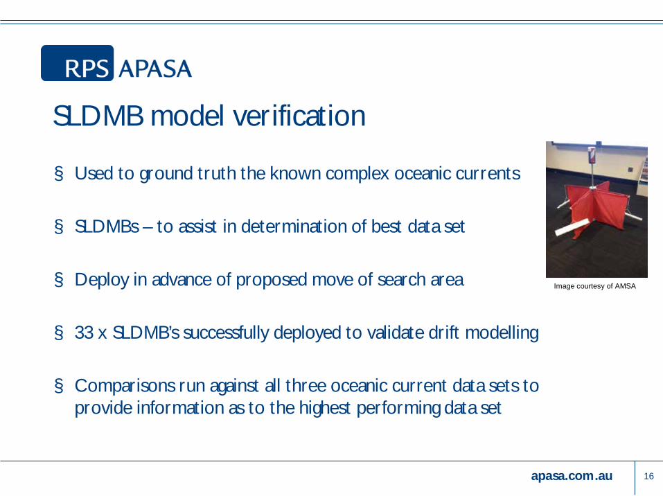
SLDMB model verification
§ Used to ground truth the known complex oceanic currents
§ SLDMBs – to assist in determination of best data set
§ Deploy in advance of proposed move of search area
§ 33 x SLDMB’s successfully deployed to validate drift modelling
§ Comparisons run against all three oceanic current data sets to provide information as to the highest performing data set
16
Image courtesy of AMSA
apasa.com.au
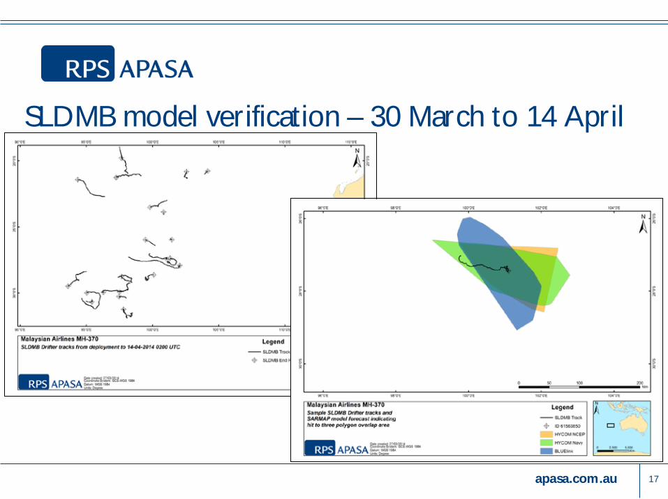
SLDMB model verification – 30 March to 14 April
17
apasa.com.au
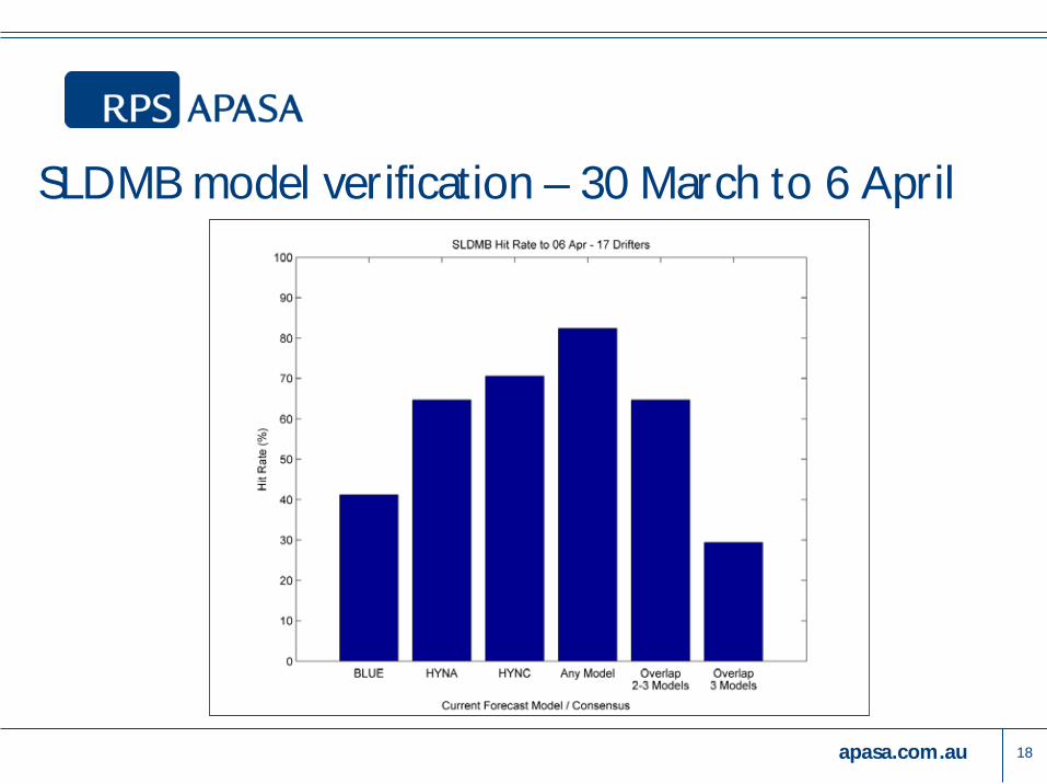
SLDMB model verification – 30 March to 6 April
18
apasa.com.au
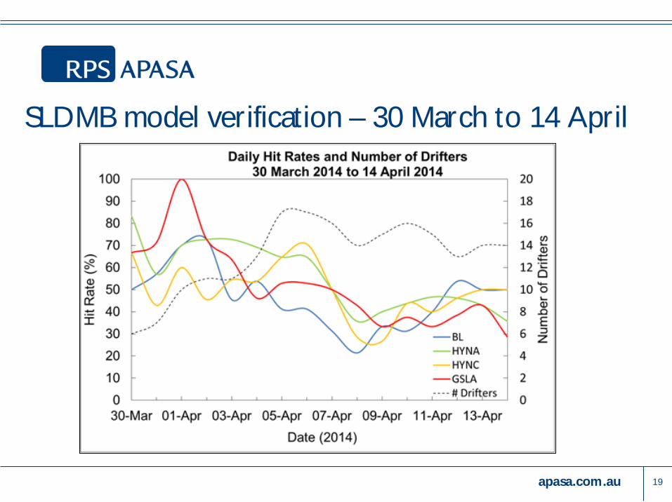
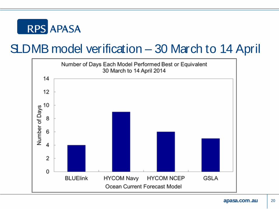
SLDMB model verification – 30 March to 14 April
19
apasa.com.au
SLDMB model verification – 30 March to 14 April
20
apasa.com.au
Summary § Complex environment, very complex scenario § Best practice combined and consensus forecasting was applied to
consider more variability than any one single model could represent § Consensus forecasting was used to present numerous different
outcomes and determine where these coincided § Model performance was evaluated throughout the incident, using
SLDMB drifters § Comparisons using SLDMB drifters allow for a model skill
assessment to be built up over time § Skill assessment may allow for potential weighting of the consensus
forecast to improve results
21
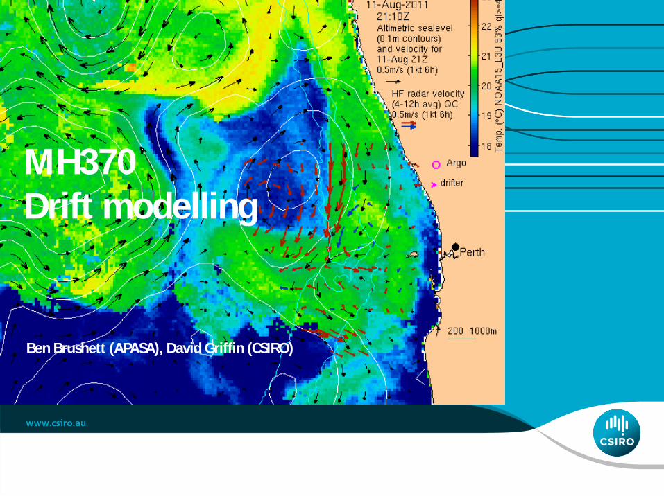
MH370 Drift modelling
Ben Brushett (APASA), David Griffin (CSIRO)
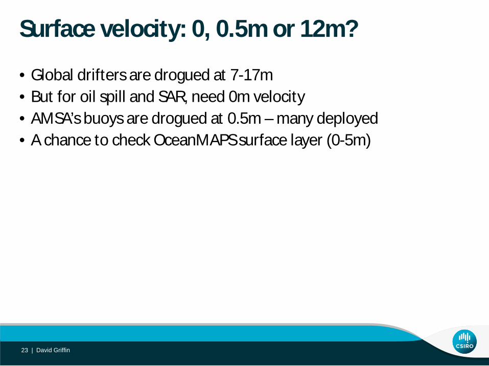
Surface velocity: 0, 0.5m or 12m?
• Global drifters are drogued at 7-17m • But for oil spill and SAR, need 0m velocity • AMSA’s buoys are drogued at 0.5m – many deployed • A chance to check OceanMAPS surface layer (0-5m)
David Griffin 23 |
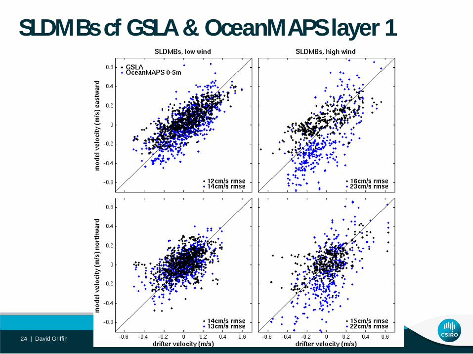
SLDMBs cf GSLA & OceanMAPS layer 1
David Griffin 24 |
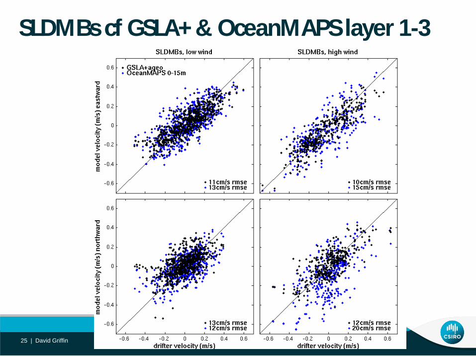
SLDMBs cf GSLA+ & OceanMAPS layer 1-3
David Griffin 25 |
Conclusion
• OceanMAPS surface layer is much too wind-sensitive (momentum not mixed, just T&S, during convection).
• GSLA geostrophic velocities have less rms error (no baroclinic instability).
David Griffin 26 |
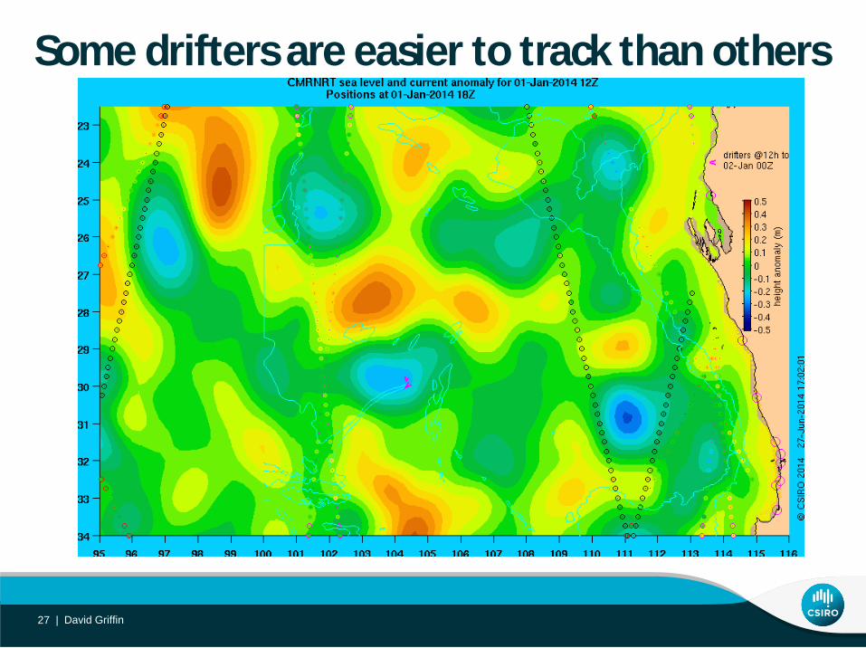
Some drifters are easier to track than others
David Griffin 27 |
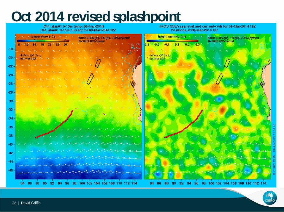
Oct 2014 revised splashpoint
David Griffin 28 |
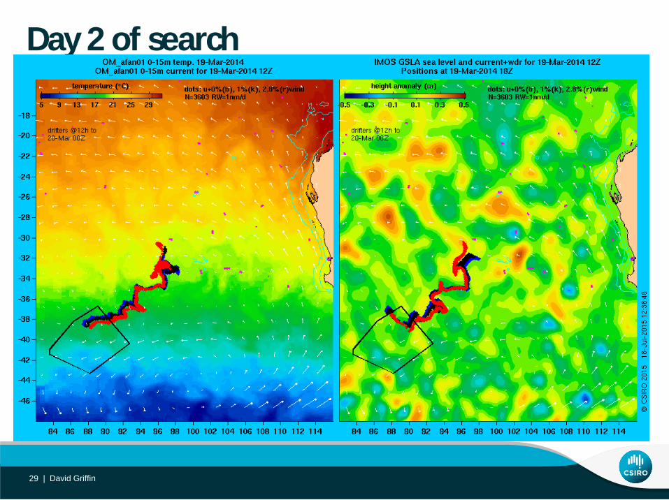
Day 2 of search
David Griffin 29 |
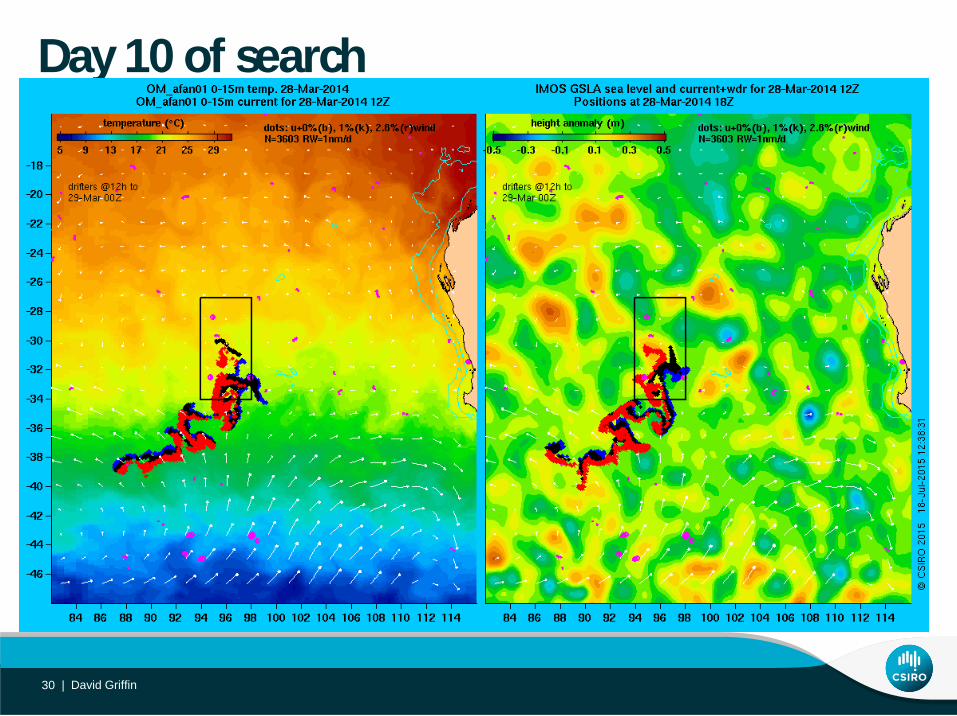
Day 10 of search
David Griffin 30 |
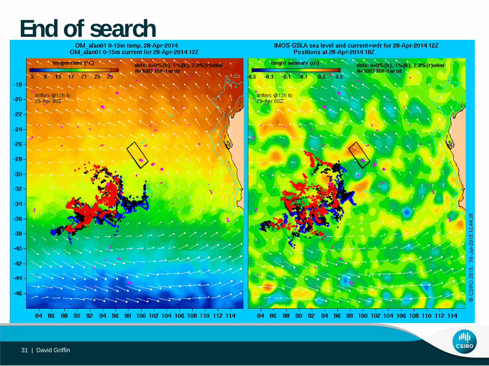
End of search
David Griffin 31 |
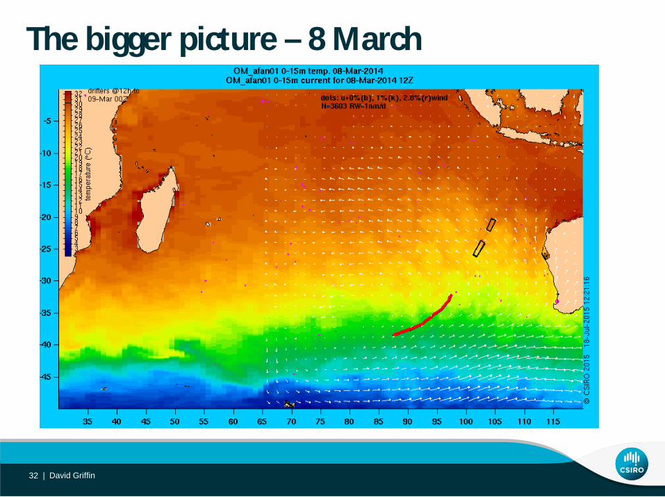
The bigger picture – 8 March
David Griffin 32 |
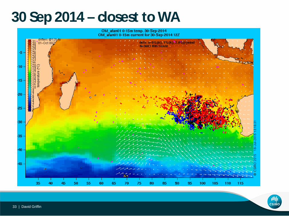
30 Sep 2014 – closest to WA
David Griffin 33 |
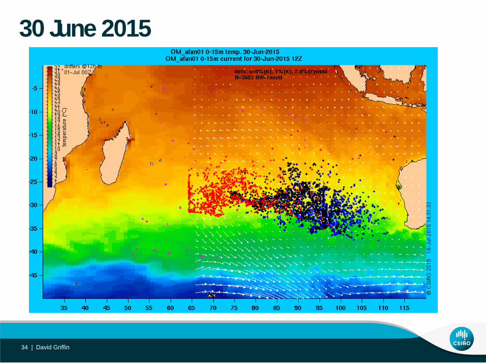
30 June 2015
David Griffin 34 |


![Modelling Enhanced Con nement in Drift-Wave Turbulence · referred to as "drift wave-zonal ow turbulence" (see ref.[6] for a detailed review). Interaction between separate components](https://img.pdfslide.us/doc/110x75/5f8df631b04ac2186d76fb65/modelling-enhanced-con-nement-in-drift-wave-turbulence-referred-to-as-drift.jpg)