Embed Size (px)
Citation preview
1
SPACE BASED WIRELESS PICO-SATELLITE SENSOR
NETWORKS
Oliver Pankiewicz
EEL 6935Embedded Systems
11-15-11
2
Satellite Background Information Algorithm Goals and Assumptions Deployments Decision making algorithm Simulation Simulation Results
Agenda
3
Distributed Adaptability and Mobility in Space Based Wireless Pico-Satellite Sensor Networks
Wei Li, Tughrul Arslan, Ahmed O. El-Rayis, Nakul Haridas, Ahmet T. Erdogan, E. Yang, School of Electronic and Information Engineering, Xi’an Jiaotong University, China, School of Engineering and Electronics, University of Edinburgh, Edinburgh EH9 3JL, United Kingdom
Presented at NASA/ESA Conference on Adaptive Hardware and Systems in 2008
Paper
4
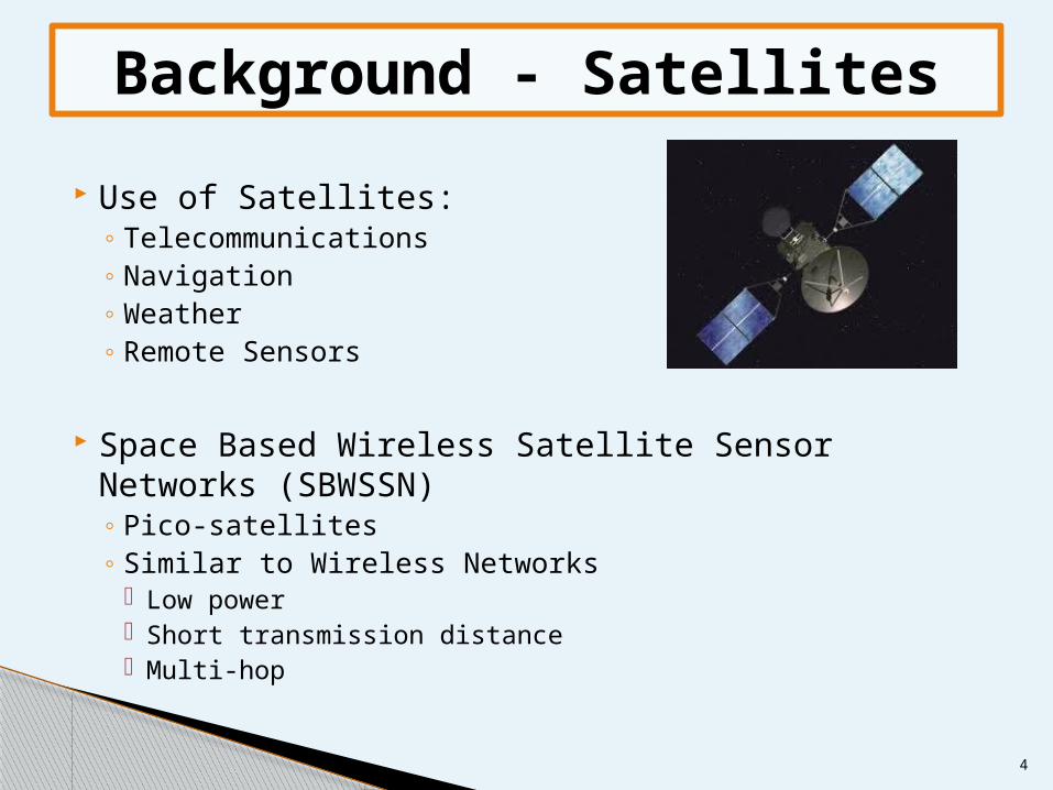
Use of Satellites:◦ Telecommunications◦ Navigation◦ Weather◦ Remote Sensors
Space Based Wireless Satellite Sensor Networks (SBWSSN)◦ Pico-satellites◦ Similar to Wireless Networks
Low power Short transmission distance Multi-hop
Background - Satellites
5
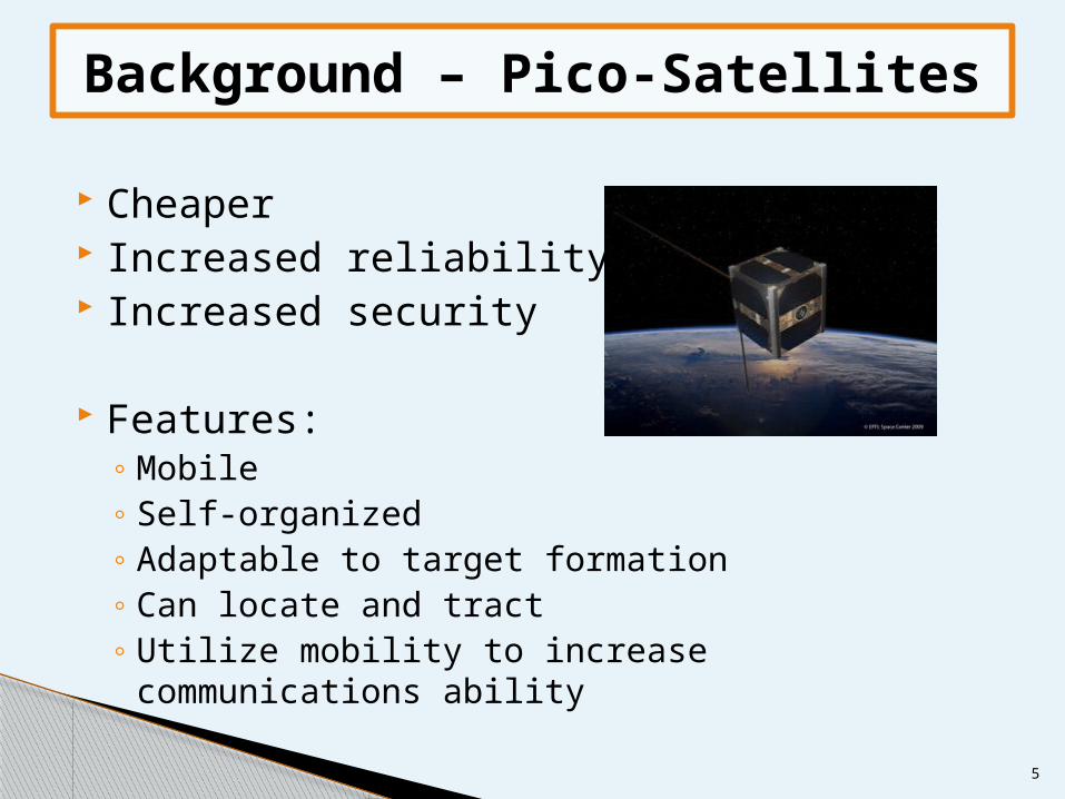
Cheaper Increased reliability Increased security
Features:◦ Mobile◦ Self-organized◦ Adaptable to target formation◦ Can locate and tract◦ Utilize mobility to increase communications ability
Background – Pico-Satellites
6
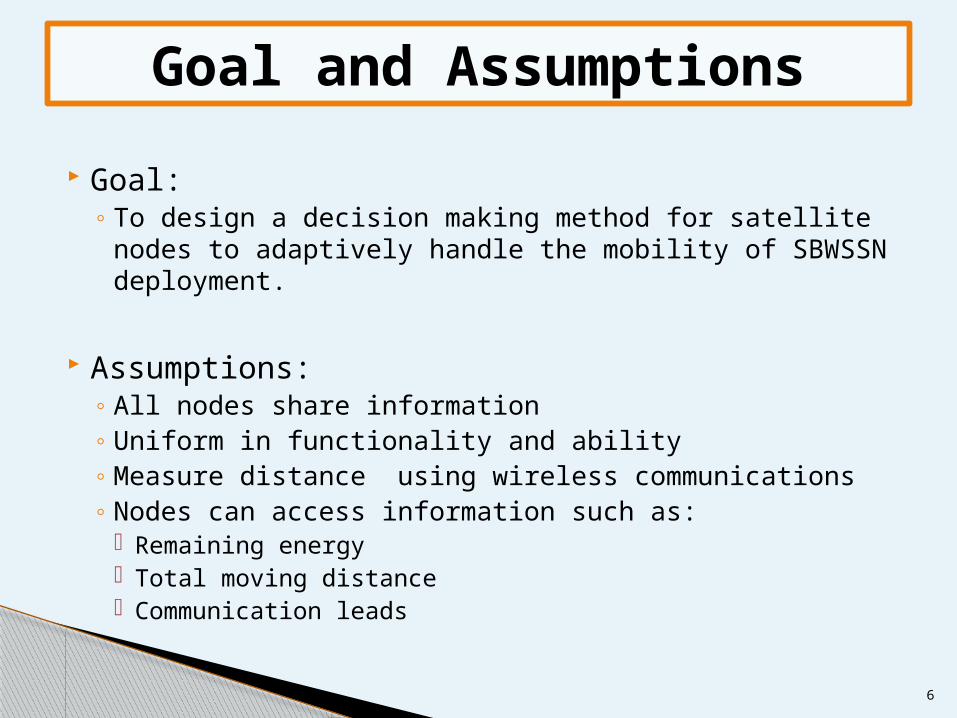
Goal:◦ To design a decision making method for satellite nodes
to adaptively handle the mobility of SBWSSN deployment.
Assumptions:◦ All nodes share information◦ Uniform in functionality and ability◦ Measure distance using wireless communications◦ Nodes can access information such as:
Remaining energy Total moving distance Communication leads
Goal and Assumptions
7
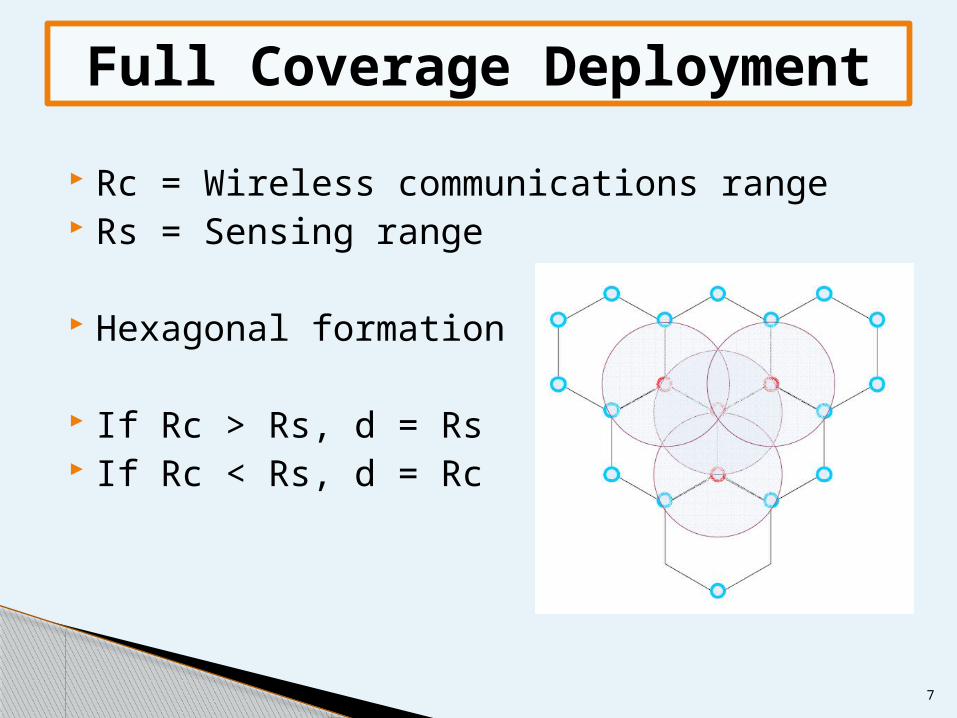
Rc = Wireless communications range Rs = Sensing range
Hexagonal formation
If Rc > Rs, d = Rs If Rc < Rs, d = Rc
Full Coverage Deployment
8
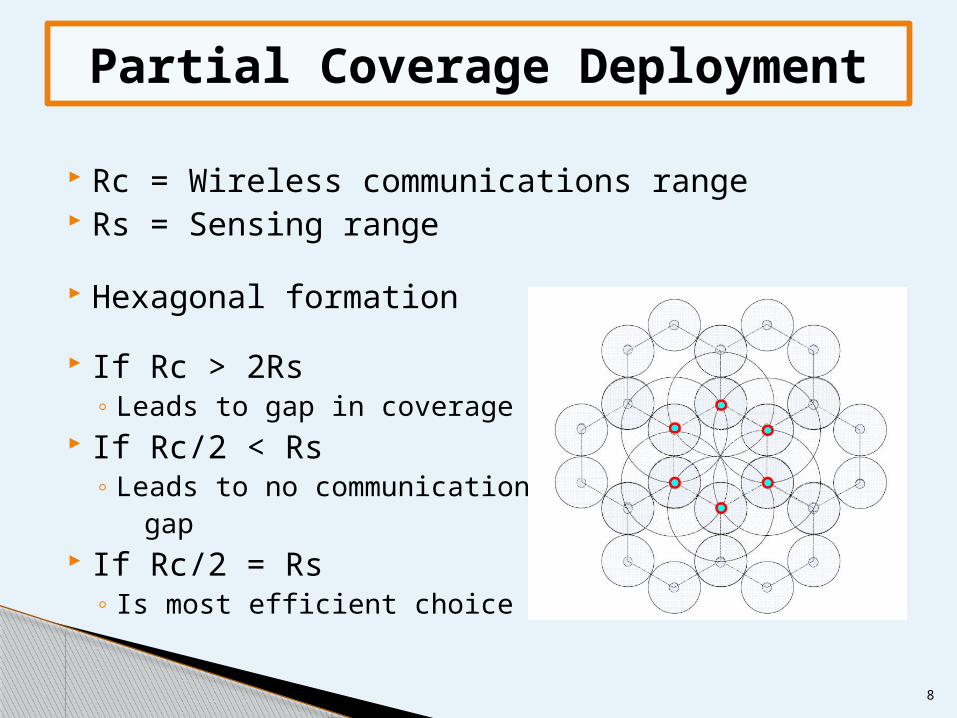
Rc = Wireless communications range Rs = Sensing range
Hexagonal formation
If Rc > 2Rs◦ Leads to gap in coverage
If Rc/2 < Rs◦ Leads to no communication gap
If Rc/2 = Rs◦ Is most efficient choice
Partial Coverage Deployment
9
Utilize position information of each node. Deploys nodes adaptively in distributed manner. Keeps nodes at distance equal to Rs and less
than Rc.
Disadvantages:◦ Vibration during converging to final deployment
formation.◦ Costs more convergence time.◦ With out boundary or virtual boundary, the algorithm
has stochastic behavior.
Virtual Force Algorithm
10
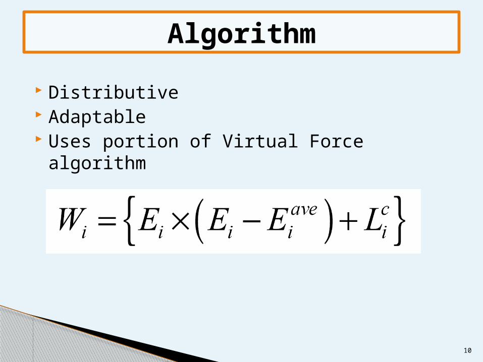
Distributive Adaptable Uses portion of Virtual Force algorithm
Algorithm
11
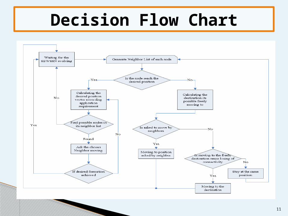
Decision Flow Chart
12
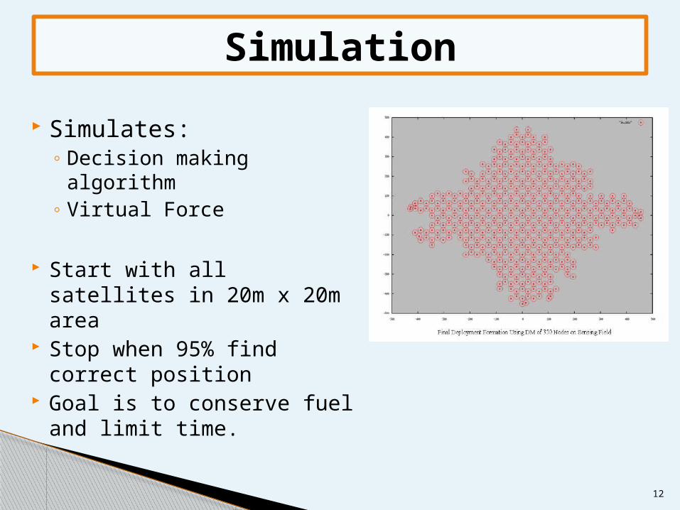
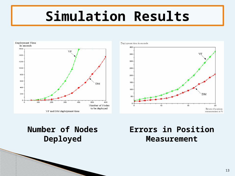
Simulates:◦ Decision making
algorithm◦ Virtual Force
Start with all satellites in 20m x 20m area
Stop when 95% find correct position
Goal is to conserve fuel and limit time.
Simulation
13
Number of Nodes Deployed
Errors in Position Measurement
Simulation Results
14
Only compare their VF and DM algorithms 2-D only Does not go into detail of how Rs and Rc is
used in their algorithm Doesn't go into details on how the Wi
equation works in the decision tree Simulation results
Paper Limitations
15
Decision Making Algorithm Designed for Space Based Wireless Satellite
Sensor Networks Optimize in energy and distribution Improvement over Virtual Force
Conclusion

16
Questions?
Please post any questions on Sakai