Embed Size (px)
Citation preview
rrrrrrrrrrro[
rrrrr[
Cemetery Survey
Groton, Connecticut
Kristin Havrilla
Summer 1996
rriI
P"Il
il
r!
F""i
rI
P"1
I
rrI
rrP"
I
rl"'"lP"!(
P"
!
INTRODUCTION
During the summer of 1996, an intern for the Planning Department in the Townof Groton conducted a survey of all known cemeteries in Groton. The survey includedinformation about conditions of grounds and markers, design elements, carving types,general age of a cemetery, and some family names and significant individuals buriedthere. In addition, potential hazards were noted and recommendations forimprovements were made. Finally, a summary of significance of the cemetery,directions and photographs were added to give further information about them.
While researching and visiting the cemeteries for this report, it became obviousthat many people were not aware of the information available. Thus, a secondaryfocus of this study became explaining what resources are available in the variouslibraries and historical societies throughout Groton. Statewide and nationalorganizations were contacted as well to find out what services they provide.
Other explanatory information is included in order to make the report fuIlyuseful for a spectrum of interested individuals. A glossary of terms, explanation ofsymbolic carvings and design elements, and explanation of maintenance problems act asintroductions, or perhaps re-introductions for users of the report. In addition, adetailed map locates cemeteries to make them easier to find.
Many individuals were very helpful and are due thank you's. Betty Chapmanand Carol Kimball took time out of their busy days to share their knowledge ofcemeteries; Bill Beaman and Marty Schoonman in the Parks and RecreationDepartment and Horace Newbury in the Public Works Department providedinformation on maintenance and locations of some hidden cemeteries; and Dr. NicholasBellantoni, the State Archaeologist aided in finding information on Native AmericanBurial Sites. Finally, thanks is due to the staff in the Planning Department whoprovided insight and help in preparing the report, in particular, Paul Duarte formapping the cemeteries in the GIS system and Nicki Boenig for helping with theorganization of the report.
Although this survey is meant to be as complete and correct as possible, someinformation may have been incorrectly interpreted. This survey is perhaps the firstcomplete report of Groton's cemeteries which notes conditions and historic significanceand not just an inventory of names on gravemarkers. HopefuIly this survey will beaninformation base and spark further reports, in which information can be corrected ifneed be.
Kristin HavrillaPlanning Department InternRoger Williams UniversitySchool of ArchitectureCenter for Historic Preservation
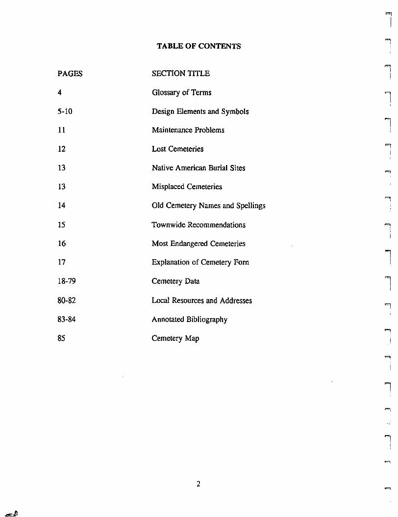
1TABLE OF CONTENTS 1
PAGES SECTION TITLE,
)
4 Glossary of Terms 1i
5-10 Design Elements and Symbols""')
11 Maintenance Problems1
12 Lost Cemeteries "li
13 Native American Burial Sites'1
13 Misplaced Cemeteries
"""114 Old Cemetery Names and Spellings I
I
15 Townwide Recommendations ""'lIJ
16 Most Endangered Cemeteries ,17 Explanation of Cemetery Fom !
18-79 Cemetery Data 'I!
80-82 Local Resources and Addresses'9,
II
83-84 Annotated Bibliography
85 Cemetery Map'l
i
""l!
.,I
!!
-"
'I!
"'l
2"'l
~
r[
r CEMETERY LISTl
r 18 Avery-Morgan Cemetery[ 20 Beth El Cemetery
22 Bill Cemetery
r 24 Binles Cemetery26 Chipman-Fish Cemetery28 Colonel Ledyard Cemetery
F'"30 Crary CemeteryI
l 32 Cushman Cemetery
r 34 Daniel Burrows Burial Plot13 Daniels Cemetery36 Fish Cemetery
r 13 James Bailey Cemetery38 Knowles Cemetery
L
40 Lower Mystic Cemetery
r 42 Niles Cemeteryl 44 Noank Valley Cemetery
46 North Burrows Cemetery
r 48 Odd Fellows Cemetery! 50 Packer Cemetery #1
52 Packer Cemetery #2r 54 Palmer Cemetery56 Park Cemetery #1
F58 Perkins Cemetery
! 60 Potter's Fieldi
62 Saint Patrick Cemetery
pm 64 Silas Burrows CemeteryI 13 Smith Cemetery,
18 Smith Lake CemeteryF 66 South Burrows CemeteryI 68 Starr Burying Grounds
70 Turner Cemeteryr 72 Wallsworth CemeteryI
74 Wells CemeteryI
76 Wightman CemeteryF'"! 78 Wood Cemeteryl
f""!I!
f"II1
rl
P" 3;I
GLOSSARY OF TERMS
Throughout this report, terms are consistently used in describing cemeteries,gravemarkers and conditions concerning them. This is meant to define the terms usedso as to keep confusion nonexistent, or at least, to a minimum. Where noted (1),definitions are taken from Lynette Strangstad's A GraveYard Preservation Planner.
conservation: a specialized field involved with the stabilizaiton, protection fromdeterioration, and preservation from loss of historic and artictic value (1).
preservation: the act of protecting, maintaining, and saving... [cemeteries] anddocuments as well as the procedures applied to the stones themelves (1).
replica: An exact copy of an artifact, in this case, gravemarkers, in order to preservethe original in a more controlled state (1).
restoration: the act of restoring- that is, reconstructing, replacing, renewing (1).
rustic: unfinished, natural state of a material, in this case, stone.
finished: shaping, cutting of a material to give it a more formal look.
motif: type of image, in this case, the artistic images found on gravemarkers.
carving: the act of shaping a material, including the shaping of a stone's surface intorelief images.
symbol: a carved motif which has spiritual, personal, societal meaning.
excellent: near perfect or near new condition of both the grounds and thegravemarkers.
good: high levels of maintenance are obvious, but a few more things could be done tospruce up appearance. Problems are minor and can easily be corrected.
decent: average condition, basic maintenance is conducted. markers are endangeredbecause of overgrowth. If problems are not corrected, permanent damage tomarkers will probably occur.
PQQI.;. worst level of condition, perhaps even abandonment of cemetery, or lack ofmaintenance for many years. Markers are difficult to discern. Markers arepermanently damaged by deterioration and mayor may not be able to besalvaged.
4
1'l
i
'1I
.,j
""1I
i.
!!
..."I
1
'1!
l
rrl
rrl
rl
rll
rl
rF!,
rrrrFI
rrrI
rl
F"l
DESIGN ELEMENTS AND SYMBOLS
Cemeteries provide a wealth of informaiton making them useful resources ontheirr own. Historic events are recorded or hinted at through markers inscriptions,such as the Battle of Groton Heights. Societal influences are reflected as well, from theway in which the cemetery's setting is designed or not designed, to the way in whichthe gravemarkers are inscribed and decorated.
A cemetery's layout tells a great deal about a society's perception of death. Ouroldest cemeteries can be classified as burying grounds, simply, places to put loved onesonce life had ended. Death was simply the end to a life of repression from the Puritanviewpoint. Death was not sentimental but rather remembered in fear.
A major transformation in views of death and health which occurred in the earlyparts of the nineteenth century changed society's views on how to bury the dead.Doctors became worried that the old burying grounds were not healthy places to visit,and at the same time new influences were changing the thinking of what happened afterdeath. Suddenly, death became an eternal life, and a beautiful place was required inorder to experience a tranquil and spiritual eternity. Mount Auburn Cemetery justoutside Boston, Massachusetts is the first of these new cemeteries and is exemplary indesign and use of flora and fauna.
Many cemeteries in Groton contain designed elements which aim to make themmore than a place to be buried. Many have path systems which bring the visitorthrough the cemetery. Sections are planned into plots or individual sections. Trees andflowers are often incorporated in order to accent the cemetery and to make it morebeautiful. On occasion, tree screens are evident, where trees line the cemetery'sfrontage along the road in order to keep everyday movement out of the peacefulsetting. Centenary trees march along the pathways giving them definition and guidingthe visitor's eye to a dramatic focal point are seen in a number of cemeteries. Benchesare also placed in some of the cemeteries in order to provide places for personalcontemplation.
Carved images on the markers symbolize a society's perception of death.Inscriptions not only aid in genealogy, but also frequently tell cause of death and otherpersonal characteristics. In addition, the artistic symbols carved into the markers act asexplanations, so to speak, of feelings about death.
An index follows which explains the meanings held by the carvings, and wherethey can be located throughout the town. This index of symbol types is not meant to beall inclusive but rather to give an idea of what some of the more common carvings arein this area and when they were commonly used.
5
'.., .--'0,
'.~
\
'-& ...
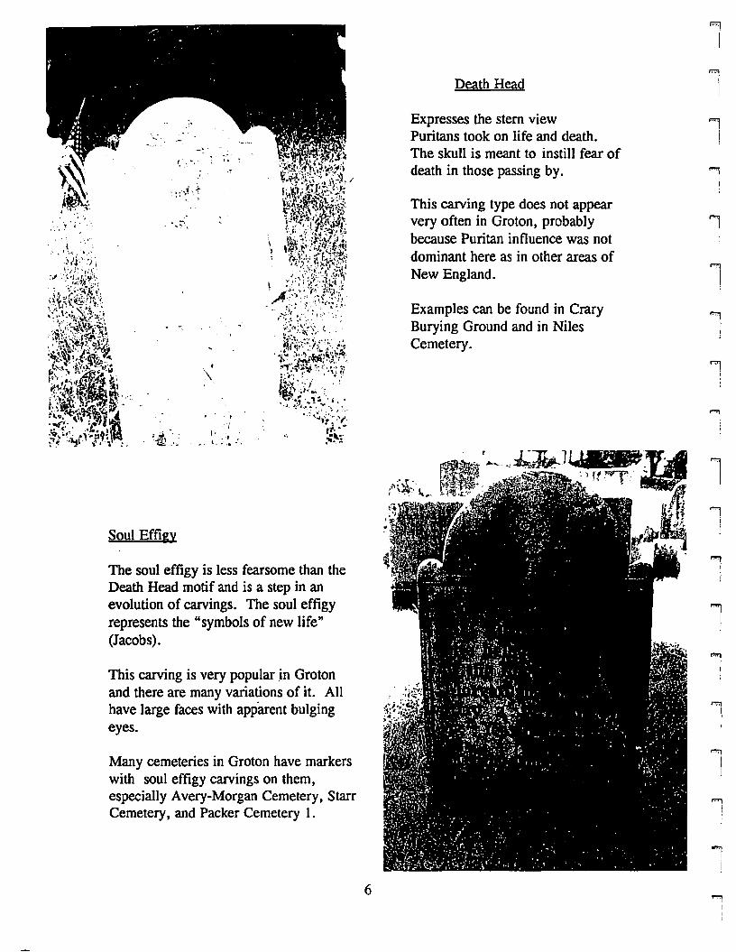
Soul Effigy
The soul effigy is less fearsome than theDeath Head motif and is a step in anevolution of carvings. The soul effigyrepresents the "symbols of new life"(Jacobs).
This carving is very popular in Grotonand there are many variations of it. Allhave large faces with apparent bulgingeyes.
Many cemeteries in Groton have markerswith soul effigy carvings on them,especially Avery-Morgan Cemetery, StarrCemetery, and Packer Cemetery 1.
6
Death Head
Expresses the stern viewPuritans took on life and death.The skull is meant to instill fear ofdeath in those passing by.
This carving type does not appearvery often in Groton, probablybecause Puritan influence was notdominant here as in other areas ofNew England.
Examples can be found in CraryBurying Ground and in NilesCemetery.
'r .1-Jr~ JI t.....1lt·.
lW:.~.'..~.' .,.... ~,.•:~.~.ft.: .',' :)It 'ry" ...t.\1t".t;~ '.. '(fl'
.'11'," ., ~. # j
<jJ ";.0-
f! '.,.
l""'1
Ii
Ii
l.....,I
lJ
1II
1
l....,
j
"1I
l
lllI
rr,rF"
\
rrl
r\
F"
I
rL
rF
t
rril
rI
ri
f""(l
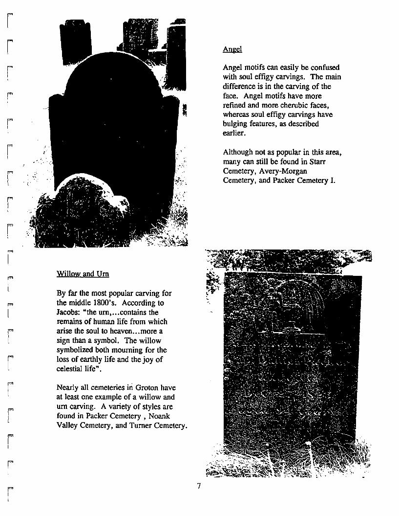
Willow and Urn
By far the most popular carving forthe middle 1800's. According toJacobs: "the urn, ...contains theremains of human life from whicharise the soul to heaven...more asign than a symbol. The willowsymbolized both mourning for theloss of earthly life and the joy ofcelestia1life" .
Nearly all cemeteries in Groton haveat least one example of a willow andurn carving. A variety of styles arefound in Packer Cemetery , NoankValley Cemetery, and Turner Cemetery.
7
Angel motifs can easily be confusedwith soul effigy carvings. The maindifference is in the carving of theface. Angel motifs have morerefined and more cherubic faces,whereas soul effigy carvings havebulging features, as describedearlier.
Although not as popular in this area,many can still be found in StarrCemetery, Avery-MorganCemetery I and Packer Cemetery I.

Flowers
In Groton, flowers are usually found onchildren's markers, and occasionallyon women's markers. They symbolizethe "beauty and brevity of life" (Jacobs).
Markers with flower carvings can befound in Noank Valley Cemetery, LowerMystic Cemetery, Colonel LedyardCemetery.
8
Architectural Elements
Gothic pointed arches, openinggates, draped cloth and tassels overround arches all fall into thiscategory which represent entranceinto the afterlife.
Examples can be found in ChipmanFish Cemetery, Noank ValleyCemetery, Lower Mystic Cemetery,and Colonel Ledyard Cemetery.
l'I
I,,tJ
li
1j
""'1II,I
1
""'l
J
'1
"'1j
""'iI1
'""lI
lJ
1l1
"""'11
rrrrrrrrrrl
rrril
rFf
rl
rr
Open Bible
"The word through which one gainsrevelation" is symbolized in markerscarved to look like bibles, or onmarkers with bibles depicted openedto a verse of the Bible.
Markers with these symbols can befound in Avery-Morgan Cemetery,and Lower Mystic Cemetery.
9
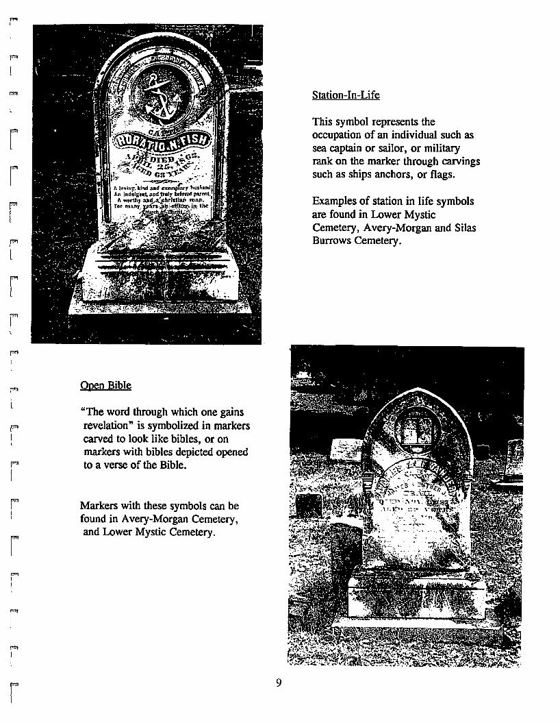
Station-In-Life
This symbol represents theoccupation of an individual such assea captain or sailor, or militaryrank on the marker through carvingssuch as ships anchors, or flags.
Examples of station in life symbolsare found in Lower MysticCemetery, Avery-Morgan and SilasBurrows Cemetery.
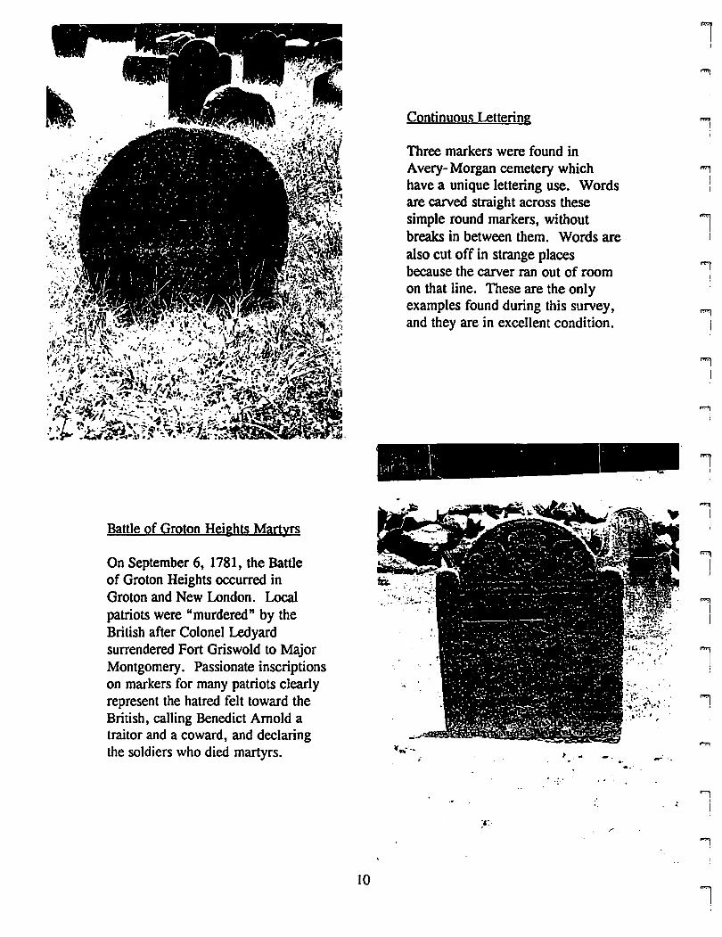
Continuous Lettering
Three markers were found inAvery- Morgan cemetery whichhave a unique lettering use. Wordsare carved straight across thesesimple round markers, withoutbreaks in between them. Words arealso cut off in strange placesbecause the carver ran out of roomon that line. These are the onlyexamples found during this survey,and they are in excellent condition.
lJ
""1II
I
l!
l'i
J
..,I
....,i
iI
Battle of Groton Heights Martyrs
On September 6, 1781, the Battleof Groton Heights occurred inGroton and New London. Localpatriots were "murdered" by theBritish after Colonel Ledyardsurrendered Fort Griswold to MajorMontgomery. Passionate inscriptionson markers for many patriots clearlyrepresent the hatred felt toward theBritish, calling Benedict Arnold atraitor and a coward, and declaringthe soldiers who died martyrs.
10
~...... , ... ....
l1
J
l1..,
]
..,
'II
ri
rpm!
rmII
i
rt
rr!
rl
rrIl
rI
rf'"I,
rl
P"
l
rI
I
r
MAINTENANCE PROBLEMS
In the upkeep of a cemetery, many seemingly innocent tasks can greatly harmthe markers in the cemetery. This list does not aim to give solutions to all problems,but aims to point out some things not to do while maintaining the cemetery.
mowing: Do not get too close to marker or be very careful not to hit it with the bladebecause old stone mark or nick easily.
lichen: In shady, moist areas this becomes a problem because the marker has a greaterchance of staying damp for long periods of time. Lichen need to be removedgently through cleaning in a non-abrasive manner. There are a number ofcleaning techniques which can be used, but consult a conservator beforeconducting any work and to hear the best options.
resetting: Again, there are a variety of ways to reset a marker which has fallen over oris leaning and a conservator should be consulted again to review the bestoptions for the situation. If a leaning marker is not reset, the marker could snapat its base from its own weight.
flaking: Document through photographs and transcription the marker now before theproblem gets worse and consult a conservator for ways to best stabilize if not toend the problem, but to slow the process as much as possible.
broken: Remember that the marker should be noticed and brought back as close to theway it was as possible. Thus, patches should closely match the stone in colorand should be as thin as possible and still get the job done properly. Iron rodscan be inserted vertically through the marker so as not visiblein order to fix thebroker marker.
I I
WST CEMETERIES
Over the years, some of Groton's cemeteries have been "lost" forever todevelopment and associated construction, neglect or to overgrowth. Usually, they havebeen family plots which were possibly overgrown or simply in the way of bulldozers.Nevertheless, they have disappeared. There are a few as well which are assumed lostbecause no one seems to know their exact locations, and combing through the brushand woods has not produced results. These are the cemeteries which seem to be lost,with guesses to their location:
Adams: Adams farm, maybe off Briar Hill Road near Latham lake.
Crouch: Crouch farm, possibly off Lower Mystic Road.
Edgecombe: Between Fort Hill and Hazelnut Hill Road.
Hannah Lester: On South Pleasant Valley Road, near Walker Hill Road.
Mitchell: Off River Road, South of S1. Patrick Cemetery.
Morgan: On Morgan Farm, which is now the site of the Groton-New London Airport.
North Lane: On South Pleasant Valley Road near Lestertown Road.
Park 2: Ofr Indigo Lane in Fieldcrest, now a backyard.
Rathbun: Brook Street and Elm Street in Noank.
12
'iI
'ii
'iII
1
,IJ
'I
'i
...,I
Ij
iI
"iiI
1
rI
r[
rI
rrF'
l
rF'"[
rr1
ri[
F""j
rrI
F'"!i
r1
FI
NATIVE AMERICAN BURIAL SITES
Groton was home to the Pequot Tribe's main village until the battle with troopsled by John Mason, which essentially obliterated the Pequots. Because of theirpresence in the area, there are a number of burial sites throughout Groton. Most of thesites contained one or two graves and many were excavated already, with artifacts incollections at the University of Connecticut, the Smithsonian in Washington, DC, andat the museum house at Fort Griswold Battlefield State Park. Much of the informationavailable is vague, including information concerning the locations of the graves.Anyone interested in locating Native American Burial Sites or in finding moreinformation about them can contact Dr. Nick Bellantoni, State Archaeologist, at theUniversity of Connecticut, Storrs, or Ed Herrick in City Utilities, Groton, CT.
MISPLACED CEMETERIES
Three cemeteries could not be visited during this survey either because theywere relatively inaccessible or because they simply could not be found. However, theyare still in existence, and given more time should be located, visited and documented.
James Bailey
Roughly in the middle of the South side of Pine Island, a single marker standsto mark James Bailey's grave. According to legend, during the Revolutionary War,Bailey's body washed up on shore of the island presumably after drowning. Becausehe lived on the island, it was decided that he should be buried there.
Chester Cemetery
In Haley Farm, a small family plot for the Chester family is supposed to belocated off to the right, in a field, near the foot of a hill. The two attempts made tofind the markers were unsuccessful.
Daniels Cemetery
This c.emetery was unknown until a conversation with Ed Herrick who said thatCity Utilities maintained it. Its approximate location is between Buddington Road andRoute 117, South of Route 184. Markers located here are all rustic footstones.
Smith Cemetery
A path can be taken from River Road, just North of the 1-95 underpass, whichleads onto the State-owned Oral School Property. Smith Cemetery is supposed to beoff to the right on a side path. When attempts were made to visit this cemetery, theside path could not be found because of overgrowth.
13
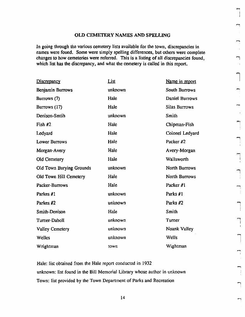
OLD CEMETERY NAMES AND SPELLING
In going through the various cemetery lists available for the town, discrepancies innames were found. Some were simply spelling differences, but others were completechanges to how cemeteries were referred. This is a listing of all discrepancies found,which list has the discrepancy, and what the cemetery is called in this report.
Discrepancy List Name in report
Benjamin Burrows unknown South Burrows
Burrows (7) Hale Daniel Burrows
Burrows (17) Hale Silas Burrows
Denison-Smtih unknown Smith
Fish #2 Hale Chipman-Fish
Ledyard Hale Colonel Ledyard
Lower Burrows Hale Packer #2
Morgan-Avery Hale Avery-Morgan
Old Cemetery Hale Wallsworth
Old Town Burying Grounds unknown North Burrows
Old Town Hill Cemetery Hale North Burrows
Packer-Burrows Hale Packer #1
Parkes #1 unknown Parks #1
Parkes #2 unknown Parks #2
Smith-Denison Hale Smith
Turner-Daboll unknown Turner
Valley Cemetery unknown Noank Valley
Welles unknown Wells
Wrightman town Wightman
Hale: list obtained from the Hale report conducted in 1932
unknown: list found in the Bill Memorial Library whose author in unknown
Town: list provided by the Town Department of Parks and Recreation
14
l
lI
1I
'""1I,
':!
1,.,.",
IIII
""1I
l
'II
...,

rrrmi!
F1i,
r
rrril
rmI[
ii;
f"'"II1
rIt
rr1
FI
rII
rI
TOWNWIDE RECOMMENDATIONS
1. Create a Groton Cemetery Association.
Some cemeteries have their own associations, while others are maintained by theTown. A townwide group could provide a resource center for cemeteries, activitiesto gain more interest in the stories told by cemeteries, and better conservation ofmarkers and cemetery integrity. In addition, a townwide association couldmonitor the upkeep and potential threats to all cemeteries involved.
2. Encourage volunteers to conduct inventories of markers.
Not only the name and date, but also the full inscription should be recorded so theywill not be lost to weathering and deterioration.
3. Create a master plan for Town managed and association managed cemeteries.
Master plans can state a preservation and conservation philosophy, note how fundswill be raised to care for the cemetery, and contain a map which locates all graves.A good example is Mount Auburn Cemetery in Cambridge, Massachusetts.
4. ALWAYS consult a conservator for work to be done on grave markers.
No matter how simple a task may seem, always, always consult a professional tolearn the best way to clean, reset, etc., markers. An uneducated, but well meaningindividual can alter beyond repair fragile markers without knowing it until too late.
s. Keep cemeteries well maintained and free of vandalism.
A clean, well kept cemetery is inviting to those who wish to learn from thecemetery, and can scare away those who wish to harm it.
6. Consult an archaeologist before digging into the ground.
Whether resetting a marker or planting new trees, a call to an archaeologist canprevent problems from arising if remains are inadvertently found.
7. Consider raising public interest through events and activities involvingcemeteries.
More people involved means more people interested in the preservation and historyof our cemeteries.
15
MOST ENDANGERED CEMETERIES
Although there are many cemeteries with minor maintenance problems, theseneed the most care and concern today. These cemeteries have serious threats to themsuch as development encroachment, or maintenance problems which have gotten out ofhand. Without action soon, irreversible damage could occur. This list intends tohighlight the Town of Groton's greatest problems in its cemeteries, however, it doesnot prioritize the problems.
1. Colonel Ledyard's stone marker, Colonel Ledyard Cemetery
Sometime during this century, well meaning Groton citizens decided to putColonel Ledyard's marker under glass in order to protect it from falling apart due tosouvenir takers and weathering. However, the marker still remains outdoors, andwater is seeping into the glassed-in marker, creating an even worse problem thanbefore. One suggestion from the Connecticut Graveyard Network, which was madeby someone from the organization without actually seeing the situation, is to cutopenings into the glass in order to let air into the opening to dry the stone out.
2. Niles Cemetery overgrowth
The Mystic Junior Woman's Club is taking care of the cemetery, however, theirvisits seem not to be frequent enough. Last year they held a major clean up day at thecemetery and cleared much of the brush but it has grown back this year. There aremany beautifully carved markers in this cemetery, at least what can be seen of them,for when the cemetery was visited the overgrowth was nearly as tall as the markers.Brush needs to be cleaned away permanently, if possible by destroying the roots.Obviously, this could be a problem if the roots are underneath the markers, however,the problem needs to be addressed more thoroughly, or at least more often.
3. Palmer Cemetery hazards
Palmer Cemetery is located just beyond a rapidly growing residentialsubdivision off Brookview Court in Noank. Although not part of the subdivision, thereis a hazard from the development because machinery can cause enough movement inthe ground to topple markers. Already, a small iron pipe has been added to thecemetery, probably from a surveyor. One careless move, and markers will fall becauseof the deteriorated state of the cemetery itself.
II
""'lI
,.",
Ij
.,I
l
1
1I
,.",I!
l ,
""lI!
l1
J
lJ
'"""l
16 ...,
rr[
r,rP'lIil
il
rL
rl
iI
rF"
I
ii
rL
rl
rrrl
rr
CEMETERY FORM EXPLANATION
Cemetery Number: Number assigned to cemetery to locate it on a map of the Town
PIN #: Parcel Identification Number assigned by the Town to the land upon which thecemetery is located
Name: Common name for cemetery
Address: Specific location of cemetery
Status: In use: burials continue to occur in cemeteryl Not in use: cemetery is nolonger used for burialsl Abandoned: cemetery has been forgotten and is not cared for
Lot Size: Total acreage of cemetery
Directions: How to get to the cemetery from the main routes in town
Caretaker: The caretaker of the cemetery: cemetery association! family members!Town of Groton
Number of Markers: Approximate number of markers in the cemetery based on aquickly calculated estimate
Earliest: Earliest date found on walk through of the cemetery
Family Names: Some common names found while recording information on walkthrough of cemetery
SymbolslUnusual Stones: Types of carvings as described earlier in this report. Also,interesting or elaborate inscriptions.
Design Elements: Elements in the layout of the cemetery which appear to have beenplanned by a designer or other individual such as controlled views, tree screens,centenary trees, family plots, plantings
Enclosure: Type of fence, wall, or barrier which separates cemetery from otherproperty or the street
Ground Conditions: A critical examination of how the grounds appeared in the daythe cemetery was visited on a basis of excellent, good, decent and poor.
Stone Conditions: A critical examination of how the stone markers are maintained ona scale of excellent, good, decent, and poor
Historic Significance: A brief synopsis of the cemetery's history including elementswhich make the cemetery unique
Hazards: Possible threats to the cemetery's existence
Recommendations: Suggestions for improvements which are maintenance,documentation, or awareness related.
Date: Date on which the cemetery was visited
17
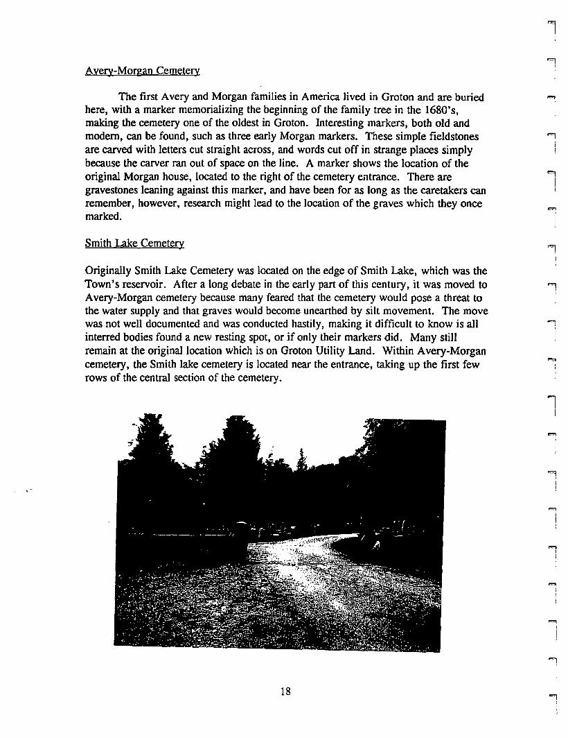
Avery-Morgan Cemetery
The first Avery and Morgan families in America lived in Groton and are buriedhere, with a marker memorializing the beginning of the family tree in the 1680's,making the cemetery one of the oldest in Groton. Interesting markers, both old andmodem, can be found, such as three early Morgan markers. These simple fieldstonesare carved with letters cut straight across, and words cut off in strange places simplybecause the carver ran out of space on the line. A marker shows the location of theoriginal Morgan house, located to the right of the cemetery entrance. There aregravestones leaning against this marker, and have been for as long as the caretakers canremember, however, research might lead to the location of the graves which they oncemarked.
Smith Lake Cemetery
Originally Smith Lake Cemetery was located on the edge of Smith Lake, which was theTown's reservoir. After a long debate in the early part of this century, it was moved toAvery-Morgan cemetery because many feared that the cemetery would pose a threat tothe water supply and that graves would become unearthed by silt movement. The movewas not well documented and was conducted hastily, making it difficult to know is allinterred bodies found a new resting spot, or if only their markers did. Many stiUremain at the original location which is on Groton Utility Land. Within Avery-Morgancemetery, the Smith lake cemetery is located near the entrance, taking up the first fewrows of the central section of the cemetery.
.,I
"'lI!
l""1
I!
""'lIj
""'1)
"'lII
..."IJ
1j
"'lI
,..' )
lj
"'liI
9iI
i!
'"'l
18"'l
r'"l
rl
rI
rL
rl
f"'"
I
rFil
rrr!
rI
iI
rI"""!L
r
r
Cemetery Number: 12 (Avery-Morgan) and 13 (Smith Lake)
PIN #: 168906485743
Name: Avery-Morgan and Smith Lake Cemeteries
Address: next to Water Filtration Plant
Status: in use
Lot Size: 6.64 acres
Directions: from route 117, turn left onto route 1 South. Turn right into WaterFiltration Plant Driveway and follow small green signs which say "Smith LakeCemetery"
Group in Charge: Avery-Morgan Cemetery Association (Gregory Johnson)
Number of Markers: approximately 200
Earliest: 1689
Family Names: Avery, Morgan, Smith, Ackley Ashbey, Graham, Edgecomb, Clark,Williams
Symbols/Unusual Stones: Many willow and urn, soul effigies and angels. Openbible. Obelisk for Avery family. Marker for Morgan House site. Marker for Averyand Morgan Families. Oldest markers: continuous lettering
Design Elements: Pine and Oak trees scattered throughout the cemetery. Stone ledgeoutcropping create quiet, serene setting.
Enclosure: Stone wall- rustic and finished.
Ground Conditions: Good- very well kept
Stone Conditions: Good: Some are leaning against Morgan House marker
Historic Significance: Smith Lake Cemetery moved here. First Avery and Morganfamilies in America
Hazards: None are obvious
Recommendations: I)Decide what to do with fallen markers and stacked markers. 2)Create a map locating significant markers and family plots.
Date: 5/29/96
19
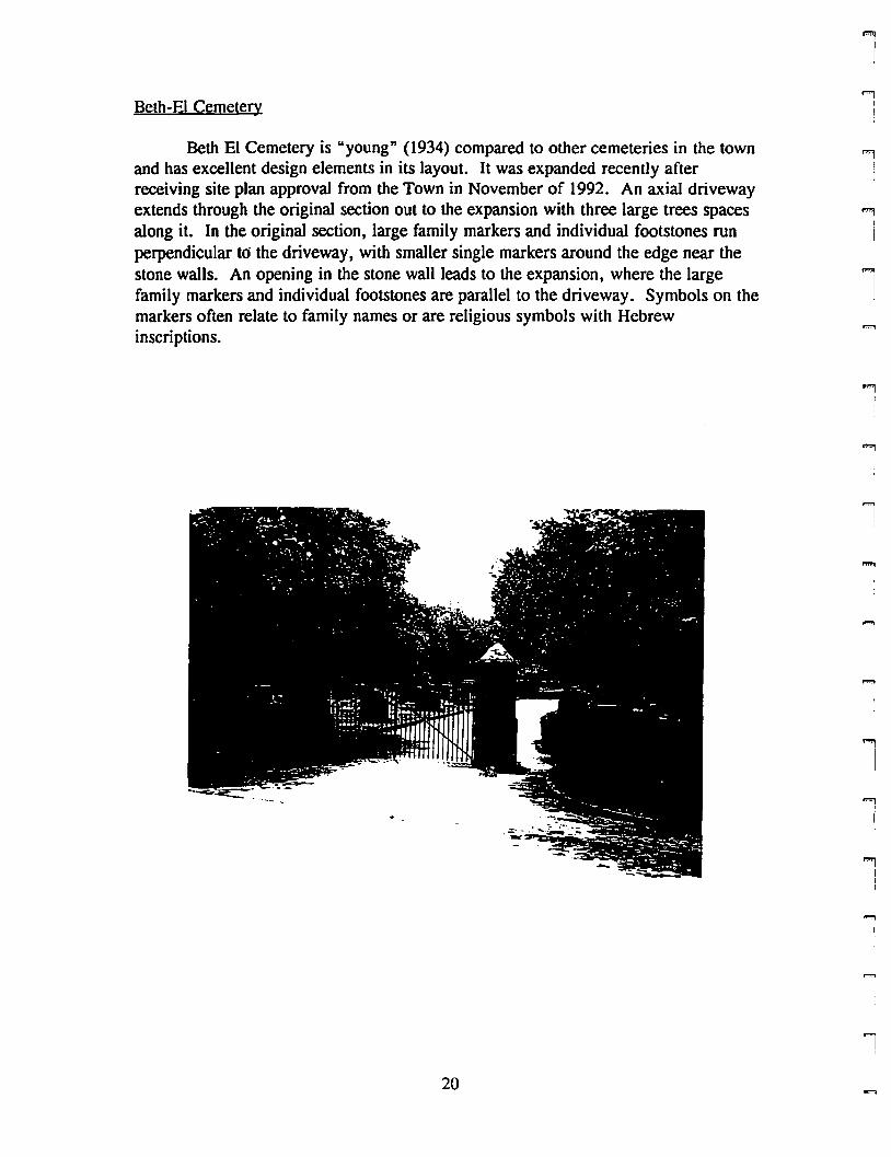
Beth-EI Cemetery
Beth El Cemetery is "young" (1934) compared to other cemeteries in the townand has excellent design elements in its layout. It was expanded recently afterreceiving site plan approval from the Town in November of 1992. An axial drivewayextends through the original section out to the expansion with three large trees spacesalong it. In the original section, large family markers and individual footstones runperpendicular to the driveway, with smaller single markers around the edge near thestone walls. An opening in the stone wall leads to the expansion, where the largefamily markers and individual footstones are parallel to the driveway. Symbols on themarkers often relate to family names or are religious symbols with Hebrewinscriptions.
20
1!
""'lI
!
""1I
I
""'1
i
"",
I
""l!
11
1
.....,I
""'1
I...,
I
iI
'""lIII
1
rrrI
rrl
rl
rrrr'I
rF""!
ril
rl
r,F""\l
rrI
Cemetery Number: 14
PIN #: 168910469673
Name: Beth EI Cemetery
Address: Lestertown Road, South Side
Status: in use
Lot Size: 4.2 acres
Directions: From Route 12 North, tum left onto Walker Hill Road and then right ontoPleasant Valley Road South. Tum left onto Lestertown Road. Cemetery is on leftafter Russ Sims Heights.
Group in Charge: Beth EI congregation (Robert Schwartz)
Number of Markers: approximately 250
Earliest: 1937
Family Names: None are dominant
Symbols/Unusual Stones: Most are family plots with large family stone andindividual footstones. Many Star of David and flowers are carved into markers.Hebrew inscriptions carved into footstones.
Design Elements: Very axial: central axis of trees perpendicular to Lestertown. Inolder section, plots are perpendicular to driveway. In newer section, plots are parallelto driveway.
Enclosure: Finished stone wall around original cemetery. Chain Hnle fence aroundnewer section. Iron entrance gates.
Ground Conditions: Good: very well maintained grass and trees. Main driveway innew section needs repaving.
Stone Conditions: Excellent: all markers appear to be in "new" condition
Historic Significance:
Hazards: None are obvious
Recommendations: l)A different fence in newer section would keep housing sceneryout of cemetery and make new section more serene. 2) Main driveway in new sectionneeds to be repaved or replaced with concrete similar to older section.
Date: 6/5/96
21
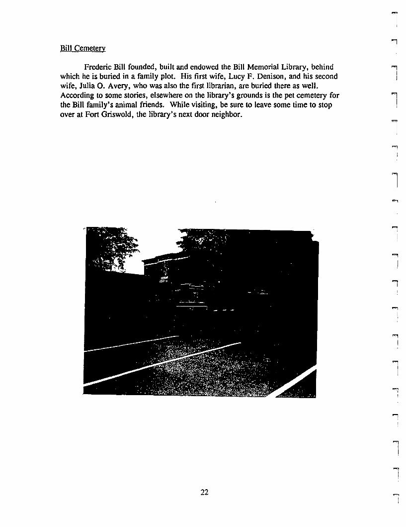
Bill Cemetery
Frederic Bill founded, built and endowed the Bill Memorial Library, behindwhich he is buried in a family plot. His first wife, Lucy F. Denison, and his secondwife, Julia O. Avery, who was also the first librarian, are buried there as well.According to some stories, elsewhere on the library's grounds is the pet cemetery forthe Bill family's animal friends. While visiting, be sure to leave some time to stopover at Fort Griswold, the library's next door neighbor.
l;
""liI
...,I
...,II
l1...,
I
'iJ
1
""'1
I,
lli
]
ll
22'l
I
rrF"!
rrF'IIl
rI
r[
rrFl
il
Fi
rl
rr
rf"'"ii
r
Cemetery Number: 32
PIN #: 168918410131
Name: Bill Cemetery
Address: Monument Street, directly behind Bill Memorial Library
Status: Not in use
Lot Size: Part of larger lot
Directions: At light on Meridian Street and Mitchell Street, go straight across. Atstop sign, tum left onto Monument Street. Follow Monument Street to Library andpark behind library in lot or on street.
Group in Charge: Bill Memorial Library
Number of Markers: 3 plus family marker
Earliest: 1894
Family Names: Bill
SymbolslUnusual Stones: Large red marble family marker with footstone for eachgrave
Design Elements: 5 large randomly spaced trees throughout the space
Enclosure: Chain link fence
Ground Conditions: Good: grass needs to be cut, but it is early in the season andprobably will be soon.
Stone Conditions: Excellent
Historic Significance: Bill family plot. Frederic Bill founded library and Julia wasfirst librarian.
Hazards: None are obvious
Recommendations: 1) A sign marking the plot would be helpful, but is not necessary.2) A different fence or no fence at all would add to the cemetery
Date: 5/22/96
23
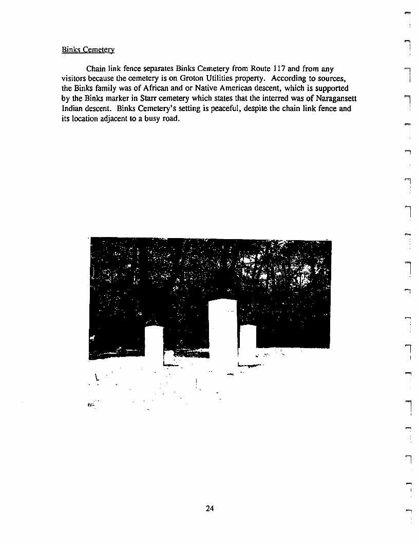
Binks Cemetery
Chain link fence separates Binks Cemetery from Route 117 and from anyvisitors because the cemetery is on Groton Utilities property. According to sources,the Binks family was of African and or Native American descent, which is supportedby the Binks marker in Starr cemetery which states that the interred was of NaragansettIndian descent. Binks Cemetery's setting is peaceful, despite the chain link fence andits location adjacent to a busy road.
l
1
l""'1
j
'II
l
\. -
l
ll..,
!
...,I
~,,
24 ...,
rFl
rFi
rl
r""II
Fl
FIi
rrri
rrrl
rr
r
r1
Cemetery Number: 30
PIN #: 169911558390
Name: Binks Cemetery
Address: Route 117
Status: ~ot in use
Lot Size: Part of larger lot
Directions: From Route 1, tum onto Route 117. Follow past 1-95 interchange.Cemetery is on left, on Groton Utilities Property, almost directly across from PaulsonRoad
Group in Charge: City Utilities, Groton (Ed Herrick)
Number of Markers: 3 plus footstones
Earliest: 1817
Family Names: Binks
Symbols/Unusual Stones: ~one
Design Elements: Markers are all facing road
Enclosure: Chain link surrounds Groton Utilities property. Cemetery is in open spaceon other side of fence
Ground Conditions: Excellent
Stone Conditions: Excellent
Historic Significance: According to one cemetery list, Binks cemetery is a Black andIndian cemetery. (A Binks marker in Starr cemetery says interred in a descendent of~arragansettIndians)
Hazards: ~one are obvious
Recommendations: 1)Erect a sign marking cemetery and significance.
Date: 7/10/96
25
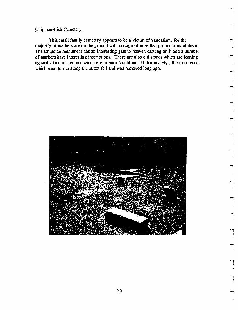
Chipman-Fish Cemetery
This small family cemetery appears to be a victim of vandalism, for themajority of markers are on the ground with no sign of unsettled ground around them.The Chipman monument has an interesting gate to heaven carving on it and a numberof markers have interesting inscriptions. There are also old stones which are leaningagainst a tree in a comer which are in poor condition. Unfortunately, the iron fencewhich used to run along the street fell and was removed long ago.
26
ll""1
Ij
l""1
i
""1!
'lI,,
..,j
'l!
""1I
l"l
!
lj
""1
I
l
...,,,i
...,,,
rr,pt
l
rit
F'l
riI,
rrrriI
rl
F
l
ri!
rF
l
Cemetery Number: 15
PIN #: 260814444353
Name: Chipman-Fish Cemetery
Address: Brook Street, west side
Status: Not in use
Lot Size: .07 acres
Directions: From route 215 (Groton Long Point Road), tum right at first entrance toBrook Street (Old Brook Street). Cemetery is on right
Group in Charge: Town of Groton
Number of Markers: Approximately 20
Earliest: 1813
Family Names: Chipman, Fish, Brown, Latham
Symbols/Unusual Stones: Chipman monument: gate to heaven. Tassels on Lydia M.Fish and Anthony Fish and Sarah W. Latham. "Stout" obelisk with geometric detailingfor Brown monument.
Design Elements: Markers are in straight lines perpendicular to road except formarkers leaning against a tree
Enclosure: Stone wall on three sides. open to road: iron fence used to be there buthas disappeared.
Ground Conditions: Good: grass is 1 foot high and needs to be mowed. OK otherthan this.
Stone Conditions: Decent: vandalism seems to be a problem: many are knockedover. A few are leaning. A few are leaning against a tree in the comer and are theonly difficult markers to read. All others are in decent condition except for being onthe ground.
Historic Significance:
Hazards: vandalism
Recommendations: l)Reset all markers. 2) Put up a fence along street- preferablyiron like the original. 3) Erect marker with name of cemetery and history
Date: 6/5/96
27
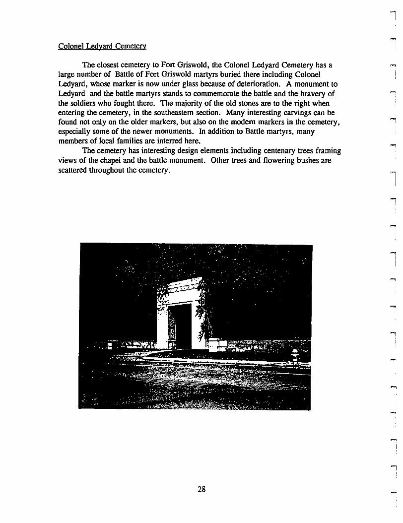
Colonel Ledyard Cemetery
The closest cemetery to Fort Griswold, the Colonel Ledyard Cemetery has alarge number of Battle of Fort Griswold martyrs buried there including ColonelLedyard, whose marker is now under glass because of deterioration. A monument toLedyard and the battle martyrs stands to commemorate the battle and the bravery ofthe soldiers who fought there. The majority of the old stones are to the right whenentering the cemetery, in the southeastern section. Many interesting carvings can befound not only on the older markers, but also on the modem markers in the cemetery,especially some of the newer monuments. In addition to Battle martyrs, manymembers of local families are interred here.
The cemetery has interesting design elements including centenary trees framingviews of the chapel and the battle monument. Other trees and flowering bushes arescattered throughout the cemetery.
28
1
1""'1
iJ
1
1
l.,
,
.."II
l
lI
iI
""'1i
II
rrL
rrrrrrrrl
rrrrrP'
l
rrr
Cemetery Number: 16
PIN #: 168807597196
Name: Colonel Ledyard Cemetery
Address: Mitchell Street
Status: In use
Lot Size: 22.39 acres
Directions: From Meridian Street, tum left onto Mitchell Street. Cemetery is .5 mileson left side of Mitchell
Group in Charge: Colonel Ledyard Cemetery Association (Don Byles)
Number of Markers: Approximately 1000
Earliest: 1770
Family Names: Ledyard, Avery, Chipman, Ashbey, Fisk, Latham, many others
Symbols/Unusual Stones: Interesting mooem markers. many soul effigies and willowand urn motifs. Many obelisks. Cut boulder for Ebenezer Avery
Design Elements: Centenary trees leading toward chapel and Ledyard monument:frame views of them. Many colorful bushes. Placed and natural boulders and rockformations. Monumental entrance gate: art deco style.
Enclosure: Stone wall, chain link fence, stone formation.
Ground Conditions: Good: grass is well maintained. Centenary trees are overgrownand block views they're supposed to frame. A few potholes in driveway.
Stone Conditions: Most are in good condition. A few have fallen and broken. Col.Ledyard marker has serious water problem because water leaks in behind the glasswhich is supposed to protect it.
Historic Significance: Many soldiers from Battle of Groton heights are buried here.Many Groton families have plots.
Hazards: None are obvious
Recommendations: 1) Repave pathways. 2) Cut back centenary trees. 3) Consult aconservator for best way to preserve/stabilize Ledyard marker. 4) Create a maplocating all markers and highlighting significant family plots and individual markers.
Date: 5/22/96
29
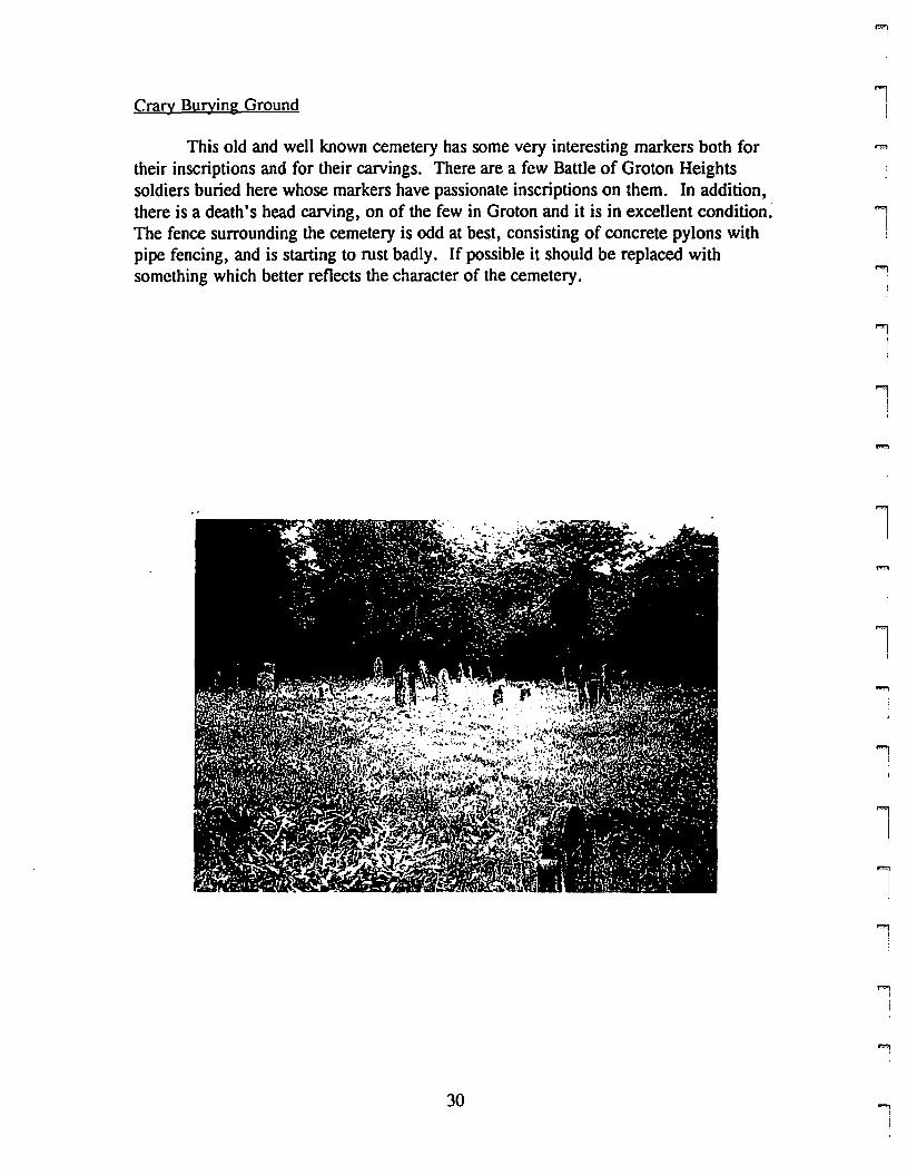
Crary Burying Ground
This old and well known cemetery has some very interesting markers both fortheir inscriptions and for their carvings. There are a few Battle of Groton Heightssoldiers buried here whose markers have passionate inscriptions on them. In addition,there is a death's head carving, on of the few in Groton and it is in excellent condition.The fence surrounding the cemetery is odd at best, consisting of concrete pylons withpipe fencing, and is starting to rust badly. If possible it should be replaced withsomething which better reflects the character of the cemetery.
""'l
I
'1IJ
1
""1)
""1I
'I!,
l
l""1
iI
lJ
'"i
i""1
I
""'lI
l,.,.,
!
,.,.,I
i
...,
30 ....,!
I
rrrrf'"'
lf""'l
IL
iI
rrrrl
r!
i[
FIf'"'I(
rII
iI
r!
Cemetery Number: 3
PIN #: 271014237223
Name: Crary Burying Ground
Address: Packer Road, near route 184
Status: ~otin use
Lot Size: . 14 acres
Directions: Follow Allyn Street (name changes to Cow Hill Road) and tum right ontoPacker Road. Cemetery is on right near intersection with route 184
Group in Charge: Town of Groton
Number of Markers: Approximately 30
Earliest: 1739
Family Names: Crary, Babcock, Smith, Ayer, Eldredge, Hicks.
Symbols/Unusual Stones: Death head, soul effigy, willow and urn motifs.
Design Elements: Markers are in straight lines facing road.
Enclosure: Metal pipe segments on concrete pilings.
Ground Conditions: Good: grass needs to be mowed though
Stone Conditions: Decent to good: some are leaning and a few have Uchen problems
Historic Significance: A few soldiers who died in the Battle of Groton Heights areburied here. One of the few locations of death head carvings found .in the Town.
Hazards: None are obvious
Recommendations: l)Replace fence, especially rusted areas. 2) Mow grass 3) Gentlyclean and reset markers.
Date: 6/24/96
31
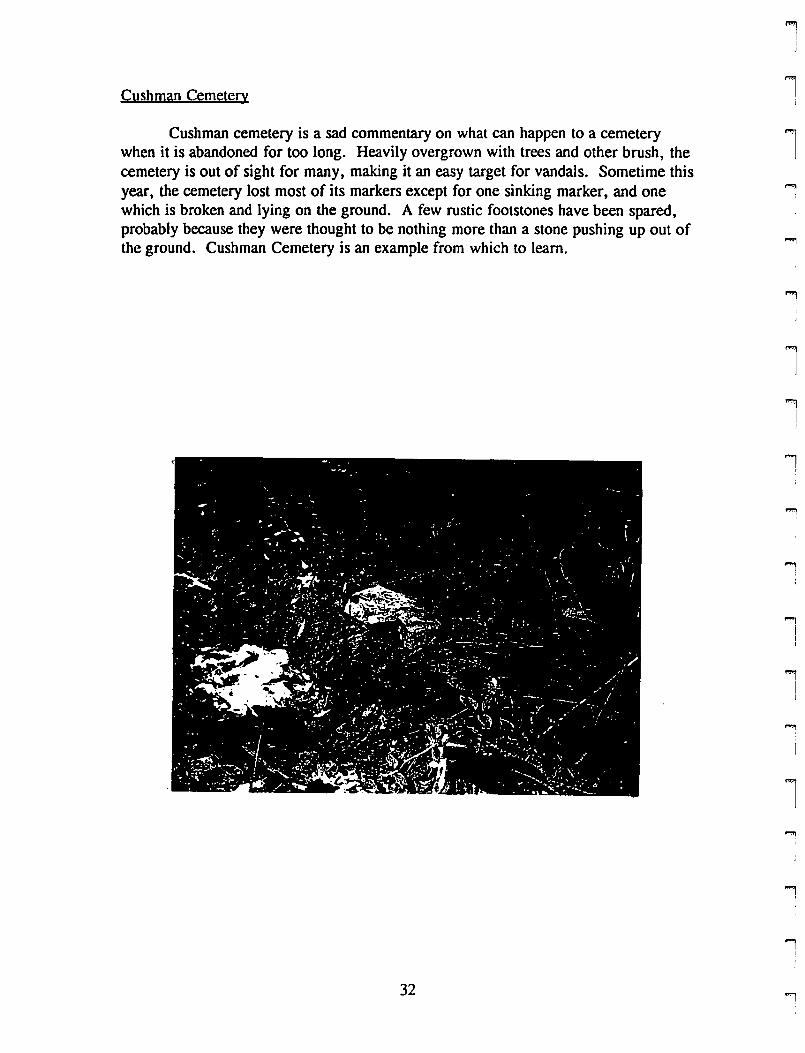
Cushman Cemetery
Cushman cemetery is a sad commentary on what can happen to a cemeterywhen it is abandoned for too long. Heavily overgrown with trees and other brush, thecemetery is out of sight for many, making it an easy target for vandals. Sometime thisyear, the cemetery lost most of its markers except for one sinking marker, and onewhich is broken and lying on the ground. A few rustic footstones have been spared,probably because they were thought to be nothing more than a stone pushing up out ofthe ground. Cushman Cemetery is an example from which to learn.
lI
"."
II
"j
]
l
"""1
I
'"9
!
1
l
...,III
..,I
lI
""li
...,!
32 '!
rrr!
rrrL
rrrrl
rF'l
rrrri\
r""I
Il
r
Cemetery Number: 26
PIN #: 271013137249
Name: Cushman Cemetery
Address: Packer Road, next to #306
Status: Abandoned
Lot Size: Part of larger lot
Directions: From Route one in Mystic, tum onto Allyn Street (name changes to CowHill Road). Tum right onto Packer Road. Cemetery is on left, on top of hill next tohouse #306. Difficult to find because of overgrowth and missing markers.
Group in Charge: None
Number of Markers: 2 plus rustic footstones (probably more markers at an earliertime)
Earliest: 1859
Family Names: Cushman
Symbols/Unusual Stones: None were visible
Design Elements: None were visible
Enclosure: Stone wall, logs on ground
Ground Conditions: Poor: trees and brush are overgrown, making it difficult to findany markers at all.
Stone Conditions: Poor: most have been stolen or vandalized. One is broken intopieces, the other is sinking.
Historic Significance:
Hazards: Vandalism has already been a hazard.
Recommendations: 1) Document what is left. 2) Set up general guidelines for allcemeteries so this doesn't happen again.
Date: 7/17/96
33
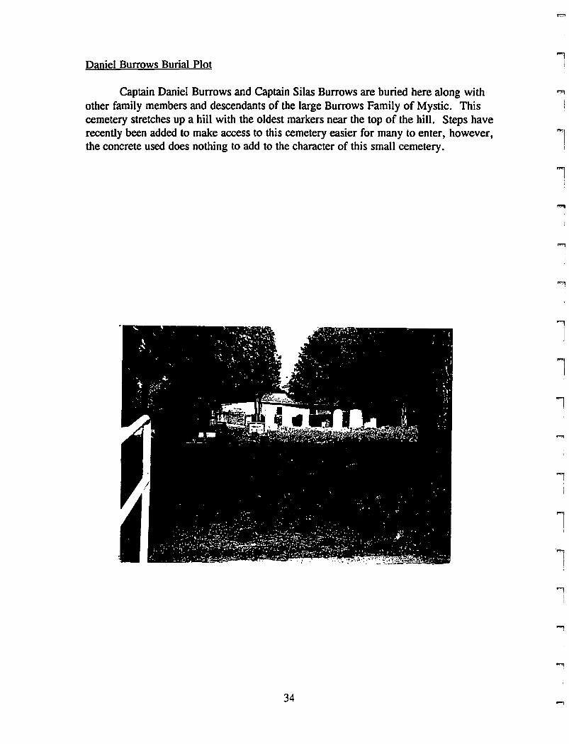
Daniel Burrows Burial Plot
Captain Daniel Burrows and Captain Silas Burrows are buried here along withother family members and descendants of the large Burrows Family of Mystic. Thiscemetery stretches up a hill with the oldest markers near the top of the hill. Steps haverecently been added to make access to this cemetery easier for many to enter, however,the concrete used does nothing to add to the character of this small cemetery.
l"1
1I
l
1
i;
i
""1
J
l1l
l
l1
'l!
""iiI
l
""i
34 -,
rrrrriIl
rF'II
rrrrF'
l
FI
rrrrr
Cemetery Number: 17
PIN #: 261918218456
Name: Daniel Burrows Cemetery
Address: Edgecombe Street, Mystic
Status: In use
Lot Size: .21 acres
Directions: Follow route 1 past Allyn Street turn. Tum left onto Elm Street andfollow to end. Turn right onto Burrows Street, and then left onto Edgecombe Street.Cemetery is on left before tum in road.
Group in Charge: Neighbors or family members
Number of Markers: Approximately 30
Earliest: 1821
Family Names: Burrows, Lamb
SymbolslUnusual Stones: Willow and urn, arches, flowers. Modern marker withurns on either side.
Design Elements: Markers in straight lines, both facing and facing away from theroad.. Oak trees flank entrance gate. other randomly placed trees within cemetery.
Enclosure: Stone wall on all sides. Iron entrance gate
Ground Conditions: Good to excellent: grass needed to be cut on day visited
Stone Conditions: Most are good: bad patch work on Capt. Daniel Burrows' wife'smarker. Lichen growth makes some difficult to read.
Historic Significance: members of Burrows family are buried here, including two seacaptains: Daniel Burrows and Silas Burrows
Hazards: none are obvious
Recommendations: 1) Gently clean markers to remove lichen
Date: 6/17/96
35
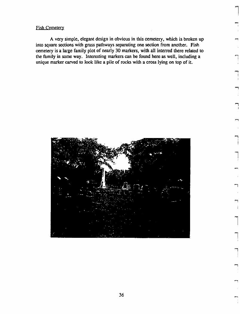
Fish Cemetery
A very simple, elegant design in obvious in this cemetery, which is broken upinto square sections with grass pathways separating one section from another. Fishcemetery is a large family plot of nearly 30 markers, with all interred there related tothe family in some way. Interesting markers can be found here as well, including aunique marker carved to look like a pile of rocks with a cross lying on top of it.
36
1"'l
]
,."
]
"1I
1
"'1!
"'1I
....,I
"'1I!
""'1I
i
...,I
l1
.,
rrrrrrrrrrrrFl
r'l
rrrr,r
Cemetery Number: 18
PIN #: 261909158627
Name: Fish Cemetery
Address: Pequot Avenue, Mystic
Status: In use
Lot Size: .59 acres
Directions: From route 1, turn onto Allyn Street. Turn right onto Sandy HollowRoad and then left onto Pequot Avenue. Cemetery is on left.
Group in Charge: Family members (Paul Ingle)
Number of Markers: Approximately 35
Earliest: 1825
Family Names: Fish
Symbols/Unusual Stones: One willow and urn motif (badly flaked). Stout obelisk,Boulder with name plaque. Marker carved to look like a pile of rocks with a cross.
Design Elements: Cemetery is arranged into rectangular plots wither by granite ties orby spaces.
Enclosure: Stone wall on all four sides. wooden picket gate which doesn't open.
Ground Conditions: Excellent: grounds are very well maintained
Stone Conditions: Good to excellent: a few markers have lichen growing on them.One is badly flaking
Historic Significance:
Hazards: None are obvious
Recommendations: 1) Clean markers. 2)Replace missing marker to fill hole. 3)Create map which locates plots by generation and explains the history of the families
Date: 6/17/96
37
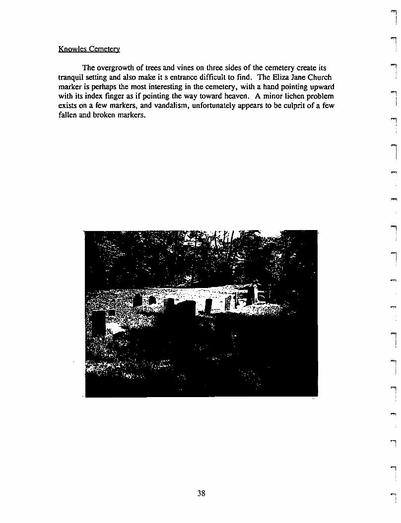
Knowles Cemetery
The overgrowth of trees and vines on three sides of the cemetery create itstranquil setting and also make it s entrance difficult to find. The Eliza Jane Churchmarker is perhaps the most interesting in the cemetery, with a hand pointing upwardwith its index finger as if pointing the way toward heaven. A minor lichen problemexists on a few markers, and vandalism, unfortunately appears to be culprit of a fewfallen and broken markers.
38
11
'"'l]
lI
"'liI
....,,i
l'I
II
"""1
I
"1I
J
l
l
1
i!
""'JI
i
""'l,
-.i
r,.
rrrrri
r!
rrrr,
r'l
rrr,r
rr
Cemetery Number: 19
PIN #: 169905272704
Name: Knowles Cemetery
Address: Northeast comer of route 184 and Toll Gate Road
Status: Not in use
Lot Size: .46 acres
Directions: From route 184 tum onto Toll Gate Road. Immediately tum right andpull into the unpaved driveway which is blocked by boulders (there is enough room topark safely). Walk down blocked off path to get to entrance opening for cemetery.
Group in Charge: Town of Groton
Number of Markers: Approximately 25
Earliest: 1838
Family Names: Lamb, Daboll, Sterry, Knowles, Perkins
SymbolslUnusual Stones: Eliza Jane Church: closed hand with index finger pointingup toward heaven. Willow and urn for Mrs. Sarah Daboll's marker. Knowles:obelisk. Granite ties for a family plot which was never finished, or the markers havedisappeared.
Design Elements: Markers are in straight lines. no other design elements
Enclosure: Rustic stone walls with overgrowth on three sides. Overgrowth only onfourth. Cut opening in growth for entrance (correct entrance'?)
Ground Conditions: Good: grass needs to be mowed, but good maintenanceotherwise.
Stone Conditions: Decent: many markers are leaning, some due to an uprooted tree.Some have lichens growing on them. Vandalism may be a problem.
Historic Significance:
Hazards: Overgrowth may/has made this cemetery a target for vandalism
Recommendations: 1) Gentle cleaning of markers with lichen cover. 2) Reset leaningmarkers 3)Create a better entrance closer to beginning of driveway or mark currententrance. 4) Erect a sign to mark cemetery
Date: 6/5/96
39
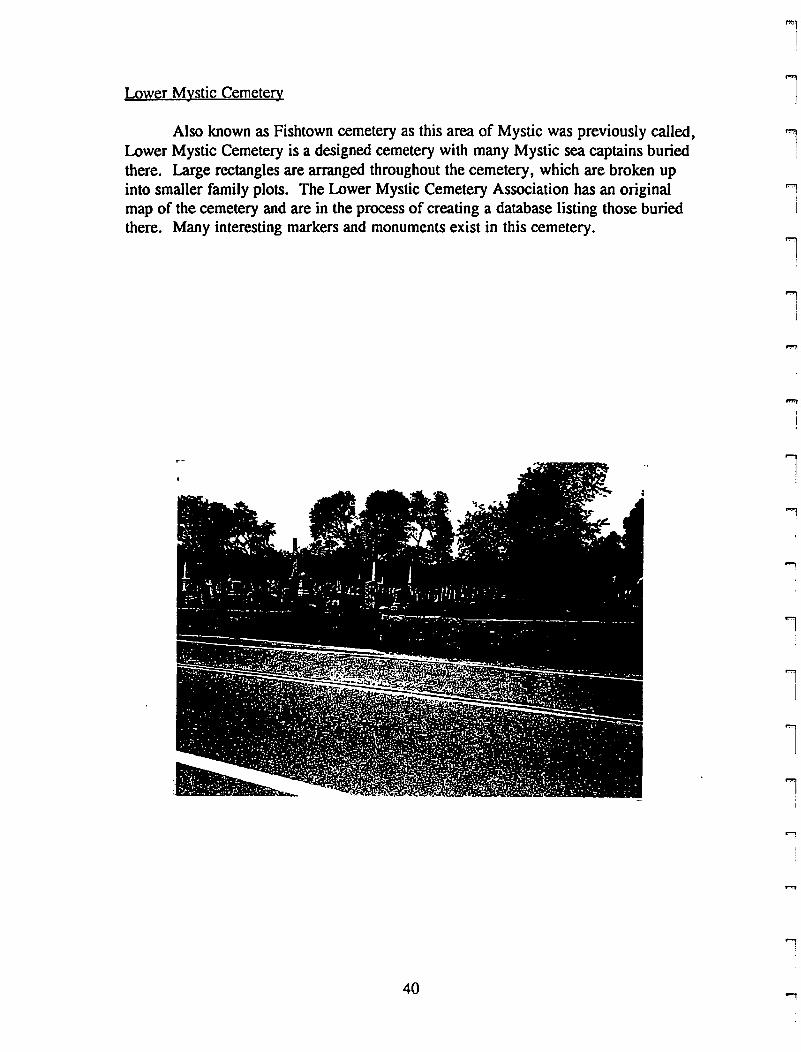
Lower Mystic Cemetery
Also known as Fishtown cemetery as this area of Mystic was previously called,Lower Mystic Cemetery is a designed cemetery with many Mystic sea captains buriedthere. Large rectangles are arranged throughout the cemetery, which are broken upinto smaller family plots. The Lower Mystic Cemetery Association has an originalmap of the cemetery and are in the process of creating a database listing those buriedthere. Many interesting markers and monuments exist in this cemetery.
40
""1I
l1
lI
l1I
""'1!
1J
'lI
l'1
...,
...,I

r[
r'"I
r1
pm
I
rpmI
F"
I
rrrP"l
rI
rrrrrrf'"!
Cemetery Number: 20
PIN #: 260920709539
Name: Lower Mystic Cemetery (Fishtown Cemetery)
Address: Route 1, Mystic
Status: In use
Lot Size: 1.88 acres
Directions: From Allyn Street, tum left onto route 1 South. Cemetery is on right,down the hill from the Mystic Ice House
Group in Charge: Lower Mystic Cemetery Association, Barry V. Connell, president
Number of Markers: Approximately 250
Earliest: 1783
Family Names: Fish, Morgan, Merritt Gallup Rathbun, Latham, Eldredge, manyothers
SymbolslUnusual Stones: Willow and urn, station in life, open bibles, architecturalelements. A number of obelisks and monuments. Mausoleum
Design Elements: Family plots set off by granite ties or iron fencing. Grass pathsbetween plots. Randomly placed trees
Enclosure: Rustic stone wall and trees. Finished stone retaining wall along road.
Ground Conditions: Good: grass was 3 inches high, but was mowed second timecemetery was visited
Stone Conditions: Decent to good: some older markers have fallen and broken, a feware sinking into ground, lichens are growing on a few.
Historic Significance: Many sea captains and sailors buried here.
Hazards: None are obvious
Recommendations: l)gently clean and reset markers. 2)Create a map locatingmarkers and family plots
Date: 6/12/96
41
Niles Cemetery
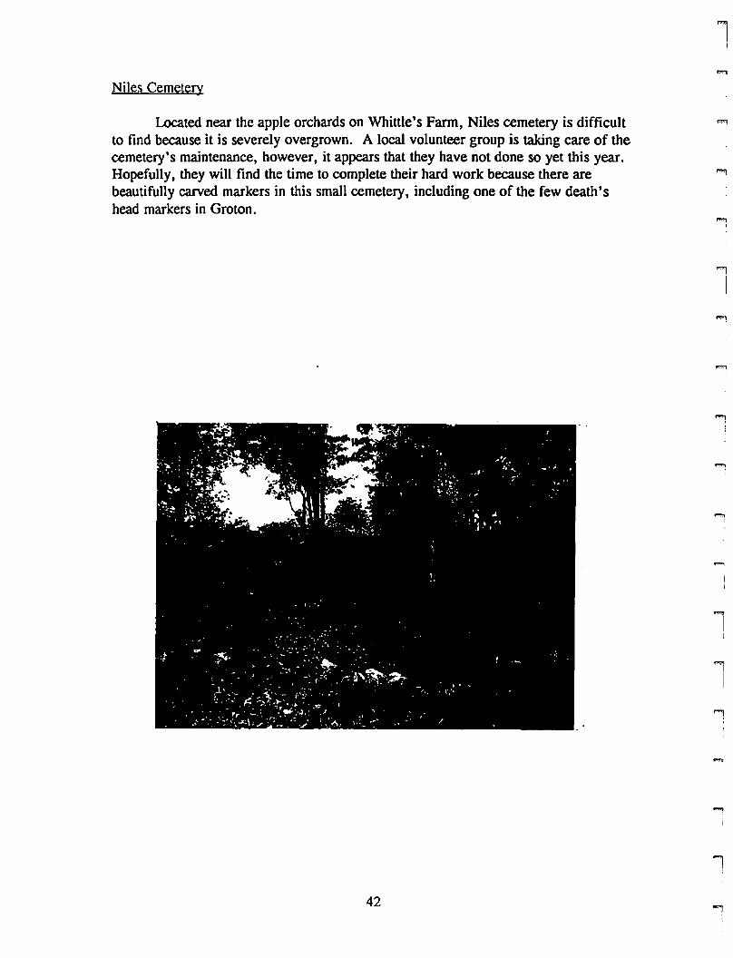
Located near the apple orchards on Whittle's Farm, Niles cemetery is difficultto find because it is severely overgrown. A local volunteer group is taking care of thecemetery's maintenance, however, it appears that they have not done so yet this year.Hopefully, they will find the time to complete their hard work because there arebeautifully carved markers in this small cemetery, including one of the few death'shead markers in Groton.
42
11l1
""1
I
l
.,."
I
..."iI
1
iI
...,
II
1
rrrI
rrI
Fii
rri1
f""'l
If""'l
I
F'"IF"
l
rrrri
r
Cemetery Number: 28
PIN #: 270019603570
Name: Niles Cemetery
Address: Noank Ledyard Road, on Whittle's Farm
Status: Not in use
Lot Size: Part of larger lot
Directions: From Flanders Road, tum right onto Noank-Ledyard Road. Whittles is onleft. Park in front of farm stand. Follow path just beyond stand. Cemetery is on leftjust before apple orchard. When visited, it was difficult to see markers because ofovergrowth.
Group in Charge: Volunteer group
Number of Markers: 10, maybe more
Earliest: 1768
Family Names: Avery
Symbols/Unusual Stones: Face of Death and Willow and Urn
Design Elements: Markers are in straight lines
Enclosure: Stone wall
Ground Conditions: Extremely poor: cemetery is completely overgrown with vineswhich are 3-4 feet high. Nearly impossible to see markers and to get to them.
Stone Conditions: As far as could be seen, good for now.
Historic Significance: Excellent examples of carvings and one of the only death headcarvings found in Groton
Hazards: Overgrowth
Recommendations: l)Cut back growth and maintain the cemetery. 2) Document themarkers in case the cemetery falls into lack of care in the future
Date: 6/24/96
43
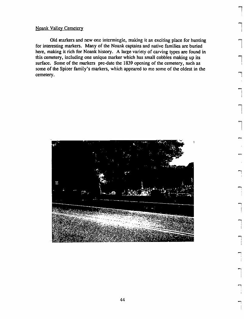
Noank Valley Cemetery
Old markers and new one intermingle, making it an exciting place for huntingfor interesting markers. Many of the Noank captains and native families are buriedhere, making it rich for Noank history. A large variety of carving types are found inthis cemetery, including one unique marker which has small cobbles making up itssurface. Some of the markers pre-date the 1839 opening of the cemetery, such assome of the Spicer family's markers, which appeared to me some of the oldest in thecemetery.
44
1
ll"'1
I
I
..,I
..,IJ
ll
j
.,
...,
..,i
lI
..,I
rrrrl
rrl
rrrriI
I"'"
i
rI
rf'"I
I"'"I(
rrIi
r
Cemetery Number: 21
PIN #: 260820811067
Name: Noank Valley Cemetery
Address: Elm Street (route 215), Noank
Status: In use
Lot Size: 5.42 acres
Directions: Follow Route 1 up Fort Hill and bear right onto Groton Long Point Road(Route 215) near top of hill. Turn left onto Brook Street and follow straight down hill.At stop sign, turn right onto Elm Street (Route 215) and follow to cemetery.
Group in Charge: Noank Valley Cemetery Association, David Blacker, president
Number of Markers: Approximately 450
Earliest: 1794
Family Names: Fitch, Rathbun, Packer, Palmer, Fish, Latham, Chipman many others
SymbolslUnusual Stones: Flowers, open bibles, willow and urn, animals (cats,doves), chain links, scroll and flowers. Many obelisks/monuments. Marker made ofsmall cobbles. Mausoleum.
Design Elements: Grass/dirt path. Very scattered organization: not many family plotsor organization by age of markers. Trees flank entrance: an oak and a juniper (?).side entrance also. Iron fence gone.
Enclosure: Stone wall, shrubs on three sides. nothing along main entrance (iron fenceused to be there).
Ground Conditions: Excellent: trees, grass are well kept.
Stone Conditions: Good to excellent: some have lichen problems, a few need to bereset. Some have been patched (not very well).
Historic Significance: Many sea captains buried. Many Noank families also.
Hazards: None are obvious
Recommendations: I)Put up a gate and fence along Elm Street. 2) Erect a sign withname and significance of cemetery. 3) reset and clean gently the markers withproblems. 4) create a map locating significant markers/monuments.
Date: 6/19/96
45

North Burrows Cemetery
From the road, North Burrows Cemetery looks like a house foundation becauseof the high stone wall which surrounds it. Inside the wall are 11 markers: 6 tabletopsand 5 standard markers. Unfortunately, the tabletops cannot easily be read becausethey are covered with dark lichen, but the inscriptions on the other markers arereadable and interesting. The Old Town Hall used to be on top of Fort Hill next to thiscemetery, and there are stories that hitching spots can still be seen on the exterior of thesouth wall of the cemetery.
46
1
ll
l!
I
"'ll
""'1,I
!,]
1!
'iIj
""lI
ll
!
!I
rrrrt
rl
ri,
P'
\
r!
rrf'1l
f'11l
rI
rrf""1
Il
rrrl
Cemetery Number: 22
PIN #: 260806288258
Name: North Burrows Cemetery
Address: Route 1, Fort Hill
Status: Not in use
Lot Size: .06 acres
Directions: Follow Route 1 up Fort Hill. Cemetery is on right, just past water tower.
Group in Charge: Town of Groton
Number of Markers: 11 plus footstones
Earliest: 1773
Family Names: Burrows, Avery
SymbolslUnusual Stones: 6 tabletops: all with long inscriptions (which are difficult toread). 5 willow and urn motifs, some with interesting inscriptions.
Design Elements: Markers in rows facing road. 2 large trees, randomly placed.
Enclosure: Finished stone wall on all four sides: looks like a house foundation fromstreet. Steps to enter from street and once inside cemetery
Ground Conditions: Decent: severely overgrown grass: 2 feet high in some places.However, later in the summer grass was moved.
Stone Conditions: Decent to poor: lichen problems on some. table tops are dirty(something growing on them?) and difficult to read.
Historic Significance: Old Town Cemetery is old name for cemetery. Groton TownHall used to be located next to it
Hazards: None are obvious
Recommendations: 1) Maintain grass more frequently in cemetery. 2) Gently cleanmarkers to remove lichens and dirt. 3) Erect a sign to mark cemetery.
Date: 6/12/96
47
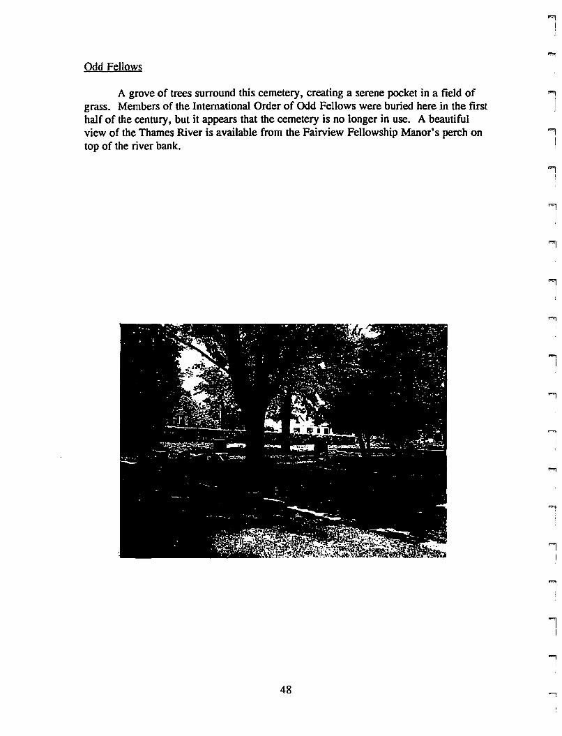
Odd Fellows
A grove of trees surround this cemetery, creating a serene pocket in a field ofgrass. Members of the International Order of Odd Fellows were buried here in the firsthalf of the century, but it appears that the cemetery is no longer in use. A beautifulview of the Thames River is available from the Fairview Fellowship Manor's perch ontop of the river bank.
1i
ll'i!
'iI
1
1l1...,
I
II
1
'i!
'iI
1I
i
48"'

rl
rr\
rrl
rrrr[
rI
f""Il
rl
rrIl
rrrr
Cemetery Number: 29
PIN #: 168906278786
Name: Odd Fellows Cemetery
Address: Fairview Fellowship Manor, Lestertown Road
Status: Not in use
Lot Size: Part of larger lot
Directions: From Route 12 North, tum left onto Walker Hill Road and then right ontoPleasant Valley Road South. Tum left onto Lestertown Road and follow up hill toFairview Fellowship Manor. Cemetery is in a tree grove beyond flagpoles.
Group in Charge:
Number of Markers: Approximately 40
Earliest: 1902
Family Names: No dominant family names
SymboIslUnusual Stones: Mostly flat markers with name and dates. Two largergranite markers. One black marble marker (fallen over)
Design Elements: In a pine grove of large trees which create shade. A few stonebenches. Beautiful view of river from Manor.
Enclosure: No enclosure- in open space except for trees
Ground Conditions: Decent: grass is 3" high by cemetery but all other is cut. Lots ofpine needles on the ground.
Stone Conditions: Good: pine needles cover all markers and grass is beginning togrow over the edges of the markers.
Historic Significance: Cemetery for members of the International Order of OddFellows who choose to be buried there.
Hazards: None are obvious
Recommendations: 1) clear needles and overgrown grass from markers.
Date: 5/22/96
49
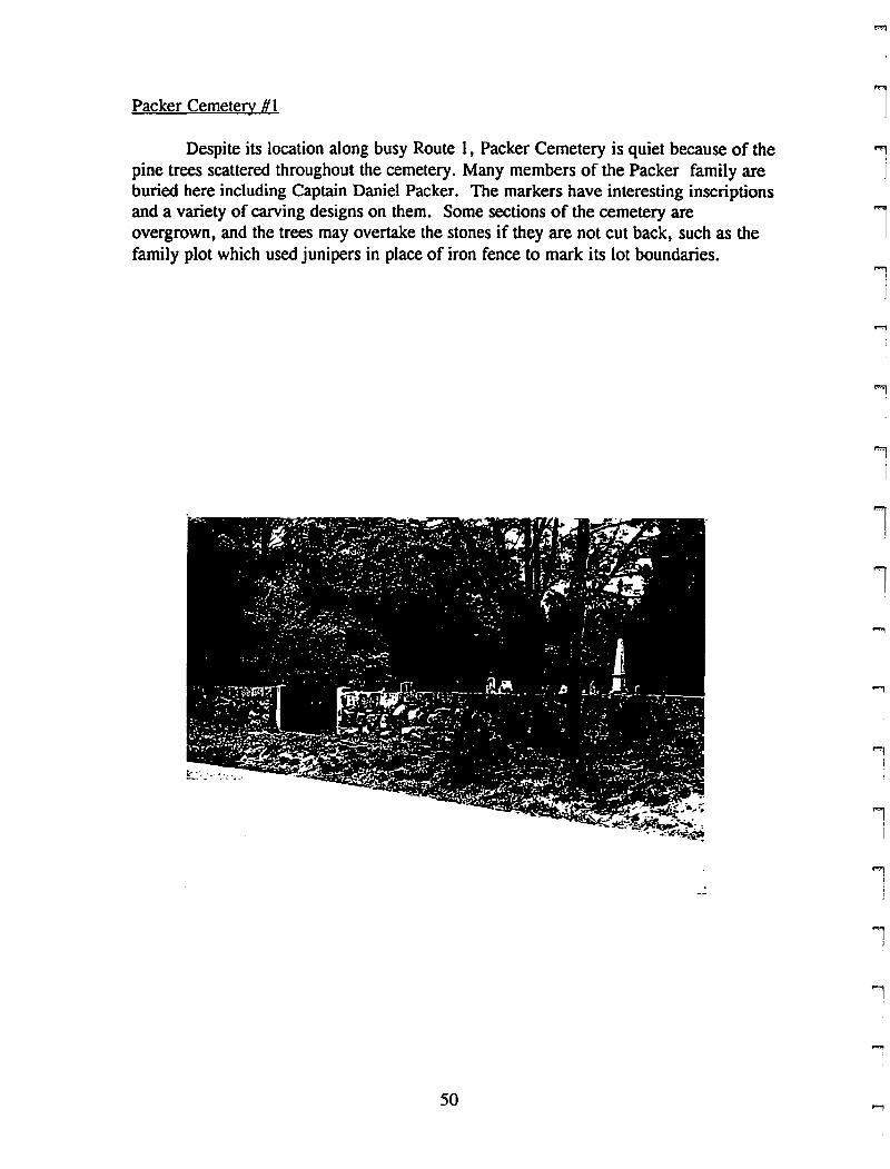
Packer Cemetery # I
Despite its location along busy Route I, Packer Cemetery is quiet because of thepine trees scattered throughout the cemetery. Many members of the Packer family areburied here including Captain Daniel Packer. The markers have interesting inscriptionsand a variety of carving designs on them. Some sections of the cemetery areovergrown, and the trees may overtake the stones if they are not cut back, such as thefamily plot which used junipers in place of iron fence to mark its lot boundaries.
'1I
lll
11
i
ll
..,
:I
.,I
I
'""1
-- ~
.,I
50 ....,
rri
rr
il
rrrrI
rrrr!
P"J
l
i\
i1
r
Cemetery Number: 9
PIN #: 261917005451
Name: Packer Cemetery #1
Address: Route 1t Mystic
Status: ~otin use
Lot Size: .85 acres
Directions: From Allyn Streett tum onto Route 1 south. Cemetery is just beforeMystic Ice House. Park at Ice House
Group in Charge: Town of Groton
Number of Markers: Approximately 150
Earliest: 1722
Family Names: Packer, Eldredget Burrowst Tiftt Sawyert Lathamt Marston t ~i1es,
Wrightman, Fish, Morgan
SymbolslUnusual Stones: A variety of types of soul effigies and willow and urnmotifs.
Design Elements: Markers are in rows perpendicular to road. Lots of trees. A treesurrounded family plot (trees are overgrown now)
Enclosure: Rustic stone wall with iron entrance gate.
Ground Conditions: Good: grass is well maintainedt but many trees are overgrownand block some markers.
Stone Conditions: Most are in good condition. Some old sandstone markers are badlyflaked and have little or no carving left. Some are leaning, stacked or broken.
Historic Significance: Sea captains and their families. ~otably: Captain DanielPacker
Hazards: ~one other than the trees
Recommendations: 1) Resett mend markers. 2) Cut back trees. 3) Create a cemeteryassociation. 4) Document markers which are in poor condition. 5) Sign markingcemetery and significance. 6) Map locating family plots and significant markers.
Date: 6/12/96
51
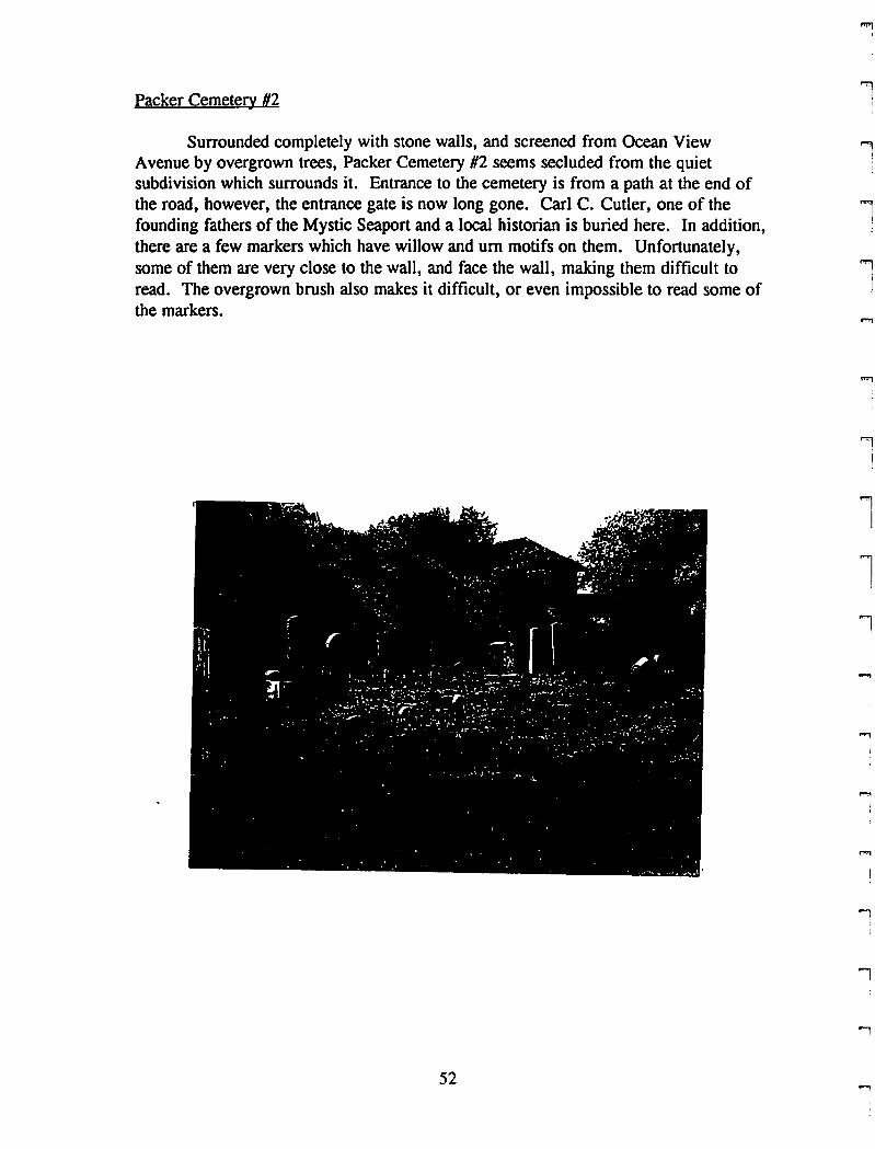
Packer Cemetery #2
Surrounded completely with stone walls, and screened from Ocean ViewAvenue by overgrown trees, Packer Cemetery #2 seems secluded from the quietsubdivision which surrounds it. Entrance to the cemetery is from a path at the end ofthe road, however, the entrance gate is now long gone. Carl C. Cutler, one of thefounding fathers of the Mystic Seaport and a local historian is buried here. In addition,there are a few markers which have willow and urn motifs on them. Unfortunately,some of them are very close to the wall, and face the wall, making them difficult toread. The overgrown brush also makes it difficult, or even impossible to read some ofthe markers.
52
li
1I,
l
l!
1
"'lII
iI
l1
....,,
""'1I
!
iI
l
rrl
rf'I'"'I(
f"'"I
rI
L
r\
rr1
rI
j""1
l
rri
f""lI
rrrI
Cemetery Number: 10
PIN #: 261805071772
Name: Packer Cemetery #2
Address: Off Ocean View Avenue
Status: Possibly in use'
Lot Size: .95 acres
Directions: From route 1, tum onto Ocean View Avenue and follow to end. Followgrass path to cemetery : entrance is on left
Group in Charge: Town of Groton
Number of Markers: Approximately 35
Earliest: 1824
Family Names: Packer, Tillinghast, Cutler, Irving
Symbols/Unusual Stones: A few willow and urn motifs. Large family monumentmarkers
Design Elements: Markers are in straight lines, almost in sections by family.Randomly placed trees
Enclosure: Stone wall on all sides. Entrance opening, but gate has been removed
Ground Conditions: Decent to good: grass is mowed but left on ground. and is nottrimmed near markers. Trees/bushes are overgrown and block markers near wall. It ispossible that maintenance had not been finished for the day.
Stone Conditions: Most in good condition. some are leaning. a few have lichenproblems. some are broken or knocked over
Historic Significance: Carl C. Cutler is buried here
Hazards: None are obvious
Recommendations: l)cut bushed back. 2)reset, clean, fix markers after consultingconservator. 3) erect a sign for the cemetery -
Date: 6/17/96
53
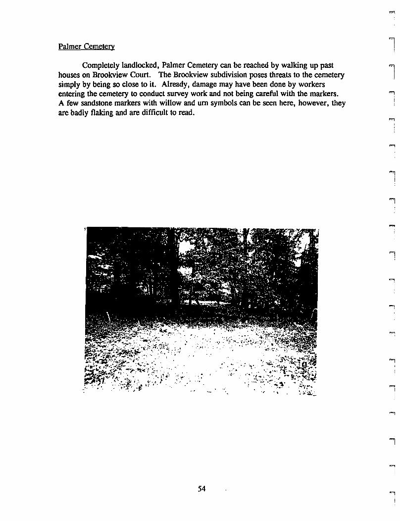
Palmer CemeteQ'
Completely landlocked, Palmer Cemetery can be reached by walking up pasthouses on Brooleview Court. The Brooleview subdivision poses threats to the cemeterysimply by being so close to it. Already, damage may have been done by workersentering the cemetery to conduct survey work and not being careful with the markers.A few sandstone markers with willow and urn symbols can be seen here, however, theyare badly flaking and are difficult to read.
54
1
1
1!
!!
..,i
i
1
1
""'II
"'1!
"""I
iI
"l
ri(
rrrpmiI
rrri
rrrrl
rFl
rI
FII
F:
Cemetery Number: 23
PIN #: 260815535186
Name: Palmer Cemetery
Address: At north end of Brookview Court, beyond housing subdivision
Status: Not in use
Lot Size: .23 acres
Directions: Follow Route 1 up Fort Hill and tum onto Groton Long Point Road(Route 215). Tum right at second entrance to Brook Street. Tum right onto BrookviewCourt and park at end of cuI de sac. Walk up dirt path to cemetery entrance.
Group in Charge: Town of Groton
Number of Markers: 25 plus footstones
Earliest: 1768
Family Names: Palmer, Brown, West, Franklin, Chipman, Mason
Symbols/Unusual Stones: Death head
Design Elements: Markers are in straight lines all facing same direction
Enclosure: Rustic stone wall on all sides
Ground Conditions: Good: needs mowing
Stone Conditions: Decent to poor: most either need to be reset or cleaned. Some arebadly flaked and cannot be read anymore.
Historic Significance: Cousins of the Stonington Palmer family are buried here
Hazards: New development all around cemetery could be a hazard
Recommendations: 1) Cut grass 2)Reset and gently clean markers 3) Erect a signwith name and stating history/importance of cemetery 4)Make sure cemetery isprotected
Date: 6/24/96
55
Park Cemetery # I
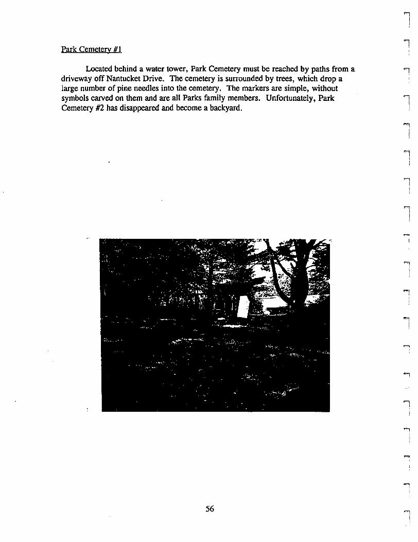
Located behind a water tower, Park Cemetery must be reached by paths from adriveway off Nantucket Drive. The cemetery is surrounded by trees, which drop alarge number of pine needles into the cemetery. The markers are simple, withoutsymbols carved on them and are all Parks family members. Unfortunately, ParkCemetery #2 has disappeared and become a backyard.
1J
iI
lJ
"l
I
1I!
I!
1'1
J
I)
"'l
!
'1
....,I
j
"'l1
"'1
56 "!II
rrrl
rl
F[
F"I
rrFl
rl
pmI(
Fl
r
rF'\
ii,
Fj,1
Cemetery Number: 6
PIN #: 271017102683
Name: Park Cemetery #1
Address: Behind water tower, off Lamphere Drive and Nantucket Drive
Status: Not in use
Lot Size: .25 acres
Directions: From Route 1, tum onto Allyn Street (name changes to Cow Hill Road).Tum left at light at top of hill onto Lamphere Road. Tum right onto Nantucket Drive.Tum right into driveway leading to playground and water tower. Follow path next towater tower down hill a short distance, and then take a different path to the right backup the hill to cemetery
Group in Charge: Town of Groton
Number of Markers: 10 plus footstones
Earliest: 1843
Family Names: Park, Avery, Curry
SymbolslUnusual Stones: None really. interesting inscriptions on a few.
Design Elements: Markers are clustered and in straight lines facing Nantucket Drive
Enclosure: Chain link fence on two sides. Trees on the others
Ground Conditions: Good: pine needles and branches on ground need to be removed
Stone Conditions: Decent to poor: most have fallen or broken and are very dirty
Historic Significance:
Hazards: Vandalism could be a problem
Recommendations: l)reset and clean markers. 2)remove pine needles and branches
Date: 7/17/96
57
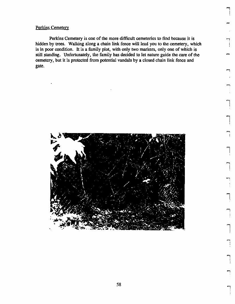
Perkins Cemetery
Perkins Cemetery is one of the more difficult cemeteries to find because it ishidden by trees. Walking along a chain link fence will lead you to the cemetery, whichis in poor condition. It is a family plot, with only two markers, only one of which isstill standing. Unfortunately, the family has decided to let nature guide the care of thecemetery, but it is protected from potential vandals by a closed chain link fence andgate.
1:
""l
I
'9
!
1
1!
1i
l'I
t
1j
i
58'9
rF'iI
i
rI
F'
I
F""
IiI
ii,
rrriI,
rl
rF'
!
i(
rl
F'II
rF'iI
Cemetery Number: 25
PIN H: 178011561042
Name: Perkins Cemetery
Address: Off Ohio Avenue and Florida Avenue
Status: Not in use
Lot Size: Part of larger lot
Directions: From route 12 North J turn right onto Gungywamp Road and then left ontoPleasant Valley Road North. At stop sign, turn right onto Ohio Avenue and follow uphill. Turn right onto Florida Avenue. Walk along chain link fence and under treecover to find cemetery
Group in Charge: Family members
Number of Markers: 2 plus footstones
Earliest: 1849
Family Names: Perkins
SymbolslUnusual Stones: None
Design Elements: None
Enclosure: Chain link fence
Ground Conditions: Poor: very shady from trees and heavily overgrown with vines
Stone Conditions: Decent to poor: markers are leaning or fallen. Stone itself is indecent c,ondition.
Historic Significance:
Hazards: Overgrowth could damage markers further
Recommendations: I)Document cemetery in present condition. 2)Decide whether tomaintain or to let further fall into ruin.
Date: 7/10/96
59
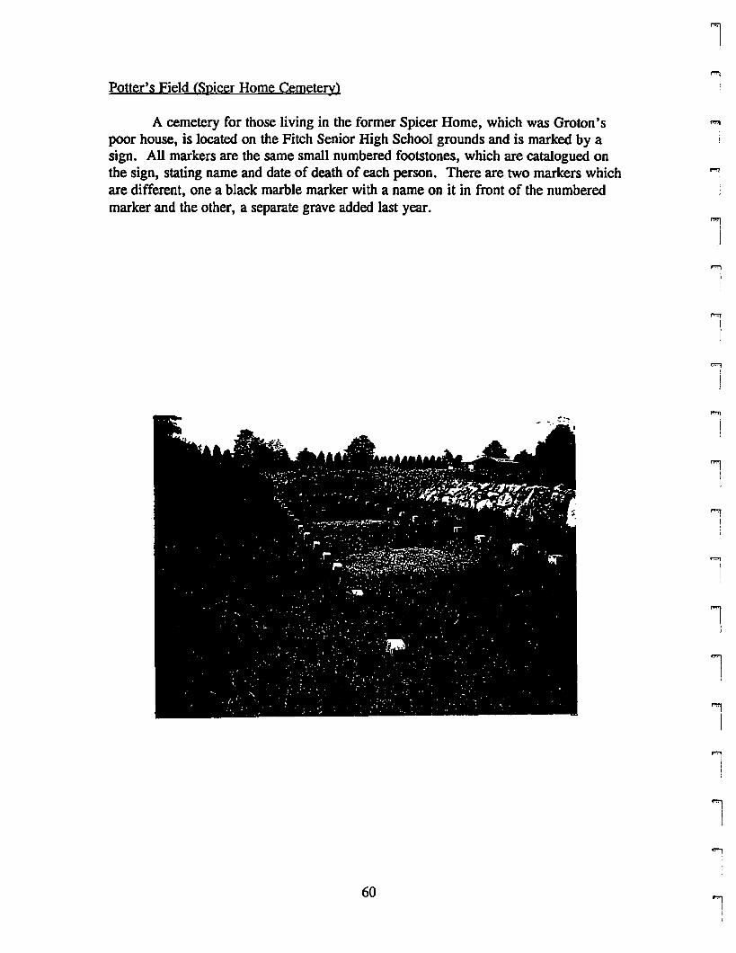
Potter's Field (Spicer Home Cemetery)
A cemetery for those living in the former Spicer Home, which was Groton'spoor house, is located on the Fitch Senior High School grounds and is marked by asign. All markers are the same small numbered footstones, which are catalogued onthe sign, stating name and date of death of each person. There are two markers whichare different, one a black marble marker with a name on it in front of the numberedmarker and the other, a separate grave added last year.
60
1'i
i
l ,
""'1!
"'1fI
'Ij
'iIj
1
1
'iI)
1j
ll'"li
'I)
"'"li
rrrrrl
Fl
rrrF
I
rr(
rrrr[
i1
Fi
r
Cemetery Number: 34
PIN #:
Name: Potter's Field (Spicer Home Cemetery)
Address: Between Fitch Senior High School and St. Mary Church
Status: In use
Lot Size: Part of larger lot
Directions: From Route 215 (Groton Long Point Road) tum right into Fitch SeniorHigh School driveway. Cemetery is on right before parking lot. Sign is visible fromdriveway.
Group in Charge: Town of Groton
Number of Markers: Approximately 50
Earliest: 1910
Family Names: No predominant family
SymbolslUnusual Stones: All markers are small footstones with numbers. Numberscorrespond to list on sign which gives name and dates. Two are different: a blackmarble stone was added next to one marker. In the far comer, a single grave withtraditional modem markers lies by itself.
Design Elements: Numbered markers form two straight lines: 1-26 and 25-46,50,52,48
Enclosure: Stone wall on two sides and brush along third side. Small opening forentrance.
Ground Conditions: Good: grass needs to be mowed and replanted in some areaswhere is has disappeared.
Stone Conditions: Markers are in good condition, however, some are sinking
Historic Significance: Cemetery is for people who lived in Spicer Home, which wasthe poor house for Groton earlier in the century.
Hazards: None are obvious
Recommendations: 1) Replant grass where needed. 2) Mow grass 3) Reset sinkingmarkers. 4) Add names fOT marker numbers 50, 52, and 58
Date: 6/5/96
61

Saint Patrick Cemetery
This beautifully designed cemetery is situated along the Mystic River withpaved driveways which meander through the cemetery in large loops. Religious statuesare scattered throughout the cemetery, with paths leading to them. It's perch along theMystic River adds to the serene and tranquil feel of the cemetery, and benches are .placed along the river for further contemplation. All markers are modem in theirdesign, and there are a number of vaults and mausoleums located throughout thecemetery.
"9
I
i!
..,I
"1I
.,I
.,I)
l"'l
I
l
lI
1I
l
1
'"1I
~
62 "'l
rrrI
rrf""l
I,,
riI
f"1
lf"Ii
rrl
r[
r,rI
rr;
r
Cemetery Number: 24
PIN #: 271019527112
Name: St. Patrick's Cemetery
Address: River Road
Status: In use
Lot Size: 4.72 acres
Directions: From Allyn Street, tum onto Cow Hill Road. Tum left onto BindlossRoad. At stop sign, tum left onto River Road and follow to cemetery
Group in Charge: Saint Patrick Church congregation
Number of Markers: Approximately 250
Earliest: 1860
Family Names: None are dominant
Symbols/Unusual Stones: Interesting modem markers and monuments. Claspedhands, Statues of religious figures
Design Elements: Tree lined central driveway. Sparse tree screen along road. Treesplaced along paths, and randomly also. Reproductions of Pieta flanked by benches.Altar. Benches by river for meditation.
Enclosure: Cobblestone wall along River Road. Trees and chain link fence. River onEast. Two entrances from River Road
Ground Conditions: Excellent: driveway could use repair/repaving
Stone Conditions: Excellent: no signs of deterioration on markers.
Historic Significance:
Hazards: none are obvious
Recommendations: I)Erect a sign for the cemetery. 2)Fix potholes in driveway
Date: 6/19/96
63
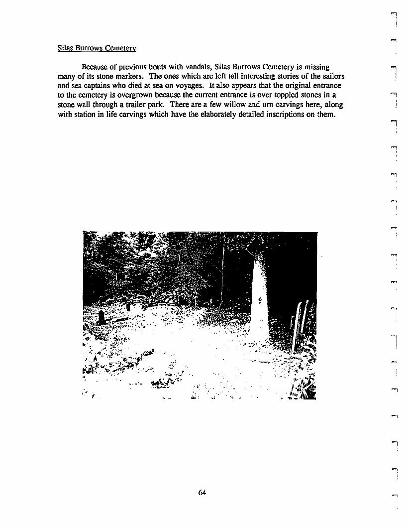
Silas Burrows Cemetery
Because of previous bouts with vandals, Silas Burrows Cemetery is missingmany of its stone markers. The ones which are left tell interesting stories of the sailorsand sea captains who died at sea on voyages. It also appears that the original entranceto the cemetery is overgrown because the current entrance is over toppled stones in astone wall through a trailer park. There are a few willow and urn carvings here, alongwith station in life carvings which have the elaborately detailed inscriptions on them.
64
l'1
j
l ,
i!
l
"'l
I
'I,i
""'1I,
'I!
1
"'11,
lJ
...,,i
rril
r
F'
l
FIt
rrrI
rI
F'I!
rn!
rl
rni
1""'1
l
Cemetery Number: 31
PIN #: 261914236097
Name: Silas Burrows Cemetery
Address: Off High Street in Mystic, in mobile home park
Status: Not in use
Lot Size: .21 acres
Directions: From Allyn Street heading North, tum right onto Sandy Hollow Road. Atstop sign, tum right onto High Street. Tum into Mystic Mobile Home park and followdriveway to left. Cemetery is on left and is visible from driveway
Group in Charge: Town of Groton
Number of Markers: 15 plus footstones
Earliest: 1843
Family Names: Burrows, Whelan, Sawyer, Leeds, Rathbun
SymbolslUnusual Stones: Willow and urn. Long and very interesting inscriptions:Ambrose Burrows
Design Elements: Markers are all perpendicular to driveway and face away from HighStreet
Enclosure: Stone wall on all four sides. Original entrance is overgrown
Ground Conditions: Good: grass is well maintained
Stone Conditions: Decent: many are knocked over (vandalism?) and a few arebroken. A few need cleaning also.
Historic Significance: Sea captains and members of the Burrows family are buriedhere. Some captains, sailors lost at sea.
Hazards: None except for vandalism. Perhaps if the mobile home park expands,however, the cemetery has survived to date, so this does not seem to be a threat
Recommendations: 1) reset markers. 2)Sign stating significance of cemetery
Date: 6/12/96
65
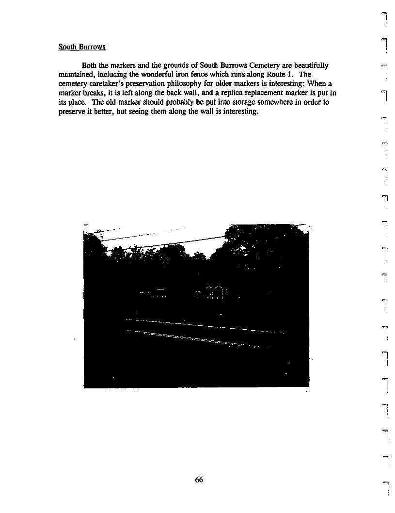
South Burrows
Both the markers and the grounds of South Burrows Cemetery are beautifullymaintained, including the wonderful iron fence which runs along Route 1. Thecemetery caretaker's preservation philosophy for older markers is interesting: When amarker breaks, it is left along the back wall, and a replica replacement marker is put inits place. The old marker should probably be put into storage somewhere in order topreselVe it better, but seeing them along the wall is interesting.
,I
I
1
l ,
"'lI!
'1IJ
1J
'"1I
l..."
I
'""1
\
1j
l'l
1i
~
66""l
rI
ri
i,I.
i'!I
ri
FI
I
F'l
rrl
f"IIt
F'"I
iI(
rrrr[
rl
rr
Cemetery Number: 11
PIN #: 260806278659
Name: South Burrows
Address: Route 1, top of Fort Hill
Status: In occasional use
Lot Size: .13 acres
Directions: Follow Route 1 up Fort Hill. South Burrows Cemetery is on right
Group in Charge: Family members «D. Belton A. Burrows)
Number of Markers: Approximately 30 plus footstones
Earliest: 1822
Family Names: Burrows, GallUp, Allen, Colby- all somehow related to the Burrows
SymbolslUnusual Stones: Large family marker for Gallup family. Intricate carvingon Burrows marker
Design Elements: All markers are in straight lines parallel to road. A singleflowering bush near the center of the cemetery which blocks a marker because it isovergrown
Enclosure: Finished stone wall on three sides and iron fence on street side withentrance gate.
Ground Conditions: Good: grass is high, but is cut regularly. Bush is overgrown (isthere a reason for the overgrowth?).
Stone Conditions: Good: decent repair for Alice C. Interesting preservationphilosophy: replica of stones which have broken have been made and the broken stonesare left leaning along the back wall of the cemetery.
Historic Significance:
Hazards: None are obvious
Recommendations: 1) A sign marking the cemetery is a good idea. 2) is there asignificance for flowering bush's overgrowth? If not, it should be cut back so it doesn'tblock marker.
Date: 6/12/96
67
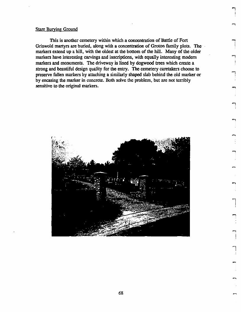
Starr Burying Ground
This is another cemetery within which a concentration of Battle of FortGriswold martyrs are buried, along with a concentration of Groton family plots. The- markers extend up a hill, with the oldest at the bottom of the hill. Many of the oldermarkers have interesting carvings and inscriptions, with equally interesting modemmarkers and monuments. The driveway is lined by dogwood trees which create astrong and beautiful design quality for the entry. The cemetery caretakers choose topreserve fallen markers by attaching a similarly shaped slab behind the old marker orby encasing the marker in concrete. Both solve the problem, but are not terriblysensitive to the original markers.
68
""1I
""'1I
1!
'ii
""liI
'iIi
""'1II
li,i,
1I
1
"'l!
l1
'I!
rrrrl
rrr,rrl
r
rrrl
rmI
r
Cemetery Number: 7
PIN #: 168911571139
Name: Starr Burying Ground
Address: Pleasant Valley Road South, west side
Status: In use
Lot Size: 10.56 acres
Directions: From Route 12 North, tum left onto Walker Hill Road. Then, tum rightonto Pleasant Valley Road South and follow .3 miles. Cemetery is on left.
Group in Charge: Starr Cemetery Association (William Gregory)
Number of Markers: Approximately 600
Earliest: 1750
Family Names: Buddington, Perkins, Starr, Binks, many others
Symbols/Unusual Stones: Many with soul effigies and willow and urn motifs. A fewtable top markers. A number of monuments.
Design Elements: Cemetery is on a hill with dogwood trees marching up the hill alongthe driveway. Trees scattered throughout the cemetery.
Enclosure: Stone wall on three sides. Chain link fence along Lestertown Road.
Ground Conditions: Good- grass could be shorter near markers, but work is probablynot over for the day yet.
Stone Conditions: Most in good condition. some older markers have fallen andbroken. a few have been reset with granite slabs attached to the backs of them.Preservation philosophy: set fallen markers in concrete representing the original shapeof the marker..
Historic Significance: Many' old Groton families have plots here. A number of Battleof Groton Heights soldiers killed are buried here as well.
Hazards: None are obvious
Recommendations: 1) Document and look into preservation of some of the older slateand sandstone markers which are weathered and difficult to read. 2) Create a mapwhich locates significant family plots and graves. 3) Consult a conservator for moresympathetic means of resetting fallen markers..
Date: 5/22/96
69
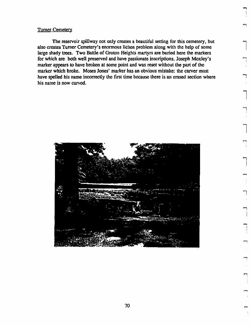
Turner Cemetery
The reservoir spillway not only creates a beautiful setting for this cemetery, butalso creates Turner Cemetery's enormous lichen problem along with the help of somelarge shady trees. Two Battle of Groton Heights martyrs are buried here the markersfor which are both well preserved and have passionate inscriptions. Joseph Moxley'smarker appears to have broken at some point and was reset without the part of themarker which broke. Moses Jones' marker has an obvious mistake: the carver musthave spelled his name incorrectly the first time because there is an erased section wherehis name is now carved.
70
..,!I
!i
""'1I
1
l
l1
I
'"'lI
l]
..,I
....,I
rrrI
ri
rf"'l
l
rrrrrrrrI
rrr~
pmi
l
r
Cemetery Number: 1
PIN #: 179011556228
Name: Turner Cemetery
Address: Gales Ferry Road, next to reservoir spillway area
Status: Not in use
Lot Size: .23 acres
Directions: From route 117 North, turn left onto Gales Ferry Road (just afterFarquhar Park). Cemetery is on right just after spillway but before fenced in utilityarea. (Only parking is a drive in spot for utility vehicles just beyond cemetery).
Group in Charge: City Utilities, Groton (Ed Herrick)
Number of Markers: Approximately 25 markers. Footstones and fieldstones also
Earliest: 1781
Family Names: Moxley, Turner, Daholl
SymbolslUnusual Stones: Two markers for soldiers who died in Battle of GrotonHeights (Moxley' and Jones) with soul effigies and interesting inscriptions. Also,markers with wIllow and urn motifs.
Design Elements: Markers are in lines and also scattered throughout space. All facethe road. A number of large oak trees which provide a lot of shade
Enclosure: Stone wall on all four sides. Iron entrance gate (doesn't open easily)
Ground Conditions: Good: grass is mowed and trees are in good condition
Stone Conditions: Moxley and Jones markers along with a few others are in goodcondition because they are in the sun. The rest of the markers are in decent to poorcondition because of lichen problem caused by constant moisture. Many are leaning.
Historic Significance: Some Battle of Groton Heights soldiers with interestingmarkers.
Hazards: None are obvious
Recommendations: 1) Gentle cleaning of markers with lichen problems. 2) Resetleaning markers. 3) Erect a sign to mark cemetery
Date: 6/5/96
71
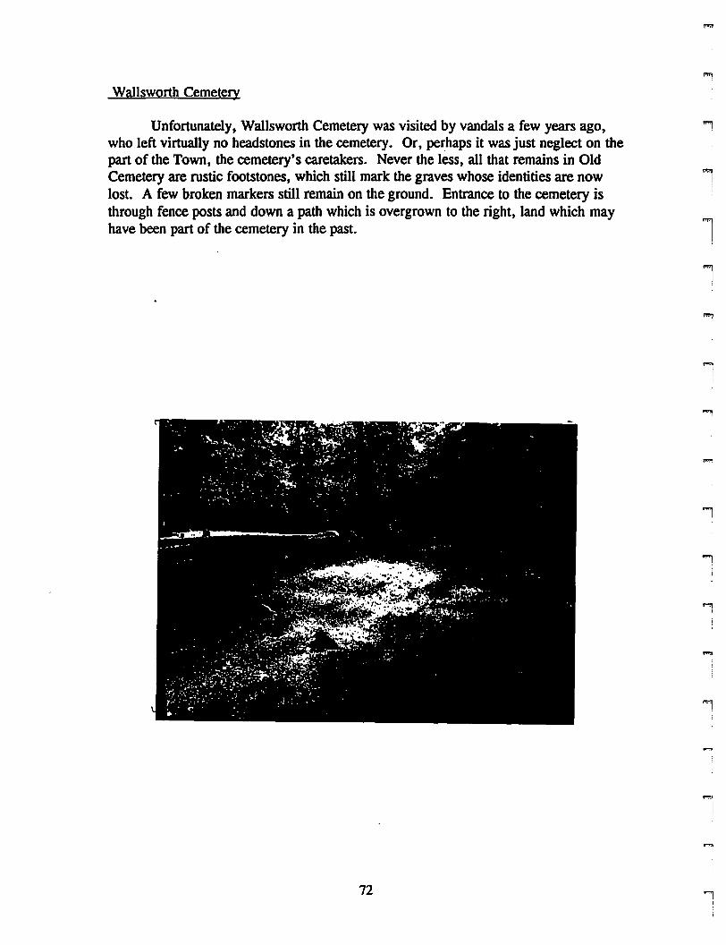
Wallsworth Cemetery
Unfortunately, Wallsworth Cemetery was visited by vandals a few years ago,who left virtually no headstones in the cemetery. Or, perhaps it was just neglect on thepart of the Town, the cemetery's caretakers. Never the less, all that remains in OldCemetery are rustic footstones, which still mark the graves whose identities are nowlost. A few broken markers still remain on the ground. Entrance to the cemetery isthrough fence posts and down a path which is overgrown to the right, land which mayhave been part of the cemetery in the past.
1
'1
1l
1J
"9I,
l
'l
~,:
li
""1II
,.,."
72 '"l
rrrrrf"'l
I
rrF'
l
rrr"
rrrl
Fl
r
r
Cemetery Number: 8
PIN #: 260914423921
Name: Wallsworth Cemetery
Address: Flanders Road, Mystic
Status: Not in use
Lot Size: 1.34 acres
Directions: From Route 1, turn onto Flanders Road. Follow.3 miles. Cemetery ison right, in between #344 and #364. Go through stone posts and follow path back tothe cemetery.
Group in Charge: Town of Groton
Number of Markers: 30 rustic footstones with a few broken markers on ground
Earliest:
Family Names: Wallsworth
SymboJslUnusual Stones: Only footstones survive
Design Elements: Hard to tell because of lack of markers
Enclosure: Rustic stone walls on all sides
Ground Conditions: Excellent: grass is mowed and trees are well maintained
Stone Conditions: All headstones are gone: vandalism? neglect?
Historic Significance: One of the older cemeteries in the Town
Hazards: None now, but it appears that vandalism was
Recommendations: 1) Erect a sign explaining history , vandalism, and listing thosewho are buried there.
Date: 7/22/96
73
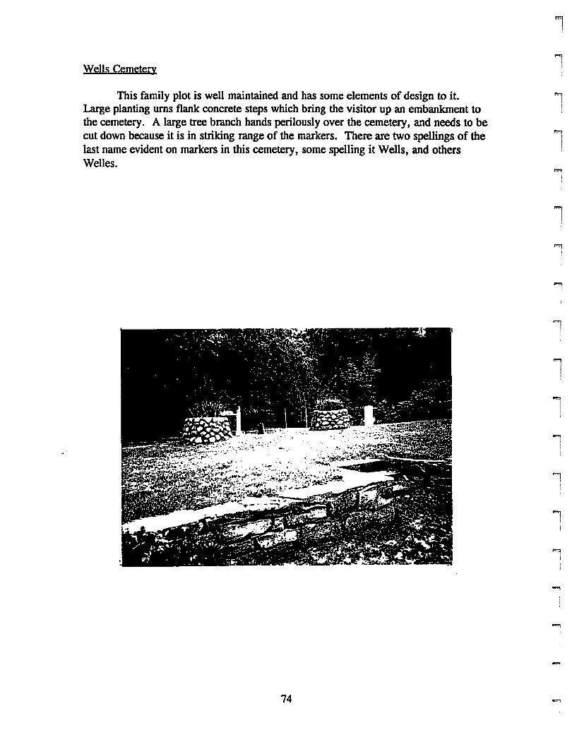
Wells Cemetery
This family plot is well maintained and has some elements of design to it.Large planting urns flank concrete steps which bring the visitor up an embankment tothe cemetery. A large tree branch hands perilously over the cemetery, and needs to becut down because it is in striking range of the markers. There are two spellings of thelast name evident on markers in this cemetery, some spelling it Wells, and othersWelles.
i!
iI
i
l""l
!
li
1
ii. J
iI
'1I
'I
'1
"'li,
-.,
74 9

rr,rrrrrF
l
r
f"lII
r'"
l
l'l
rmI
rFII
Fl
i
Cemetery Number: 2
PIN #: 271014337813
Name: Wells Cemetery
Address: Welles Road
Status: In use
Lot Size: .08 acres
Directions: From Route 184 easterly, turn left onto Welles Road. Cemetery is onright up a small embankment. Park at the old school house just past the cemetery
Group in Charge: Family members (Ed Welles)
Number of Markers: 9
Earliest: 1844
Family Names: Wells, Welles
Symbols/Unusual Stones: None are used
Design Elements: Marker are all in straight lines perpendicular to road. Largeplanting pots flank steps leading up to cemetery
Enclosure: Stone wall on three sides. Open to the road
Ground Conditions: Excellent except for a large low hanging branch from a tree
Stone Conditions: Good: one marker has rust on it from a patch job. Lichen isgrowing on a few.
Historic Significance:
Hazards: Tree branch could knock marker over
Recommendations: l)Erect a new sign for cemetery. 2) Cut branch back
Date: 6/24/96
75
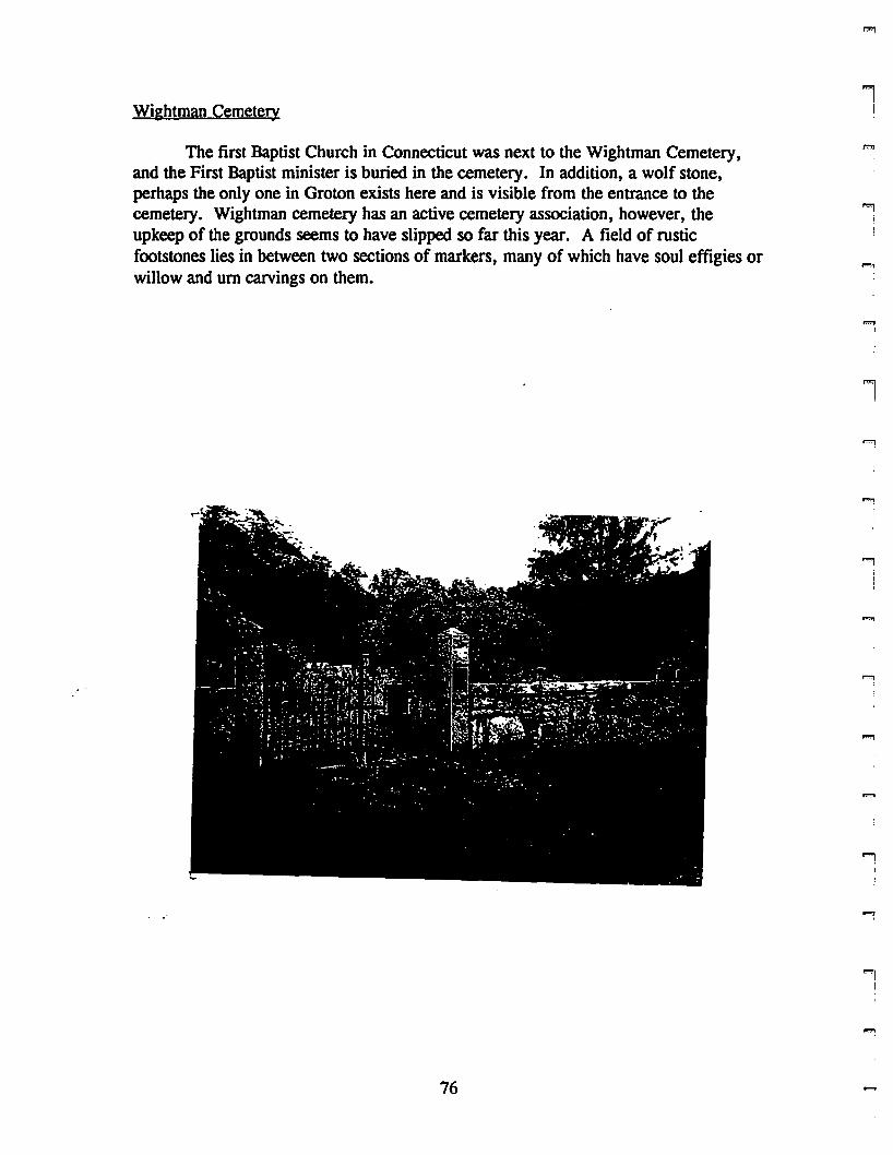
Wightman Cemetery
The first Baptist Church in Connecticut was next to the Wightman Cemetery,and the First Baptist minister is buried in the cemetery. In addition, a wolf stone,perhaps the only one in Groton exists here and is visible from the entrance to thecemetery. Wightman cemetery has an active cemetery association, however, theupkeep of the grounds seems to have slipped so far this year. A field of rusticfootstones lies in between two sections of markers, many of which have soul effigies orwillow and urn carvings on them.
76
'[i
'[I
l
lJ
"'1)
1i
1
....,

rrrrl
rrr[
F(
F'"[
rFl
rrl
Fl
rt
r\
rl
r
Cemetery Number: 4
PIN #: 270015721874
Name: Wightman Cemetery
Address: Cold Spring Road
Status: In use
Lot Size: .98 acres
Directions: From Route 184, tum onto Cow Hill Road. Tum left onto Packer Road.When road splits, take left fork onto Godfrey Road. At stop sign, bear right onto ColdSpring Road.. Cemetery is on left. Follow dirt path up slight hill to cemetery
Group in Charge: Wightman Cemetery Association (Dan La Capra)
Number of Markers: Approximately 100, plus approximately 100 rustic footstones
Earliest: 1747
Family Names: Wightman, Lamb, Denison, Burrows, LampherelLandphere,Holdridge, Haley, Colver/Culver, many others
SymbolslUnusual Stones: Soul effigies, Willow and urn. Wolf stone.
Design Elements: Markers are in rows but face many directions. Generally groupedby families. Randomly placed trees.
Enclosure: Finished stone wall. Iron entrance gate.
Ground Conditions: Good: grass is 2 feet high in some places
Stone Conditions: Most are in good condition. Lichen problems on old slate (1)markers. Some are badly flaked
Historic Significance: Site of first Baptist church in Connecticut. First Baptistminister buried here.
Hazards: None are obvious
Recommendations: 1)maintain grass. 2) Map cemetery locating markers andsignificance off those buried there.
Date: 6/26/96
77
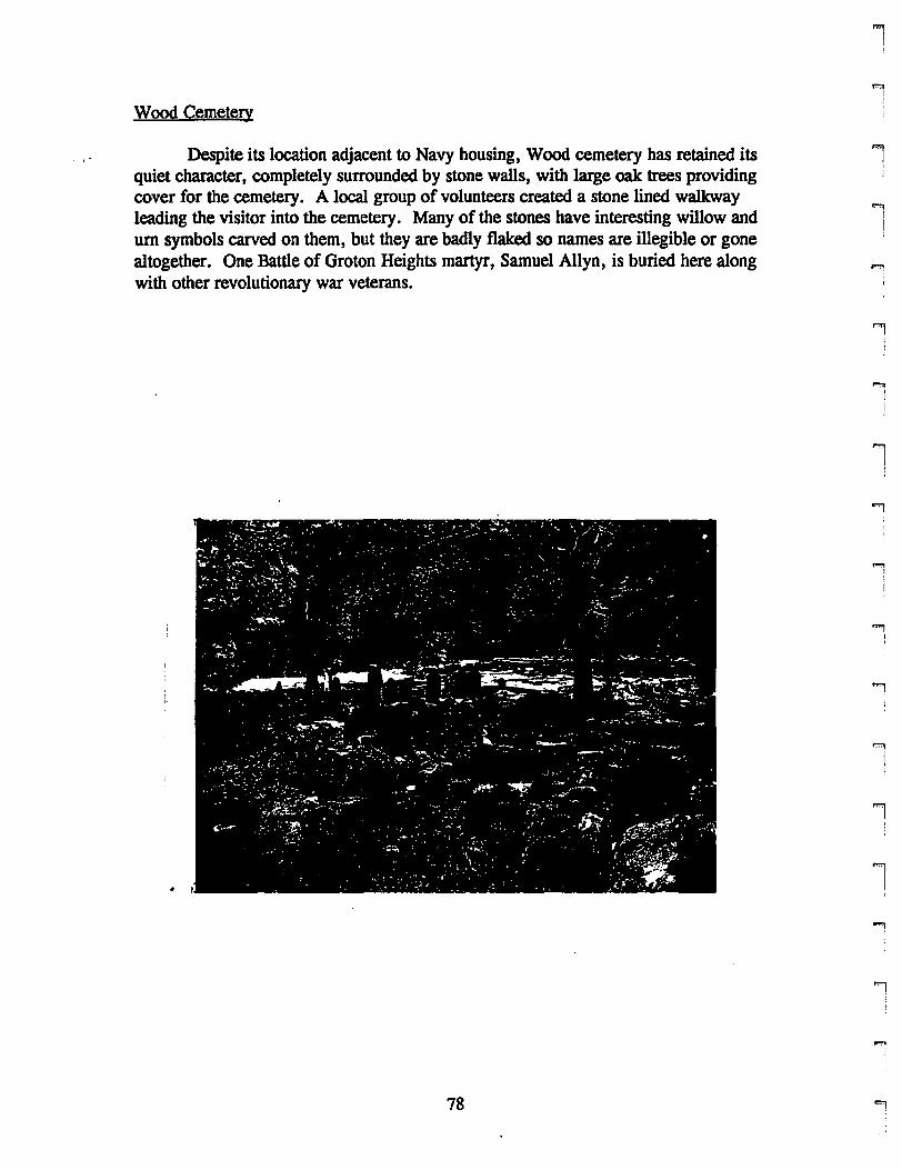
Wood Cemetery
Despite its location adjacent to Navy housing, Wood cemetery has retained itsquiet character, completely surrounded by stone walls, with large oak trees providingcover for the cemetery. A local group of volunteers created a stone lined walkwayleading the visitor into the cemetery. Many of the stones have interesting willow andurn symbols carved on them, but they are badly flaked so names are illegible or gonealtogether. One Battle of Groton Heights martyr, Samuel Allyn, is buried here alongwith other revolutionary war veterans.
78
,,"l
i
.,iJ
'1!
l!
....,I,
1!
'1,
1I
...,
!i
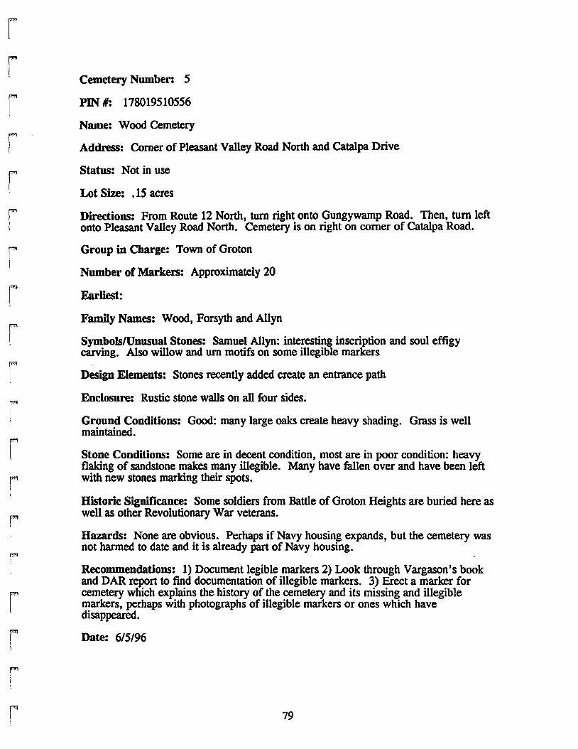
rF"
t
rit
rr(
rI
rF!
rr
r
rl
rriI,
rFI
Cemetery Number: 5
PIN #: 178019510556
Name: Wood Cemetery
Address: Comer of Pleasant Valley Road North and Catalpa Drive
Status: Not in use
Lot Size: .15 acres
Directions: From Route 12 North, tum right onto Gungywamp Road. Then, tum leftonto Pleasant Valley Road North. Cemetery is on right on comer of Catalpa Road.
Group in Charge: Town of Groton
Number of Markers: Approximately 20
Earliest:
Family Names: Wood, Forsyth and Allyn
SymbolslUnusual Stones: Samuel Allyn: interesting inscription and soul effigycarving. Also willow and urn motifs on some illegible markers
Design Elements: Stones recently added create an entrance path
Enclosure: Rustic stone walls on all four sides.
Ground Conditions: Good: many large oaks create heavy shading. Grass is wellmaintained.
Stone Conditions: Some are in decent condition, most are in poor condition: heavyflaking of sandstone makes many illegible. Many have fallen over and have been leftwith new stones marking their spots.
Historic Significance: Some soldiers from Battle of Groton Heights are buried here aswell as other Revolutionary War veterans.
Hazards: None are obvious. Perhaps if Navy housing expands, but the cemetery wasnot harmed to date and it is already part of Navy housing.
Recommendations: 1) Document legible markers 2) Look through Vargason's bookand DAR report to find documentation of illegible markers. 3) Erect a marker forcemetery which explains the history of the cemetery and its missing and illegiblemarkers, perhaps with photographs of illegible markers or ones which havedisappeared.
Date: 6/5/96
79
LOCAL RESOURCES
Association for Graveyard Studies
This is a New England based organization which focuses on the history andpreservation of graveyards and the conservation of markers within them. Appropriatetechniques for conservation can be recommended as well as conservators in the localarea. In addition, the AGS has a number of publications which they send out tointerested individuals which cover various topics including the preservation ofcemeteries, listing cemeteries on the National Register of Historic Places, and the do'sand don'ts of conservation.
Bill Memorial Library
The "Groton Room" upstairs has two resources not available elsewhere. Thefirst is a photo scrapbook which documents gravemarkers of Battle of Groton Heights"martyrs" with complete inscriptions, which is called the DAR scrapbook and was puttOgether in the 1930's. The other is a tin box which contains information aboutcemeteries not only in Groton, but also in New London, Ledyard, Preston and a fewother towns. Listings of burials are included in the Groton folder as well as maps fromthe Hale report. A list of cemeteries on a pink 11x17 piece of paper is useful, howeverits source is unknown. In addition, a careful reading must be given for some of thenames used are different than on other lists, and old route numbers and street names aregiven. Smith and Vargason's book as well as other eyewitness accounts of the Battle ofGroton heights are available as are books about Groton's history.
Blunt-White Library <Mystic Seaport Museum)
A library pass can be obtained from either entrance gate to the Seaport for thosewho are not members. Only staff can check resources out of the library or wanderthrough the stacks, however, the staff is very helpful and finds the information for you.Oral history accounts, original maps and volumes concerning maritime and localhistory are available, but not much concerning cemeteries. One book found here andnot in other locations is Lynette Strangstad's A Graveyard Preservation Primer.
. Connecticut Graveyard Network
A newly formed organization, the Connecticut Graveyard Network (CGN) plansto draw together individuals throughout the state who are interested in the variety ofsubjects related to graveyards. To date, the group has held tours of cemeteries in anumber of towns and hopes to host a symposium in the fall covering a related topic.Information about conservation, which conservators to call, history and many othersubjects can be obtained from CGN.
80
l
"'lI
""'1iI
II,
'1!
,.",
I
...,.,!
rl
F'l
rF'1
F'"I
FI
ri
F'"i
rF
I
ri
F'"1
l
rI
r.."....
FI[
rI
rl
Groton Plannine Department
The Town of Groton has a recent history of involvement with historicpreservation, including a preservation plan for the Town which was finished thissummer. Any town resident interested in cemetery information can look through orcopy the resources available in the Planning Department during business hours. Allphotographic records from this report are indexed and for a fee can be copied. Inaddition, copies of the survey are available for reading, and may be purchased for theprice of reproduction. The cemetery map produced for the survey is available to takeon cemetery hunting sprees.
The Department also has three pamphlets produced by the Association forGraveyard Studies which can be copied or simply looked through by interestedindividuals. They are: "The Care of Old Cemeteries", "Guide to Forming a 'CemeteryFriends' Organization", and "National Register Cemeteries".
Groton Public Library
The "Local History Room" next to the meeting rooms covers not only Grotonbut also other towns in the area. Access is granted by asking at the information deskand leaving a form of identification as collateral. The Hale Report for Groton islocated here as well as the Noank Valley and Smith Lake Cemetery Burial listings.Slater's book on Early Connecticut Burials is available, as are as Smith and Vargason'sbook and a variety of other books about Groton, Mystic, and Noank history. Copies ofStonington Historical Society's graveyard guide can be checked out along with Jacobs'book Stranger Stop and Cast an Eye.
Indian and Colonial Research Center
Open only limited hours on Tuesday, Thursday and Saturday, this interestingresearch center holds much information on local history, and some information onGroton cemeteries. Its main Groton resource is the Hale report.
Mystic-Noank Library
The local history section is upstairs, and is kept locked up when not in use. Notmuch is available about Groton cemeteries, but it has many book about Groton, Noank,and Mystic history. The Hale reports for Groton and Stonington and the Stoningtonhistorical Society guide are available. Make sure to play with Emily, the library cat,on your way out.
81
ADDRESSFS FOR RESOURCFS
"'1I
!
Association for Graveyard Studies278 Main Street Suite 207Greenfield, MA 01301
Bill Memorial Library240 Monument StreetGroton, CT 06340
(413) 772-0836
(860) 445-0392
..."!
Blunt-White LibraryMystic Seaport MuseumGreenmanville AvenueMystic, CT 06355
Connecticut Graveyard Network135 Wells StreetManchester, cr 06040
Groton Planning Department45 Fort Hill RoadGroton, CT 06340
Groton Public LibraryRoute 117Groton, CT 06340
(860) 572-0711 ""1
"9I
(860) 643-5652 "1I
~
(860) 441-6610
l(860) 441-6750
l
Ed HerrickGrounds MaintenanceCity Utilities
Indian and Colonial Research CenterMain StreetOld Mystic, CT 06372
Mystic-Noank Library40 Library StreetMystic, CT 06355
State ArchaeologistDr. Nicholas F. BellantoniConnecticut State Museum of Natural HistoryUniversity of ConnecticutStorrs, CT 06269-3023
82
(860) 446-4073
(860) 536-9771
(860) 572-8191
(860) 486-5248/486-4460
..,JII
l..,
II
rri
FI
rrrI
r\
F\
rF[
r
rrl
rpmI
r\
rl
I
ANNOTATED BmLIOGRAPHY
Hale, Charles R. Headstone Inscriptions: Town of Groton. Hartford, CT: 1932.
An WPA project which lists all headstone inscriptions until 1932 by cemeteryand also alphabetically with page references. Veterans of Foreign Wars are listed bycemetery and alphabetically by war with page references as well. Name, birth anddeath dates, and relationships are included, however, complete inscription transcriptionwas not conducted.
Jacobs, G. Walker•. Stranger Stop and Cast an Eye: A Guide to Gravestones andGravestone Rubbing. Brattleboro, VT: ~e Stephen Greene Press, 1973.
Excellent source for information about symbols carved on markers and for theproper techniques for gravestone rubbings. Sketches and photographic examplesaccompany the text to give a clearer view of types. Explanations of stone carvers andtheir styles are given as well.
Parks and Recreation Department, City of Boston. The Boston Experience: A Manualfor Historic Burying Grounds Preservation. Boston, MA.
A guide which explains how to conduct a complete survey of burying groundsincluding marker surveys, creating a preservation or conservation philosophy, findingconservators, and conducting conservation work.
~thbun, Benjamin F. Noank Cemetery Burials. 1986-7.
Alphabetized listing of burials in Noank Valley Cemetery with plot numbers,name, maiden name, title, birth and death dates.
Slater, James A. The Colonial Burying Grounds of Eastern Connecticut and The MenWho Made Them. Hamden, CT: The Shoestring Press, 1987.
This book is written in two parts, the first explains who carved gravemarkers,and how to identify them. The second part details colonial burying grounds inlocations around the state, discussing a number of the older cemeteries in Groton.
Smith, Carolyn, and Helen Vergason. September 6, 1781: North Groton's Story.New London, CT: New London Printers, Inc., 1981.
A twentieth century account of the Battle of Groton Heights, which explainshow the battle happened, who was involved, and where the "martyrs" are buried. Inaddition, headstone inscriptions are transcribed and photographed, along with directionsto the cemeteries.
83
Smith, Walter B. III. Smith Lake Cemetery 1723-1905 in Groton. CT. 1992.
A pamphlet written about the history of Smith Lake Cemetery and its move toits present location near Avery-Morgan cemetery. Includes a list of burialsalphabetically and chronologically. May not be complete because the move was notwell documented.
Stonington Historical Society. Stonington Grayeyards: A Guide. Stonington, CT:1980.
An excellent reference which gives location, historical significance and generalconditions for all cemeteries and graves in the Town of Stonington. In addition,carvings and symbolism are briefly described along with stonecarvers. The Hale reportfor the Town of Stonington is included in full.
Strangstad, Lynette. A Gravestone Preservation Primer. Nashville, TN: TheAmerican Association for State and Local History, 1983.
Explains the importance of preserving graveyards, and how to preserve,conserve, restore graveyards. In addition, concerns caretakers should take into accountare explained with possible solutions, including gravestone rubbing, working withvolunteers, public awareness and security. Instructions are also given on how toconduct accurate gravestone inventories and maps and how to do basic conservation.
84
""'I!
'""1
I
1
11
!
1""1
I
i
!]
1!
...,
....,
...,
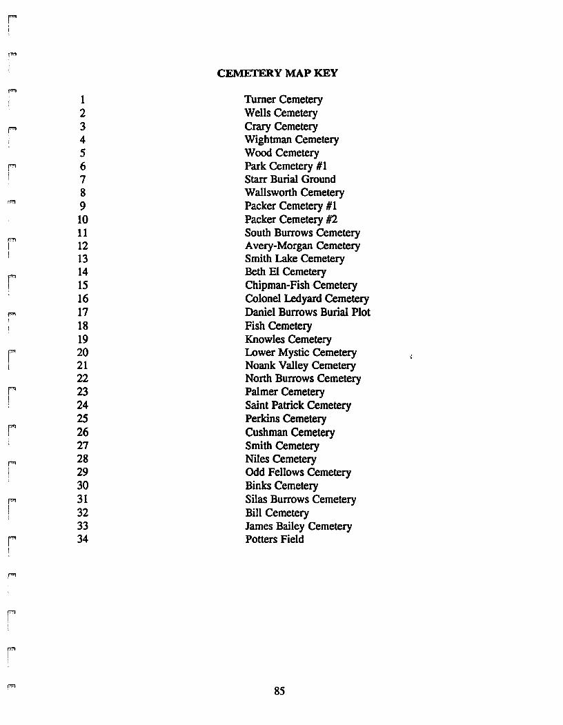
iI
r=
CEMETERY MAP KEY
f"'"Turner Cemetery1
2 Wells Cemetery
F 3 Crary Cemetery4 Wightman Cemetery5 Wood Cemetery
F 6 Park Cemetery #17 Starr Burial Ground8 Wallsworth Cemetery
n'I 9 Packer Cemetery #110 Packer Cemetery #211 South Burrows Cemetery
r=12 Avery-Morgan CemeteryI
I 13 Smith Lake Cemetery
r 14 Beth El Cemetery15 Chipman-Fish ·Cemetery16 Colonel Ledyard Cemetery
f"'1 17 Daniel Burrows Burial Plot18 Fish Cemetery19 Knowles Cemetery
r 20 Lower Mystic CemeteryI 21 Noank Valley Cemetery
22 North Burrows Cemetery
r 23 Palmer Cemetery24 Saint Patrick Cemetery25 Perkins Cemetery
r 26 Cushman Cemetery27 Smith Cemetery
f"'l 28 Niles CemeteryI 29 Odd Fellows Cemetery!
30 Binks Cemeteryf"'I 31 Silas Burrows CemeteryI 32 Bill CemeteryI
33 James Bailey Cemeteryf'" 34 Potters FieldI
!
f"'I
il
r85
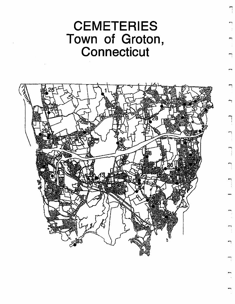
CEMETERIESTown of Groton,
Connecticut
ii
'l;