Embed Size (px)
Citation preview
North East Yorkshire Mesolithic Project
Archaeological Evaluation
Bransdale Ridge and Peat Moss / Wetherhouse Moor
North Yorkshire
Summer 2010
TA 11/04
OASIS ID 94563
North East Yorkshire Mesolithic Project
Archaeological Evaluation
Bransdale Ridge and Peat Moss / Wetherhouse Moor
North Yorkshire
Summer 2010
February 2011
Rachel Grahame with contributions from Allan Hall, Jim Innes and Peter Rowe
TA 11/04
OASIS ID 94563
© Tees Archaeology, North York Moors National Park Authority and English Heritage
Tees Archaeology, Sir William Gray House, Clarence Road, Hartlepool, TS24 8BT
Tel: 01429 523455 Fax: 01429 523477 email: [email protected]
Contents
Summary 1
Acknowledgments 2
1. Introduction 3
2. Aims and Objectives 4
3. Methodology 5
4. Bransdale Ridge 6
4.1 Introduction 6
4.2 Areas A and B 7
4.3 Areas C and D 7
4.4 Lithic Assessment Peter Rowe 8
5. Peat Moss / Wetherhouse Moor 11
5.1 Introduction 11
5.2 Area A 12
5.3 Area B 12
5.4 Areas C, D and E 12
5.5 Lithic Assessment Peter Rowe 13
6. Environmental Samples 15
6.1 Assessment of plant remains from a sample from Peat Moss/Wetherhouse Moor, N. Yorkshire Allan Hall 15
6.2 Pollen analysis at Bransdale Ridge and West Bilsdale Moor. North York Moors project phase 3 Jim Innes 15
7. Discussion 18
Bibliography 19
Appendix 1 MPB10 Bransdale Shovel Pit and Context Catalogue (CD only)
Appendix 2 MPW10 Peat Moss / Wetherhouse Moor Shovel Pit and Context Catalogue (CD only)
Figures
1 The location of the sites at Bransdale and Peat Moss / Wetherhouse Moor
2 The location of shovel pits and test pits at Bransdale
3 Bransdale Area A, shovel pits and test pits
4 Bransdale Area B, shovel pits and test pits
5 Bransdale Area C, shovel pits and test pits
6 Bransdale Area D, shovel pits and test pits
7 Bransdale, plan of Test Pit 1
8 Bransdale Test Pit 4, southwest facing section
9 Bransdale Test Pit 2, plan and east facing section
10 Bransdale Test Pit 3, plan and north facing section
11 The location of shovel pits and test pits at Peat Moss / Wetherhouse Moor
12 Peat Moss / Wetherhouse Moor Area A, shovel pits and test pits
13 Peat Moss / Wetherhouse Moor Area B and eastern part of Area C, shovel pits and test pits
14 Peat Moss / Wetherhouse Moor western part of Area C, shovel pits and test pits
15 Peat Moss / Wetherhouse Moor Area D, shovel pits and test pits
16 Peat Moss / Wetherhouse Moor Area E, shovel pits and test pits
17 Peat Moss / Wetherhouse Moor Test Pit 1, plan and northwest facing section
18 Peat Moss / Wetherhouse Moor Test Pit 2, plan and south facing section
19 Pollen diagram from Bransdale Ridge
20 Pollen diagram from Meggy Mires, West Bilsdale Moor
Mesolithic Project Zone 6 Evaluation _______________________________________________________________________________
_______________________________________________________________________________ Tees Archaeology 1
Summary This report describes the methodology and results of two archaeological evaluations undertaken by Tees Archaeology Research and Fieldwork Section at Bransdale Ridge and Peat Moss / Wetherhouse Moor, North Yorkshire. The fieldwork was undertaken in July and August 2010 as part of an English Heritage funded partnership project between Tees Archaeology and the North York Moors National Park Authority researching the Mesolithic in north east Yorkshire.
Bransdale Ridge is in a prominent location on the edge of a steep valley, whilst Peat Moss / Wetherhouse Moor is situated above a high moorland spring head basin. Both sites have been previously identified as sites of potential settlement due to the presence of lithic scatters. They were evaluated using a programme of shovel pitting followed by targeted test pitting.
At Bransdale Ridge, the flint assemblage demonstrates occupation during the late or very late Mesolithic. Despite a limited number of finds compared to previous excavations, shallow cut features were identified in two test pits. There seems to have been little modern disturbance of the site, and it has potential for further investigation which could be tightly focused around the location of previous excavations.
At Peat Moss / Wetherhouse Moor, the flint assemblage demonstrates occupation during the late or very late Mesolithic. Only one cut feature was found which is probably natural in origin. The comparatively low number of flints found and the disturbance of the site during the modern period suggests this site may have limited potential for further investigation.
Mesolithic Project Zone 6 Evaluation _______________________________________________________________________________
_______________________________________________________________________________ Tees Archaeology 2
Acknowledgements The project was funded by English Heritage, the North York Moors National Park Authority and Tees Archaeology.
Fieldwork was carried out by Rachel Grahame (Project Officer), Aaron Goode (Field Officer), and Kevin Horsley and David Errickson (Site Assistants) of Tees Archaeology, and by volunteers Francis Barnard, Joanne Burrell, Howard Carr, John Carss, Pat Dean, Mike Dixon, Tom Gibbs, Arthur Hoggett, Steve Jennings, Sam Newton, Robbie Sanderson, Abigail Sharkey, Alan Simkins and Rob Western.
Assistance was also given by staff of the North York Moors National Park Authority, particularly Mags Waughman (Archaeological Conservation Officer), and by Dr. Margaret Nieke, Rosy Eaton and Andrew Craven of Natural England.
We would particularly like to thank the owners of the Nawton Towers Estate and Hawnby Estate for allowing us access to their land, and the estate staff for their invaluable assistance; particulary Roy Brown on behalf of Nawton Towers, and John Richardson and James Savile of the Hawnby Estate Office and Trevor Bailey the Shoot Manager at Hawnby. We would also like to thank the many keepers and farmers on both estates who took an interest in our work.
Mesolithic Project Zone 6 Evaluation _______________________________________________________________________________
_______________________________________________________________________________ Tees Archaeology 3
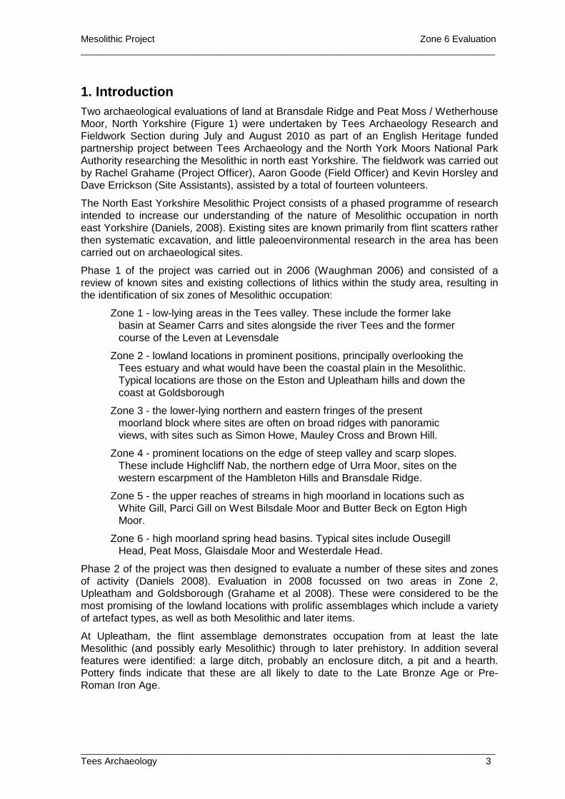
1. Introduction Two archaeological evaluations of land at Bransdale Ridge and Peat Moss / Wetherhouse Moor, North Yorkshire (Figure 1) were undertaken by Tees Archaeology Research and Fieldwork Section during July and August 2010 as part of an English Heritage funded partnership project between Tees Archaeology and the North York Moors National Park Authority researching the Mesolithic in north east Yorkshire. The fieldwork was carried out by Rachel Grahame (Project Officer), Aaron Goode (Field Officer) and Kevin Horsley and Dave Errickson (Site Assistants), assisted by a total of fourteen volunteers.
The North East Yorkshire Mesolithic Project consists of a phased programme of research intended to increase our understanding of the nature of Mesolithic occupation in north east Yorkshire (Daniels, 2008). Existing sites are known primarily from flint scatters rather then systematic excavation, and little paleoenvironmental research in the area has been carried out on archaeological sites.
Phase 1 of the project was carried out in 2006 (Waughman 2006) and consisted of a review of known sites and existing collections of lithics within the study area, resulting in the identification of six zones of Mesolithic occupation:
Zone 1 - low-lying areas in the Tees valley. These include the former lake basin at Seamer Carrs and sites alongside the river Tees and the former course of the Leven at Levensdale
Zone 2 - lowland locations in prominent positions, principally overlooking the Tees estuary and what would have been the coastal plain in the Mesolithic. Typical locations are those on the Eston and Upleatham hills and down the coast at Goldsborough
Zone 3 - the lower-lying northern and eastern fringes of the present moorland block where sites are often on broad ridges with panoramic views, with sites such as Simon Howe, Mauley Cross and Brown Hill.
Zone 4 - prominent locations on the edge of steep valley and scarp slopes. These include Highcliff Nab, the northern edge of Urra Moor, sites on the western escarpment of the Hambleton Hills and Bransdale Ridge.
Zone 5 - the upper reaches of streams in high moorland in locations such as White Gill, Parci Gill on West Bilsdale Moor and Butter Beck on Egton High Moor.
Zone 6 - high moorland spring head basins. Typical sites include Ousegill Head, Peat Moss, Glaisdale Moor and Westerdale Head.
Phase 2 of the project was then designed to evaluate a number of these sites and zones of activity (Daniels 2008). Evaluation in 2008 focussed on two areas in Zone 2, Upleatham and Goldsborough (Grahame et al 2008). These were considered to be the most promising of the lowland locations with prolific assemblages which include a variety of artefact types, as well as both Mesolithic and later items.
At Upleatham, the flint assemblage demonstrates occupation from at least the late Mesolithic (and possibly early Mesolithic) through to later prehistory. In addition several features were identified: a large ditch, probably an enclosure ditch, a pit and a hearth. Pottery finds indicate that these are all likely to date to the Late Bronze Age or Pre-Roman Iron Age.
Mesolithic Project Zone 6 Evaluation _______________________________________________________________________________
_______________________________________________________________________________ Tees Archaeology 4
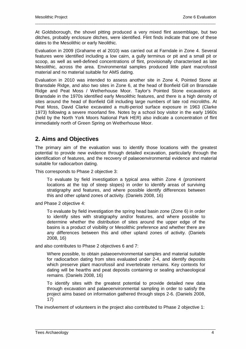
At Goldsborough, the shovel pitting produced a very mixed flint assemblage, but two ditches, probably enclosure ditches, were identified. Flint finds indicate that one of these dates to the Mesolithic or early Neolithic.
Evaluation in 2009 (Grahame et al 2010) was carried out at Farndale in Zone 4. Several features were identified including a low cairn, a gully terminus or pit and a small pit or scoop, as well as well-defined concentrations of flint, provisionally characterised as late Mesolithic, across the area. Environmental samples produced little plant macrofossil material and no material suitable for AMS dating.
Evaluation in 2010 was intended to assess another site in Zone 4, Pointed Stone at Bransdale Ridge, and also two sites in Zone 6, at the head of Bonfield Gill on Bransdale Ridge and Peat Moss / Wetherhouse Moor. Taylor’s Pointed Stone excavations at Bransdale in the 1970s identified early Mesolithic features, and there is a high density of sites around the head of Bonfield Gill including large numbers of late rod microliths. At Peat Moss, David Clarke excavated a multi-period surface exposure in 1963 (Clarke 1973) following a severe moorland fire. Notes by a school boy visitor in the early 1960s (held by the North York Moors National Park HER) also indicate a concentration of flint immediately north of Green Spring on Wetherhouse Moor.
2. Aims and Objectives The primary aim of the evaluation was to identify those locations with the greatest potential to provide new evidence through detailed excavation, particularly through the identification of features, and the recovery of palaeoenvironmental evidence and material suitable for radiocarbon dating.
This corresponds to Phase 2 objective 3:
To evaluate by field investigation a typical area within Zone 4 (prominent locations at the top of steep slopes) in order to identify areas of surviving stratigraphy and features, and where possible identify differences between this and other upland zones of activity. (Daniels 2008, 16)
and Phase 2 objective 4:
To evaluate by field investigation the spring head basin zone (Zone 6) in order to identify sites with stratigraphy and/or features, and where possible to determine whether the distribution of sites around the upper edge of the basins is a product of visibility or Mesolithic preference and whether there are any differences between this and other upland zones of activity. (Daniels 2008, 16)
and also contributes to Phase 2 objectives 6 and 7:
Where possible, to obtain palaeoenvironmental samples and material suitable for radiocarbon dating from sites evaluated under 2-4, and identify deposits which preserve plant macrofossil and invertebrate remains. Key contexts for dating will be hearths and peat deposits containing or sealing archaeological remains. (Daniels 2008, 16)
To identify sites with the greatest potential to provide detailed new data through excavation and palaeoenvironmental sampling in order to satisfy the project aims based on information gathered through steps 2-6. (Daniels 2008, 17)
The involvement of volunteers in the project also contributed to Phase 2 objective 1:
Mesolithic Project Zone 6 Evaluation _______________________________________________________________________________
_______________________________________________________________________________ Tees Archaeology 5
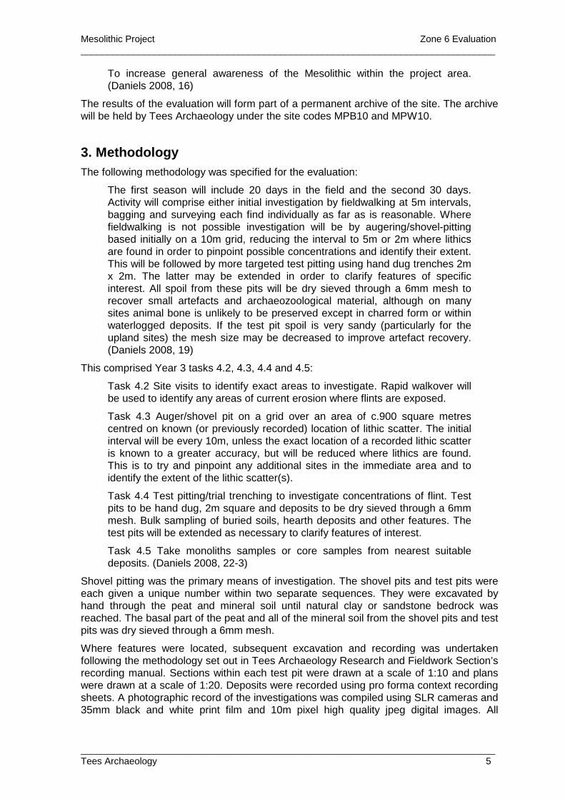
To increase general awareness of the Mesolithic within the project area. (Daniels 2008, 16)
The results of the evaluation will form part of a permanent archive of the site. The archive will be held by Tees Archaeology under the site codes MPB10 and MPW10.
3. Methodology The following methodology was specified for the evaluation:
The first season will include 20 days in the field and the second 30 days. Activity will comprise either initial investigation by fieldwalking at 5m intervals, bagging and surveying each find individually as far as is reasonable. Where fieldwalking is not possible investigation will be by augering/shovel-pitting based initially on a 10m grid, reducing the interval to 5m or 2m where lithics are found in order to pinpoint possible concentrations and identify their extent. This will be followed by more targeted test pitting using hand dug trenches 2m x 2m. The latter may be extended in order to clarify features of specific interest. All spoil from these pits will be dry sieved through a 6mm mesh to recover small artefacts and archaeozoological material, although on many sites animal bone is unlikely to be preserved except in charred form or within waterlogged deposits. If the test pit spoil is very sandy (particularly for the upland sites) the mesh size may be decreased to improve artefact recovery. (Daniels 2008, 19)
This comprised Year 3 tasks 4.2, 4.3, 4.4 and 4.5:
Task 4.2 Site visits to identify exact areas to investigate. Rapid walkover will be used to identify any areas of current erosion where flints are exposed.
Task 4.3 Auger/shovel pit on a grid over an area of c.900 square metres centred on known (or previously recorded) location of lithic scatter. The initial interval will be every 10m, unless the exact location of a recorded lithic scatter is known to a greater accuracy, but will be reduced where lithics are found. This is to try and pinpoint any additional sites in the immediate area and to identify the extent of the lithic scatter(s).
Task 4.4 Test pitting/trial trenching to investigate concentrations of flint. Test pits to be hand dug, 2m square and deposits to be dry sieved through a 6mm mesh. Bulk sampling of buried soils, hearth deposits and other features. The test pits will be extended as necessary to clarify features of interest.
Task 4.5 Take monoliths samples or core samples from nearest suitable deposits. (Daniels 2008, 22-3)
Shovel pitting was the primary means of investigation. The shovel pits and test pits were each given a unique number within two separate sequences. They were excavated by hand through the peat and mineral soil until natural clay or sandstone bedrock was reached. The basal part of the peat and all of the mineral soil from the shovel pits and test pits was dry sieved through a 6mm mesh.
Where features were located, subsequent excavation and recording was undertaken following the methodology set out in Tees Archaeology Research and Fieldwork Section’s recording manual. Sections within each test pit were drawn at a scale of 1:10 and plans were drawn at a scale of 1:20. Deposits were recorded using pro forma context recording sheets. A photographic record of the investigations was compiled using SLR cameras and 35mm black and white print film and 10m pixel high quality jpeg digital images. All
Mesolithic Project Zone 6 Evaluation _______________________________________________________________________________
_______________________________________________________________________________ Tees Archaeology 6
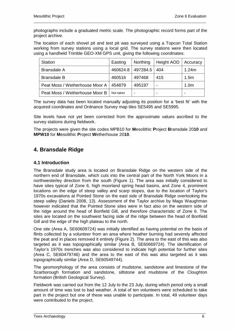
photographs include a graduated metric scale. The photographic record forms part of the project archive.
The location of each shovel pit and test pit was surveyed using a Topcon Total Station working from survey stations using a local grid. The survey stations were then located using a handheld Trimble GEO-XM GPS unit, giving the following coordinates:
Station Easting Northing Height AOD Accuracy
Bransdale A 460624.8 497284.5 404 1.24m
Bransdale B 460516 497468 415 1.5m
Peat Moss / Wetherhouse Moor A 454879 495197 - 1.0m
Peat Moss / Wetherhouse Moor B Not taken - - -
The survey data has been located manually adjusting its position for a ‘best fit’ with the acquired coordinates and Ordnance Survey map tiles SE5495 and SE5995.
Site levels have not yet been corrected from the approximate values ascribed to the survey stations during fieldwork.
The projects were given the site codes MPB10 for Mesolithic Project Bransdale 2010 and MPW10 for Mesolithic Project Wetherhouse 2010.
4. Bransdale Ridge
4.1 Introduction
The Bransdale study area is located on Bransdale Ridge on the western side of the northern end of Bransdale, which cuts into the central part of the North York Moors in a northwesterley direction from the south (Figure 1). The area was initially considered to have sites typical of Zone 6, high moorland spring head basins, and Zone 4, prominent locations on the edge of steep valley and scarp slopes, due to the location of Taylor’s 1970s excavations at Pointed Stone on the east side of Bransdale Ridge overlooking the steep valley (Daniels 2008, 13). Assessment of the Taylor archive by Mags Waughman however indicated that the Pointed Stone sites were in fact also on the western side of the ridge around the head of Bonfield Gill, and therefore characteristic of Zone 6. The sites are located on the southwest facing side of the ridge between the head of Bonfield Gill and the edge of the high plateau to the north.
One site (Area A, SE60609724) was initially identified as having potential on the basis of flints collected by a volunteer from an area where heather burning had severely affected the peat and in places removed it entirely (Figure 2). The area to the east of this was also targeted as it was topographically similar (Area B, SE60669724). The identification of Taylor’s 1970s trenches was also considered to indicate high potential for further sites (Area C, SE60479746) and the area to the east of this was also targeted as it was topographically similar (Area D, SE60549744).
The geomorphology of the area consists of mudstone, sandstone and limestone of the Scarborough formation and sandstone, siltstone and mudstone of the Cloughton formation (British Geological Survey).
Fieldwork was carried out from the 12 July to the 23 July, during which period only a small amount of time was lost to bad weather. A total of ten volunteers were scheduled to take part in the project but one of these was unable to participate. In total, 49 volunteer days were contributed to the project.
Mesolithic Project Zone 6 Evaluation _______________________________________________________________________________
_______________________________________________________________________________ Tees Archaeology 7
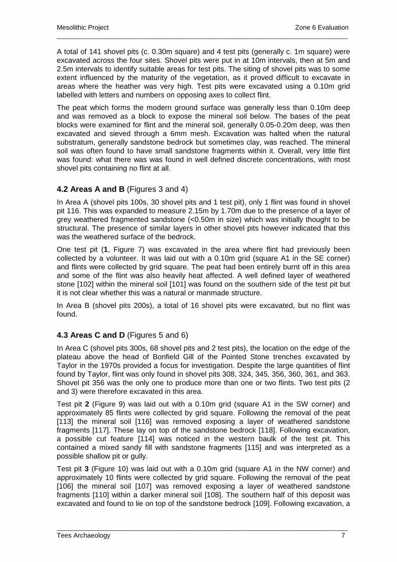
A total of 141 shovel pits (c. 0.30m square) and 4 test pits (generally c. 1m square) were excavated across the four sites. Shovel pits were put in at 10m intervals, then at 5m and 2.5m intervals to identify suitable areas for test pits. The siting of shovel pits was to some extent influenced by the maturity of the vegetation, as it proved difficult to excavate in areas where the heather was very high. Test pits were excavated using a 0.10m grid labelled with letters and numbers on opposing axes to collect flint.
The peat which forms the modern ground surface was generally less than 0.10m deep and was removed as a block to expose the mineral soil below. The bases of the peat blocks were examined for flint and the mineral soil, generally 0.05-0.20m deep, was then excavated and sieved through a 6mm mesh. Excavation was halted when the natural substratum, generally sandstone bedrock but sometimes clay, was reached. The mineral soil was often found to have small sandstone fragments within it. Overall, very little flint was found: what there was was found in well defined discrete concentrations, with most shovel pits containing no flint at all.
4.2 Areas A and B (Figures 3 and 4)
In Area A (shovel pits 100s, 30 shovel pits and 1 test pit), only 1 flint was found in shovel pit 116. This was expanded to measure 2.15m by 1.70m due to the presence of a layer of grey weathered fragmented sandstone (<0.50m in size) which was initially thought to be structural. The presence of similar layers in other shovel pits however indicated that this was the weathered surface of the bedrock.
One test pit (1, Figure 7) was excavated in the area where flint had previously been collected by a volunteer. It was laid out with a 0.10m grid (square A1 in the SE corner) and flints were collected by grid square. The peat had been entirely burnt off in this area and some of the flint was also heavily heat affected. A well defined layer of weathered stone [102] within the mineral soil [101] was found on the southern side of the test pit but it is not clear whether this was a natural or manmade structure.
In Area B (shovel pits 200s), a total of 16 shovel pits were excavated, but no flint was found.
4.3 Areas C and D (Figures 5 and 6)
In Area C (shovel pits 300s, 68 shovel pits and 2 test pits), the location on the edge of the plateau above the head of Bonfield Gill of the Pointed Stone trenches excavated by Taylor in the 1970s provided a focus for investigation. Despite the large quantities of flint found by Taylor, flint was only found in shovel pits 308, 324, 345, 356, 360, 361, and 363. Shovel pit 356 was the only one to produce more than one or two flints. Two test pits (2 and 3) were therefore excavated in this area.
Test pit 2 (Figure 9) was laid out with a 0.10m grid (square A1 in the SW corner) and approximately 85 flints were collected by grid square. Following the removal of the peat [113] the mineral soil [116] was removed exposing a layer of weathered sandstone fragments [117]. These lay on top of the sandstone bedrock [118]. Following excavation, a possible cut feature [114] was noticed in the western baulk of the test pit. This contained a mixed sandy fill with sandstone fragments [115] and was interpreted as a possible shallow pit or gully.
Test pit 3 (Figure 10) was laid out with a 0.10m grid (square A1 in the NW corner) and approximately 10 flints were collected by grid square. Following the removal of the peat [106] the mineral soil [107] was removed exposing a layer of weathered sandstone fragments [110] within a darker mineral soil [108]. The southern half of this deposit was excavated and found to lie on top of the sandstone bedrock [109]. Following excavation, a
Mesolithic Project Zone 6 Evaluation _______________________________________________________________________________
_______________________________________________________________________________ Tees Archaeology 8
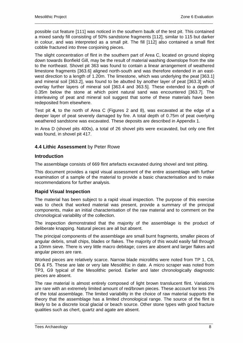
possible cut feature [111] was noticed in the southern baulk of the test pit. This contained a mixed sandy fill consisting of 50% sandstone fragments [112], similar to 115 but darker in colour, and was interpreted as a small pit. The fill [112] also contained a small flint cobble fractured into three conjoining pieces.
The slight concentration of flint in the southern part of Area C, located on ground sloping down towards Bonfield Gill, may be the result of material washing downslope from the site to the northeast. Shovel pit 363 was found to contain a linear arrangement of weathered limestone fragments [363.6] aligned north-south and was therefore extended in an east-west direction to a length of 1.20m. The limestone, which was underlying the peat [363.1] and mineral soil [363.2], was found to be abutted by another layer of peat [363.3] which overlay further layers of mineral soil [363.4 and 363.5]. These extended to a depth of 0.35m below the stone at which point natural sand was encountered [363.7]. The interleaving of peat and mineral soil suggest that some of these materials have been redeposited from elsewhere.
Test pit 4, to the north of Area C (Figures 2 and 8), was excavated at the edge of a deeper layer of peat severely damaged by fire. A total depth of 0.75m of peat overlying weathered sandstone was excavated. These deposits are described in Appendix 1.
In Area D (shovel pits 400s), a total of 26 shovel pits were excavated, but only one flint was found, in shovel pit 417.
4.4 Lithic Assessment by Peter Rowe
Introduction
The assemblage consists of 669 flint artefacts excavated during shovel and test pitting.
This document provides a rapid visual assessment of the entire assemblage with further examination of a sample of the material to provide a basic characterisation and to make recommendations for further analysis.
Rapid Visual Inspection
The material has been subject to a rapid visual inspection. The purpose of this exercise was to check that worked material was present, provide a summary of the principal components, make an initial characterisation of the raw material and to comment on the chronological variability of the collection.
The inspection demonstrated that the majority of the assemblage is the product of deliberate knapping. Natural pieces are all but absent.
The principal components of the assemblage are small burnt fragments, smaller pieces of angular debris, small chips, blades or flakes. The majority of this would easily fall through a 10mm sieve. There is very little macro debitage; cores are absent and larger flakes and angular pieces are rare.
Worked pieces are relatively scarce. Narrow blade microliths were noted from TP 1, C6, D6 & F5. These are late or very late Mesolithic in date. A micro scraper was noted from TP3, G9 typical of the Mesolithic period. Earlier and later chronologically diagnostic pieces are absent.
The raw material is almost entirely composed of light brown translucent flint. Variations are rare with an extremely limited amount of red/brown pieces. These account for less 1% of the total assemblage. The limited variability in the choice of raw material supports the theory that the assemblage has a limited chronological range. The source of the flint is likely to be a discrete local glacial or beach source. Other stone types with good fracture qualities such as chert, quartz and agate are absent.

Mesolithic Project Zone 6 Evaluation _______________________________________________________________________________
_______________________________________________________________________________ Tees Archaeology 9
Assessment of sample
The lithics from TP2 were chosen as a sample for further assessment. They represent approximately 15% of the entire assemblage.
The material was removed from its packaging, examined by eye and sorted into broad categories as detailed in Table 1 below. No measurements, cataloguing or microscopic analysis were carried out at this stage.
Grid Microlith Blade or
blade fragment
Flake or flake frag.
Chip Angular Waste
Burnt frag.
Total
A2 0 1 2 1 0 0 4 A3 0 3 2 0 3 0 8 A4 0 1 1 3 3 0 8 A8 0 0 0 0 1 0 1 A10 0 0 0 0 2 0 2 B2 0 0 0 1 0 0 1 C1 0 0 0 1 0 0 1 C2 0 0 1 0 0 0 1 C3 0 0 1 3 0 0 4 C4 0 2 1 1 0 0 4 C7 0 1 0 0 0 0 1 D2 0 1 2 0 0 0 3 D3 0 1 0 1 0 0 2 D4 0 0 2 3 0 0 5 D6 0 1 0 0 0 0 1 D8 0 1 0 0 0 0 1 D9 0 0 0 1 1 0 2 E6 0 1 0 0 0 0 1 E7 0 0 0 0 1 0 1 E8 0 0 1 0 0 0 1 E9 0 0 0 2 0 0 2 F2 0 0 1 0 0 0 1 F4 0 1 1 0 1 0 3 F7 0 0 0 0 1 0 1 F8 0 0 1 0 0 0 1 F9 0 0 0 0 1 0 1 G3 0 2 0 0 0 0 2 G6 0 1 0 0 0 0 1 H3 0 0 0 0 0 1 1 H4 0 0 0 0 0 1 1 H5 0 2 2 0 0 0 4 H6 0 0 0 0 1 1 2 H8 0 0 0 0 0 1 1 H9 0 0 0 2 0 0 2 H10 0 0 0 1 0 0 1 I3 0 0 0 1 0 0 1 I4 0 0 0 0 1 0 1 I6 0 0 1 0 0 0 1 I7 0 0 0 1 0 0 1 I8 0 0 0 2 0 0 2 J2 1 1 1 0 0 0 3 J3 0 0 2 0 0 0 2 Total 1 20 22 24 16 4 87
Table 1: Summary of lithic material from Test Pit 2
Mesolithic Project Zone 6 Evaluation _______________________________________________________________________________
_______________________________________________________________________________ Tees Archaeology 10
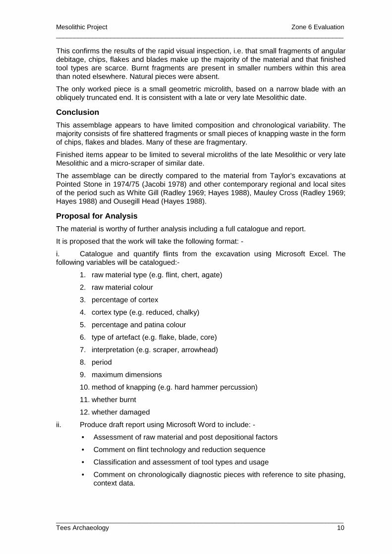
This confirms the results of the rapid visual inspection, i.e. that small fragments of angular debitage, chips, flakes and blades make up the majority of the material and that finished tool types are scarce. Burnt fragments are present in smaller numbers within this area than noted elsewhere. Natural pieces were absent.
The only worked piece is a small geometric microlith, based on a narrow blade with an obliquely truncated end. It is consistent with a late or very late Mesolithic date.
Conclusion
This assemblage appears to have limited composition and chronological variability. The majority consists of fire shattered fragments or small pieces of knapping waste in the form of chips, flakes and blades. Many of these are fragmentary.
Finished items appear to be limited to several microliths of the late Mesolithic or very late Mesolithic and a micro-scraper of similar date.
The assemblage can be directly compared to the material from Taylor’s excavations at Pointed Stone in 1974/75 (Jacobi 1978) and other contemporary regional and local sites of the period such as White Gill (Radley 1969; Hayes 1988), Mauley Cross (Radley 1969; Hayes 1988) and Ousegill Head (Hayes 1988).
Proposal for Analysis
The material is worthy of further analysis including a full catalogue and report.
It is proposed that the work will take the following format: -
i. Catalogue and quantify flints from the excavation using Microsoft Excel. The following variables will be catalogued:-
1. raw material type (e.g. flint, chert, agate)
2. raw material colour
3. percentage of cortex
4. cortex type (e.g. reduced, chalky)
5. percentage and patina colour
6. type of artefact (e.g. flake, blade, core)
7. interpretation (e.g. scraper, arrowhead)
8. period
9. maximum dimensions
10. method of knapping (e.g. hard hammer percussion)
11. whether burnt
12. whether damaged
ii. Produce draft report using Microsoft Word to include: -
• Assessment of raw material and post depositional factors
• Comment on flint technology and reduction sequence
• Classification and assessment of tool types and usage
• Comment on chronologically diagnostic pieces with reference to site phasing, context data.
Mesolithic Project Zone 6 Evaluation _______________________________________________________________________________
_______________________________________________________________________________ Tees Archaeology 11
• Discussion of the potential of the assemblage for further work such as refitting experiments.
• Comparative analysis at the regional level to find other examples of similar sites and compare artefact morphology and technology. The assemblage needs to be set into its regional context through a detailed search for available published comparanda.
iii. Recommendations and captions for illustration
5. Peat Moss / Wetherhouse Moor
5.1 Introduction
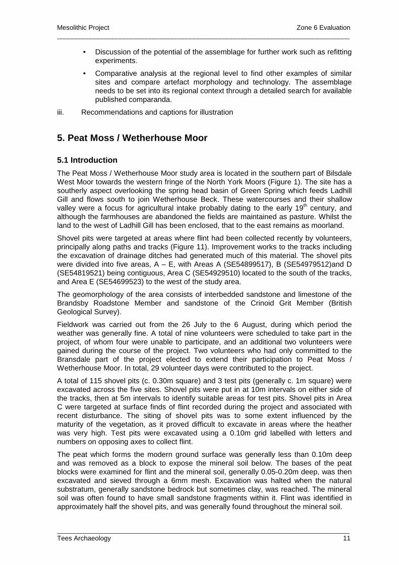
The Peat Moss / Wetherhouse Moor study area is located in the southern part of Bilsdale West Moor towards the western fringe of the North York Moors (Figure 1). The site has a southerly aspect overlooking the spring head basin of Green Spring which feeds Ladhill Gill and flows south to join Wetherhouse Beck. These watercourses and their shallow valley were a focus for agricultural intake probably dating to the early 19th century, and although the farmhouses are abandoned the fields are maintained as pasture. Whilst the land to the west of Ladhill Gill has been enclosed, that to the east remains as moorland.
Shovel pits were targeted at areas where flint had been collected recently by volunteers, principally along paths and tracks (Figure 11). Improvement works to the tracks including the excavation of drainage ditches had generated much of this material. The shovel pits were divided into five areas, A – E, with Areas A (SE54899517), B (SE54979512)and D (SE54819521) being contiguous, Area C (SE54929510) located to the south of the tracks, and Area E (SE54699523) to the west of the study area.
The geomorphology of the area consists of interbedded sandstone and limestone of the Brandsby Roadstone Member and sandstone of the Crinoid Grit Member (British Geological Survey).
Fieldwork was carried out from the 26 July to the 6 August, during which period the weather was generally fine. A total of nine volunteers were scheduled to take part in the project, of whom four were unable to participate, and an additional two volunteers were gained during the course of the project. Two volunteers who had only committed to the Bransdale part of the project elected to extend their participation to Peat Moss / Wetherhouse Moor. In total, 29 volunteer days were contributed to the project.
A total of 115 shovel pits (c. 0.30m square) and 3 test pits (generally c. 1m square) were excavated across the five sites. Shovel pits were put in at 10m intervals on either side of the tracks, then at 5m intervals to identify suitable areas for test pits. Shovel pits in Area C were targeted at surface finds of flint recorded during the project and associated with recent disturbance. The siting of shovel pits was to some extent influenced by the maturity of the vegetation, as it proved difficult to excavate in areas where the heather was very high. Test pits were excavated using a 0.10m grid labelled with letters and numbers on opposing axes to collect flint.
The peat which forms the modern ground surface was generally less than 0.10m deep and was removed as a block to expose the mineral soil below. The bases of the peat blocks were examined for flint and the mineral soil, generally 0.05-0.20m deep, was then excavated and sieved through a 6mm mesh. Excavation was halted when the natural substratum, generally sandstone bedrock but sometimes clay, was reached. The mineral soil was often found to have small sandstone fragments within it. Flint was identified in approximately half the shovel pits, and was generally found throughout the mineral soil.
Mesolithic Project Zone 6 Evaluation _______________________________________________________________________________
_______________________________________________________________________________ Tees Archaeology 12
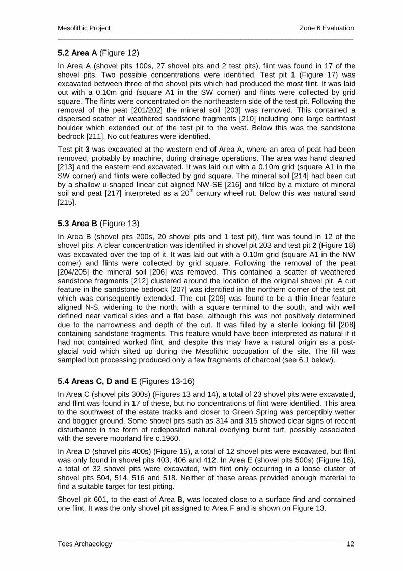
5.2 Area A (Figure 12)
In Area A (shovel pits 100s, 27 shovel pits and 2 test pits), flint was found in 17 of the shovel pits. Two possible concentrations were identified. Test pit 1 (Figure 17) was excavated between three of the shovel pits which had produced the most flint. It was laid out with a 0.10m grid (square A1 in the SW corner) and flints were collected by grid square. The flints were concentrated on the northeastern side of the test pit. Following the removal of the peat [201/202] the mineral soil [203] was removed. This contained a dispersed scatter of weathered sandstone fragments [210] including one large earthfast boulder which extended out of the test pit to the west. Below this was the sandstone bedrock [211]. No cut features were identified.
Test pit 3 was excavated at the western end of Area A, where an area of peat had been removed, probably by machine, during drainage operations. The area was hand cleaned [213] and the eastern end excavated. It was laid out with a 0.10m grid (square A1 in the SW corner) and flints were collected by grid square. The mineral soil [214] had been cut by a shallow u-shaped linear cut aligned NW-SE [216] and filled by a mixture of mineral soil and peat [217] interpreted as a 20th century wheel rut. Below this was natural sand [215].
5.3 Area B (Figure 13)
In Area B (shovel pits 200s, 20 shovel pits and 1 test pit), flint was found in 12 of the shovel pits. A clear concentration was identified in shovel pit 203 and test pit 2 (Figure 18) was excavated over the top of it. It was laid out with a 0.10m grid (square A1 in the NW corner) and flints were collected by grid square. Following the removal of the peat [204/205] the mineral soil [206] was removed. This contained a scatter of weathered sandstone fragments [212] clustered around the location of the original shovel pit. A cut feature in the sandstone bedrock [207] was identified in the northern corner of the test pit which was consequently extended. The cut [209] was found to be a thin linear feature aligned N-S, widening to the north, with a square terminal to the south, and with well defined near vertical sides and a flat base, although this was not positively determined due to the narrowness and depth of the cut. It was filled by a sterile looking fill [208] containing sandstone fragments. This feature would have been interpreted as natural if it had not contained worked flint, and despite this may have a natural origin as a post-glacial void which silted up during the Mesolithic occupation of the site. The fill was sampled but processing produced only a few fragments of charcoal (see 6.1 below).
5.4 Areas C, D and E (Figures 13-16)
In Area C (shovel pits 300s) (Figures 13 and 14), a total of 23 shovel pits were excavated, and flint was found in 17 of these, but no concentrations of flint were identified. This area to the southwest of the estate tracks and closer to Green Spring was perceptibly wetter and boggier ground. Some shovel pits such as 314 and 315 showed clear signs of recent disturbance in the form of redeposited natural overlying burnt turf, possibly associated with the severe moorland fire c.1960.
In Area D (shovel pits 400s) (Figure 15), a total of 12 shovel pits were excavated, but flint was only found in shovel pits 403, 406 and 412. In Area E (shovel pits 500s) (Figure 16), a total of 32 shovel pits were excavated, with flint only occurring in a loose cluster of shovel pits 504, 514, 516 and 518. Neither of these areas provided enough material to find a suitable target for test pitting.
Shovel pit 601, to the east of Area B, was located close to a surface find and contained one flint. It was the only shovel pit assigned to Area F and is shown on Figure 13.
Mesolithic Project Zone 6 Evaluation _______________________________________________________________________________
_______________________________________________________________________________ Tees Archaeology 13
5.5 Lithic Assessment by Peter Rowe
Introduction
The assemblage consists of 522 flint artefacts excavated during shovel and test pitting.
This document provides a rapid visual assessment of the entire assemblage with further examination of a sample of the material to provide a basic characterisation and to make recommendations for further analysis.
Rapid Visual Inspection
The material has been subject to a rapid visual inspection. The purpose of this exercise was to check that worked material was present, provide a summary of the principal components, make an initial characterisation of the raw material and to comment on the chronological variability of the collection.
The inspection demonstrated that the majority of the assemblage is the product of deliberate knapping. Natural pieces are all but absent.
The principal components of the assemblage are angular debris, flakes, and a smaller proportion of blades. Cores are present in small numbers e.g. TP1, E9 produced a small flake core with opposed platforms and TP2, K11 produced a well reduced, single platform blade core.
Worked pieces are relatively scarce. Narrow blade microliths were noted from SP03; SP322; SP514; TP 2, D2, E3, F8 & M13. These are late or very late Mesolithic in date. A small tanged, bifacial arrowhead was noted from SP213 of early Bronze Age date.
The raw material is almost entirely composed of light brown translucent flint. Variations are rare with a limited amount of red/brown pieces or toffee coloured pieces. These account for less 10% of the total assemblage. The limited variability in the choice of raw material supports the theory that the assemblage has a limited chronological range. The source of the flint is likely to be a discrete local glacial or beach source. Other stone types with good fracture qualities such as chert, quartz and agate are absent.
Assessment of sample
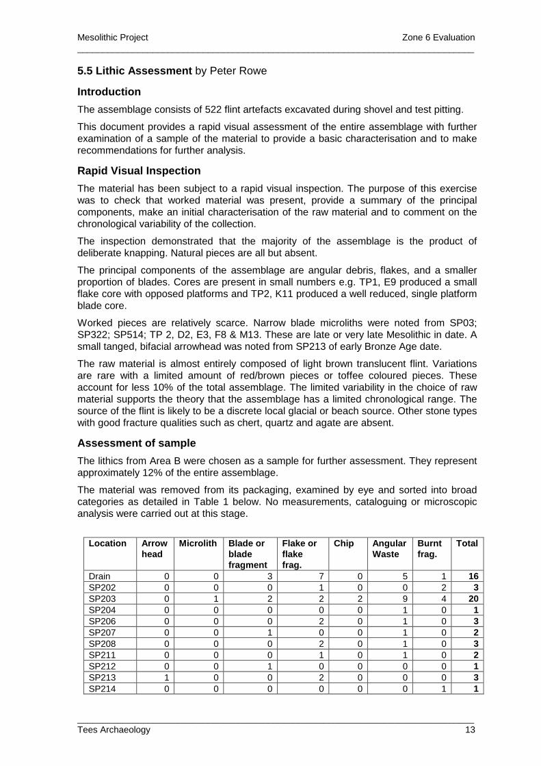
The lithics from Area B were chosen as a sample for further assessment. They represent approximately 12% of the entire assemblage.
The material was removed from its packaging, examined by eye and sorted into broad categories as detailed in Table 1 below. No measurements, cataloguing or microscopic analysis were carried out at this stage.
Location Arrow
head Microlith Blade or
blade fragment
Flake or flake frag.
Chip Angular Waste
Burnt frag.
Total
Drain 0 0 3 7 0 5 1 16 SP202 0 0 0 1 0 0 2 3 SP203 0 1 2 2 2 9 4 20 SP204 0 0 0 0 0 1 0 1 SP206 0 0 0 2 0 1 0 3 SP207 0 0 1 0 0 1 0 2 SP208 0 0 0 2 0 1 0 3 SP211 0 0 0 1 0 1 0 2 SP212 0 0 1 0 0 0 0 1 SP213 1 0 0 2 0 0 0 3 SP214 0 0 0 0 0 0 1 1
Mesolithic Project Zone 6 Evaluation _______________________________________________________________________________
_______________________________________________________________________________ Tees Archaeology 14
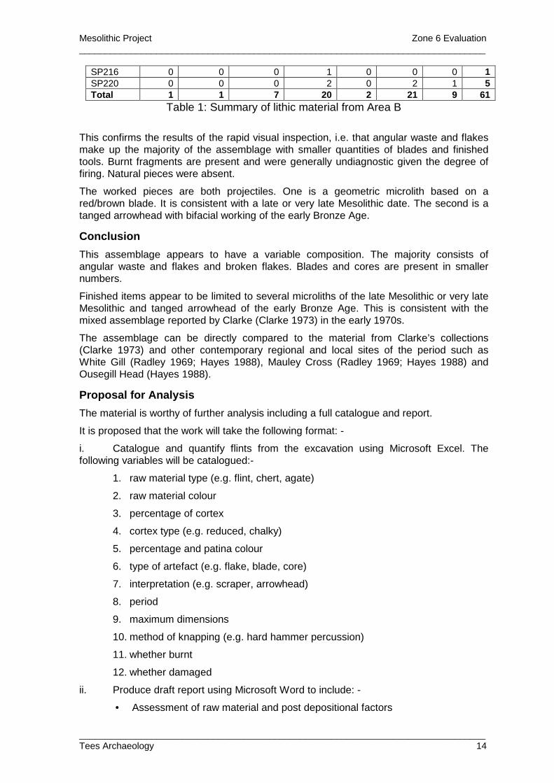
SP216 0 0 0 1 0 0 0 1 SP220 0 0 0 2 0 2 1 5 Total 1 1 7 20 2 21 9 61
Table 1: Summary of lithic material from Area B
This confirms the results of the rapid visual inspection, i.e. that angular waste and flakes make up the majority of the assemblage with smaller quantities of blades and finished tools. Burnt fragments are present and were generally undiagnostic given the degree of firing. Natural pieces were absent.
The worked pieces are both projectiles. One is a geometric microlith based on a red/brown blade. It is consistent with a late or very late Mesolithic date. The second is a tanged arrowhead with bifacial working of the early Bronze Age.
Conclusion
This assemblage appears to have a variable composition. The majority consists of angular waste and flakes and broken flakes. Blades and cores are present in smaller numbers.
Finished items appear to be limited to several microliths of the late Mesolithic or very late Mesolithic and tanged arrowhead of the early Bronze Age. This is consistent with the mixed assemblage reported by Clarke (Clarke 1973) in the early 1970s.
The assemblage can be directly compared to the material from Clarke’s collections (Clarke 1973) and other contemporary regional and local sites of the period such as White Gill (Radley 1969; Hayes 1988), Mauley Cross (Radley 1969; Hayes 1988) and Ousegill Head (Hayes 1988).
Proposal for Analysis
The material is worthy of further analysis including a full catalogue and report.
It is proposed that the work will take the following format: -
i. Catalogue and quantify flints from the excavation using Microsoft Excel. The following variables will be catalogued:-
1. raw material type (e.g. flint, chert, agate)
2. raw material colour
3. percentage of cortex
4. cortex type (e.g. reduced, chalky)
5. percentage and patina colour
6. type of artefact (e.g. flake, blade, core)
7. interpretation (e.g. scraper, arrowhead)
8. period
9. maximum dimensions
10. method of knapping (e.g. hard hammer percussion)
11. whether burnt
12. whether damaged
ii. Produce draft report using Microsoft Word to include: -
• Assessment of raw material and post depositional factors
Mesolithic Project Zone 6 Evaluation _______________________________________________________________________________
_______________________________________________________________________________ Tees Archaeology 15
• Comment on flint technology and reduction sequence
• Classification and assessment of tool types and usage
• Comment on chronologically diagnostic pieces with reference to site phasing, context data.
• Discussion of the potential of the assemblage for further work such as refitting experiments.
• Comparative analysis at the regional level to find other examples of similar sites and compare artefact morphology and technology. The assemblage needs to be set into its regional context through a detailed search for available published comparanda.
iii. Recommendations and captions for illustration
6. Environmental Samples
6.1 Assessment of plant remains from a sample from Peat Moss/Wetherhouse Moor, N. Yorkshire (site code MPW10)
Dr Allan Hall Department of Archaeology, University of York, King’s Manor, York YO1 7EP
A single sample of sediment from 2010 excavations at Peat Moss/Wetherhouse Moor was submitted by Tees Archaeology for an assessment of its content of macrofossil plant remains. The sample (numbered 1), from Context 208, the fill of a feature containing Mesolithic flint, comprised 7.5 kg (about 4 l.) of light orange-brown silty fine sand rich in angular iron-rich sandstone clasts to about 40 mm and with a component of about 10% by volume paler (light grey-brown) silty clay in clasts to about 30 mm and 10% modern roots. A 6 kg (~3 l.) subsample was initially disaggregated in water, then soaked in a dilute solution of sodium pyrophosphate for a few days to assist in dispersing the clay fraction. The resultant residue and washover (of less dense material) were dried in an oven at 30C. The former comprised about 1.2 l. of coarse sand with sandstone fragments, the latter about 0.2 l. of matted roots amongst which there were at most a very few specks (< 2 mm) of wood charcoal. The deposit is evidently not worth pursuing further as a source of archaeobotanical evidence.
6.2 Pollen analysis at Bransdale Ridge and West Bilsdale Moor. North York Moors project phase 3
Dr Jim Innes Department of Geography, Durham University, Science Laboratories, South Road, Durham, DH1 3LE
In support of the excavations on Bransdale Ridge and Wetherhouse Moor, two sediment profiles were assessed palynologically. Eight pollen levels were counted from Bransdale Ridge and sixteen levels from Meggy Mires, the closest area of deeper peat that could be found near the Wetherhouse Moor site. Almost a metre of peat was recovered from very close to the excavation area on Bransdale Ridge of which the basal fifteen centimetres appeared to be of pre-elm decline age. 260 centimetres were recovered from Meggy Mires on West Bilsdale Moor, of which the basal forty were clearly of pre-elm decline age. Pollen samples were prepared using standard techniques and at least 500 land pollen grains were counted at each level. The stratigraphy at each profile is shown on the pollen diagrams, but comprised mainly amorphous peat.
Mesolithic Project Zone 6 Evaluation _______________________________________________________________________________
_______________________________________________________________________________ Tees Archaeology 16
Results
Bransdale Ridge
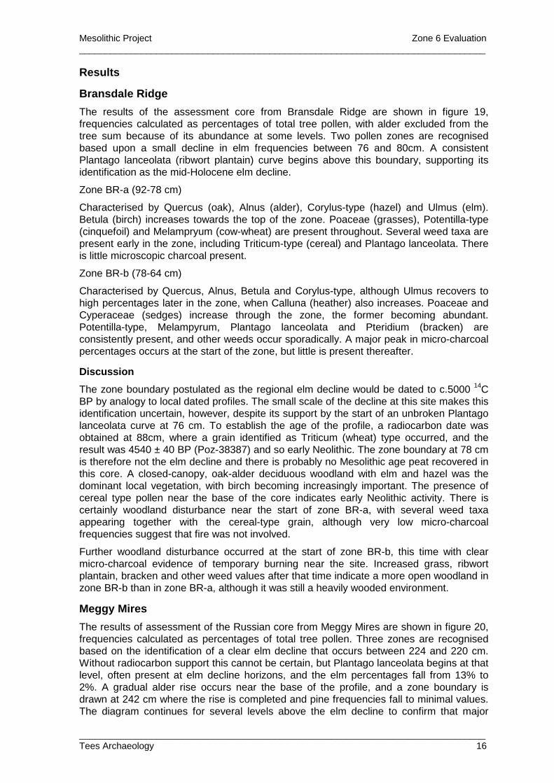
The results of the assessment core from Bransdale Ridge are shown in figure 19, frequencies calculated as percentages of total tree pollen, with alder excluded from the tree sum because of its abundance at some levels. Two pollen zones are recognised based upon a small decline in elm frequencies between 76 and 80cm. A consistent Plantago lanceolata (ribwort plantain) curve begins above this boundary, supporting its identification as the mid-Holocene elm decline.
Zone BR-a (92-78 cm)
Characterised by Quercus (oak), Alnus (alder), Corylus-type (hazel) and Ulmus (elm). Betula (birch) increases towards the top of the zone. Poaceae (grasses), Potentilla-type (cinquefoil) and Melampryum (cow-wheat) are present throughout. Several weed taxa are present early in the zone, including Triticum-type (cereal) and Plantago lanceolata. There is little microscopic charcoal present.
Zone BR-b (78-64 cm)
Characterised by Quercus, Alnus, Betula and Corylus-type, although Ulmus recovers to high percentages later in the zone, when Calluna (heather) also increases. Poaceae and Cyperaceae (sedges) increase through the zone, the former becoming abundant. Potentilla-type, Melampyrum, Plantago lanceolata and Pteridium (bracken) are consistently present, and other weeds occur sporadically. A major peak in micro-charcoal percentages occurs at the start of the zone, but little is present thereafter.
Discussion
The zone boundary postulated as the regional elm decline would be dated to c.5000 14C BP by analogy to local dated profiles. The small scale of the decline at this site makes this identification uncertain, however, despite its support by the start of an unbroken Plantago lanceolata curve at 76 cm. To establish the age of the profile, a radiocarbon date was obtained at 88cm, where a grain identified as Triticum (wheat) type occurred, and the result was 4540 ± 40 BP (Poz-38387) and so early Neolithic. The zone boundary at 78 cm is therefore not the elm decline and there is probably no Mesolithic age peat recovered in this core. A closed-canopy, oak-alder deciduous woodland with elm and hazel was the dominant local vegetation, with birch becoming increasingly important. The presence of cereal type pollen near the base of the core indicates early Neolithic activity. There is certainly woodland disturbance near the start of zone BR-a, with several weed taxa appearing together with the cereal-type grain, although very low micro-charcoal frequencies suggest that fire was not involved.
Further woodland disturbance occurred at the start of zone BR-b, this time with clear micro-charcoal evidence of temporary burning near the site. Increased grass, ribwort plantain, bracken and other weed values after that time indicate a more open woodland in zone BR-b than in zone BR-a, although it was still a heavily wooded environment.
Meggy Mires
The results of assessment of the Russian core from Meggy Mires are shown in figure 20, frequencies calculated as percentages of total tree pollen. Three zones are recognised based on the identification of a clear elm decline that occurs between 224 and 220 cm. Without radiocarbon support this cannot be certain, but Plantago lanceolata begins at that level, often present at elm decline horizons, and the elm percentages fall from 13% to 2%. A gradual alder rise occurs near the base of the profile, and a zone boundary is drawn at 242 cm where the rise is completed and pine frequencies fall to minimal values. The diagram continues for several levels above the elm decline to confirm that major
Mesolithic Project Zone 6 Evaluation _______________________________________________________________________________
_______________________________________________________________________________ Tees Archaeology 17
recovery of elm pollen percentages does not occur, and in the absence of any significant elm representation above 222 cm, that is accepted as the elm decline horizon.
Three pollen assemblage zones are recognised
Zone MM-a (260-242 cm)
Characterised by Pinus (pine), Ulmus, Quercus and Corylus-type, with Betula and low but increasing frequencies of Alnus. Calluna is significant and there are increases for Poaceae and Melampyrum at the end of the zone. Potentilla-type and Succisa (Devils-bit scabious) are common throughout. Micro-charcoal frequencies are high, peaking at the end of the zone.
Zone MM-b (242-222 cm)
Characterised by Alnus, Quercus and Ulmus, with a low Tilia (lime) curve. Poaceae, Cyperaceae and Potentilla-type are common. Micro-charcoal frequencies are low but consistent.
Zone MM-c (222 -192 cm)
Characterised by Alnus and Quercus, with Poaceae, Cyperaceae, Calluna and Corylus-type important. Plantago lanceolata and Fraxinus (ash) are consistently present.
Discussion
Zones MM-a and MM-b correspond to the Mesolithic period, with the alder rise (c. 6500 14C BP) and the elm decline (c. 5000 14C BP) relatively dated by analogy with other pollen profiles in the region. Zone MM-c will correlate with the early Neolithic. The presence of high pine values in MM-a conforms with regional macrofossil and pollen evidence of pine woods mixed with areas of oak-elm-hazel deciduous woodland. The forest appears to have been relatively closed canopy until a phase of woodland disturbance occurred that coincides with the alder rise. High micro-charcoal percentages occur together with peaks in frequency for Melampyrum, a herb recognised as being favoured by woodland burning, grasses and some weeds such as Chenopodiaceae (fat hen family). Other open-ground weeds Plantago lanceolata and Rumex (dock) occur as the alder rise is completed. This appears to be a local woodland fire that may well have assisted, or even prompted, the switch from pine to alder woods that was occurring at the time.
There is little evidence of further woodland disturbance during the next zone, when mid-Holocene deciduous oak-elm-alder-lime woods were established, until near the end when occasional grains of weeds including Melampyrum, Urtica (nettle) and Artemisia (mugwort) are recorded. Tree pollen frequencies are unaffected, however. High grass percentages may be associated with wetland grasses on the mire surface and margins rather than indicating open grassy areas away from the wetland. The sharp elm decline marks the transition to the Neolithic, with possible human activity indicated by Plantago lanceolata, although any impacts on the woodland must have been slight. Evidence for fire is poor, except for at and immediately after the elm decline. Little seems to have occurred during the Neolithic.
Summary
Both of these upland sites from the western North York Moors contain evidence of forest disturbance. Meggy Mires records both Late Mesolithic and Neolithic activity on West Bilsdale Moor, but only early Neolithic evidence occurs at Bransdale Ridge. Fire was more important on West Bilsdale Moor. Signs of woodland disturbance are present at both sites, and Bransdale Ridge contains a cereal-type pollen grain in the early Neolithic levels. Both sites have indications of woodland opening after the elm decline, although much more so at Bransdale Ridge. In both cases deciduous woodland characterises the
Mesolithic Project Zone 6 Evaluation _______________________________________________________________________________
_______________________________________________________________________________ Tees Archaeology 18
mid-Holocene vegetation. Meggy Mires is much the longer record and the early mid-Holocene switch from pine forest to deciduous woodland is recorded, dated elsewhere about 6500 14C BP, where it is accompanied by evidence of local forest burning. There is high potential that finer resolution investigation would reveal clearer pollen evidence of woodland disturbance at both sites. A new core is required from Bransdale Ridge to include Late Mesolithic age peat.
7. Discussion This year’s fieldwork at Bransdale has indicated that there are few concentrations of flint in this area and that the trenches excavated by Taylor in the 1970s may represent the focus of Mesolithic occupation here. The paucity of flint compared to Taylor’s collection does not however necessarily indicate a lack of potential for the rest of the site, as there is not necessarily a direct correlation between the presence of large quantities of flint and the occurrence of other indicators of occupation.
The presence of two possible cut features in Test Pits 2 and 3 suggest this area might be worth reinvestigation, avoiding Taylor’s trenches as these have been fully excavated. Assessment of the flint from test pit 2 indicates a limited chronological range within the late or very late Mesolithic. It is also not clear whether the layers of weathered stone found in test pits 1, 2 and 3 and in many of the shovel pits represent a natural or manmade construct, or whether they are naturally occurring but in some cases modified to accommodate areas of occupation.
It is recommended that further open area excavation should be carried out in Area C to try and identify further features within the mineral soil and weathered sandstone deposits. The difficulties of identifying these features due to the similarity of their fills to the surrounding deposits should be a consideration in planning any further work.
At Peat Moss / Wetherhouse Moor, the results were less encouraging. Again assessment of the flint indicates a limited chronological range within the late or very late Mesolithic, with some activity in the Early Bronze Age. The low number of flints found suggests that they occur in discrete concentrations, unfortunately immediately above the spring head basin, along a contour which is also the route used since the mid-20th century for vehicle access. The proliferation of tracks in this area may have destroyed much of the evidence for Mesolithic occupation. There is perhaps better potential for the survival of features in the enclosed land to the northwest of Green Spring which is currently under pasture, although it has probably been ploughed in the past. Unfortunately the single environmental sample from the site produced little in the way of charred plant remains and no material suitable for AMS dating.
As at Farndale in 2009, the presence of groups of weathered sandstone fragments overlying the natural bedrock at both sites, sometimes well defined, is difficult to explain as a natural phenomenon. These are undoubtedly derived from the sandstone bedrock, but in many places appear to form structures, though it is by no means clear that they have been modified in any way.
Mesolithic Project Zone 6 Evaluation _______________________________________________________________________________
_______________________________________________________________________________ Tees Archaeology 19
Bibliography British Geological Survey at http://www.bgs.ac.uk/
Clarke, D. 1973 ‘Peat Moss: A North Riding Mesolithic Workshop’ The Brigantian 2, 9-14
Daniels, R 2008 North East Yorkshire Mesolithic: Updated Project Design for Phase 2 Tees Archaeology report for English Heritage
Grahame, R with Hall, A, Innes, J, Rowe, P and Vyner, B 2008 Archaeological Evaluation: Upleatham, Redcar and Cleveland and Goldsborough, North Yorkshire Tees Archaeology report TA08/10 for English Heritage OASIS ID 52502
Grahame, R with Hall, A, Innes, J, and Rowe, P 2010 Archaeological Evaluation: Farndale, North Yorkshire Tees Archaeology report TA10/06 for English Heritage OASIS ID 75003
Hayes, R. 1988 North-East Yorkshire Studies: Archaeological Papers Roman Antiquities Section, Yorkshire Archaeological Society
Jacobi, R. 1978 Northern England in the eighth millennium bc: an essay In P. A. Mellars (Ed) 1978 The Early Postglacial Settlement of Northern Europe 295-332
Ordnance Survey First Edition map of 1857, 6 inches to 1 mile = 1:10560, Yorkshire Sheets 57 and 58
Radley, J. 1969 ‘The Mesolithic Period in North-East Yorkshire’ Yorkshire Archaeological Journal 42, 314-327
Waughman, M. 2006 North East Yorkshire Mesolithic: Phase 1 report Tees Archaeology report TA/06/11 for English Heritage