Embed Size (px)
Citation preview
1
MINISTRY OF LANDS, HOUSING AND URBAN DEVELOPMENT
UGANDA
SESSION: GOVERNANCE AND THE LAW: LESSONS
FOR THE POLICY.
PAPER: IMPROVING LAND ADMINISTRATION FOR
GOOD GOVERNANCE: WHAT UGANDA CAN DO TO
ACHIEVE COMPLETE COVERAGE.
BY
MINISTER OF LANDS, HOUSING AND URBAN
DEVELOPMENT
22ND MARCH, 2017
2
1.0 Introduction
Land in Uganda like other agrarian societies is the only primary means of survival; to
generate a livelihood, accumulate wealth and transfer it between generations. It is
probably the most invaluable asset for the citizens of Uganda. With more than 80% of
the population on rural land directly deriving livelihoods through subsistence agriculture,
land access, ownership and use are core to economic, social and environmental drivers
of land reforms in Uganda.
It is against the central role of land and its resources in Uganda’s economic
development agenda that successive political regimes sought to reform land tenure
relations. Since 1995 fundamental legal, policy, and structural institutional changes
were made to streamline paradigm shift in land management. Article 237 of the 1995
Constitution provided a landmark change, and directly bestowed the ultimate ownership
of land to the people of Uganda; vested in them in accordance with freehold, leasehold,
mailo land and customary land tenure system. The government obtained the residual
authority to control land use in the public interest; and may “under laws made by
parliament and policies made from time to time regulate the use of land.”
Good governance in land administration is not a new issue, and is as important in the
developing world as it is in developed countries. Land is increasingly becoming an
important governance issue. It is recognized that undivided political commitment is
required to handle land governance matters. Good land Governance is critical in
managing the growing pressure on land as a result of population increase which has led
to an increase in land conflicts and disputes. According to World Bank, Uganda
measures approximately 199,810 square kilometers of which 15% is forest area and
15% covered by water which leaves little area for habitation and agricultural practices.
The remaining area of habitation and agricultural practices has been competed for by
the increasing population of Uganda which increased from 9.5 million in 1969 to 24.2
million in 2002 and to 34.9 million in 2014 as per the last population census conducted.
3
2.0 Legal and Institutional Framework for improving Land
Administration for Good Governance
a) Legal Framework
In 1995, the Uganda government embarked on land reform starting with the
Constitutional provisions. Since 1995, many policies and laws have been promulgated
to streamline land governance. In addition, financial, human and infrastructure
resources have been put in place to enhance the process. All these efforts are
attributed to the recognition that secure land rights and effective land governance are
key stimulants to social and economic development for Uganda.
Uganda undertook a series of ambitious legal and policy reforms with regard to property
rights and resource governance, towards a fundamental reform in rights and tenure
management of land.
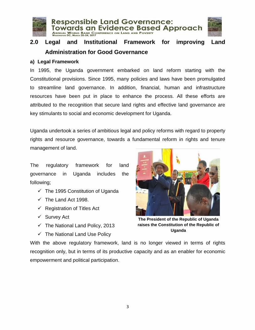
The regulatory framework for land
governance in Uganda includes the
following;
The 1995 Constitution of Uganda
The Land Act 1998.
Registration of Titles Act
Survey Act
The National Land Policy, 2013
The National Land Use Policy
With the above regulatory framework, land is no longer viewed in terms of rights
recognition only, but in terms of its productive capacity and as an enabler for economic
empowerment and political participation.
The President of the Republic of Uganda
raises the Constitution of the Republic of
Uganda
4
b) Institutional Framework
In 1993, the Odoki Constitutional Commission Report, set the framework for extensive
reforms contained in the 1995 Constitution, which introduced radical changes in the
relationships between the State and the land and vested the radical title in the citizens
of Uganda and in accordance with specific land tenure systems enumerated therein
(Mailo, freehold, leasehold and customary). This reversed the provisions of the Land
Reform Decree 1975 and accepted a multiple tenure system. A new system of land
administration was also established as contained in the 1995 Constitution and Land Act.
The institutional structures introduced included:
Area Land Committees
The 1998 Land Act under section 64 – 67 provides for the establishment an Area Land
Committee at each sub-county or division level, qualifications of the members,
remuneration and meetings of the committee. The committee assists the District Land
Board in an advisory capacity on matters relating to land, including ascertaining
rights in land by adjudicating upon and demarcating land.
In 2004, the Land (Amendment) Act was enacted to streamline the administrative
structures of the land administration system. It attempted to level the implementation of
administrative reforms by lifting Area land committees operations in land management
to a level where service delivery was feasible.
District Land Boards
The Constitution established that a District Land Board will be established at each
District. In performing their duties, DLBs must follow the provisions of the Constitution,
Land Act and the land Regulations, on the ownership and management of land. The
national and district polices and the customs or guiding principles of an area have to be
born in mind. Their duties include:
Hold and allocate land in the district that does not belong to any person or
authority,
5
Facilitate the registration and transfer of interests in land,
Cause surveys, plans, maps, drawings and estimates to be made,
Compile and maintain a list of compensations payable in respect to crops,
building of a non-permanent nature after consulting the technical officers of the
district,
Review every year the list of compensation rates, referred to in paragraph (e) of
subsection (1).
Physical Planning Committees
The Physical Planning Act 2010 declared the whole Country a planning area and
repealed the Town and Country Planning Act Cap 246. The Act provides for
establishment of the National Physical Planning Board (NPPB), whose functions among
others include:-
(i). Advising Government on matters relating to physical planning;
(ii). Hear and determine appeals lodged by persons or Local Governments
aggrieved by the decision of any Physical Planning Committee (PPCs);
(iii). To determine and resolve physical planning matters referred to it by
PPCs;
(iv). Approve regional, urban or district physical development plans and
recommend to the Minister national plans for approval.
The Act establishes Physical Planning Committees (PPCs) at a district level,
urban centre level in city, municipality, town council and a division and at the sub-
county level.
District Land Office
The office provides technical services to the district administration and the District Land
Board. The office comprises: A Land Officer, a Physical Planner and a District Staff
Surveyor.
6
Ministry Zonal Offices (MZOs)
Although the Land Act provides for the establishment of functional Land Offices in every
district, MLHUD realised that there are very few districts with fully fledged Land Offices
that are able to provide land services. In a bid to address this challenge, the Ministry
has decided to establish twenty-one Zonal Land Offices in selected cadastral zones.
The setting up of the MZOs has been phased as follows:-
(i). Seven (7) MZOs have been set up in Kampala, Wakiso, Jinja, Masaka, Mukono,
Mbarara and Lira; and the MLHUD Headquarters to serve the rest of the
country;
(ii). The next six (6) MZOs are scheduled to be set up in Mbale, Gulu, Arua, Masindi,
Kibaale and Kabarole;
(iii). The last eight (8) MZOs are Tororo, Soroti, Moroto, Kabale, Luwero, Rukungiri,
Mpigi and Mityana.
The MZOs are meant to be one-stop centre for excellence for provision of land services
with modern equipment and all the personnel in place. An MZO is meant to serve the
districts within its area of jurisdiction. A district which is unable to recruit the relevant
staff for its Land Office can therefore access such services from the MZO where it is
situated.
Uganda Land Commission
The Uganda Land Commission (ULC) was established by the 1995 Constitution of the
Republic of Uganda. The Constitution provides for the setting up of Uganda Land
Commission as an autonomous body; and at the commencement of the financial year
2006/07, Ministry of Finance Planning and Economic Development created a vote for
Uganda Land Commission.
Arising out of the provisions of the Constitution, Parliament enacted laws that are
contained in the 1998 Land Act, which regulate the operation of the Uganda Land
Commission. The functions of the Uganda Land Commission are not decentralized but
7
the Commission may liaise with the independent District Land Boards (DLB) with regard
to Government land in the Districts.
The Commission has the following powers in the performance of its functions under the
Constitution and the Land Act and in conformity with the Government Policy in relation
to land matters;
acquire by purchase, exchange or otherwise hold land rights, easements or
interests in land;
erect, alter, enlarge, improve, or demolish any building or other erection on any
land held by it;
sell, lease or otherwise deal with the land held by it;
do such other things as may be necessary for or incidental to the exercise of
those powers and the performance of those functions.
Institutional Framework for Land Tribunals
There are currently 5 different land disputes resolution mechanisms, 3 of which are
basically quasi-judicial organs set up under the 1998 land Act in an effort to bring land
services closer to and make them more acceptable for the users. These are – traditional
institutions (clan leaders and elders), Local Council courts, Magistrates courts,
Mediators and Land Tribunals. Land disputes (conflicts) resolutions mechanism still
remains a sticky matter despite the provision for establishment of Land Tribunals in both
the 1995 Constitution and the Land Act 1998.
In 2004, the Land (Amendment) Act was enacted to streamline the administrative
structures of the land administration system. It attempted to level the implementation of
administrative reforms in dispute resolution by clarifying jurisdiction of the local council
courts and land tribunals. The jurisdiction of Land Tribunals was to determine disputes
relating to the grant, lease, repossession, transfer or acquisition of land by individuals,
and the determination of any disputes relating to the amount of compensation to be paid
for land compulsorily acquired.
8
The National Land Policy provides for the need for legal recognition of the dual
operation of both customary and statutory systems in land rights administration, land
dispute resolution and land management by empowering customary authorities to
undertake these functions. The Ministry responsible for lands will continue to perform
only residual roles including policy formulation and implementation, resource
mobilization, standard setting, quality control, and monitoring and evaluation. Some of
the land administration and management functions are delegated to district local
governments.
However, the institutional framework for Land Governance in Uganda operates within
two parallel systems that work hand in hand comprising;
a) The traditional customary/informal systems governed by customs and norms of
given communities and
b) The centralized statutory/formal (state) system governed by written law as
discussed above.
9
3.0 Interventions being implemented to achieve universal coverage
in Uganda
The interventions undertaken by the Ministry of Lands, Housing and Urban
Development are guided by the Policy and Legal Frameworks developed; and the Land
Sector Strategic Plans (I and II).
Decentralization of Lands, Housing and Urban Development Services
Limited access to land registration services has been a key bottleneck to universal
coverage. When land offices are far away from communities who are poor, then
achieving complete coverage even for a few who are able to afford becomes a problem.
Having identified this bottleneck, the Government enacted the 1998 Land Act that
decentralized land management and dispute settlement mechanism. It requires the
creation of new institutions for land management/administration and land dispute
resolution. These have been designed to shift the focus of land management to the
local level, and provide for effective community involvement in land management
decisions. This was done through creation of District Land Offices and appointment of
Land Management Institutions including: the District Land Boards, Area Land
Committees, Physical Planning Committees and Recorders among others.
The Ministry through a World Bank supported project has embarked on decentralizing
land offices (Ministry Zonal Offices) that are well computerized with all land related
services as a one stop centre. The country was divided into 21 zones leading to 21
Ministry Zonal Offices. At these Offices one is able to:
a) Conduct a search/verify property
b) Make land transfer
c) Register land title
d) Process deed plans
e) Process a Mortgage
10
f) Acquire Physical Planning Services
g) Acquire Valuation services
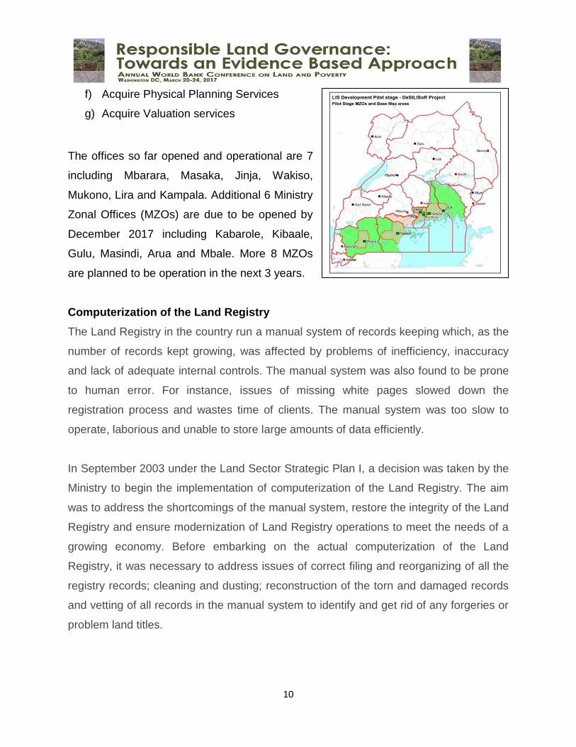
The offices so far opened and operational are 7
including Mbarara, Masaka, Jinja, Wakiso,
Mukono, Lira and Kampala. Additional 6 Ministry
Zonal Offices (MZOs) are due to be opened by
December 2017 including Kabarole, Kibaale,
Gulu, Masindi, Arua and Mbale. More 8 MZOs
are planned to be operation in the next 3 years.
Computerization of the Land Registry
The Land Registry in the country run a manual system of records keeping which, as the
number of records kept growing, was affected by problems of inefficiency, inaccuracy
and lack of adequate internal controls. The manual system was also found to be prone
to human error. For instance, issues of missing white pages slowed down the
registration process and wastes time of clients. The manual system was too slow to
operate, laborious and unable to store large amounts of data efficiently.
In September 2003 under the Land Sector Strategic Plan I, a decision was taken by the
Ministry to begin the implementation of computerization of the Land Registry. The aim
was to address the shortcomings of the manual system, restore the integrity of the Land
Registry and ensure modernization of Land Registry operations to meet the needs of a
growing economy. Before embarking on the actual computerization of the Land
Registry, it was necessary to address issues of correct filing and reorganizing of all the
registry records; cleaning and dusting; reconstruction of the torn and damaged records
and vetting of all records in the manual system to identify and get rid of any forgeries or
problem land titles.
11
The Ministry completed the basic computerization of land title records. It involved
capturing of the existing records in digital format into a computer database and,
indexing of the records to facilitate searching and retrieval on the data in digital form.
This computerization involved data entry, indexing and scanning of Mailo land records
for the Kampala, Wakiso and Mpigi Districts to ease search and retrieval of the land
records in digital format. By May, 2009 all the Mailo land record data for the Kibuga,
Kyadondo, Busiro, Mawokota, Gomba and Butambala have been entered in the
Computer database.
This intervention on basic computerization enabled the Land Registry to generate
computer related information on ownership of plots as well as information on Mailo land
transactions such as changes in property ownership and encumbrances thereon for the
Districts of Kampala, Wakiso and Mpigi. As a result of the basic computerization, there
was substantial improvement in the delivery of land services. It used to take 3 to 5 years
to register transaction. Now with the basic computerization and other initiatives, it takes
3 to 4 weeks depending on the type of transaction lodged.
In order to carry out comprehensive computerization, the Government with support from
the World Bank, secured some funding through the Private Sector Foundation Uganda
(PSFU) towards the implementation of the Land Sector Strategic Plan I. This led to the
development of the comprehensive National Land Information System (LIS). The LIS is
not only aimed at mere comprehensive computerization but is also aimed at supporting
reforms to ensure an efficient and effective Land Administration System. This LIS was
piloted in 9 sites comprised of 6 Ministry Zonal Offices including: Mbarara, Masaka,
Jinja, Kampala, Wakiso and Mukono; the National Land Information Centre; Surveys
and Mapping Department; and Ministry Headquarters to support the rest of the country.
Currently, the World Bank through International Development Agency is supporting the
Government of Uganda to implement a Competitive and Enterprise Development
Project. It is under this component that the Ministry is planning to construct up to nine
12
zonal land offices in Kabale, Luwero, Mityana, Mpigi, Moroto, Rukungiri, Soroti, Mukono
and Tororo, which, in addition to the 13 already constructed/renovated offices, will form
a national network of zonal offices to host the computerized Land Information System
(LIS); and enhance the design of the current LIS to support not only land registration but
also land valuation and physical development planning functions, and rolling it out from
the six pilot zonal land offices to all 21 zonal land offices in the country, including the
conversion of the associated land records among other activities.
Since the operations, Uganda has registered an increase in titles from 478,8371 in 2013
to 503,206 in December 2016.
Systematic Land Adjudication and Certification
The other issue curtailing complete coverage is the cost of surveying as a prerequisite
of registration of land titles. In Uganda government privatized surveying services. Many
people are poor and cannot afford cost of surveying, the reason why coverage is so low.
To address this, the Ministry through development partners is implementing a program
for systematic demarcation (Systematic Land Adjudication and Certification) with
support from the World Bank
It is generally accepted globally that registration of interests in land and recognition of
such interests by the state increases security of tenure and hence promotes investment
in land. The standard processes leading to registration of land include adjudication of
rights, demarcation of rights on ground, cadastral survey to document the boundaries
and registration to certify the rights holders and interested parties. Systematic
adjudication is where land rights, rights holders and interested parties are ascertained in
a methodical and systematic manner, parcel by parcel for a large area. Traditionally,
Systematic adjudication is initiated and substantially funded by government and may
compel all land owners to participate. However, of recent, participation in systematic
1 Figures exclude Title records from the districts of Rukungiri, Kabale, Luwero, Kabarole and Mityana
13
adjudication has been left as an option for the land owners to decide after massive
sensitization.
The need for systematic Adjudication in the country was realized as early as 1950s
when the first attempts were made in Ankole and Bugisu. These efforts were re-
introduced in 2001 under the Land Sector Strategic Plan I (2001-11) and the rollout
activities will be further expanded under LSSP II (2013-23). The proceeding sections
outline these past efforts and provide a synthesis of the lessons learnt which have
implications for the current systematic adjudication and certification Program. The
colonial government attempted to pilot systematic adjudication through nationwide
consultations. At that time, the districts of Kigezi and Ankole accepted the program;
these were later joined by the then Bugisu (now Mbale) district. The first pilot scheme
was in Nyakeina Parish in the then Rujumbura County in Kigezi (now Rukungiri District)
in 1958. In Ankole district, the scheme was piloted in Sheema County (Bushenyi district)
specifically in Shuuku and Kagango sub- counties in 1959. It was extended to Bugisu
district in 1960 in Bubirabi County.
Although the exercise was a success to a certain extent, it was affected by limited
technical and institutional capacity as well as limited awareness. Kamusiime et al
(2005)2 reported from previous reports, that because of capacity problems, some plots
were adjudicated in duplicate, others not at all, and with names all mixed up. It was
reported that less than 30% of the applicants finally collected their final certificates and
this was attributed to the limited knowledge on the importance of a certificate of title and
perhaps the limited economic utility of the titles at the time.
Following the land reform under the 1995 constitution, a 10-year Land Sector Strategic
plan (LSSP 2001-2011) was designed to provide the operational institutional and
financial framework for the implementation of sector wide reforms and land
2Kamusiime H, Rugadya M and Obaikol E (2005): Capital Creation, Transfer or Reversal; Assessing the Outcomes of Systematic Demarcation of Customary Tenure in Uganda.
14
management including the implementation of the Land Act (1998). One of the key
activities implemented under LSSP I was the piloting of Systematic Demarcation (SD) of
land, which addressed LSSP 1 objectives 3 and 4 namely;
Objective 3: “improving the livelihoods of poor people through a more
equitable distribution of land access and ownership, and greater tenure
security for vulnerable groups.” and,
Objective 4: “increasing availability, accessibility, affordability, and use of
land information for planning and implementing development programs.”
The overall aim of Systematic Demarcation was to enhance security of tenure,
ownership and management of land with the ultimate goal of uplifting the livelihoods of
the poor and vulnerable groups in Uganda.
The pilot was carried out in phases; phase one covered 2parishes of Rukarango in
Ntungamo District, and Aminit3, in Soroti District while the second phase covered the 3
parishes of Bulowooza, in Iganga District; Bumbobi and Bumasikye in Mbale District
and Bwanswa in Kibaale District. While piloting systematic demarcation, the issues of
cost and affordability by the rural poor, integration with existing scattered parcels of
registered land, data quality, technology requirements and gender were among the
major consideration.
Currently with support from the World Bank, the Ministry is rolling out the systematic
demarcation program in the eastern, Western and southern part of the country. It is
expected that approximately 1,000,000 titles will be issued.
Issuance of Certificates of Customary Ownership and Occupancy
Given that approximately 80% of the land in Uganda is held customarily and highly
unregistered, the Government of Uganda enacted the 1998 Land Act that provided for
3 The exercise in Amunit was never completed as the community turned violent.
15
issuance of Certificates of Customary Ownership and Certificates of Occupancy. This
program is pro-poor and looks at protection of women, vulnerable groups and families.
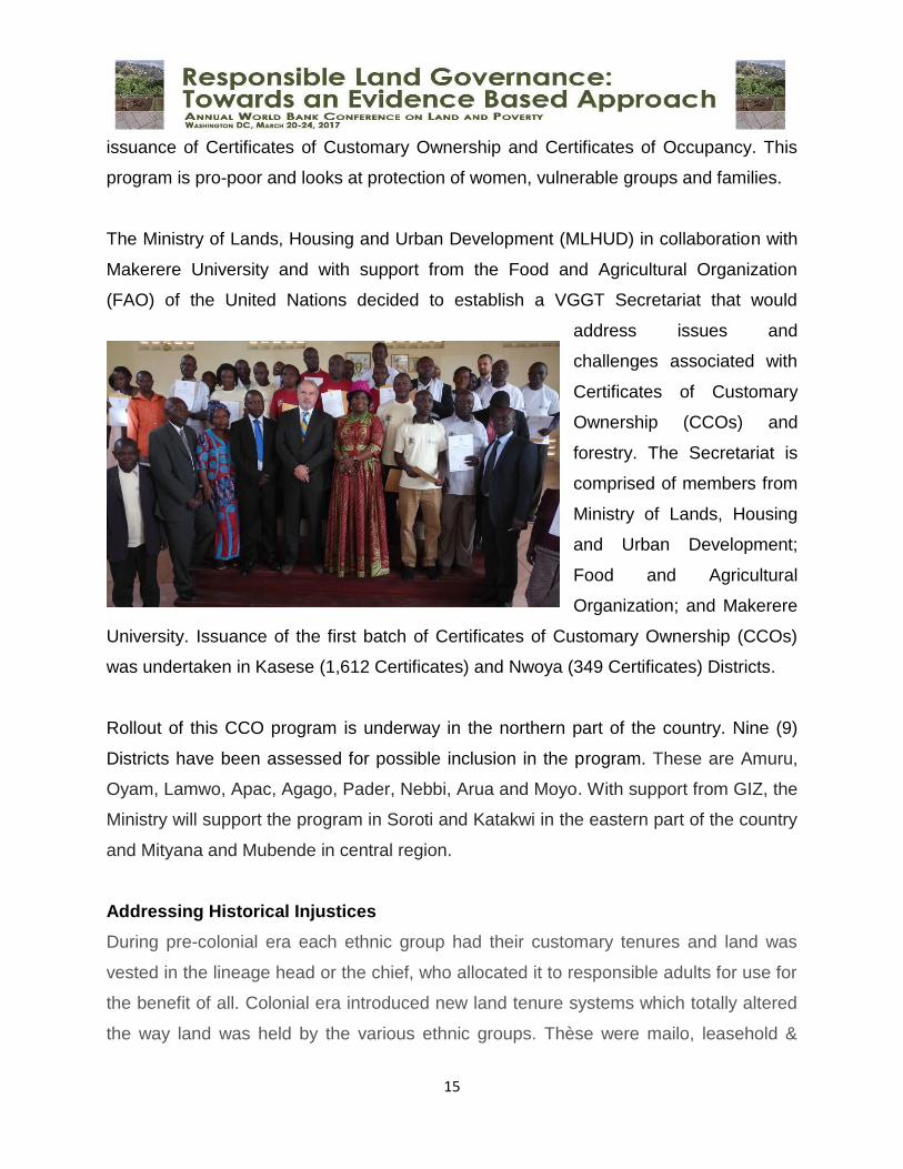
The Ministry of Lands, Housing and Urban Development (MLHUD) in collaboration with
Makerere University and with support from the Food and Agricultural Organization
(FAO) of the United Nations decided to establish a VGGT Secretariat that would
address issues and
challenges associated with
Certificates of Customary
Ownership (CCOs) and
forestry. The Secretariat is
comprised of members from
Ministry of Lands, Housing
and Urban Development;
Food and Agricultural
Organization; and Makerere
University. Issuance of the first batch of Certificates of Customary Ownership (CCOs)
was undertaken in Kasese (1,612 Certificates) and Nwoya (349 Certificates) Districts.
Rollout of this CCO program is underway in the northern part of the country. Nine (9)
Districts have been assessed for possible inclusion in the program. These are Amuru,
Oyam, Lamwo, Apac, Agago, Pader, Nebbi, Arua and Moyo. With support from GIZ, the
Ministry will support the program in Soroti and Katakwi in the eastern part of the country
and Mityana and Mubende in central region.
Addressing Historical Injustices
During pre-colonial era each ethnic group had their customary tenures and land was
vested in the lineage head or the chief, who allocated it to responsible adults for use for
the benefit of all. Colonial era introduced new land tenure systems which totally altered
the way land was held by the various ethnic groups. Thèse were mailo, leasehold &
16
freehold ignoring customary tenure system. To formalize these changes, the British
signed 3 native agreements with the kingdoms of Buganda, Ankole and Toro in 1900,
1900 & 1901 respectively. These agreements outlined terms for administering land in
these areas among other things. Majority of the original controllers of the land in the
customary system were left out in the agreements and this led to disputes and
uprisings.
There was no native agreement with Bunyoro kingdom, basically because the king and
his chiefs refused to relinquish their sovereignty and be governed by the colonial
masters. It was then forcefully overtaken and the land vested in her Majesty’s Gov’t and
annexed to Buganda and allocated out leaving indigenous people tenants at will on land
which formerly belonged to them. In all cases pre-existing private interests of small
holders, mainly land use rights were not legally recognized, the multi-layered structure
of rights persisted and has become a defining characteristic of the complexity of land
relations in Uganda.
The Land Fund intends to address these issues of historical injustices and colonial
legacies which resulted into multiple rights and interests over the same piece of land
and dispossession and loss of ancestral land by some communities. Implementation of
the Land Fund will also help in the fight against poverty given the diverse targeted
beneficiaries and its linkages to other Gov’t strategic objectives.
In the absence of Land Fund Regulations, the Commission under Government Project:
Support to Uganda Land Commission, has been acquiring registered land from land
owners on willing seller – willing buyer basis as an interim solution to stop illegal
evictions of the bonafide occupants. Since inception of the project in FY 2002/03 to-
date, the Commission has acquired 62,279.74 hectares of land with bonafide
occupants. Full implementation of the Land fund will restore land tenure security of
occupants. Evidence from all over the world indicates that households will not make
land-related investments on land to which they do not have secure property rights (not
17
necessarily full ownership). Systematic land regularization will have a significant
investment benefit, such as promotion of use of land as collateral.
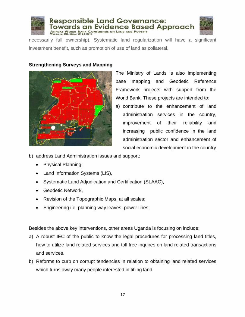
Strengthening Surveys and Mapping
The Ministry of Lands is also implementing
base mapping and Geodetic Reference
Framework projects with support from the
World Bank. These projects are intended to:
a) contribute to the enhancement of land
administration services in the country,
improvement of their reliability and
increasing public confidence in the land
administration sector and enhancement of
social economic development in the country
b) address Land Administration issues and support:
Physical Planning;
Land Information Systems (LIS),
Systematic Land Adjudication and Certification (SLAAC),
Geodetic Network,
Revision of the Topographic Maps, at all scales;
Engineering i.e. planning way leaves, power lines;
Besides the above key interventions, other areas Uganda is focusing on include:
a) A robust IEC of the public to know the legal procedures for processing land titles,
how to utilize land related services and toll free inquires on land related transactions
and services.
b) Reforms to curb on corrupt tendencies in relation to obtaining land related services
which turns away many people interested in titling land.
18
c) Developing a comprehensive regulation to guide private surveyors on the charges
related to surveying which is a major impediment to processing titles.
d) Working toward comprehensive online land transactions services.
e) Engagement of Key local opinion leaders and traditional leaders who are custodians
of managing norms and customs of registering customary land tenure system which
constitute over 70% of the land tenure system in Uganda. Without their cooperation
and involvement, many people would not register their land in those communities.
The Ministry has therefore created a framework of educating them, sensitizing them
and codifying their norms to facilitate land registration.
f) Mobilizing, educating and sensitizing the political class and the elite on the various
programs to facilitate them with knowledge in order to enable them support the
programs and mobilize communities to embrace land registration as an economic
venture. This is because land in Uganda is very emotive; some people attach more
cultural prestige to its value more than the economic value. Therefore engaging
political leaders who can mobilize and sensitize the people is key.
g) The Ministry is in the process of reviewing and amending of land related laws that
may be outdated or conflicting with the Constitution and the Land Act
h) Mechanisms to address land disputes in a speedy manner including strengthening
the legal framework, institutional capacity and procedural linkages between land
administration institutions and the Judiciary and also by establishing a clear
hierarchy for dispute resolution to guarantee fairness, promptness, finality and
authoritativeness of decisions over tenure rights.
i) Establishment of Client Charter that provides for the procedures and fees of land
registration.
4.0 Challenges
Staff Capacity- There are stiff staffing problems facing offices in which land
records are kept. In most offices it is either that the number of staff recruited is
less than the required number. This has led to too much pressure and backlog of
19
work. The end result is that the staff becomes inefficient and the whole process
becomes slow.
Mind-set of the managers of the system, the clientele to be served, MDAs and
Development Partners
Inadequate sensitization of stakeholders on land related matters and adoption of
new systems for land management
Insufficient budgetary provisions for support of land administration service
delivery including maintenance and sustenance of the installed system
Infrastructure challenges including intermittent power supply in some places and
limited internet connectivity
5.0 Mitigating challenges
Improving efficiency; Procedures to register property transactions should be short
and simple. The fewer steps there are, the less opportunity for informal
payments.
Complete effective land registration system; Reliable land information system has
great advantage for the effective and efficient land administration.
Public Involvement and sensitization; Public involvement is essential in any
innovation if it is to succeed as it's the needs of the users of the proposed
innovation that is focused on. Public involvement acts an educator to the masses
and an evaluation for the system that is being developed or used. It also makes
the community feel they are important and so they will work together in order to
ensure that any proposed development takes place. It also serves to make an
innovation better since they could be having solutions to the problems. However,
there is need for continuous sensitization campaigns to increase the level of
awareness and appreciation of land related matters and reforms.
Improvement of budgetary provisions to support land administration activities.
Enhancing institutional and organizational capacity; Institutional and organizational
capacity plays a vital role in land administration practices.
20
Applying continuous monitoring and evaluation process: Any activity needs continuous
monitoring and evaluation process from its initial stage to its completion period.
There is need to strengthen continuous monitoring and evaluation process of the
activities related to land administration.
Complete decentralization of Local Land Record Offices; Government passed the
Local Government Act of 1997, which provides the legal basis for
decentralization and the devolution of functions, powers and services from the
centre to local governments. This will increase transparency and governance of
land information which will reduce on bureaucracies involved. It will also
contribute greatly towards getting people interested in the system since services
will be brought nearer to the public.
Staff training, development and recruitment; There is need for continuous training
of staff to manage and administer land record practices in the various land
offices. They should be trained at both a lower (technicians) and higher
(managerial) level since systems/technologies are dynamic and change at all
times and levels. There is a need for people involved in land information
management to have broader knowledge on land which will enable easy
exchange and interaction of information. The staff can continually be trained
through seminars, conferences, workshops, short and long courses. This will
enable staff to be competent and well informed. There is also need to recruit the
required number of staff in order to enable staff work without pressure resulting
from much backlog.
Strong institution linkages should be embraced to avoid data duplication and
overlap. This will help streamline data and information in preparation for a land
information system. Institution linkage will enable data sharing amongst
institutions that use the same data. This linkage will enable institutions to not only
generate information they can use internally, but generate information that can
be used externally by other institutions.
21
Women Land Rights
Ugandan women supply 70-80% of agricultural labour yet only 30% of women control
the proceeds from land. Formally, women own only 16% of land, while informal
ownership is about 15% and conjugal ownership is estimated at 3% and gender
disparities in ownership have been documented for all tenure types.
The current systems of land ownership have further complicated women's access and
ownership of land and its use for economic production. The NDP attributes the unequal
ownership of land housing to disparities in incomes of men and women, with men
owning most of the houses except for family houses classified as matrimonial property
as decreed by the Land Act 1998 (Cap. 277) to be jointly owned by spouses. It also
acknowledges women's powerlessness over land use and decision-making due to lack
of ownership as well as low levels of awareness over rights accorded in law.
Ugandan land legislation does not, at the outset, appear to discriminate against women
as it is largely gender neutral and provides the same ownership conditions for men and
women. This is mainly attributed to conducive provisions in the Constitution (1995), the
Land Act (1998), the Succession Act and the National Land Policy that are gender
sensitive and provide the overall legal framework for the pursuance of women’s rights.
Efforts to strengthen women’s land rights include: joint registration of land rights in the
name of men and women (or women only); information and legal aid campaigns to
inform women of their land rights; and measures to protect against disinheritance
among others.
6.0 Conclusion
Although good governance in land administration is not a new issue, it is importantly an
issue that will always remain of concern to governments, donors, NGOs and Civil
Society. It is not a subject that will become unfashionable or redundant.
22
The importance of land administration for good governance is highly relevant to the
agendas of all countries. Governments with a record of transparency, accountability and
responsiveness are far more likely to attract investment, provide high-quality public
services and manage resources cost-effectively.
On behalf of the Government of Uganda, I would like to thank the World Bank, UN
Habitat, EU, GIZ, FAO and Ford Foundation and many others, for the collaborative
support they have extended to us which is aimed at improving land administration and
management in the country.