Embed Size (px)
Citation preview
Wayne Belzer
Environmental Engineer
International Boundary and Water Commission, United States Section
Lower Rio Grande/Río Bravo Water Quality Initiative
(LRGWQI)
**Treaty of Guadalupe-Hidalgo of 1848 established the
International Boundary between the U.S. and Mexico
*Convention of 1889 established the IBC to resolve boundary disputes.
*Convention of 1906 provided for distribution of surface waters between the two countries.
*Treaty of 1944 changed the name to IBWC and provided the mission to allocate waters, build dams, flood control, address sanitation.
*Treaty of 1970 resolved boundary differences for maintaining the Rio Grande and Colorado River boundaries.
*Commission consists of a Unites States and a Mexican Section.
*
*IBWC has been sampling water quality for:
*1977: Joint Report of Engineers
*Rio Grande Water Bulletin
*Special projects under Minutes (i.e. Toxic Substances studies - IBWC Minute 289 and Laredo/NL study - Minute 297)
*In 1998 IBWC Rio Grande sampling efforts were merged with efforts by the State of Texas
*Samples for use by the US for Clean Water Act assessment requirements, permitting, and identification of water quality issues.
*
*Conventionals:
*Field – pH, DO, temp, sp. conductance
*Conventional – salts, nutrients
*Microbiological (Fecal Coliform, E. Coli)
*Other Parameters:
*Metals in water and sediment
*Organics in water and sediment
*Aquatic habitat assessment
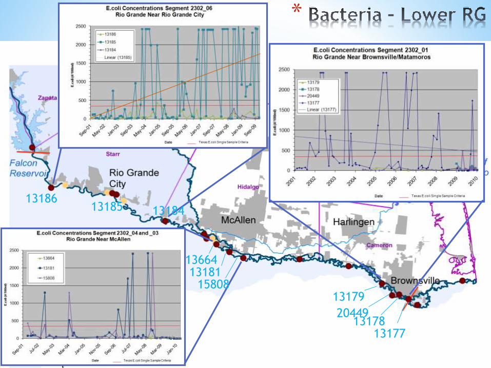
13179
2044913178
13177
1366413181
15808
13185 1318413186
*
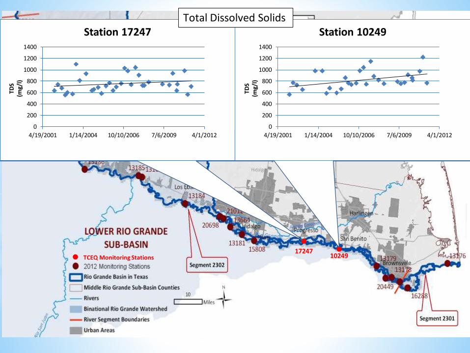
1024917247
TCEQ Monitoring Stations
0
200
400
600
800
1000
1200
1400
4/19/2001 1/14/2004 10/10/2006 7/6/2009 4/1/2012
Station 17247
TDS
(mg/
l)
0
200
400
600
800
1000
1200
1400
4/19/2001 1/14/2004 10/10/2006 7/6/2009 4/1/2012
Station 10249
TDS
(mg/
l)
Total Dissolved Solids
*
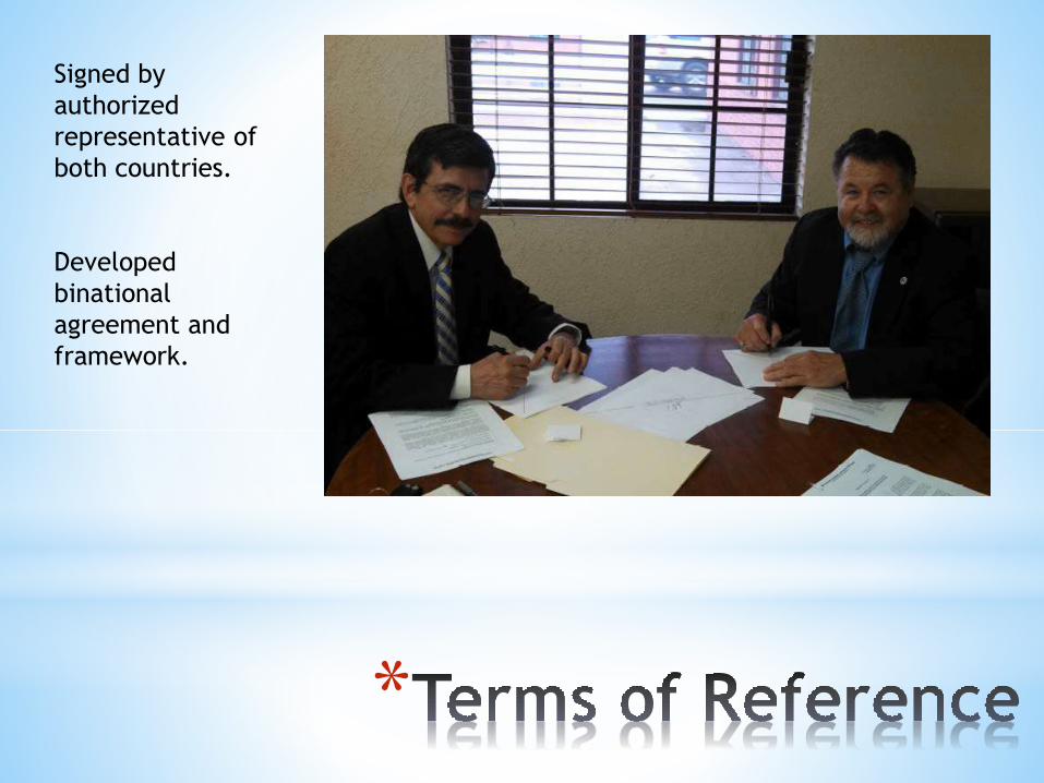
Signed by
authorized
representative of
both countries.
Developed
binational
agreement and
framework.
*
*a. Address current and future water quality issues of the Lower Rio Bravo/Rio Grande.
*b. Implement management procedures and programs that enable affected parties to manage wastewater discharges and improve water quality conditions.
*c. Evaluate current wastewater discharge infrastructure and management strategies for the potential for improving the quality of effluent discharges into the Lower Rio Bravo/Rio Grande.
*d. Evaluate new mechanisms and strategies for system operations that could improve ambient water quality and address border sanitation concerns.
*e. Improve salinity management for return flows into the Lower Rio Bravo/Rio Grande.
* f. Based on the results of the evaluations carried out, implement programs and projects to meet these objectives as appropriate, and result in measurable and sustainable improvements in the ambient water quality of the Lower Rio Bravo/Rio Grande.
*Support provided by state Universities in both
countries and from BECC/COCEF
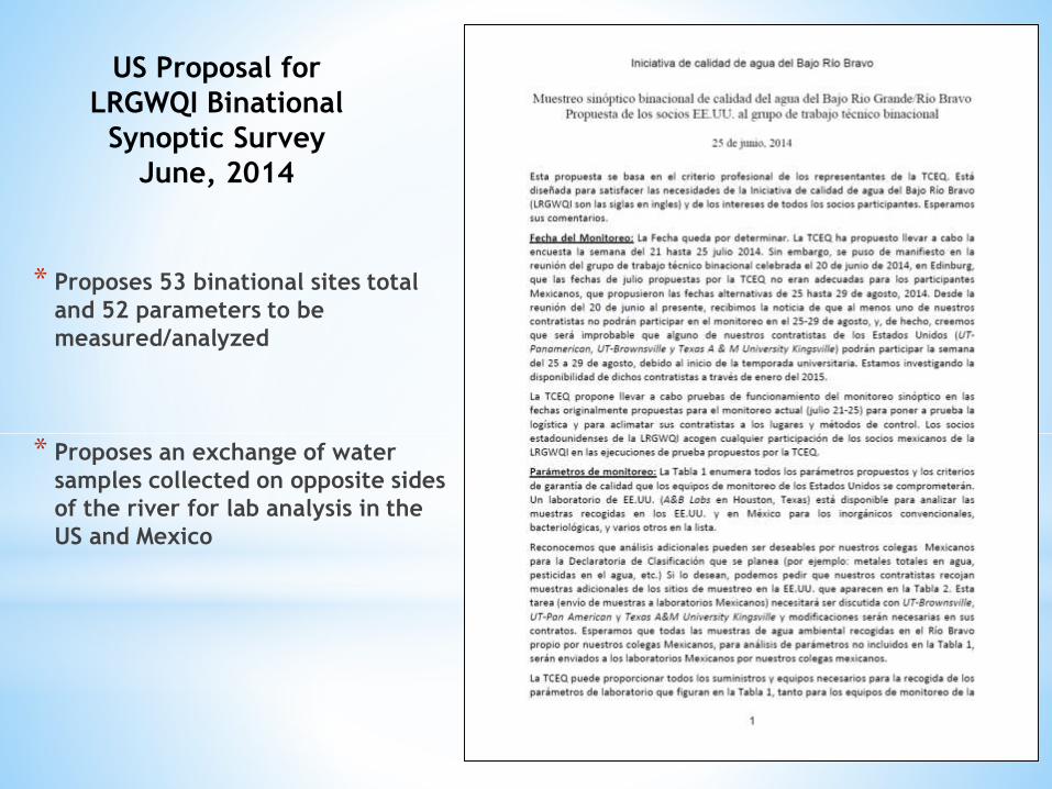
US Proposal for
LRGWQI Binational
Synoptic Survey
June, 2014
* Proposes 53 binational sites total
and 52 parameters to be
measured/analyzed
* Proposes an exchange of water
samples collected on opposite sides
of the river for lab analysis in the
US and Mexico
*
*Phase 1
*Historical data review
* Identification of data gaps
*Data collection
*Data analysis and modeling
*Phase 2
*Expanded sampling
*Source Identification
*Recommendations
* Implementation
*Development of a binational watershed protection plan
*
*Develop recommendations by using the model
to determine effective solutions.
*Recommendations come from scientific
community, public input, emergent
technologies, best management practices from
other projects.
*Expected completion in 2018
*
*Historical data was shared between the two
countries of all historical data available from
all agencies for the years of 2000-2014
*Data was merged and analyzed for trends in
the indicator parameters.
*Data was analyzed for changes over time and
spatially
*
*Synoptic surveys were collected seasonally in
2015.
*Samples were collected by 6 binational teams
that collected samples across 2 days
*Samples were split between the 2 countries for
laboratory analysis
*Data used to calibrate the steady state model
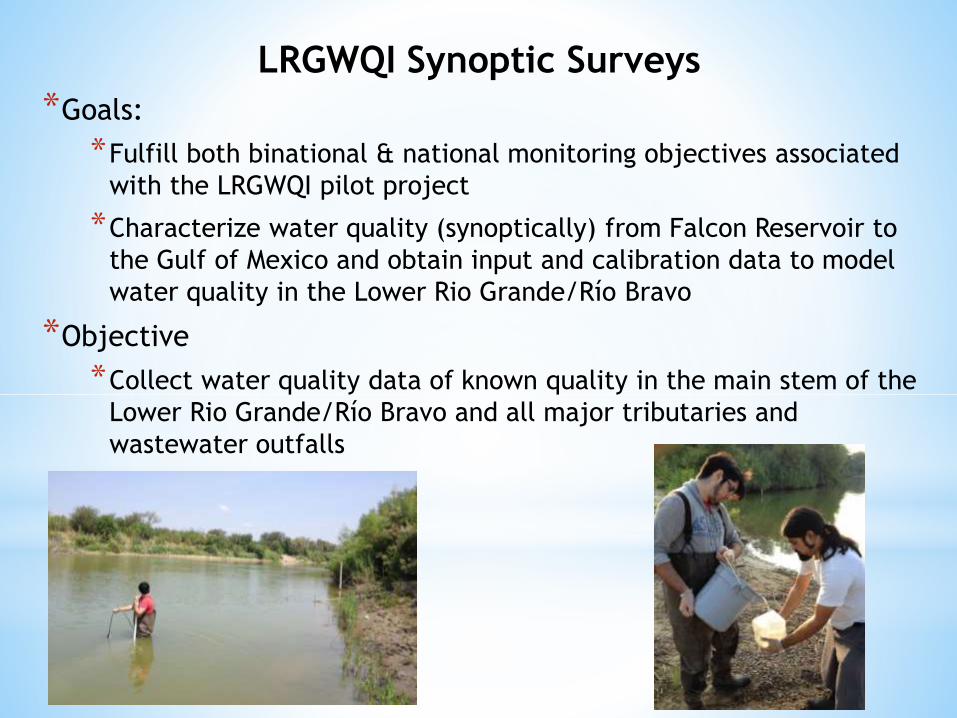
LRGWQI Synoptic Surveys
*Goals:
*Fulfill both binational & national monitoring objectives associated
with the LRGWQI pilot project
*Characterize water quality (synoptically) from Falcon Reservoir to
the Gulf of Mexico and obtain input and calibration data to model
water quality in the Lower Rio Grande/Río Bravo
*Objective
*Collect water quality data of known quality in the main stem of the
Lower Rio Grande/Río Bravo and all major tributaries and
wastewater outfalls
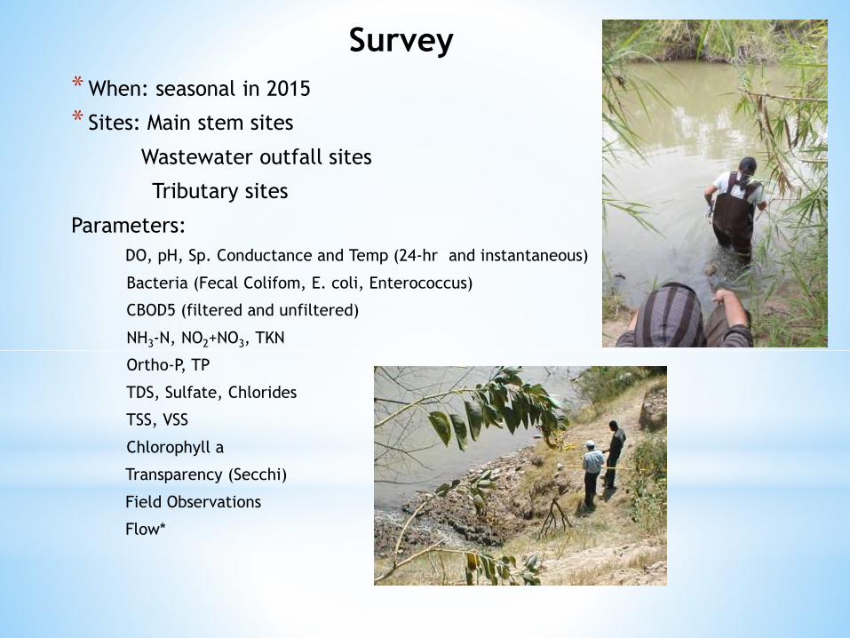
*When: seasonal in 2015
* Sites: Main stem sites
Wastewater outfall sites
Tributary sites
Parameters:
DO, pH, Sp. Conductance and Temp (24-hr and instantaneous)
Bacteria (Fecal Colifom, E. coli, Enterococcus)
CBOD5 (filtered and unfiltered)
NH3-N, NO2+NO3, TKN
Ortho-P, TP
TDS, Sulfate, Chlorides
TSS, VSS
Chlorophyll a
Transparency (Secchi)
Field Observations
Flow*
Survey
*16 main stem sites
*3 tributaries in Mexico (Arroyo El Coronel, Río Alamo, Río San Juan)
*1 tributary site in the U.S. (Arroyo Los Olmos)
*7 drains in Mexico (Rancherias, Puertecitos, Huizache, El Morillo, El Anhelo, Los Fresnos, Los Indios)
*16 wastewater outfalls in Mexico
*12 wastewater outfall sites in the U.S.
Synoptic Sampling Sites
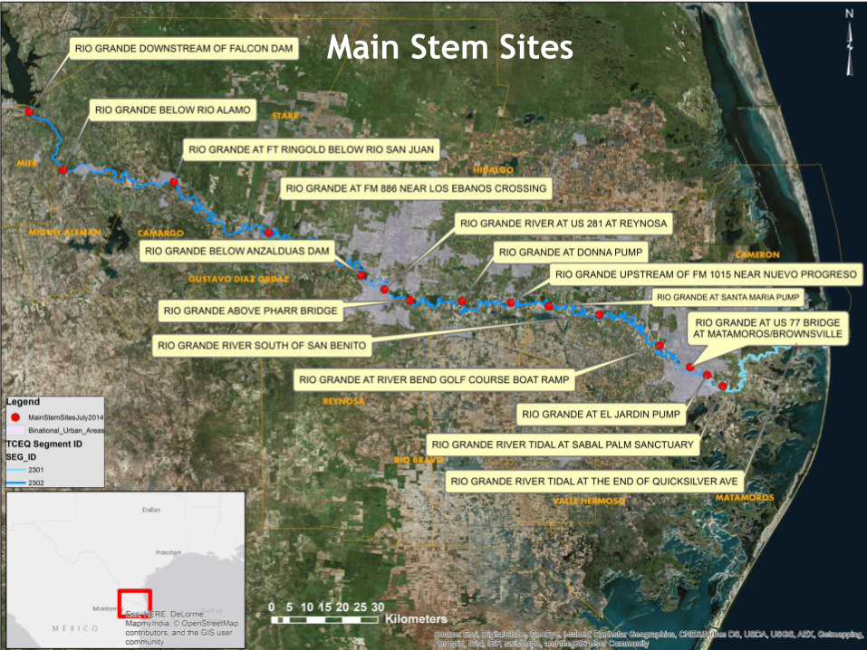
Main Stem Sites
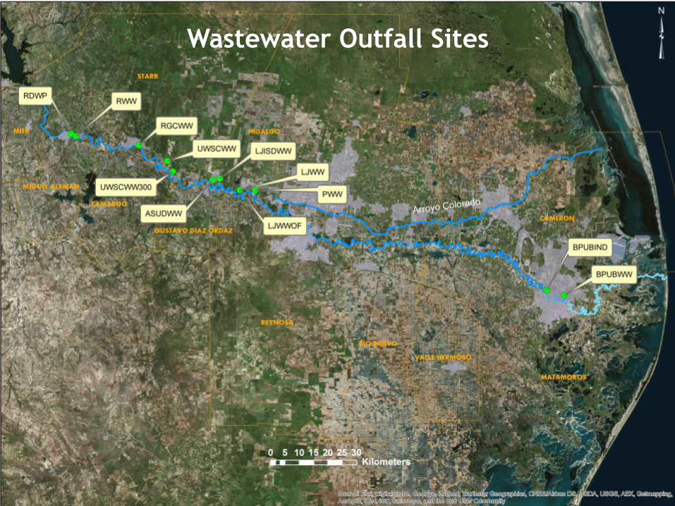
Wastewater Outfall Sites
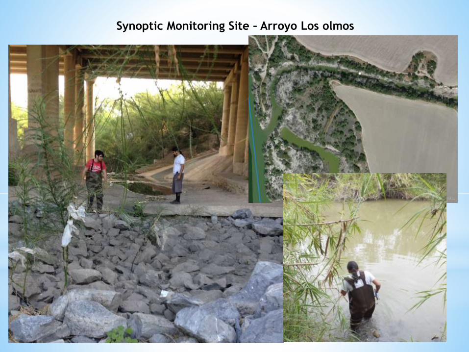
Synoptic Monitoring Site – Arroyo Los olmos
0
500
1000
1500
2000
2500
3000
3500
4000
4500
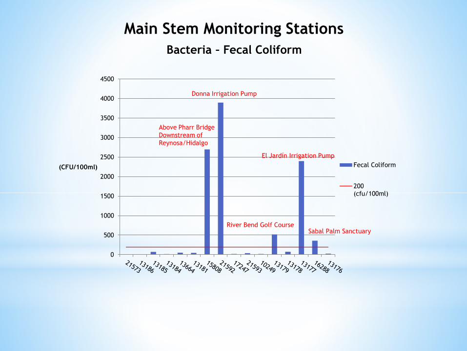
(CFU/100ml) Fecal Coliform
200(cfu/100ml)
Above Pharr Bridge
Downstream of
Reynosa/Hidalgo
Donna Irrigation Pump
River Bend Golf Course
El Jardín Irrigation Pump
Sabal Palm Sanctuary
Main Stem Monitoring Stations
Bacteria – Fecal Coliform
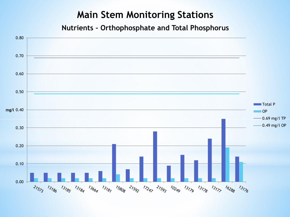
Main Stem Monitoring Stations
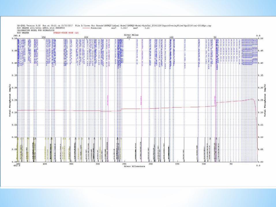
Nutrients – Orthophosphate and Total Phosphorus
0.00
0.10
0.20
0.30
0.40
0.50
0.60
0.70
0.80
mg/l
Total P
OP
0.69 mg/l TP
0.49 mg/l OP
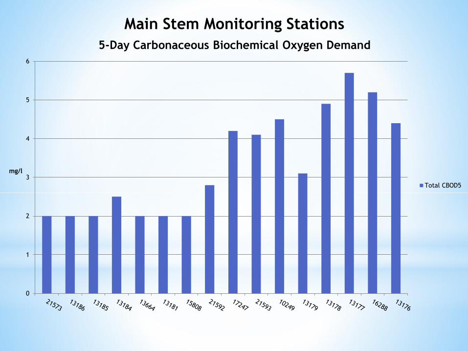
Main Stem Monitoring Stations
5-Day Carbonaceous Biochemical Oxygen Demand
0
1
2
3
4
5
6
mg/l
Total CBOD5
0
0.5
1
1.5
2
2.5
3
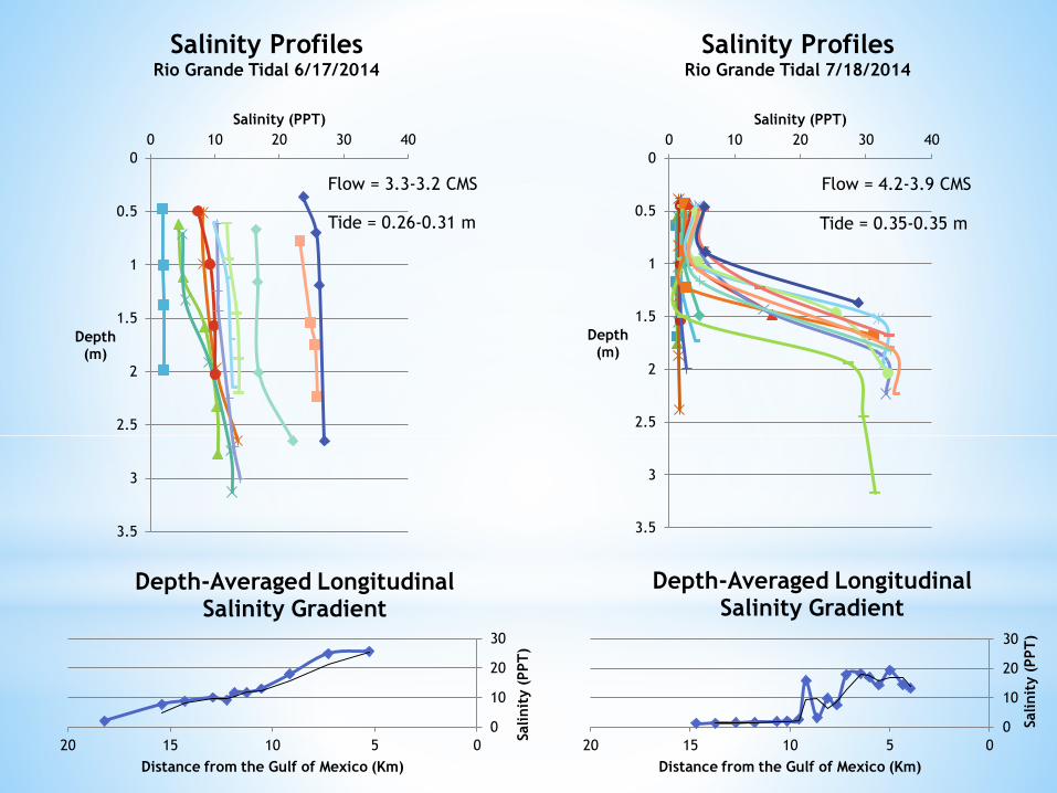
3.5
0 10 20 30 40
Depth(m)
Salinity (PPT)
Salinity ProfilesRio Grande Tidal 7/18/2014
0
10
20
30
05101520
Salinit
y (
PPT
)
Distance from the Gulf of Mexico (Km)
Depth-Averaged Longitudinal Salinity Gradient
0
0.5
1
1.5
2
2.5
3
3.5
0 10 20 30 40
Depth(m)
Salinity (PPT)
Salinity Profiles Rio Grande Tidal 6/17/2014
Flow = 4.2-3.9 CMSFlow = 3.3-3.2 CMS
Tide = 0.26-0.31 m Tide = 0.35-0.35 m
0
10
20
30
05101520
Salinit
y (
PPT
)
Distance from the Gulf of Mexico (Km)
Depth-Averaged Longitudinal Salinity Gradient
*
*Developed by State of Louisiana based on the
Texas water quality model (Qual-TX)
*Simple 1 dimensional model
*Built in equations for water quality
attenuation, sensitivities, impacts.
*Allows for rapid analysis of changes in
parameters
Arr
oyo
Lo
s O
lmo
s
D.M
. C
uev
itas
San
Fra
nci
sco
Ban
co #
60
Dre
n H
uiz
ach
e.
Extr
acci
ón
km
46
Dre
n P
uer
teci
tos.
1 0
8-4
647.0
0O
CRBR5139M
1,
SBR-
0035
D.M
. C
ity
of
Río
Gra
nd
e11212-0
01
13185,
13185
13103
M41
Ob
ra d
e To
ma
.
14313-0
01
M47
M46
M45
M48
Ob
ra d
e To
ma
.
14415-0
01
OC
RBR5136M
1
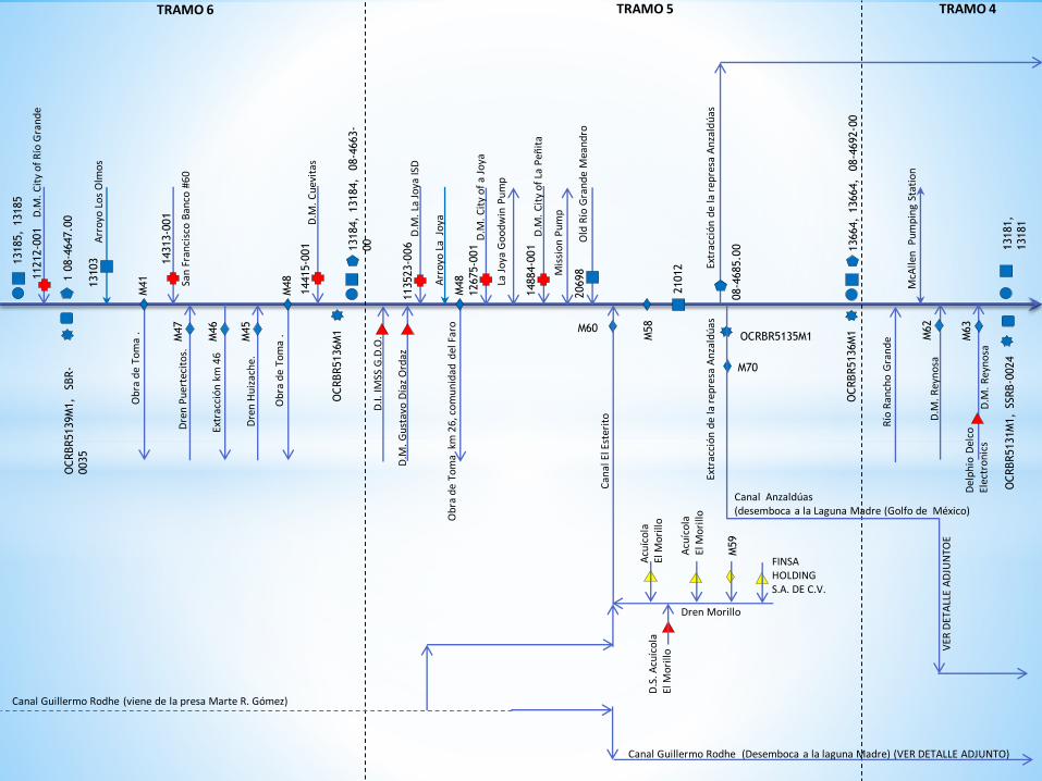
TRAMO 6
13184,
13184,
08-4
663-
00
TRAMO 5
Dren Morillo
Arr
oyo
La
Jo
ya
D.M
. C
ity
of
La P
eñit
a
D.M
. C
ity
of
a Jo
ya
D.M
. La
Jo
ya IS
D
Extr
acci
ón
de
la r
epre
sa A
nza
ldú
as
Old
Río
Gra
nd
e M
ean
dro
D.M
. G
ust
avo
Día
z O
rdaz
D.I.
IM
SS G
.D.O
.
Mis
sio
n P
um
p
La J
oya
Go
od
win
Pu
mp
113523-0
06
M48
Ob
ra d
e To
ma
km
26
, co
mu
nid
ad d
el F
aro
12675-0
01
14884-0
01
M60
Acu
íco
la
El M
ori
lloD
.S. A
cuíc
ola
El M
ori
llo
20698
Acu
íco
la
El M
ori
llo
M58
21012
Can
al E
l Est
erit
o
M59
FINSA HOLDINGS.A. DE C.V.
OCRBR5135M1
M70
Canal Anzaldúas (desemboca a la Laguna Madre (Golfo de México)
08-4
685.0
0
Extr
acci
ón
de
la r
epre
sa A
nza
ldú
as
VER
DET
ALL
E A
DJU
NTO
E
OC
RBR5136M
113664,
13664,
08-4
692-0
0
D.M
. R
eyn
osa
D.M
. R
eyn
osa
McA
llen
P
um
pin
g St
atio
n
Río
Ran
cho
Gra
nd
e M62
M63
OC
RBR5131M
1,
SSRB-0
024
13181,
13181
TRAMO 4
Canal Guillermo Rodhe (viene de la presa Marte R. Gómez)
Canal Guillermo Rodhe (Desemboca a la laguna Madre) (VER DETALLE ADJUNTO)
Del
ph
io D
elco
Elec
tro
nic
s

*