Embed Size (px)
Citation preview
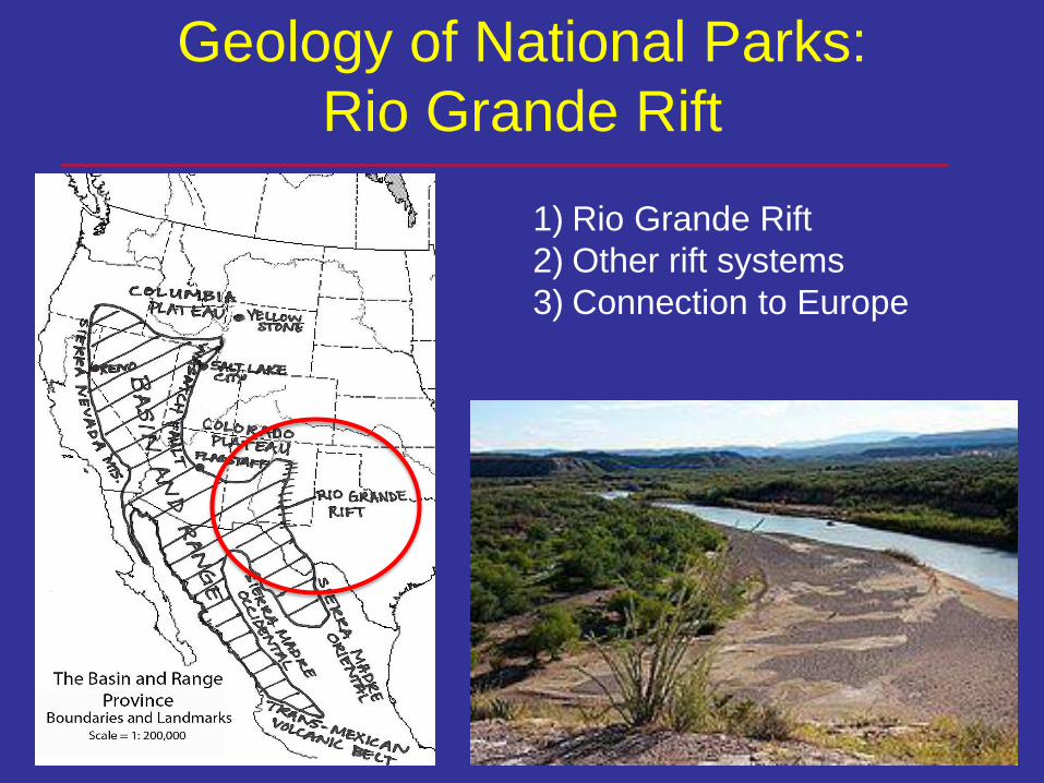
Geology of National Parks:
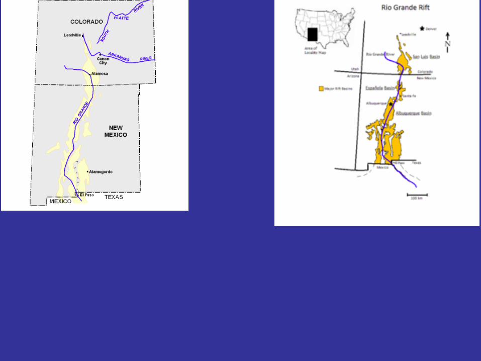
Rio Grande Rift
1) Rio Grande Rift
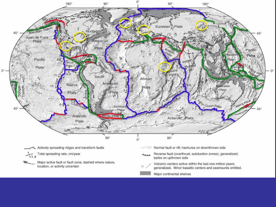
2) Other rift systems
3) Connection to Europe
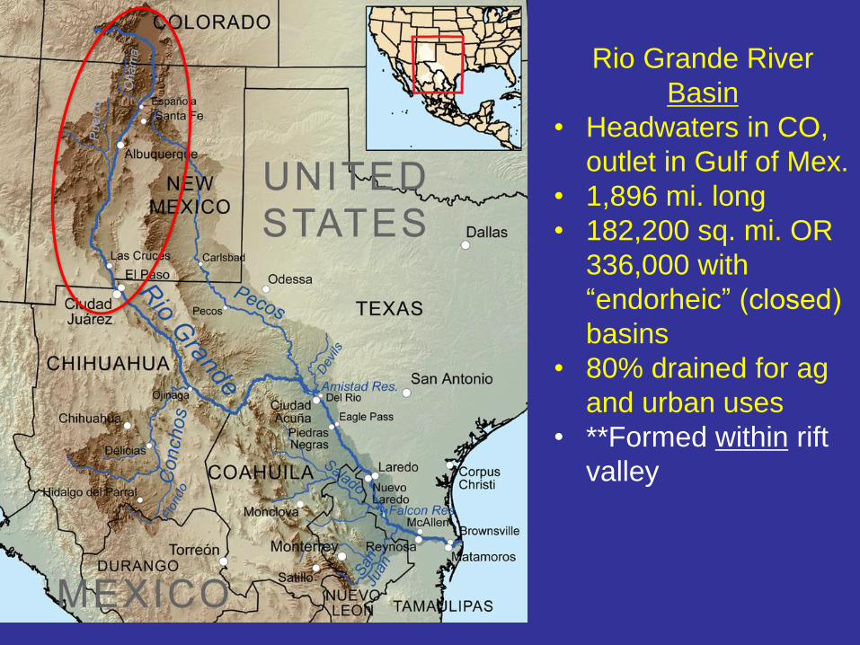
Rio Grande River
Basin
• Headwaters in CO,
outlet in Gulf of Mex.
• 1,896 mi. long
• 182,200 sq. mi. OR
336,000 with
“endorheic” (closed)
basins
• 80% drained for ag
and urban uses
• **Formed within rift
valley
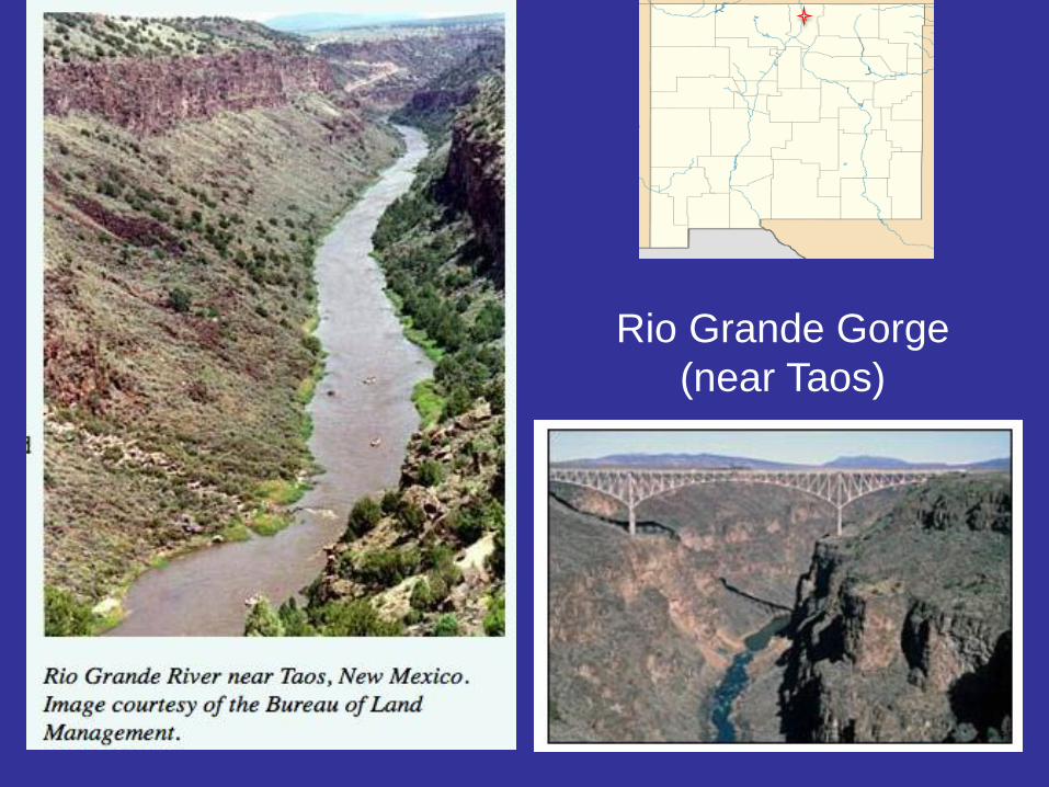
Rio Grande Gorge
(near Taos)
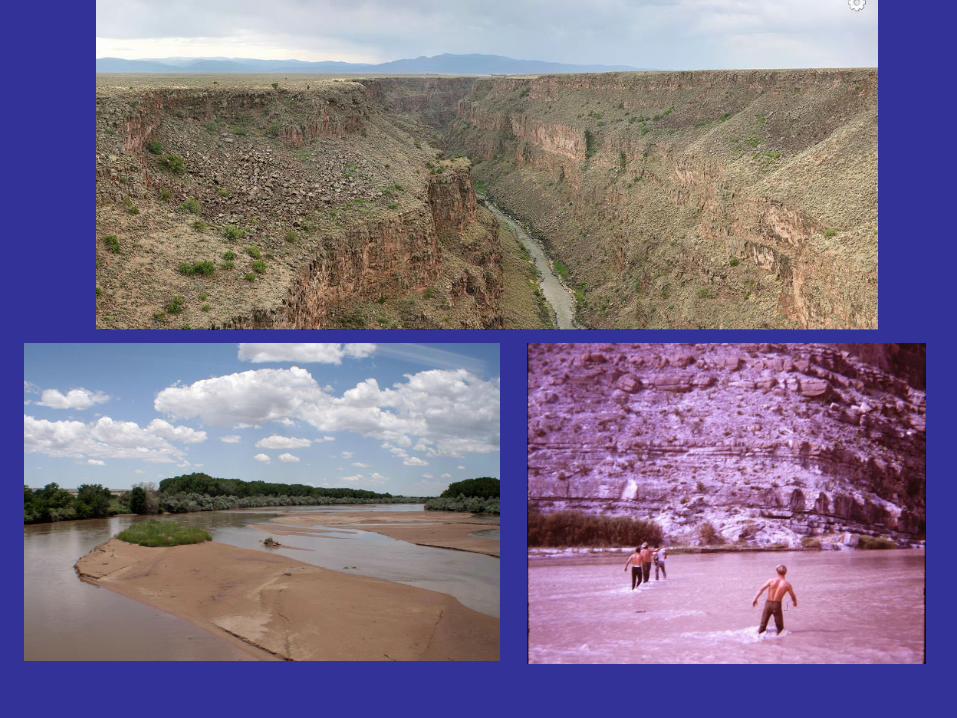
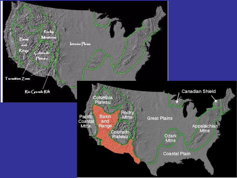
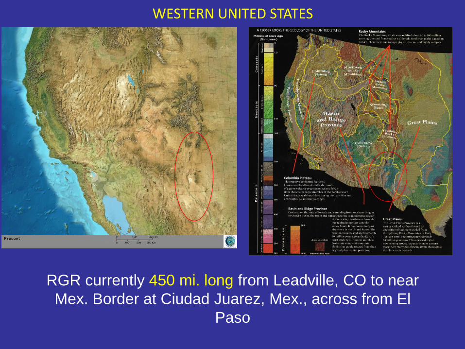
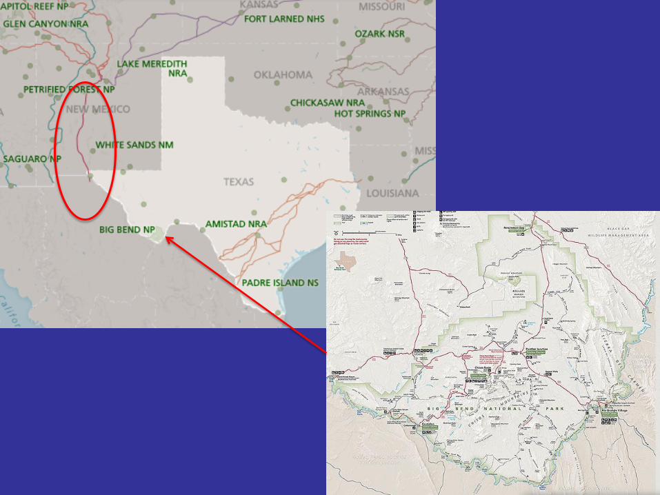
WESTERN UNITED STATES
RGR currently 450 mi. long from Leadville, CO to near
Mex. Border at Ciudad Juarez, Mex., across from El
Paso
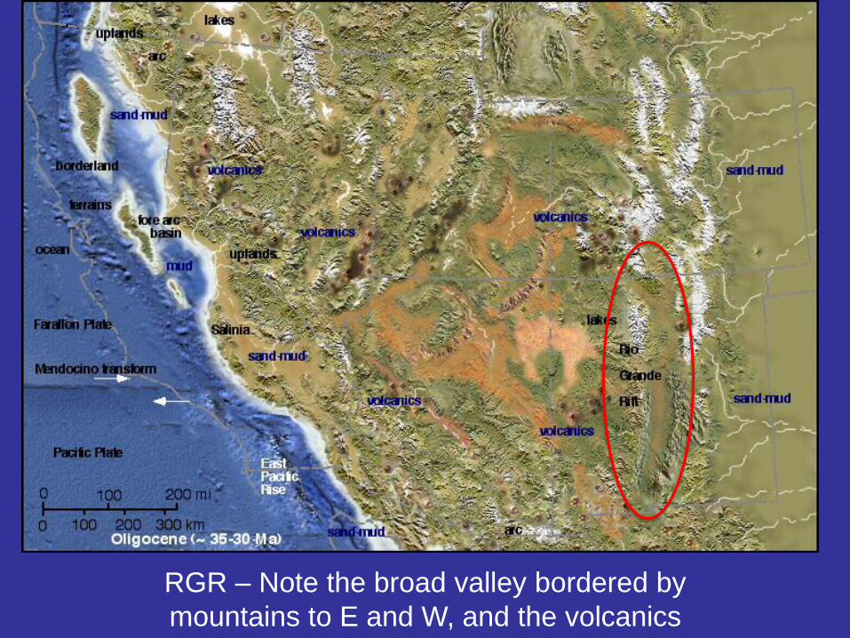
RGR – Note the broad valley bordered by
mountains to E and W, and the volcanics
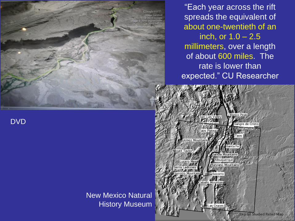
DVD
New Mexico Natural
History Museum
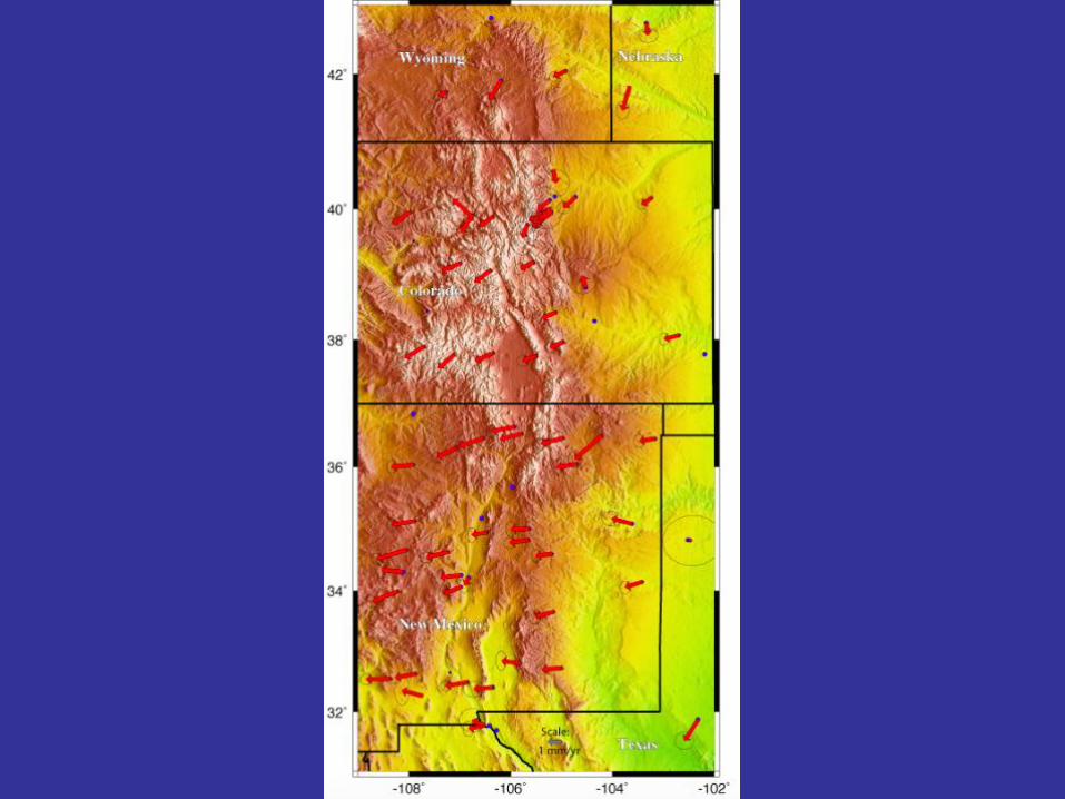
“Each year across the rift
spreads the equivalent of
about one-twentieth of an
inch, or 1.0 – 2.5
millimeters, over a length
of about 600 miles. The
rate is lower than
expected.” CU Researcher
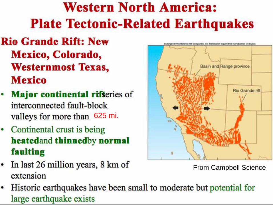
From Campbell Science
625 mi.
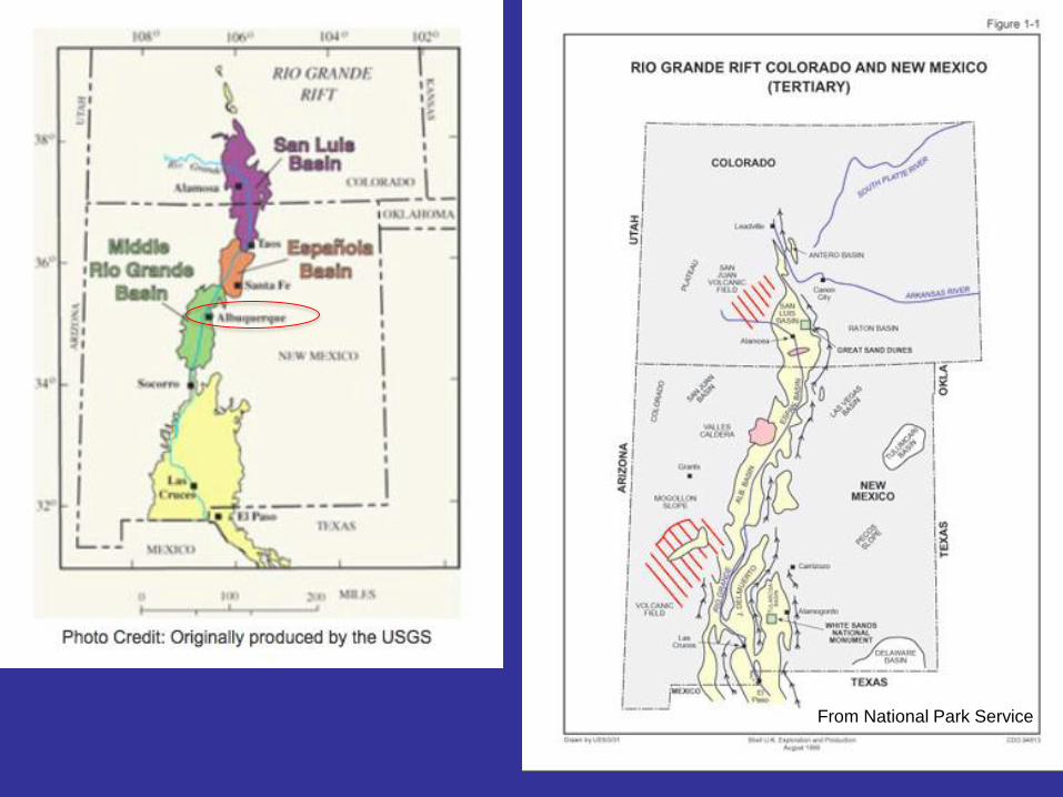
From National Park Service
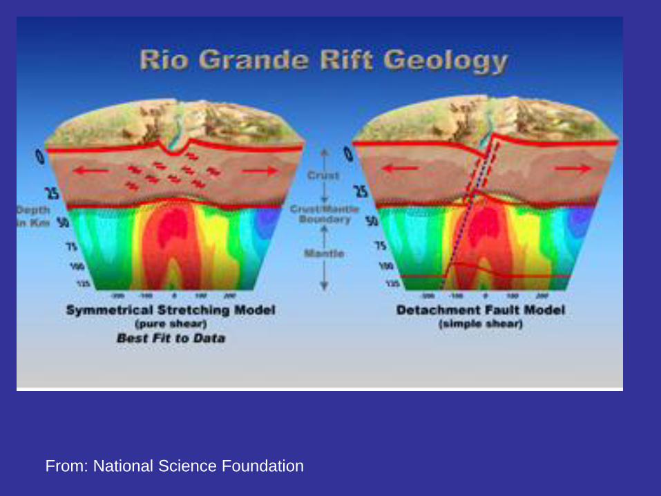
From: National Science Foundation
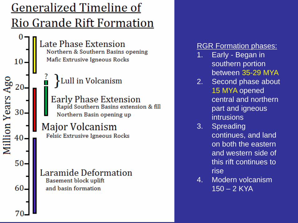
RGR Formation phases:
1. Early - Began in
southern portion
between 35-29 MYA
2. Second phase about
15 MYA opened
central and northern
part and igneous
intrusions
3. Spreading
continues, and land
on both the eastern
and western side of
this rift continues to
rise
4. Modern volcanism
150 – 2 KYA
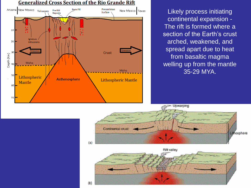
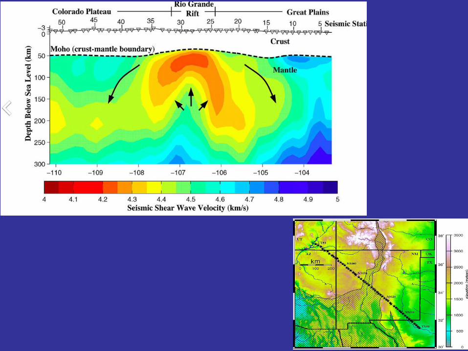
Likely process initiating
continental expansion -
The rift is formed where a
section of the Earth’s crust
arched, weakened, and
spread apart due to heat
from basaltic magma
welling up from the mantle
35-29 MYA.
New Mexico Natural
History Museum
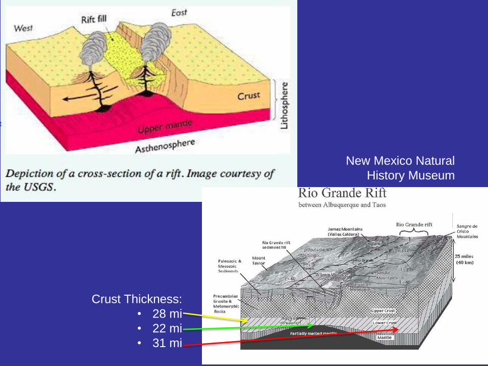
Crust Thickness:
• 28 mi
• 22 mi
• 31 mi
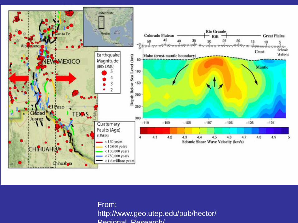
From:
http://www.geo.utep.edu/pub/hector/
Regional_Research/
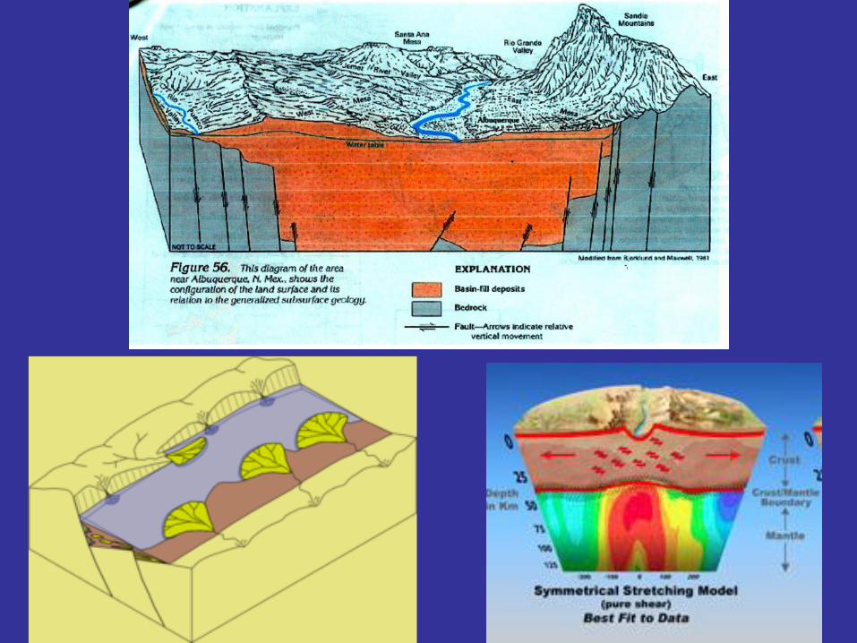
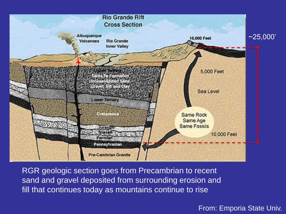
RGR geologic section goes from Precambrian to recent
sand and gravel deposited from surrounding erosion and
fill that continues today as mountains continue to rise
~25,000’
From: Emporia State Univ.
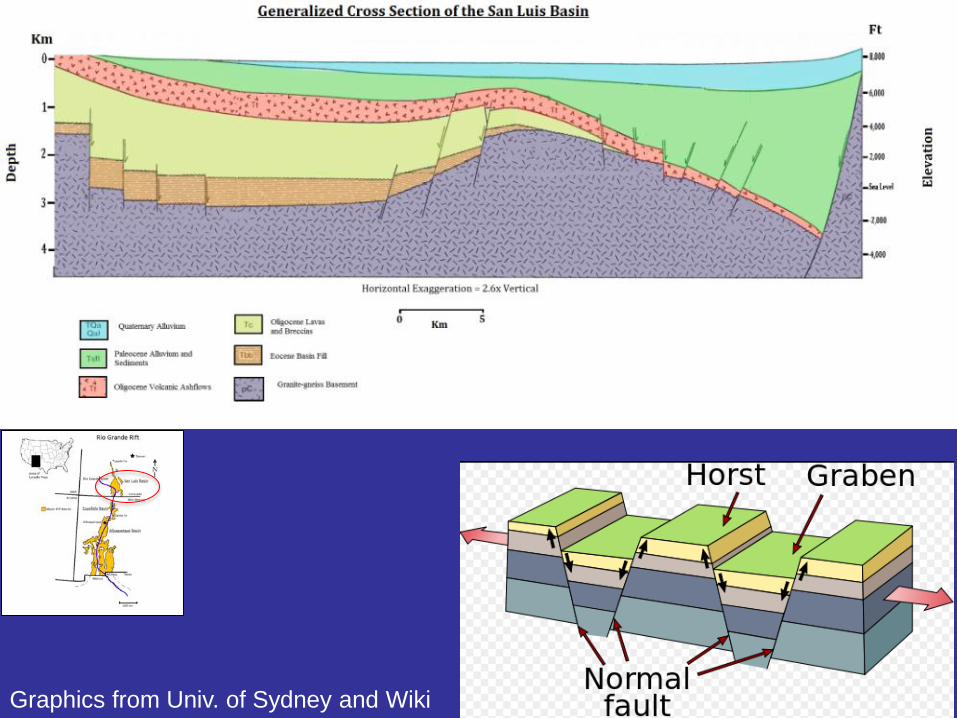
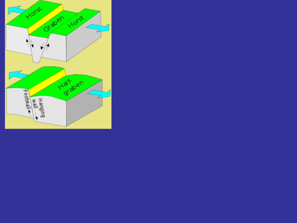
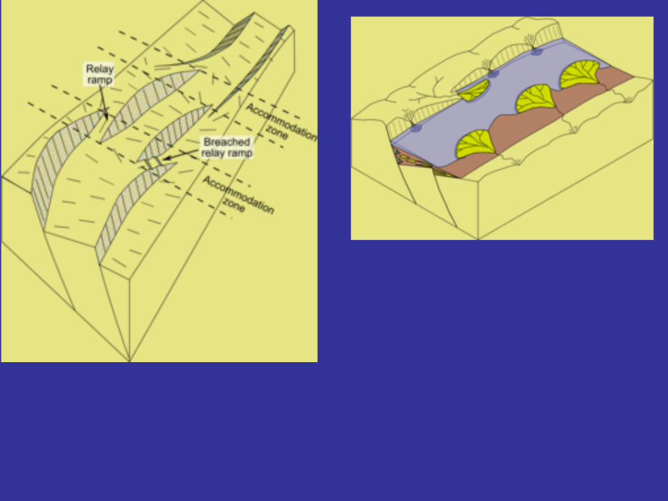
Graphics from Univ. of Sydney and Wiki
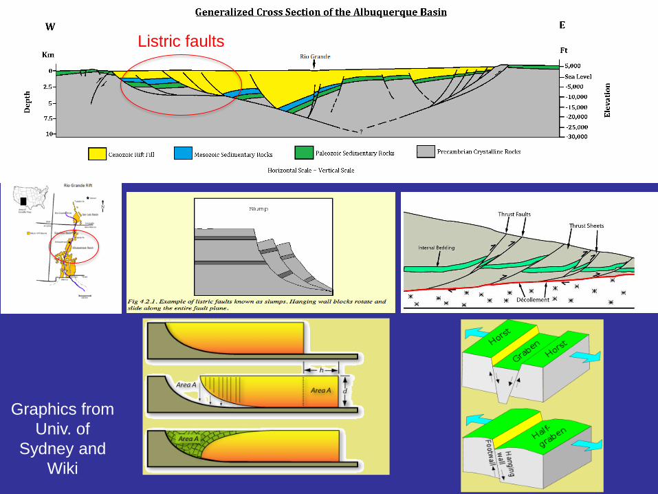
Graphics from
Univ. of
Sydney and
Wiki
Listric faults
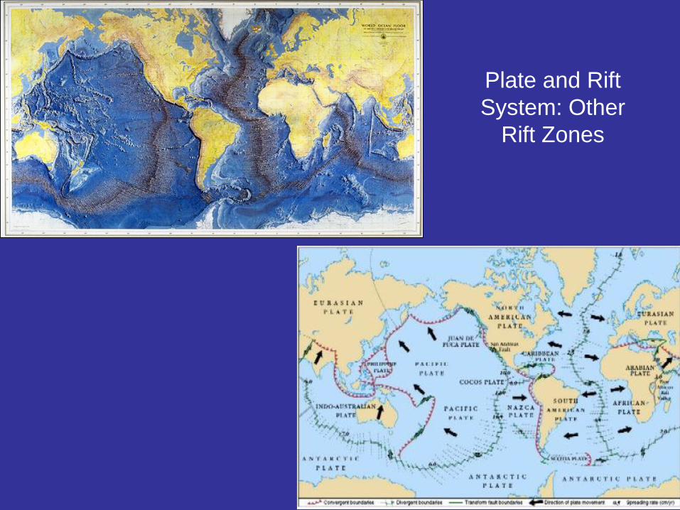
Plate and Rift
System: Other
Rift Zones
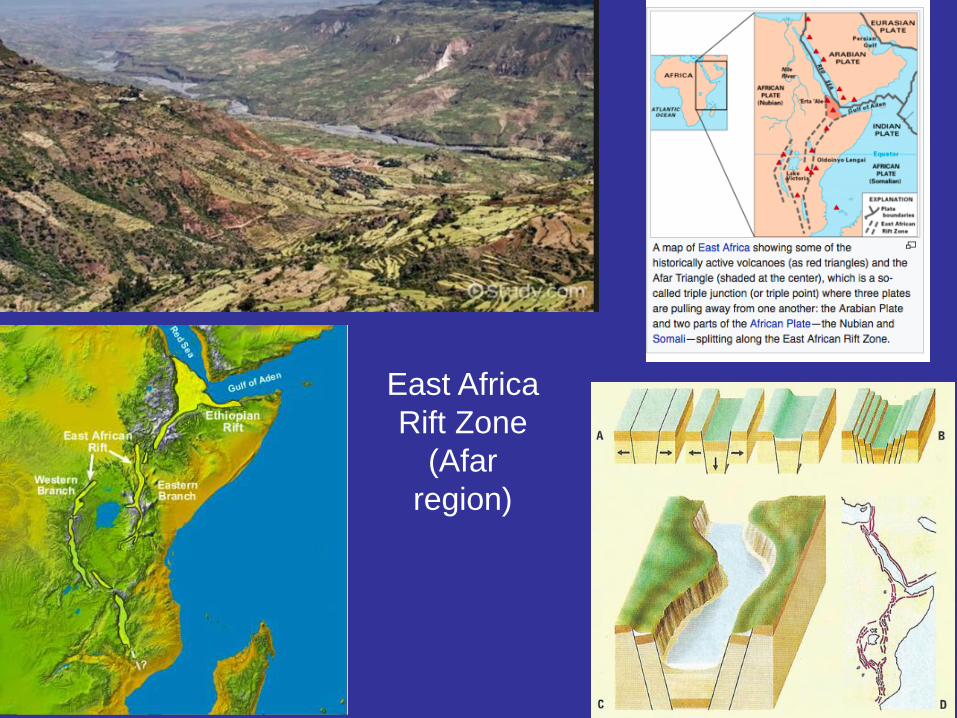
East Africa
Rift Zone
(Afar
region)
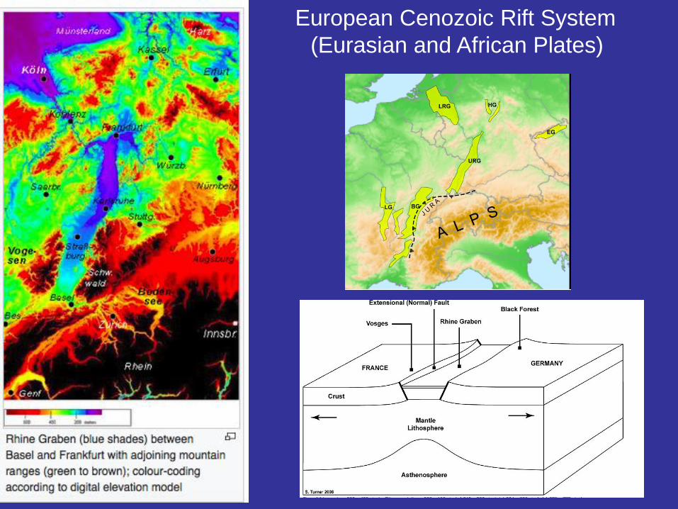
European Cenozoic Rift System
(Eurasian and African Plates)
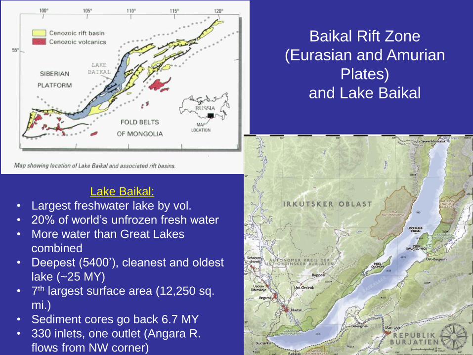
Baikal Rift Zone
(Eurasian and Amurian
Plates)
and Lake Baikal
Lake Baikal:
• Largest freshwater lake by vol.
• 20% of world’s unfrozen fresh water
• More water than Great Lakes
combined
• Deepest (5400’), cleanest and oldest
lake (~25 MY)
• 7th largest surface area (12,250 sq.
mi.)
• Sediment cores go back 6.7 MY
• 330 inlets, one outlet (Angara R.
flows from NW corner)
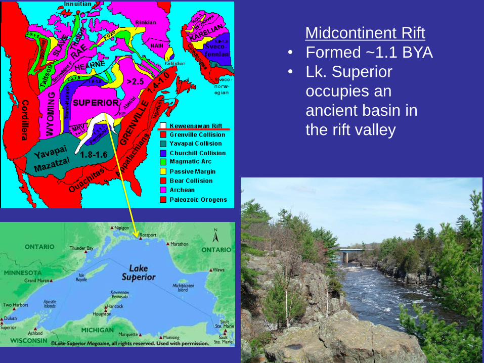
Midcontinent Rift
• Formed ~1.1 BYA
• Lk. Superior
occupies an
ancient basin in
the rift valley
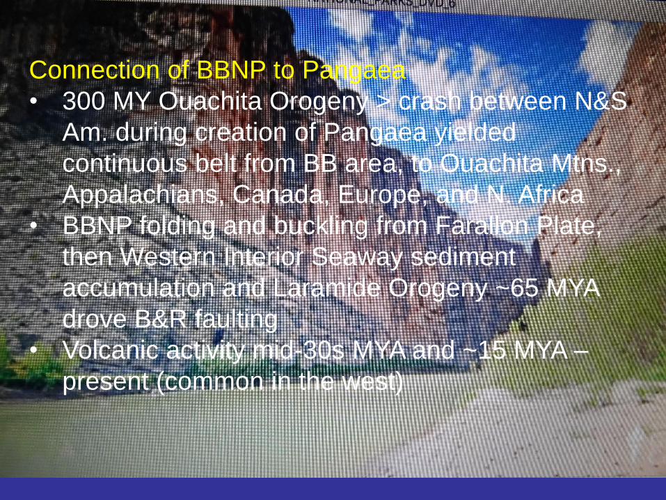
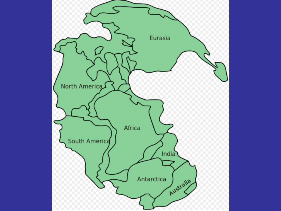
Connection of BBNP to Pangaea
• 300 MY Ouachita Orogeny > crash between N&S
Am. during creation of Pangaea yielded
continuous belt from BB area, to Ouachita Mtns.,
Appalachians, Canada, Europe, and N. Africa
• BBNP folding and buckling from Farallon Plate,
then Western Interior Seaway sediment
accumulation and Laramide Orogeny ~65 MYA
drove B&R faulting
• Volcanic activity mid-30s MYA and ~15 MYA –
present (common in the west)
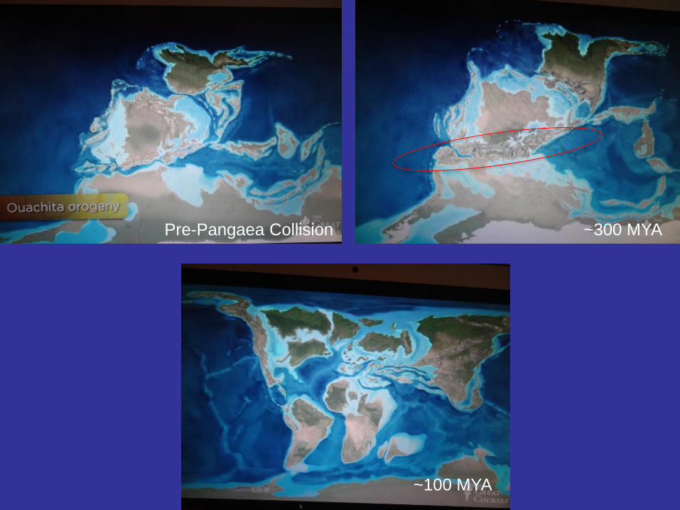
~300 MYA
~100 MYA
Pre-Pangaea Collision


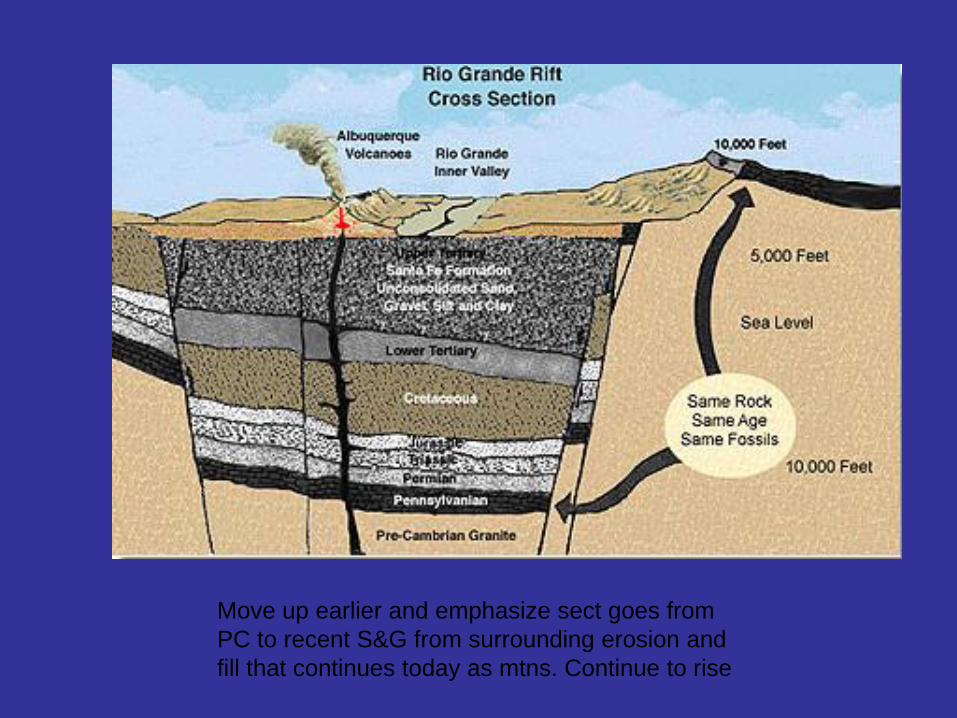
Move up earlier and emphasize sect goes from
PC to recent S&G from surrounding erosion and
fill that continues today as mtns. Continue to rise
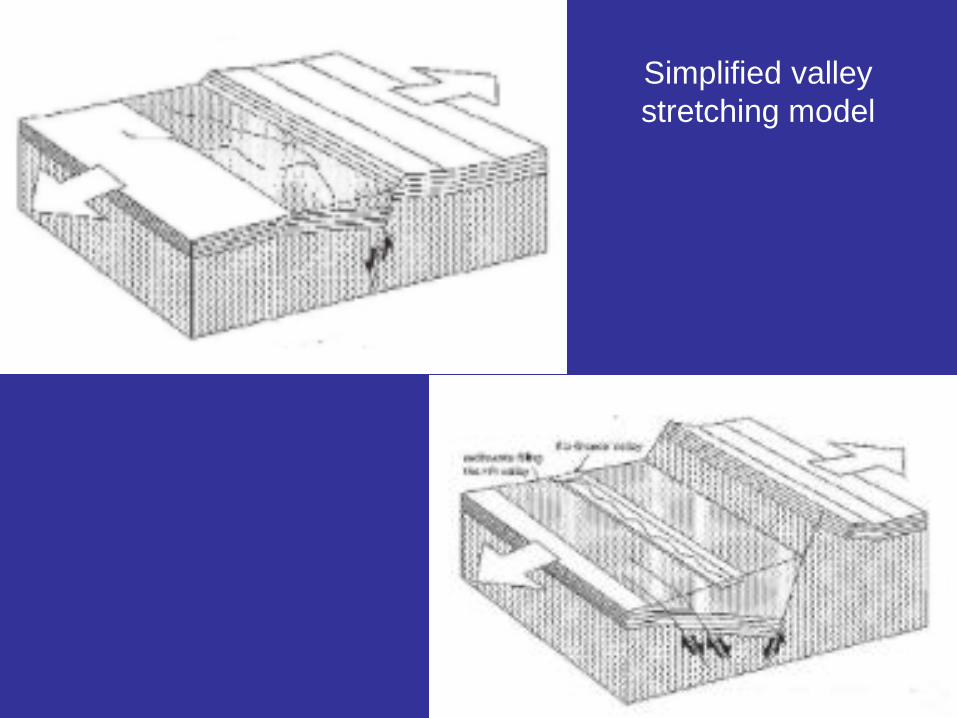
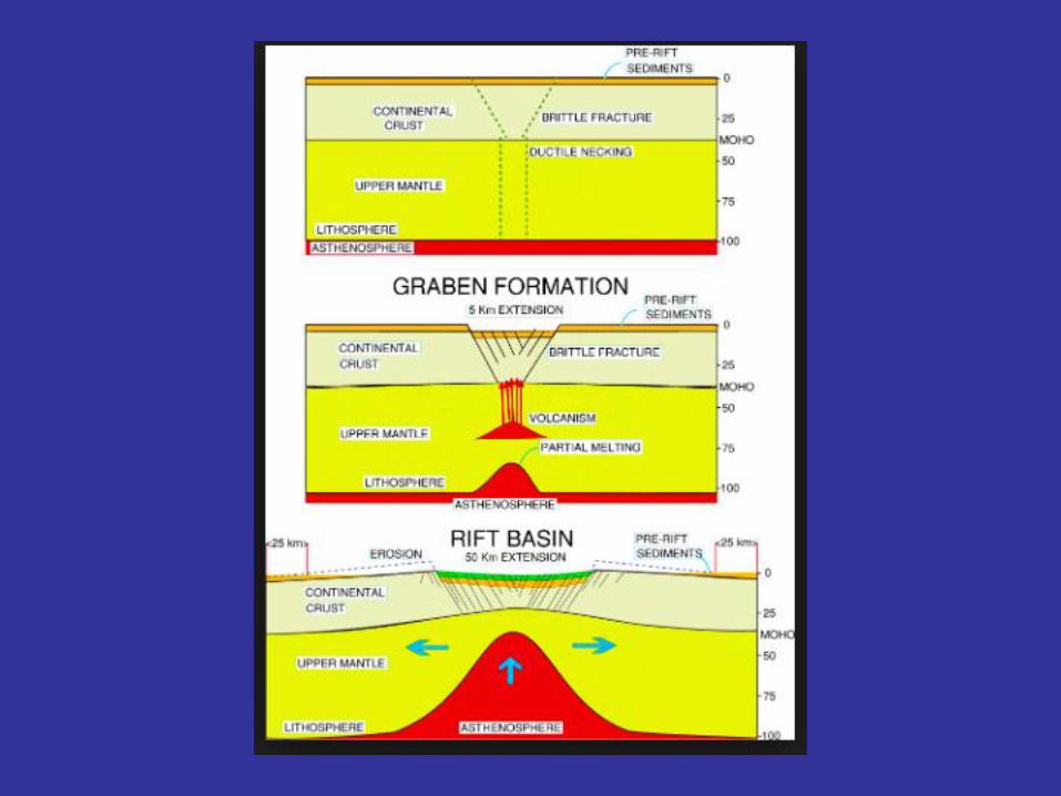
Simplified valley
stretching model
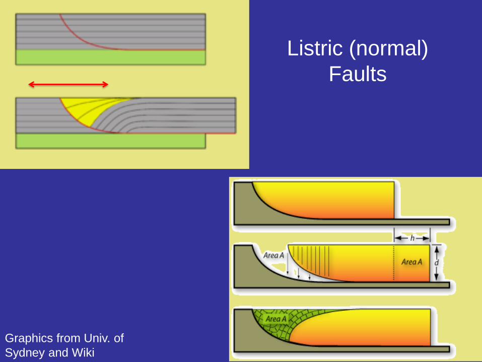
Listric (normal)
Faults
Graphics from Univ. of
Sydney and Wiki