Embed Size (px)
Citation preview
Rio Grande
Aerial Flood Survey
Downstream of Lajitas to Rio Grande Village
September 20, 2008
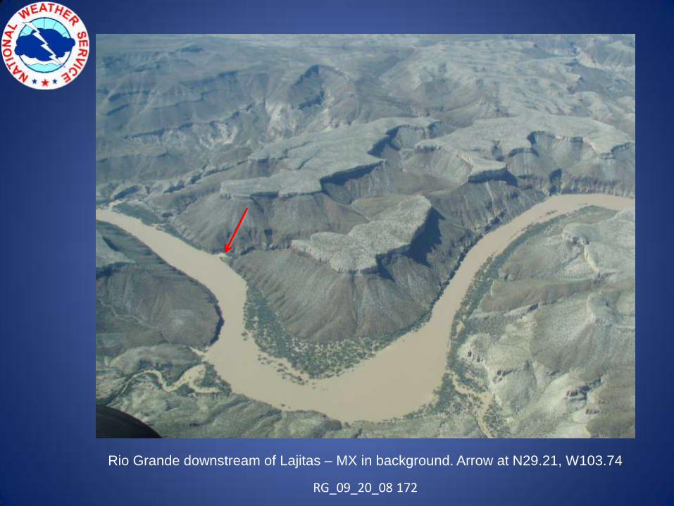
Rio Grande downstream of Lajitas – MX in background. Arrow at N29.21, W103.74
RG_09_20_08 172
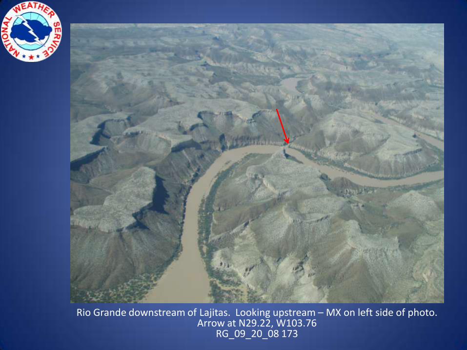
Rio Grande downstream of Lajitas. Looking upstream – MX on left side of photo. Arrow at N29.22, W103.76
RG_09_20_08 173
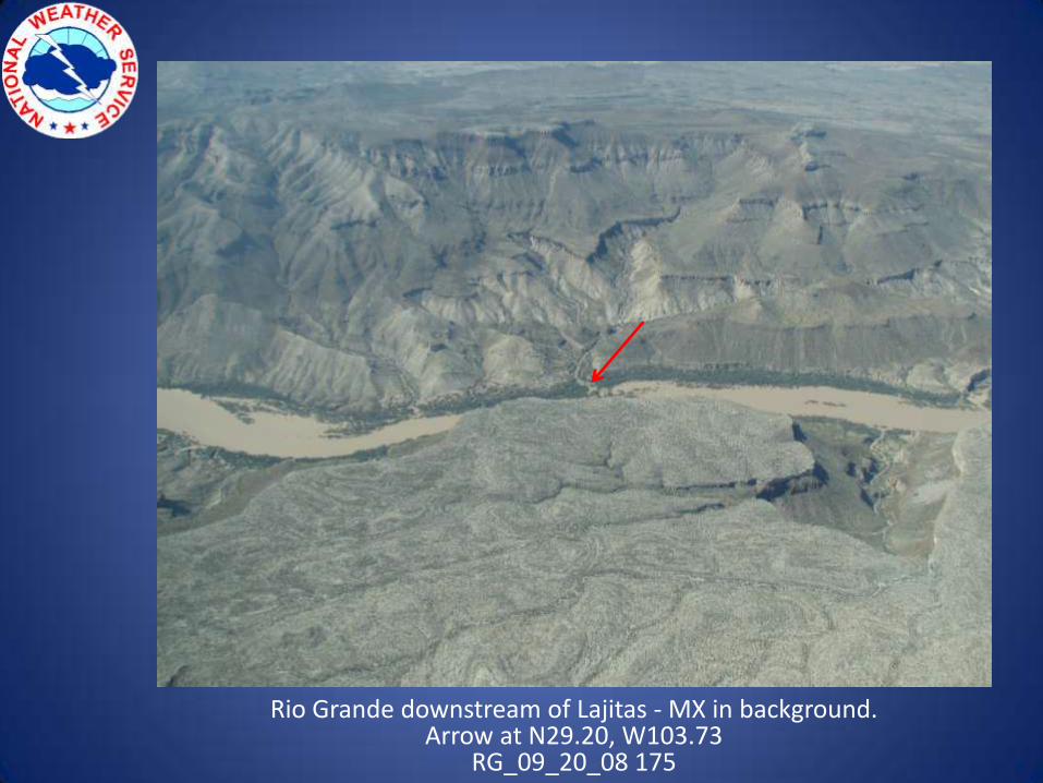
Rio Grande downstream of Lajitas - MX in background. Arrow at N29.20, W103.73
RG_09_20_08 175
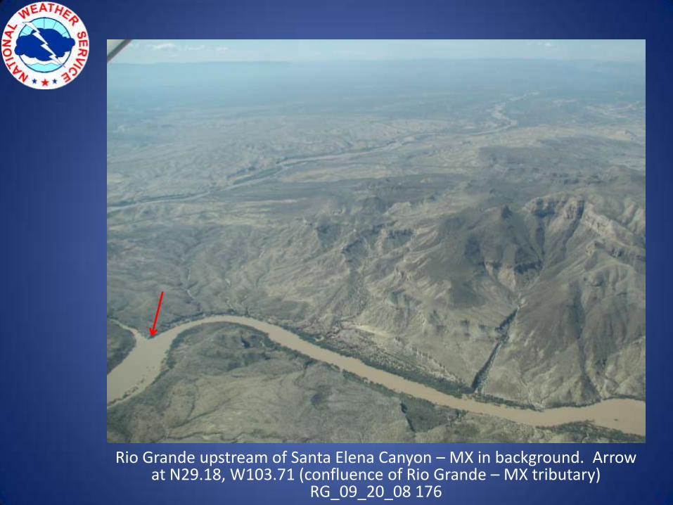
Rio Grande upstream of Santa Elena Canyon – MX in background. Arrow at N29.18, W103.71 (confluence of Rio Grande – MX tributary)
RG_09_20_08 176
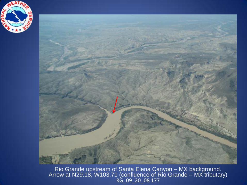
Rio Grande upstream of Santa Elena Canyon – MX background. Arrow at N29.18, W103.71 (confluence of Rio Grande – MX tributary)
RG_09_20_08 177
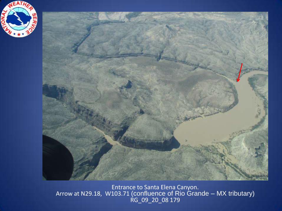
Entrance to Santa Elena Canyon. Arrow at N29.18, W103.71 (confluence of Rio Grande – MX tributary)
RG_09_20_08 179
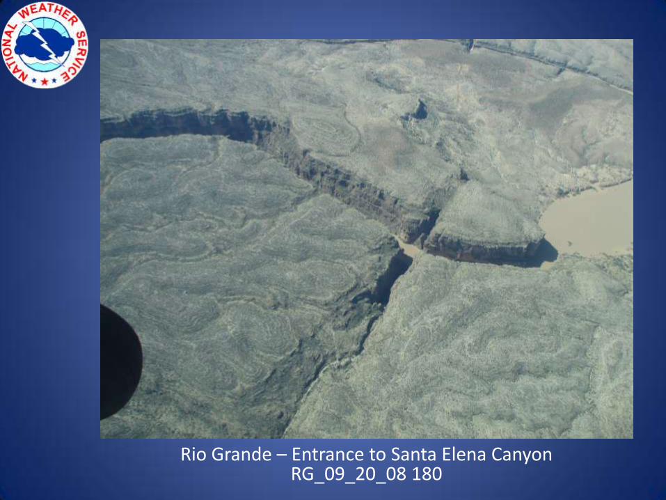
Rio Grande – Entrance to Santa Elena CanyonRG_09_20_08 180
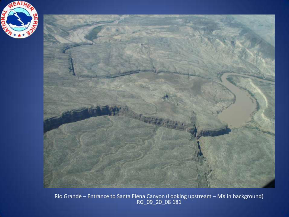
Rio Grande – Entrance to Santa Elena Canyon (Looking upstream – MX in background)RG_09_20_08 181
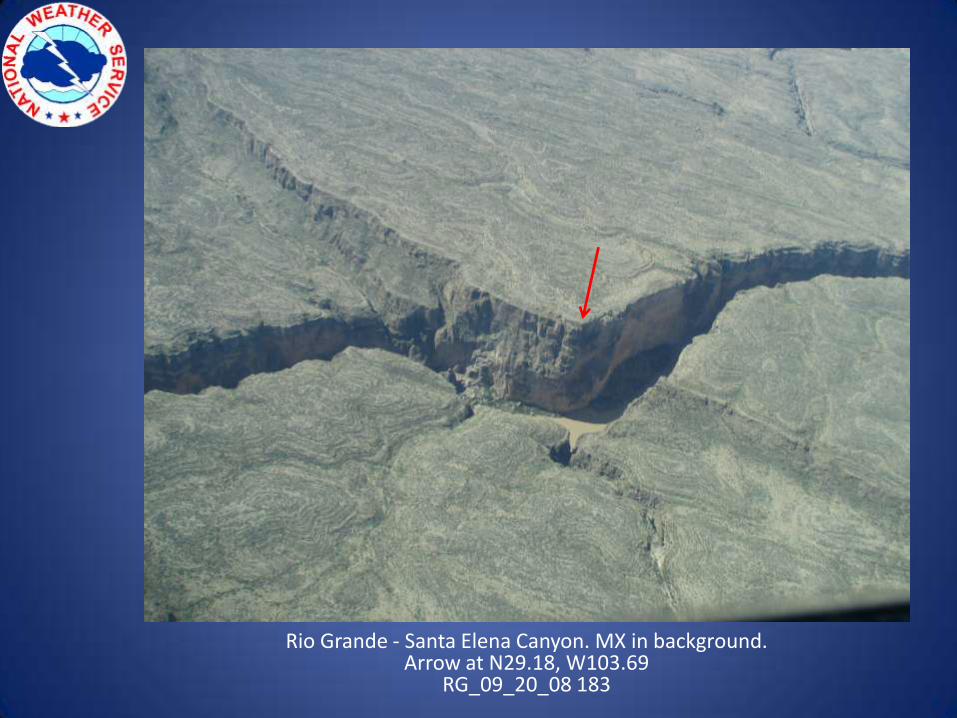
Rio Grande - Santa Elena Canyon. MX in background. Arrow at N29.18, W103.69
RG_09_20_08 183
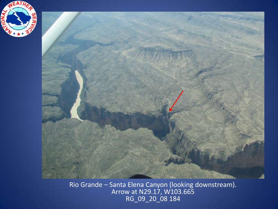
Rio Grande – Santa Elena Canyon (looking downstream).Arrow at N29.17, W103.665
RG_09_20_08 184
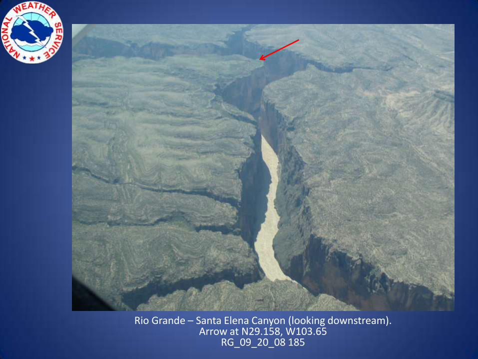
Rio Grande – Santa Elena Canyon (looking downstream).Arrow at N29.158, W103.65
RG_09_20_08 185
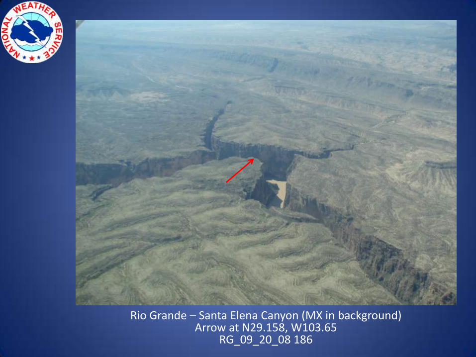
Rio Grande – Santa Elena Canyon (MX in background)Arrow at N29.158, W103.65
RG_09_20_08 186
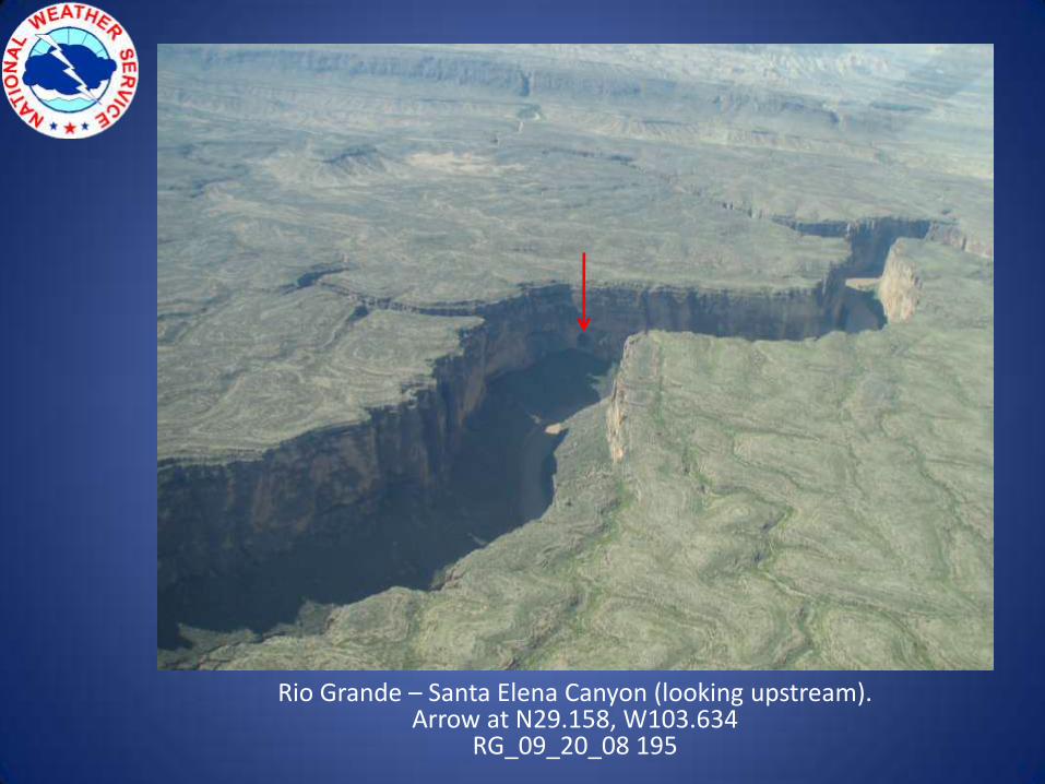
Rio Grande – Santa Elena Canyon (looking upstream).Arrow at N29.158, W103.634
RG_09_20_08 195
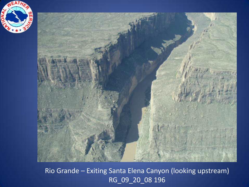
Rio Grande – Exiting Santa Elena Canyon (looking upstream)RG_09_20_08 196
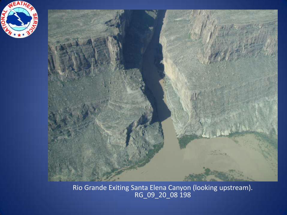
Rio Grande Exiting Santa Elena Canyon (looking upstream).RG_09_20_08 198
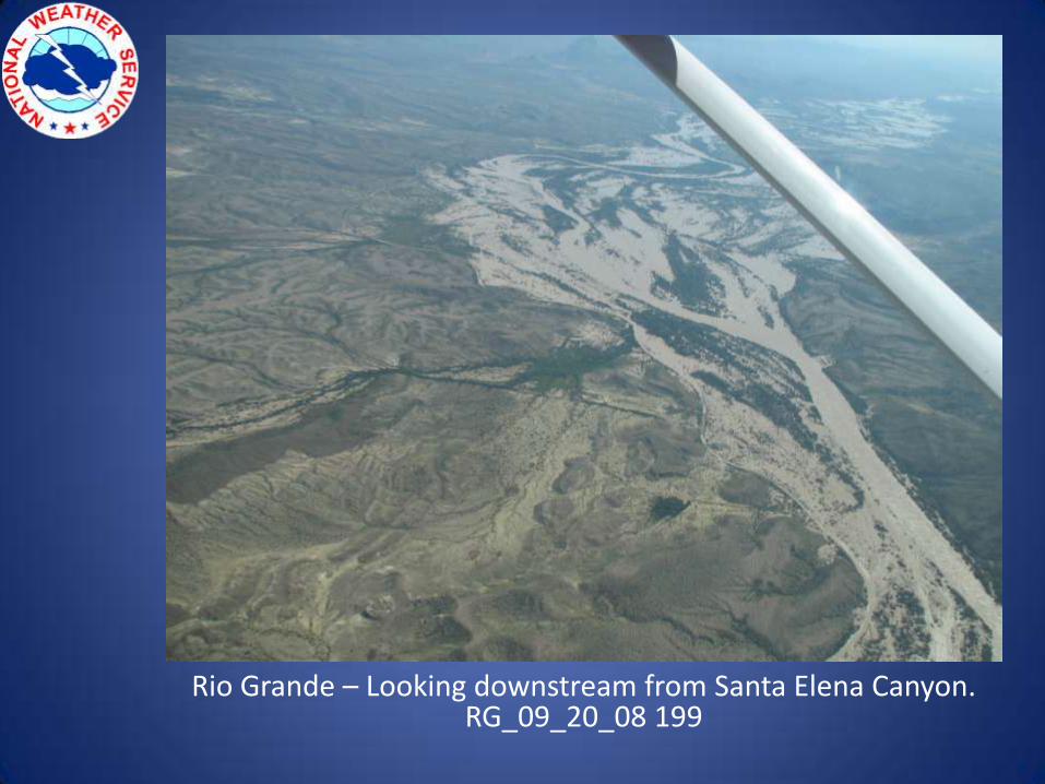
Rio Grande – Looking downstream from Santa Elena Canyon.RG_09_20_08 199
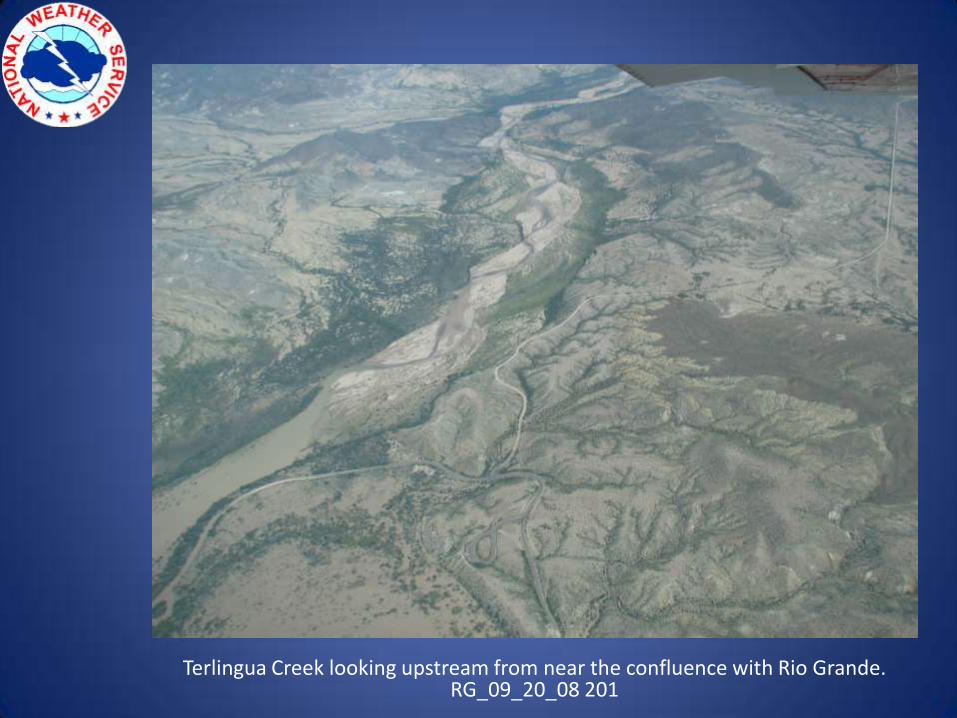
Terlingua Creek looking upstream from near the confluence with Rio Grande.RG_09_20_08 201
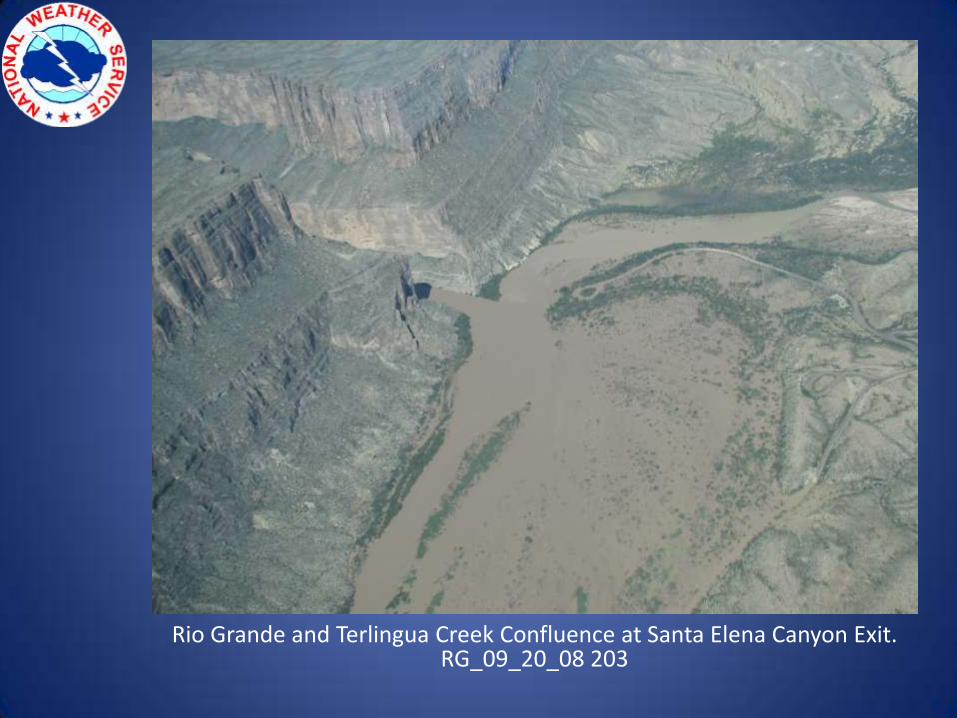
Rio Grande and Terlingua Creek Confluence at Santa Elena Canyon Exit.RG_09_20_08 203
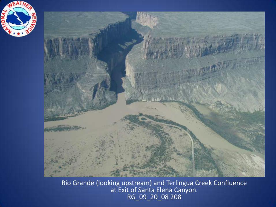
Rio Grande (looking upstream) and Terlingua Creek Confluence at Exit of Santa Elena Canyon.
RG_09_20_08 208
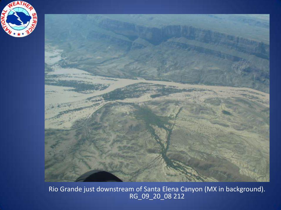
Rio Grande just downstream of Santa Elena Canyon (MX in background).RG_09_20_08 212
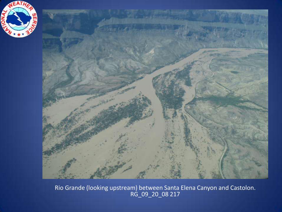
Rio Grande (looking upstream) between Santa Elena Canyon and Castolon.RG_09_20_08 217
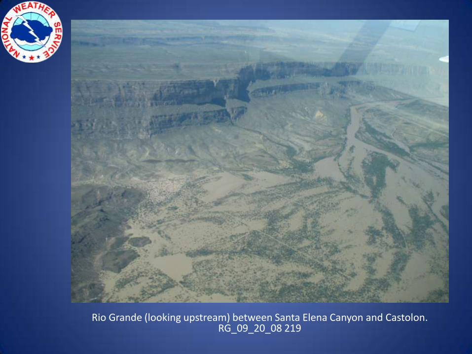
Rio Grande (looking upstream) between Santa Elena Canyon and Castolon.RG_09_20_08 219
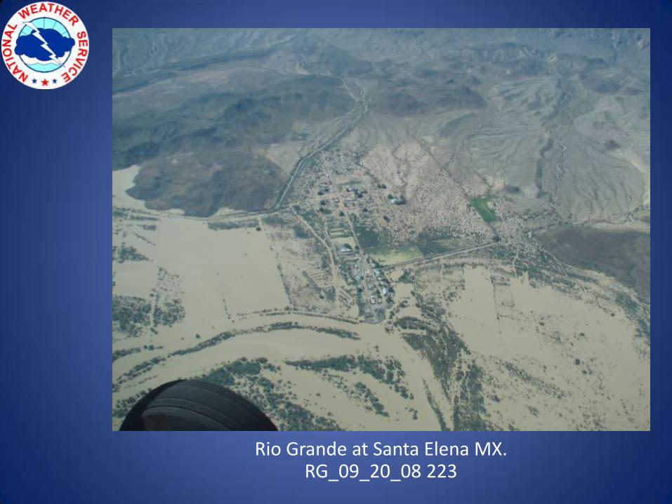
Rio Grande at Santa Elena MX.RG_09_20_08 223
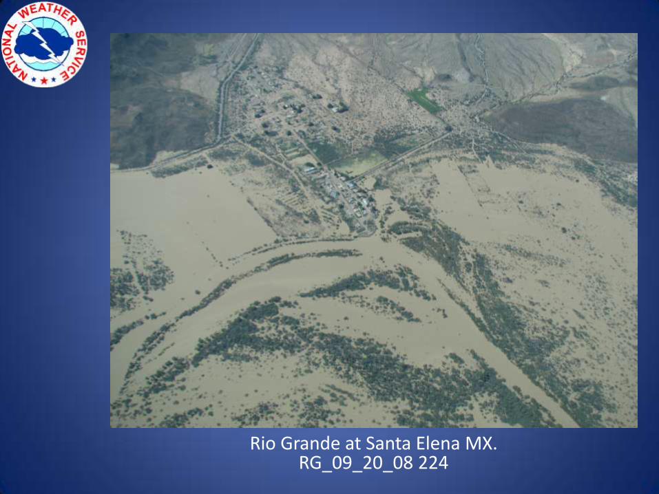
Rio Grande at Santa Elena MX.RG_09_20_08 224
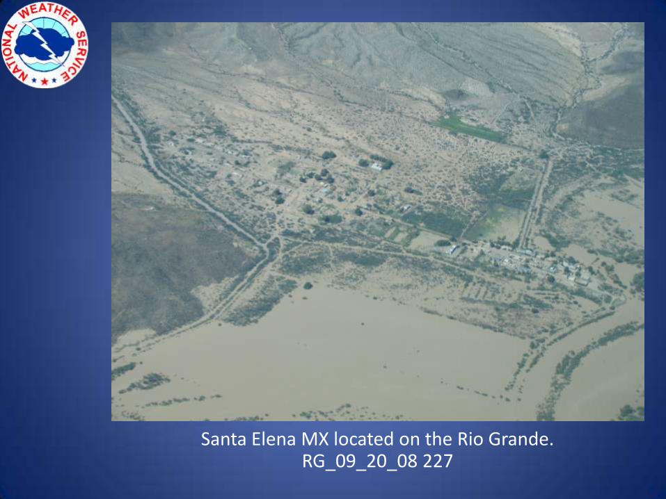
Santa Elena MX located on the Rio Grande.RG_09_20_08 227
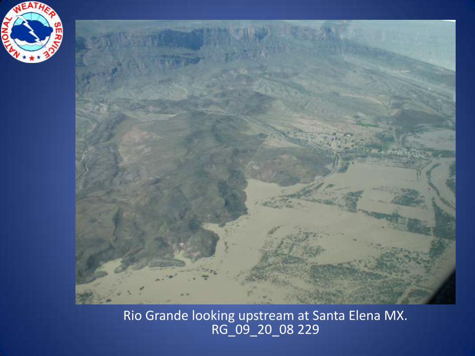
Rio Grande looking upstream at Santa Elena MX.RG_09_20_08 229
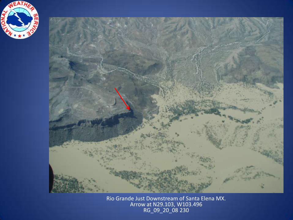
Rio Grande Just Downstream of Santa Elena MX.Arrow at N29.103, W103.496
RG_09_20_08 230
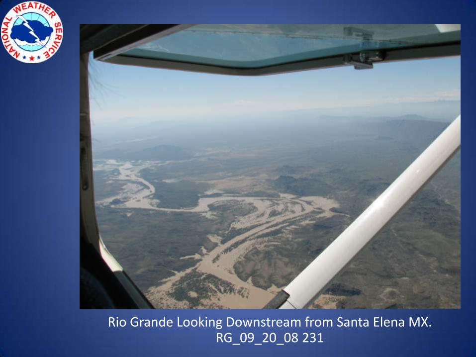
Rio Grande Looking Downstream from Santa Elena MX.RG_09_20_08 231
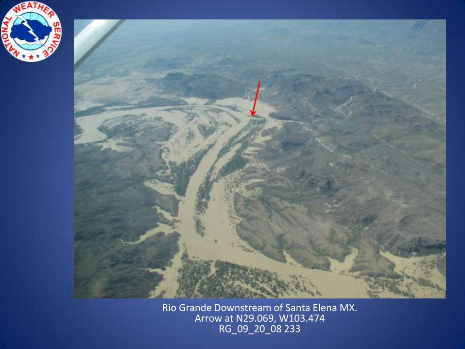
Rio Grande Downstream of Santa Elena MX.Arrow at N29.069, W103.474
RG_09_20_08 233
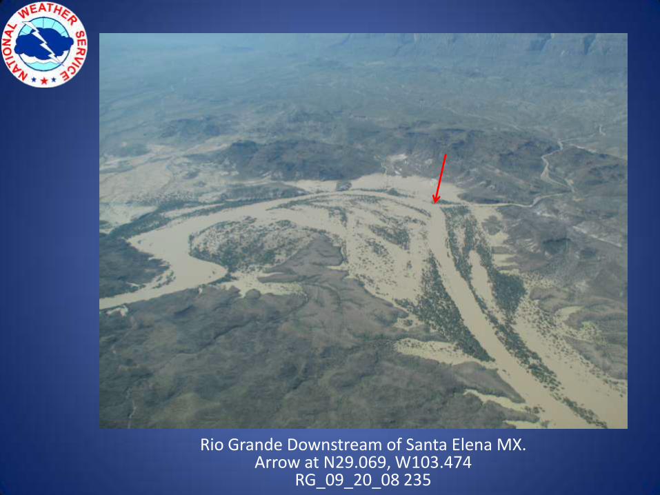
Rio Grande Downstream of Santa Elena MX.Arrow at N29.069, W103.474
RG_09_20_08 235
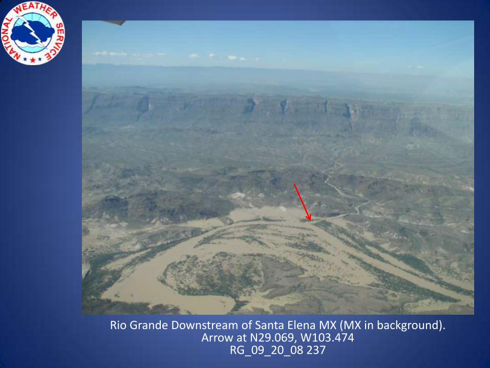
Rio Grande Downstream of Santa Elena MX (MX in background).Arrow at N29.069, W103.474
RG_09_20_08 237
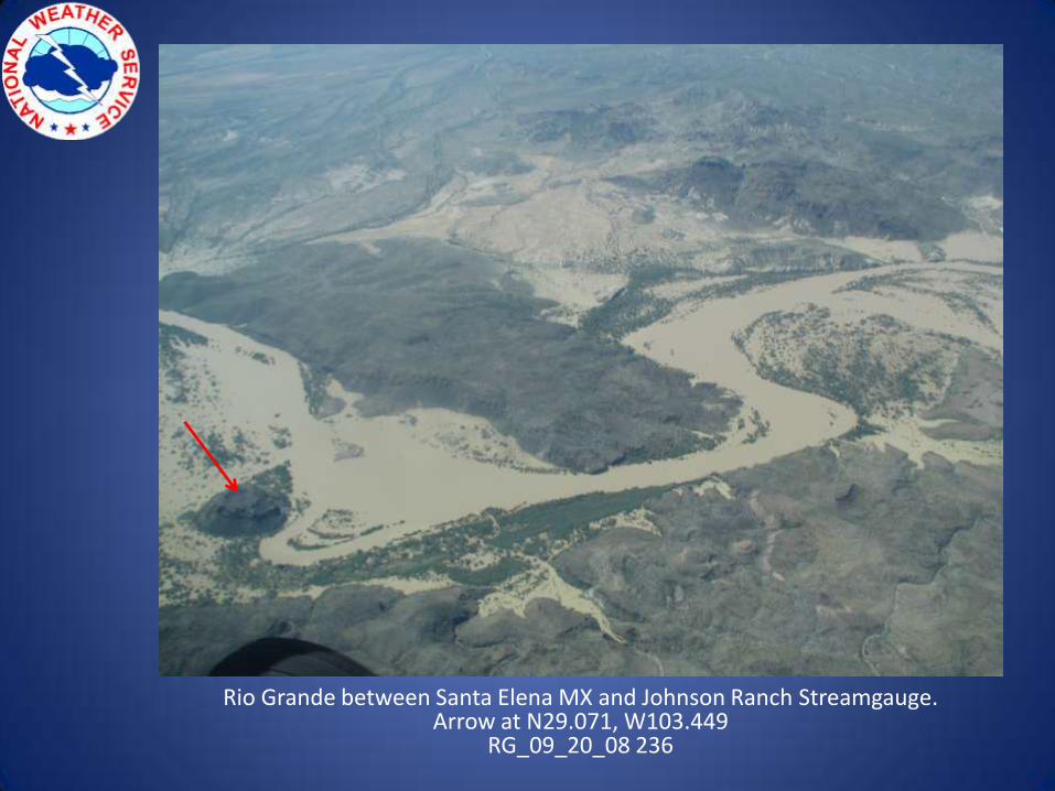
Rio Grande between Santa Elena MX and Johnson Ranch Streamgauge.Arrow at N29.071, W103.449
RG_09_20_08 236

Rio Grande Looking Downstream Toward Johnson Ranch Streamgauge.Arrow at N29.071, W103.449
RG_09_20_08 234
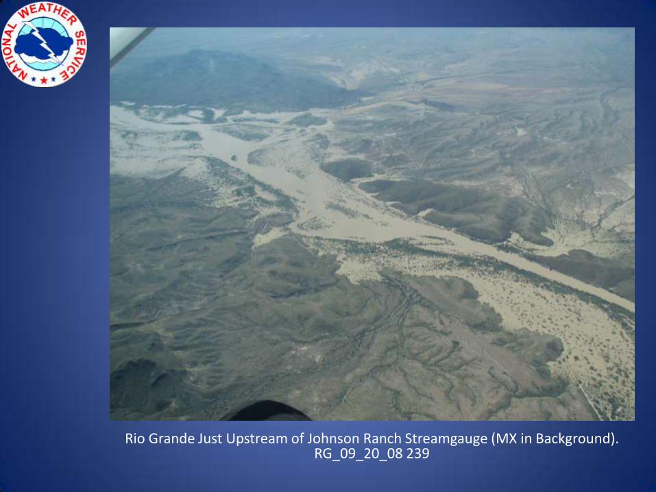
Rio Grande Just Upstream of Johnson Ranch Streamgauge (MX in Background).RG_09_20_08 239
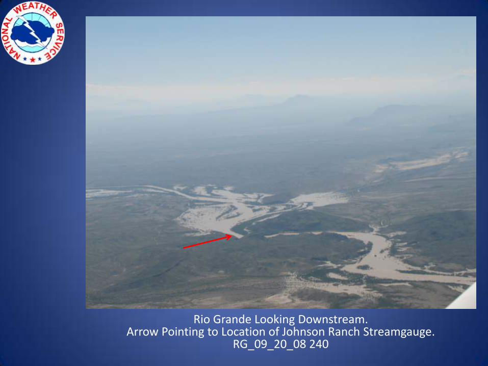
Rio Grande Looking Downstream.Arrow Pointing to Location of Johnson Ranch Streamgauge.
RG_09_20_08 240
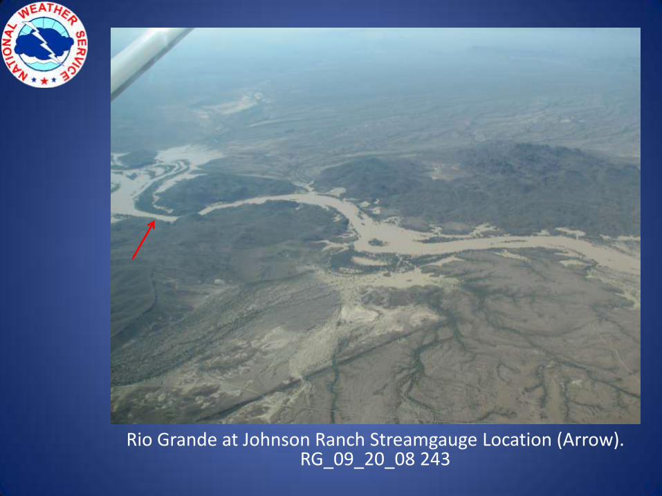
Rio Grande at Johnson Ranch Streamgauge Location (Arrow).RG_09_20_08 243
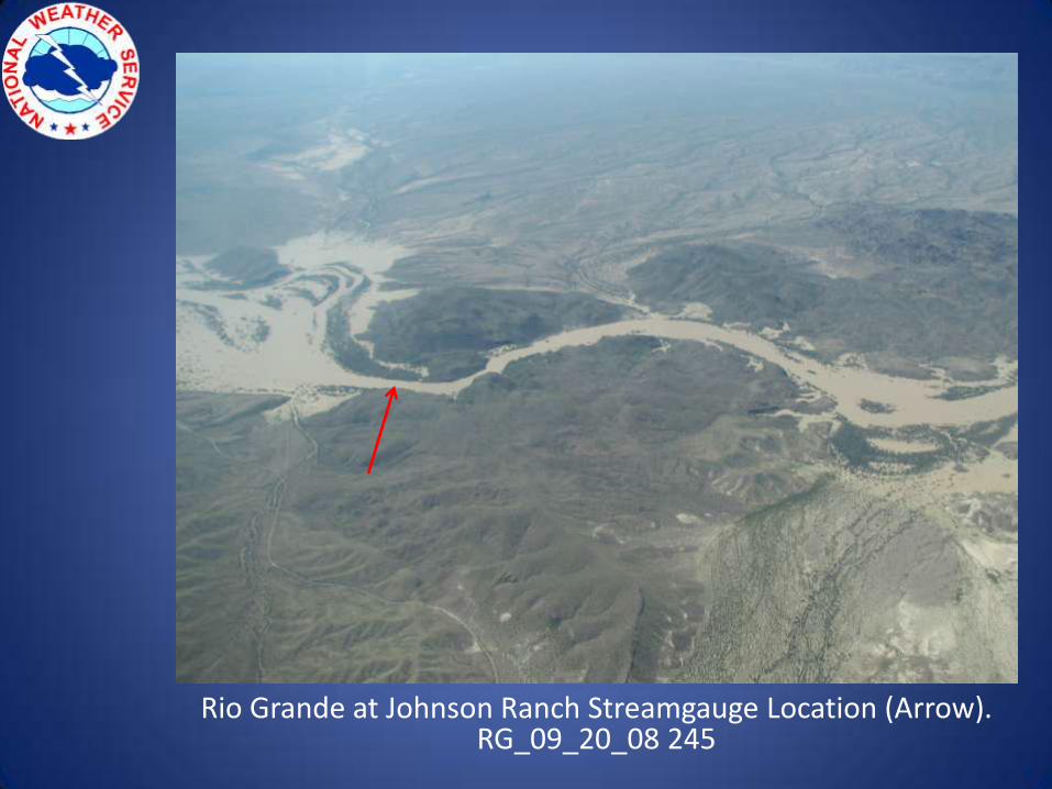
Rio Grande at Johnson Ranch Streamgauge Location (Arrow).RG_09_20_08 245
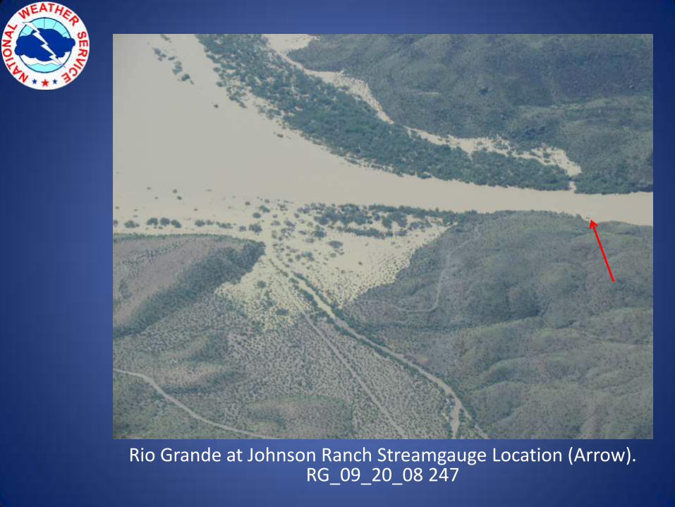
Rio Grande at Johnson Ranch Streamgauge Location (Arrow).RG_09_20_08 247
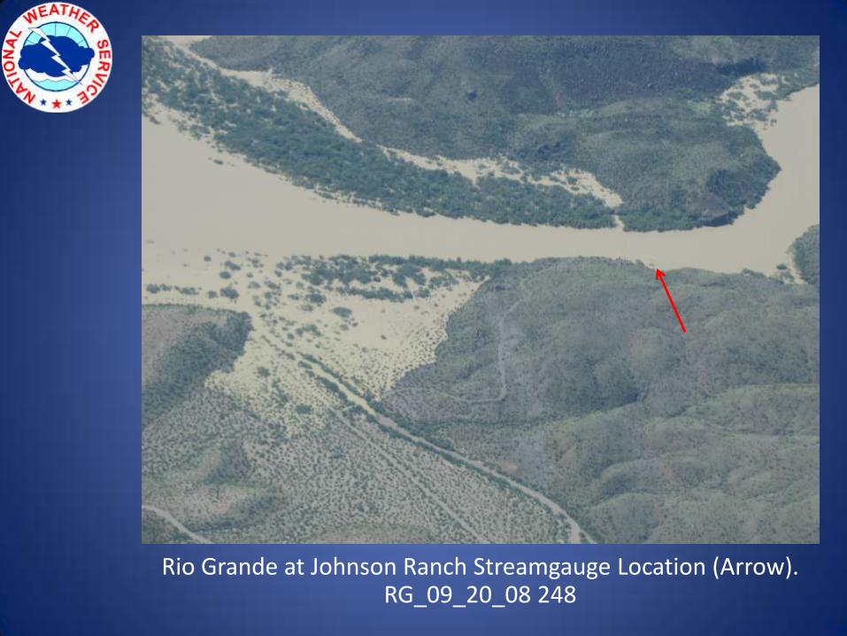
Rio Grande at Johnson Ranch Streamgauge Location (Arrow).RG_09_20_08 248
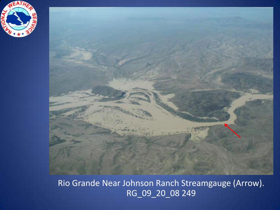
Rio Grande Near Johnson Ranch Streamgauge (Arrow).RG_09_20_08 249
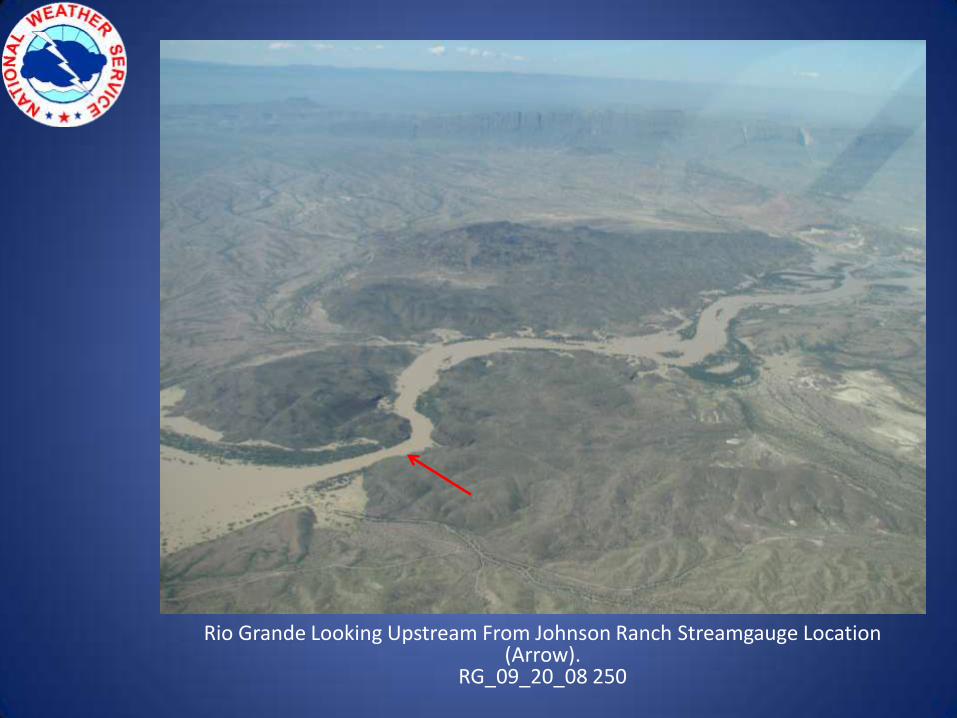
Rio Grande Looking Upstream From Johnson Ranch Streamgauge Location (Arrow).
RG_09_20_08 250
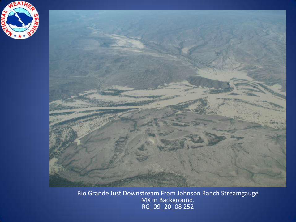
Rio Grande Just Downstream From Johnson Ranch StreamgaugeMX in Background.RG_09_20_08 252
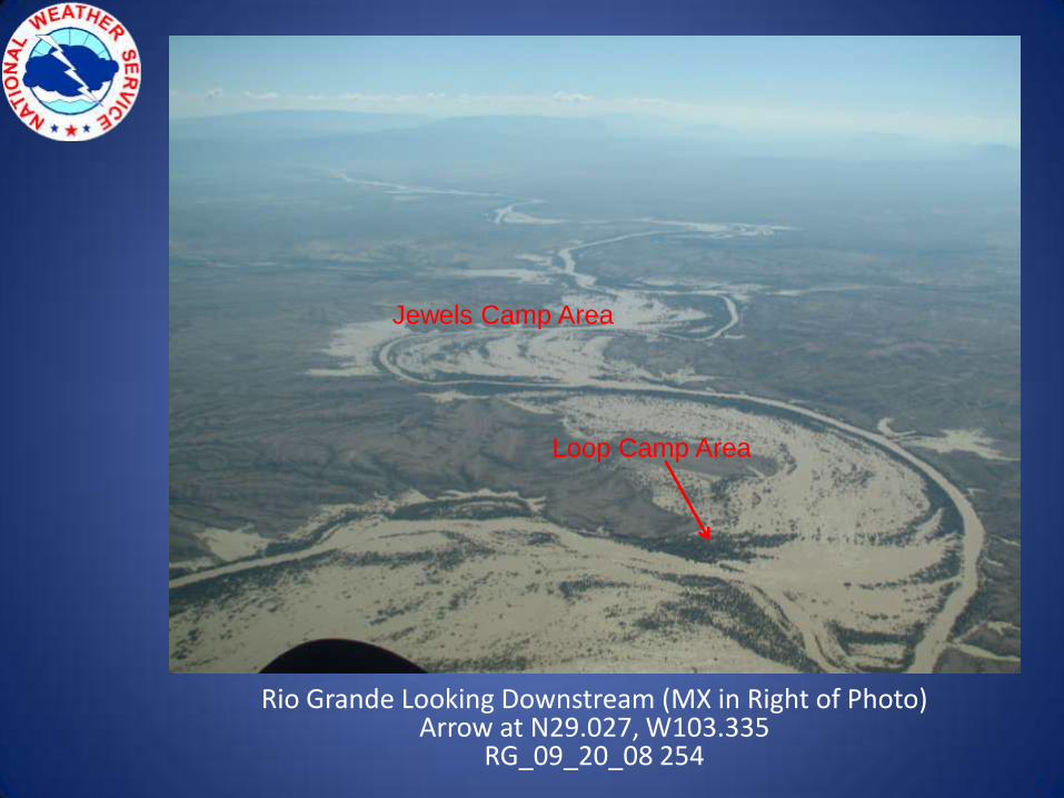
Rio Grande Looking Downstream (MX in Right of Photo)Arrow at N29.027, W103.335
RG_09_20_08 254
Loop Camp Area
Jewels Camp Area
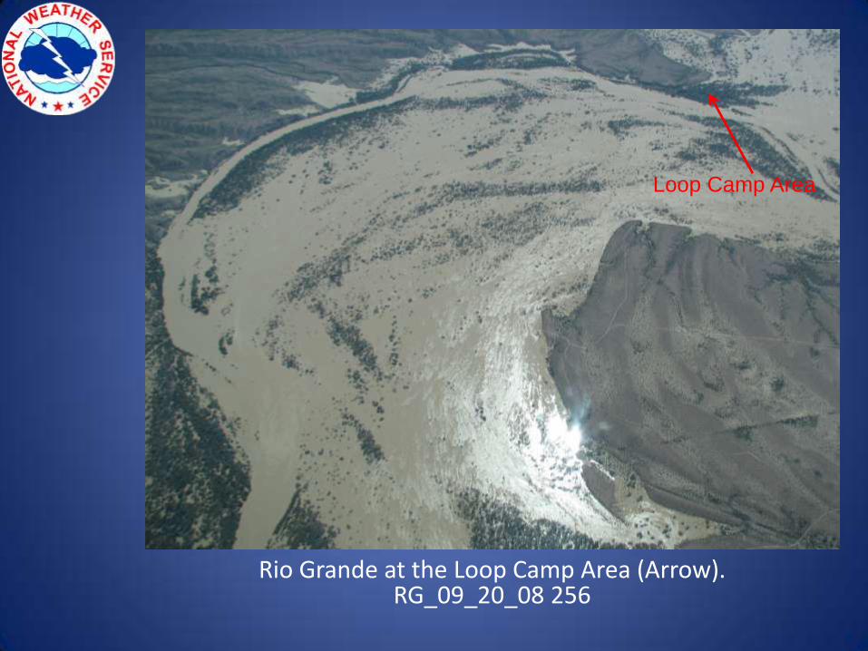
Rio Grande at the Loop Camp Area (Arrow).RG_09_20_08 256
Loop Camp Area
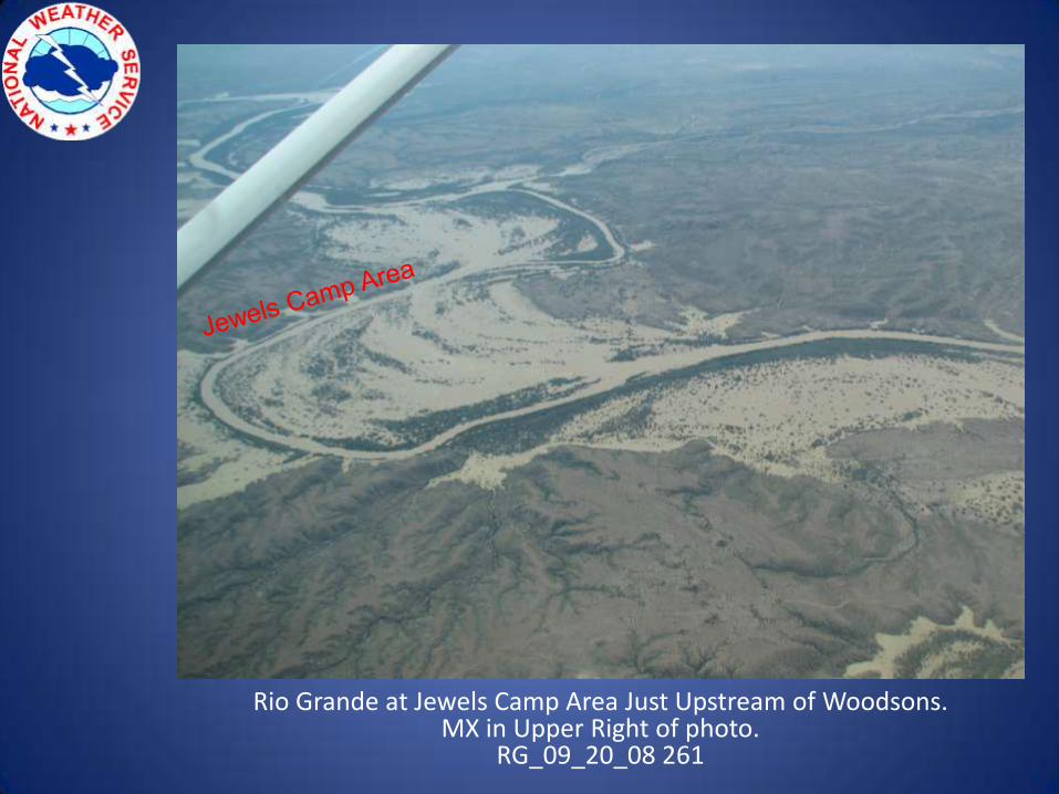
Rio Grande at Jewels Camp Area Just Upstream of Woodsons.MX in Upper Right of photo.
RG_09_20_08 261

Rio Grande at Jewels Camp Area – MX in Background.Arrow at N29.003, W103.308
RG_09_20_08 262
Jewels Camp
Area
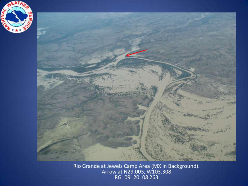
Rio Grande at Jewels Camp Area (MX in Background).Arrow at N29.003, W103.308
RG_09_20_08 263
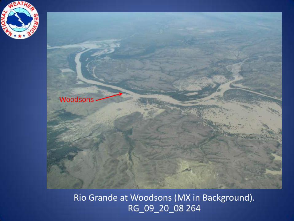
Rio Grande at Woodsons (MX in Background).RG_09_20_08 264
Woodsons
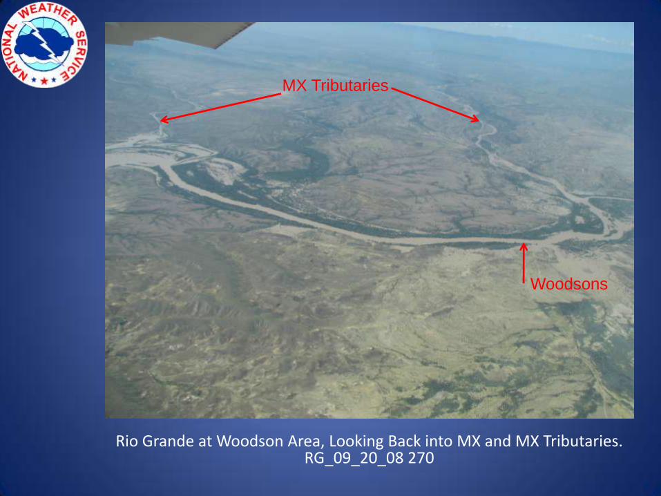
Rio Grande at Woodson Area, Looking Back into MX and MX Tributaries.RG_09_20_08 270
Woodsons
MX Tributaries
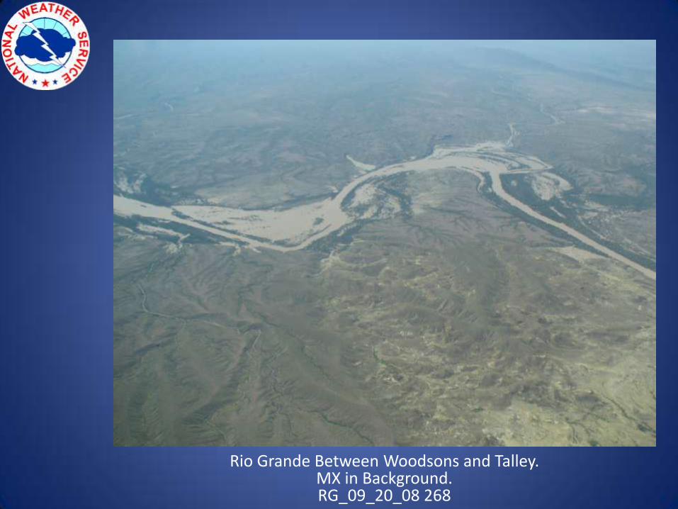
Rio Grande Between Woodsons and Talley.MX in Background.RG_09_20_08 268
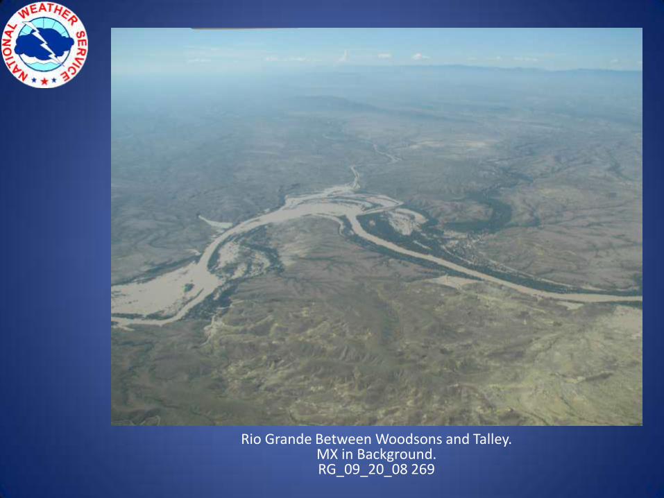
Rio Grande Between Woodsons and Talley. MX in Background.RG_09_20_08 269
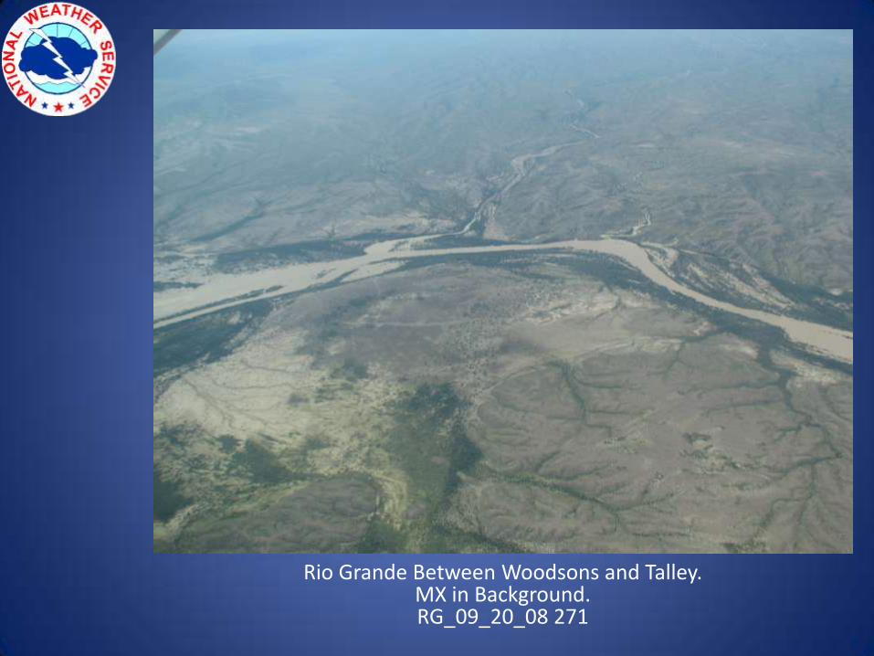
Rio Grande Between Woodsons and Talley.MX in Background.RG_09_20_08 271
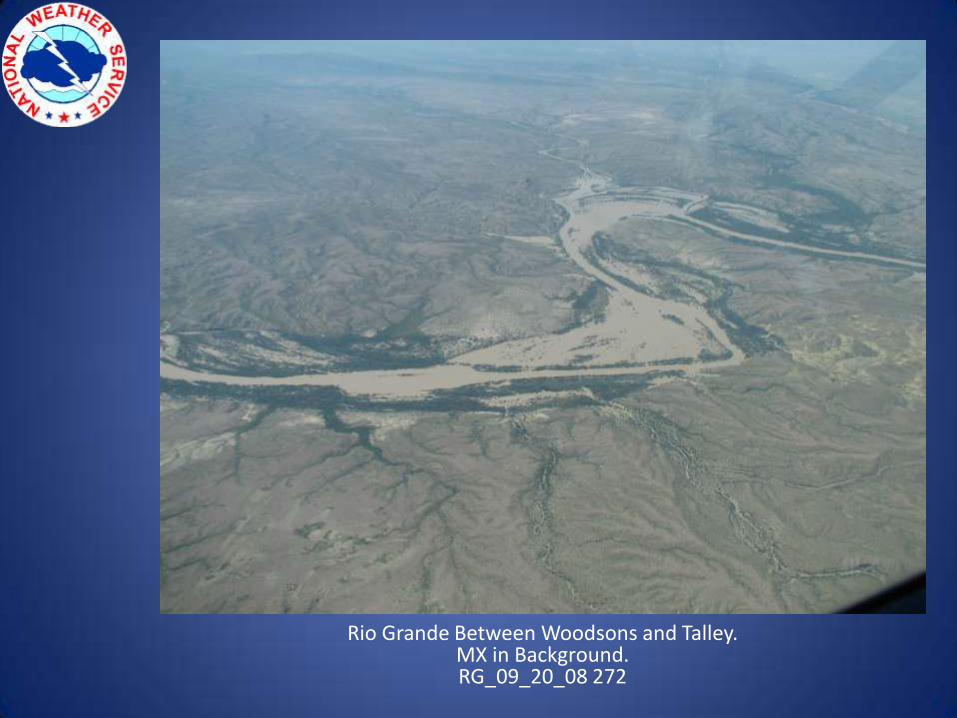
Rio Grande Between Woodsons and Talley.MX in Background.RG_09_20_08 272
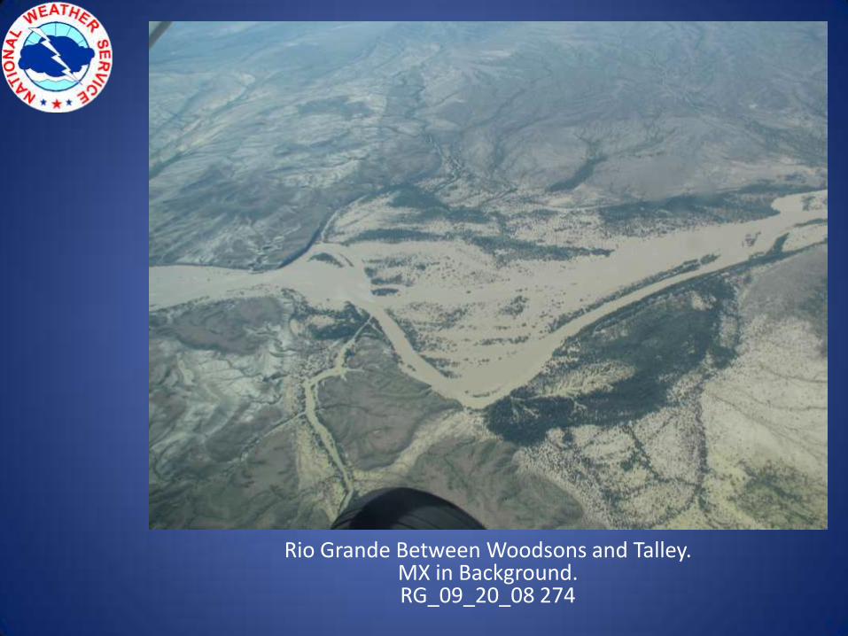
Rio Grande Between Woodsons and Talley.MX in Background.RG_09_20_08 274
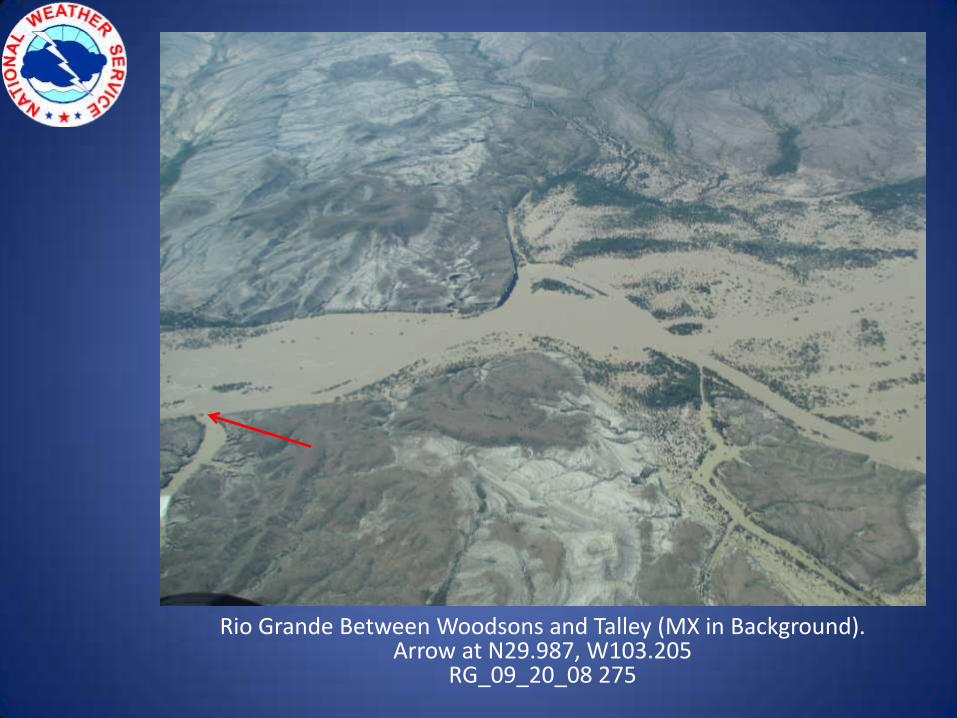
Rio Grande Between Woodsons and Talley (MX in Background).Arrow at N29.987, W103.205
RG_09_20_08 275
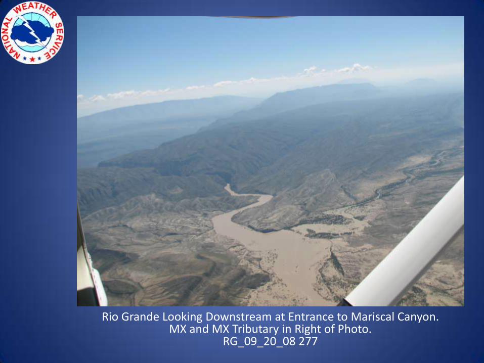
Rio Grande Looking Downstream at Entrance to Mariscal Canyon.MX and MX Tributary in Right of Photo.
RG_09_20_08 277
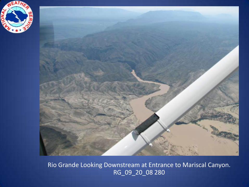
Rio Grande Looking Downstream at Entrance to Mariscal Canyon.RG_09_20_08 280
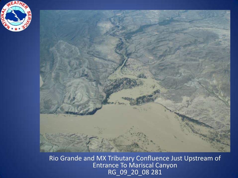
Rio Grande and MX Tributary Confluence Just Upstream of Entrance To Mariscal Canyon
RG_09_20_08 281

Rio Grande at Entrance to Mariscal Canyon.MX in Background.RG_09_20_08 285
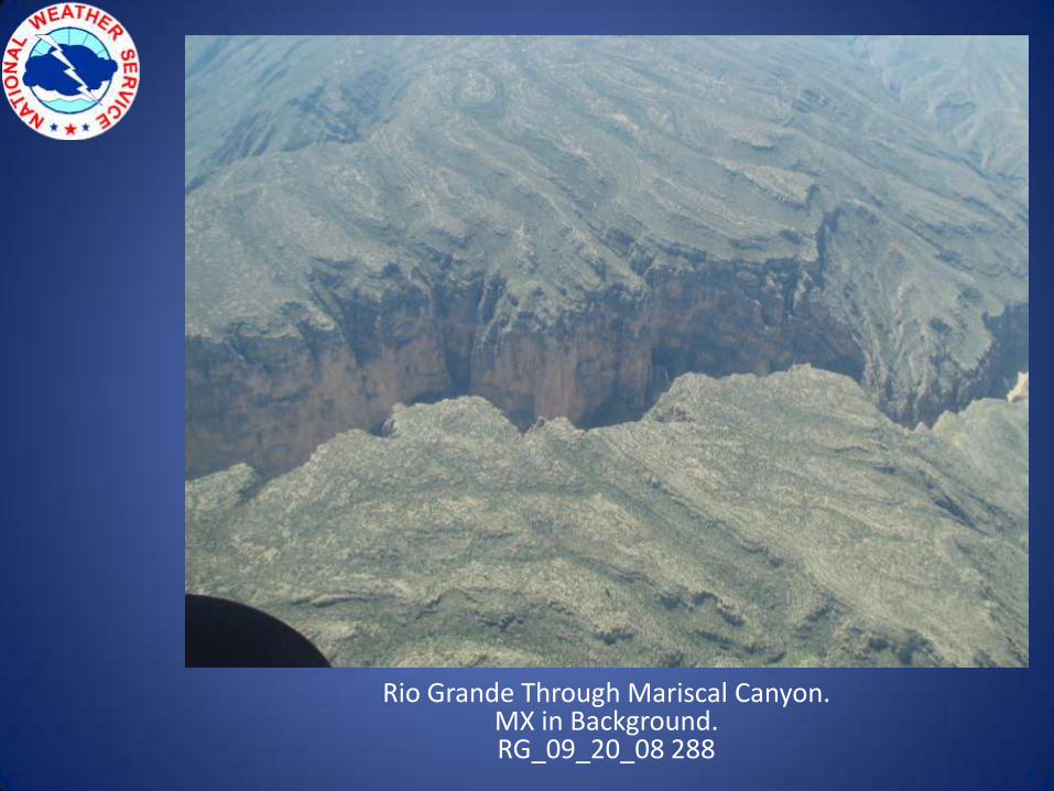
Rio Grande Through Mariscal Canyon.MX in Background.RG_09_20_08 288
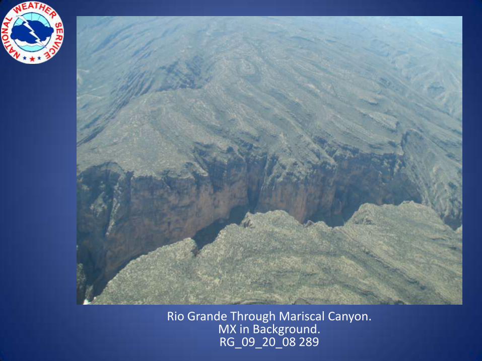
Rio Grande Through Mariscal Canyon.MX in Background.RG_09_20_08 289
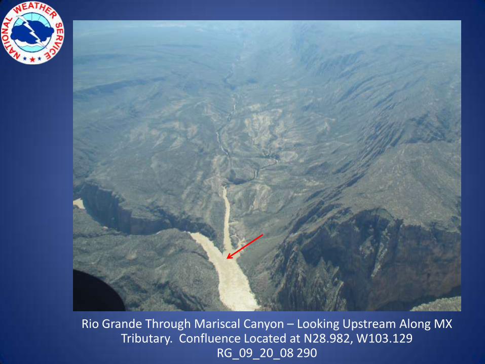
Rio Grande Through Mariscal Canyon – Looking Upstream Along MX Tributary. Confluence Located at N28.982, W103.129
RG_09_20_08 290
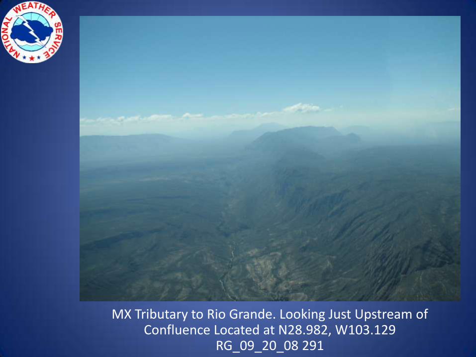
MX Tributary to Rio Grande. Looking Just Upstream of Confluence Located at N28.982, W103.129
RG_09_20_08 291
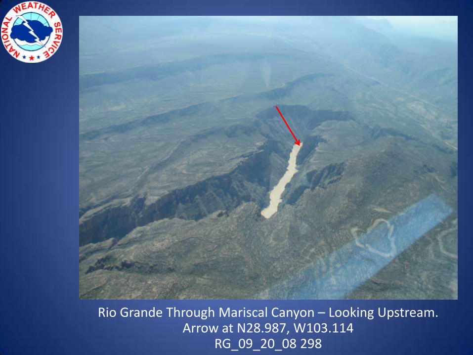
Rio Grande Through Mariscal Canyon – Looking Upstream.Arrow at N28.987, W103.114
RG_09_20_08 298
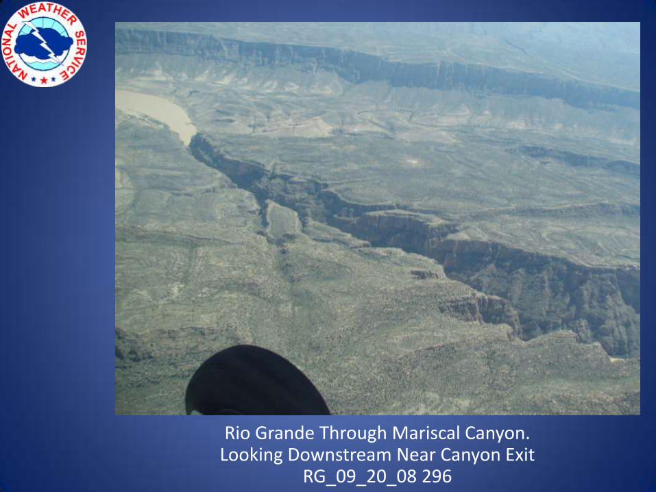
Rio Grande Through Mariscal Canyon.Looking Downstream Near Canyon Exit
RG_09_20_08 296
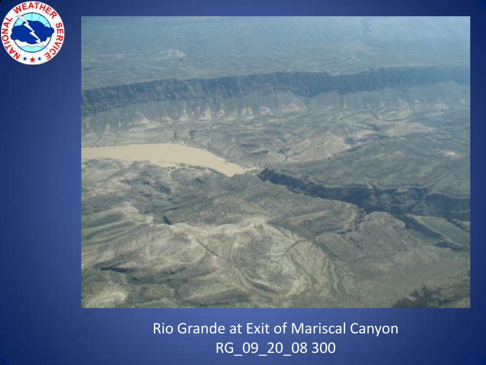
Rio Grande at Exit of Mariscal CanyonRG_09_20_08 300
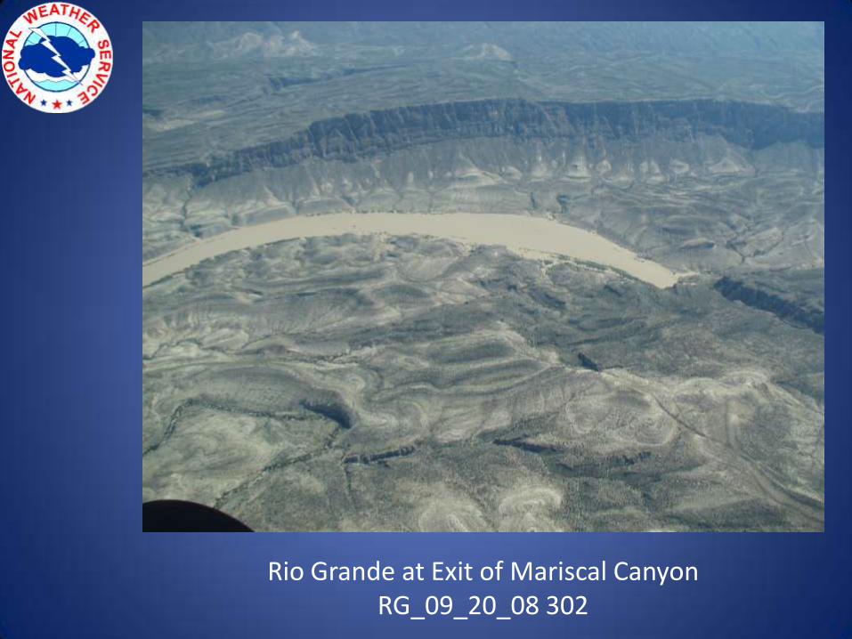
Rio Grande at Exit of Mariscal CanyonRG_09_20_08 302
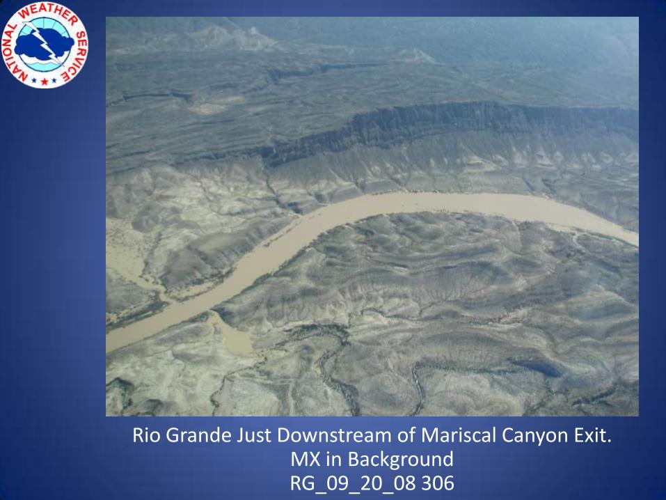
Rio Grande Just Downstream of Mariscal Canyon Exit.MX in BackgroundRG_09_20_08 306
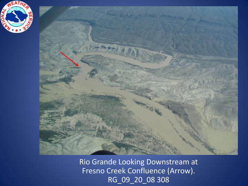
Rio Grande Looking Downstream at Fresno Creek Confluence (Arrow).
RG_09_20_08 308
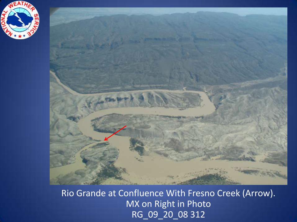
Rio Grande at Confluence With Fresno Creek (Arrow).MX on Right in Photo
RG_09_20_08 312
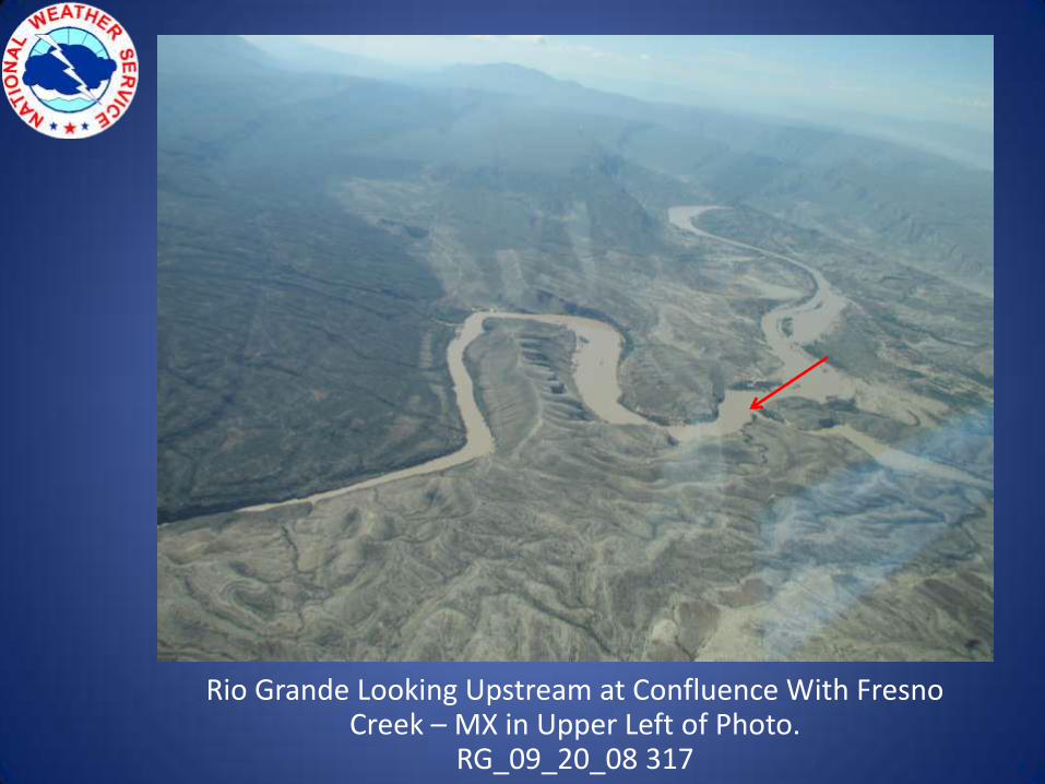
Rio Grande Looking Upstream at Confluence With Fresno Creek – MX in Upper Left of Photo.
RG_09_20_08 317
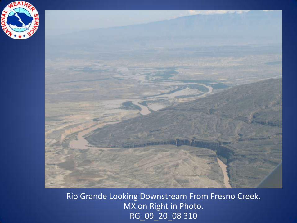
Rio Grande Looking Downstream From Fresno Creek.MX on Right in Photo.
RG_09_20_08 310
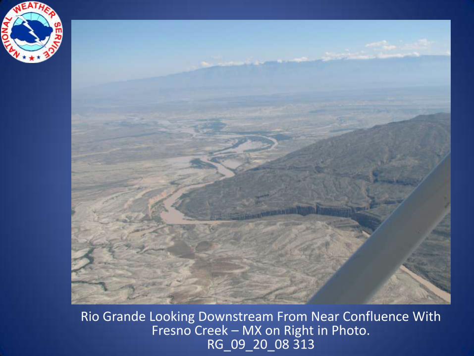
Rio Grande Looking Downstream From Near Confluence With Fresno Creek – MX on Right in Photo.
RG_09_20_08 313
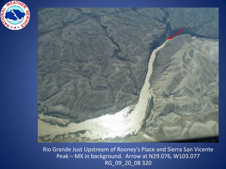
Rio Grande Just Upstream of Rooney’s Place and Sierra San Vicente Peak – MX in background. Arrow at N29.076, W103.077
RG_09_20_08 320
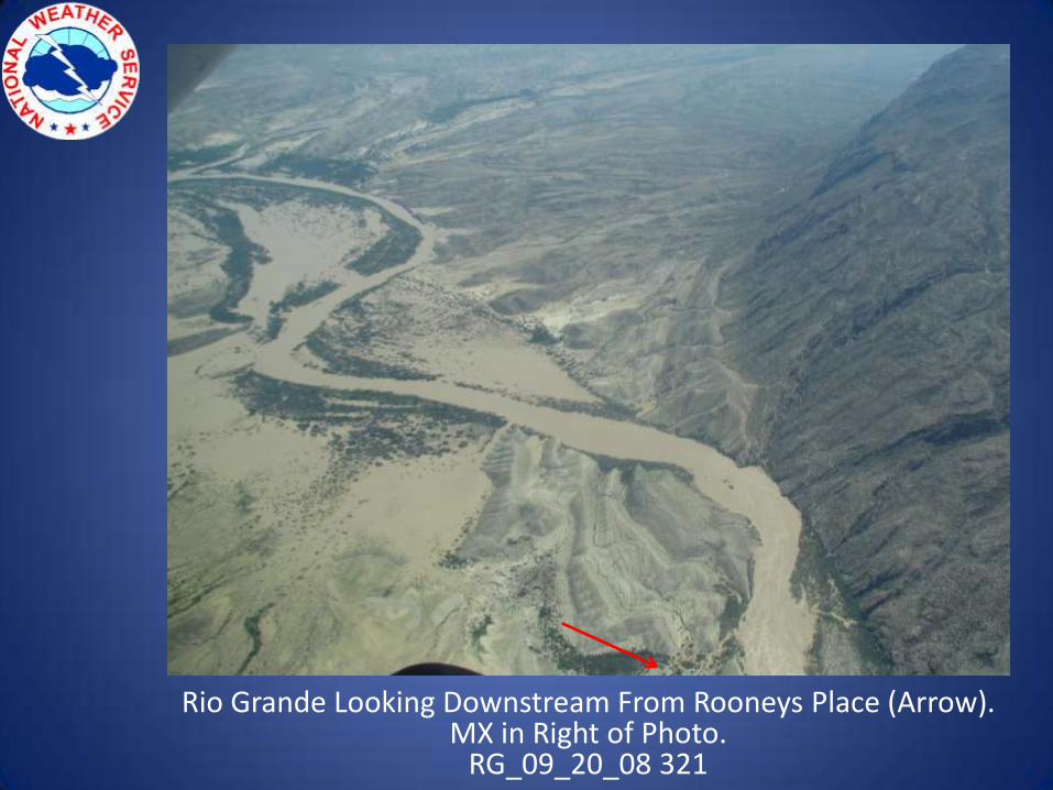
Rio Grande Looking Downstream From Rooneys Place (Arrow).MX in Right of Photo.
RG_09_20_08 321
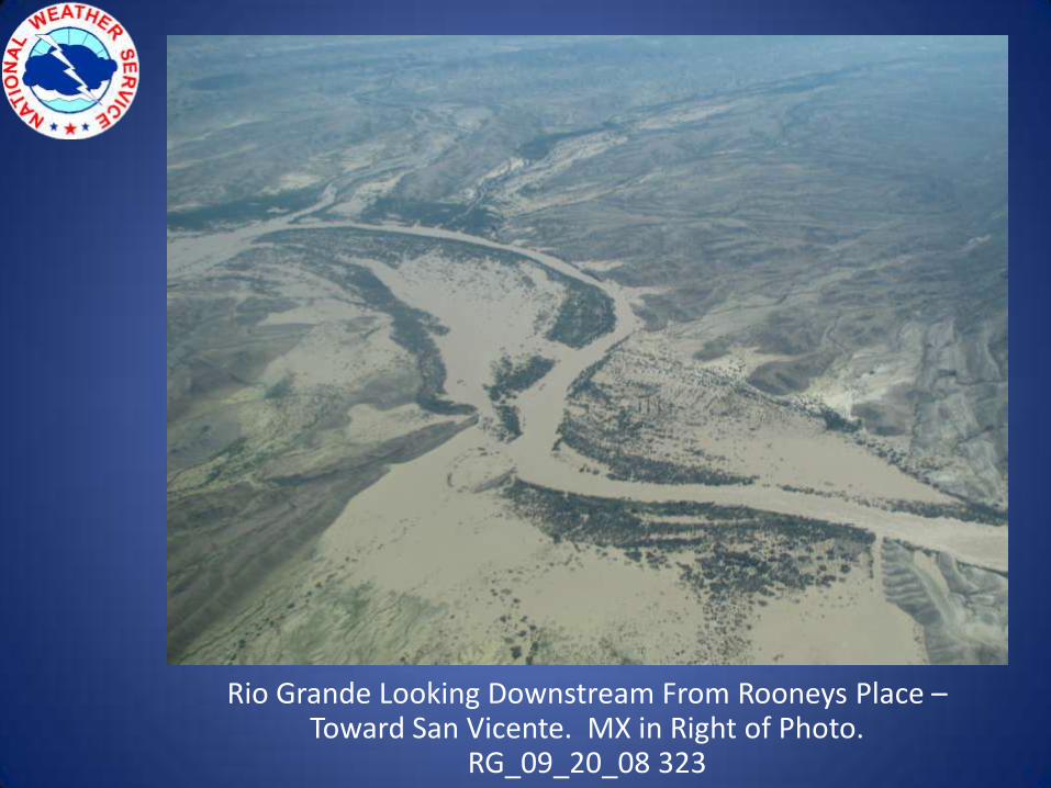
Rio Grande Looking Downstream From Rooneys Place –Toward San Vicente. MX in Right of Photo.
RG_09_20_08 323
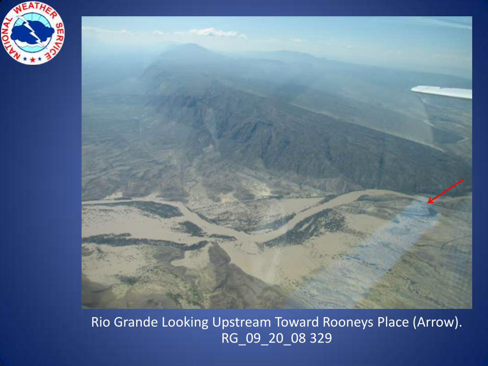
Rio Grande Looking Upstream Toward Rooneys Place (Arrow).RG_09_20_08 329
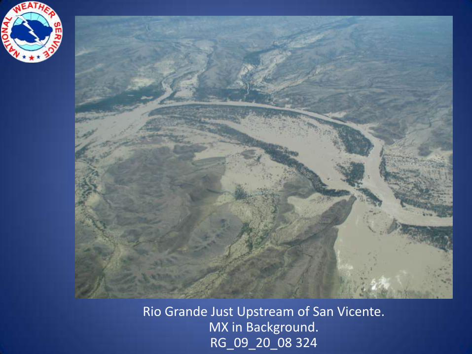
Rio Grande Just Upstream of San Vicente.MX in Background.RG_09_20_08 324
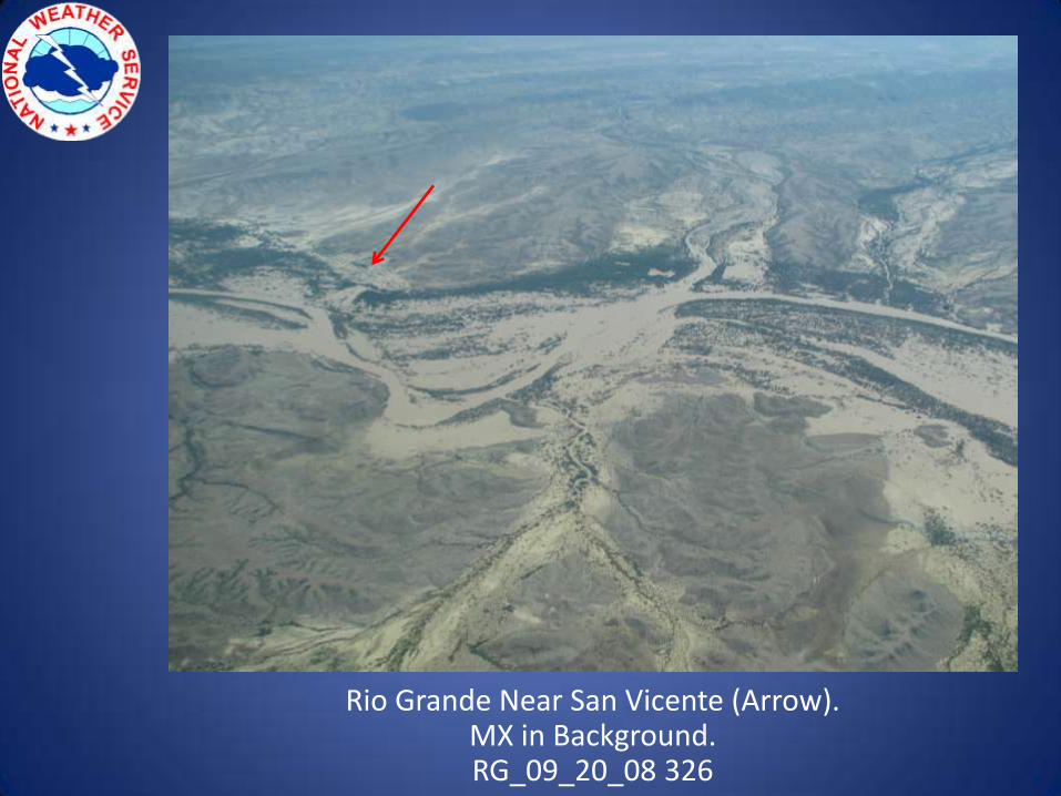
Rio Grande Near San Vicente (Arrow).MX in Background.RG_09_20_08 326
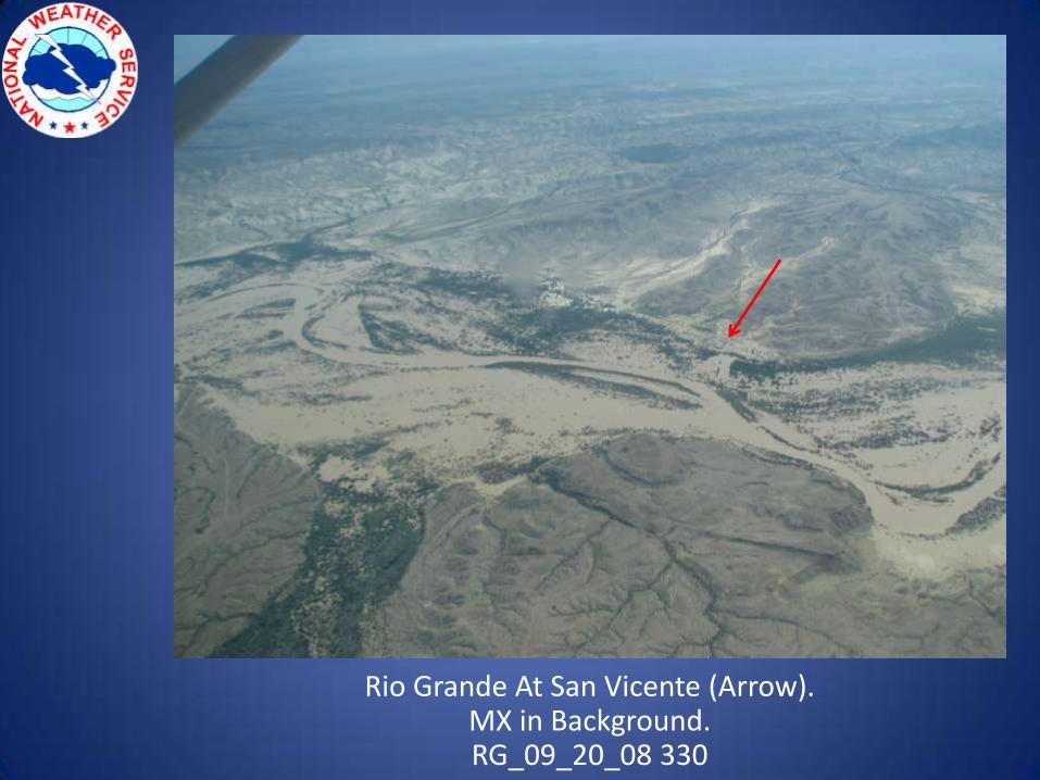
Rio Grande At San Vicente (Arrow).MX in Background.RG_09_20_08 330
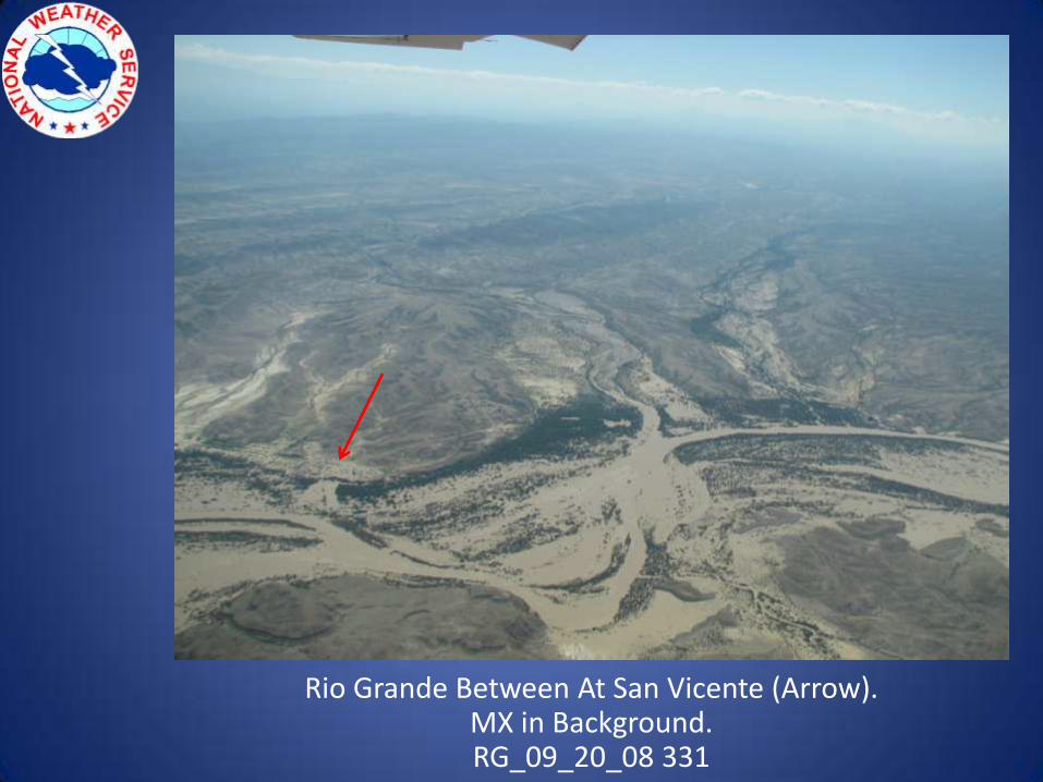
Rio Grande Between At San Vicente (Arrow).MX in Background.RG_09_20_08 331
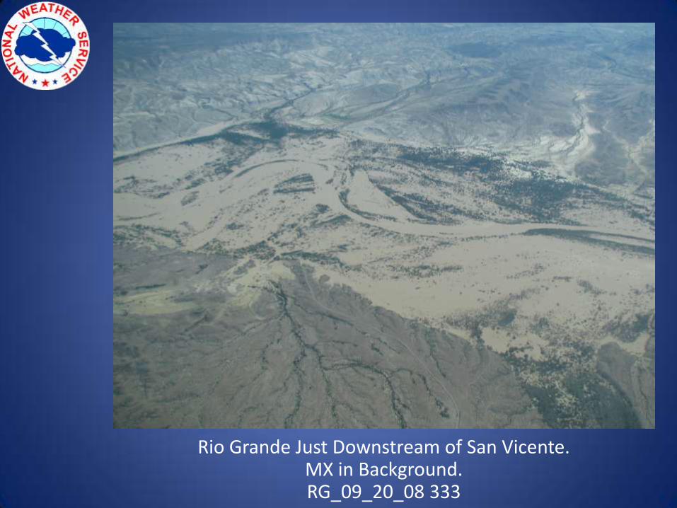
Rio Grande Just Downstream of San Vicente.MX in Background.RG_09_20_08 333
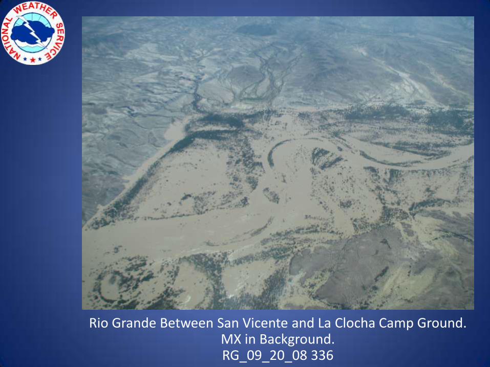
Rio Grande Between San Vicente and La Clocha Camp Ground.MX in Background.RG_09_20_08 336
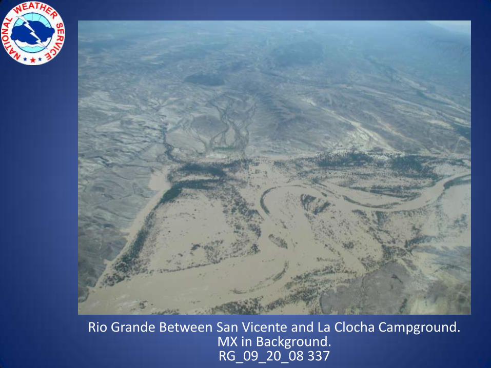
Rio Grande Between San Vicente and La Clocha Campground.MX in Background.RG_09_20_08 337
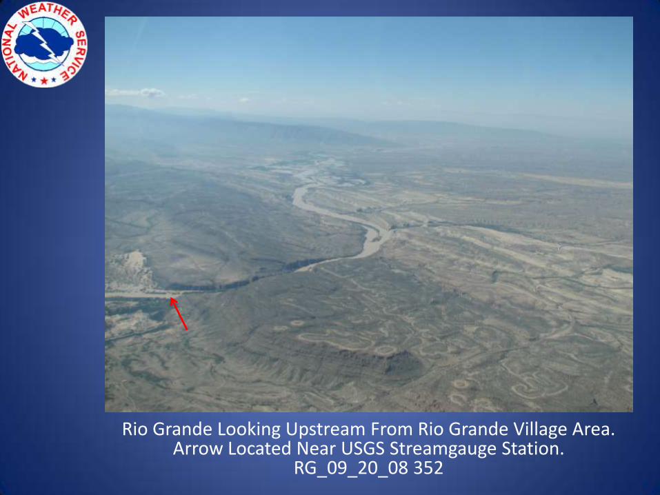
Rio Grande Looking Upstream From Rio Grande Village Area. Arrow Located Near USGS Streamgauge Station.
RG_09_20_08 352
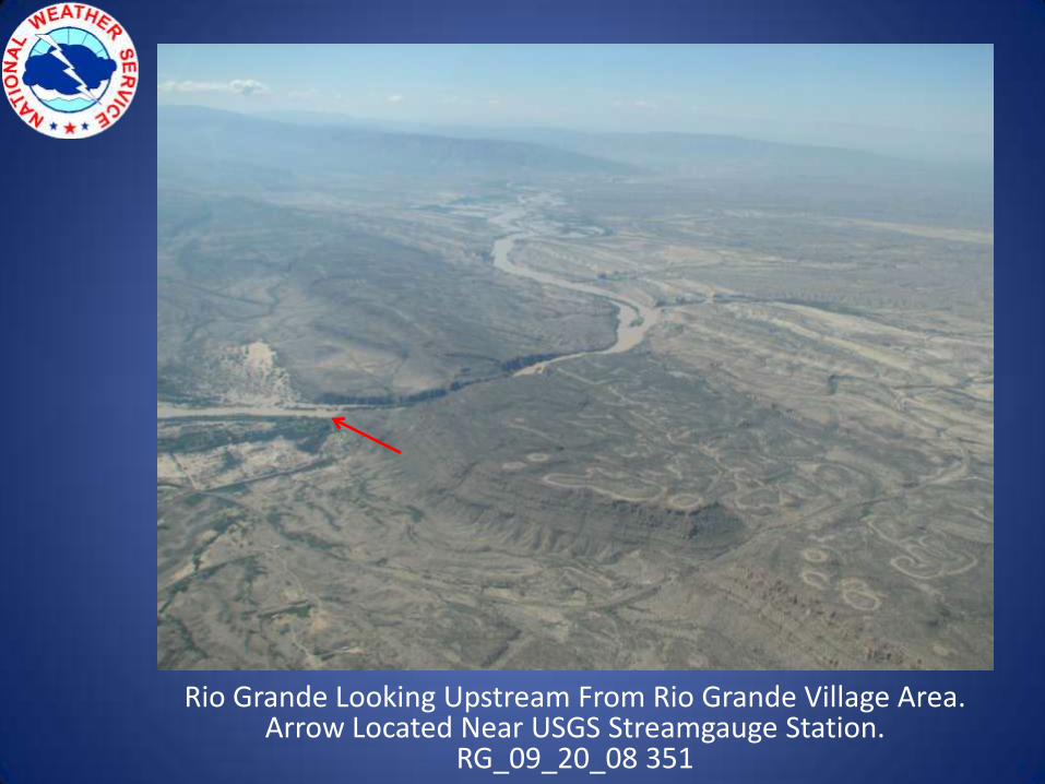
Rio Grande Looking Upstream From Rio Grande Village Area.Arrow Located Near USGS Streamgauge Station.
RG_09_20_08 351
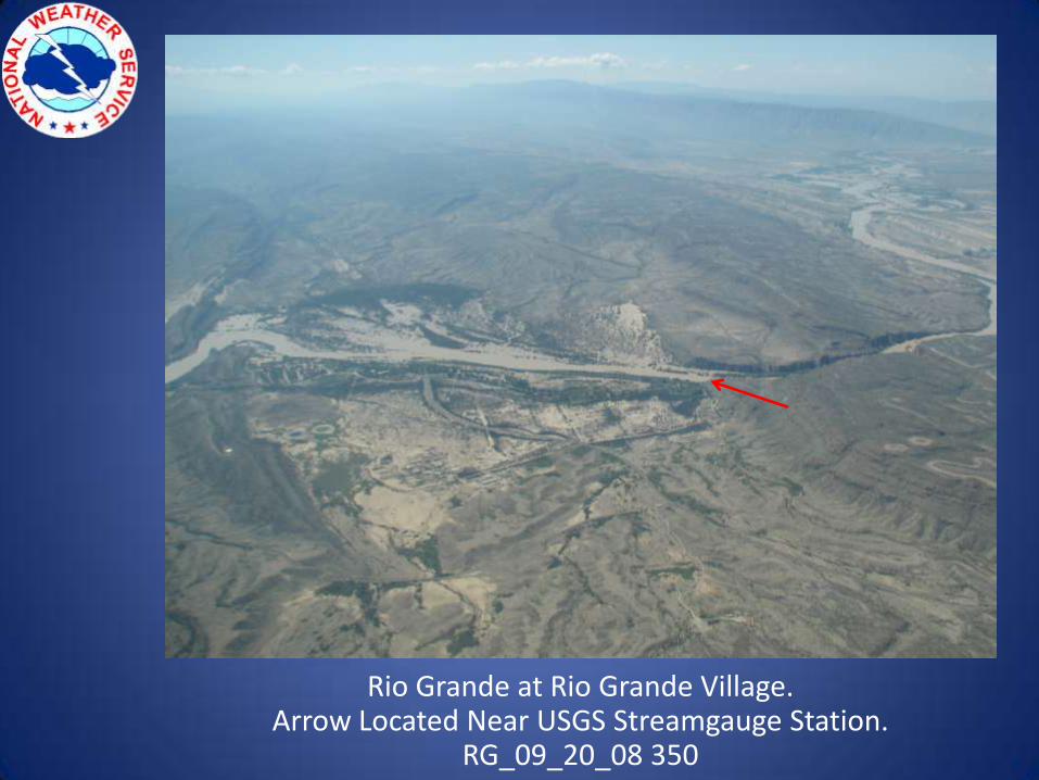
Rio Grande at Rio Grande Village.Arrow Located Near USGS Streamgauge Station.
RG_09_20_08 350
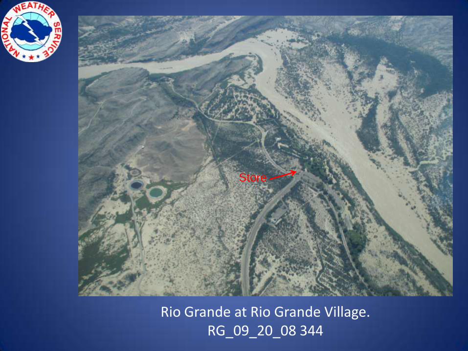
Rio Grande at Rio Grande Village.RG_09_20_08 344
Store
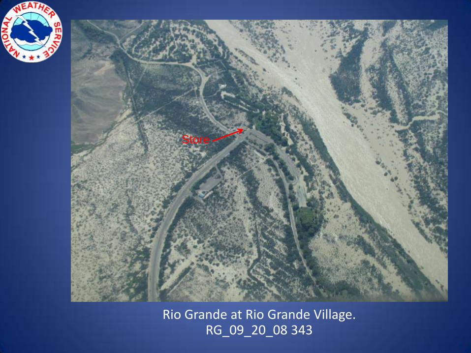
Rio Grande at Rio Grande Village.RG_09_20_08 343
Store
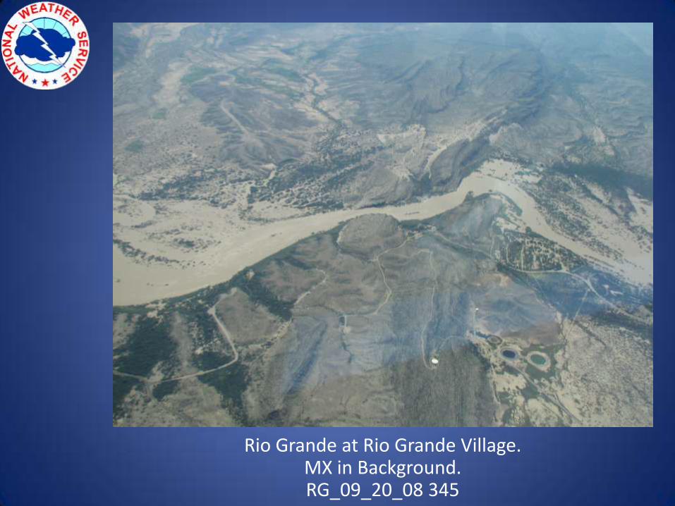
Rio Grande at Rio Grande Village.MX in Background.RG_09_20_08 345
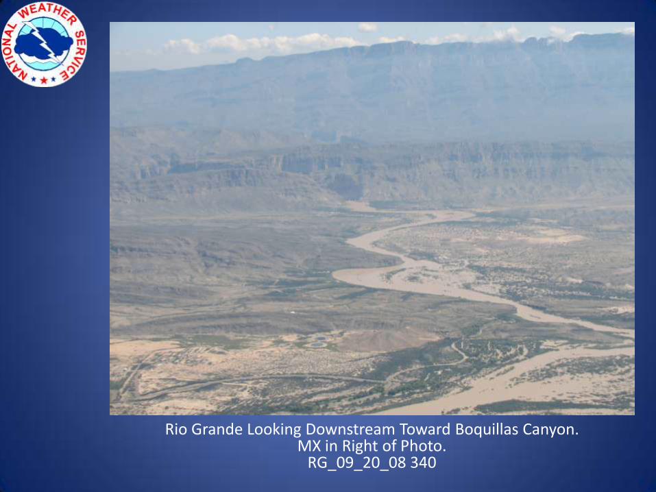
Rio Grande Looking Downstream Toward Boquillas Canyon.MX in Right of Photo.
RG_09_20_08 340
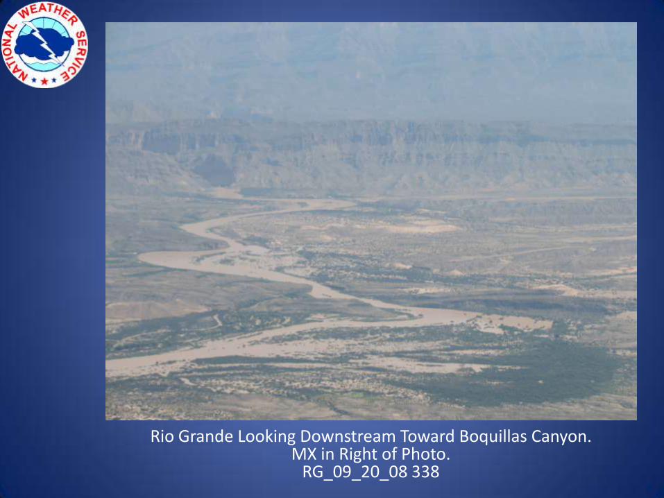
Rio Grande Looking Downstream Toward Boquillas Canyon. MX in Right of Photo.
RG_09_20_08 338
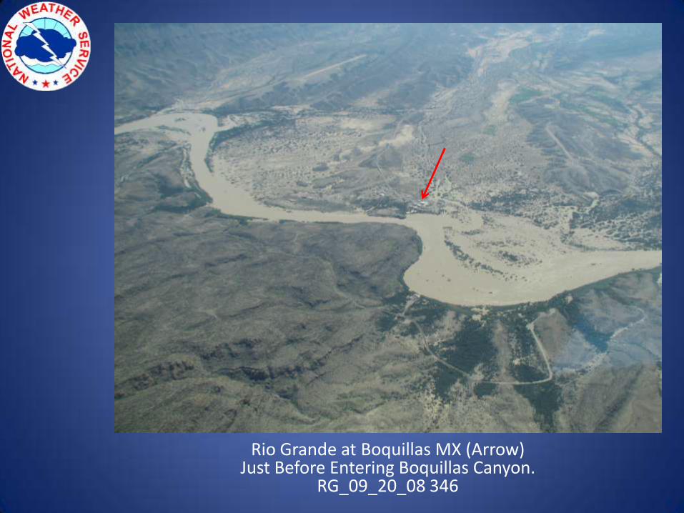
Rio Grande at Boquillas MX (Arrow) Just Before Entering Boquillas Canyon.
RG_09_20_08 346
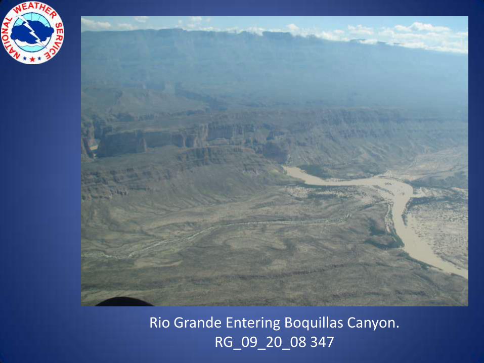
Rio Grande Entering Boquillas Canyon.RG_09_20_08 347