Embed Size (px)
Citation preview
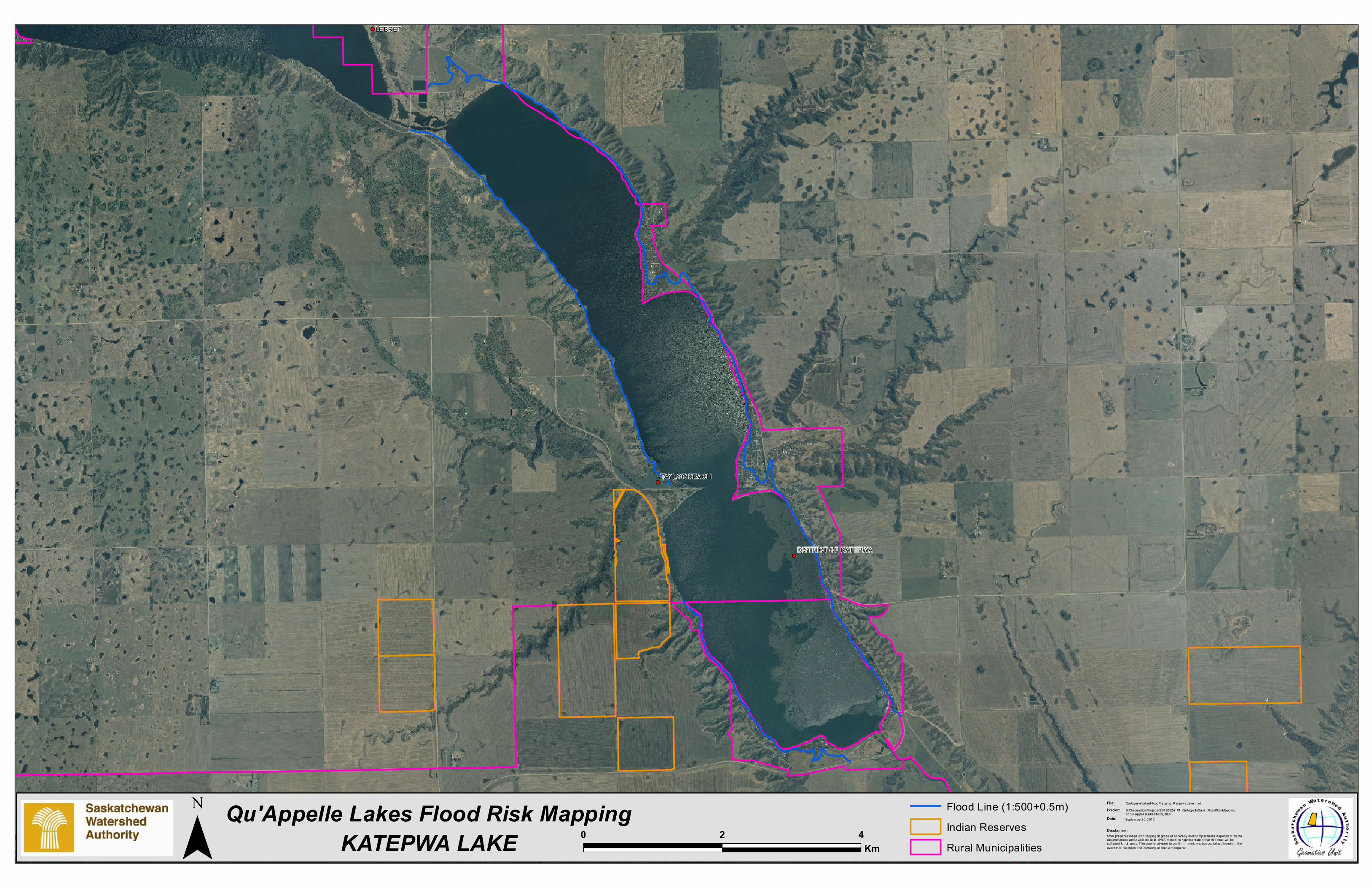
LEBRET
TAYLOR BEACH
DISTRICT OF KATEPWA
Qu'Appelle Lakes Flood Risk MappingSWA prepares maps with varying degrees of accuracy and completeness dependant on the circumstances and avai lable data. SWA makes no r epr esentation that this map wil l be sufficient for al l uses. The user is advised to confirm the in formation conta ined here in in the event that precision and currency of data are requi red.
Disclaime r:
File:Folder:Date:
QuAppel leLakesFloodMapping_K atepwaLake.mxdH:\Geomatics\Pro jects \20120824_01_QuA ppelleSask_FloodRiskMappingForQuAppelleLakes\M xd_fi lesSeptember20, 2012
Flood Line (1:500+0.5m)Indian ReservesRural MunicipalitiesKATEPWA LAKE¯ 0 42
Km


![Deep Reinforcement Learning-based Image Captioning with ...web.cs.ucla.edu/~zhou.ren/Zhou_CVPR17_talk.pdf · [Fang et al. CVPR 2015] [Lebret et al. ICLR 2015] [Mao et al. ICLR 2015]](https://img.pdfslide.us/doc/110x75/5f53a97e312fc2727924c906/deep-reinforcement-learning-based-image-captioning-with-webcsuclaeduzhourenzhoucvpr17talkpdf.jpg)