Embed Size (px)
Citation preview
Larry SzarekLarry SzarekPenn State UniversityPenn State University
MGIS ProgramMGIS ProgramCapstone Project ProposalCapstone Project Proposal
Using a Utility Geodatabase to Using a Utility Geodatabase to Store & Edit Drainage Plat Store & Edit Drainage Plat
MapsMaps
Presentation OutlinePresentation Outline
ObjectiveObjective BackgroundBackground Identification & Description of the ProblemIdentification & Description of the Problem Proposed Solution to the ProblemProposed Solution to the Problem Process for Solving the ProblemProcess for Solving the Problem Potential ObstaclesPotential Obstacles Project TimelineProject Timeline Questions/Comments/SuggestionQuestions/Comments/Suggestion

ObjectiveObjective
Arc SDE Geodatabase
Feature Classes

BackgroundBackground

BackgroundBackground
Philadelphia Water DepartmentPhiladelphia Water Department
OUR MISSION
The Philadelphia Water Department and Water Revenue Bureau serve the Greater Philadelphia region by providing integrated water, wastewater, and storm water services. The utility's primary mission is to plan for, operate, and maintain both the infrastructure and the organization necessary to purvey high quality drinking water, to provide an adequate and reliable water supply for all household, commercial, and community needs, and to sustain and enhance the region's watersheds and quality of life by managing wastewater and storm water effectively.
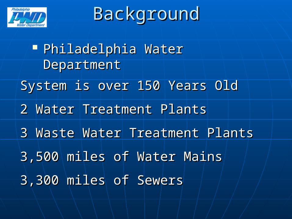
BackgroundBackground
Philadelphia Water DepartmentPhiladelphia Water Department
System is over 150 Years OldSystem is over 150 Years Old
2 Water Treatment Plants2 Water Treatment Plants
3 Waste Water Treatment Plants3 Waste Water Treatment Plants
3,500 miles of Water Mains3,500 miles of Water Mains
3,300 miles of Sewers3,300 miles of Sewers

GIS at the Philadelphia Water GIS at the Philadelphia Water DepartmentDepartment
Began in 1996Began in 1996 Orthophotography & Planimetrics (1996)Orthophotography & Planimetrics (1996) GIS Strategic Action Plan (2000)GIS Strategic Action Plan (2000) Raster Imaging (2001)Raster Imaging (2001) Engineering Records Viewer (2002)Engineering Records Viewer (2002) Data Conversion (2003 -2005)Data Conversion (2003 -2005) Data maintenance & Application Data maintenance & Application
Development (Current)Development (Current)

Applications of GIS at PWD Applications of GIS at PWD
Sewer Assessment & InspectionsSewer Assessment & Inspections Document ManagementDocument Management Hydraulic ModelingHydraulic Modeling Storm water & Combined Sewer Overflow ModelingStorm water & Combined Sewer Overflow Modeling Planning & EngineeringPlanning & Engineering Preventative MaintenancePreventative Maintenance Tracing & Valve IsolationTracing & Valve Isolation Emergency ResponseEmergency Response Work Order/Asset ManagementWork Order/Asset Management Legacy Application LinkingLegacy Application Linking
GIS at PWDGIS at PWD
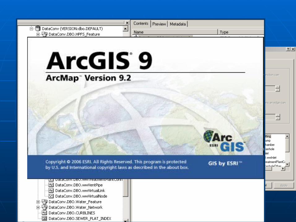
Enterprise GISEnterprise GIS• ArcSDE 9.2ArcSDE 9.2• ArcGIS Server 9.2ArcGIS Server 9.2• ArcGIS Desktop 9.2ArcGIS Desktop 9.2• AutoDesk Mapguide 6.5AutoDesk Mapguide 6.5
Water & Sewer Infrastructure Water & Sewer Infrastructure GeodatabaseGeodatabase
• Geometric NetworkGeometric Network• 120 Feature Classes120 Feature Classes• Over 1 million featuresOver 1 million features

Identification Identification & Description& Description
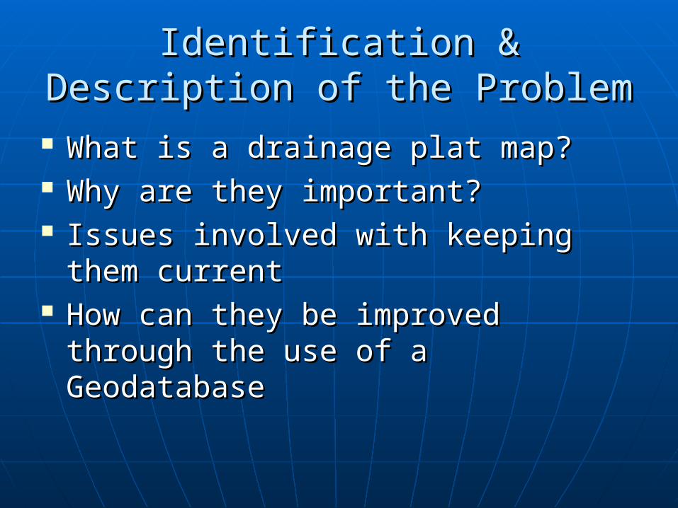
Identification & Description of the Identification & Description of the ProblemProblem
What is a drainage plat map?What is a drainage plat map? Why are they important?Why are they important? Issues involved with keeping them Issues involved with keeping them
currentcurrent How can they be improved through How can they be improved through
the use of a Geodatabasethe use of a Geodatabase

Philadelphia Water Department Philadelphia Water Department Drainage Plat Maps (History)Drainage Plat Maps (History)
Date back to the 1940’s when they were Date back to the 1940’s when they were maintained as hand drawn linen maps.maintained as hand drawn linen maps.
Converted to Mylar sheets with a Converted to Mylar sheets with a corresponding index map in the 1970’scorresponding index map in the 1970’s
Converted to .tif files in 2001 and are now Converted to .tif files in 2001 and are now maintained digitally.maintained digitally.
Full Sets are printed once a year and Full Sets are printed once a year and distributed throughout the departmentdistributed throughout the department
4 Years ago the full set was georeferenced 4 Years ago the full set was georeferenced & rubbersheeted & rubbersheeted
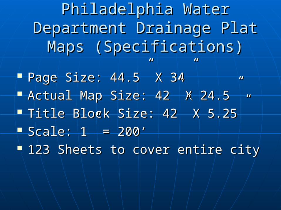
Philadelphia Water Department Philadelphia Water Department Drainage Plat Maps (Specifications)Drainage Plat Maps (Specifications)
Page Size: 44.5” X 34”Page Size: 44.5” X 34” Actual Map Size: 42” X 24.5”Actual Map Size: 42” X 24.5” Title Block Size: 42” X 5.25”Title Block Size: 42” X 5.25” Scale: 1” = 200’Scale: 1” = 200’ 123 Sheets to cover entire city123 Sheets to cover entire city

What does a Drainage Plat show?What does a Drainage Plat show?
A rough plan view of the entire sewer A rough plan view of the entire sewer system (storm, sanitary & combined)system (storm, sanitary & combined)
Size, material, & grade for all sewersSize, material, & grade for all sewers Invert elevations for all manholesInvert elevations for all manholes Base map information (hydrology, streets, Base map information (hydrology, streets,
facilities, right of ways, railroads, etc.)facilities, right of ways, railroads, etc.) Street elevationsStreet elevations Descriptive annotation for specific parts Descriptive annotation for specific parts
and aspects of the systemand aspects of the system Areas that are currently under constructionAreas that are currently under construction

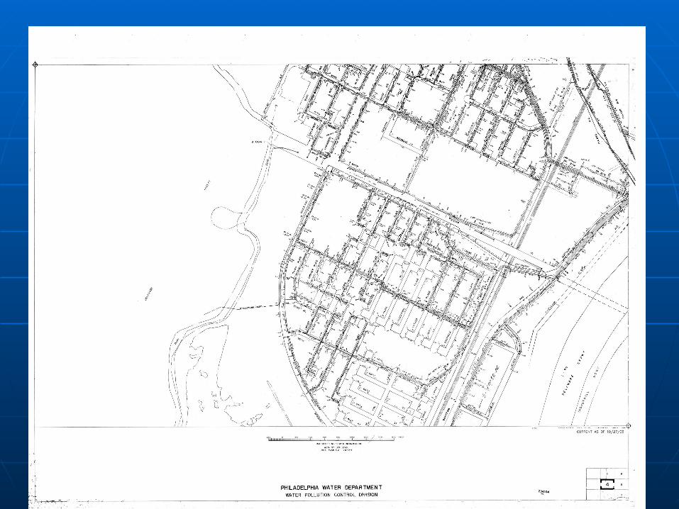
Philadelphia Water Department Philadelphia Water Department Drainage Plat Maps (Examples)Drainage Plat Maps (Examples)
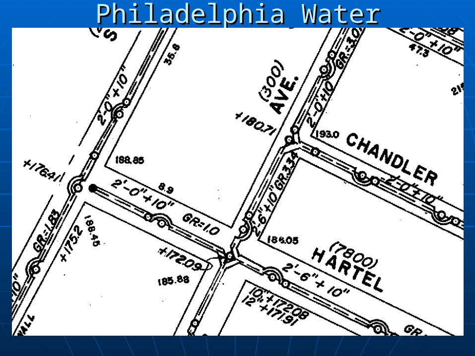
Philadelphia Water Department Philadelphia Water Department Drainage Plat Maps (Examples)Drainage Plat Maps (Examples)
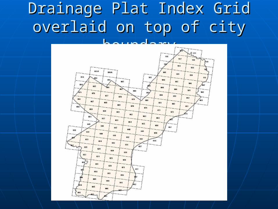
Drainage Plat Index Grid overlaid Drainage Plat Index Grid overlaid on top of city boundaryon top of city boundary
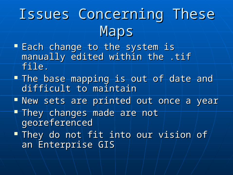
Issues Concerning These MapsIssues Concerning These Maps
Each change to the system is Each change to the system is manually edited within the .tif file.manually edited within the .tif file.
The base mapping is out of date and The base mapping is out of date and difficult to maintaindifficult to maintain
New sets are printed out once a yearNew sets are printed out once a year They changes made are not They changes made are not
georeferencedgeoreferenced They do not fit into our vision of an They do not fit into our vision of an
Enterprise GISEnterprise GIS

Proposed Proposed SolutionSolution

How Using a Geodatabase Can How Using a Geodatabase Can Improve these mapsImprove these maps
AccuracyAccuracy PresentationPresentation MaintenanceMaintenance AnalysisAnalysis

ProcessProcess
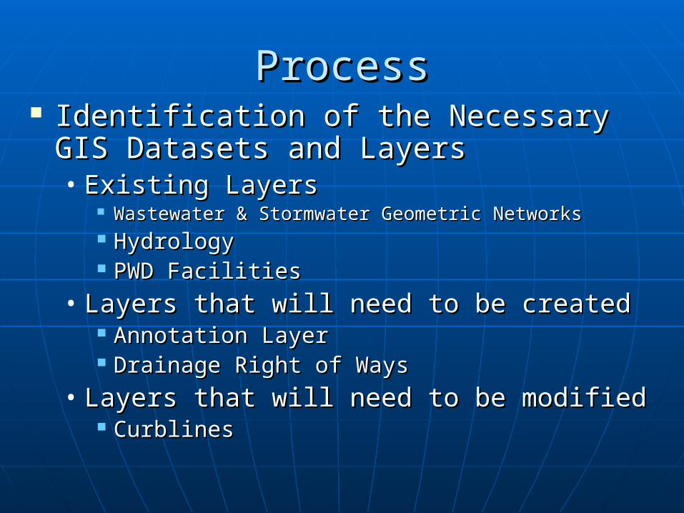
ProcessProcess Identification of the Necessary GIS Identification of the Necessary GIS
Datasets and LayersDatasets and Layers• Existing LayersExisting Layers
Wastewater & Stormwater Geometric NetworksWastewater & Stormwater Geometric Networks HydrologyHydrology PWD FacilitiesPWD Facilities
• Layers that will need to be createdLayers that will need to be created Annotation LayerAnnotation Layer Drainage Right of WaysDrainage Right of Ways
• Layers that will need to be modifiedLayers that will need to be modified CurblinesCurblines

Choosing a Pilot TileChoosing a Pilot Tile CriteriaCriteria
• Area that has all 3 types of sewer systemsArea that has all 3 types of sewer systems• Full tile Full tile • Relatively congested areaRelatively congested area• Contains at least 1 of the following:Contains at least 1 of the following:
PWD FacilityPWD Facility Drainage right of wayDrainage right of way Body of waterBody of water Intercepting ChamberIntercepting Chamber Intercepting SewerIntercepting Sewer Force MainForce Main Pump StationPump Station
ProcessProcess
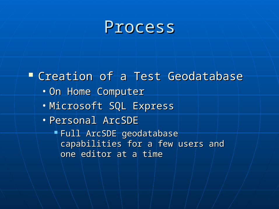
Creation of a Test GeodatabaseCreation of a Test Geodatabase• On Home ComputerOn Home Computer• Microsoft SQL ExpressMicrosoft SQL Express• Personal ArcSDE Personal ArcSDE
Full ArcSDE geodatabase capabilities Full ArcSDE geodatabase capabilities for a few users and one editor at a for a few users and one editor at a timetime
ProcessProcess
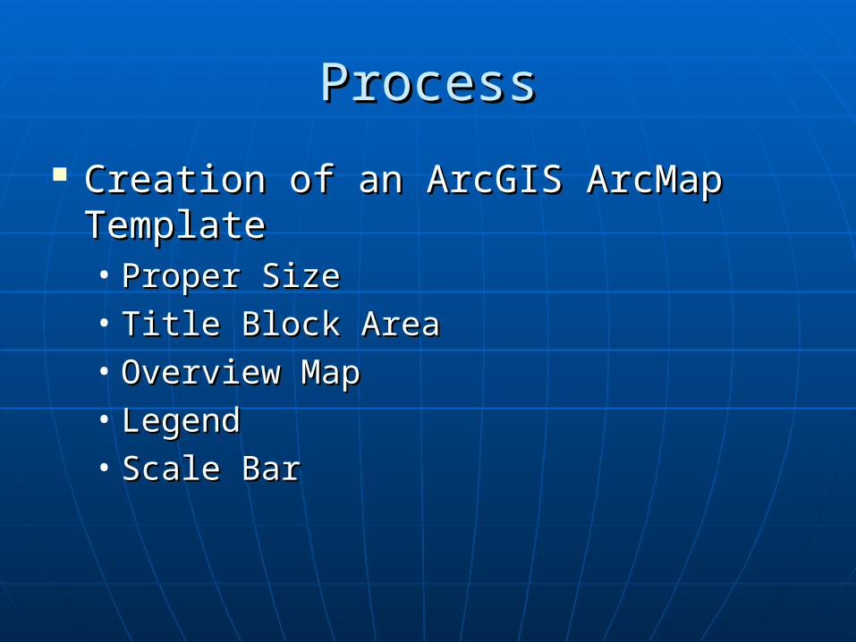
Creation of an ArcGIS ArcMap Creation of an ArcGIS ArcMap TemplateTemplate• Proper SizeProper Size• Title Block AreaTitle Block Area• Overview MapOverview Map• LegendLegend• Scale BarScale Bar

ProcessProcess
Creation of a Creation of a Custom Symbol SetCustom Symbol Set• ArcMap Style ArcMap Style
ManagerManager• ArcMap Symbol ArcMap Symbol
Property EditorProperty Editor

ProcessProcess
Creation of Creation of AnnotationAnnotation• Use of Annotation Use of Annotation
Feature ClassesFeature Classes Feature linkedFeature linked Stand AloneStand Alone
ProcessProcess
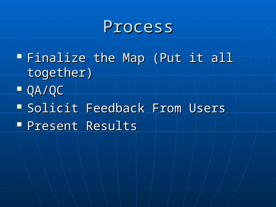
Finalize the Map (Put it all together)Finalize the Map (Put it all together) QA/QCQA/QC Solicit Feedback From UsersSolicit Feedback From Users Present ResultsPresent Results

Potential Potential ObstaclesObstacles
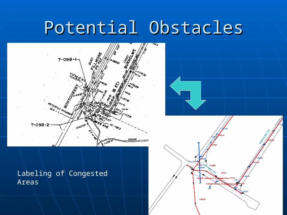
Potential ObstaclesPotential Obstacles
Labeling of Congested Areas
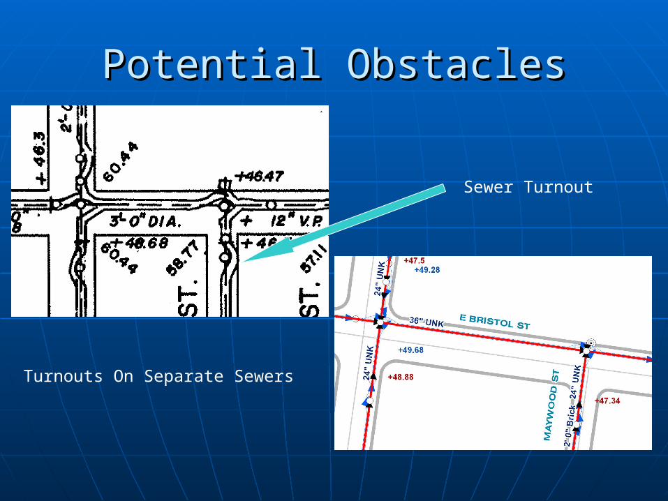
Potential ObstaclesPotential Obstacles
Turnouts On Separate Sewers
Sewer Turnout
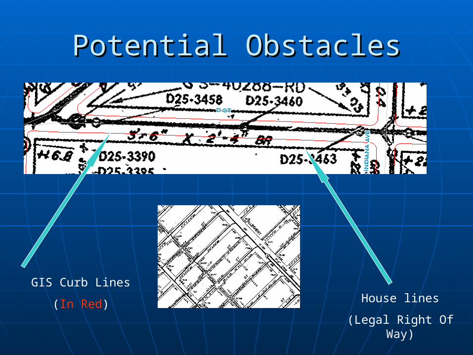
Potential ObstaclesPotential Obstacles
House lines
(Legal Right Of Way)
GIS Curb Lines
(In Red)
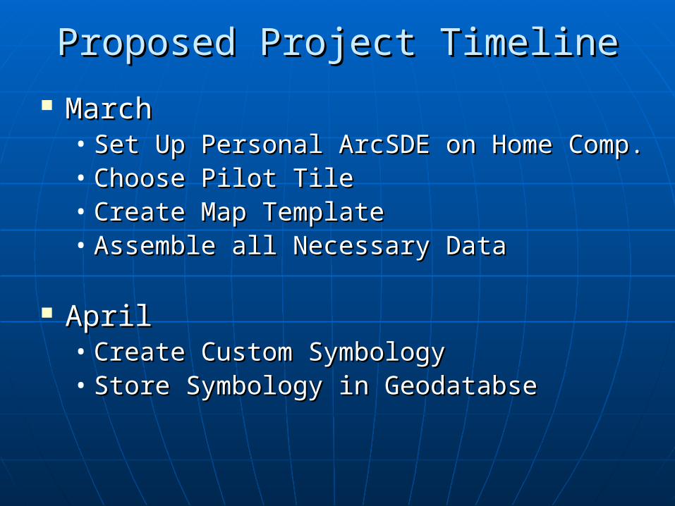
Proposed Project TimelineProposed Project Timeline
MarchMarch• Set Up Personal ArcSDE on Home Comp.Set Up Personal ArcSDE on Home Comp.• Choose Pilot TileChoose Pilot Tile• Create Map TemplateCreate Map Template• Assemble all Necessary DataAssemble all Necessary Data
AprilApril• Create Custom SymbologyCreate Custom Symbology• Store Symbology in GeodatabseStore Symbology in Geodatabse

Project TimelineProject Timeline MayMay
• AnnotationAnnotation
JuneJune• Put it all togetherPut it all together• Get Feedback From UsersGet Feedback From Users• QA/QCQA/QC
JulyJuly• Create a Presentation & PaperCreate a Presentation & Paper
August August • Present Results at ESRI’s User Conference in San Diego, CAPresent Results at ESRI’s User Conference in San Diego, CA
(Abstract Accepted)(Abstract Accepted)

Questions,Questions,Comments,Comments,
SuggestionsSuggestions


![Marcin SZAREK, Gözde ÖZCAN [Biped Robot]](https://img.pdfslide.us/doc/110x75/577cc4671a28aba711992e3b/marcin-szarek-goezde-oezcan-biped-robot.jpg)