Embed Size (px)
Citation preview

Robert Kircher
Enterprise Services, Senior Solutions Architect/Consultant
Design a Geodatabase
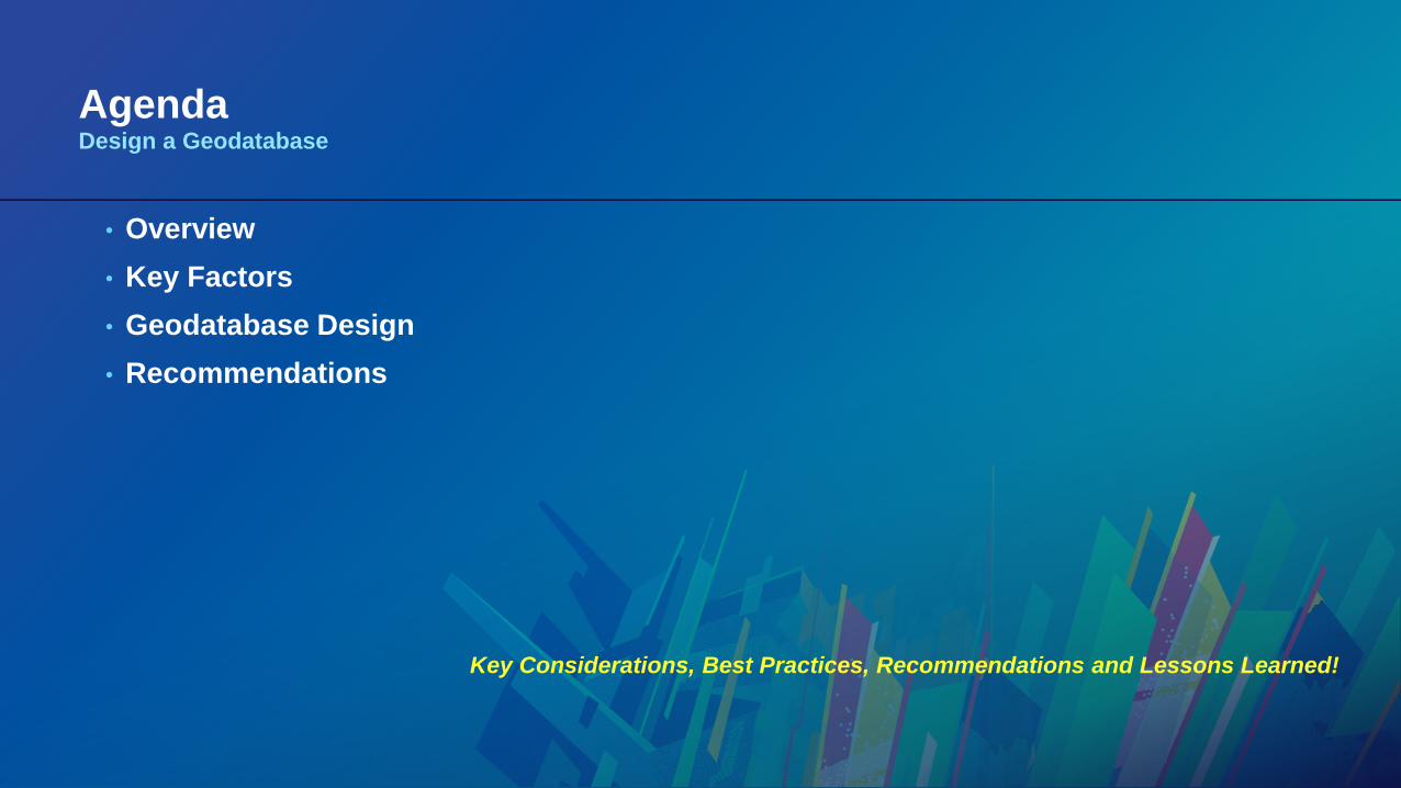
AgendaDesign a Geodatabase
• Overview
• Key Factors
• Geodatabase Design
• Recommendations
Key Considerations, Best Practices, Recommendations and Lessons Learned!

Overview
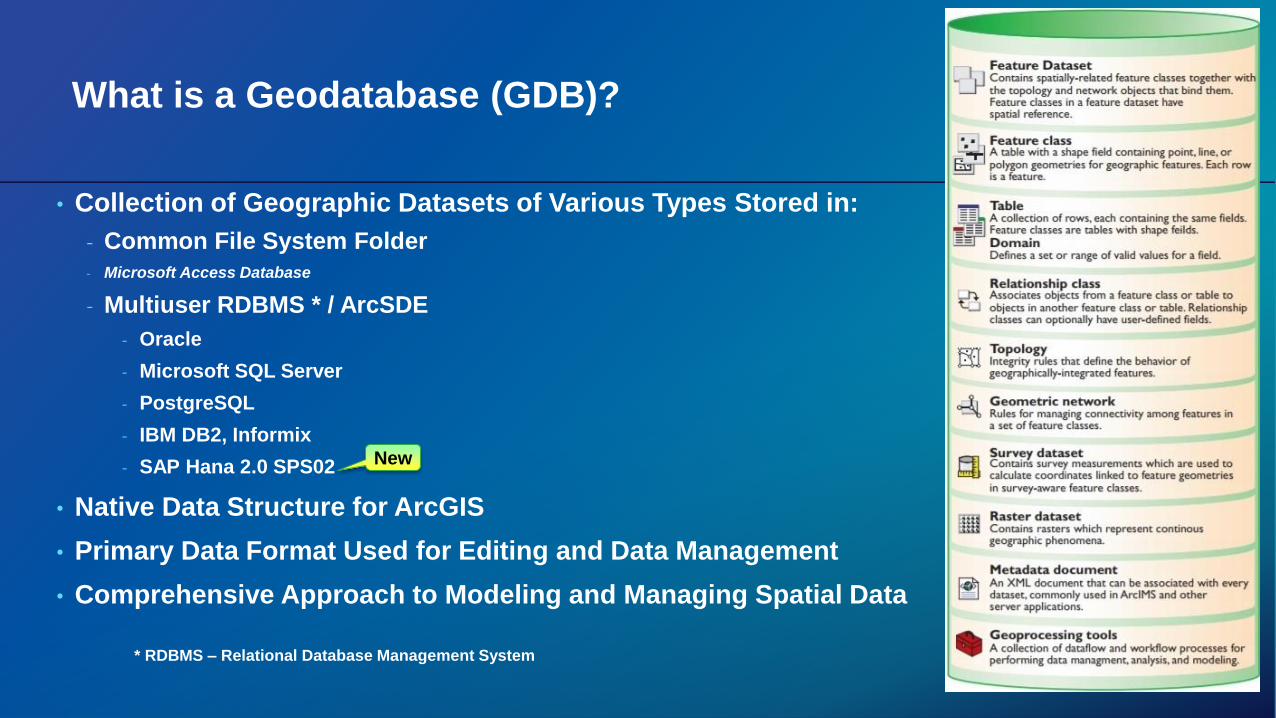
What is a Geodatabase (GDB)?
• Collection of Geographic Datasets of Various Types Stored in:
- Common File System Folder
- Microsoft Access Database
- Multiuser RDBMS * / ArcSDE
- Oracle
- Microsoft SQL Server
- PostgreSQL
- IBM DB2, Informix
- SAP Hana 2.0 SPS02
• Native Data Structure for ArcGIS
• Primary Data Format Used for Editing and Data Management
• Comprehensive Approach to Modeling and Managing Spatial Data
* RDBMS – Relational Database Management System
New
Design a Geodatabase
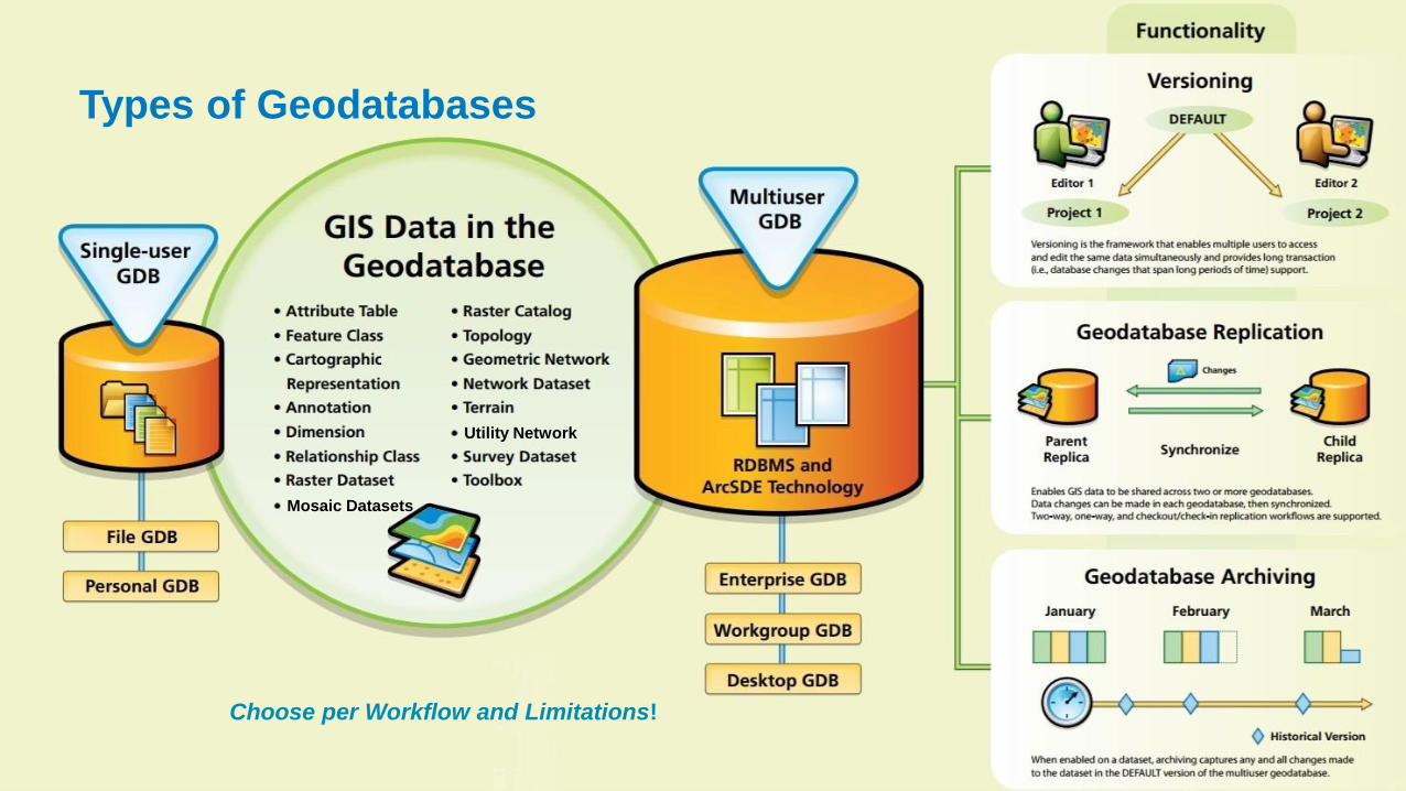
Types of Geodatabases
Choose per Workflow and Limitations!
Utility Network
Mosaic Datasets

Key Factors
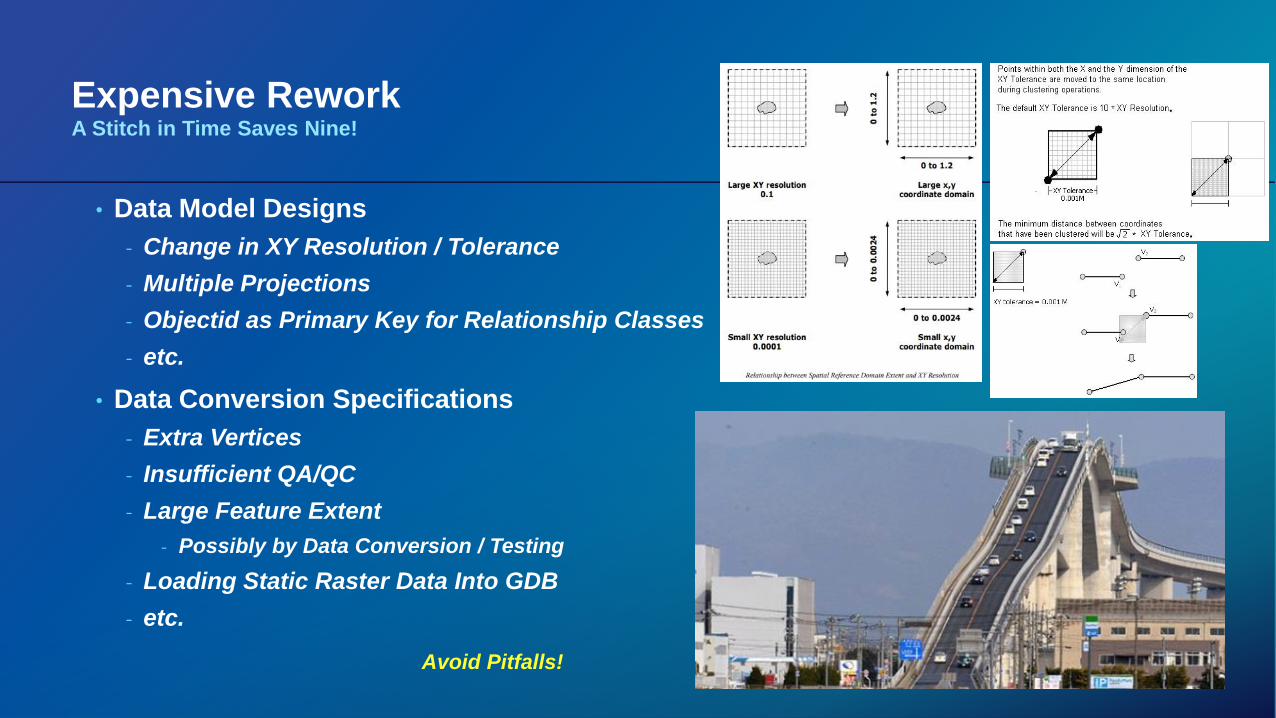
Expensive ReworkA Stitch in Time Saves Nine!
• Data Model Designs
- Change in XY Resolution / Tolerance
- Multiple Projections
- Objectid as Primary Key for Relationship Classes
- etc.
• Data Conversion Specifications
- Extra Vertices
- Insufficient QA/QC
- Large Feature Extent
- Possibly by Data Conversion / Testing
- Loading Static Raster Data Into GDB
- etc.
Avoid Pitfalls!
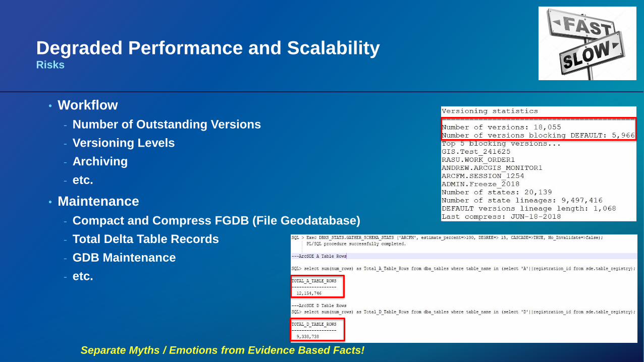
Degraded Performance and ScalabilityRisks
• Workflow
- Number of Outstanding Versions
- Versioning Levels
- Archiving
- etc.
• Maintenance
- Compact and Compress FGDB (File Geodatabase)
- Total Delta Table Records
- GDB Maintenance
- etc.
Separate Myths / Emotions from Evidence Based Facts!
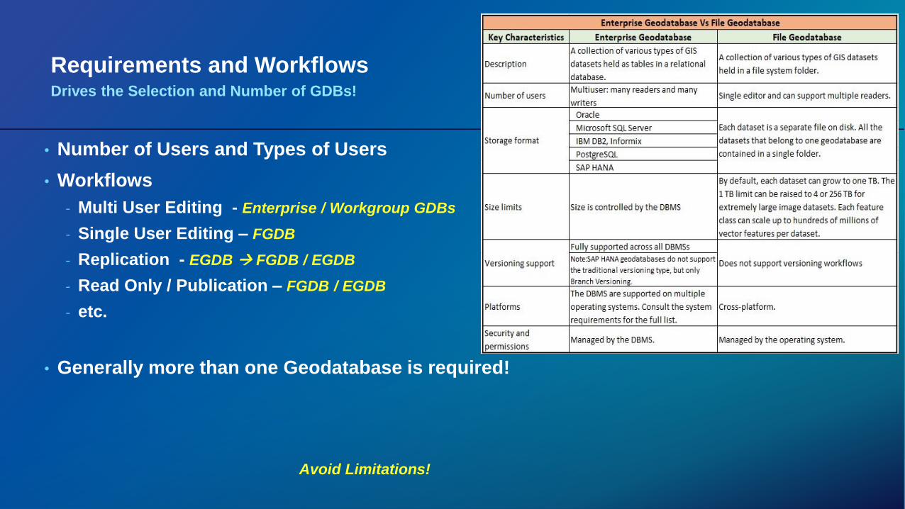
Requirements and WorkflowsDrives the Selection and Number of GDBs!
• Number of Users and Types of Users
• Workflows
- Multi User Editing - Enterprise / Workgroup GDBs
- Single User Editing – FGDB
- Replication - EGDB FGDB / EGDB
- Read Only / Publication – FGDB / EGDB
- etc.
• Generally more than one Geodatabase is required!
Avoid Limitations!
Geodatabase Design
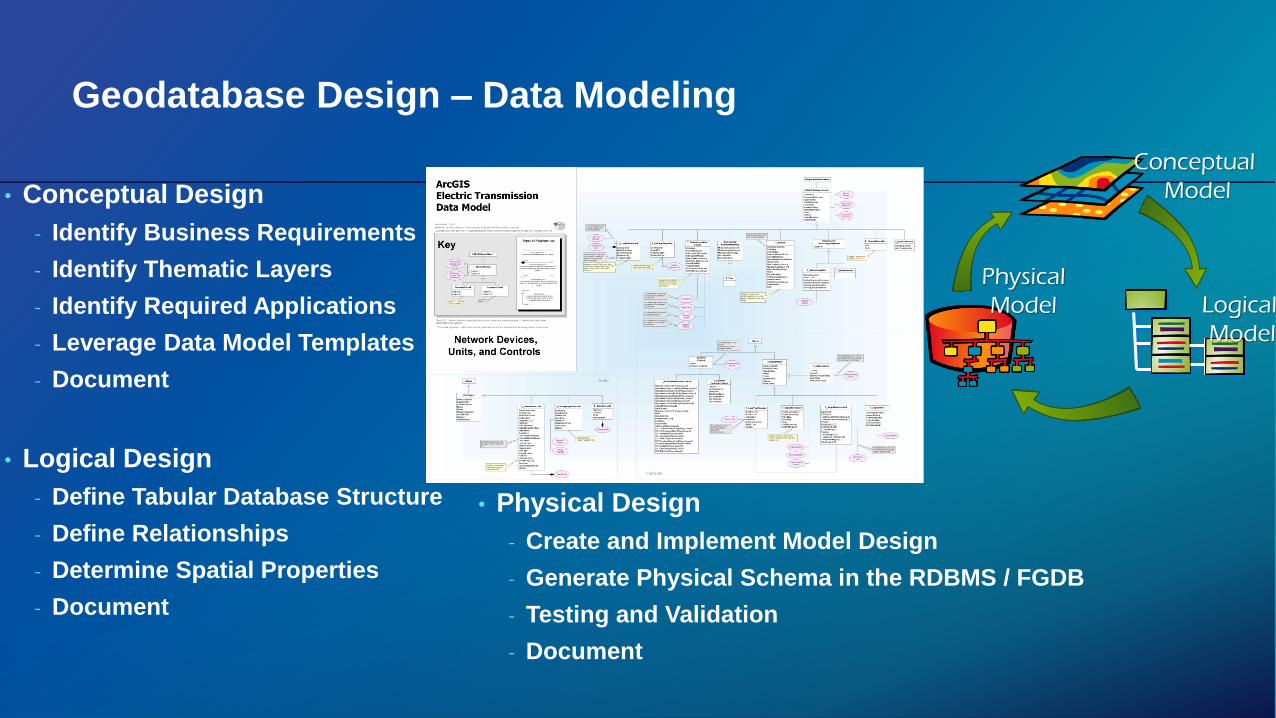
Geodatabase Design – Data Modeling
• Conceptual Design
- Identify Business Requirements
- Identify Thematic Layers
- Identify Required Applications
- Leverage Data Model Templates
- Document
• Logical Design
- Define Tabular Database Structure
- Define Relationships
- Determine Spatial Properties
- Document
• Physical Design
- Create and Implement Model Design
- Generate Physical Schema in the RDBMS / FGDB
- Testing and Validation
- Document
Conceptual
Model
Logical
Model
Physical
Model

Geodatabase Design – Process
• Tools
- X-Ray Add-In
- Geodatabase Diagrammer
- Sparx Systems' Enterprise Architect
- Geometric Network Configuration Manager
• 11 Technical Steps!
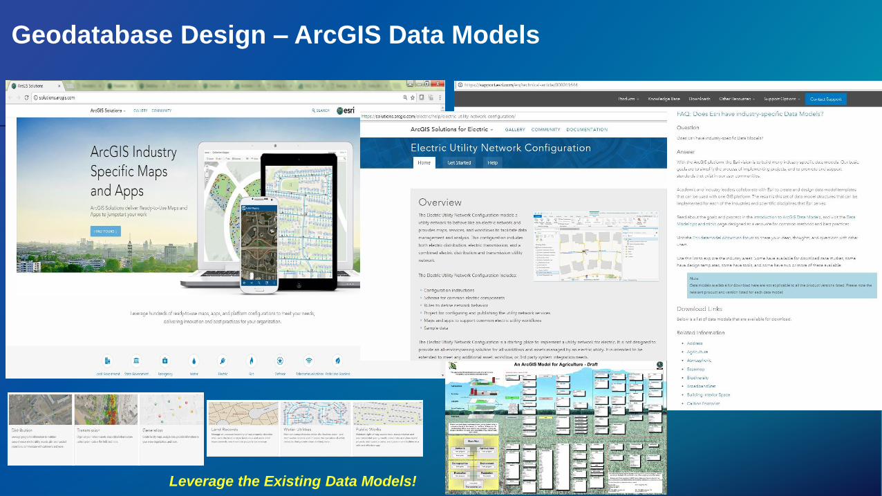
Geodatabase Design – ArcGIS Data Models
Leverage the Existing Data Models!

Recommendations
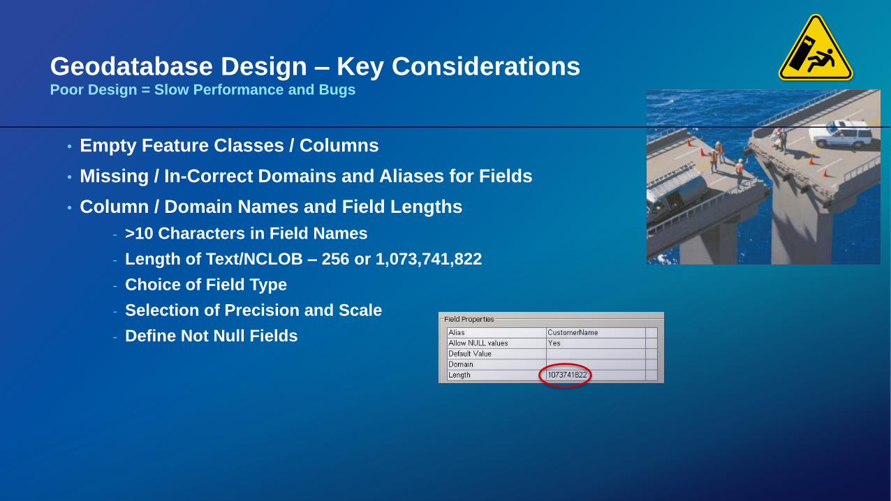
Geodatabase Design – Key ConsiderationsPoor Design = Slow Performance and Bugs
• Empty Feature Classes / Columns
• Missing / In-Correct Domains and Aliases for Fields
• Column / Domain Names and Field Lengths
- >10 Characters in Field Names
- Length of Text/NCLOB – 256 or 1,073,741,822
- Choice of Field Type
- Selection of Precision and Scale
- Define Not Null Fields
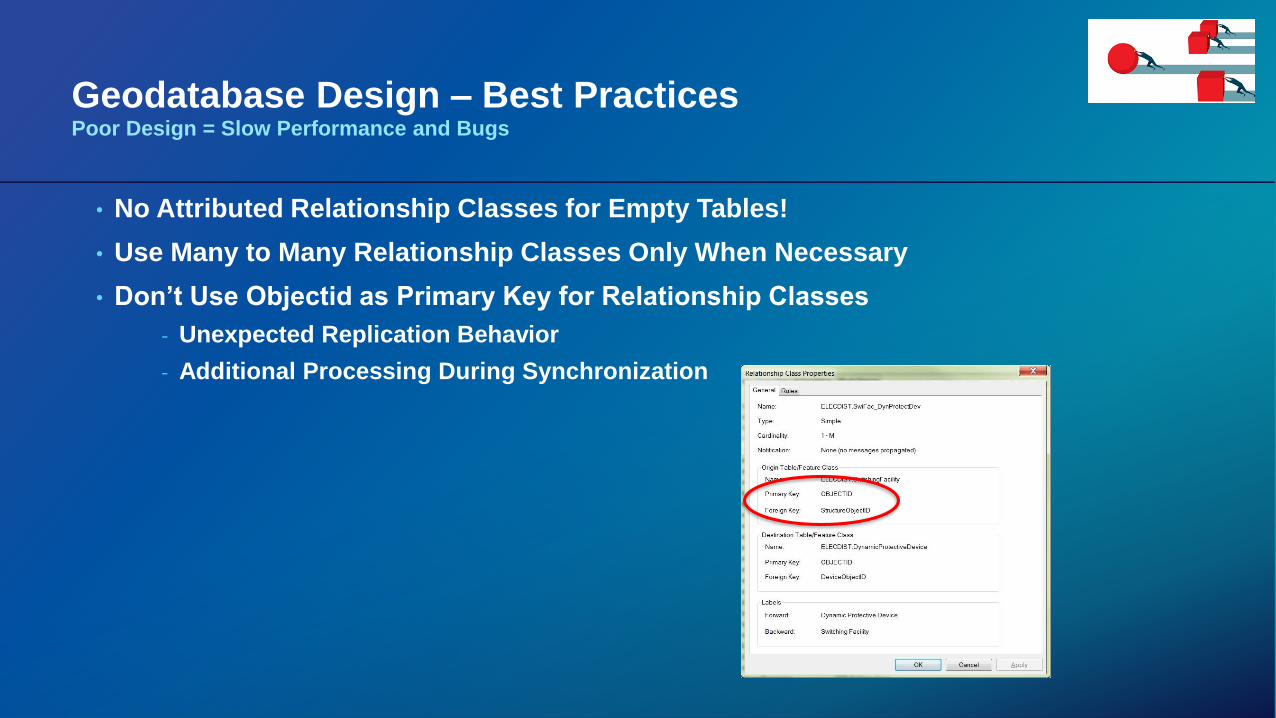
Geodatabase Design – Best PracticesPoor Design = Slow Performance and Bugs
• No Attributed Relationship Classes for Empty Tables!
• Use Many to Many Relationship Classes Only When Necessary
• Don’t Use Objectid as Primary Key for Relationship Classes
- Unexpected Replication Behavior
- Additional Processing During Synchronization
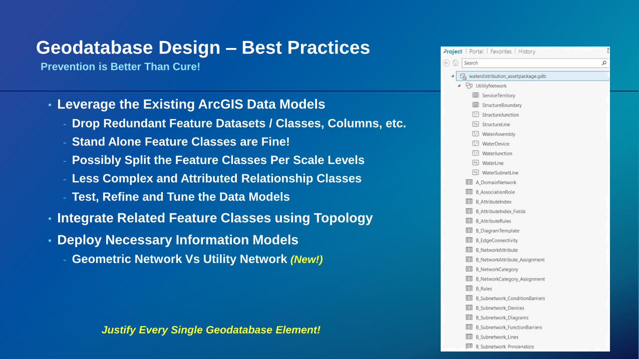
Geodatabase Design – Best Practices
• Leverage the Existing ArcGIS Data Models
- Drop Redundant Feature Datasets / Classes, Columns, etc.
- Stand Alone Feature Classes are Fine!
- Possibly Split the Feature Classes Per Scale Levels
- Less Complex and Attributed Relationship Classes
- Test, Refine and Tune the Data Models
• Integrate Related Feature Classes using Topology
• Deploy Necessary Information Models
- Geometric Network Vs Utility Network (New!)
Justify Every Single Geodatabase Element!
Prevention is Better Than Cure!
Geodatabase Design – Best Practices
• Select Single Coordinate System
- On the Fly Projection is Expensive
- Geometric Network Editing Does Not Support “On the Fly Projection”
• Create Feature Datasets or Databases for Each LOB (Line of Businesses)
- Depends on Size, Access, Usage and Maintenance
- E.g. Landbase, Gas, Electric, Water GDBs, etc.
Prevention is Better Than Cure!
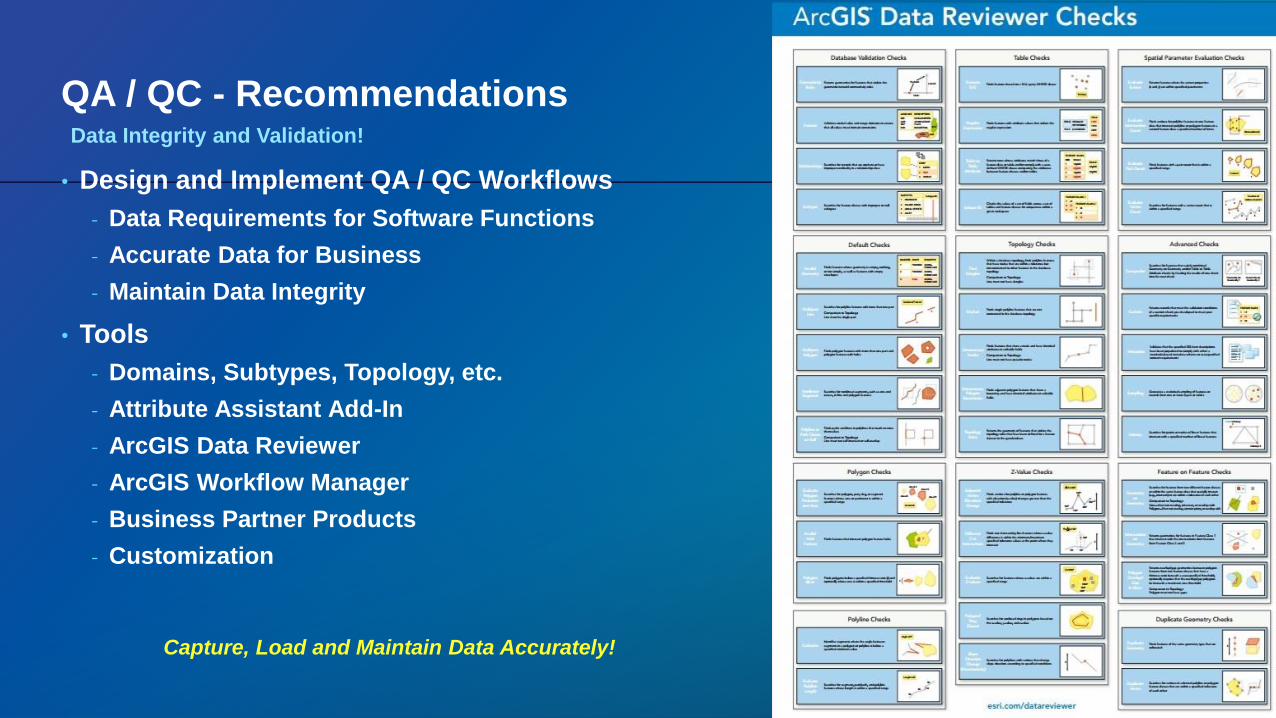
QA / QC - Recommendations
• Design and Implement QA / QC Workflows
- Data Requirements for Software Functions
- Accurate Data for Business
- Maintain Data Integrity
• Tools
- Domains, Subtypes, Topology, etc.
- Attribute Assistant Add-In
- ArcGIS Data Reviewer
- ArcGIS Workflow Manager
- Business Partner Products
- Customization
Prevention is Better Than Cure!
Capture, Load and Maintain Data Accurately!
Data Integrity and Validation!
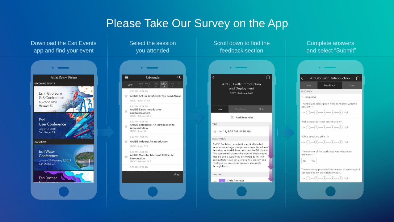
Complete answers
and select “Submit”
Scroll down to find the
feedback section
Select the session
you attended
Download the Esri Events
app and find your event
Please Take Our Survey on the App
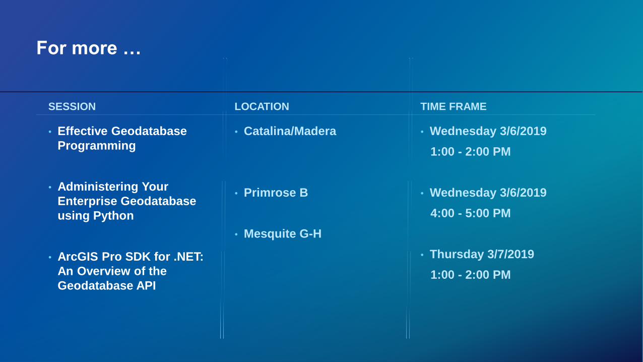
For more …
• Effective Geodatabase
Programming
• Administering Your
Enterprise Geodatabase
using Python
• ArcGIS Pro SDK for .NET:
An Overview of the
Geodatabase API
SESSION LOCATION
• Catalina/Madera
• Primrose B
• Mesquite G-H
TIME FRAME
• Wednesday 3/6/2019
1:00 - 2:00 PM
• Wednesday 3/6/2019
4:00 - 5:00 PM
• Thursday 3/7/2019
1:00 - 2:00 PM