Embed Size (px)
Citation preview

GRASS applications: an overview
Marco CIOLLI, Paolo ZATELLI
Dipartimento di Ingegneria Civile e Ambientale, Università degli Studi di Trento, via Mesiano 77, 38100 Trento,
tel. 0461/882618, Fax 0461/882672, e-mail [email protected]
Abstract In the last few years, GRASS GIS has known wide popularity as it is well documented by the recent GRASS Users conferences, both at national and international levels. It is therefore possible to give an organized overview of a wide amount of applications of this GIS to many different topics and problems. The range of applications goes from environmental modeling to DTM validation, from atmosphere modeling to LIDAR data elaboration, from wildlife management to Avalanche risk assessment, from GPS planning to geomorphologic modeling. Because of the Open source and free software development model of GRASS, the development and the applications are entwined, giving each other new momentum. Moreover, because of the current intense development of GRASS it is possible to foresee exciting and entirely new fields of applicability especially for 3D modeling, time series elaboration and Data Base management. 1. Introduction GRASS GIS is currently gaining wide popularity due to its high quality and its Open Source/Free Software nature. GRASS overall high quality is well acknowledged by its spreading within scientific and academic institutions, as well as by public administrations and professional users. GRASS benefits from its Open Source/Free Software development model because of the effectiveness of this model and because of the good reputation Open Source/Free Software is gaining not only between IT technicians. The number of GRASS applications is growing rapidly, with the typical advantage of Open Source/Free Software projects, where applications and development are tightly entwined. In fact, often an application leads to the development of new modules, which are then used for other applications and so on. A collection of GRASS applications is important because it can make GRASS users aware of its many capabilities and it can attract new users, who can find here a reference to documentation of GRASS’ use in their application field of interest. 2. Applications overview The main point in the compilation of a collection is the choice of a classification criterion, which should be successful in quickly directing the reader looking for a specific application and useful for the reader considering the overall GRASS capability at the same time. GRASS applications are here classified simply by their scientific and/or application area, because this is probably the most direct way to present a list of works in the GIS field. The applications are organized in the following categories:
1. Environmental monitoring; 2. Geology;
3. Mathematical models; 4. LIDAR; 5. Solar radiation; 6. Climate and atmospheric models; 7. Landslides risk mapping; 8. Wildfires risk mapping; 9. Glaciers; 10. Geomorphology; 11. Traffic and acoustic pollution; 12. Archeology; 13. Forest management; 14. Avalanches risk mapping; 15. Flood forecasting and management; 16. GPS planning; 17. Wildlife management; 18. GRASS and WebGIS; 19. GRASS and PDAs.
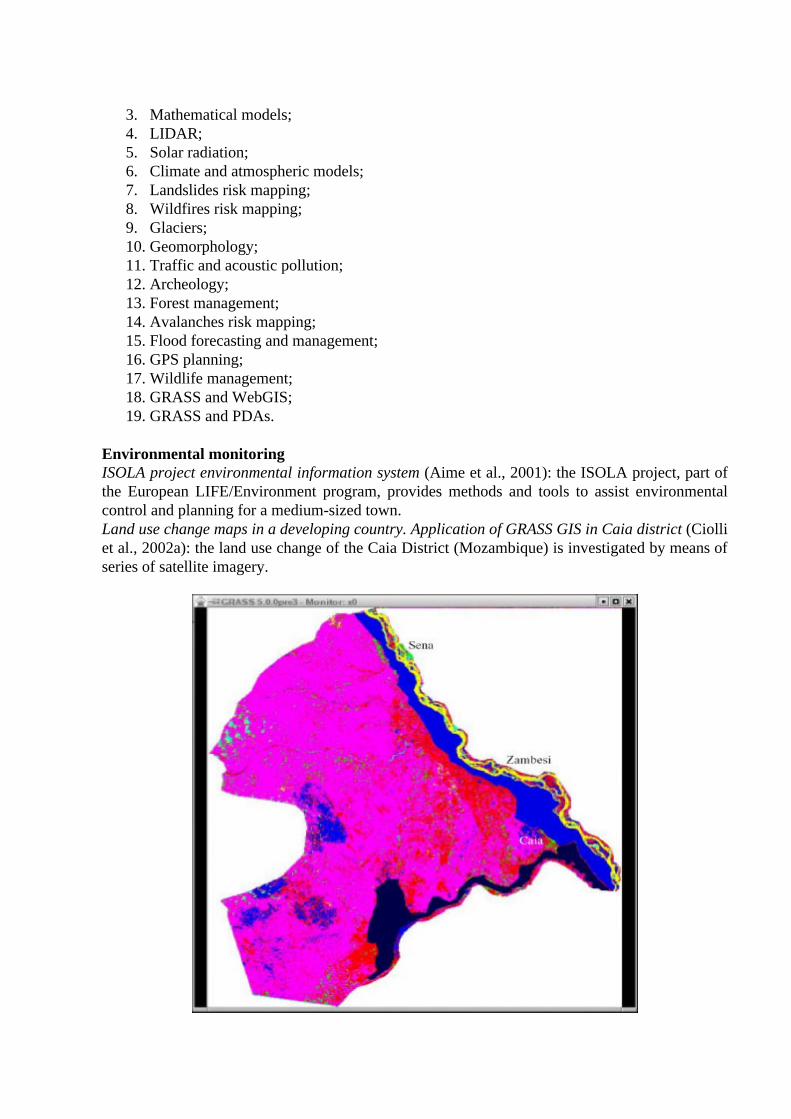
Environmental monitoring ISOLA project environmental information system (Aime et al., 2001): the ISOLA project, part of the European LIFE/Environment program, provides methods and tools to assist environmental control and planning for a medium-sized town. Land use change maps in a developing country. Application of GRASS GIS in Caia district (Ciolli et al., 2002a): the land use change of the Caia District (Mozambique) is investigated by means of series of satellite imagery.
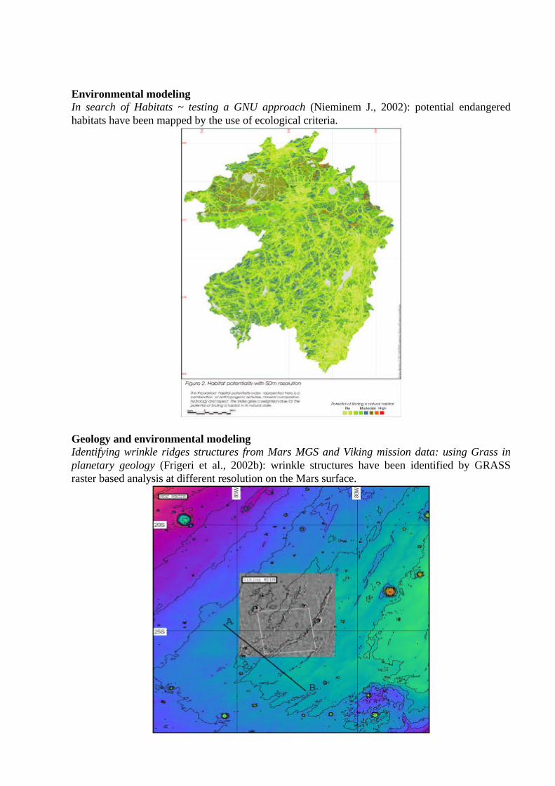
Environmental modeling In search of Habitats ~ testing a GNU approach (Nieminem J., 2002): potential endangered habitats have been mapped by the use of ecological criteria.
Geology and environmental modeling Identifying wrinkle ridges structures from Mars MGS and Viking mission data: using Grass in planetary geology (Frigeri et al., 2002b): wrinkle structures have been identified by GRASS raster based analysis at different resolution on the Mars surface.
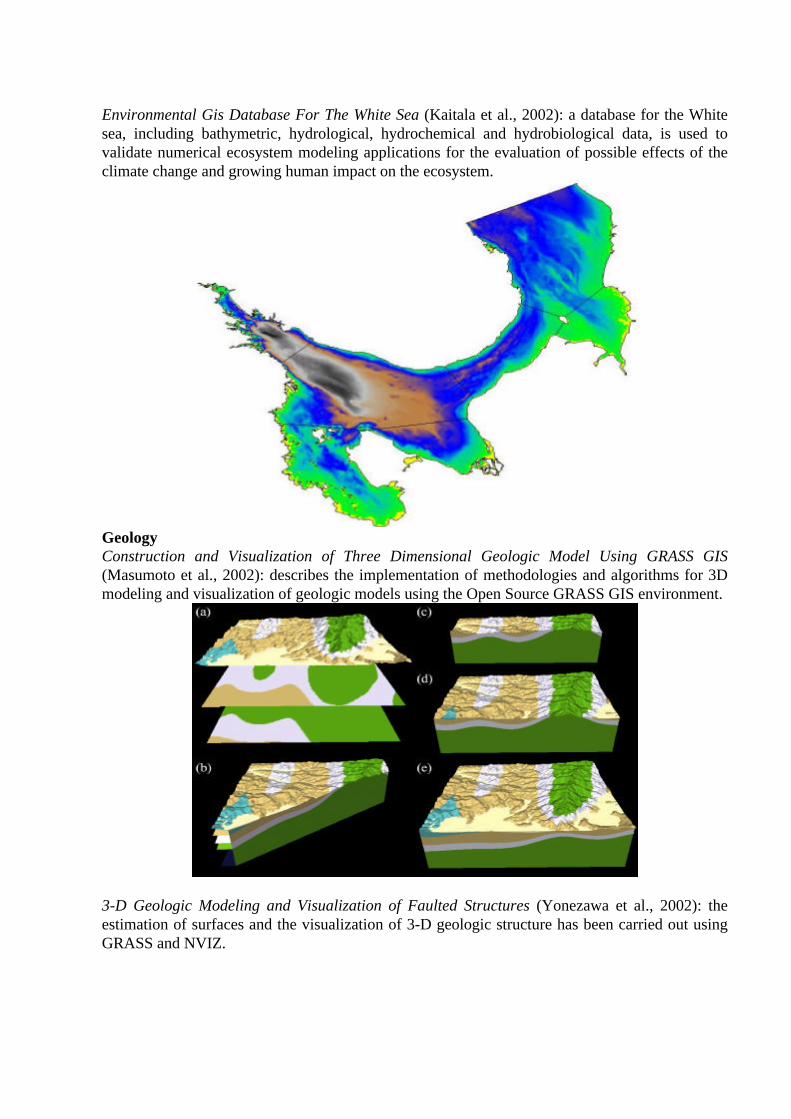
Environmental Gis Database For The White Sea (Kaitala et al., 2002): a database for the White sea, including bathymetric, hydrological, hydrochemical and hydrobiological data, is used to validate numerical ecosystem modeling applications for the evaluation of possible effects of the climate change and growing human impact on the ecosystem.
Geology Construction and Visualization of Three Dimensional Geologic Model Using GRASS GIS (Masumoto et al., 2002): describes the implementation of methodologies and algorithms for 3D modeling and visualization of geologic models using the Open Source GRASS GIS environment.
3-D Geologic Modeling and Visualization of Faulted Structures (Yonezawa et al., 2002): the estimation of surfaces and the visualization of 3-D geologic structure has been carried out using GRASS and NVIZ.
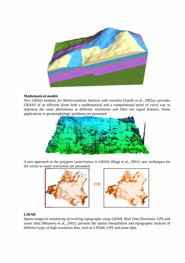
Mathematical models New GRASS modules for Multiresolution Analysis with wavelets (Zatelli et al., 2002a): provides GRASS of an efficient (from both a mathematical and a computational point of view) way to represent the same phenomena at different resolutions and filter out signal features. Some applications to geomorphologic problems are presented.
A new approach to the polygons rasterization in GRASS (Biagi et al., 2001): new techniques for the vector to raster conversion are presented.
LIDAR Spatio-temporal monitoring of evolving topography using LIDAR, Real Time Kinematic GPS and sonar data (Mitasova et al., 2002): presents the spatial interpolation and topographic analysis of different types of high resolution data, such as LIDAR, GPS and sonar data.
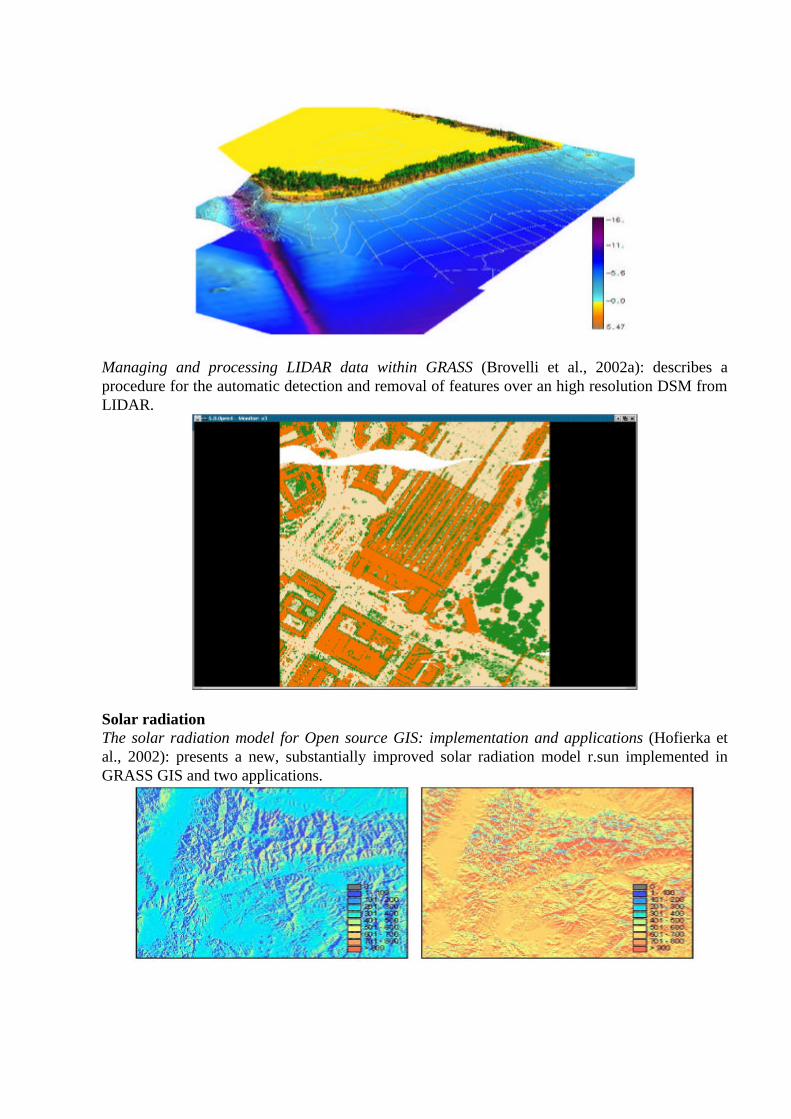
Managing and processing LIDAR data within GRASS (Brovelli et al., 2002a): describes a procedure for the automatic detection and removal of features over an high resolution DSM from LIDAR.
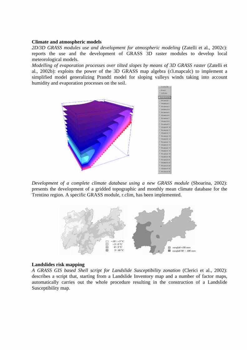
Solar radiation The solar radiation model for Open source GIS: implementation and applications (Hofierka et al., 2002): presents a new, substantially improved solar radiation model r.sun implemented in GRASS GIS and two applications.
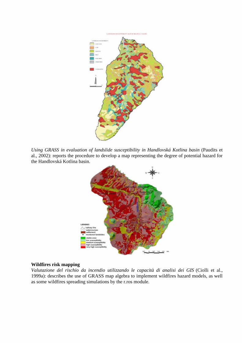
Climate and atmospheric models 2D/3D GRASS modules use and development for atmospheric modeling (Zatelli et al., 2002c): reports the use and the development of GRASS 3D raster modules to develop local meteorological models. Modelling of evaporation processes over tilted slopes by means of 3D GRASS raster (Zatelli et al., 2002b): exploits the power of the 3D GRASS map algebra (r3.mapcalc) to implement a simplified model generalizing Prandtl model for sloping valleys winds taking into account humidity and evaporation processes on the soil.
Development of a complete climate database using a new GRASS module (Sboarina, 2002): presents the development of a gridded topographic and monthly mean climate database for the Trentino region. A specific GRASS module, r.clim, has been implemented.
Landslides risk mapping A GRASS GIS based Shell script for Landslide Susceptibility zonation (Clerici et al., 2002): describes a script that, starting from a Landslide Inventory map and a number of factor maps, automatically carries out the whole procedure resulting in the construction of a Landslide Susceptibility map.
Using GRASS in evaluation of landslide susceptibility in Handlovská Kotlina basin (Paudits et al., 2002): reports the procedure to develop a map representing the degree of potential hazard for the Handlovská Kotlina basin.
Wildfires risk mapping Valutazione del rischio da incendio utilizzando le capacità di analisi dei GIS (Ciolli et al., 1999a): describes the use of GRASS map algebra to implement wildfires hazard models, as well as some wildfires spreading simulations by the r.ros module.

Glaciers Scale-dependent geomorphometric analysis for glacier mapping at Nanga Parbat (Bonk, 2002): reports the use of hierarchically modeling to delineate alpine glaciers on the landscape.
maximum spread velocity Wildfire simulation
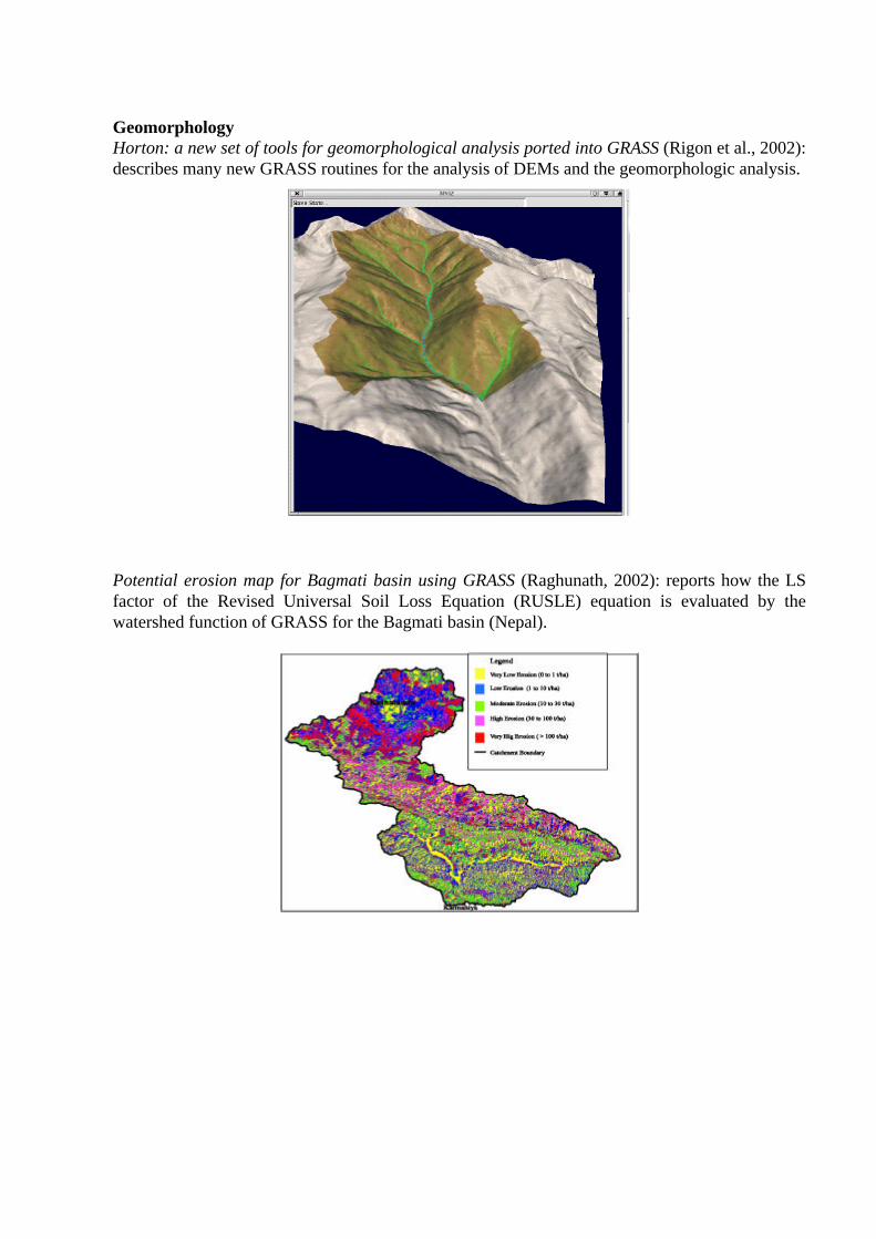
Geomorphology Horton: a new set of tools for geomorphological analysis ported into GRASS (Rigon et al., 2002): describes many new GRASS routines for the analysis of DEMs and the geomorphologic analysis.
Potential erosion map for Bagmati basin using GRASS (Raghunath, 2002): reports how the LS factor of the Revised Universal Soil Loss Equation (RUSLE) equation is evaluated by the watershed function of GRASS for the Bagmati basin (Nepal).
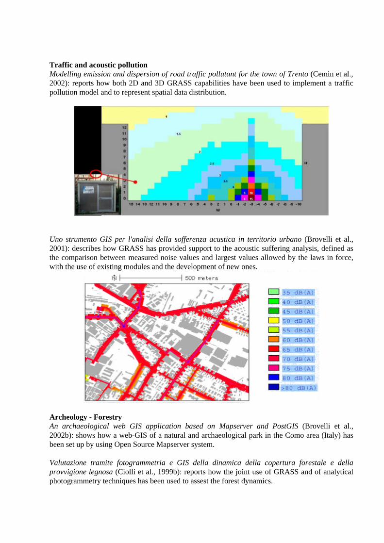
Traffic and acoustic pollution Modelling emission and dispersion of road traffic pollutant for the town of Trento (Cemin et al., 2002): reports how both 2D and 3D GRASS capabilities have been used to implement a traffic pollution model and to represent spatial data distribution.
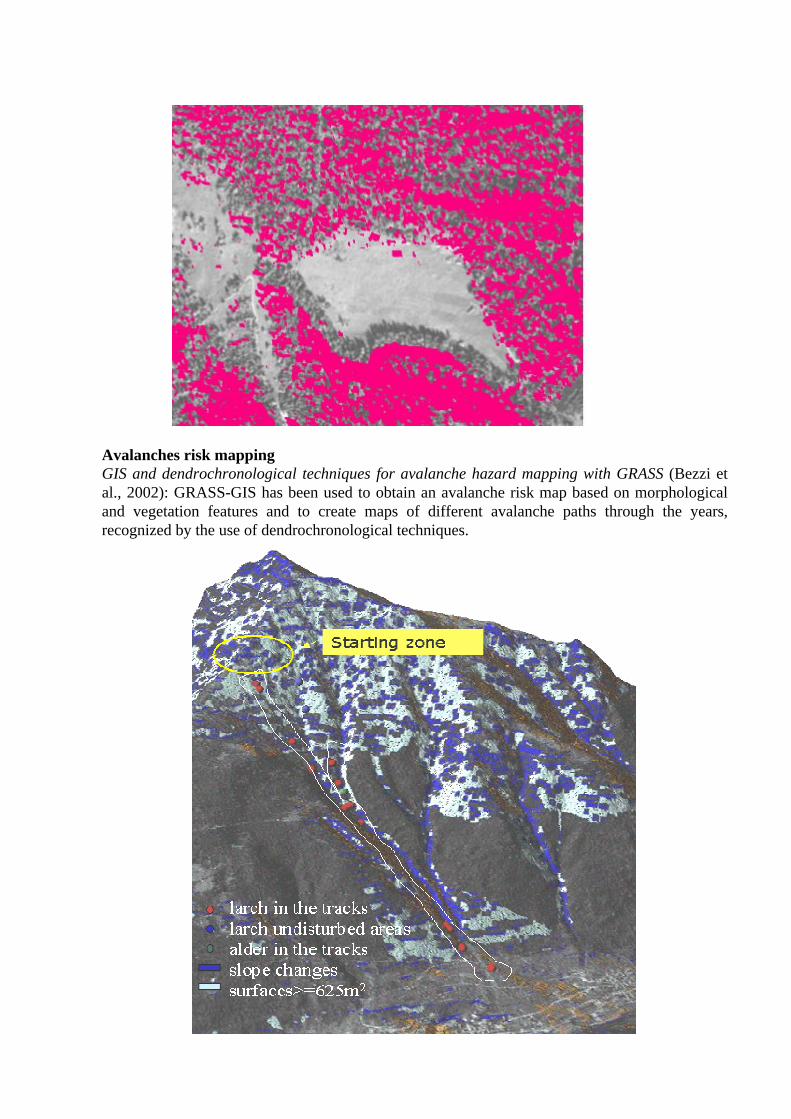
Uno strumento GIS per l'analisi della sofferenza acustica in territorio urbano (Brovelli et al., 2001): describes how GRASS has provided support to the acoustic suffering analysis, defined as the comparison between measured noise values and largest values allowed by the laws in force, with the use of existing modules and the development of new ones.
Archeology - Forestry An archaeological web GIS application based on Mapserver and PostGIS (Brovelli et al., 2002b): shows how a web-GIS of a natural and archaeological park in the Como area (Italy) has been set up by using Open Source Mapserver system. Valutazione tramite fotogrammetria e GIS della dinamica della copertura forestale e della provvigione legnosa (Ciolli et al., 1999b): reports how the joint use of GRASS and of analytical photogrammetry techniques has been used to assest the forest dynamics.
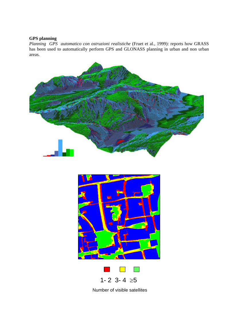
Avalanches risk mapping GIS and dendrochronological techniques for avalanche hazard mapping with GRASS (Bezzi et al., 2002): GRASS-GIS has been used to obtain an avalanche risk map based on morphological and vegetation features and to create maps of different avalanche paths through the years, recognized by the use of dendrochronological techniques.

Traffic management Traffic database management with GRASS and PostgreSQL (Ciolli et al., 2003): GRASS and PostgreSQL have been used to manage and map a traffic database of the city of Trento (Italy).
GPS planning Planning GPS automatico con ostruzioni realistiche (Fruet et al., 1999): reports how GRASS has been used to automatically perform GPS and GLONASS planning in urban and non urban areas.
Number of visible satellites
1- 2 3- 4 ≥5
Wildlife management Remote Sensing/GIS techniques for risk assessment of Borrelia burgdorferi infection (Altobelli et al., 2001): the risk of Borrelia burgdorferi infection has been evaluated using remote sensing data processed in GRASS.
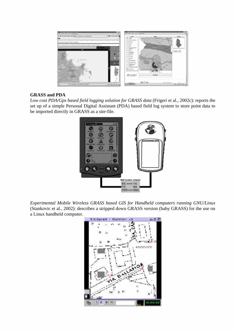
WEB GIS GRASS on the WEB (Hess, 2002): proposes a design based on a combination of PHP, GRASS scripts and other Linux standard tools for the access to geocoded data through a standard web browser.
Using Mapserver to Integrate Local Government Spatial Data (Greenwood, 2002): describes the use of Mapserver to integrate spatial data from several county and municipal governmental departments.

Wildlife Management and Landscape Analysis in the GRASS GIS (Menegon et al., 2002): describes how new GRASS GIS resources have been developed and integrated for centralized data archiving and predictive modeling in several wildlife management tasks in Trentino, Italian Alps.
Implementing an online spatial database using the GRASS GIS environment (Raghavan et al., 2002): describes a prototype Spatial Information System for Geological Modeling (SISGeM) where the spatial data management is carried out using GRASS.
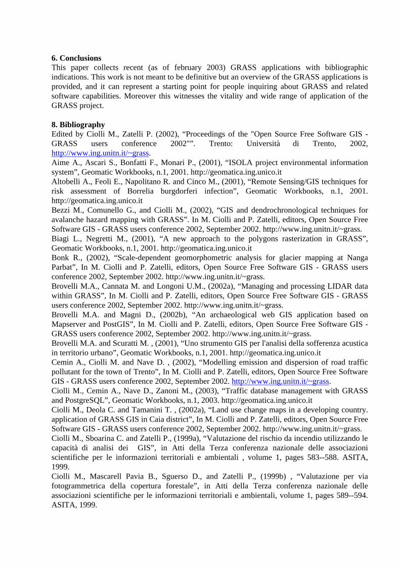
GRASS and PDA Low cost PDA/Gps based field logging solution for GRASS data (Frigeri et al., 2002c): reports the set up of a simple Personal Digital Assistant (PDA) based field log system to store point data to be imported directly in GRASS as a site-file.
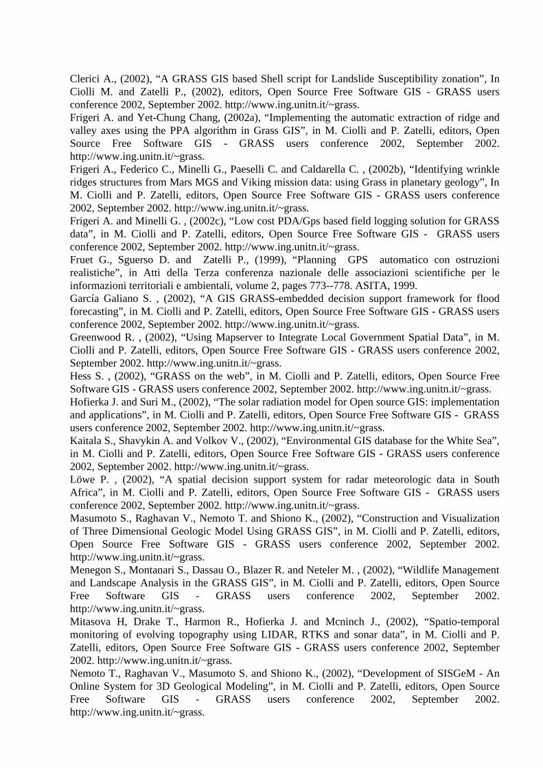
Experimental Mobile Wireless GRASS based GIS for Handheld computers running GNU/Linux (Stankovic et al., 2002): describes a stripped down GRASS version (baby GRASS) for the use on a Linux handheld computer.
6. Conclusions This paper collects recent (as of february 2003) GRASS applications with bibliographic indications. This work is not meant to be definitive but an overview of the GRASS applications is provided, and it can represent a starting point for people inquiring about GRASS and related software capabilities. Moreover this witnesses the vitality and wide range of application of the GRASS project. 8. Bibliography Edited by Ciolli M., Zatelli P. (2002), “Proceedings of the "Open Source Free Software GIS - GRASS users conference 2002"”. Trento: Università di Trento, 2002, http://www.ing.unitn.it/~grass. Aime A., Ascari S., Bonfatti F., Monari P., (2001), “ISOLA project environmental information system”, Geomatic Workbooks, n.1, 2001. http://geomatica.ing.unico.it Altobelli A., Feoli E., Napolitano R. and Cinco M., (2001), “Remote Sensing/GIS techniques for risk assessment of Borrelia burgdorferi infection”, Geomatic Workbooks, n.1, 2001. http://geomatica.ing.unico.it Bezzi M., Comunello G., and Ciolli M., (2002), “GIS and dendrochronological techniques for avalanche hazard mapping with GRASS”. In M. Ciolli and P. Zatelli, editors, Open Source Free Software GIS - GRASS users conference 2002, September 2002. http://www.ing.unitn.it/~grass. Biagi L., Negretti M., (2001), “A new approach to the polygons rasterization in GRASS”, Geomatic Workbooks, n.1, 2001. http://geomatica.ing.unico.it Bonk R., (2002), “Scale-dependent geomorphometric analysis for glacier mapping at Nanga Parbat”, In M. Ciolli and P. Zatelli, editors, Open Source Free Software GIS - GRASS users conference 2002, September 2002. http://www.ing.unitn.it/~grass. Brovelli M.A., Cannata M. and Longoni U.M., (2002a), “Managing and processing LIDAR data within GRASS”, In M. Ciolli and P. Zatelli, editors, Open Source Free Software GIS - GRASS users conference 2002, September 2002. http://www.ing.unitn.it/~grass. Brovelli M.A. and Magni D., (2002b), “An archaeological web GIS application based on Mapserver and PostGIS”, In M. Ciolli and P. Zatelli, editors, Open Source Free Software GIS - GRASS users conference 2002, September 2002. http://www.ing.unitn.it/~grass. Brovelli M.A. and Scuratti M. , (2001), “Uno strumento GIS per l'analisi della sofferenza acustica in territorio urbano”, Geomatic Workbooks, n.1, 2001. http://geomatica.ing.unico.it Cemin A., Ciolli M. and Nave D. , (2002), “Modelling emission and dispersion of road traffic pollutant for the town of Trento”, In M. Ciolli and P. Zatelli, editors, Open Source Free Software GIS - GRASS users conference 2002, September 2002. http://www.ing.unitn.it/~grass. Ciolli M., Cemin A., Nave D., Zanoni M., (2003), “Traffic database management with GRASS and PostgreSQL”, Geomatic Workbooks, n.1, 2003. http://geomatica.ing.unico.it Ciolli M., Deola C. and Tamanini T. , (2002a), “Land use change maps in a developing country. application of GRASS GIS in Caia district”, In M. Ciolli and P. Zatelli, editors, Open Source Free Software GIS - GRASS users conference 2002, September 2002. http://www.ing.unitn.it/~grass. Ciolli M., Sboarina C. and Zatelli P., (1999a), “Valutazione del rischio da incendio utilizzando le capacità di analisi dei GIS”, in Atti della Terza conferenza nazionale delle associazioni scientifiche per le informazioni territoriali e ambientali , volume 1, pages 583--588. ASITA, 1999. Ciolli M., Mascarell Pavia B., Sguerso D., and Zatelli P., (1999b) , “Valutazione per via fotogrammetrica della copertura forestale”, in Atti della Terza conferenza nazionale delle associazioni scientifiche per le informazioni territoriali e ambientali, volume 1, pages 589--594. ASITA, 1999.
Clerici A., (2002), “A GRASS GIS based Shell script for Landslide Susceptibility zonation”, In Ciolli M. and Zatelli P., (2002), editors, Open Source Free Software GIS - GRASS users conference 2002, September 2002. http://www.ing.unitn.it/~grass. Frigeri A. and Yet-Chung Chang, (2002a), “Implementing the automatic extraction of ridge and valley axes using the PPA algorithm in Grass GIS”, in M. Ciolli and P. Zatelli, editors, Open Source Free Software GIS - GRASS users conference 2002, September 2002. http://www.ing.unitn.it/~grass. Frigeri A., Federico C., Minelli G., Paeselli C. and Caldarella C. , (2002b), “Identifying wrinkle ridges structures from Mars MGS and Viking mission data: using Grass in planetary geology”, In M. Ciolli and P. Zatelli, editors, Open Source Free Software GIS - GRASS users conference 2002, September 2002. http://www.ing.unitn.it/~grass. Frigeri A. and Minelli G. , (2002c), “Low cost PDA/Gps based field logging solution for GRASS data”, in M. Ciolli and P. Zatelli, editors, Open Source Free Software GIS - GRASS users conference 2002, September 2002. http://www.ing.unitn.it/~grass. Fruet G., Sguerso D. and Zatelli P., (1999), “Planning GPS automatico con ostruzioni realistiche”, in Atti della Terza conferenza nazionale delle associazioni scientifiche per le informazioni territoriali e ambientali, volume 2, pages 773--778. ASITA, 1999. García Galiano S. , (2002), “A GIS GRASS-embedded decision support framework for flood forecasting”, in M. Ciolli and P. Zatelli, editors, Open Source Free Software GIS - GRASS users conference 2002, September 2002. http://www.ing.unitn.it/~grass. Greenwood R. , (2002), “Using Mapserver to Integrate Local Government Spatial Data”, in M. Ciolli and P. Zatelli, editors, Open Source Free Software GIS - GRASS users conference 2002, September 2002. http://www.ing.unitn.it/~grass. Hess S. , (2002), “GRASS on the web”, in M. Ciolli and P. Zatelli, editors, Open Source Free Software GIS - GRASS users conference 2002, September 2002. http://www.ing.unitn.it/~grass. Hofierka J. and Suri M., (2002), “The solar radiation model for Open source GIS: implementation and applications”, in M. Ciolli and P. Zatelli, editors, Open Source Free Software GIS - GRASS users conference 2002, September 2002. http://www.ing.unitn.it/~grass. Kaitala S., Shavykin A. and Volkov V., (2002), “Environmental GIS database for the White Sea”, in M. Ciolli and P. Zatelli, editors, Open Source Free Software GIS - GRASS users conference 2002, September 2002. http://www.ing.unitn.it/~grass. Löwe P. , (2002), “A spatial decision support system for radar meteorologic data in South Africa”, in M. Ciolli and P. Zatelli, editors, Open Source Free Software GIS - GRASS users conference 2002, September 2002. http://www.ing.unitn.it/~grass. Masumoto S., Raghavan V., Nemoto T. and Shiono K., (2002), “Construction and Visualization of Three Dimensional Geologic Model Using GRASS GIS”, in M. Ciolli and P. Zatelli, editors, Open Source Free Software GIS - GRASS users conference 2002, September 2002. http://www.ing.unitn.it/~grass. Menegon S., Montanari S., Dassau O., Blazer R. and Neteler M. , (2002), “Wildlife Management and Landscape Analysis in the GRASS GIS”, in M. Ciolli and P. Zatelli, editors, Open Source Free Software GIS - GRASS users conference 2002, September 2002. http://www.ing.unitn.it/~grass. Mitasova H, Drake T., Harmon R., Hofierka J. and Mcninch J., (2002), “Spatio-temporal monitoring of evolving topography using LIDAR, RTKS and sonar data”, in M. Ciolli and P. Zatelli, editors, Open Source Free Software GIS - GRASS users conference 2002, September 2002. http://www.ing.unitn.it/~grass. Nemoto T., Raghavan V., Masumoto S. and Shiono K., (2002), “Development of SISGeM - An Online System for 3D Geological Modeling”, in M. Ciolli and P. Zatelli, editors, Open Source Free Software GIS - GRASS users conference 2002, September 2002. http://www.ing.unitn.it/~grass.
Nieminen J. , (2002), “In search of Habitats testing a GNU approach”, in M. Ciolli and P. Zatelli, editors, Open Source Free Software GIS - GRASS users conference 2002, September 2002. http://www.ing.unitn.it/~grass. O'Donnell S. , (2002), “Weather Radar Enhanced Flash Flood Forecasting”, in M. Ciolli and P. Zatelli, editors, Open Source Free Software GIS - GRASS users conference 2002, September 2002. http://www.ing.unitn.it/~grass. Paudits P. and Bednarik M., (2002), “Using GRASS in evaluation of landslide susceptibility in Handlovská Kotlina basin”, in M. Ciolli and P. Zatelli, editors, Open Source Free Software GIS - GRASS users conference 2002, September 2002. http://www.ing.unitn.it/~grass. Raghavan V., Masumoto S., Santitamont P. and Honda K. , (2002), “Implementing an online spatial database using the GRASS GIS environment”, in M. Ciolli and P. Zatelli, editors, Open Source Free Software GIS - GRASS users conference 2002, September 2002. http://www.ing.unitn.it/~grass. Raghunath J., (2002), “Potential erosion map for Bagmati basin using GRASS”, in M. Ciolli and P. Zatelli, editors, Open Source Free Software GIS - GRASS users conference 2002, September 2002. http://www.ing.unitn.it/~grass. Rigon R., Antonello A., Pisoni S. and Cozzini A., (2002), “Horton: a new set of tools for geomorphological analysis ported into GRASS”, in M. Ciolli and P. Zatelli, editors, Open Source Free Software GIS - GRASS users conference 2002, September 2002. http://www.ing.unitn.it/~grass. Sboarina C., (2002), “Development of a complete climate database using a new GRASS module”, in M. Ciolli and P. Zatelli, editors, Open Source Free Software GIS - GRASS users conference 2002, September 2002. http://www.ing.unitn.it/~grass. Stankovic J., Neteler M. and Flor R. , (2002), “Experimental Mobile Wireless GRASS based GIS for Handheld computers running GNU/Linux.”, in M. Ciolli and P. Zatelli, editors, Open Source Free Software GIS - GRASS users conference 2002, September 2002. http://www.ing.unitn.it/~grass. Yonezawa G., Nemoto T., Masumoto S. and Shiono K., (2002), “3-D Geologic Modeling and Visualization of Faulted Structures”, in M. Ciolli and P. Zatelli, editors, Open Source Free Software GIS - GRASS users conference 2002, September 2002. http://www.ing.unitn.it/~grass. Zatelli P. and Antonello A., (2002a), “New GRASS modules for Multiresolution Analysis with wavelets”, in M. Ciolli and P. Zatelli, editors, Open Source Free Software GIS - GRASS users conference 2002, September 2002. http://www.ing.unitn.it/~grass. Zatelli P, Ciolli M, De Franceschi M., Rea R. and Zardi D., (2002b), “Modelling of evaporation processes over tilted slopes by means of 3D GRASS raster”, in M. Ciolli and P. Zatelli, editors, Open Source Free Software GIS - GRASS users conference 2002, September 2002. http://www.ing.unitn.it/~grass. Zatelli P., Ciolli M., Vitti A., and Zardi D., (2002c), “2D/3D GRASS modules use and development for atmospheric modeling”, in M. Ciolli and P. Zatelli, editors, Open Source Free Software GIS - GRASS users conference 2002, September 2002. http://www.ing.unitn.it/~grass.