Embed Size (px)
Citation preview

2008 Free and Open Source Software for Geospatial FOSS4G September 29, October 3 Cape Town 1
How Open Source GIS and related tools can help in African project and projects can help to develop new
tools: the case of Rwanda and the new GRASS-Epanet interface.
Marco Ciolli, Maurizio Righetti, Chiara Sboarina, Clara Tattoni, Alfonso Vitti, Paolo Zatelli, Paolo Bertola
Dipartimento di Ingegneria Civile ed AmbientaleUniversità di Trento
ITALYvia Mesiano 77, 38100 Trento, tel. +39-0461-882625
email [email protected]

2008 Free and Open Source Software for Geospatial FOSS4G September 29, October 3 Cape Town 2
Rwanda
We are here

2008 Free and Open Source Software for Geospatial FOSS4G September 29, October 3 Cape Town 3
IntroductionIntroduction● Rwanda has many problems related to water: an effective
management of existing water systems to control quantity and quality, a correct design of the future water supply systems are crucial to obtain sustainable results in a long term view in a fragile environment.
● Even if with some inconsistencies, Rwanda is among one of the most advanced African countries in information technology and GIS.
● This can be used to make the country’s water supply, environmental monitoring and evaluation system function more efficiently.
2008 Free and Open Source Software for Geospatial FOSS4G September 29, October 3 Cape Town 4
ACP EU Water facility projectACP EU Water facility project● FACILITE ACP-UE POUR L’EAU – Actions dans les Payes ACP –
EuropeAid/122979/C/ACT/ACP – 9° Fonds européen de développement, “Interventions pour le renforcement du réseau hydraulique, pour la protection de l'environnement et la sensibilisation à un usage responsable en collaboration avec le District de Gicumbi dans la Province du Nord” (AVSI, Movimondo, UniTN).
● ACP EU project use a cooperative approach, sharing with local operators the knowledge about the current water management situation and studying together new tools to improve the situation.
● These tools include both the technical solutions regarding river restoration and water system devices and the software to manage those systems.

2008 Free and Open Source Software for Geospatial FOSS4G September 29, October 3 Cape Town 5
Goals of the ACP EU Project in north Rwanda (Trento University)Goals of the ACP EU Project in north Rwanda (Trento University)
● To improve water facilities using FOSS systems.● To develop a reliable FOSS geodatabase to be used as a base for all
the geographic elaboration, i.e. involving spatially distributed objects.● To setup a semi-automatic water supply systems design procedure. ● To improve the capabilities of Rwanda water operators to design and
manage water distribution networks and related resources. ● To design and build microhydropower plants.● To carry out an integrated approach taking into account ecological
conditions of rivers and hydrological systems improving the water distribution network using naturalistic techniques to limit the negative impacts and to restore degradated areas.
2008 Free and Open Source Software for Geospatial FOSS4G September 29, October 3 Cape Town 6
The Software side: GRASS and EPANETThe Software side: GRASS and EPANET
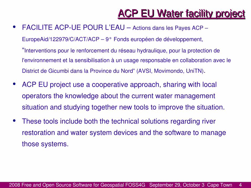
GRASS (http://grass.osgeo.org/) is one of the most important and most advanced FOSS GIS, used all over the world in many different projects and applications, the FOSS approach makes it the ideal tool to spread GIS in developing countries.
EPANET (http://www.epa.gov/nrmrl/wswrd/dw/epanet.html)is a Public domain software to model the hydraulic and water quality behavior of water distribution piping systems by the US Environmental Protection Agency.
2008 Free and Open Source Software for Geospatial FOSS4G September 29, October 3 Cape Town 7
The Software sideThe Software side● The management of the water systems can be improved by means of
tools like EPANET, but they can be further improved by coupling this tool with a GIS.
● EPANET software is public domain and it is widely used all over the world in research and professional applications, but no FOSS interface is available to exchange data to and from a GIS system, although MS windows only, freeware (but not OS) epa2gis and shp2epa are available but documentation is lacking.
● We present here a preliminary version of an interface (still under development) between the FOSS GIS GRASS and EPANET.
2008 Free and Open Source Software for Geospatial FOSS4G September 29, October 3 Cape Town 8
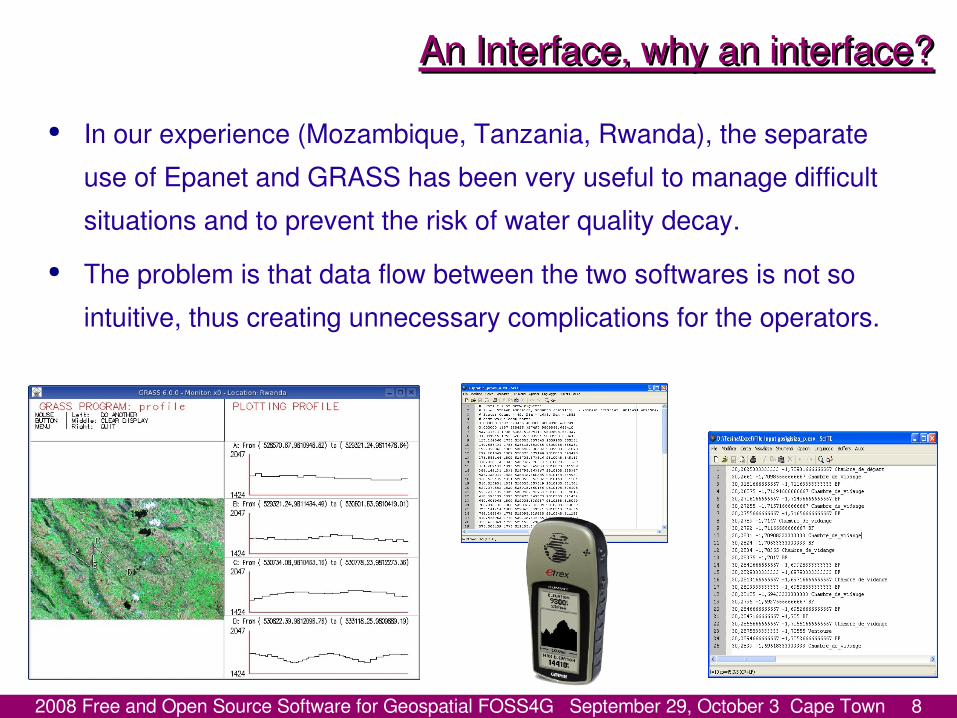
An Interface, why an interface?An Interface, why an interface?● In our experience (Mozambique, Tanzania, Rwanda), the separate
use of Epanet and GRASS has been very useful to manage difficult situations and to prevent the risk of water quality decay.
● The problem is that data flow between the two softwares is not so intuitive, thus creating unnecessary complications for the operators.

2008 Free and Open Source Software for Geospatial FOSS4G September 29, October 3 Cape Town 9
An Interface, why an interface?An Interface, why an interface?● Previous experiences have shown that when data transfer becomes
too complicated, users tend to replicate database in each platform leading to inconsistencies, data fault or loss and, eventually, to data quality degradation.
● The same experiences have shown that when users are allowed to use both GIS and EPANET using reliable data, they obtain the best from the two environments.
2008 Free and Open Source Software for Geospatial FOSS4G September 29, October 3 Cape Town 10
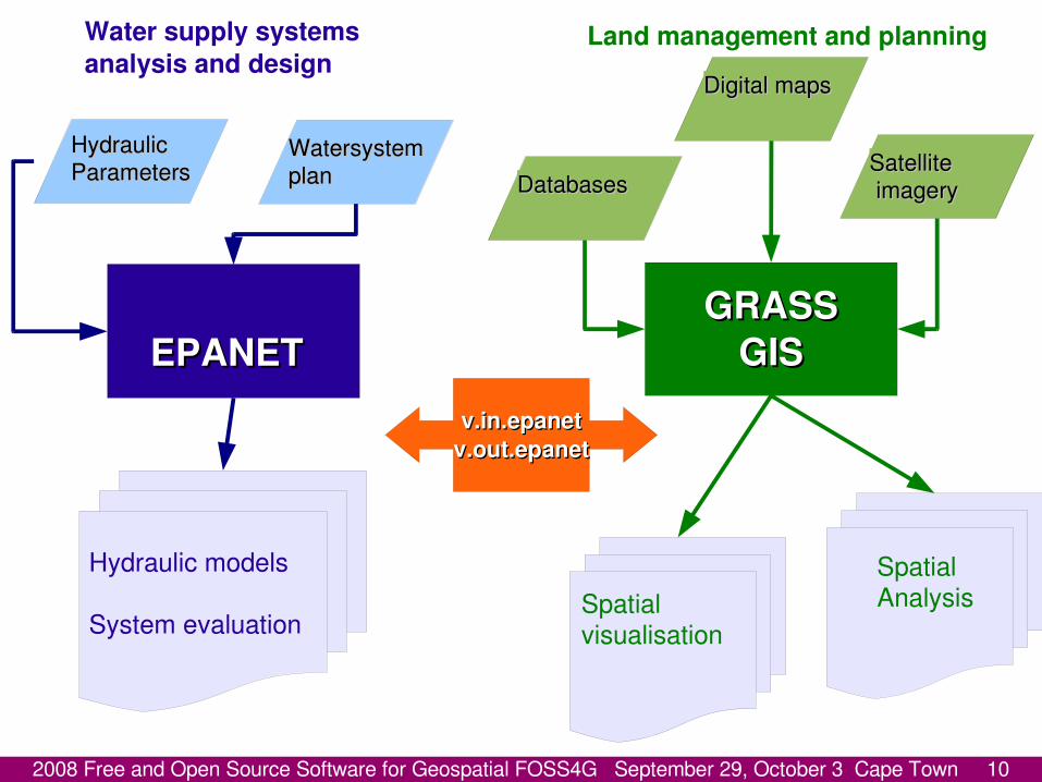
HydraulicHydraulicParametersParameters
WatersystemWatersystemplanplan
EPANETEPANET
Water supply systems analysis and design
Hydraulic models
System evaluation
SatelliteSatellite imageryimagery
Spatial Analysis
GRASSGRASSGISGIS
Digital mapsDigital maps
Land management and planning
Spatial visualisation
DatabasesDatabases
v.in.epanetv.in.epanetv.out.epanetv.out.epanet

2008 Free and Open Source Software for Geospatial FOSS4G September 29, October 3 Cape Town 11
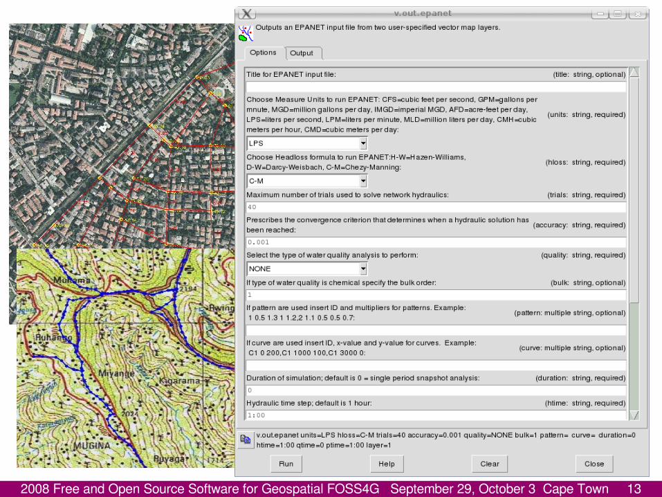
Interface prototypeInterface prototype● The need of an interface that makes the Sws easily “talk” to each
other is evident. Such an interface in a FOSS GIS can be significantly useful to spread the use of this tools, allowing water managers to be more effective.
● An effective design of a water supply system must take into account not only technical problems that can be solved by means of personal experience and with software skills, but also sustainability aspects that can be highlighted by the use of a GIS.
● A first step toward a complete integration has been the development of the possibility to exchange data between the two software systems, preserving cartographic coordinates, attributes and water system information when data are exchanged.
2008 Free and Open Source Software for Geospatial FOSS4G September 29, October 3 Cape Town 12
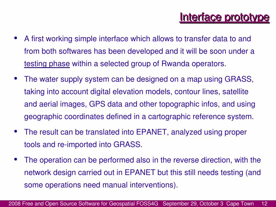
Interface prototypeInterface prototype● A first working simple interface which allows to transfer data to and
from both softwares has been developed and it will be soon under a testing phase within a selected group of Rwanda operators.
● The water supply system can be designed on a map using GRASS, taking into account digital elevation models, contour lines, satellite and aerial images, GPS data and other topographic infos, and using geographic coordinates defined in a cartographic reference system.
● The result can be translated into EPANET, analyzed using proper tools and re-imported into GRASS.
● The operation can be performed also in the reverse direction, with the network design carried out in EPANET but this still needs testing (and some operations need manual interventions).
2008 Free and Open Source Software for Geospatial FOSS4G September 29, October 3 Cape Town 13
2008 Free and Open Source Software for Geospatial FOSS4G September 29, October 3 Cape Town 14
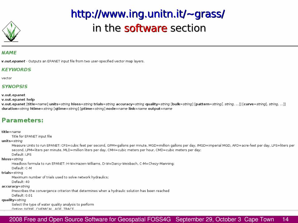
http://www.ing.unitn.it/~grass/http://www.ing.unitn.it/~grass/ in the in the softwaresoftware section section

2008 Free and Open Source Software for Geospatial FOSS4G September 29, October 3 Cape Town 15

2008 Free and Open Source Software for Geospatial FOSS4G September 29, October 3 Cape Town 16
2008 Free and Open Source Software for Geospatial FOSS4G September 29, October 3 Cape Town 17
Compatibility and database structureCompatibility and database structure•The interface has been developed studying the EPANET input/output files format details, to design a geodatabase carrying the same information, both geographic and semantic. •The final format is compatible with the most common formats used in geodatabases, like PostGIS/PostgreSQL, so data can be accessed by means of any GIS able to read it, proprietary and FOSS. •While water supply systems design and management can be carried out effectively with EPANET, GRASS can be used to map existing (or possible) erosion risk areas, river restored areas (naturalistic engineering), hydro-power plants, agriculture and grazing land use: all these information can contribute to model the response of the territory to future impact. •The research group is currently carrying out tests to verify the translation tool.
2008 Free and Open Source Software for Geospatial FOSS4G September 29, October 3 Cape Town 18
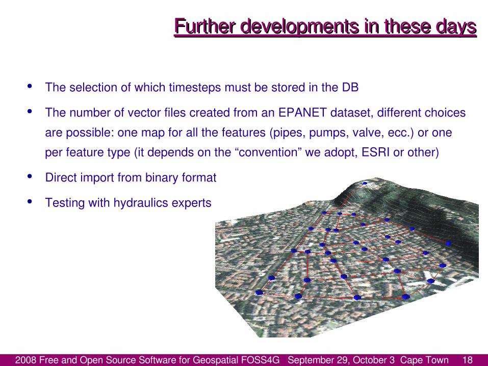
Further developments in these daysFurther developments in these days
● The selection of which timesteps must be stored in the DB ● The number of vector files created from an EPANET dataset, different choices
are possible: one map for all the features (pipes, pumps, valve, ecc.) or one per feature type (it depends on the “convention” we adopt, ESRI or other)
● Direct import from binary format ● Testing with hydraulics experts
2008 Free and Open Source Software for Geospatial FOSS4G September 29, October 3 Cape Town 19
FOSS4G fosteringFOSS4G fostering● A further important goal of the project is to foster the adoption of FOSS GIS
and related software for land planning and natural resource management, operating a transition from proprietary software to FOSS.
● For this reason, in the next months and years (the duration of the project is three years) the interface will be perfected and courses will be held both to share knowledge about generic GRASS use and to teach specifically how to manage water systems with running EPANET within GRASS.
● The courses will be held by means of specifically developed tutorials, using local examples and in French language. The project is addressed not only to water technicians and software specialists, but also to local communities.

2008 Free and Open Source Software for Geospatial FOSS4G September 29, October 3 Cape Town 20
The sustainability sideThe sustainability sideThe project goes beyond the mere technical applications and involves also the
local communities to:● maintain riversides with simple natural techniques;● learn together how to carry out a sustainable use of water in order to protect
the fragile and already dramatically altered ecosystems of the overpopulated area;
● design and build two microhydropower plants.
We have to teach something but also to learn a lot!
2008 Free and Open Source Software for Geospatial FOSS4G September 29, October 3 Cape Town 21
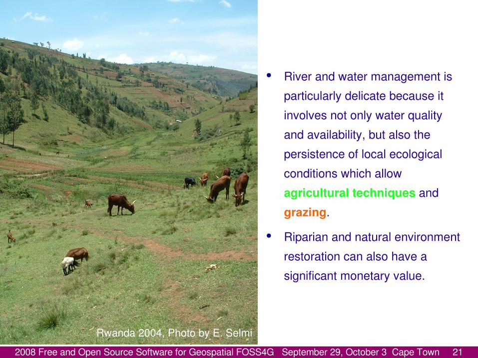
Rwanda 2004, Photo by E. Selmi
● River and water management is particularly delicate because it involves not only water quality and availability, but also the persistence of local ecological conditions which allow agricultural techniques and grazing.
● Riparian and natural environment restoration can also have a significant monetary value.
2008 Free and Open Source Software for Geospatial FOSS4G September 29, October 3 Cape Town 22
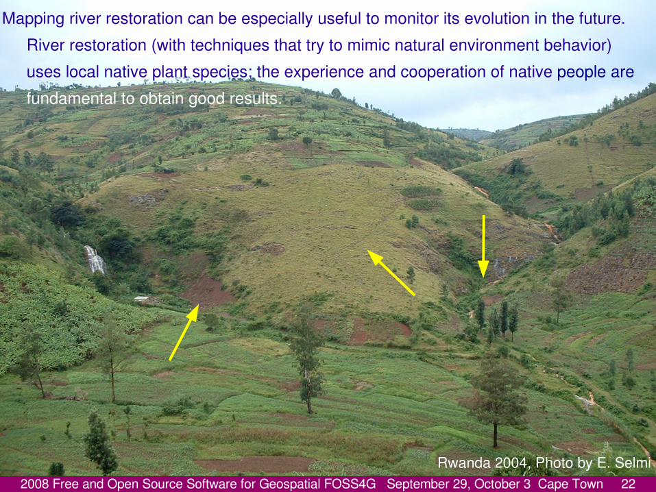
Rwanda 2004, Photo by E. Selmi
Mapping river restoration can be especially useful to monitor its evolution in the future. River restoration (with techniques that try to mimic natural environment behavior) uses local native plant species; the experience and cooperation of native people are fundamental to obtain good results.

2008 Free and Open Source Software for Geospatial FOSS4G September 29, October 3 Cape Town 23
River RestorationRiver RestorationSuppose we will reach the best collaborative effort between local and
foreign technicians, the perfect restoration interventions and the participation of local communities... we will need:
Continuous and correct monitoring on the field and keeping track of land changes to guide the process corrections that will be necessary in the long term, with an iterative self correcting process.
The adoption of naturalistic engineering techniques is taken into account to reduce the impact of 2 new medium-micro hydro-power plants which are being set up during the project and to deal with overgrazing problem or agricultural over-exploiting of river banks.
The combination of GIS techniques and land control by natives can be the key?

2008 Free and Open Source Software for Geospatial FOSS4G September 29, October 3 Cape Town 24
Other sustainability and software issuesOther sustainability and software issues● Past tragic events occurred in Rwanda are the clear indicators that
only a sustainable approach in the area can give some hope that people will have enough to maintain themselves and live in peace in such an over populated area.
● Management and planning must be carried out involving the society at all levels, and communities participation is crucial to have long terms results both in software knowledge spreading and in simple land management techniques application.
● In this environment the use of FOSS GIS is particularly important because guarantees freedom to use software and independence.

2008 Free and Open Source Software for Geospatial FOSS4G September 29, October 3 Cape Town 25
ConclusionsConclusions● Different previous experiences carried out in Africa have driven the
group to develop a GRASS–EPANET interface. This interface is a first step forward to integrate a software specifically designed for water supply system management with a FOSS GIS, giving advantages both to GRASS and to EPANET.
● As in the tradition of FOSS the interface can be improved and expanded hopefully not only by the authors, but also by everyone who is interested in its development.
● The interface is part of a bigger project which involves an integrated approach to water and ecological problems.

2008 Free and Open Source Software for Geospatial FOSS4G September 29, October 3 Cape Town 26
Future perspectivesFuture perspectives● Future monitoring will be crucial for the whole project and a
geographical approach together with local communities participation can be the tools to succeed in the monitoring and the preservation of riparian restoration, water resources, natural environment and agricultural and grazing land.
● The new interface can be important to make the work of technicians easier, but the overall project success depends on the participative approach. Tools alone do not guarantee neither project results, nor quality.
● Certainly, the possibility to deal with GIS and water supply system with an integrated approach can be useful both to spread GIS technologies and FOSS systems.
2008 Free and Open Source Software for Geospatial FOSS4G September 29, October 3 Cape Town 27Rwanda 2004, Photo by E. Selmi