Embed Size (px)
DESCRIPTION
Capstone Project Proposal Ruth Ann Trudell Spring 2009. Design and Implementation of a Geodatabase for New York Canal Inspection Data. Credits. Patrick Kennelly, Associate Professor, Penn State University Jamie DeLuca , GIS Specialist, NY State Canal Corporation - PowerPoint PPT Presentation
Citation preview
Design and Implementation of a Geodatabase for New York Canal
Inspection Data
Capstone Project ProposalRuth Ann Trudell
Spring 2009

Credits Patrick Kennelly, Associate Professor,
Penn State University Jamie DeLuca, GIS Specialist, NY State
Canal Corporation DOT staff for support and insights
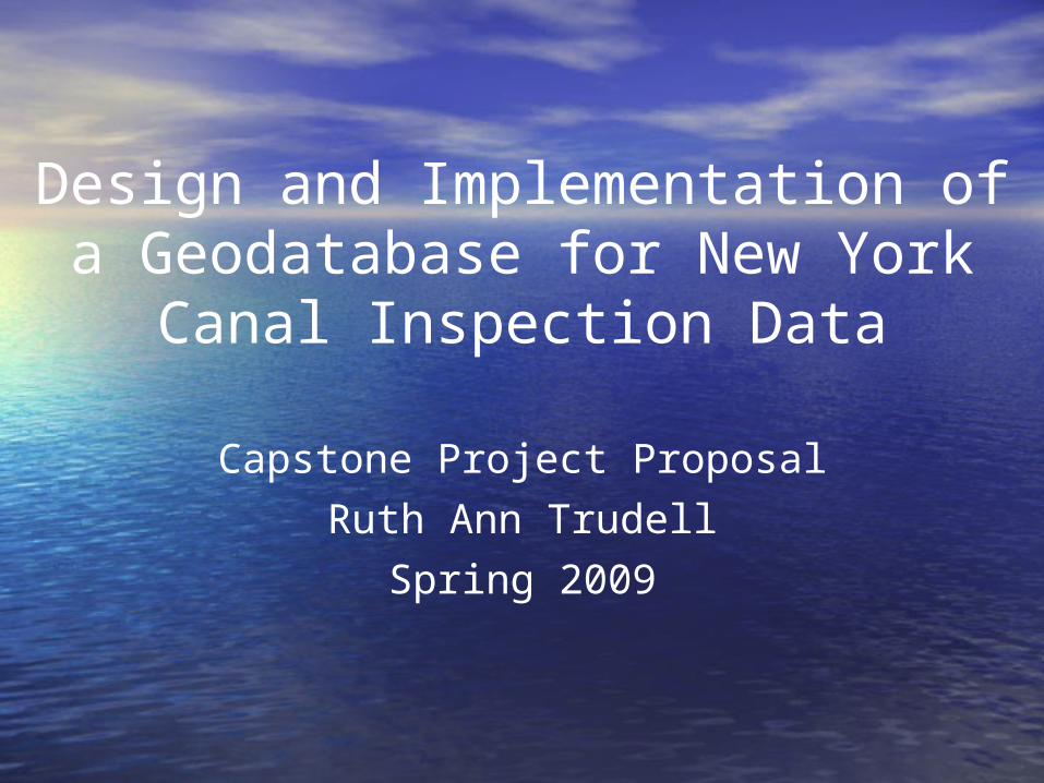
Discussion Outline
•Geographic context and brief history of NY State Canals
•Current canal management•Embankment inventory
methods/need for modernization•Status of existing inventory data•Time line for data model
development
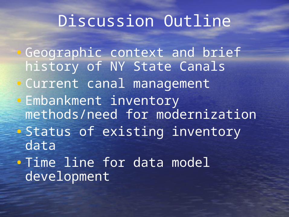
Geography and History of NY State Canal System
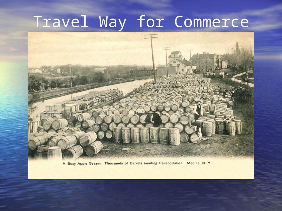
Travel Way for Commerce

Current Canal System
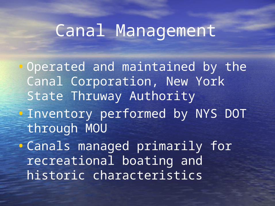
Canal Management•Operated and maintained by the
Canal Corporation, New York State Thruway Authority
• Inventory performed by NYS DOT through MOU
•Canals managed primarily for recreational boating and historic characteristics

Historic Values
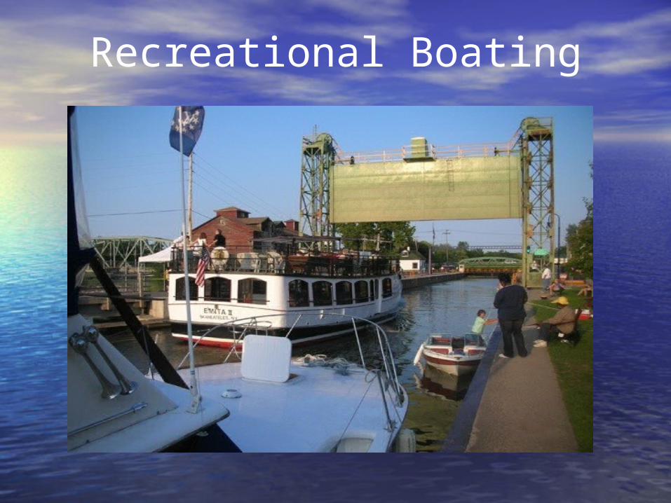
Recreational Boating

Bicycling
Canal Construction
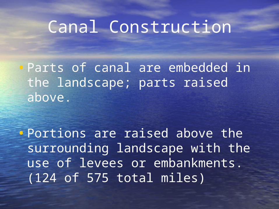
•Parts of canal are embedded in the landscape; parts raised above.
•Portions are raised above the surrounding landscape with the use of levees or embankments. (124 of 575 total miles)

Typical High Embankment
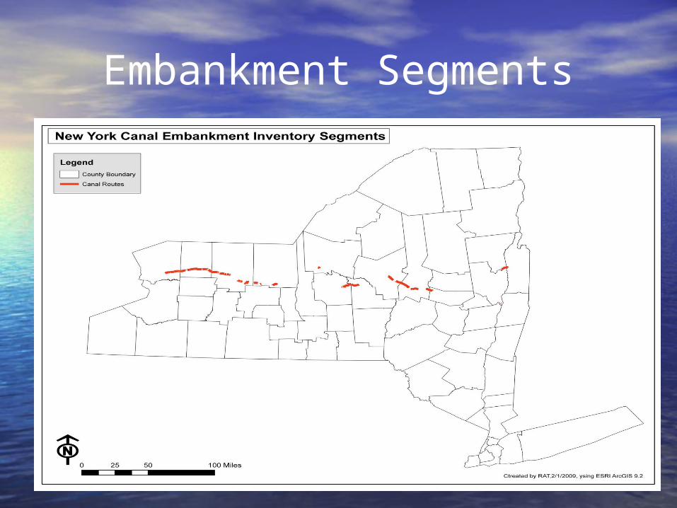
Embankment Segments

Embankment Failure
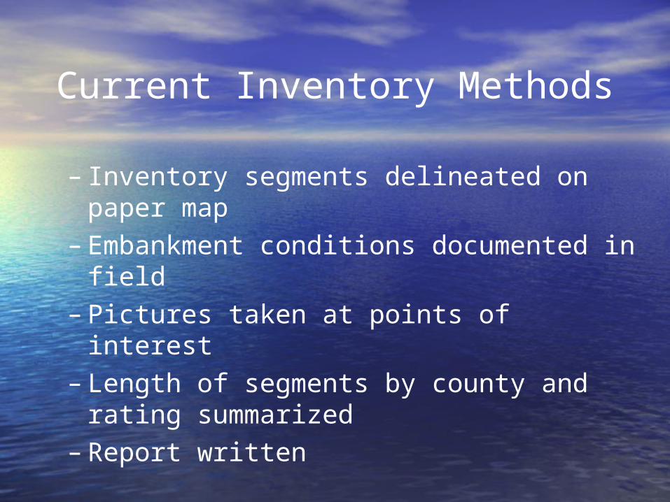
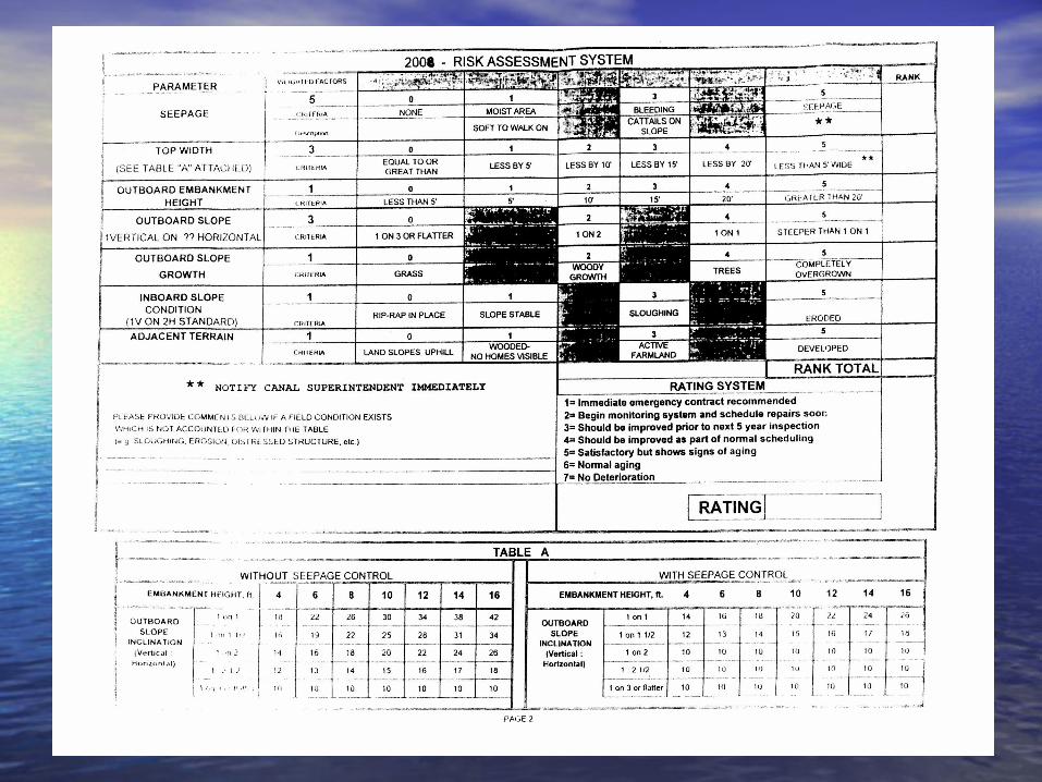
Current Inventory Methods
– Inventory segments delineated on paper map
– Embankment conditions documented in field
– Pictures taken at points of interest– Length of segments by county and rating
summarized– Report written
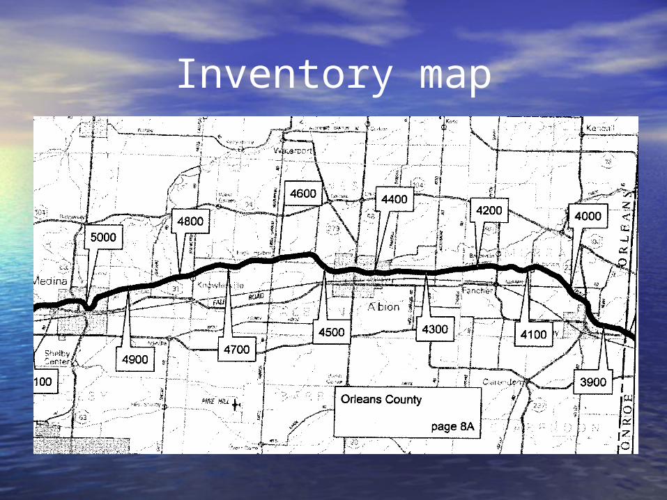
Inventory map
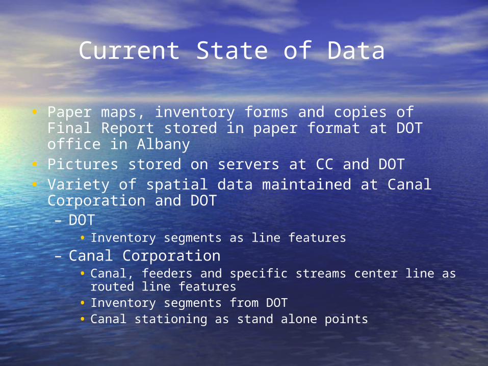
Current State of Data
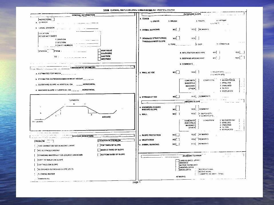
• Paper maps, inventory forms and copies of Final Report stored in paper format at DOT office in Albany
• Pictures stored on servers at CC and DOT• Variety of spatial data maintained at Canal
Corporation and DOT– DOT
• Inventory segments as line features– Canal Corporation
• Canal, feeders and specific streams center line as routed line features
• Inventory segments from DOT• Canal stationing as stand alone points

Solution? Geodatabase!
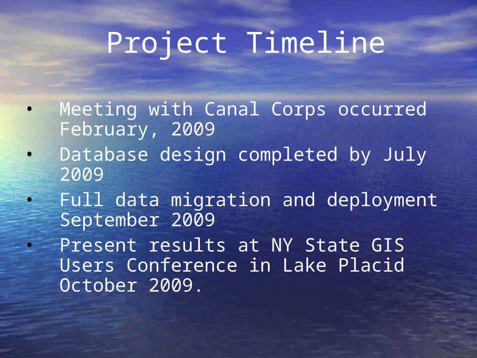
Project Timeline• Meeting with Canal Corps occurred
February, 2009• Database design completed by July 2009• Full data migration and deployment
September 2009• Present results at NY State GIS Users
Conference in Lake Placid October 2009.
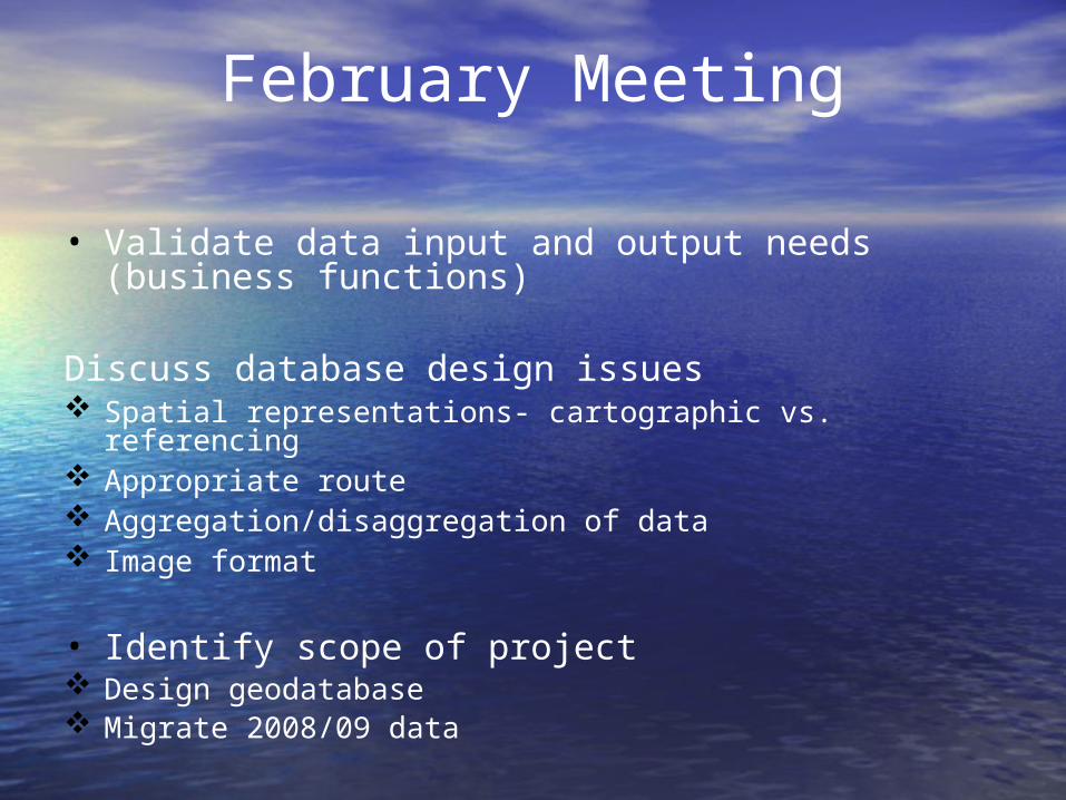
• Validate data input and output needs (business functions)
Discuss database design issues Spatial representations- cartographic vs. referencing Appropriate route Aggregation/disaggregation of data Image format
• Identify scope of project Design geodatabase Migrate 2008/09 data
February Meeting
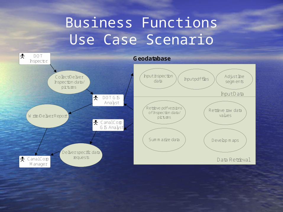
Business FunctionsUse Case Scenario
DOT GIS Analyst
Canal Corp Manager
Canal Corp GIS Analyst
DOT Inspector
Collect/Deliver Inspection data/
pictures
Retrieve pdf versions of Inspection data/
pictures
Input inspection data Input pdf files Adjust line
segments
Geodatabase
Input Data
Data Retrieval
Retrieve raw data values
Summarize data Develop maps
Write/Deliver Report
Deliver specific data requests
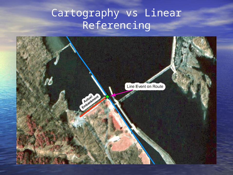
Cartography vs Linear Referencing
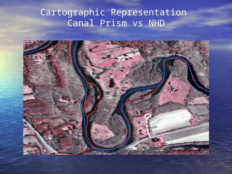
Cartographic Representation Canal Prism vs NHD
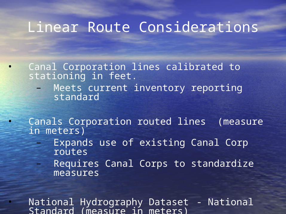
Linear Route Considerations
• Canal Corporation lines calibrated to stationing in feet. – Meets current inventory reporting standard
• Canals Corporation routed lines (measure in meters)– Expands use of existing Canal Corp routes– Requires Canal Corps to standardize
measures
• National Hydrography Dataset - National Standard (measure in meters)– Enhances future hydraulic modeling
capabilities– Allows spatial analysis of features affecting
canals but that on unrouted tributaries
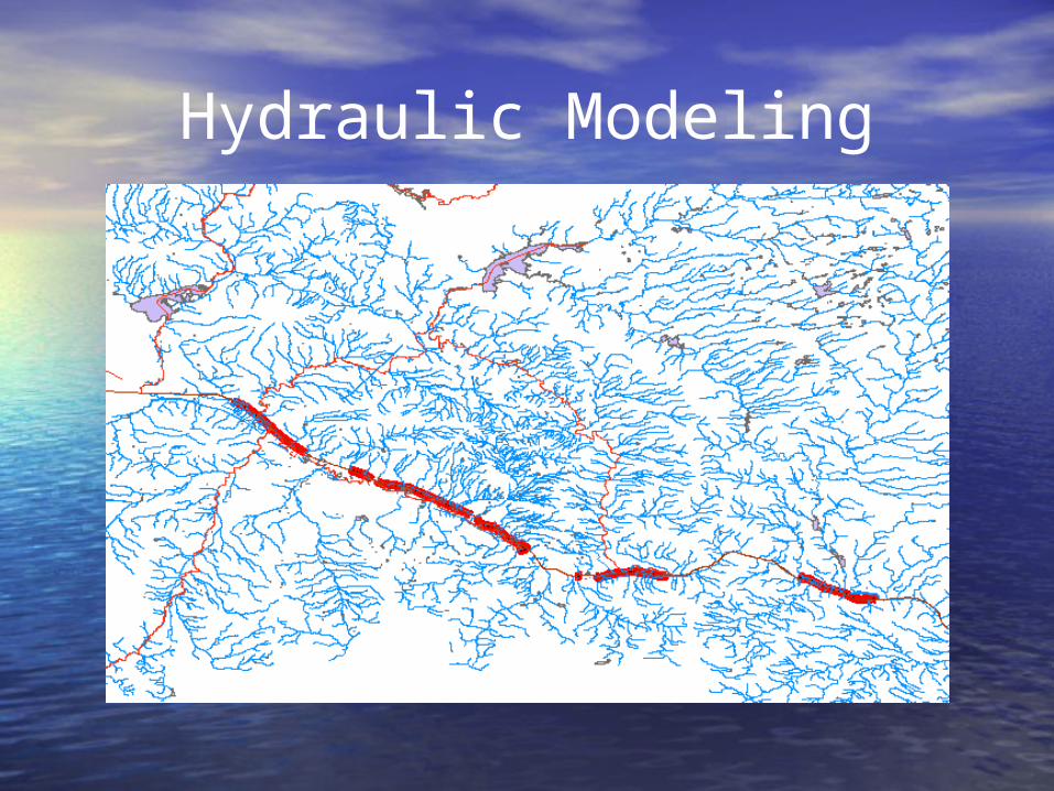
Hydraulic Modeling
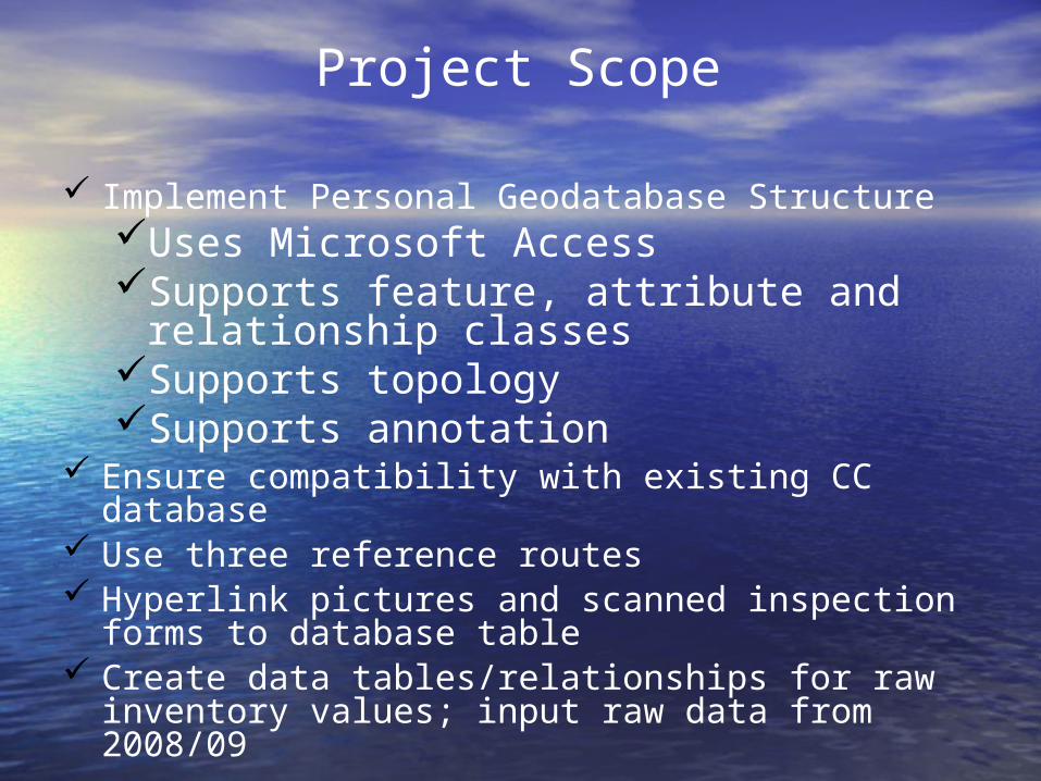
Project Scope
Implement Personal Geodatabase StructureUses Microsoft AccessSupports feature, attribute and
relationship classesSupports topologySupports annotation
Ensure compatibility with existing CC database Use three reference routes Hyperlink pictures and scanned inspection forms
to database table Create data tables/relationships for raw inventory
values; input raw data from 2008/09
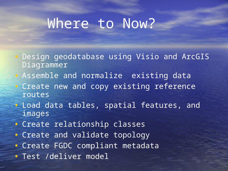
Where to Now?
• Design geodatabase using Visio and ArcGIS Diagrammer
• Assemble and normalize existing data• Create new and copy existing reference routes• Load data tables, spatial features, and images• Create relationship classes• Create and validate topology• Create FGDC compliant metadata• Test /deliver model
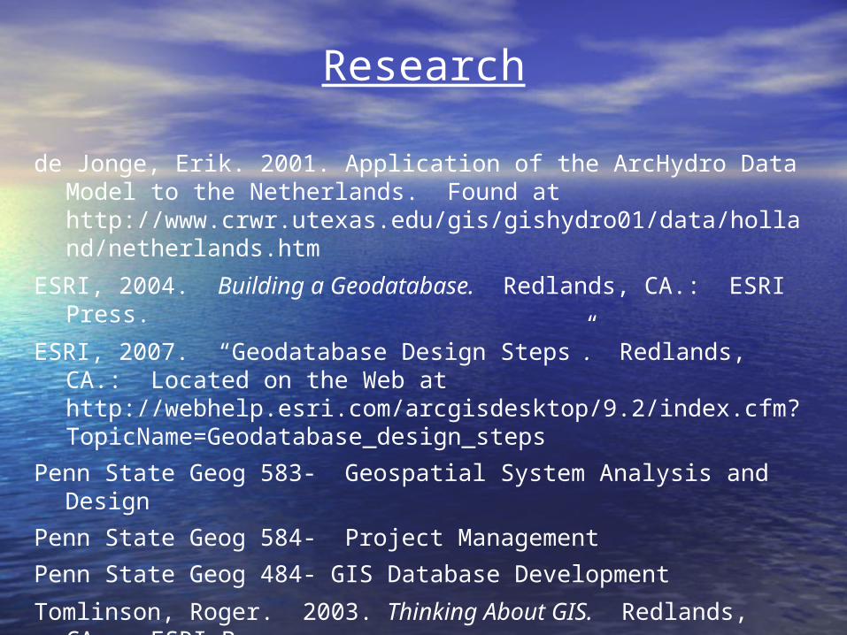
Research
de Jonge, Erik. 2001. Application of the ArcHydro Data Model to the Netherlands. Found at http://www.crwr.utexas.edu/gis/gishydro01/data/holland/netherlands.htm
ESRI, 2004. Building a Geodatabase. Redlands, CA.: ESRI Press.
ESRI, 2007. “Geodatabase Design Steps”. Redlands, CA.: Located on the Web at http://webhelp.esri.com/arcgisdesktop/9.2/index.cfm?TopicName=Geodatabase_design_steps
Penn State Geog 583- Geospatial System Analysis and DesignPenn State Geog 584- Project ManagementPenn State Geog 484- GIS Database DevelopmentTomlinson, Roger. 2003. Thinking About GIS. Redlands, CA.:
ESRI Press.

Questions?