Embed Size (px)
Citation preview

Conservation Agriculture as a Potential
Pathway to Better Resource
Management, Higher Productivity,
and Improved Socio-Economic
Conditions in the Andean Region
Jeffrey Alwang
Blacksburg, Virginia
6 May 2010
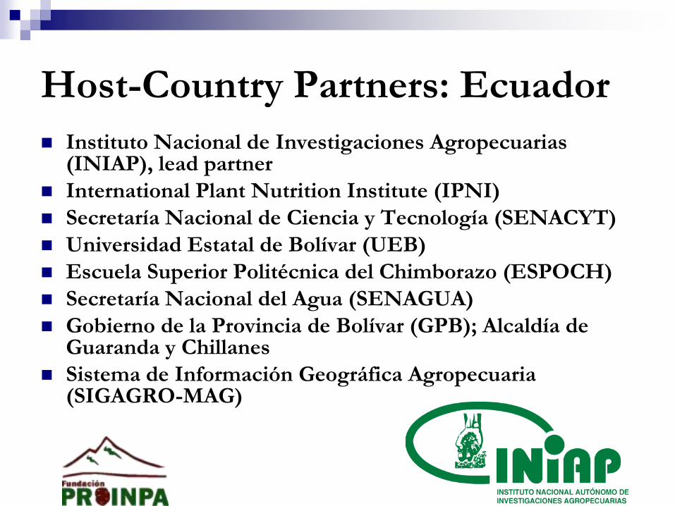
Host-Country Partners: Ecuador
Instituto Nacional de Investigaciones Agropecuarias (INIAP), lead partner
International Plant Nutrition Institute (IPNI)
Secretaría Nacional de Ciencia y Tecnología (SENACYT)
Universidad Estatal de Bolívar (UEB)
Escuela Superior Politécnica del Chimborazo (ESPOCH)
Secretaría Nacional del Agua (SENAGUA)
Gobierno de la Provincia de Bolívar (GPB); Alcaldía de Guaranda y Chillanes
Sistema de Información Geográfica Agropecuaria (SIGAGRO-MAG)
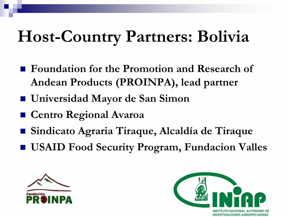
Host-Country Partners: Bolivia
Foundation for the Promotion and Research of
Andean Products (PROINPA), lead partner
Universidad Mayor de San Simon
Centro Regional Avaroa
Sindicato Agraria Tiraque, Alcaldía de Tiraque
USAID Food Security Program, Fundacion Valles

US Partners
Jeffrey Alwang Ag. and Applied Economics, Virginia Tech
Darrell Bosch, Ag. and Applied Economics, Virginia Tech
George W. Norton Ag. and Applied Economics, Virginia Tech
Sarah Hamilton, International Development, Univ. of Denver
Paul Backman, Plant Pathology, Penn State
Rob Gallagher, Crop and Soil Sciences, Penn State
Beth Gugino, Plant Pathology, Penn State
Richard Stehouwer, Crop and Soil Sciences, Penn State
Wills Flowers, Entomology and Biological Control, Florida A&M
Jorge A. Delgado, Soil Plant Nutrient Research Unit, USDA/ARS, Fort Collins, CO
Other Partner
CIAT, Cali Colombia
Project Objectives
Identify and evaluate production practices and farming components that can be assembled into CA production systems for Bolivar, Ecuador and Tiraque, Bolivia;
Validate candidate CAPS in terms of impacts on: soil health, soil retention and carbon and other nutrient balances; sustained productivity; profitability; risk bearing; the environment; compatibility with household livelihood strategies; and social conditions including gender considerations;
Promote adoption of the most appropriate CAPS by identifying mechanisms to increase their profitability;
Project Objectives
Design and evaluate mechanisms for disseminating
results to similar areas;
Evaluate overall impacts of the research along several
dimensions including soil health, productivity,
economic, social and environmental; and
Strengthen the capacity of government and non-
government institutions to develop and disseminate
CAPS in the Andean regions of target countries

Conservation Agriculture In its purest form, CA is based on three principles: (i) minimum
or no mechanical soil disturbance; (ii) permanent organic soil cover; and (iii) diversified crop rotations
We view CA as a continuum running from a single or small number of practices to a full-blown CAPS
Our proposal: investigate alternatives to increase agricultural productivity in a sustainable fashion through improvements in soil health, better rotations, cost-effective and sustainable pest and nutrient management, and improved water management. Off-farm innovations can also raise incomes and reduce the stress on the natural resource base
Key point: we are working beyond the trinity of the pure form of CA

“Other” CA Components: Our
Project
Bio-inputs to increase soil productivity
Pest control methods to increase profitability
Agro-forestry: control erosion, manage water, income
diversification and biological diversity
Economic considerations:
Costs and profitability of CA: beyond the production system
External costs and benefits: mechanisms to capture these
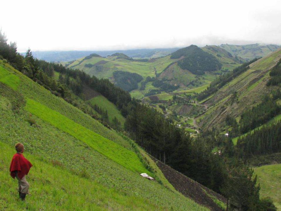
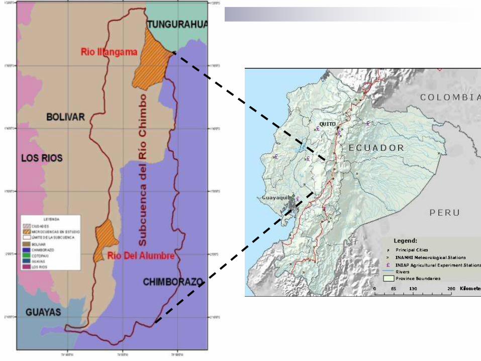
Sites: Chimbo, Ecuador & Tiraque,
Bolivia
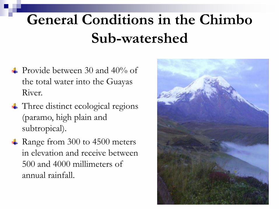
General Conditions in the Chimbo
Sub-watershed
Provide between 30 and 40% of
the total water into the Guayas
River.
Three distinct ecological regions
(paramo, high plain and
subtropical).
Range from 300 to 4500 meters
in elevation and receive between
500 and 4000 millimeters of
annual rainfall.

High rates of erosion
contribute to sedimentation
and turbidity in surface water
Reduction in water levels and
flows caused by
deforestation and expansion
of the agricultural frontier
Less water available and
more variability in rainfall in
recent years
Environmental Conditions in Sub-watersheds
Two Micro-watersheds
Illangama:
High elevation, more rainfall, cold and frost
Predominantly indigenous
Alumbre:
Lower elevation, semi-tropical
Mestizo families
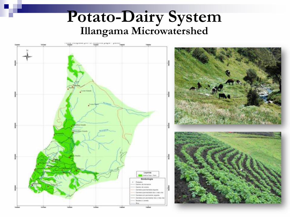
Potato-Dairy SystemIllangama Microwatershed
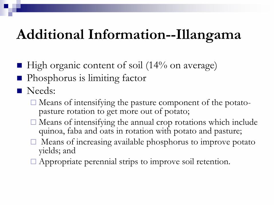
Additional Information--Illangama
High organic content of soil (14% on average)
Phosphorus is limiting factor
Needs:Means of intensifying the pasture component of the potato-
pasture rotation to get more out of potato;
Means of intensifying the annual crop rotations which include quinoa, faba and oats in rotation with potato and pasture;
Means of increasing available phosphorus to improve potato yields; and
Appropriate perennial strips to improve soil retention.
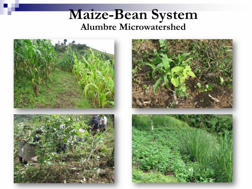
Maize-Bean SystemAlumbre Microwatershed
Additional Information--Alumbre
Land-holdings are relatively high
Soils are highly degraded and susceptible to
erosion
Means are needed to increase soil retention,
improve soil health, while increasing food
security, diversifying agricultural systems, and
increasing returns to agriculture

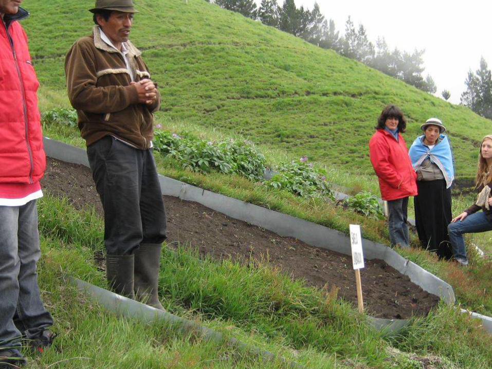
Management Alternatives: Prior
SANREM Phase
Improved pastures with deviation ditches
Potato cultivation in contours
Management of improved pastures
Reduced-tillage maize
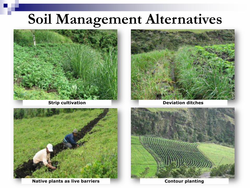
Soil Management Alternatives
Strip cultivation
Native plants as live barriers
Deviation ditches
Contour planting
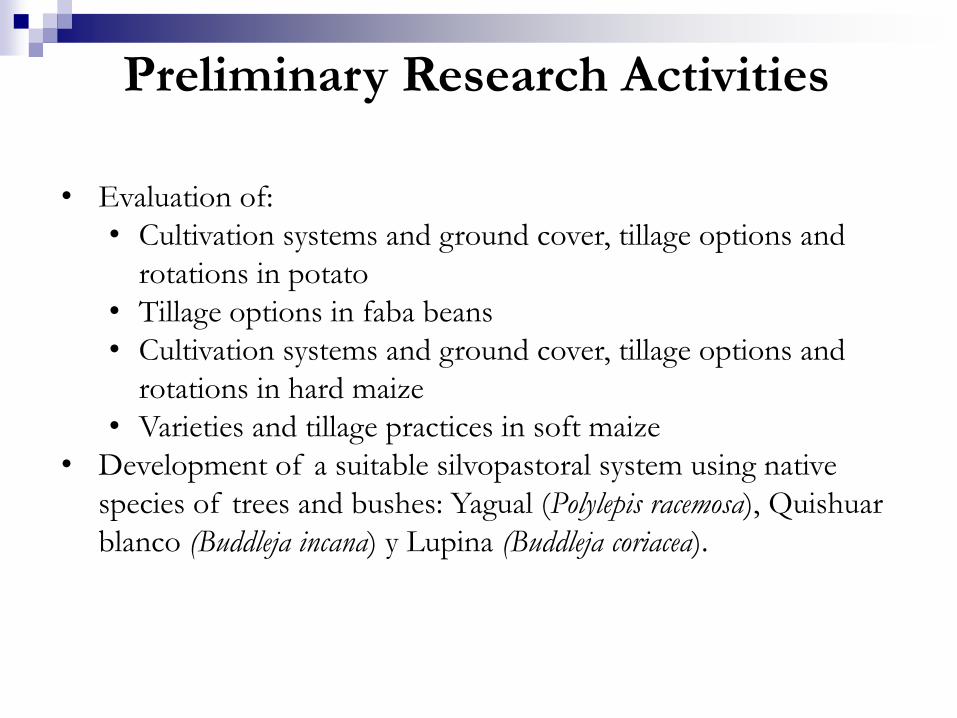
• Evaluation of:
• Cultivation systems and ground cover, tillage options and
rotations in potato
• Tillage options in faba beans
• Cultivation systems and ground cover, tillage options and
rotations in hard maize
• Varieties and tillage practices in soft maize
• Development of a suitable silvopastoral system using native
species of trees and bushes: Yagual (Polylepis racemosa), Quishuar
blanco (Buddleja incana) y Lupina (Buddleja coriacea).
Preliminary Research Activities
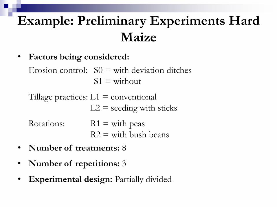
• Factors being considered:
Erosion control: S0 = with deviation ditches
S1 = without
Tillage: L1 = conventional
L2 = reduced
Rotations: R1 = oats-vicia and forage mix
R2 = forage mix
• Number of treatments: 8
• Number of repetitions: 3
• Experimental design: Partial divided
Example: Potato Experiments
• Factors being considered:
Erosion control: S0 = with deviation ditches
S1 = without
Tillage practices: L1 = conventional
L2 = seeding with sticks
Rotations: R1 = with peas
R2 = with bush beans
• Number of treatments: 8
• Number of repetitions: 3
• Experimental design: Partially divided
Example: Preliminary Experiments Hard
Maize
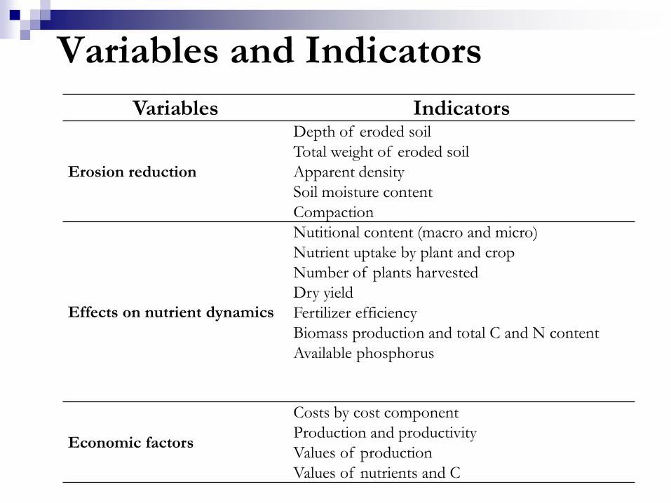
Variables Indicators
Erosion reduction
Depth of eroded soil
Total weight of eroded soil
Apparent density
Soil moisture content
Compaction
Effects on nutrient dynamics
Nutitional content (macro and micro)
Nutrient uptake by plant and crop
Number of plants harvested
Dry yield
Fertilizer efficiency
Biomass production and total C and N content
Available phosphorus
Economic factors
Costs by cost component
Production and productivity
Values of production
Values of nutrients and C
Variables and Indicators
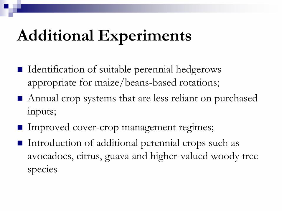
Additional Experiments
Identification of suitable perennial hedgerows
appropriate for maize/beans-based rotations;
Annual crop systems that are less reliant on purchased
inputs;
Improved cover-crop management regimes;
Introduction of additional perennial crops such as
avocadoes, citrus, guava and higher-valued woody tree
species

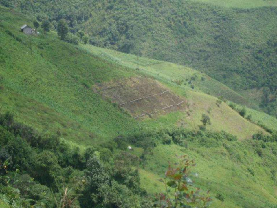
Field Trials in Alumbre Ecuador:
Tillage and Deviation Ditches

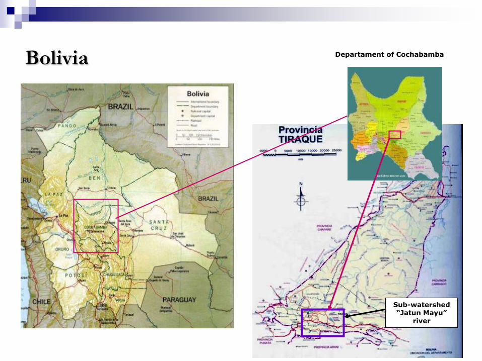
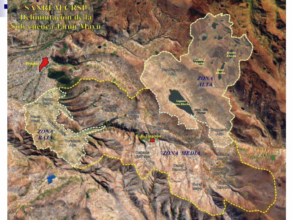
Bolivia Departament of Cochabamba
Sub-watershed “Jatun Mayu”
river

Conditions in Tiraque, Bolivia
Research site located in southern Tiraque Province, 70 Km from Cochabamba
Between 3000 and 4200 masl, with slopes between 10 and 25% in areas under cultivation and between 20 and 40% in pastured areas.
Comprised of 14 communities, with a population of approximately 3,000
The area is semi humid, with approximately 550 mm of annual rainfall, and cold climate
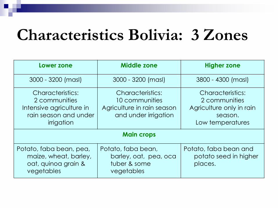
Characteristics Bolivia: 3 Zones
Lower zone Middle zone Higher zone
3000 - 3200 (masl) 3000 - 3200 (masl) 3800 - 4300 (masl)
Characteristics:
2 communities
Intensive agriculture in
rain season and under irrigation
Characteristics:
10 communities
Agriculture in rain season and under irrigation
Characteristics:
2 communities
Agriculture only in rain season.
Low temperatures
Main crops
Potato, faba bean, pea,
maize, wheat, barley,
oat, quinoa grain & vegetables
Potato, faba bean,
barley, oat, pea, oca
tuber & some vegetables
Potato, faba bean and
potato seed in higher places.
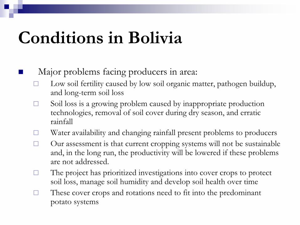
Conditions in Bolivia
Major problems facing producers in area: Low soil fertility caused by low soil organic matter, pathogen buildup,
and long-term soil loss
Soil loss is a growing problem caused by inappropriate production technologies, removal of soil cover during dry season, and erratic rainfall
Water availability and changing rainfall present problems to producers
Our assessment is that current cropping systems will not be sustainable and, in the long run, the productivity will be lowered if these problems are not addressed.
The project has prioritized investigations into cover crops to protect soil loss, manage soil humidity and develop soil health over time
These cover crops and rotations need to fit into the predominant potato systems

Lower and medium watershed – design 1
Treatment
1 2 3 4
1 fallow/pastur
e
Potatoes
Conventional
tillage
Manure-
based fertility
fallow
Quinua
Reduced
tillage
Fava
Reduced
Tillage
2 oats – residue
harvested
sudan grass
harvested
3 oats – residue
retained
sudan grass
retained
4 oat/Vetch –
residue
harvested
sudan
grass/legum
e
harvested
5 oat/vetch –
residue
retained
sudan
grass/legum
e
retained

Other Research Components
Development of a nitrogen index tool to
facilitate farm planning
SANREM Internship Program (research
opportunities for UG students)
Tradeoffs analysis: on/off-farm, productivity-
environment
Tool to identify adoption propensities

INPUT
CALCULATED BY
THE INDEX
OUTPUT
OUTPUT (Losses)
N – Index:
Inputs and Outputs
Agricultural Soil
Fertilizer N
Initial Inorganic N in the Root
Zone
Mineralized N from
SOM
N from Atmospheric Deposition
Manure N
Mineralized N from Crop Residue
N in Irrigation
Water
Total N in the System
Ammonia Volatilization
Denitrification
N Uptake by Crops
Leaching
Final Residual Soil NO3-
Surface Transport
N Use Efficiency
Cropping System
N Applied:N Removed
Algorithms used by the N-Index are published in: Delgado et al., 2008. Ecol. Eng. 32:108-120
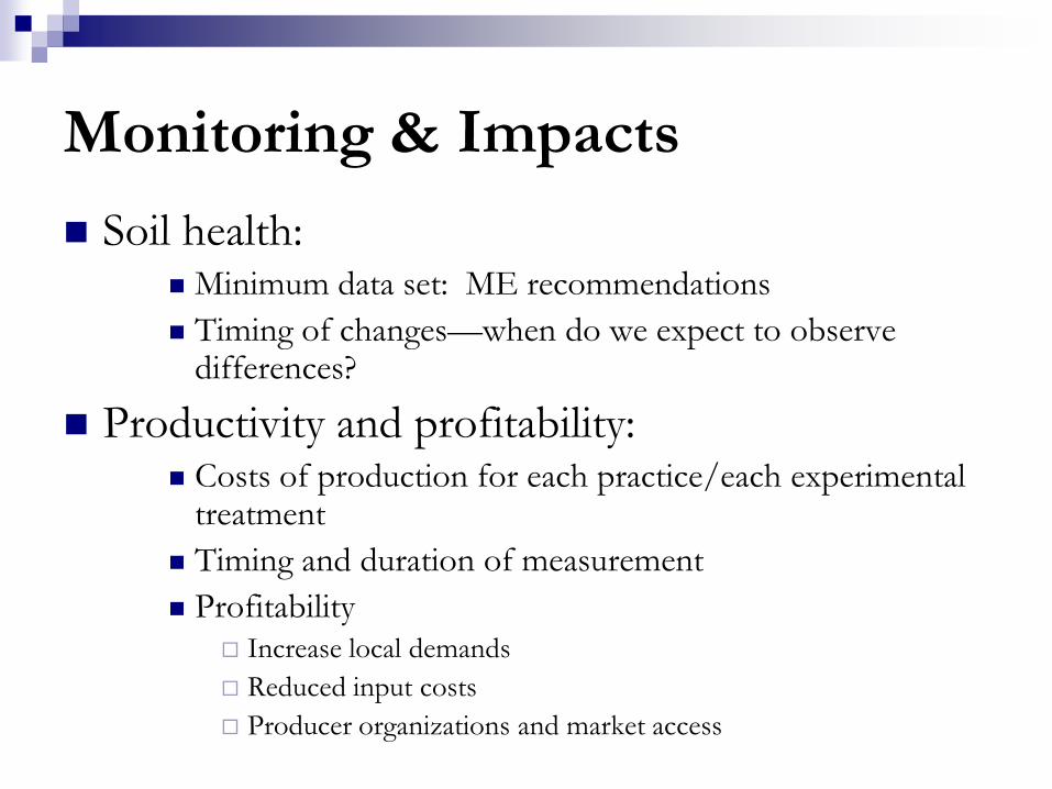
Monitoring & Impacts
Soil health: Minimum data set: ME recommendations
Timing of changes—when do we expect to observe differences?
Productivity and profitability: Costs of production for each practice/each experimental
treatment
Timing and duration of measurement
Profitability Increase local demands
Reduced input costs
Producer organizations and market access

Off-farm Impacts
Water quality and run-off
Payments for environmental services
Water quality, reduced sedimentation
Carbon sequestration
Potential value capture for adopters—institutional barriers
to this capture
Adding up—aggregation
End of project—adoption and spread
2
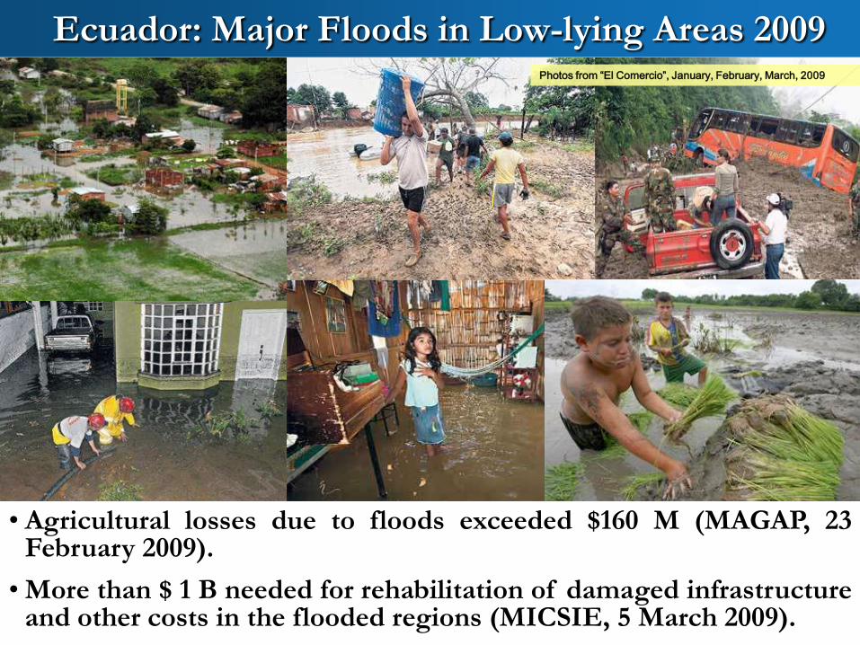
Photos from “El Comercio”, January, February, March, 2009
• Agricultural losses due to floods exceeded $160 M (MAGAP, 23February 2009).
• More than $ 1 B needed for rehabilitation of damaged infrastructureand other costs in the flooded regions (MICSIE, 5 March 2009).
Ecuador: Major Floods in Low-lying Areas 2009
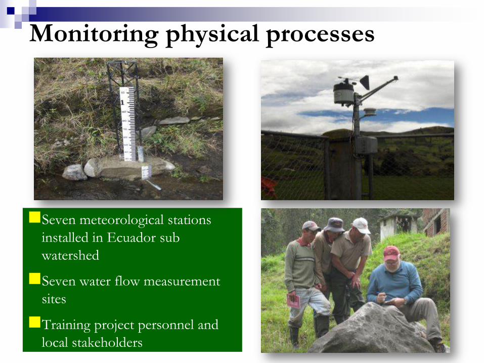
Monitoring physical processes
Seven meteorological stations
installed in Ecuador sub
watershed
Seven water flow measurement
sites
Training project personnel and
local stakeholders
182184
271
272
215
178
180
N
EW
S
MICROCUENCA DEL RÍO ILLANGAMA
726000
726000
727000
727000
728000
728000
729000
729000
730000
730000
731000
731000
732000
732000
733000
733000
734000
734000
735000
735000
736000
736000
737000
737000
738000
738000
739000
739000
740000
740000
741000
741000
9827000 9827000
9828000 9828000
9829000 9829000
9830000 9830000
9831000 9831000
9832000 9832000
9833000 9833000
9834000 9834000
9835000 9835000
9836000 9836000
9837000 9837000
9838000 9838000
9839000 9839000
9840000 9840000
9841000 9841000
9842000 9842000
9843000 9843000
9844000 9844000
9845000 9845000
9846000 9846000
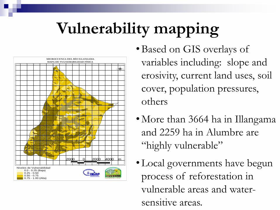
Niveles de Vulnerabilidad0.0 - 0.25 (Baja)0.25 - 0.500.50 - 0.750.75 - 1.00 (Alta)
MAPA DE VULNERABILIDAD FÍSICA
2000 0 2000 4000 m
Vulnerability mapping• Based on GIS overlays of
variables including: slope and
erosivity, current land uses, soil
cover, population pressures,
others
• More than 3664 ha in Illangama
and 2259 ha in Alumbre are
“highly vulnerable”
• Local governments have begun
process of reforestation in
vulnerable areas and water-
sensitive areas.

Thank you!
Chimborazo Volcano, Ecuador