Embed Size (px)
Citation preview
Complete Streets Design and Separation of Users for Safety and SustainabilityCARLY QUEEN
TRAFFIC ENGINEERING (CEE 6603)
APRIL 22, 2015
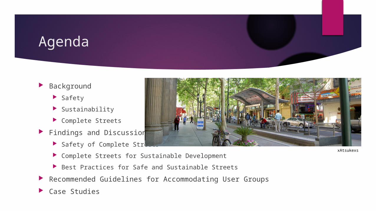
Agenda
Background
Safety
Sustainability
Complete Streets
Findings and Discussion
Safety of Complete Streets
Complete Streets for Sustainable Development
Best Practices for Safe and Sustainable Streets
Recommended Guidelines for Accommodating User Groups
Case Studies
xAtsukexs
Safety
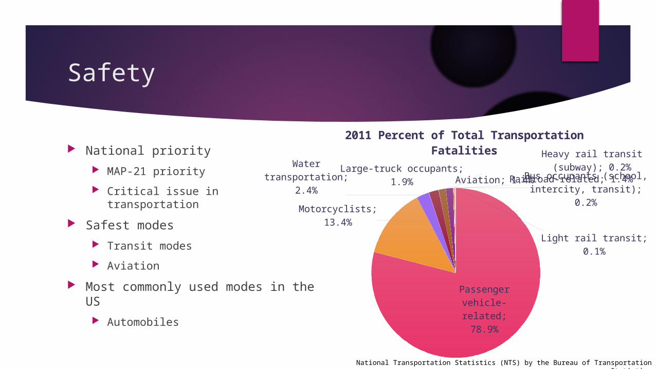
National priority
MAP-21 priority
Critical issue in transportation
Safest modes
Transit modes
Aviation
Most commonly used modes in the US
Automobiles
Passenger vehicle-re-
lated; 78.9%
Motorcyclists; 13.4%
Water transporta-tion; 2.4%
Large-truck occupants; 1.9% Aviation; 1.4%Railroad-related; 1.4%
Heavy rail transit (subway); 0.2%
Bus occupants (school, in-tercity, transit); 0.2%
Light rail transit; 0.1%
2011 Percent of Total Transportation Fatalities
National Transportation Statistics (NTS) by the Bureau of Transportation Statistics
Safety
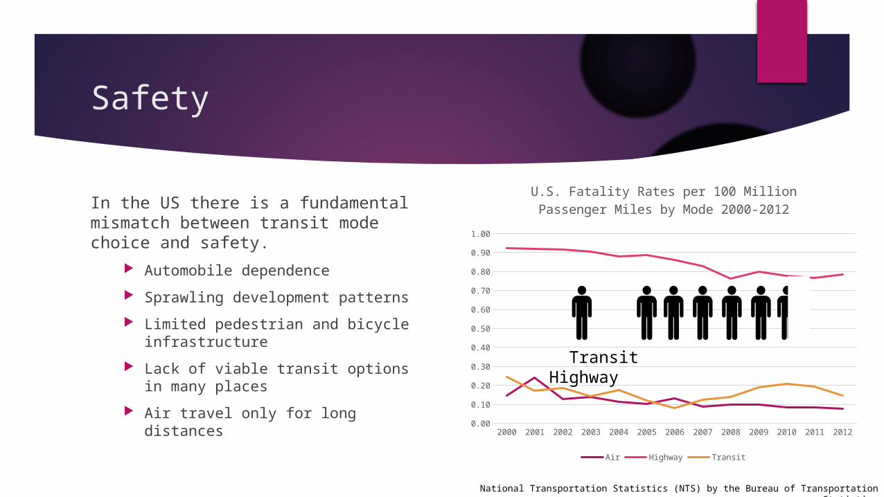
In the US there is a fundamental mismatch between transit mode choice and safety.
Automobile dependence
Sprawling development patterns
Limited pedestrian and bicycle infrastructure
Lack of viable transit options in many places
Air travel only for long distances
National Transportation Statistics (NTS) by the Bureau of Transportation Statistics
2000 2001 2002 2003 2004 2005 2006 2007 2008 2009 2010 2011 20120.00
0.10
0.20
0.30
0.40
0.50
0.60
0.70
0.80
0.90
1.00
U.S. Fatality Rates per 100 Million Passenger Miles by Mode 2000-2012
Air Highway Transit
Transit Highway
Safety
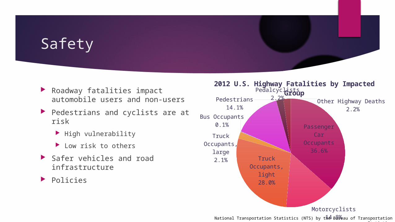
Roadway fatalities impact automobile users and non-users
Pedestrians and cyclists are at risk
High vulnerability
Low risk to others
Safer vehicles and road infrastructure
Policies
Passenger Car Occupants
36.6%
Motorcyclists14.8%
Truck Oc-cupants,
light28.0%
Truck Oc-cupants,
large2.1%
Bus Occupants0.1%
Pedestrians14.1%
Pedalcyclists2.2%
Other Highway Deaths 2.2%
2012 U.S. Highway Fatalities by Impacted Group
National Transportation Statistics (NTS) by the Bureau of Transportation Statistics
Sustainability
World Commission on Environment and Development
Our Common Future (1986)
Sustainable development
“Development which meets the needs of current generations without compromising the ability of future generations to meet their own needs.”
Closed Loop Systems
Triple Bottom Line vs. Russian Dolls Approach
Economic
Social
Environmental
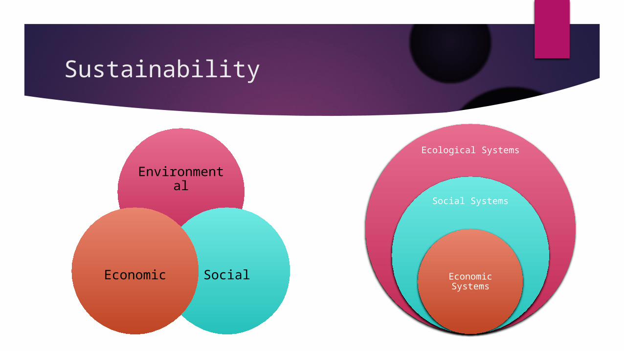
Sustainability
Environmental
SocialEconomic
Ecological Systems
Social Systems
Economic Systems
Sustainability
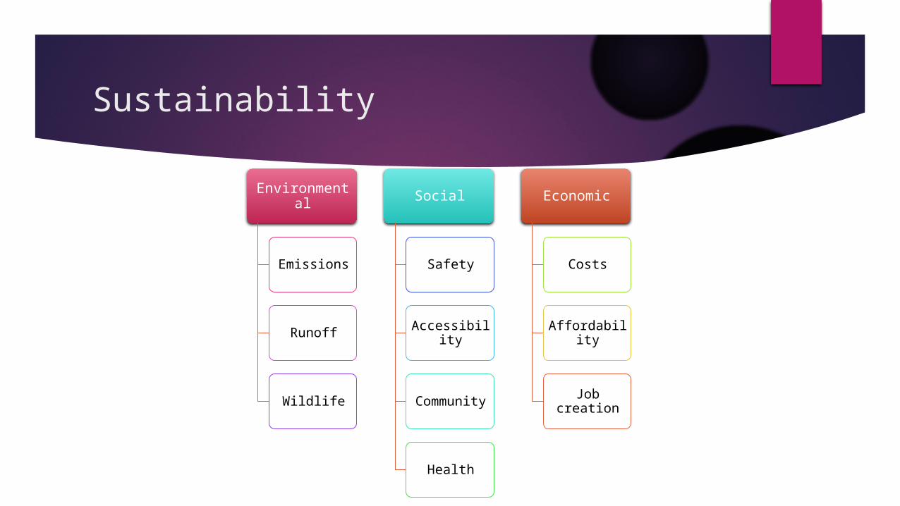
Environmental
Emissions
Runoff
Wildlife
Social
Safety
Accessibility
Community
Health
Economic
Costs
Affordability
Job creation
Complete Streets
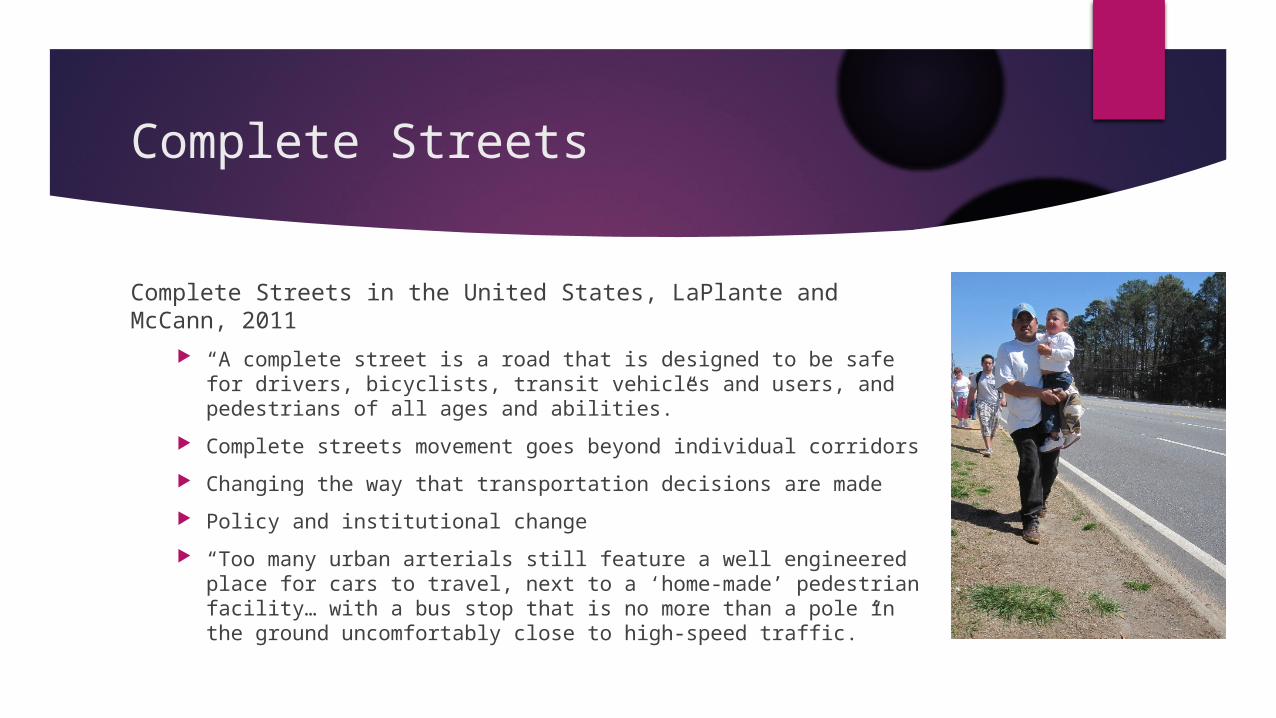
Complete Streets in the United States, LaPlante and McCann, 2011
“A complete street is a road that is designed to be safe for drivers, bicyclists, transit vehicles and users, and pedestrians of all ages and abilities.”
Complete streets movement goes beyond individual corridors
Changing the way that transportation decisions are made
Policy and institutional change
“Too many urban arterials still feature a well engineered place for cars to travel, next to a ‘home-made’ pedestrian facility… with a bus stop that is no more than a pole in the ground uncomfortably close to high-speed traffic.”
Complete Streets
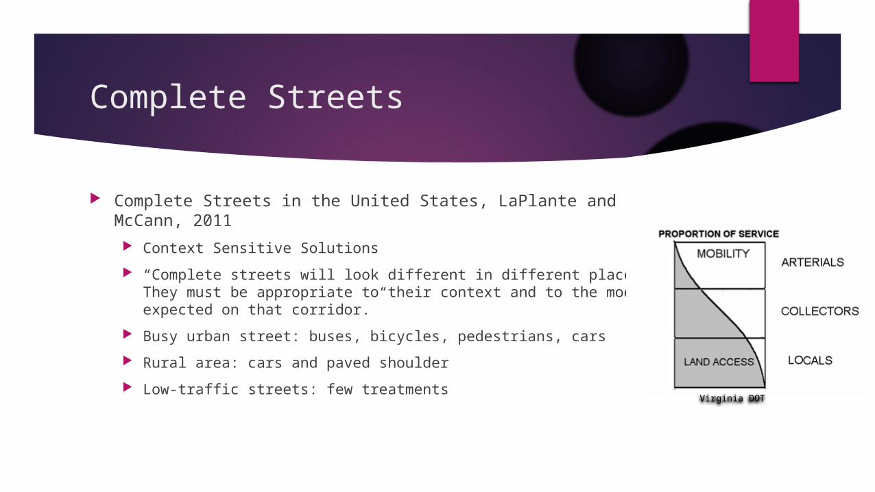
Complete Streets in the United States, LaPlante and McCann, 2011
Context Sensitive Solutions
“Complete streets will look different in different places. They must be appropriate to their context and to the modes expected on that corridor.”
Busy urban street: buses, bicycles, pedestrians, cars
Rural area: cars and paved shoulder
Low-traffic streets: few treatmentsVirginia DOT
Complete Streets
Complete Streets in the United States, LaPlante and McCann, 2011
Redefine agency policies and procedures to serve all modes
Adapt design guidelines accordingly
Train staff in serving all modes and implementing complete streets policies
Collect base data on all users and modes for before-and-after studies
Complete Streets
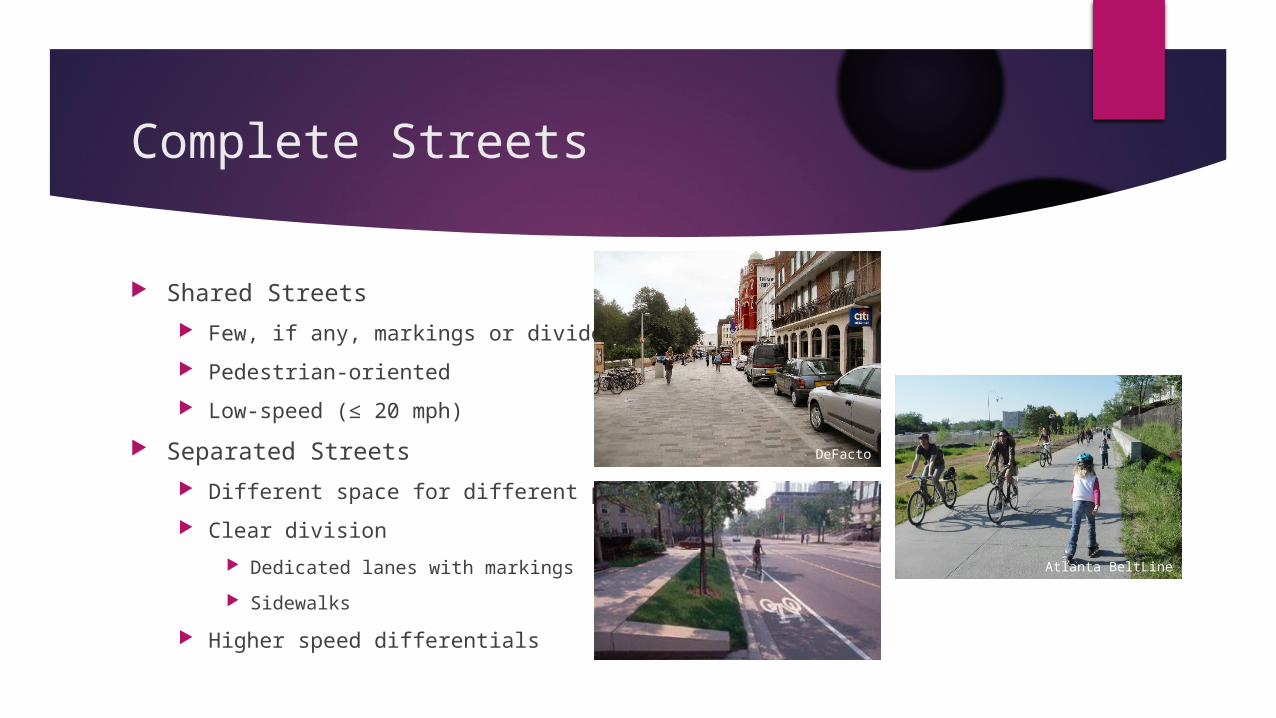
Shared Streets
Few, if any, markings or dividers
Pedestrian-oriented
Low-speed (≤ 20 mph)
Separated Streets
Different space for different purposes
Clear division
Dedicated lanes with markings
Sidewalks
Higher speed differentials
DeFacto
Atlanta BeltLine
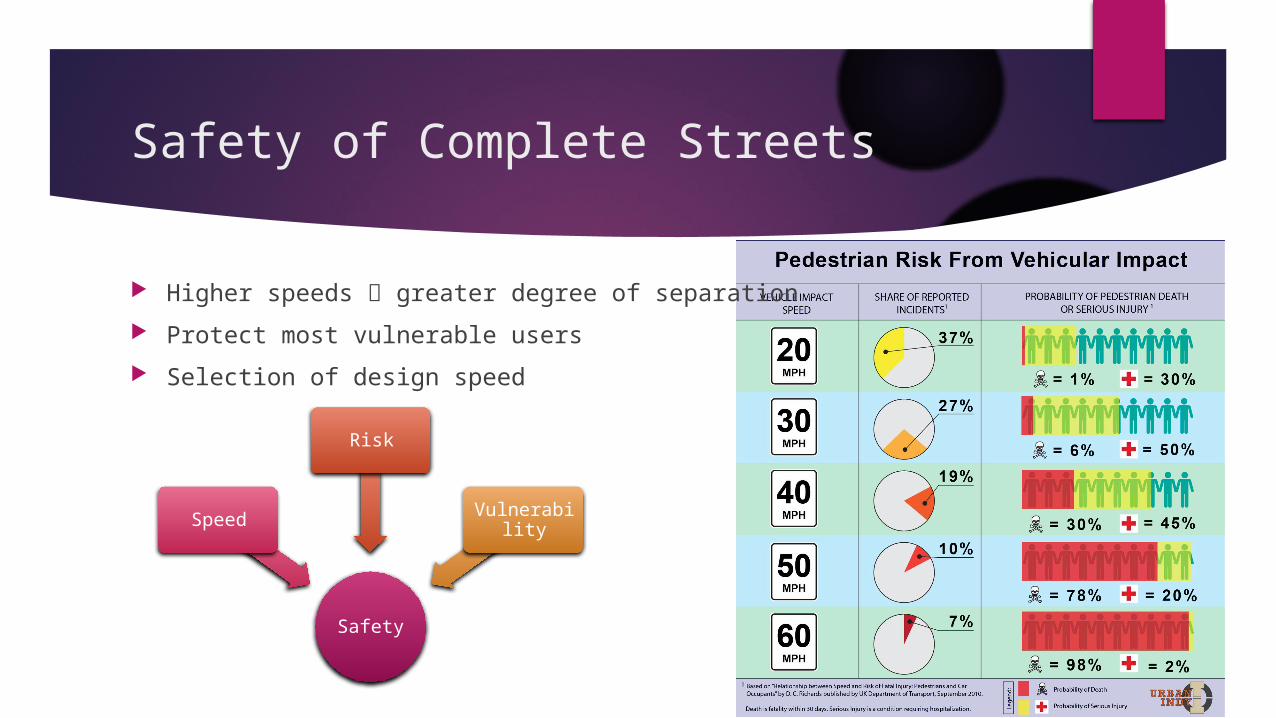
Safety of Complete Streets
Safety
Speed
Risk
Vulnerability
Higher speeds greater degree of separation
Protect most vulnerable users
Selection of design speed
Safety of Complete Streets
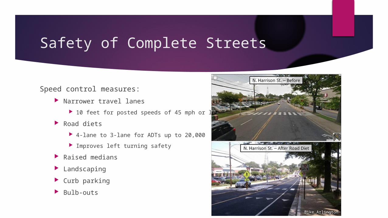
Speed control measures:
Narrower travel lanes
10 feet for posted speeds of 45 mph or less
Road diets
4-lane to 3-lane for ADTs up to 20,000
Improves left turning safety
Raised medians
Landscaping
Curb parking
Bulb-outs
Bike Arlington
Safety of Complete Streets
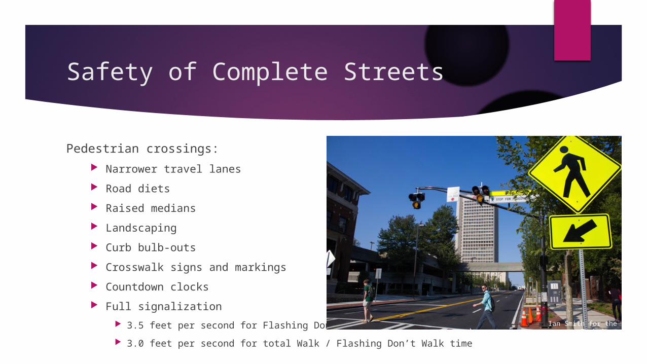
Pedestrian crossings:
Narrower travel lanes
Road diets
Raised medians
Landscaping
Curb bulb-outs
Crosswalk signs and markings
Countdown clocks
Full signalization
3.5 feet per second for Flashing Don’t Walk
3.0 feet per second for total Walk / Flashing Don’t Walk timeBike Arlington
Ian Smith for the Technique

Complete Streets for Sustainable Development
Choice of Modes
Social
Quality of life
Health benefits from increased activity
Safety benefits from increased transit ridership
Community benefits
Economic
Affordable access
Low barriers to entry
Environmental
Viable alternatives to the automobile
More distributed, possibly fewer emissions Ryan Gravel
Matthew Blackett
Complete Streets for Sustainable Development
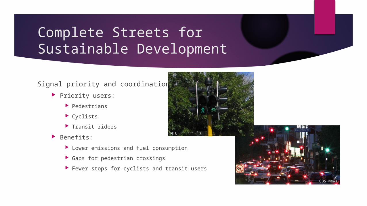
Signal priority and coordination
Priority users:
Pedestrians
Cyclists
Transit riders
Benefits:
Lower emissions and fuel consumption
Gaps for pedestrian crossings
Fewer stops for cyclists and transit users
MTC
CBS News
Best Practices for Safe and Sustainable Streets
Access for all ages, abilities, and appropriate modes
Context sensitive, street as place
Design for desired (not observed) speeds
Shared approach works best in low-speed (≤ 20 mph) situations
Separation of users in high-speed situations, especially when large differences in user speeds are present
Dedicated right-of-way as needed
Separate corridors may be used for different user groups
Complete networks for each user group
Signal coordination and priority for active modes and transit (as appropriate)
Comprehensive approach to managing stormwater runoff, emissions, and wildlife
Trees for shade and separation, places to linger and rest
Guidelines for Accommodating Pedestrians
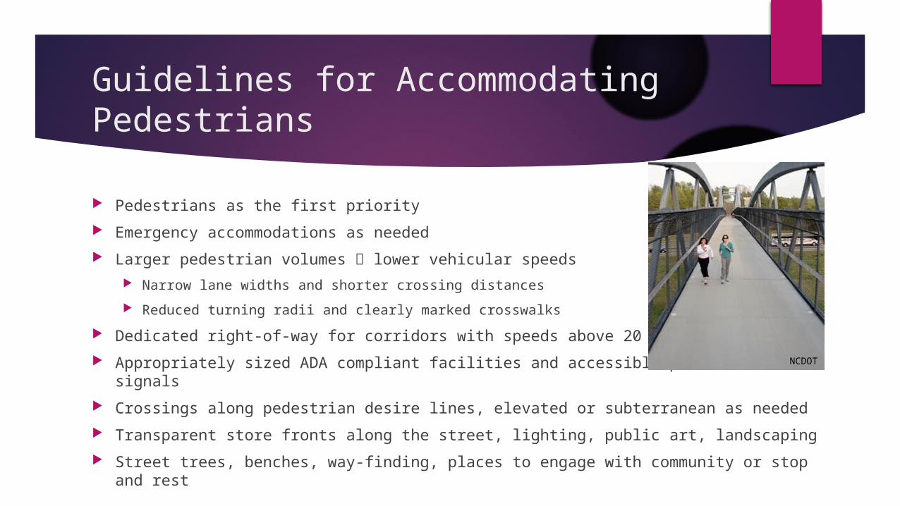
Pedestrians as the first priority
Emergency accommodations as needed
Larger pedestrian volumes lower vehicular speeds
Narrow lane widths and shorter crossing distances
Reduced turning radii and clearly marked crosswalks
Dedicated right-of-way for corridors with speeds above 20 mph
Appropriately sized ADA compliant facilities and accessible pedestrian signals
Crossings along pedestrian desire lines, elevated or subterranean as needed
Transparent store fronts along the street, lighting, public art, landscaping
Street trees, benches, way-finding, places to engage with community or stop and rest
NCDOT
Guidelines for Accommodating Cyclists
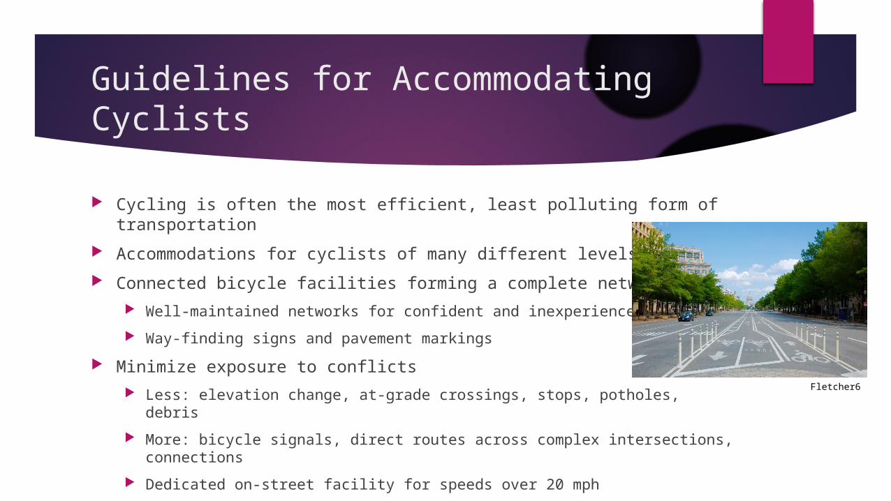
Cycling is often the most efficient, least polluting form of transportation
Accommodations for cyclists of many different levels
Connected bicycle facilities forming a complete network
Well-maintained networks for confident and inexperienced cyclists
Way-finding signs and pavement markings
Minimize exposure to conflicts
Less: elevation change, at-grade crossings, stops, potholes, debris
More: bicycle signals, direct routes across complex intersections, connections
Dedicated on-street facility for speeds over 20 mph
Off-street bicycle facilities for speeds over 30 mph and less confident cyclists
Fletcher6
Guidelines for Accommodating Transit Users
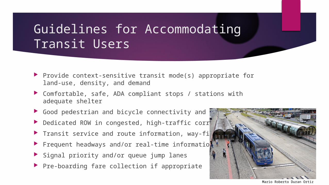
Provide context-sensitive transit mode(s) appropriate for land-use, density, and demand
Comfortable, safe, ADA compliant stops / stations with adequate shelter
Good pedestrian and bicycle connectivity and infrastructure
Dedicated ROW in congested, high-traffic corridors
Transit service and route information, way-finding
Frequent headways and/or real-time information
Signal priority and/or queue jump lanes
Pre-boarding fare collection if appropriate
Mario Roberto Duran Ortiz
Guidelines for Accommodating Automobile Passengers
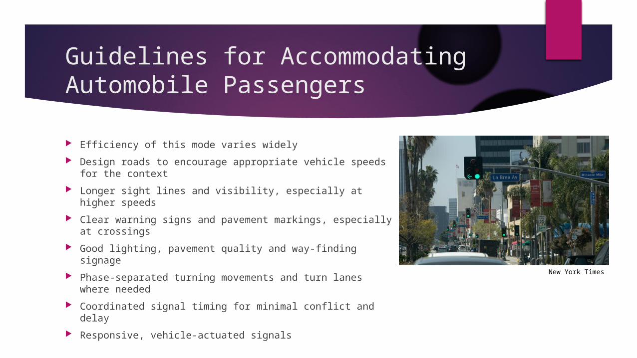
Efficiency of this mode varies widely
Design roads to encourage appropriate vehicle speeds for the context
Longer sight lines and visibility, especially at higher speeds
Clear warning signs and pavement markings, especially at crossings
Good lighting, pavement quality and way-finding signage
Phase-separated turning movements and turn lanes where needed
Coordinated signal timing for minimal conflict and delay
Responsive, vehicle-actuated signals
New York Times
Guidelines for Accommodating Freight / Industrial Passengers
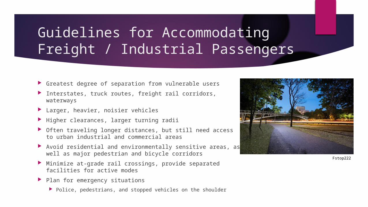
Greatest degree of separation from vulnerable users
Interstates, truck routes, freight rail corridors, waterways
Larger, heavier, noisier vehicles
Higher clearances, larger turning radii
Often traveling longer distances, but still need access to urban industrial and commercial areas
Avoid residential and environmentally sensitive areas, as well as major pedestrian and bicycle corridors
Minimize at-grade rail crossings, provide separated facilities for active modes
Plan for emergency situations
Police, pedestrians, and stopped vehicles on the shoulder
Fstop222
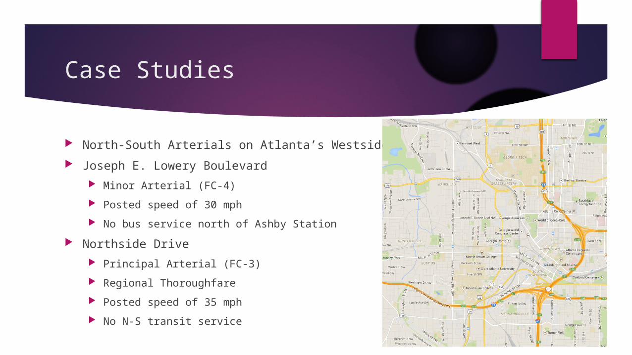
Case Studies
North-South Arterials on Atlanta’s Westside
Joseph E. Lowery Boulevard
Minor Arterial (FC-4)
Posted speed of 30 mph
No bus service north of Ashby Station
Northside Drive
Principal Arterial (FC-3)
Regional Thoroughfare
Posted speed of 35 mph
No N-S transit service
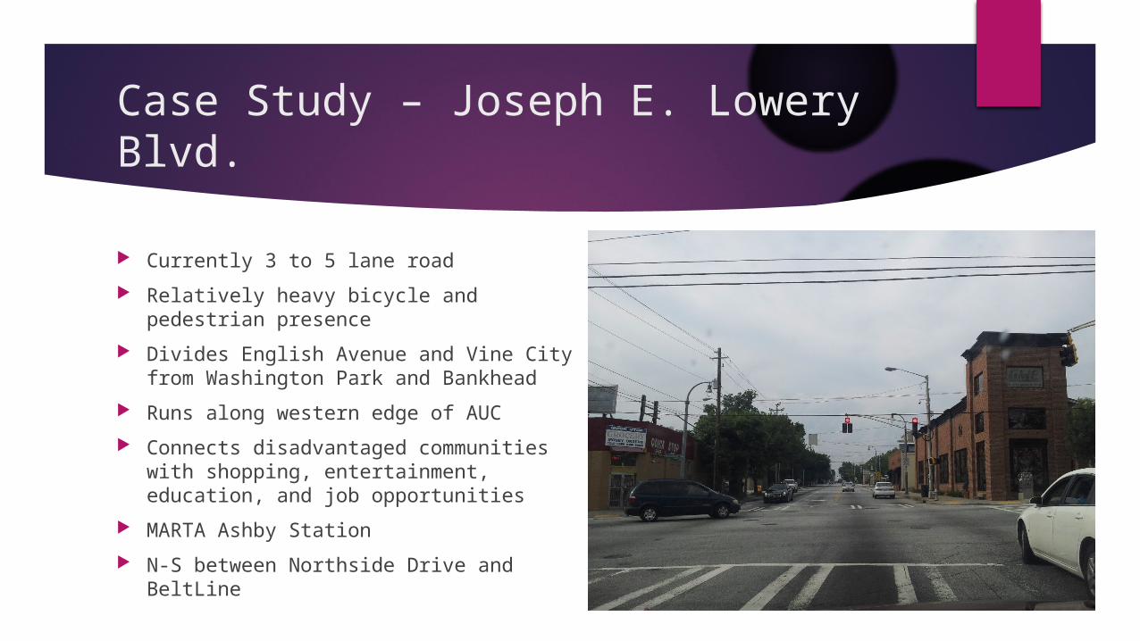
Case Study – Joseph E. Lowery Blvd.
Currently 3 to 5 lane road
Relatively heavy bicycle and pedestrian presence
Divides English Avenue and Vine City from Washington Park and Bankhead
Runs along western edge of AUC
Connects disadvantaged communities with shopping, entertainment, education, and job opportunities
MARTA Ashby Station
N-S between Northside Drive and BeltLine
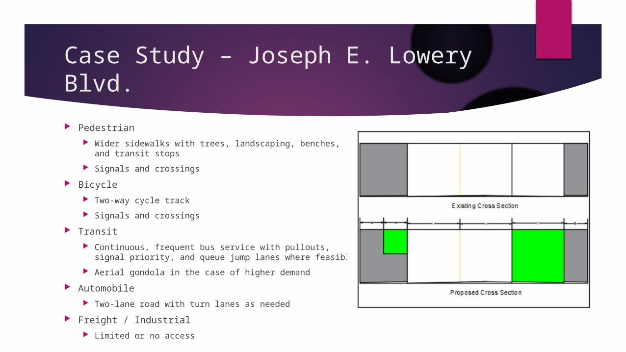
Case Study – Joseph E. Lowery Blvd.
Pedestrian
Wider sidewalks with trees, landscaping, benches, and transit stops
Signals and crossings
Bicycle
Two-way cycle track
Signals and crossings
Transit
Continuous, frequent bus service with pullouts, signal priority, and queue jump lanes where feasible
Aerial gondola in the case of higher demand
Automobile
Two-lane road with turn lanes as needed
Freight / Industrial
Limited or no access
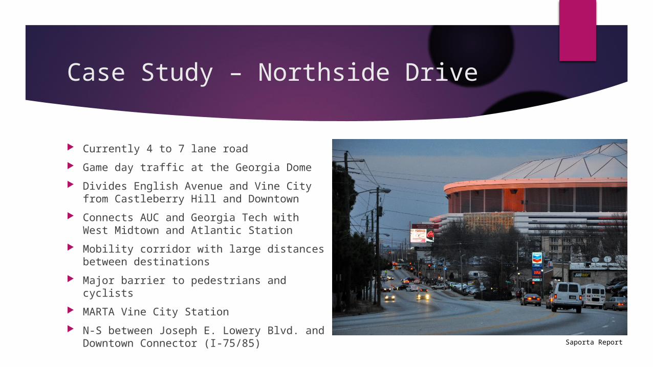
Case Study – Northside Drive
Currently 4 to 7 lane road
Game day traffic at the Georgia Dome
Divides English Avenue and Vine City from Castleberry Hill and Downtown
Connects AUC and Georgia Tech with West Midtown and Atlantic Station
Mobility corridor with large distances between destinations
Major barrier to pedestrians and cyclists
MARTA Vine City Station
N-S between Joseph E. Lowery Blvd. and Downtown Connector (I-75/85) Saporta Report

Case Study – Northside Drive
Pedestrian
Wider sidewalks with trees, landscaping, benches, and transit stops
Signals and crossings, possibly an ADA accessible bike/pedestrian bridge
Bicycle
Bus and bike lanes
Signals and crossings
Transit
Bus Rapid Transit
Automobile
One fewer general purpose lane in each direction where possible
Freight / Industrial
Allowed, but this is not a major freight or industrial corridor
Conclusion
Complete streets can improve the safety and sustainability of our communities if properly implemented
Accommodating all appropriate modes will increase mobility, accessibility, and quality of life
Complete networks should be established for each user group with direct, convenient, and well-maintained routes connecting activity centers and other destinations
Shared space is best implemented where major differences between the size and speed of users are not desired
Minimize the risk and exposure of most vulnerable users for safety
Viable mode choices, including active and transit modes where appropriate, improve the sustainability of our communities in many ways
References
Auttapone (Aut) Karndacharuk, Douglas J. Wilson, and Roger C. M. Dunn. 2013. "Analysis of Pedestrian Performance in Shared-Space Environments." Transportation Research Record: Journal of the Transportation Research Board (Transportation Research Board of the National Academies) (2393): 1-11.
Boston Transportation Department. 2013. "Multimodal Intersections." In Boston Complete Streets Guidelines, by Boston Transportation Department, 141-147. Boston, MA: Boston Transportation Department.
Cornelius Nuworsoo and Erin Cooper. 2013. "Considerations for Integrating Bicycling and Walking Facilities into Urban Infrastructure." Transportation Research Record: Journal of the Transportation Research Board (Transportation Research Board of the National Academies) (2393): 125-133.
Emma Barnes and Marc Schlossberg. 2013. "Improving Cyclist and Pedestrian Environment While Maintaining Vehicle Throughput: Before- and After-Construction Analysis." Transportation Research Record: Journal of the Transportation Research Board (Transportation Research Board of the National Academies) (2393): 85-94.
Ioannis Kaparias, Michael G. H. Bell, Weili Dong, Aditya Sastrawinata, Amritpal Singh, Xuxi Wang, and Bill Mount. 2013. "Analysis of Pedestrian-Vehicle Traffic Conflicts in Street Designs with Elements of Shared Space." Transportation Research Record: Journal of the Transportation Research Board (Transportation Research Board of the National Academies) (2393): 21-30.
John N. LaPlante and Barbara McCann. 2011. "Complete Streets in the United States." TRB Annual Meeting. Washington, D.C.: Transportation Research Board of the National Academies. 1-11.
Kristine M. Williams and Herbert Levinson. 2011. "The Role of Access Management in Sustainable Development." Transportation and Development Institute Congress. American Society of Civil Engineers. 1026-1035.


![Separation Processes - ChE 4M3 0.5cm [width=0.2]/Users ... · I Geankoplis, \Transport Processes and Separation Process Principles", 4th edition, chapter 14. I Perry’s Chemical](https://img.pdfslide.us/doc/110x75/5e1088cb79b8c97e9e36fd16/separation-processes-che-4m3-05cm-width02users-i-geankoplis-transport.jpg)


![Separation Processes: Filtration - ChE 4M3 0.5cm [width=0.2]/Users](https://img.pdfslide.us/doc/110x75/586cadd51a28ab55088bb819/separation-processes-filtration-che-4m3-05cm-width02users-.jpg)